February 2008
Monthly Archive
Posted by Glenn
[3] Comments
February 19-20 2008
Air Temperatures – The following maximum temperatures were recorded across the state of Hawaii Tuesday:
Lihue, Kauai – 80
Honolulu, Oahu – 80
Kaneohe, Oahu – 80
Kahului, Maui – 79
Hilo, Hawaii – 83
Kailua-Kona, Hawaii – 80
Temperatures ranged between these warmest and coolest spots near sea level at 4 a.m. Tuesday morning:
Kailua-kona – 71F
Kahului, Maui – 58
Precipitation Totals – The following numbers represent the largest precipitation totals (inches) during the last 24 hours on each of the major islands, as of Tuesday afternoon:
0.01 MOLOAA DAIRY, KAUAI
0.02 MANOA LYON ARBORETUM, OAHU
0.00 MOLOKAI
0.00 LANAI
0.00 KAHOOLAWE
0.04 ULUPALAKUA, MAUI
0.03 WAIKII, BIG ISLAND
Weather Chart – Here’s the latest (automatically updated) weather map. A high pressure ridge extending southwest from a small high pressure system just to the east of Hawaii…is now over Kauai. This pressure configuration will cause light and variable winds, with daytime sea breezes through Thursday. Here’s a Weather Map Symbol page for clarification about what all those weather symbols mean on the map.
Satellite and Radar Images: To view the cloud conditions we have here in Hawaii, please use the following satellite links, starting off with the Infrared Satellite Image of the islands to see all the clouds around the state during the day and night. This next image is one that gives close images of the islands only during the daytime hours, and is referred to as a Close-up visible image. This next image shows a larger view of the Pacific…giving perspective to the wider ranging cloud patterns in the Pacific Ocean…out from the islands. To help you keep track of where any showers may be around the islands, here’s the latest animated radar image.
Hawaii’s Mountains – Here’s a link to the live webcam on the summit of near 14,000 foot Mauna Kea on the Big Island of Hawaii. The tallest peak on the island of Maui is the Haleakala Crater, which is near 10,000 feet in elevation. These two webcams are available during the daylight hours here in the islands…and when there’s a big moon rising just after sunset for an hour or two! Plus, during the nights and early mornings you will be able to see stars, and the sunrise too…depending upon cloud conditions.
Aloha Paragraphs
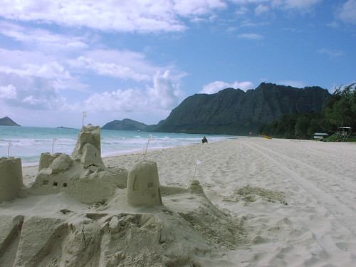
Sand Castles on the beach in Hawaii
Photo Credit: flickr.com
Light and variable winds will remain in place through the work week…with stronger south kona winds arriving later this weekend. Storms in the middle latitudes of the north central Pacific, are keeping our trade wind producing high pressure ridge down over the islands of Maui County Tuesday evening. Daytime sea breezes will blow near the beaches, followed by downslope land breezes during the nights. There remains the good chance of brisk southerly winds associated with an active cold front arriving Sunday…followed by cool north winds after it passes through into Monday.
This convective weather pattern will provide clear skies during the mornings, giving way to afternoon clouds over and around the mountains. The clouds will clear back at night, providing a good view of the upcoming full moon Wednesday evening here in the islands. As usual during a weather pattern such as this, the beaches will be the sunniest places. The overlying atmosphere is dry and stable from Kauai down through the Big Island. This will keep whatever showers that may fall in the upcountry areas light and spotty at best. The computer models are showing a showery cold front arriving Sunday into next Monday.
It’s Tuesday evening as I begin updating this last paragraph of today’s narrative. A well established convective weather pattern remains in place over the Hawaiian Islands now. Clear nights, with cooler than normal temperatures, will provide a near cloud free start to the mornings. As the sun gets higher in the sky, clouds will begin to form over and around the mountains, although for the most part, will be dry ones. ~~~ It’s looking more and more likely that an active Pacific cold front will push down through the state later this coming weekend into next Monday. If this frontal passage occurs as the computer models are suggesting, we would see breezy south kona winds arriving ahead of a showery cloud band, followed by brisk and cool north to northeast winds in the wake of its passage. ~~~ This week looks like a good one, although with light winds, and a fairly low inversion layer, we’ll see quite a bit of haze around the edges. As mentioned above, the nights and early mornings will be on the cool side, with the need for an extra blanket on the bed perhaps necessary, even right down at sea level. ~~~ Speaking of the nights, this month’s full moon will occur, at least here in the islands, early Wednesday evening. It has already been quite large and bright the last few nights, so that Tuesday night through Thursday nights will continue to see that moon really beaming down on us! ~~~ Tuesday turned out to be one of the sunniest days of the month so far. The mid afternoon hours finally saw some pretty light weight cumulus clouds congregating around the mountains. As has been the case the last few days, there will continue to be generally dry weather just about everywhere! I’ll be back very early Wednesday morning with your next new weather narrative from paradise. I hope you have a great Tuesday night wherever you happen to be spending it! Aloha for now…Glenn.
Interesting: An apparent meteor streaked through the sky over the Pacific Northwest early Tuesday, drawing reports of bright lights and sonic booms in parts of Washington, Oregon and Idaho.
Although a witness reported seeing the object strike the Earth in a remote part of Adams County, in southeast Washington, it had not been found.
"I’m convinced it was a meteor," said Geoff Chester, spokesman for the U.S. Naval Observatory in Washington, D.C. "It was a classic description of a fireball."
Chester speculated the meteor was the size of a big suitcase and had been orbiting the sun for millions of years before entering Earth’s orbit.
The Federal Aviation Administration said a private pilot reported seeing the meteor hit the Earth in a burst of light near State Route 26 and the Lind-Hatton Road about 5:45 a.m.
The Adams County sheriff’s office had no immediate reports of damage, injury or a meteor landing in the area, about 175 miles east-southeast of Seattle and 90 miles southwest of Spokane.
Chester said people commonly think they see a meteor hit or about to hit the ground, when it is nowhere close. Most meteorites that strike the Earth are never found, he said
"When you see objects like this in the sky your sense of scale is distorted," he said. "It’s a common optical illusion."
A number of pilots reported seeing the meteor streaking through the sky from Boise, Idaho, into Washington state, the FAA said.
Surveillance cameras in the region captured a ball of light in the sky and then a flash illuminating the early morning darkness.
Glenn’s TV Weather show is back online now. One day’s show will replaced with the next new days show at around 9am HST (11am PST – 2pm EST)…Monday through Friday. Thanks to the folks at the Maui Media Lab in Paia for making this happen!
Posted by Glenn
1 Comment
February 18-19 2008
Air Temperatures – The following maximum temperatures were recorded across the state of Hawaii Monday:
Lihue, Kauai – 81
Honolulu, Oahu – 80
Kaneohe, Oahu – 81
Kahului, Maui – 78
Hilo, Hawaii – 83
Kailua-Kona, Hawaii – 80
Temperatures ranged between these warmest and coolest spots near sea level at 6 a.m. Monday morning:
Honolulu, Oahu – 72F
Kahului, Maui – 60
Precipitation Totals – The following numbers represent the largest precipitation totals (inches) during the last 24 hours on each of the major islands, as of Monday afternoon:
0.01 MOUNT WAIALEALE, KAUAI
0.57 WAIANAE, OAHU
0.04 MOLOKAI
0.00 LANAI
0.00 KAHOOLAWE
0.94 KAUPO GAP, MAUI
0.10 POHAKULOA WEST, BIG ISLAND
Weather Chart – Here’s the latest (automatically updated) weather map. A high pressure ridge extending southwest from a high pressure system far NE of Hawaii…is now over Maui. This pressure configuration will cause light and variable winds, with daytime sea breezes through Wednesday. Here’s a Weather Map Symbol page for clarification about what all those weather symbols mean on the map.
Satellite and Radar Images: To view the cloud conditions we have here in Hawaii, please use the following satellite links, starting off with the Infrared Satellite Image of the islands to see all the clouds around the state during the day and night. This next image is one that gives close images of the islands only during the daytime hours, and is referred to as a Close-up visible image. This next image shows a larger view of the Pacific…giving perspective to the wider ranging cloud patterns in the Pacific Ocean…out from the islands. To help you keep track of where any showers may be around the islands, here’s the latest animated radar image.
Hawaii’s Mountains – Here’s a link to the live webcam on the summit of near 14,000 foot Mauna Kea on the Big Island of Hawaii. The tallest peak on the island of Maui is the Haleakala Crater, which is near 10,000 feet in elevation. These two webcams are available during the daylight hours here in the islands…and when there’s a big moon rising just after sunset for an hour or two! Plus, during the nights and early mornings you will be able to see stars, and the sunrise too…depending upon cloud conditions.
Aloha Paragraphs
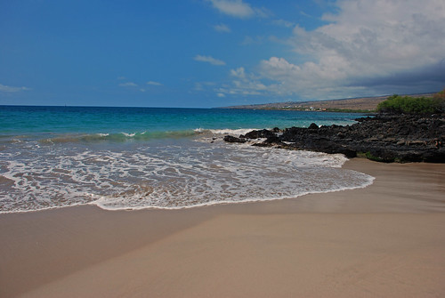
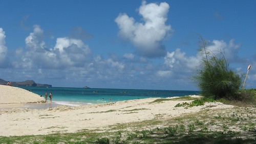
Lovely secluded Hawaiian beach
Photo Credit: flickr.com
Light winds from the south and SE, will give way to light trade winds…and then become stronger south kona winds by the weekend. Storms in the middle latitudes of the north central Pacific, are keeping our trade wind producing high pressure ridge down over the Big Island on this Presidents Day holiday. There will be light south to SE winds, gradually becoming light easterly trade winds starting Tuesday. Despite the variable directions of our winds this week, they will remain light in general. There remains the chance of windy southerly winds associated with an active cold front arriving this weekend.
We remain in a convective weather pattern Monday evening, with clear skies in the mornings giving way to increased clouds during the afternoons…with showers mostly over the interior sections. As usual during a weather pattern such as this, the beaches will be the sunniest places. When the trade winds return, albeit lightly on Tuesday, we may see a few showers, in addition to the afternoon inland showers…falling along the windward sides too. The computer models are showing a possible rainy weather event later this coming weekend.
It’s Monday evening as I begin updating this last paragraph of today’s narrative. Our high pressure ridge, which slipped just south of the Big Island Sunday, bringing increased moisture and clouds…has migrated northward over the state again. This essentially stopped the south winds, but kept a drift of air from the southeast over the islands. This puts us squarely back into a convective weather pattern, with clear cool mornings, becoming cloudy during the afternoon hours in the upcountry sections of each island. These clouds will drop some showers, although nothing heavy is indicated. ~~~ If you had a chance to read down through the two paragraphs above, you know that our weather here in the Aloha state will remain pretty similar from one day to the next through most of this week…with light trade winds returning soon. ~~~ The one change we see up ahead would occur this weekend…when we could finally see a vigorous Pacific cold front push down through the state Sunday. If this were to manifest as the computer models are insisting, we would see blustery south kona winds arriving ahead of a wet frontal cloud band, followed by brisk and cool north winds in the wake of its passage next Monday. ~~~ Sunday afternoon I drove over to the windward side here on Maui, to the lush area in Haiku. A good friend had a birthday party, with lots of friends attending, who are my friends as well. We had a good time, eating lots of delicious food, and having a few drinks. This persons husband is a music expert, and played all kinds of great tunes on his sound system. When we finished dinner, which we ate outside on the large deck, we went out onto the expansive lawn, and sat in chairs around a bonfire. It was a lovely evening, with the growing tropical moon shining brightly above. I finally got tired, although it was hard to leave the good conversations, along with the cake and ice cream…taking the drive back up the Haleakala Crater to Kula. Wow, a dance party Saturday night, and then another party Sunday night, that’s unusual for me. ~~~ Monday, because it was a holiday, allowed me to stay home, at least for the most part. I did have some house work to do, although I must admit, I didn’t sink into it quite as much as I thought I would. I took one of my cars to get some minor repairs, although fortunately my mechanic lives here in Kula, Maui. It got volcanically hazy as I expected this weekend, and cloudy this afternoon as well. There were a few light showers, but they didn’t amount to much as it turned out. ~~~ I’ll be back very early Tuesday morning with your next new weather narrative, I hope you have a lovely Monday night until then! Aloha for now…Glenn.
Glenn’s TV Weather show is back online again now. The colors aren’t perfect, although they are close enough. One day’s show will replaced with the next new days show at around 9am HST (11am PST – 2pm EST)…Monday through Friday. Thanks to the folks at the Maui Media Lab in Paia for making this happen!
Posted by Glenn
1 Comment
February 17-18 2008
Air Temperatures – The following maximum temperatures were recorded across the state of Hawaii Sunday:
Lihue, Kauai – 82
Honolulu, Oahu – 81
Kaneohe, Oahu – 82
Kahului, Maui – 78
Hilo, Hawaii – 82
Kailua-Kona, Hawaii – 80
Temperatures ranged between these warmest and coolest spots near sea level at 6 a.m. Sunday morning:
Honolulu, Oahu – 74F
Hilo, Hawaii – 61
Precipitation Totals – The following numbers represent the largest precipitation totals (inches) during the last 24 hours on each of the major islands, as of Sunday afternoon:
0.53 MOHIHI CROSSING, KAUAI
0.99 WAIANAE VALLEY, OAHU
0.38 MOLOKAI
0.11 LANAI
0.01 KAHOOLAWE
0.14 KULA BRANCH STATION, MAUI
0.41 PALI 2, BIG ISLAND
Weather Chart – Here’s the latest (automatically updated) weather map. A high pressure ridge extending southwest from a high pressure system far NE of Hawaii…is now over Maui County. This pressure configuration will cause light and variable winds…with a slight drift of air from the southeast direction through Monday. Here’s a Weather Map Symbol page for clarification about what all those weather symbols mean on the map.
Satellite and Radar Images: To view the cloud conditions we have here in Hawaii, please use the following satellite links, starting off with the Infrared Satellite Image of the islands to see all the clouds around the state during the day and night. This next image is one that gives close images of the islands only during the daytime hours, and is referred to as a Close-up visible image. This next image shows a larger view of the Pacific…giving perspective to the wider ranging cloud patterns in the Pacific Ocean…out from the islands. To help you keep track of where any showers may be around the islands, here’s the latest animated radar image.
Hawaii’s Mountains – Here’s a link to the live webcam on the summit of near 14,000 foot Mauna Kea on the Big Island of Hawaii. The tallest peak on the island of Maui is the Haleakala Crater, which is near 10,000 feet in elevation. These two webcams are available during the daylight hours here in the islands…and when there’s a big moon rising just after sunset for an hour or two! Plus, during the nights and early mornings you will be able to see stars, and the sunrise too…depending upon cloud conditions.
Aloha Paragraphs
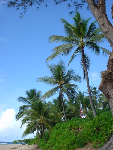
The beautiful Coconut Palm trees of Hawaii
Photo Credit: flickr.com
Light south winds have replaced the light and variable winds of late, as our ridge has moved just south of the Big Island. Storms in the middle latitudes of the north central Pacific, have forced our trade wind producing high pressure ridge down over the Big Island or even a tad south of there Sunday afternoon. There will be light southerly kona winds, which has brought tropical moisture into our area now. This light field of winds will remain active through the next several days, with the chance of windy conditions associated with an active cold front for next weekend.
The kona breezes are bringing increased clouds into the state, with a better chance of showers now. These clouds will ride into the leeward coasts and slopes, dropping some showers, mostly light…although a few could be locally heavier here and there. As usual during a weather pattern such as this, the windward beaches will be the sunniest places. Looking further ahead, some of the computer models are showing possible rainy weather moving in later next weekend.
It’s Sunday afternoon as I begin updating this last paragraph of today’s narrative. Light south winds will be the name of the game for the time being…with showers most likely along the south facing slopes. ~~~ If you had a chance to read down through the two paragraphs above, you know that our weather here in the Aloha state will remain pretty similar from one day to the next into the new week ahead. The big change might occur later next weekend, when we could finally see a vigorous Pacific cold front barrel down through the state. If it did manifest, as a few of the models are describing, we may see blustery south kona winds arriving, ahead of a wet frontal cloud band, followed by brisk and cool north winds following its passage. There is still a lot of uncertainty around this possibility, being that it’s still a week out into the future…we’ll see what happens as we move through the week. ~~~ I drove down the mountain to lower Kula with my neighbors last evening, after a going away dinner for a friend who was leaving to go back to Switzerland. This birthday party was a fun one, with someone playing CD’s, and the living room floor filled with wild and crazy dancers…myself included! I have another friends birthday party to attend this afternoon, over on the windward side in Haiku. There won’t be any dancing, unfortunately, but it will be fun nonetheless. ~~~ I’ll be back Monday morning with your next new weather narrative. I hope you have a great Sunday night until then! Aloha for now…Glenn.
Glenn’s TV Weather show is back online again now. The colors aren’t perfect, although they are close enough. One day’s show will replaced with the next new days show at around 9am HST (11am PST – 2pm EST)…Monday through Friday. Thanks to the folks at the Maui Media Lab in Paia for making this happen!
Posted by Glenn
No Comments
February 16-17 2008
Air Temperatures – The following maximum temperatures were recorded across the state of Hawaii Saturday:
Lihue, Kauai – 78
Honolulu, Oahu – 80
Kaneohe, Oahu – 80
Kahului, Maui – 77
Hilo, Hawaii – 81
Kailua-Kona, Hawaii – 80
Temperatures ranged between these warmest and coolest spots near sea level at 5 a.m. Saturday morning:
Kailua-kona – 71F
Kahului, Maui – 58
Precipitation Totals – The following numbers represent the largest precipitation totals (inches) during the last 24 hours on each of the major islands, as of Saturday afternoon:
0.24 MOHIHI CROSSING, KAUAI
0.22 WAIPIO, OAHU
0.01 MOLOKAI
0.13 LANAI
0.00 KAHOOLAWE
0.09 HANA AIRPORT, MAUI
0.84 KEALAKEKUA, BIG ISLAND
Weather Chart – Here’s the latest (automatically updated) weather map. A high pressure ridge extending southwest from a high pressure system far NE of Hawaii…is now over Maui County. This pressure configuration will cause light and variable winds through Monday. Here’s a Weather Map Symbol page for clarification about what all those weather symbols mean on the map.
Satellite and Radar Images: To view the cloud conditions we have here in Hawaii, please use the following satellite links, starting off with the Infrared Satellite Image of the islands to see all the clouds around the state during the day and night. This next image is one that gives close images of the islands only during the daytime hours, and is referred to as a Close-up visible image. This next image shows a larger view of the Pacific…giving perspective to the wider ranging cloud patterns in the Pacific Ocean…out from the islands. To help you keep track of where any showers may be around the islands, here’s the latest animated radar image.
Hawaii’s Mountains – Here’s a link to the live webcam on the summit of near 14,000 foot Mauna Kea on the Big Island of Hawaii. The tallest peak on the island of Maui is the Haleakala Crater, which is near 10,000 feet in elevation. These two webcams are available during the daylight hours here in the islands…and when there’s a big moon rising just after sunset for an hour or two! Plus, during the nights and early mornings you will be able to see stars, and the sunrise too…depending upon cloud conditions.
Aloha Paragraphs
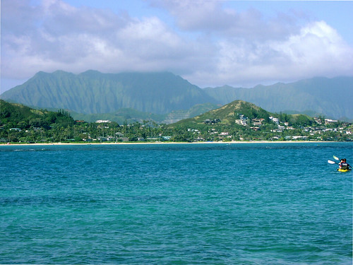
The beautiful windward side of Oahu
Photo Credit: flickr.com
A light wind convective weather weather pattern is well established over the Hawaiian Islands this weekend. Storms in the middle latitudes of the north central Pacific, have forced our trade wind producing high pressure ridge down over Maui County Saturday night. Our local winds will consist revolve around daytime sea breezes, and land breezes at night. The localized southeast wind flow may bring some minor volcanic haze up over the Kona slopes of the Big Island, and on up the island chain to the islands of Maui County. SE winds will bring slightly humid air into the Aloha state as well, with noticeably warmer daytime temperatures, or at least they will feel that way.
Generally nice weather conditions will prevail, although with afternoon clouds, and a few showers falling locally. These clouds will drop those few showers, although most of them aren’t expected to be particularly heavy. The beaches may become cloudy in the afternoons, although the bulk of the showers will concentrate their efforts in the upcountry areas. During the nights, those daytime clouds will collapse, with downslope breezes bringing somewhat cooler than normal temperatures down to sea level. As usual during a weather pattern such as this, the beaches will be the sunniest places.
It’s Saturday night as I begin updating this last paragraph of today’s narrative. Light winds and dry weather will be the name of the game for the time being…with just those afternoon convective cumulus clouds with their associated showers upcountry. The upside of this situation is of course the general lack of clouds and rainfall near the beaches, while the downside, well, I don’t think there is one! It may feel a bit too warm during the days, and a tad too cool during the early morning hours, but other than those minor inconveniences, it will be smooth sailing! The beaches should be marvelous the next couple of days, with the light winds making for very smooth ocean conditions, except where waves are breaking of course. ~~~ I saw a new film Friday evening after work. This film didn’t get all that good of ratings, although as soon as I walked in the crowded theatre, I knew that wasn’t going to matter all that much. At any rate, this film was called Jumper (2008), starring Hayden Christensen, and Samuel L. Jackson, among others. A genetic anomaly allows a young man to teleport himself anywhere. He discovers this gift has existed for centuries and finds himself in a war that has been raging for thousands of years between "Jumpers" and those who have sworn to kill them. It didn’t take long for me to realized that I was totally engaged in this fast paced film, and was enjoying myself very much. As a matter of fact, it was a very fun film, and I was glad I decided to see it, despite the relatively low ratings. If you want a peek at this adventure, action…science fiction flick, here’s a trailer. ~~~ What a day it was Saturday, especially at the beaches, where cloud free skies prevailed in many areas. I went down to Paia to shop, and literally there weren’t any clouds, except the dark ones back over the summit of the Haleakala Crater, and the West Maui Mountains. When I got home to Kula, it was very dark and cloudy. Those clouds finally let loose with some pretty good showers, falling briefly somewhere inbetween the moderate to heavy range…although light generally. These clouds will evaporate later tonight, with another super clear morning on tap Sunday. ~~~ I have dinner plans with my neighbors, and then I got invited to a dance party down the mountain a short distance, so I may get a chance to dance a bit, which would be nice….really nice actually! I’ll be back Sunday morning with more weather updates, I hope you enjoy your Saturday night until then! Aloha for now…Glenn.
Glenn’s TV Weather show is back online again now. The colors aren’t perfect, although they are close enough. One day’s show will replaced with the next new days show at around 9am HST (11am PST – 2pm EST)…Monday through Friday. Thanks to the folks at the Maui Media Lab in Paia for making this happen!
Posted by Glenn
No Comments
February 15-16 2008
Air Temperatures – The following maximum temperatures were recorded across the state of Hawaii Friday:
Lihue, Kauai – 79
Honolulu, Oahu – 80
Kaneohe, Oahu – 77
Kahului, Maui – 79
Hilo, Hawaii – 82
Kailua-Kona, Hawaii – 81
Temperatures ranged between these warmest and coolest spots near sea level at 4 a.m. Friday morning:
Kaneohe, Oahu – 72F
Kahului, Maui – 57
Precipitation Totals – The following numbers represent the largest precipitation totals (inches) during the last 24 hours on each of the major islands, as of Friday afternoon:
0.14 MOUNT WAIALEALE, KAUAI
0.02 MAUNAWILI, OAHU
0.00 MOLOKAI
0.07 LANAI
0.00 KAHOOLAWE
0.13 WEST WAILUAIKI, MAUI
0.16 GLENWOOD, BIG ISLAND
Weather Chart – Here’s the latest (automatically updated) weather map. A high pressure ridge extending southwest from a high pressure system far NE of Hawaii…will drop down over the islands soon. This pressure configuration will cause light and variable winds, with a tendency for them to come up from the southeast direction through Sunday. Here’s a Weather Map Symbol page for clarification about what all those weather symbols mean on the map.
Satellite and Radar Images: To view the cloud conditions we have here in Hawaii, please use the following satellite links, starting off with the Infrared Satellite Image of the islands to see all the clouds around the state during the day and night. This next image is one that gives close images of the islands only during the daytime hours, and is referred to as a Close-up visible image. This next image shows a larger view of the Pacific…giving perspective to the wider ranging cloud patterns in the Pacific Ocean…out from the islands. To help you keep track of where any showers may be around the islands, here’s the latest animated radar image.
Hawaii’s Mountains – Here’s a link to the live webcam on the summit of near 14,000 foot Mauna Kea on the Big Island of Hawaii. The tallest peak on the island of Maui is the Haleakala Crater, which is near 10,000 feet in elevation. These two webcams are available during the daylight hours here in the islands…and when there’s a big moon rising just after sunset for an hour or two! Plus, during the nights and early mornings you will be able to see stars, and the sunrise too…depending upon cloud conditions.
Aloha Paragraphs
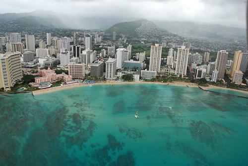
Honolulu and Waikiku Beach on Oahu
Photo Credit: flickr.com
The Hawaiian Islands have now entered a light wind convective weather pattern. Storms in the middle latitudes of the north central Pacific, has forced our trade wind producing high pressure ridge down over the islands now, initiating this change in our wind regime. Our local winds will have a tendency to come up from the southeast direction as we move into the weekend. This will bring some volcanic haze up over the Kona slopes of the Big Island, and on up the island chain to the islands of Maui County. SE winds will bring humid air into the Aloha state as well, with noticeably warmer daytime temperatures, or at least they will feel that way.
Days will start off clear, leading to clouds forming over and around the mountains during the afternoons. These interior clouds will drop a few showers locally, although most of them aren’t expected to be particularly heavy. The leeward beaches may become cloudy in the afternoons, although the bulk of the showers will concentrate their efforts in the upcountry areas. During the nights, those daytime clouds will collapse, with downslope breezes bringing somewhat cooler than normal temperatures down to sea level. As usual during a weather pattern such as this, the beaches will be the sunniest places…especially during the mornings.
It’s Aloha Friday evening as I begin updating this last paragraph of today’s narrative. We’ve seen the trade winds blowing almost everyday this year, through most of January, and all of February so far. This is about to come to a screeching halt, as our trade wind producing high pressure ridge gets displaced southward. As the ridge drops right down over us, our winds will become light to very light. This in turn will put us into a convective weather pattern, which simply means clear mornings giving way to afternoon clouds over and around the mountains. At times, under these circumstances, we can see heavy downpours in the upcountry areas. This time around however, that doesn’t look like it will happen…with most of the showers falling in the light to moderate category. ~~~ The trade winds aren’t scheduled to return anytime soon, so that we’ll be hanging out in this light wind condition well into the future. This suggests that we’ll see some form of haze developing, which may eventually become very noticeable. As the winds will be drifting up from the southeast, there’s a good chance that some of this haze will have volcanic origins. It will take the return of the trade winds at some point next week to finally ventilate away these hazy conditions. ~~~ I’m heading from Kihei over to Kahului now, where I’ll take in a new film this evening. This isn’t exactly the highest rated film of the year, by any means, although I’m in the mood to see a film anyway….what else is new Glenn!? At any rate, this film is called Jumper (2008), starring Hayden Christensen, and Samuel L. Jackson, among others. A genetic anomaly allows a young man to teleport himself anywhere. He discovers this gift has existed for centuries and finds himself in a war that has been raging for thousands of years between "Jumpers" and those who have sworn to kill them. I’ll let you know what I think of this when I come back online Saturday morning with your next new weather narrative. If you want a peek at this adventure, action…science fiction flick, here’s a trailer. ~~~ I hope you have a great Friday night wherever you happen to be spending it! Aloha for now…Glenn.
Glenn’s TV Weather show is back online again now. The colors aren’t perfect, although they are close enough. One day’s show will replaced with the next new days show at around 9am HST (11am PST – 2pm EST)…Monday through Friday. Thanks to the folks at the Maui Media Lab in Paia for making this happen!
Posted by Glenn
No Comments
February 14-15 2008
Air Temperatures – The following maximum temperatures were recorded across the state of Hawaii Thursday:
Lihue, Kauai – 78
Honolulu, Oahu – 81
Kaneohe, Oahu – 77
Kahului, Maui – 77
Hilo, Hawaii – 77
Kailua-Kona, Hawaii – 80
Temperatures ranged between these warmest and coolest spots near sea level at 4 a.m. Thursday morning:
Kaneohe, Oahu – 72F
Hilo, Hawaii – 63
Precipitation Totals – The following numbers represent the largest precipitation totals (inches) during the last 24 hours on each of the major islands, as of Thursday afternoon:
0.05 MOUNT WAIALEALE, KAUAI
0.03 OAHU FOREST NWR, OAHU
0.01 MOLOKAI
0.00 LANAI
0.00 KAHOOLAWE
0.01 PUU KUKUI, MAUI
0.53 KEALAKEKUA, BIG ISLAND
Weather Chart – Here’s the latest (automatically updated) weather map. A high pressure ridge extending southwest from a high pressure system far NE of Hawaii…will drop down over the islands soon. This pressure configuration will cause light and variable winds, with a tendency for them to come up from the southeast direction through Saturday. Here’s a Weather Map Symbol page for clarification about what all those weather symbols mean on the map.
Satellite and Radar Images: To view the cloud conditions we have here in Hawaii, please use the following satellite links, starting off with the Infrared Satellite Image of the islands to see all the clouds around the state during the day and night. This next image is one that gives close images of the islands only during the daytime hours, and is referred to as a Close-up visible image. This next image shows a larger view of the Pacific…giving perspective to the wider ranging cloud patterns in the Pacific Ocean…out from the islands. To help you keep track of where any showers may be around the islands, here’s the latest animated radar image.
Hawaii’s Mountains – Here’s a link to the live webcam on the summit of near 14,000 foot Mauna Kea on the Big Island of Hawaii. The tallest peak on the island of Maui is the Haleakala Crater, which is near 10,000 feet in elevation. These two webcams are available during the daylight hours here in the islands…and when there’s a big moon rising just after sunset for an hour or two! Plus, during the nights and early mornings you will be able to see stars, and the sunrise too…depending upon cloud conditions.
Aloha Paragraphs
Happy Valentine’s Day!
Photo Credit: flickr.com
We’re at the end of a long lasting trade wind weather pattern here in Hawaii, as we turn the corner into a light wind convective pattern. The latest weather map shows a 1030 millibar high pressure system far to the northeast of Hawaii, with its associated ridge extended southwest, to a point north and northeast of the islands Thursday night. Storms in the middle latitudes of the north central Pacific, will force our trade wind producing high pressure ridge down over the islands soon, initiating this change in wind speed and direction. Winds will be considerably lighter than any time since way back in January…Friday into the weekend, continuing that way into early next week.
The unusually dry conditions continue, although there will begin to be afternoon clouds and a few showers over the interior sections as we move into the weekend. Whatever showers that are around now, will fall mostly along the windward sides for the time being, although not many of them. As the winds get softer soon, we’ll see an increase in clouds building up over and around the mountains during the afternoon hours on each of the islands. These interior clouds will drop a few showers locally, although aren’t expected to be particularly heavy. The leeward beaches may become cloudy in the afternoons locally, although the bulk of the showers will concentrate their efforts most effectively in the upcountry areas.
It’s Valentine’s Day evening as I updating this last paragraph of today’s narrative. As noted in the two paragraphs above, we’re heading into a different weather pattern than we’ve seen for quite a while. The trade winds will soon be going on vacation, pushed southward by storms in the north Pacific. As the ridge migrates over us, or even slightly south of the islands, we’ll see very light winds, becoming dead calm at times. This will bring with it localized hazy conditions, with cooler than normal early mornings, giving way to somewhat warmer than normal daytime air temperatures. The daytime heating will prompt lots of afternoon clouds to gather over and around the mountains, with showers falling locally…before clearing out again after sunset. ~~~ Meanwhile, a major winter storm far to the NW of the islands generated a very large swell train of waves, which is breaking here in the islands today. This deep storm had hurricane force winds pointed in the direction of Hawaii several days ago. This swell will be one of our largest of the winter season, causing the issuance of high surf warnings along those north and west facing shores. This will be dangerous surf, and everyone should use extra caution when getting near the ocean in those areas through the next several days. ~~~ I’ll be back very early Friday morning with your next new weather narrative from paradise, I hope you have a very pleasant Thursday night until then! Aloha, Glenn.
Glenn’s TV Weather show is back online again now. The colors aren’t perfect, although they are close enough. One day’s show will replaced with the next new days show at around 9am HST (11am PST – 2pm EST)…Monday through Friday. Thanks to the folks at the Maui Media Lab in Paia for making this happen!
Posted by Glenn
No Comments
February 13-14 2008
Air Temperatures – The following maximum temperatures were recorded across the state of Hawaii Wednesday:
Lihue, Kauai – 78
Honolulu, Oahu – 83
Kaneohe, Oahu – 77
Kahului, Maui – 76
Hilo, Hawaii – 79
Kailua-Kona, Hawaii – 80
Temperatures ranged between these warmest and coolest spots near sea level at 4 a.m. Wednesday morning:
Lihue, Kauai – 73F
Kahului, Maui – 60
Precipitation Totals – The following numbers represent the largest precipitation totals (inches) during the last 24 hours on each of the major islands, as of Wednesday afternoon:
0.29 MOUNT WAIALEALE, KAUAI
0.07 OAHU FOREST NWR, OAHU
0.00 MOLOKAI
0.00 LANAI
0.00 KAHOOLAWE
0.03 WEST WAILUAIKI, MAUI
0.60 GLENWOOD, BIG ISLAND
Weather Chart – Here’s the latest (automatically updated) weather map. A 1031 millibar high pressure system remains far NE of the islands Thursday. This high pressure cell has a ridge extending southwest to a point north and NE of Hawaii. This pressure configuration will keep light to moderately strong trade winds blowing across our area…gradually getting lighter Friday. Here’s a Weather Map Symbol page for clarification about what all those weather symbols mean on the map.
Satellite and Radar Images: To view the cloud conditions we have here in Hawaii, please use the following satellite links, starting off with the Infrared Satellite Image of the islands to see all the clouds around the state during the day and night. This next image is one that gives close images of the islands only during the daytime hours, and is referred to as a Close-up visible image. This next image shows a larger view of the Pacific…giving perspective to the wider ranging cloud patterns in the Pacific Ocean…out from the islands. To help you keep track of where any showers may be around the islands, here’s the latest animated radar image.
Hawaii’s Mountains – Here’s a link to the live webcam on the summit of near 14,000 foot Mauna Kea on the Big Island of Hawaii. The tallest peak on the island of Maui is the Haleakala Crater, which is near 10,000 feet in elevation. These two webcams are available during the daylight hours here in the islands…and when there’s a big moon rising just after sunset for an hour or two! Plus, during the nights and early mornings you will be able to see stars, and the sunrise too…depending upon cloud conditions.
Aloha Paragraphs
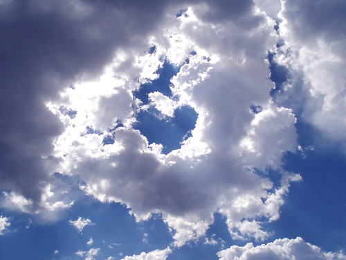
Hello Paradise!
Photo Credit: flickr.com
The balmy trade winds will continue to grace the Hawaiian Islands through Thursday, then get lighter Friday into the weekend. The latest weather map shows a moderately strong 1032 millibar high pressure system far to the northeast of Hawaii, which continues to be the source of our trade winds Wednesday night. Forecast weather maps show that later this week, our winds will become lighter, and turn southeast. Storms in the middle latitudes of the north central Pacific, will force our trade wind producing high pressure ridge down over the islands then, initiating this change in wind speed and direction.
We continue to enjoy this dry weather period, with little change expected anytime soon. Whatever showers that do fall will be quite light, with the most generous amounts falling along the windward sides. The south and west facing leeward sides will have a dry week, with lots of sunshine during the days. As the winds get softer this coming weekend, we’ll see some increase in clouds building up over and around the mountains during the afternoon hours. These interior clouds will drop a few showers, but nothing heavy is expected. This drier than normal winter period will extend into next week.
It’s Wednesday evening as I begin updating this last paragraph of today’s narrative. There will continue to be generous amounts of our famous Hawaiian sunshine beaming down now. This of course will keep the daytime air temperatures rising up into the 80F’s along the leeward beaches…perhaps even topping out near the middle 80’s in those very warmest spots! This is winter weather at its absolute best, just fabulous really. The winds have been quite light along our leeward beaches, which adds to the great beaching opportunities as well. If you happen to make it to one of our incredible sandy beaches today, don’t burn your feet on the hot sand, and keep an eye out for those whales splashing around offshore. As I’ve been saying here, and on my TV weather show too, it just doesn’t get much better than this in February! ~~~ Meanwhile, over on the north and west facing beaches, it’s very nice as well. One thing that we’ll need to be aware of soon is the rising surf Thursday. A major winter storm far to the NW of the islands generated a very large swell train of waves, which are heading this way now. This deep storm had hurricane force winds pointed in the direction of Hawaii several days ago. This swell will be one of our largest of the winter season, and cause the issuance of high surf warnings along those north and west facing shores. This will be dangerous surf, and everyone should use extra caution when getting near the ocean in those areas through the next several days. ~~~ Wednesday saw more clouds than we’ve seen the last several days, although they remained dry for the most part. The trade winds came up a little more than lately as well, but remained well within the managable light to moderately strong range. ~~~ I will be back very early Thursday morning, with your Valentine’s Day version of this weather narrative from paradise. I hope everyone has a great Wednesday night, wherever you happen to be spending it! Aloha for now…Glenn.
Interesting: Chances are about even that Lake Mead, the prime source of water for the desert city of Las Vegas, will run dry in 13 years if usage is not cut back, according to study released on Tuesday.
The finding is the latest warning about water woes threatening the future of the fast-growing U.S. casino capital and comes amid a sustained drought in the American West.
The study by two researchers at the Scripps Institution of Oceanography at the University of California San Diego calculates a 10 percent chance that Lake Mead will run dry in six years and a 50 percent probability it will be gone by 2021 absent other changes.
"Our reaction was frankly one of being stunned," study co-author Tim Barnett, a marine research physicist, said in an interview. "We had not expected the problem to be so severe and so up close to us in time."
Since its almost Valentine’s Day, we’d better starting thinking in these terms: Flirting is universal. A woman living in New York City and one in rural Cambodia may not have much in common, but when it comes to attracting a little attention, they both employ the very same move: smiling, arching their eyebrows, then averting their gaze and giggling. Animals flirt, too: Birds, reptiles, and even fish have their own way of strutting their stuff. Moral of the story: If the simple sea bass can act cute to enhance a romantic agenda, you can, too—so give it a go!
If you like to listen to all kinds of music online…try this, pandora.com
Glenn’s TV Weather show is back online again now. The colors aren’t perfect, although they are close enough. One day’s show will replaced with the next new days show at around 9am HST (11am PST – 2pm EST)…Monday through Friday. Thanks to the folks at the Maui Media Lab in Paia for making this happen!
Posted by Glenn
No Comments
February 12-13 2008
Air Temperatures – The following maximum temperatures were recorded across the state of Hawaii Tuesday:
Lihue, Kauai – 79
Honolulu, Oahu – 83
Kaneohe, Oahu – 79
Kahului, Maui – 81
Hilo, Hawaii – 75
Kailua-Kona, Hawaii – 81
Temperatures ranged between these warmest and coolest spots near sea level at 4 a.m. Tuesday morning:
Lihue, Kauai – 73F
Kahului, Maui – 60
Precipitation Totals – The following numbers represent the largest precipitation totals (inches) during the last 24 hours on each of the major islands, as of Tuesday afternoon:
0.39 MOUNT WAIALEALE, KAUAI
0.27 AHUIMANU LOOP, OAHU
0.00 MOLOKAI
0.00 LANAI
0.00 KAHOOLAWE
0.14 PUU KUKUI, MAUI
0.46 LAUPAHOEHOE, BIG ISLAND
Weather Chart – Here’s the latest (automatically updated) weather map. A moderately strong 1033 millibar high pressure system remains far NE of the islands Wednesday. This high pressure cell has a ridge extendding southwest to a point north of Hawaii. This pressure configuration will keep light to moderately strong trade winds blowing across our area into Thursday. Here’s a Weather Map Symbol page for clarification about what all those weather symbols mean on the map.
Satellite and Radar Images: To view the cloud conditions we have here in Hawaii, please use the following satellite links, starting off with the Infrared Satellite Image of the islands to see all the clouds around the state during the day and night. This next image is one that gives close images of the islands only during the daytime hours, and is referred to as a Close-up visible image. This next image shows a larger view of the Pacific…giving perspective to the wider ranging cloud patterns in the Pacific Ocean…out from the islands. To help you keep track of where any showers may be around the islands, here’s the latest animated radar image.
Hawaii’s Mountains – Here’s a link to the live webcam on the summit of near 14,000 foot Mauna Kea on the Big Island of Hawaii. The tallest peak on the island of Maui is the Haleakala Crater, which is near 10,000 feet in elevation. These two webcams are available during the daylight hours here in the islands…and when there’s a big moon rising just after sunset for an hour or two! Plus, during the nights and early mornings you will be able to see stars, and the sunrise too…depending upon cloud conditions.
Aloha Paragraphs
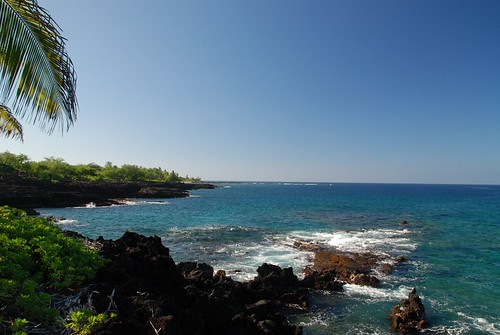
The volcanic Kona coast on the Big Island
Our local trade winds will remain light to moderately strong through Wednesday into Thursday…and then slip down in strength Friday into the weekend. The latest weather map shows an area of high pressure far to the northeast of Hawaii, which is the source of our trade winds now. Forecast weather charts suggest that later this week, our winds will get quite light, and turn to the southeast. Storms in the middle latitudes of the north central Pacific, will force our trade wind producing high pressure ridge down over the islands then, the reason for the slow down in our local wind speeds…and the shift in direction as well.
As far as rain goes, there won’t be much, with dry conditions lasting through the remainder of the work week. Whatever showers that do fall will be quite light, with the most generous amounts falling during the night and early morning hours along the windward sides. The south and west facing leeward sides will have a dry week, with lots of sunshine during the days. As the winds get softer this coming weekend, we’ll see some increase in clouds building up over and around the mountains during the afternoon hours. These interior clouds will drop a few showers, but nothing heavy is expected.
It’s Tuesday evening as I begin updating this last paragraph of today’s narrative. The Hawaiian Islands will continue to enjoy very favorable winter weather conditions. The trough of low pressure, which gave us trouble earlier in the month, remains a safe distance to the east of the islands. When that trough moved away, we saw a fair weather ridge of high pressure take its place. This upper level ridge is protecting us from storms to our north, shunting their associated cold fronts by safely to the north as well. This ridge aloft is suppressing showers, keeping clouds from getting thick, which makes them less shower prone. All things considered, it doesn’t get too much better than this during the month of February! ~~~ As expected, Tuesday was one of those special days during winter, when it could just as easily have been a summer day. High temperatures Tuesday, which topped out at a very comfortalbe 83F degrees at the Honolulu airport, were warm everywhere. Here in Kihei, it felt like around 85F degrees while I was sitting by the beach at lunch, and I’m sure it was just like that over on Front Street in Lahaina town as well. Oh yeah, the word paradise immediately pops into ones mind while in the islands now, it is that good. ~~~ I didn’t see any today, but I know that they’re out there…the Humpback Whales that is. I know people are seeing them offshore from the beach, or taking a whale cruise to get a closer look. We are still well into the heart of the whale watching season, which lasts through March into April. ~~~ I will be back very early Wednesday morning with your next new weather narrative, I hope you have a great Tuesday night until then! Aloha for now…Glenn.
Interesting: A new concept car from General Motors could get 53 mpg on a propulsion system pioneered in submarines about a hundred years ago.
Rechargeable batteries power an electric motor that turns the wheels. There’s also an engine, which can be used to charge the batteries. The setup worked for the U.S. Navy during the Wilson Administration, so it just might also shine on 21st Century American highways. At least that’s what GM apparently hopes, as it is reportedly intends to have the car in production by 2010 as an addition to the Chevy lineup.
"They have taken the way that the automobile industry thinks about hybrid cars, and turned it on its ear," said Michelle Krebs, editor at Edmunds AutoObserver.com. "If you don’t drive far, you may never need gasoline. No other major car maker had done this."
Most hybrid cars, she noted, retain a connection between the engine and the wheels, and use the electric motor to supplement the gasoline engine.
If you like to listen to all kinds of music online…try this, pandora.com
Glenn’s TV Weather show is back online again now. The colors aren’t perfect, although they are close enough. One day’s show will replaced with the next new days show at around 9am HST (11am PST – 2pm EST)…Monday through Friday. Thanks to the folks at the Maui Media Lab in Paia for making this happen!
Posted by Glenn
[5] Comments
February 11-12 2008
Air Temperatures – The following maximum temperatures were recorded across the state of Hawaii Monday:
Lihue, Kauai – 79
Honolulu, Oahu – 82
Kaneohe, Oahu – 78
Kahului, Maui – 77
Hilo, Hawaii – 78
Kailua-Kona, Hawaii – 81
Temperatures ranged between these warmest and coolest spots near sea level at 4 a.m. Monday morning:
Lihue, Kauai – 73F
Hilo, Hawaii – 64
Precipitation Totals – The following numbers represent the largest precipitation totals (inches) during the last 24 hours on each of the major islands, as of Monday afternoon:
0.21 MOUNT WAIALEALE, KAUAI
0.34 LUALUALEI, OAHU
0.00 MOLOKAI
0.00 LANAI
0.00 KAHOOLAWE
0.14 WEST WAILUAIKI, MAUI
0.27 HILO AIRPORT, BIG ISLAND
Weather Chart – Here’s the latest (automatically updated) weather map. A 1029 millibar high pressure system is evident far to the NE of the islands Monday, which will be moving closer. This pressure configuration will keep light-moderately strong trade winds blowing through Tuesday…locally moderately strong and gusty. Here’s a Weather Map Symbol page for clarification about what all those weather symbols mean on the map.
Satellite and Radar Images: To view the cloud conditions we have here in Hawaii, please use the following satellite links, starting off with the Infrared Satellite Image of the islands to see all the clouds around the state during the day and night. This next image is one that gives close images of the islands only during the daytime hours, and is referred to as a Close-up visible image. This next image shows a larger view of the Pacific…giving perspective to the wider ranging cloud patterns in the Pacific Ocean…out from the islands. To help you keep track of where any showers may be around the islands, here’s the latest animated radar image.
Hawaii’s Mountains – Here’s a link to the live webcam on the summit of near 14,000 foot Mauna Kea on the Big Island of Hawaii. The tallest peak on the island of Maui is the Haleakala Crater, which is near 10,000 feet in elevation. These two webcams are available during the daylight hours here in the islands…and when there’s a big moon rising just after sunset for an hour or two! Plus, during the nights and early mornings you will be able to see stars, and the sunrise too…depending upon cloud conditions.
Aloha Paragraphs

Valentine’s Day is just up the road!
Light to moderately strong trade winds will persist through this work week. The latest weather map shows an area of high pressure far to the northeast of Hawaii…offshore from the San Francisco, California coast. Computer forecast models suggest that by this coming Friday into the weekend, our winds will get quite light. Low pressure in the middle latitudes of the central Pacific, will force our trade wind producing high pressure ridge down over the islands then. Our local winds will swing around to the southeast by Saturday and Sunday. Often when the air flow comes in from this direction we see volcanic haze move up over the Kona coast, and further up the island chain to Maui at times.
A high pressure ridge aloft will keep showers limited this week, and for the most part restricted to the windward coasts and slopes. Whatever showers that do fall will be quite light, becoming most generous during the night and early morning hours. The south and west facing leeward sides will have a dry week, with lots of sunshine during the days. As the winds get softer this coming weekend, we will see some increase in clouds building up over and around the mountains during the afternoon hours. These interior clouds won’t drop many showers however, as the upper air ridge of high pressure will remain in place over the islands, limiting the showers then as well.
It’s Monday evening as I begin updating this last paragraph of today’s narrative. This will be the first week in a long time that we could actually call fairly normal…in terms of weather at least. The one thing that remains somewhat unusual will be the long lasting period of trade winds that have blown this year so far. January was filled with trade winds, except for about a week…while February has seen trade winds blowing everyday so far. Typically, the trade winds would be less dominant during winter, with light and variable wind days, along with days with south to SW winds blowing more often here in Hawaii. Having said that, we’re expecting our winds to finally stop coming in from the trade wind direction this coming weekend. ~~~ As we embark on this new week, I see absolutely no problems, in regards to rainfall or strong winds. As a matter of fact, this should be a lovely week! The leeward beaches especially will be in fine shape, making for very inviting conditions for our local residents, and of course all the visitors that are here as well. ~~~ The one thing that I notice that’s different this evening, compared to this morning, is the high level cirrus clouds that have moved in. This looping satellite image shows them dropping down from the north. As long as they’re around, we should have nice sunset and sunrise colors! ~~~ I’m starting to get excited about Valentine’s Day, as noted by the picture up the page. I like holiday’s in general, but Thursday is one of the more fun ones…having all to do with love and all! Love is… ~~~ I hope you have a good Monday night wherever you happen to be spending it! I’ll be back very early Tuesday morning, dark and early, with your next new weather narrative from paradise. Aloha for now…Glenn.
Interesting: It lived up to its name: The temperature in International Falls fell to 40 below zero Monday, just a few days after the northern Minnesota town won a federal trademark making it officially the "Icebox of the Nation.” It was so cold that resident Nick McDougall couldn’t even get his car trunk lid to close after he got out his charger to kick-start his dead battery. By late morning, the temperature had risen all the way to 18 — below zero. "This is about as cold as it gets, this is bad. There’s no wind — it’s just cold,” said McDougall, 48, a worker at The Fisherman, a convenience store and gas station in the town on the Canadian border. "People just don’t go out, unless you have to go to work.” Residents of the area use electric engine block heaters to keep their cars from freezing. "You plug in your car, for sure, and you put the car in the garage if you can,” McDougall said. His garage is full of other things, so he had to park outside — a "big mistake.” The previous record low in International Falls was 37 below, set in 1967, said meteorologist Mike Stewart at the weather service in Duluth. The cold was expected, he said: "When the winds finally died off and the skies cleared off, it just dropped.”
Glenn’s TV Weather show is back online again now. The colors aren’t perfect, although they are close enough. One day’s show will replaced with the next new days show at around 9am HST (11am PST – 2pm EST)…Monday through Friday. Thanks to the folks at the Maui Media Lab in Paia for making this happen!
Posted by Glenn
No Comments
February 10-11 2008
Air Temperatures – The following maximum temperatures were recorded across the state of Hawaii Sunday:
Lihue, Kauai – 79
Honolulu, Oahu – 82
Kaneohe, Oahu – 78
Kahului, Maui – 80
Hilo, Hawaii – 79
Kailua-Kona, Hawaii – 81
Temperatures ranged between these warmest and coolest spots near sea level at 5 a.m. Sunday morning:
Lihue, Kauai – 73F
Kahului, Maui, Kauai – 61
Precipitation Totals – The following numbers represent the largest precipitation totals (inches) during the last 24 hours on each of the major islands, as of Sunday afternoon:
1.16 MOUNT WAIALEALE, KAUAI
0.28 OAHU FOREST NWR, OAHU
0.00 MOLOKAI
0.01 LANAI
0.00 KAHOOLAWE
0.18 WEST WAILUAIKI, MAUI
0.50 GLENWOOD, BIG ISLAND
Weather Chart – Here’s the latest (automatically updated) weather map. A 1030 millibar high pressure system is evident far to the NE of the islands Monday, which will be moving closer. This pressure configuration will keep light-moderately strong trade winds blowing through Tuesday. Here’s a Weather Map Symbol page for clarification about what all those weather symbols mean on the map.
Satellite and Radar Images: To view the cloud conditions we have here in Hawaii, please use the following satellite links, starting off with the Infrared Satellite Image of the islands to see all the clouds around the state during the day and night. This next image is one that gives close images of the islands only during the daytime hours, and is referred to as a Close-up visible image. This next image shows a larger view of the Pacific…giving perspective to the wider ranging cloud patterns in the Pacific Ocean…out from the islands. To help you keep track of where any showers may be around the islands, here’s the latest animated radar image.
Hawaii’s Mountains – Here’s a link to the live webcam on the summit of near 14,000 foot Mauna Kea on the Big Island of Hawaii. The tallest peak on the island of Maui is the Haleakala Crater, which is near 10,000 feet in elevation. These two webcams are available during the daylight hours here in the islands…and when there’s a big moon rising just after sunset for an hour or two! Plus, during the nights and early mornings you will be able to see stars, and the sunrise too…depending upon cloud conditions.
Aloha Paragraphs

Our famous Hawaiian sunshine will be in full measure now
Drier air both at the surface and aloft, with keep favorably inclined weather circumstances in the Hawaiian Islands now. The upper trough, which kept our atmosphere unstable for so long, is now out of the picture to our SE and east. As the trough moves away, the entire state will find good weather, which will extend into the new week ahead. There will still be a few windward biased showers around, and a few around the mountains, although mostly light ones….while the leeward beaches bask in warm sunshine now!
The trade winds are with us now, and will last through most of the new week ahead. The latest weather map shows an area of high pressure well established far to the northeast of Hawaii. Forecast weather charts suggest that the trade winds will continue well into the future. These winter trade winds will be just strong enough to keep a small craft wind advisory active in those windiest areas around the Big Island and Maui. The trade winds will get lighter as we get into next weekend…although that’s too far out into the future to know for sure at this point
It’s Sunday evening as I begin updating this last paragraph of today’s narrative. As noted above, our weather is back to normal now, which is good thing, after all the clouds and showers over the last week and a half. The atmospheric destabilizing upper trough of low pressure has been replaced with high pressure now. This has eliminated completely the chance of heavy showers, and as a matter of fact, most showers will be on the light side of the precipitation spectrum. Enough about clouds and showers, it’s time to focus our attention on clear skies and warm sunshine! The days will find lots of sunshine beaming down, and in many of the leeward areas, that sun will prevail all day long. The latest computer forecast model output shows no cold fronts, or any other organized shower areas looming in the distance. So, I think we can relax into what looks like a prolonged period of good weather. ~~~ It’s Sunday evening here in Kula, Maui. I just got finished making a nice pasta sauce. I sauteed in extra virgin olive oil a whole organic red onion. Then I sliced in a lot of fresh mushrooms, and three small organic zucchini…along with a small medium hot green pepper. Once I had that nicely cooking, I added a whole can of roasted organic diced tomatoes. Later this evening I’ll cook up some pasta, topping it with the sauce, adding some wild organic capers, and finally, grate some Romano Pecorino cheese. I love these simple pasta sauces, which I’ll eat each night through the coming work week. I’m too tired to start over a new meal each night after work, so its very easy to cook some pasta, and heat up just the right amount of pasta sauce to go with it. ~~~ I’ll be back very early Monday morning with your next new weather narrative, I hope you have a peaceful Sunday night until then. Aloha for now…Glenn.
Weekend poem, this time written by Robert Bly, called The Third Body…
A man and a woman sit near each other, and they do
not long
At this moment to be older, or younger, or born
In any other nation, or any other time, or any other
place.
They are content to be where they are, talking or not
talking.
Their breaths together feed someone whom we do
not know.
The man sees the way his fingers move;
He sees her hands close around a book she hands to
him.
They obey a third body that they share in common.
They have promised to love that body.
Age may come; parting may come; death will come!
A man and a woman sit near each other;
As they breathe they feed someone we do not know,
Someone we know of, whom we have never seen.
Glenn’s TV Weather show is back online again now. The colors aren’t perfect, although they are close enough. One day’s show will replaced with the next new days show at around 9am HST (11am PST – 2pm EST)…Monday through Friday. Thanks to the folks at the Maui Media Lab in Paia for making this happen!
« Previous Page — Next Page »


