


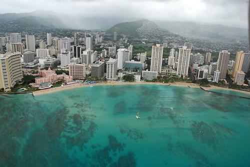
Hawaiian Islands weather details and Aloha paragraphs
Posted by GlennFebruary 15-16 2008
Air Temperatures – The following maximum temperatures were recorded across the state of Hawaii Friday:
Lihue, Kauai – 79
Honolulu, Oahu – 80
Kaneohe, Oahu – 77
Kahului, Maui – 79
Hilo, Hawaii – 82
Kailua-Kona, Hawaii – 81
Temperatures ranged between these warmest and coolest spots near sea level at 4 a.m. Friday morning:
Kaneohe, Oahu – 72F
Kahului, Maui – 57
Precipitation Totals – The following numbers represent the largest precipitation totals (inches) during the last 24 hours on each of the major islands, as of Friday afternoon:
0.14 MOUNT WAIALEALE, KAUAI
0.02 MAUNAWILI, OAHU
0.00 MOLOKAI
0.07 LANAI
0.00 KAHOOLAWE
0.13 WEST WAILUAIKI, MAUI
0.16 GLENWOOD, BIG ISLAND
Weather Chart – Here’s the latest (automatically updated) weather map. A high pressure ridge extending southwest from a high pressure system far NE of Hawaii…will drop down over the islands soon. This pressure configuration will cause light and variable winds, with a tendency for them to come up from the southeast direction through Sunday. Here’s a Weather Map Symbol page for clarification about what all those weather symbols mean on the map.
Satellite and Radar Images: To view the cloud conditions we have here in Hawaii, please use the following satellite links, starting off with the Infrared Satellite Image of the islands to see all the clouds around the state during the day and night. This next image is one that gives close images of the islands only during the daytime hours, and is referred to as a Close-up visible image. This next image shows a larger view of the Pacific…giving perspective to the wider ranging cloud patterns in the Pacific Ocean…out from the islands. To help you keep track of where any showers may be around the islands, here’s the latest animated radar image.
Hawaii’s Mountains – Here’s a link to the live webcam on the summit of near 14,000 foot Mauna Kea on the Big Island of Hawaii. The tallest peak on the island of Maui is the Haleakala Crater, which is near 10,000 feet in elevation. These two webcams are available during the daylight hours here in the islands…and when there’s a big moon rising just after sunset for an hour or two! Plus, during the nights and early mornings you will be able to see stars, and the sunrise too…depending upon cloud conditions.
The Hawaiian Islands have now entered a light wind convective weather pattern. Storms in the middle latitudes of the north central Pacific, has forced our trade wind producing high pressure ridge down over the islands now, initiating this change in our wind regime. Our local winds will have a tendency to come up from the southeast direction as we move into the weekend. This will bring some volcanic haze up over the Kona slopes of the Big Island, and on up the island chain to the islands of Maui County. SE winds will bring humid air into the Aloha state as well, with noticeably warmer daytime temperatures, or at least they will feel that way.
Days will start off clear, leading to clouds forming over and around the mountains during the afternoons. These interior clouds will drop a few showers locally, although most of them aren’t expected to be particularly heavy. The leeward beaches may become cloudy in the afternoons, although the bulk of the showers will concentrate their efforts in the upcountry areas. During the nights, those daytime clouds will collapse, with downslope breezes bringing somewhat cooler than normal temperatures down to sea level. As usual during a weather pattern such as this, the beaches will be the sunniest places…especially during the mornings.
It’s Aloha Friday evening as I begin updating this last paragraph of today’s narrative. We’ve seen the trade winds blowing almost everyday this year, through most of January, and all of February so far. This is about to come to a screeching halt, as our trade wind producing high pressure ridge gets displaced southward. As the ridge drops right down over us, our winds will become light to very light. This in turn will put us into a convective weather pattern, which simply means clear mornings giving way to afternoon clouds over and around the mountains. At times, under these circumstances, we can see heavy downpours in the upcountry areas. This time around however, that doesn’t look like it will happen…with most of the showers falling in the light to moderate category. ~~~ The trade winds aren’t scheduled to return anytime soon, so that we’ll be hanging out in this light wind condition well into the future. This suggests that we’ll see some form of haze developing, which may eventually become very noticeable. As the winds will be drifting up from the southeast, there’s a good chance that some of this haze will have volcanic origins. It will take the return of the trade winds at some point next week to finally ventilate away these hazy conditions. ~~~ I’m heading from Kihei over to Kahului now, where I’ll take in a new film this evening. This isn’t exactly the highest rated film of the year, by any means, although I’m in the mood to see a film anyway….what else is new Glenn!? At any rate, this film is called Jumper (2008), starring Hayden Christensen, and Samuel L. Jackson, among others. A genetic anomaly allows a young man to teleport himself anywhere. He discovers this gift has existed for centuries and finds himself in a war that has been raging for thousands of years between "Jumpers" and those who have sworn to kill them. I’ll let you know what I think of this when I come back online Saturday morning with your next new weather narrative. If you want a peek at this adventure, action…science fiction flick, here’s a trailer. ~~~ I hope you have a great Friday night wherever you happen to be spending it! Aloha for now…Glenn.
Glenn’s TV Weather show is back online again now. The colors aren’t perfect, although they are close enough. One day’s show will replaced with the next new days show at around 9am HST (11am PST – 2pm EST)…Monday through Friday. Thanks to the folks at the Maui Media Lab in Paia for making this happen!