


Hawaiian Islands weather details & Aloha paragraphs
Posted by GlennFebruary 14-15 2008
Air Temperatures – The following maximum temperatures were recorded across the state of Hawaii Thursday:
Lihue, Kauai – 78
Honolulu, Oahu – 81
Kaneohe, Oahu – 77
Kahului, Maui – 77
Hilo, Hawaii – 77
Kailua-Kona, Hawaii – 80
Temperatures ranged between these warmest and coolest spots near sea level at 4 a.m. Thursday morning:
Kaneohe, Oahu – 72F
Hilo, Hawaii – 63
Precipitation Totals – The following numbers represent the largest precipitation totals (inches) during the last 24 hours on each of the major islands, as of Thursday afternoon:
0.05 MOUNT WAIALEALE, KAUAI
0.03 OAHU FOREST NWR, OAHU
0.01 MOLOKAI
0.00 LANAI
0.00 KAHOOLAWE
0.01 PUU KUKUI, MAUI
0.53 KEALAKEKUA, BIG ISLAND
Weather Chart – Here’s the latest (automatically updated) weather map. A high pressure ridge extending southwest from a high pressure system far NE of Hawaii…will drop down over the islands soon. This pressure configuration will cause light and variable winds, with a tendency for them to come up from the southeast direction through Saturday. Here’s a Weather Map Symbol page for clarification about what all those weather symbols mean on the map.
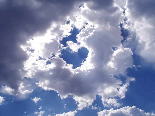
Satellite and Radar Images: To view the cloud conditions we have here in Hawaii, please use the following satellite links, starting off with the Infrared Satellite Image of the islands to see all the clouds around the state during the day and night. This next image is one that gives close images of the islands only during the daytime hours, and is referred to as a Close-up visible image. This next image shows a larger view of the Pacific…giving perspective to the wider ranging cloud patterns in the Pacific Ocean…out from the islands. To help you keep track of where any showers may be around the islands, here’s the latest animated radar image.
Hawaii’s Mountains – Here’s a link to the live webcam on the summit of near 14,000 foot Mauna Kea on the Big Island of Hawaii. The tallest peak on the island of Maui is the Haleakala Crater, which is near 10,000 feet in elevation. These two webcams are available during the daylight hours here in the islands…and when there’s a big moon rising just after sunset for an hour or two! Plus, during the nights and early mornings you will be able to see stars, and the sunrise too…depending upon cloud conditions.
We’re at the end of a long lasting trade wind weather pattern here in Hawaii, as we turn the corner into a light wind convective pattern. The latest weather map shows a 1030 millibar high pressure system far to the northeast of Hawaii, with its associated ridge extended southwest, to a point north and northeast of the islands Thursday night. Storms in the middle latitudes of the north central Pacific, will force our trade wind producing high pressure ridge down over the islands soon, initiating this change in wind speed and direction. Winds will be considerably lighter than any time since way back in January…Friday into the weekend, continuing that way into early next week.
The unusually dry conditions continue, although there will begin to be afternoon clouds and a few showers over the interior sections as we move into the weekend. Whatever showers that are around now, will fall mostly along the windward sides for the time being, although not many of them. As the winds get softer soon, we’ll see an increase in clouds building up over and around the mountains during the afternoon hours on each of the islands. These interior clouds will drop a few showers locally, although aren’t expected to be particularly heavy. The leeward beaches may become cloudy in the afternoons locally, although the bulk of the showers will concentrate their efforts most effectively in the upcountry areas.
It’s Valentine’s Day evening as I updating this last paragraph of today’s narrative. As noted in the two paragraphs above, we’re heading into a different weather pattern than we’ve seen for quite a while. The trade winds will soon be going on vacation, pushed southward by storms in the north Pacific. As the ridge migrates over us, or even slightly south of the islands, we’ll see very light winds, becoming dead calm at times. This will bring with it localized hazy conditions, with cooler than normal early mornings, giving way to somewhat warmer than normal daytime air temperatures. The daytime heating will prompt lots of afternoon clouds to gather over and around the mountains, with showers falling locally…before clearing out again after sunset. ~~~ Meanwhile, a major winter storm far to the NW of the islands generated a very large swell train of waves, which is breaking here in the islands today. This deep storm had hurricane force winds pointed in the direction of Hawaii several days ago. This swell will be one of our largest of the winter season, causing the issuance of high surf warnings along those north and west facing shores. This will be dangerous surf, and everyone should use extra caution when getting near the ocean in those areas through the next several days. ~~~ I’ll be back very early Friday morning with your next new weather narrative from paradise, I hope you have a very pleasant Thursday night until then! Aloha, Glenn.
Glenn’s TV Weather show is back online again now. The colors aren’t perfect, although they are close enough. One day’s show will replaced with the next new days show at around 9am HST (11am PST – 2pm EST)…Monday through Friday. Thanks to the folks at the Maui Media Lab in Paia for making this happen!