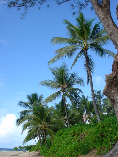
Hawaiian Islands weather details & Aloha paragraphs
Posted by GlennFebruary 17-18 2008
Air Temperatures – The following maximum temperatures were recorded across the state of Hawaii Sunday:
Lihue, Kauai – 82
Honolulu, Oahu – 81
Kaneohe, Oahu – 82
Kahului, Maui – 78
Hilo, Hawaii – 82
Kailua-Kona, Hawaii – 80
Temperatures ranged between these warmest and coolest spots near sea level at 6 a.m. Sunday morning:
Honolulu, Oahu – 74F
Hilo, Hawaii – 61
Precipitation Totals – The following numbers represent the largest precipitation totals (inches) during the last 24 hours on each of the major islands, as of Sunday afternoon:
0.53 MOHIHI CROSSING, KAUAI
0.99 WAIANAE VALLEY, OAHU
0.38 MOLOKAI
0.11 LANAI
0.01 KAHOOLAWE
0.14 KULA BRANCH STATION, MAUI
0.41 PALI 2, BIG ISLAND
Weather Chart – Here’s the latest (automatically updated) weather map. A high pressure ridge extending southwest from a high pressure system far NE of Hawaii…is now over Maui County. This pressure configuration will cause light and variable winds…with a slight drift of air from the southeast direction through Monday. Here’s a Weather Map Symbol page for clarification about what all those weather symbols mean on the map.
Satellite and Radar Images: To view the cloud conditions we have here in Hawaii, please use the following satellite links, starting off with the Infrared Satellite Image of the islands to see all the clouds around the state during the day and night. This next image is one that gives close images of the islands only during the daytime hours, and is referred to as a Close-up visible image. This next image shows a larger view of the Pacific…giving perspective to the wider ranging cloud patterns in the Pacific Ocean…out from the islands. To help you keep track of where any showers may be around the islands, here’s the latest animated radar image.
Hawaii’s Mountains – Here’s a link to the live webcam on the summit of near 14,000 foot Mauna Kea on the Big Island of Hawaii. The tallest peak on the island of Maui is the Haleakala Crater, which is near 10,000 feet in elevation. These two webcams are available during the daylight hours here in the islands…and when there’s a big moon rising just after sunset for an hour or two! Plus, during the nights and early mornings you will be able to see stars, and the sunrise too…depending upon cloud conditions.
Light south winds have replaced the light and variable winds of late, as our ridge has moved just south of the Big Island. Storms in the middle latitudes of the north central Pacific, have forced our trade wind producing high pressure ridge down over the Big Island or even a tad south of there Sunday afternoon. There will be light southerly kona winds, which has brought tropical moisture into our area now. This light field of winds will remain active through the next several days, with the chance of windy conditions associated with an active cold front for next weekend.
The kona breezes are bringing increased clouds into the state, with a better chance of showers now. These clouds will ride into the leeward coasts and slopes, dropping some showers, mostly light…although a few could be locally heavier here and there. As usual during a weather pattern such as this, the windward beaches will be the sunniest places. Looking further ahead, some of the computer models are showing possible rainy weather moving in later next weekend.
It’s Sunday afternoon as I begin updating this last paragraph of today’s narrative. Light south winds will be the name of the game for the time being…with showers most likely along the south facing slopes. ~~~ If you had a chance to read down through the two paragraphs above, you know that our weather here in the Aloha state will remain pretty similar from one day to the next into the new week ahead. The big change might occur later next weekend, when we could finally see a vigorous Pacific cold front barrel down through the state. If it did manifest, as a few of the models are describing, we may see blustery south kona winds arriving, ahead of a wet frontal cloud band, followed by brisk and cool north winds following its passage. There is still a lot of uncertainty around this possibility, being that it’s still a week out into the future…we’ll see what happens as we move through the week. ~~~ I drove down the mountain to lower Kula with my neighbors last evening, after a going away dinner for a friend who was leaving to go back to Switzerland. This birthday party was a fun one, with someone playing CD’s, and the living room floor filled with wild and crazy dancers…myself included! I have another friends birthday party to attend this afternoon, over on the windward side in Haiku. There won’t be any dancing, unfortunately, but it will be fun nonetheless. ~~~ I’ll be back Monday morning with your next new weather narrative. I hope you have a great Sunday night until then! Aloha for now…Glenn.
Glenn’s TV Weather show is back online again now. The colors aren’t perfect, although they are close enough. One day’s show will replaced with the next new days show at around 9am HST (11am PST – 2pm EST)…Monday through Friday. Thanks to the folks at the Maui Media Lab in Paia for making this happen!


 Email Glenn James: