


Hawaiian Islands weather details & Aloha paragraphs
Posted by GlennFebruary 13-14 2008
Air Temperatures – The following maximum temperatures were recorded across the state of Hawaii Wednesday:
Lihue, Kauai – 78
Honolulu, Oahu – 83
Kaneohe, Oahu – 77
Kahului, Maui – 76
Hilo, Hawaii – 79
Kailua-Kona, Hawaii – 80
Temperatures ranged between these warmest and coolest spots near sea level at 4 a.m. Wednesday morning:
Lihue, Kauai – 73F
Kahului, Maui – 60
Precipitation Totals – The following numbers represent the largest precipitation totals (inches) during the last 24 hours on each of the major islands, as of Wednesday afternoon:
0.29 MOUNT WAIALEALE, KAUAI
0.07 OAHU FOREST NWR, OAHU
0.00 MOLOKAI
0.00 LANAI
0.00 KAHOOLAWE
0.03 WEST WAILUAIKI, MAUI
0.60 GLENWOOD, BIG ISLAND
Weather Chart – Here’s the latest (automatically updated) weather map. A 1031 millibar high pressure system remains far NE of the islands Thursday. This high pressure cell has a ridge extending southwest to a point north and NE of Hawaii. This pressure configuration will keep light to moderately strong trade winds blowing across our area…gradually getting lighter Friday. Here’s a Weather Map Symbol page for clarification about what all those weather symbols mean on the map.
Satellite and Radar Images: To view the cloud conditions we have here in Hawaii, please use the following satellite links, starting off with the Infrared Satellite Image of the islands to see all the clouds around the state during the day and night. This next image is one that gives close images of the islands only during the daytime hours, and is referred to as a Close-up visible image. This next image shows a larger view of the Pacific…giving perspective to the wider ranging cloud patterns in the Pacific Ocean…out from the islands. To help you keep track of where any showers may be around the islands, here’s the latest animated radar image.
Hawaii’s Mountains – Here’s a link to the live webcam on the summit of near 14,000 foot Mauna Kea on the Big Island of Hawaii. The tallest peak on the island of Maui is the Haleakala Crater, which is near 10,000 feet in elevation. These two webcams are available during the daylight hours here in the islands…and when there’s a big moon rising just after sunset for an hour or two! Plus, during the nights and early mornings you will be able to see stars, and the sunrise too…depending upon cloud conditions.
The balmy trade winds will continue to grace the Hawaiian Islands through Thursday, then get lighter Friday into the weekend. The latest weather map shows a moderately strong 1032 millibar high pressure system far to the northeast of Hawaii, which continues to be the source of our trade winds Wednesday night. Forecast weather maps show that later this week, our winds will become lighter, and turn southeast. Storms in the middle latitudes of the north central Pacific, will force our trade wind producing high pressure ridge down over the islands then, initiating this change in wind speed and direction.
We continue to enjoy this dry weather period, with little change expected anytime soon. Whatever showers that do fall will be quite light, with the most generous amounts falling along the windward sides. The south and west facing leeward sides will have a dry week, with lots of sunshine during the days. As the winds get softer this coming weekend, we’ll see some increase in clouds building up over and around the mountains during the afternoon hours. These interior clouds will drop a few showers, but nothing heavy is expected. This drier than normal winter period will extend into next week.
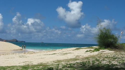
It’s Wednesday evening as I begin updating this last paragraph of today’s narrative. There will continue to be generous amounts of our famous Hawaiian sunshine beaming down now. This of course will keep the daytime air temperatures rising up into the 80F’s along the leeward beaches…perhaps even topping out near the middle 80’s in those very warmest spots! This is winter weather at its absolute best, just fabulous really. The winds have been quite light along our leeward beaches, which adds to the great beaching opportunities as well. If you happen to make it to one of our incredible sandy beaches today, don’t burn your feet on the hot sand, and keep an eye out for those whales splashing around offshore. As I’ve been saying here, and on my TV weather show too, it just doesn’t get much better than this in February! ~~~ Meanwhile, over on the north and west facing beaches, it’s very nice as well. One thing that we’ll need to be aware of soon is the rising surf Thursday. A major winter storm far to the NW of the islands generated a very large swell train of waves, which are heading this way now. This deep storm had hurricane force winds pointed in the direction of Hawaii several days ago. This swell will be one of our largest of the winter season, and cause the issuance of high surf warnings along those north and west facing shores. This will be dangerous surf, and everyone should use extra caution when getting near the ocean in those areas through the next several days. ~~~ Wednesday saw more clouds than we’ve seen the last several days, although they remained dry for the most part. The trade winds came up a little more than lately as well, but remained well within the managable light to moderately strong range. ~~~ I will be back very early Thursday morning, with your Valentine’s Day version of this weather narrative from paradise. I hope everyone has a great Wednesday night, wherever you happen to be spending it! Aloha for now…Glenn.
Interesting: Chances are about even that Lake Mead, the prime source of water for the desert city of Las Vegas, will run dry in 13 years if usage is not cut back, according to study released on Tuesday.
The finding is the latest warning about water woes threatening the future of the fast-growing U.S. casino capital and comes amid a sustained drought in the American West.
The study by two researchers at the Scripps Institution of Oceanography at the University of California San Diego calculates a 10 percent chance that Lake Mead will run dry in six years and a 50 percent probability it will be gone by 2021 absent other changes.
"Our reaction was frankly one of being stunned," study co-author Tim Barnett, a marine research physicist, said in an interview. "We had not expected the problem to be so severe and so up close to us in time."
Since its almost Valentine’s Day, we’d better starting thinking in these terms: Flirting is universal. A woman living in New York City and one in rural Cambodia may not have much in common, but when it comes to attracting a little attention, they both employ the very same move: smiling, arching their eyebrows, then averting their gaze and giggling. Animals flirt, too: Birds, reptiles, and even fish have their own way of strutting their stuff. Moral of the story: If the simple sea bass can act cute to enhance a romantic agenda, you can, too—so give it a go!
If you like to listen to all kinds of music online…try this, pandora.com
Glenn’s TV Weather show is back online again now. The colors aren’t perfect, although they are close enough. One day’s show will replaced with the next new days show at around 9am HST (11am PST – 2pm EST)…Monday through Friday. Thanks to the folks at the Maui Media Lab in Paia for making this happen!