


Hawaiian Islands weather details & Aloha paragraphs
Posted by GlennFebruary 19-20 2008
Air Temperatures – The following maximum temperatures were recorded across the state of Hawaii Tuesday:
Lihue, Kauai – 80
Honolulu, Oahu – 80
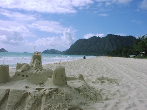
Kaneohe, Oahu – 80
Kahului, Maui – 79
Hilo, Hawaii – 83
Kailua-Kona, Hawaii – 80
Temperatures ranged between these warmest and coolest spots near sea level at 4 a.m. Tuesday morning:
Kailua-kona – 71F
Kahului, Maui – 58
Precipitation Totals – The following numbers represent the largest precipitation totals (inches) during the last 24 hours on each of the major islands, as of Tuesday afternoon:
0.01 MOLOAA DAIRY, KAUAI
0.02 MANOA LYON ARBORETUM, OAHU
0.00 MOLOKAI
0.00 LANAI
0.00 KAHOOLAWE
0.04 ULUPALAKUA, MAUI
0.03 WAIKII, BIG ISLAND
Weather Chart – Here’s the latest (automatically updated) weather map. A high pressure ridge extending southwest from a small high pressure system just to the east of Hawaii…is now over Kauai. This pressure configuration will cause light and variable winds, with daytime sea breezes through Thursday. Here’s a Weather Map Symbol page for clarification about what all those weather symbols mean on the map.
Satellite and Radar Images: To view the cloud conditions we have here in Hawaii, please use the following satellite links, starting off with the Infrared Satellite Image of the islands to see all the clouds around the state during the day and night. This next image is one that gives close images of the islands only during the daytime hours, and is referred to as a Close-up visible image. This next image shows a larger view of the Pacific…giving perspective to the wider ranging cloud patterns in the Pacific Ocean…out from the islands. To help you keep track of where any showers may be around the islands, here’s the latest animated radar image.
Hawaii’s Mountains – Here’s a link to the live webcam on the summit of near 14,000 foot Mauna Kea on the Big Island of Hawaii. The tallest peak on the island of Maui is the Haleakala Crater, which is near 10,000 feet in elevation. These two webcams are available during the daylight hours here in the islands…and when there’s a big moon rising just after sunset for an hour or two! Plus, during the nights and early mornings you will be able to see stars, and the sunrise too…depending upon cloud conditions.
Light and variable winds will remain in place through the work week…with stronger south kona winds arriving later this weekend. Storms in the middle latitudes of the north central Pacific, are keeping our trade wind producing high pressure ridge down over the islands of Maui County Tuesday evening. Daytime sea breezes will blow near the beaches, followed by downslope land breezes during the nights. There remains the good chance of brisk southerly winds associated with an active cold front arriving Sunday…followed by cool north winds after it passes through into Monday.
This convective weather pattern will provide clear skies during the mornings, giving way to afternoon clouds over and around the mountains. The clouds will clear back at night, providing a good view of the upcoming full moon Wednesday evening here in the islands. As usual during a weather pattern such as this, the beaches will be the sunniest places. The overlying atmosphere is dry and stable from Kauai down through the Big Island. This will keep whatever showers that may fall in the upcountry areas light and spotty at best. The computer models are showing a showery cold front arriving Sunday into next Monday.
It’s Tuesday evening as I begin updating this last paragraph of today’s narrative. A well established convective weather pattern remains in place over the Hawaiian Islands now. Clear nights, with cooler than normal temperatures, will provide a near cloud free start to the mornings. As the sun gets higher in the sky, clouds will begin to form over and around the mountains, although for the most part, will be dry ones. ~~~ It’s looking more and more likely that an active Pacific cold front will push down through the state later this coming weekend into next Monday. If this frontal passage occurs as the computer models are suggesting, we would see breezy south kona winds arriving ahead of a showery cloud band, followed by brisk and cool north to northeast winds in the wake of its passage. ~~~ This week looks like a good one, although with light winds, and a fairly low inversion layer, we’ll see quite a bit of haze around the edges. As mentioned above, the nights and early mornings will be on the cool side, with the need for an extra blanket on the bed perhaps necessary, even right down at sea level. ~~~ Speaking of the nights, this month’s full moon will occur, at least here in the islands, early Wednesday evening. It has already been quite large and bright the last few nights, so that Tuesday night through Thursday nights will continue to see that moon really beaming down on us! ~~~ Tuesday turned out to be one of the sunniest days of the month so far. The mid afternoon hours finally saw some pretty light weight cumulus clouds congregating around the mountains. As has been the case the last few days, there will continue to be generally dry weather just about everywhere! I’ll be back very early Wednesday morning with your next new weather narrative from paradise. I hope you have a great Tuesday night wherever you happen to be spending it! Aloha for now…Glenn.
Interesting: An apparent meteor streaked through the sky over the Pacific Northwest early Tuesday, drawing reports of bright lights and sonic booms in parts of Washington, Oregon and Idaho.
Although a witness reported seeing the object strike the Earth in a remote part of Adams County, in southeast Washington, it had not been found.
"I’m convinced it was a meteor," said Geoff Chester, spokesman for the U.S. Naval Observatory in Washington, D.C. "It was a classic description of a fireball."
Chester speculated the meteor was the size of a big suitcase and had been orbiting the sun for millions of years before entering Earth’s orbit.
The Federal Aviation Administration said a private pilot reported seeing the meteor hit the Earth in a burst of light near State Route 26 and the Lind-Hatton Road about 5:45 a.m.
The Adams County sheriff’s office had no immediate reports of damage, injury or a meteor landing in the area, about 175 miles east-southeast of Seattle and 90 miles southwest of Spokane.
Chester said people commonly think they see a meteor hit or about to hit the ground, when it is nowhere close. Most meteorites that strike the Earth are never found, he said
"When you see objects like this in the sky your sense of scale is distorted," he said. "It’s a common optical illusion."
A number of pilots reported seeing the meteor streaking through the sky from Boise, Idaho, into Washington state, the FAA said.
Surveillance cameras in the region captured a ball of light in the sky and then a flash illuminating the early morning darkness.
Glenn’s TV Weather show is back online now. One day’s show will replaced with the next new days show at around 9am HST (11am PST – 2pm EST)…Monday through Friday. Thanks to the folks at the Maui Media Lab in Paia for making this happen!