


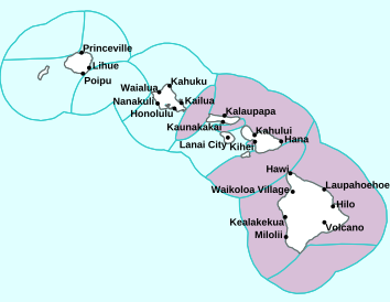
Air Temperatures – The following high temperatures (F) were recorded across the state of Hawaii Saturday…along with the low temperatures Saturday:
79 – 66 Lihue, Kauai
81 – 71 Honolulu, Oahu
77 – 66 Molokai AP
81 – 68 Kahului AP, Maui
78 – 67 Kona AP, Hawaii
77 – 65 Hilo, Hawaii
Here are the latest 24-hour precipitation totals (inches) for each of the islands Saturday evening:
1.35 Mount Waialeale, Kauai
0.11 Kamananui Stream, Oahu
0.33 Molokai
0.00 Lanai
0.01 Kahoolawe
0.92 West Wailuaiki, Maui
0.59 Kawainui Stream, Big Island
The following numbers represent the strongest wind gusts (mph) Saturday evening:
32 Port Allen, Kauai
44 Oahu Forest NWR, Oahu
35 Molokai
30 Lanai
42 Kahoolawe
35 Maalaea Bay, Maui
42 Waikoloa, Big Island
Hawaii’s Mountains – Here’s a link to the live webcam on the summit of our tallest mountain Mauna Kea (nearly 13,800 feet high) on the Big Island of Hawaii. Here’s the webcam for the 10,000+ feet high Haleakala Crater on Maui. These webcams are available during the daylight hours here in the islands, and at night whenever there’s a big moon shining down. Also, at night you will be able to see the stars, and the sunrise and sunset too…depending upon weather conditions.

A swath of high clouds continues its journey…out of the deeper tropics
(click on the images to enlarge them)

These high level clouds are extending up over the state as far as Oahu

Partly to mostly cloudy skies…with a few clear areas

There are showers falling locally – Looping image
Small Craft Advisory…pink color below
High Surf Advisory…purple color below
~~~ Hawaii Weather Narrative ~~~
Broad Brush Overview: Windy trades will continue, as strong high pressure remains north of the state. Clouds being carried along in the trades will focus rainfall over windward areas…although some of these showers will spread leeward at times. An increase in showers is expected tonight through Monday morning, as a band of moisture moves through. The trade winds are expected to gradually become lighter Monday through later in the new week.
Details: Locally windy trades will continue through Monday, although the trade wind speeds should edge slightly lower Monday. We could see a slight increase in the trade wind speeds tonight and again Sunday night, when the windier areas across Maui County and the Big Island could see Wind Advisories issued by the NWS. A band of moisture is expected to push into the islands tonight and linger through Monday morning.
This should bring periods of fairly wet weather to windward areas, with leeward spillover activity on the smaller islands. High cirrus clouds are also expected to spread northward into the central islands, and perhaps as far west as Oahu through Sunday, as a sub-tropical strong jet stream lifts northward over the state. The thickest high cloud cover is expected over Maui County and the Big Island through early Sunday.
Looking Further Ahead: Typical late winter trade wind weather conditions are expected statewide late Monday morning through the remainder of the work week, with some decrease in shower coverage likely toward the end of the week. The trades will trend downward Monday and Monday night, then hold in the moderate range Tuesday through Thursday…becoming lighter by Friday. Off and on showers will continue to favor windward and mountain areas.
Here’s a near real-time Wind Profile of the Pacific Ocean – along with a Closer View of the islands / Here’s the latest Weather Map
Marine Environmental Conditions: A surface high will remain parked northeast of the islands through the weekend, supporting strong to near gale force trade winds. The trades will drive an increase in wind swell waves that will combine with an increasing northwest swell to bring elevated seas, and a Small Craft Advisory (SCA) is posted through Monday for all waters. Winds and seas will gradually trend down early in the new week as the high moves away, and a front washes out north of the state. A new high building north-northwest of the islands Tuesday and Wednesday, will support light to moderate trade winds.
A new northwest swell will peak tonight, then gradually diminish Sunday into Monday. A slightly smaller northwest swell arriving Monday through Wednesday will produce surf below advisory levels. Yet another northwest swell arriving Thursday…may peak near advisory levels before diminishing Friday.
Rough and choppy surf along east facing shores will gradually build to advisory levels Sunday and Monday, as the upstream fetch of trade winds increases. Surf along east facing shores is expected to diminish Tuesday and Wednesday as winds diminish. A small south swell will build slightly into Sunday, peak below advisory levels…then diminish Monday and Tuesday.

World-wide Tropical Cyclone Activity
Here’s the latest Pacific Disaster Center (PDC) Weather Wall Presentation covering the western Pacific Ocean, the Indian Ocean, and the Arabian Sea, including retiring Tropical Cyclone 18S (Idai)…and a tropical disturbance being referred to as Invest 99S
>>> Atlantic Ocean: The 2019 hurricane season begins June 1, 2019
Here’s a satellite image of the Atlantic
>>> Gulf of Mexico: The 2019 hurricane season begins June 1, 2019
>>> Caribbean Sea: The 2019 hurricane season begins June 1, 2019
Here’s a satellite image of the Caribbean Sea…and the Gulf of Mexico
>>> Eastern Pacific: The 2019 hurricane season begins May 15, 2019
Here’s the link to the National Hurricane Center (NHC)
>>> Central Pacific: The 2019 hurricane season begins June 1, 2019
Here’s the link to the Central Pacific Hurricane Center (CPHC)
>>> Northwest Pacific Ocean: No active tropical cyclones
>>> South Pacific Ocean: No active tropical cyclones
>>> North and South Indian Oceans / Arabian Sea:
Tropical Cyclone 18S (Idai)
JTWC textual advisory
JTWC graphical track map
Interesting: Meet ‘The Blobs’: Two Continent-Size Mountains in Earth’s Deep Mantle That Nobody Understands – About halfway between your feet and the center of Earth, two continent-size mountains of hot, compressed rock pierce the gut of the planet — and scientists know almost nothing about them.
Technically, these mysterious hunks of rock are called “large low-shear-velocity provinces” (LLSVPs), because seismic waves shuddering through Earth always slow down when passing through these structures.
A mesmerizing image, featured in an article on Eos (the official news site of the American Geophysical Union, or AGU), gives us one of the most detailed views yet of these rocky anomalies — which most scientists simply call “the blobs.”
Geophysicists have known about the blobs since the 1970s but aren’t much closer to understanding them today.
“They’re among the largest things inside the Earth,” University of Maryland geologist Ved Lekic told Eos reporter Jenessa Duncombe, “and yet we literally don’t know what they are, where they came from, how long they’ve been around, or what they do.”
This much is evident: The blobs begin thousands of miles below Earth’s surface, where the planet’s rocky lower mantle meets the molten outer core. One blob lurks deep below the Pacific Ocean, the other beneath Africa and parts of the Atlantic. Both are massive, stabbing up about halfway through the mantle and measuring as long as continents. According to Duncombe, each blob stretches about 100 times higher than Mount Everest; if they sat on the planet’s surface, the International Space Station would have to navigate around them.
To get a better sense of their shape and scale, take a look at the stunning 3D map of the blobs that Lekic and University of Cambridge seismologist Sanne Cottaar created in 2016 (shown above). The blobs’ vast, cascading plains have been likened to mountains of sand or interconnected pits of gravel, Duncombe wrote, but whether they’re lower- or higher-density than the surrounding mantle remains a point of contention among scientists.
Equally mysterious is how, if at all, the blobs affect geological functions such as plate tectonics and volcanism. A more recent map of the structures, presented by University of Oxford doctoral student Maria Tsekhmistrenko at the 2018 annual meeting of the AGU, suggests that the tips of the blobs might branch into plumes of hot material that brush up against volcanic hotspots just below Earth’s surface. What does this mean? Nobody knows. It may take many more decades to better understand the enigma near the heart of our planet. Luckily, the blobs don’t seem to be going anywhere.
Cory Bradley Says:
Glenn,
We have been visiting Kapalua for the last 4 years now and have found your site the most helpful in Hawaii forecasts. I noticed Kapalua appears to be on the boarder of which weather zone it falls in for Maui. Then today it seemed much more cloudy in Kapalua than Lahaina (boat excursion). Does it’s position create more cloudy weather than other parts of Western Maui? Or was this just random chance? Thanks!
Cory
~~~ Hi Cory, nice to hear from you, and thanks for your positive feedback on my website!
Kapalua is on the upper west side of the island, in the mainstream of the trade wind flow. In contrast, Lahaina is in the lee of the West Maui Mountains. Kapalua receives much more clouds and rain, as it is exposed to the trades, while Lahaina in much drier, and the trade showers typically get down there…typically getting about as far as Kaanapali.
No, it’s far from random, and happens all along the windward sides of all the islands, including Kapalua, Maui. The leeward sides typically have much fewer showers, including Lahaina…along with Kihei and Wailea, over on the east side of Maui.
This is why I often suggest to folks that taking a short drive from Napili and Kapalua, back into Lahaina town…will often get one back into sunny and dry weather.
I hope this helps, and enjoy the rest of your vacation!
Aloha, Glenn
Graham Smith Says:
Hi Glenn. My rain gauge recorded just under 19 inches of rain this past February, and this is more than the combined total of February rainfall in the four immediately prior years. What happened and is it an indicator of a real wet year coming up? Thanks.
~~~ Hi Graham, good hearing from you. Wow, 19″ of rain! I don’t know where in Hawaii you live, although that’s a lot of rain anywhere…outside of the rain forest areas.
I don’t think that this wet winter will necessarily translate to a wet 2019. As a matter of fact, we now have an El Nino happening, which typically brings somewhat drier than normal conditions. It’s beyond me to say what the rest of the year will see in terms of rainfall.
Aloha, Glenn
Eric G. Says:
Hi Glenn, I am keeping my fingers crossed that your forecasts are more accurate than Weather.com. I have faith in you! 🙂 My wife and I will be arriving in Honolulu on March 5. I don’t mind a little breeze, but winds of 25 mph for March 8-10 seem a bit much. I hope the trade winds temper a bit.
Take care,
Eric
~~~ Hi Eric, good to hear from you, and good news of your coming to Honolulu on vacation!
25 mph trade winds are no big deal, I wouldn’t worry about that if I were you. Actually, if you are going to be in Honolulu, the winds will likely be less than that.
Have a great time!
Aloha, Glenn
Eliza Says:
Aloha Glenn –
What an amazing stretch of cooler and wet weather we’ve had. Long range forecasting has us shifting back to the usual patterns in this month? Or are they fractured forever?
Just me being a curious inquisitive cat. BTW, how is your kitty?
Thanks for all you do for your intrepid readers.
Smiles,
Eliza
~~~ Hi Eliza, its so true, the islands have had unusually chilly winter weather lately! The latest forecast idea has the recent cool north to northeasterly winds…veering back towards the more easterly trade wind direction. This should take the edge off the cool weather, at least hopefully. I do recall other times, although its been quite some time, that our winter turned cooler than normal.
I for one enjoy winter to be wintery, even in Hawaii!
I trust you are well and fine, thanks for your interesting comment Eliza.
Aloha, Glenn
Bob Bentham Says:
Hi Glen I just found your site and must say I’m very impressed with the details and information. My wife and I will be arriving on Maui Mar 9 for 10 days and will be checking in every day to see what is happening with the weather. We are leaving the west coast of Canada where it’s been colder than normal and more snow than we normally get. Looking forward to some warm Maui sunshine. Cheers Bob
~~~ Hi Bob, good to hear from you, and am glad you found my website…thanks for your positive feedback!
You have a good long vacation coming up, and I’m sure that you’ll greatly enjoy that warm tropical sunshine that you’re envisioning!
Have a special time, and take your warm afterglow back to the great country of Canada afterwards.
Aloha, Glenn