May 2009
Monthly Archive
Posted by Glenn
No Comments
May 21-22, 2009
Air Temperatures – The following maximum temperatures were recorded across the state of Hawaii Thursday afternoon:
Lihue, Kauai – 79
Honolulu, Oahu – 82
Kaneohe, Oahu – 80
Kahului, Maui – 82
Hilo, Hawaii – 82
Kailua-kona – 84
Air Temperatures ranged between these warmest and coolest spots near sea level – and on the highest mountains…at 4 p.m. Thursday afternoon:
Kailua-kona – 82F
Lihue, Kauai – 75
Haleakala Crater – 45 (near 10,000 feet on Maui)
Mauna Kea summit – 32 (near 14,000 feet on the Big Island)
Precipitation Totals – The following numbers represent the largest precipitation totals (inches) during the last 24 hours on each of the major islands, as of Thursday afternoon:
0.04 Anahola, Kauai
0.02 Waimanalo, Oahu
0.00 Molokai
0.00 Lanai
0.25 Kahoolawe
0.03 West Wailuaiki, Maui
0.39 Hilo airport, Big Island
Marine Environment – Here’s the latest (automatically updated) weather map shows a low pressure system to the north of the state. This map also shows a high pressure system far to the northwest, with another cell far to the northeast. The low is located in an area, which is acting like a blocking force…not allowing the normal trade winds to blow across our tropical latitudes. Winds will be light generally south to southeast Friday and Saturday.
Satellite and Radar Images: To view the cloud conditions we have here in Hawaii, please use the following satellite links, starting off with the Infrared Satellite Image of the islands to see all the clouds around the state during the day and night. This next image is one that gives close images of the islands only during the daytime hours, and is referred to as a Close-up visible image. This next image shows a larger view of the Pacific…giving perspective to the wider ranging cloud patterns in the Pacific Ocean. Finally, here’s a looping IR satellite image, making viewable the clouds around the islands 24 hours a day. To help you keep track of where any showers may be around the islands, here’s the latest animated radar image.
Hawaii’s Mountains – Here’s a link to the live webcam on the summit of near 14,000 foot Mauna Kea on the Big Island of Hawaii. The tallest peak on the island of Maui is the Haleakala Crater, which is near 10,000 feet in elevation. These two webcams are available during the daylight hours here in the islands…and when there’s a big moon rising just after sunset for an hour or two! Plus, during the nights and early mornings you will be able to see stars, and the sunrise too…depending upon weather conditions.
Aloha Paragraphs

The incredible windward side of Oahu
The long lasting low pressure cell to our north is still around, although it has lost most of its integrity…at least compared to earlier in the week. We can use this weather map to see the low, which is sitting several hundred miles to the north of the islands. The low has a comma shaped frontal cloud band uncurling from the center of this low, to the east, south, and southwest of our islands. Winds will be light and variable in direction Thursday night and Friday. Light and variable winds will keep the muggy weather around…along with localized haze as well. A new weather feature will prompt southeast breezes to arrive this weekend, which could help to increase not only the volcanic haze, but also showers.
A new upper level low pressure system, with its associated cold air aloft, will swing by to the north of the state this weekend…increasing the chance of unsettled weather. The cold air will make our local atmosphere considerably more unstable than it is now. At the same time, we’ll find the residual moisture, from the old cold front to our east and southeast of the Big Island, helping to feed the showers. This precipitation could fall just about anywhere, but the models show Maui, and the Big Island receiving the most generous amounts. As our winds turn more southeast by Saturday, it will help to transport these shower bearing clouds our way.
The primary weather feature here in the islands continues to be the low pressure system to the north of the islands. It’s not nearly as intact as it was over the last several days. However, if you look closely however, into the area north of Hawaii, using this link…you’ll be able to spot this new counterclockwise rotating low pressure cell. This late season low continues to effectively block our trade winds. This time of year, with light winds and a sun that is nearly directly overhead during the days, we will find sultry conditions. Referring back to the satellite picture, you will find that there is more high cirrus looming to our southwest and west…where we get our intrusions of this high icy moisture.
The Hawaiian Islands remain in an area of light and variable winds, which in itself is quite unusual for this late in the month of May. We often find at least moderately strong trade winds blowing across our tropical latitudes this time of year. Setting that aside for a moment, we’re looking at what may become an even more unlikely weather event arriving this weekend. The computer models show, as noted above, a rainfall producing low pressure system moving by to our north. This low will have cold air associated with it aloft…which will enhance showers here in Hawaii. Looking at the models, they generally show a moisture bearing shield of clouds moving up over the Big Island to Maui, where showers are expected. The island of Oahu is just beyond these showery clouds, although it wouldn’t be surprising to see showers arriving there this weekend too.
It’s early Thursday evening as I begin writing this last section of today’s weather narrative. As usual, at this time of day, I’m ready to head back upcountry to Kula. Looking out the window here in Kihei, before I leave, I can see about equal parts of clear blue skies, and partly cloudy conditions. At noon, when I was out for lunch, I was already beginning to see some added haze in our atmosphere. It will take getting out there, out of this office, before I’ll be able to take a better look around. I do however expect to see more haze collecting over the islands, the source of which is the volcanic vents down on the Big Island. Before I leave this computer, I want to point out to you, that despite the clouds that are around, using this looping radar image, that its mostly dry across most of the island chain. As noted in the information above, the next increase in showers will likely hold off until the weekend, especiall over Maui and the Big Island. ~~~ Ok, I’m outta here, I’m down the road, I’m off work now, heading home for my evening walk. I hope you have a great Thursday night, and will plan on visiting me again here, as of early Friday morning. Aloha for now…Glenn.
Interesting: President Obama’s announcement on tailpipe emissions reaffirmed a commitment that goes beyond regulation of the auto industry. The move is part of a broader White House strategy to confront the risk of global warming while making green-collar jobs a centerpiece of the economy.
For ordinary Americans, the resulting changes could be far-reaching. Lighter-weight vehicles appear likely to become more popular. More tax dollars are being tabbed for clean-energy technology. And for years to come, college students might find that some of the hottest job opportunities lie in helping to keep the planet cool.
Interesting2: U.S. emissions of carbon dioxide related to energy use fell 2.8 percent last year, according to an estimate by the Energy Information Administration, driven down by high oil prices and the sagging economy. The drop in carbon dioxide emissions was the steepest since 1982. The amount of carbon dioxide produced for every dollar of economic output also declined by 3.8 percent, the federal agency said, as industry and motorists became more efficient and frugal and as renewable energy sources gained a slightly larger share of the energy market.
That was far greater than the average decline in carbon intensity in previous years. Carbon dioxide is the most prevalent of the greenhouse gases that contribute to climate change, and the EIA numbers were made public as Congress weighs complex legislation that would put a nationwide ceiling on emissions of those gases.
Interesting3: A groundswell of "green" investment and activity has been building on Native American Indian tribal lands around the country. Recent action at the tribal, state and federal levels, as well as in local communities and the private sector, bodes well for the future of these marginalized populations and lands. It also dovetails nicely with what we’ve come to associate and identify with in traditional American Indian culture and beliefs.
Secretary of the Interior Ken Salazar on April 25 announced that the Department’s Indian Affairs office will offer federally guaranteed loans for businesses owned by American Indians under the American Recovery and Reinvestment Act of 2009, a small part of some $3 billion the Department expects to invest among federally recognized Native American Indian tribal communities through President Obama’s economic recovery plan.
Renewable energy and sustainable lifestyle practices have already sparked a good amount of interest and activity among Native American Indian tribes. Case in point is an eco-tourism project on the Ramona Indian Reservation near Anza in southern California where the Ramona Band of Cahuilla Mission Native Americans’ resort is being built.
Interesting4: Many farmers are installing nest boxes to encourage the birds, which hunt the crop-damaging rodents. In Israel, where there is a drive to reduce the use of toxic chemical pesticides, this has been turned into a government-funded national program. Scientists and conservation charities from Jordan and Palestine have joined the scheme. According to the charity BirdLife International, hundreds of birds of prey – including many endangered species – have been killed in Israel through eating rodents containing poisonous "rodenticides" sprayed on to crop fields. But scientists in Israel are now working with farmers to combat this problem – deploying the birds as natural pest controllers. "There is a real need to reduce the use of chemicals in agriculture here," said Motti Charter, a researcher from Tel Aviv.
Interesting5: Global methane emissions from rice paddies could be cut by 30 per cent if fields are drained at least once during the growing season and rice crop waste is applied off-season, according to a study. Methane is a significant contributor to global warming and is produced by certain types of bacteria in oxygen-deprived environments — such as those feeding on the organic waste in water-covered rice paddies.
"Draining allows organic material to decompose aerobically as it is not covered by standing water," says Yan Xiaoyuan of the Institute of Soil Science, Chinese Academy of Sciences, who led the study.
The team says that if draining is combined with applying rice straw — the stem and leaves left behind after harvesting — methane emissions could be reduced by 7.6 million tons a year, representing around 30 per cent of global emissions from rice fields.
Rice straw is traditionally either burned between growing seasons or ploughed back into the soil as a source or nutrients for the next season’s crop. When the field is reflooded, microorganisms feeding on the rice straw generate methane.
But if the straw is left to decompose in the open air of a drained field during the fallow season, methane emissions would be reduced, say Yan and his colleagues, and the rice straw could still supply some nutrients to the soil.
Both technologies have been adopted sporadically across the world to reduce methane emissions, but this research is "the most updated of its kind", according to Reiner Wassmann, coordinator of the Rice and Climate Change Consortium at the International Rice Research Institute.
Stanley Tyler from the US-based University of California, Irvine: "Flooded and rain-fed rice paddies are one of the few wholly man-made methane sources and potentially one of the best chances for humans to control methane emissions." Wassman cautioned that the feasibility of the approach had yet to be tested, as there had not been any "outscaling" from experimental fields to farmers’ rice fields.
Interesting6: As new fuel efficiency standards for cars make news in the United States, scientists in Canada are already developing more fuel-efficient, and more polite, cattle. The research promises to lower costs to farmers by reducing the amount of feed needed for raising cattle. It could also help the environment by reducing the number of methane released into the atmosphere, where it is a climate-warming greenhouse gas. "Ruminants produce a lot of methane; three cows equal one [mid-sized] car" in terms of global warming potential, said John Basarab, an agricultural research scientist for the Alberta government.
Interesting7: Recently, the US Department of Energy announced it has two forms of finance available to catapult the speedy development of enhanced geothermal systems into being. The stimulus package will spur growth of this type of energy by 15 to 16 percent by 2012 or 2013. The sector will benefit from the provision of $42 billion worth of grants for renewable energy and new technology to boost efficiency, along with over $130 billion in tax credits and loans.
So what exactly is geothermal energy, how does it operate and will it become widespread? The concept of geothermal energy has been around for many years already. There are around 6 million households and businesses in the US that run on geothermal energy.
Half of those are directly connected with geothermal power plants while the rest of the homes rely on their own geothermal heat pumps, according to information from the Geothermal Energy Association. The homes that use a heat pump operate electrically powered systems which directly tap into the energy stored in the earth, using the relatively constant temperature and in some cases ground water as an energy and hot water source.
"[Geothermal pumps] are 3.5 – 5 times as efficient as the most efficient fossil fuel furnace" according to the association. In other words, for every unit of energy used to power the heat pump, 3.5 – 5 units of energy is generated. Houses or businesses situated close to a direct geothermal source often create a direct use system.
They tap the heat or cooling in the soil and use it directly in industrial processes, aquaculture ponds, greenhouses or heat systems in buildings. This method is said to lead to energy savings of up to 80 percent compared to fossil fuels. The latest technology in use in geothermal power provision enables larger parties to generate electricity wholesale, relying on hot water (cooler than 300 degrees.)
It is relatively simple to build geothermal heat pumps or electricity generators because the level at which the earth turns warm is only around three feet or more. The earth’s frost line, the point underground at which the temperature always stays above 32 degrees, tops this layer.
Pumps are connected to the warmer depths by an earth loop of piping. The loop transports the natural heat to indoor units, even in winter. The energy of the heat particles are compressed which increases the heat content and distributed throughout the duct work in homes and businesses.
Interesting8: When the going gets rough, the tough apparently sing slower. As vegetation reclaimed formerly cleared land in California, Oregon and Washington over the last 35 years, male white-crowned sparrows have lowered their pitch and slowed down their singing so that their love songs would carry better through heavier foliage.
"This is the first time that anyone has shown that bird songs can shift with rapid changes in habitat," says biologist Elizabeth Derryberry who made the finding as part of her dissertation research at Duke University.
She compared recordings of individual birds in 15 different areas with some nearly forgotten recordings made at the same spots in the 1970s by a California Academy of Sciences researcher, and found that the musical pitch and speed of the trill portion of the sparrows’ short songs had dropped considerably.
"I was really surprised to find that songs had changed in a similar way in so many different populations." She then used archival aerial photography to see how the foliage had changed in a subset of those spots, and found that the one population whose song hadn’t slowed down lived in an area where the foliage hadn’t changed either.
The physics is clear, but the biology is a little less certain. A lower, slower song suffers less reverberation in denser foliage and will be heard more accurately. In turn, that means it is more likely to be copied by young males who are choosing which song they will learn. Over generations, that should cause the song to slow down and drop in pitch as the foliage changes.
Interesting9: With the current outbreak of swine flu, and in the absence of a vaccine or treatment at present, the only way to contain the virus is to get people around the world to take precautionary measures. Johannes Brug, Arja Aro, and Jan Hendrik Richardus now show that there are three key parameters that convince people to take precautions.
Firstly, they need to be aware of the risk to them. Secondly, they need to believe that effective protective actions are available and have confidence in them. Lastly, communications about risk need to be carefully managed so that they express the actual risk accurately to prevent mass scares.
The authors review the importance of risk perception and show that for people to voluntarily take precautionary actions, it is essential that they are aware of and understand the risk. Indeed, risk perception is a key feature of many health behavior theories.
On the one hand, unrealistic optimism about health risks is often observed in relation to familiar risks and can result in a false sense of security and lack of precautions. On the other hand, pessimism is more likely for new, unfamiliar risks that are perceived to be uncontrollable and may lead to unnecessary mass scares.
As a consequence, implementation of precautionary measures requires effective risk communication that leads to realistic perceptions of risk, as well as knowledge and skills to promote precautionary practices.
The authors argue that scientific knowledge in the area of infectious disease control is limited. Looking at how risk is communicated, they show that, in the early stages of a possible pandemic, risk perceptions and people’s confidence in recommended protective actions depend on effective communications.
Interesting10: The world is abuzz with climate change – in more ways than one. Swelling waves and rising sea levels can be detected in the way the planet "hums", says an oceanographer. Peter Bromirski, of the Scripps Institution of Oceanography at the University of California, San Diego, says that seismic listening stations provide a long-term record of how the amount of energy reaching the world’s shores is changing with climate change.
Most geologists who study seismology try to eliminate background noise in their data, but a handful of researchers have started to take a closer look at it. They have identified at least three different types of "noise", including the Earth’s hum, which was first discovered in 1998. The other two are called "microseisms" – tiny earthquakes – and have slightly different acoustic properties.
Both the hum and microseisms are triggered by waves thumping the Earth’s crust, so if waves change, geologists should be able to "hear" it. Bigger waves cause higher amplitude microseisms and hum, says Bromirski. This roughly translates to a louder noise in the seismological data. "Onshore measurements of microseisms track wave height offshore reasonably well," agrees Spahr Webb of Columbia University’s Earth Institute.
n some locations, seismograms have been faithfully recording every shake in the Earth’s crust for nearly a century, meaning geologists can dissect what Bromirski calls the "treasure trove" of archived paper drums – and find out how ocean waves have changed over the last 100 years. "The calibrated seismometer records go back further than do good wave measuring systems," adds Webb.
This may all seem academic, but bigger waves carry more energy. As a result, the century-long record of hum and microseisms can reveal how much of a pounding coasts have experienced, and could help predict how much more pounding they can expect. "This is important from coastal erosion and shoreline change perspectives under rising sea levels," says Bromirski.
Posted by Glenn
No Comments
May 20-21, 2009
Air Temperatures – The following maximum temperatures were recorded across the state of Hawaii Wednesday afternoon:
Lihue, Kauai – 80
Honolulu, Oahu – 81
Kaneohe, Oahu – 78
Kahului, Maui – 81
Hilo, Hawaii – 80
Kailua-kona – 84
Air Temperatures ranged between these warmest and coolest spots near sea level – and on the highest mountains…at 4 p.m. Wednesday afternoon:
Kailua-kona – 82F
Hilo, Hawaii – 75
Haleakala Crater – 52 (near 10,000 feet on Maui)
Mauna Kea summit – 45 (near 14,000 feet on the Big Island)
Precipitation Totals – The following numbers represent the largest precipitation totals (inches) during the last 24 hours on each of the major islands, as of Wednesday afternoon:
0.05 Kokee, Kauai
0.09 Schofield Barracks, Oahu
0.00 Molokai
0.00 Lanai
0.00 Kahoolawe
0.01 Kahakuloa, Maui
1.14 Pali 2, Big Island
Marine Environment – Here’s the latest (automatically updated) weather map shows a low pressure system to the north of the state. This same weather map shows a strong high pressure system far to the northwest, with another high pressure cell far to the northeast. The low is located in an area, which is acting like a blocking force…not allowing the normal trade winds to blow across our tropical latitudes. Winds will be light and variable Thursday and Friday.
Satellite and Radar Images: To view the cloud conditions we have here in Hawaii, please use the following satellite links, starting off with the Infrared Satellite Image of the islands to see all the clouds around the state during the day and night. This next image is one that gives close images of the islands only during the daytime hours, and is referred to as a Close-up visible image. This next image shows a larger view of the Pacific…giving perspective to the wider ranging cloud patterns in the Pacific Ocean. Finally, here’s a looping IR satellite image, making viewable the clouds around the islands 24 hours a day. To help you keep track of where any showers may be around the islands, here’s the latest animated radar image.
Hawaii’s Mountains – Here’s a link to the live webcam on the summit of near 14,000 foot Mauna Kea on the Big Island of Hawaii. The tallest peak on the island of Maui is the Haleakala Crater, which is near 10,000 feet in elevation. These two webcams are available during the daylight hours here in the islands…and when there’s a big moon rising just after sunset for an hour or two! Plus, during the nights and early mornings you will be able to see stars, and the sunrise too…depending upon weather conditions.
Aloha Paragraphs

Fun on the Beach…Hawaii
A usual late season area of low pressure remains cemented into place just north of Maui County, with a feeble cold front stretching down from it…into the area just east of the Big Island. The majority of the computer models keep this low in place to our north, which strongly suggests it will hang out up there for the time being. We can use this weather map to see this low, and its associated dissipating cold front just offshore from the Big Island. Winds will be light and variable in direction Wednesday into Thursday, right on into the weekend. Light and variable winds are notorious for giving very warm and muggy weather…along with localized haze to our islands. The computer models now show a new low pressure system forming to the NNW of the islands this weekend, keeping our trade winds away until next week.
The closeness of the low pressure system to our island chain will keep our overlying atmosphere rather stagnant…with light sea breezes at best. We have definitely moved into a light winded convective weather pattern Wednesday…through the rest of the week, and what now looks like longer. Using this satellite image, we can see that the residual clouds associated the cold front, which passed through the islands over the last couple of days, is still near…and out to the east and NE of the Big Island. Meanwhile, glancing at this looping satellite picture, we can see an area of high cirrus clouds migrating our way from the west of Kauai to. It looks likely that these high clouds will stick around for at least another day or two…and the way it looks from here, right on into the weekend.
The primary weather feature here in the islands Wednesday night, continues to be the low pressure system to the north of the islands. It’s not as bold or impressive looking as it was over the last couple of days. If you look closely however, into the area north of Hawaii, using this link, you’ll be able to spot this counterclockwise rotating low pressure cell. This late season low is effectively blocking our trade winds. This time of year, with light winds and a sun that is nearly directly overhead during the days, we will find sultry conditions. This muggy reality will start off with clear to partly cloudy skies in the mornings, giving way to cloudiness during the afternoons, with a few localized showers over the interior parts of the islands.
It’s early Wednesday evening as I begin writing this last section of today’s weather narrative. We had thought that the trade winds would return as we moved into early next week…as noted above. The latest computer model output however, now shows another low pressure system moving into the area to our northwest, which could keep our light winds in place beyond the weekend. This low pressure system could act to increase our showers too. ~~~ Looking out the windows here in Kihei, before I jump in the car for the ride back upcountry, I see partly to mostly cloudy skies. A large part of this cloudiness is associated with the high cirrus clouds streaming across our island skies. There may very well be a beautiful sunset this evening, and then again on Thursday morning as well. That’s when I’ll be back with you again, I hope you have a restful night, and are full of life’s energy on Thursday! Bye for now…Glenn.
Interesting: Railroad companies are pressing federal regulators to cut back on trains carrying hazardous materials through urban areas, saying they fear a catastrophic release of toxic chemicals in a large city. The companies also fear billions in legal claims if toxic materials spill during a derailment or act of sabotage. Rail industry associations are petitioning to allow railroads for the first time to refuse to carry chemicals such as chlorine over long distances.
Federal law requires railroads to transport such materials, which are used in manufacturing, agriculture and water treatment. The companies’ move is opposed by the Obama administration and others who say railroads are the safest way to move toxic materials.
If trucks end up carrying materials that railroads reject, "that would pose a much greater danger," said Patricia Abbate of Citizens for Rail Safety, a Massachusetts advocacy group. The railroad petition is the latest effort to address the danger posed by the 110,000 carloads of toxic chemicals rail companies carry each year.
Navy researchers have said an attack on a chemical-carrying train could kill 100,000 people. Photograph shows several train cars transporting new motor vehicles on their sides after the train derailed along the McDade Expressway in Scranton, Pa., in March. Two train cars carrying hazardous materials were intact after one-fourth of a 43-car freight train derailed.
Interesting2: Experts say that more than half of the world’s coral reefs could disappear in the next 50 years, in large part because of higher ocean temperatures caused by climate change. But now Stanford University scientists have found evidence that some coral reefs are adapting and may actually survive global warming.
"Corals are certainly threatened by environmental change, but this research has really sparked the notion that corals may be tougher than we thought," said Stephen Palumbi, a professor of biology and a senior fellow at Stanford’s Woods Institute for the Environment. Palumbi and his Stanford colleagues began studying the resiliency of coral reefs in the Pacific Ocean in 2006 with the support of a Woods Institute Environmental Venture Project grant.
The project has expanded and is now being funded by Conservation International and the Bio-X program at Stanford. "The most exciting thing was discovering live, healthy corals on reefs already as hot as the ocean is likely to get 100 years from now," said Palumbi, director of Stanford’s Hopkins Marine Station.
"How do they do that?" Coral reefs form the basis for thriving, healthy ecosystems throughout the tropics. They provide homes and nourishment for thousands of species, including massive schools of fish, which in turn feed millions of people across the globe. Corals rely on partnerships with tiny, single-celled algae called zooxanthellae.
The corals provide the algae a home, and, in turn, the algae provide nourishment, forming a symbiotic relationship. But when rising temperatures stress the algae, they stop producing food, and the corals spit them out. Without their algae symbionts, the reefs die and turn stark white, an event referred to as "coral bleaching."
During particularly warm years, bleaching has accounted for the deaths of large numbers of corals. In the Caribbean in 2005, a heat surge caused more than 50 percent of corals to bleach, and many still have not recovered, according to the Global Coral Reef Monitoring Network, an international collaboration of government officials, policymakers and marine scientists, including Palumbi.
In recent years, scientists discovered that some corals resist bleaching by hosting types of algae that can handle the heat, while others swap out the heat-stressed algae for tougher, heat-resistant strains. Palumbi’s team set out to investigate how widely dispersed these heat-tolerant coral reefs are across the globe and to learn more about the biological processes that allow them to adapt to higher temperatures.
In 2006, Palumbi and graduate student Tom Oliver, now a postdoctoral researcher at Stanford, traveled to Ofu Island in American Samoa. Ofu, a tropical coral reef marine reserve, has remained healthy despite gradually warming waters.
Interesting3: The decline of honeybee colonies has slowed slightly since last fall, but a mysterious combination of ailments is still decimating the insect’s population, federal researchers say. U.S. Department of Agriculture researchers found that honeybee colonies declined by 29 percent between September 2008 and early April.
That’s an improvement over the last two years, when researchers found that 32 percent and 36 percent of all beekeepers surveyed lost hives. Domestic honeybee stocks have been waning since 2004 because of a puzzling illness scientists called colony collapse disorder, which causes adult bees to inexplicably forsake their broods. Bees now appear also to be suffering from other ailments.
Interesting4: Scientists have for the first time genetically modified white corn to increase the levels of several different vitamins — bringing closer the prospect of crops that can deliver full nutritional requirements. The team increased the levels of beta-carotene, the precursor of vitamin A 170-fold; levels of vitamin C six-fold and also doubled the folic acid in the African staple.
White corn normally contains only trace amounts of beta-carotene. Diseases caused by low consumption of vitamin A, vitamin C and folate are widespread in Africa, says lead researcher Paul Christou of the University of Lleida in Spain. Until recently researchers had struggled to introduce multiple genes into a plant simultaneously to create several different traits.
His team developed a method that transfers the desired genes into plant embryos by bombarding them with gene-coated metal particles The resulting plants are then screened for those containing the required genes. The method can introduce an unlimited number of transgenes into any plant, says Christou. The method is quicker than others and the genes persist in subsequent generations.
Interesting5: The most comprehensive modeling yet carried out on the likelihood of how much hotter the Earth’s climate will get in this century shows that without rapid and massive action, the problem will be about twice as severe as previously estimated six years ago – and could be even worse than that. The study uses the MIT Integrated Global Systems Model, a detailed computer simulation of global economic activity and climate processes that has been developed and refined by the Joint Program on the Science and Policy of Global Change since the early 1990s.
The new research involved 400 runs of the model with each run using slight variations in input parameters, selected so that each run has about an equal probability of being correct based on present observations and knowledge. Other research groups have estimated the probabilities of various outcomes, based on variations in the physical response of the climate system itself. But the MIT model is the only one that interactively includes detailed treatment of possible changes in human activities as well – such as the degree of economic growth, with its associated energy use, in different countries.
Interesting6: NOAA’s Central Pacific Hurricane Center today announced that projected climate conditions point to a near to below normal hurricane season in the Central Pacific Basin this year. An average season has 4-5 tropical cyclones which includes tropical depressions, tropical storms, and hurricanes. The prediction was issued at a news conference called to urge Hawaii residents to be fully prepared for the onset of hurricane season, which begins June 1.
“Living on an island in the middle of the Pacific means each person and family should have an emergency plan every hurricane season. It is now time to review these plans before a storm threatens,” said Jim Weyman, director of the Central Pacific Hurricane Center. “Planning and preparation are key to surviving a hurricane.”
The forecast, a collaborative project with the Central Pacific Hurricane Center and NOAA’s Climate Prediction Center, calls for an 80% chance of a near- to below- normal season. Because of uncertainties in current predictions for El Nino, both a near-normal and below-normal season are equally likely at this time.
The outlook also indicates a 20% chance of an above-normal season. Climate patterns similar to those expected this year have historically produced a wide range of activity. Allowing for these uncertainties, the Central Pacific Hurricane Center forecasts the expected occurrence of 3-5 tropical cyclones in the central Pacific during the 2009 season.
This outlook is a general guide to the overall seasonal hurricane activity and does not predict whether, where, or when any of these systems will affect Hawaii. Once a tropical cyclone forms in the central Pacific or moves into the area, however, the hurricane center swings into action.
Weyman said, “Our hurricane specialists are ready to track any tropical cyclone, from a depression to a hurricane in the Central Pacific Basin, and then provide accurate forecasts.” The Central Pacific Hurricane Center calls in additional staff meteorologists when a system forms.
They continuously monitor the weather conditions, employing a dense network of satellites, land- and ocean-based sensors and aircraft reconnaissance missions operated by NOAA and its partners. This array of data supplies the information for complex computer modeling and human expertise that serves as the basis for the hurricane center’s track and intensity forecasts that extend out five days. The science behind the outlook is rooted in the analysis and prediction of current and future global climate patterns as compared to previous seasons with similar conditions.
Interesting7: Earth may have a heartbeat. Evidence from Hawaii and Iceland hints that the planet’s core may be dispatching simultaneous plumes of magma towards the surface every 15 million years or so. If the hypothesis is true, it would revolutionise our ideas of what’s happening far below our feet.
Independent scientists contacted by New Scientist were split, with some scornful and others intrigued. Rolf Mjelde of the University of Bergen and Jan Inge Faleide of the University of Oslo, both in Norway, used seismological data to measure the thickness of Earth’s crust between Iceland and Greenland. Iceland is on the Mid-Atlantic Ridge, where magma wells up to form fresh crust.
The measurements allowed Mjelde and Faleide to infer the past flow of magma in the plume generally thought to rise beneath Iceland. When this plume is strong, it thickens the crust that it forms at the surface. They found that the crust has thickened roughly every 15 million years, suggesting the plume pulses at around that frequency.
Regular pulsing of plumes is not a new idea, but when the pair compared their results with similar pulsing in Hawaii, which also sits on a plume, they found a surprising correlation. Data collected by Emily Van Ark and Jian Lin of the Woods Hole Oceanographic Institution, Massachusetts, suggests that Hawaii’s plume pulses have coincided with Iceland’s.
"These two are on very different parts of the Earth, so I don’t think the synchrony could be related to something in the mantle," says Mjelde. "It must relate to the core somehow. I can’t see any other possibility." This would mean that the Earth’s core periodically heats up the overlying mantle, generating synchronised plumes that rise to the surface at widely separated spots.
Interesting8: Mars may have had a wet, life-friendly past without ever getting warmer than the freezing point of water. So concludes a new study that investigates what would happen to various mineral solutions on Mars. Researchers found that solutions containing certain combinations of sulphur, silicon and other ions stay liquid even down to -28 °C – a much more plausible temperature for early Mars than one above 0 °C.
"The results were a happy surprise," says Ricardo Amils of the Astrobiology Centre in Madrid, Spain. "The concentrations you need are not much higher than seawater."In the study, Alberto Fairén of NASA’s Ames Research Center in Moffett Field, California, used models to determine what would happened to water loaded up with generous helpings of calcium, sodium, silicon, iron and sulphur ions, among others.
The relative concentrations of the ingredients matched mineral compositions sampled by four Mars probes: the landers Viking 1 and Mars Pathfinder, and the rovers Spirit and Opportunity. In many cases, the water not only remained liquid at extremely low temperatures but precipitated minerals as it got colder, including jarosite, haematite and gypsum – all present on Mars today.
Sad9: Stars of the show they may be, but elephants, lions and tigers are the wild animals least suited to life in a circus, concludes the first global study of animal welfare in circuses. "It’s no one single factor," says Stephen Harris of the University of Bristol, UK, and lead researcher of the study. "Whether it’s lack of space and exercise, or lack of social contact, all factors combined show it’s a poor quality of life compared with the wild," he says.
The survey concludes that on average, wild animals spend just 1 to 9 per cent of their time training, and the rest confined to cages, wagons or enclosures typically covering a quarter the area recommended for zoos. Worst affected are elephants, lions, tigers and bears. Often they’re confined to cages where they pace up and down for hours on end.
"Even if they are in a larger, circus pen, there’s no enrichment such as logs to play with, in case they use them to break the fence and escape," says Harris. Travel also takes its toll, although the evidence is limited. The study cites data showing that concentrations of the stress hormone cortisol in saliva from circus tigers remains abnormal up to 6 days after transport, and up to 12 days in tigers who’ve never travelled before.
The itineraries can be grueling too. When Harris and his colleagues analyzed 153 European and North American circus trips, troupes only stayed at each single location for an average of a week before moving on, with an average of almost 300 kilometers between locations. Even when they reach their destinations, the animals are often kept in conditions drastically different from their natural habitat.
Elephants can be shackled for 12 to 23 hours per day when not performing, in areas from just 7 to 12 square meters. Often, they could only move as far as the chain would let them, just 1 to 2 meters. In the wild, elephants spend 40 to 75 per cent of their time feeding, and cover up to 50 kilometers in a day.
Evidence also shows that circus elephants, lions, tigers, bears and even parrots, adopt repetitive abnormal movements and pacing, called stero-types. The animals also suffer ill-health both from confinement and from the tricks they learn to perform. Elephants, for example, become obese through inactivity and develop rheumatoid disorders and lameness as a result, as well as joint and hernia problems through having to adopt unnatural positions during performance.
Posted by Glenn
No Comments
May 19-20, 2009
Air Temperatures – The following maximum temperatures were recorded across the state of Hawaii Tuesday afternoon:
Lihue, Kauai – 81
Honolulu, Oahu – 85
Kaneohe, Oahu – 79
Kahului, Maui – 81
Hilo, Hawaii – 81
Kailua-kona – 84
Air Temperatures ranged between these warmest and coolest spots near sea level – and on the highest mountains…at 4 p.m. Tuesday afternoon:
Kailua-kona – 83F
Princeville, Kauai – 75
Haleakala Crater – 45 (near 10,000 feet on Maui)
Mauna Kea summit – 41 (near 14,000 feet on the Big Island)
Precipitation Totals – The following numbers represent the largest precipitation totals (inches) during the last 24 hours on each of the major islands, as of Tuesday afternoon:
0.12 Kokee, Kauai
0.02 Makua Ridge, Oahu
0.00 Molokai
0.00 Lanai
0.00 Kahoolawe
0.26 West Wailuaiki, Maui
1.78 Kapapala Ranch, Big Island
Marine Environment – Here’s the latest (automatically updated) weather map shows a low pressure system to the north of the state, with associated weak cold fronts in our general area. This same weather map shows a strong high pressure system far to the northwest, with another high pressure cell far to the northeast. The low is located in an area, which is acting like a blocking force…not allowing the normal trade winds to blow across our tropical latitudes. Winds will be light and variable Wednesday through Thursday.
Satellite and Radar Images: To view the cloud conditions we have here in Hawaii, please use the following satellite links, starting off with the Infrared Satellite Image of the islands to see all the clouds around the state during the day and night. This next image is one that gives close images of the islands only during the daytime hours, and is referred to as a Close-up visible image. This next image shows a larger view of the Pacific…giving perspective to the wider ranging cloud patterns in the Pacific Ocean. Finally, here’s a looping IR satellite image, making viewable the clouds around the islands 24 hours a day. To help you keep track of where any showers may be around the islands, here’s the latest animated radar image.
Hawaii’s Mountains – Here’s a link to the live webcam on the summit of near 14,000 foot Mauna Kea on the Big Island of Hawaii. The tallest peak on the island of Maui is the Haleakala Crater, which is near 10,000 feet in elevation. These two webcams are available during the daylight hours here in the islands…and when there’s a big moon rising just after sunset for an hour or two! Plus, during the nights and early mornings you will be able to see stars, and the sunrise too…depending upon weather conditions.
Aloha Paragraphs

Dolphin in Hawaiian waters…doing its thing!
The cold front that brought showers to the islands recently has stalled just to the east of the Big Island Tuesday…with a new weaker cold front edging into the state over Kauai and perhaps Oahu. The so called "parent low pressure system", for these frontal cloud bands…remains just to the north of our islands. We can use this weather map, to see this low and its associated dissipating cold fronts. Winds will turn light and variable in direction Wednesday into Thursday, right on into the weekend. Light and variable winds are famous for hot and muggy weather…along with localized haze. The computer models don’t show returning trade winds until late this weekend, or early next week.
The old cold front is east and northeast of the Big Island, with the newest, or latest, having migrated over Kauai, which may make it to Oahu Tuesday night…before falling apart. Using this satellite image, we can see that the residual clouds along and behind the first front, are stretched back over the Big Island’s windward side. We can see from this looping radar image, that there are a few showers around the Big Island, with a couple of very minor ones around Kauai and Oahu. As the light and variable winds arrive soon, we’ll see afternoon clouds dropping a few showers…typically over the interior upcountry areas. When the trade winds return late this week, or early next week, we should see a few windward biased showers returning then.
The main weather story here in the islands Tuesday night, continues to be the low pressure system to the north of the islands. Here’s a link to check out this counterclockwise rotating low pressure cell. This late season low will remain in place for another day or two, eventually opening up into a trough…which then dips down over the islands. This in turn will move us into a convective weather pattern, with light and variable winds. This time of year, with light winds and a sun that is pretty much directly overhead, we will find sultry conditions. This muggy reality will start off with clear skies in the morning, giving way to cloudiness during the afternoons, with localized showers over the islands.
It’s early Tuesday evening as I begin writing this last section of today’s weather narrative. Skies, which started of quite cloudy in the morning, cleared back very nicely during the afternoon hours…at least in most places around the Aloha state. Looking out the window here in Kihei, Maui, it’s generally clear in all directions. The bulk of the Haleakala Crater is nearly cloud free, while the West Maui Mountains are uncharacteristically clear as well. The breezes, which were a little gusty from the north earlier, have backed off too. The haze is all gone, at least for the time being. As we move into the expected light and variable conditions coming up, we may see some localized haze develop, but for now…we can enjoy really clear skies for a change! ~~~ I’m about ready to get into my car for the drive back home to Kula. I’m looking forward to being home, and enjoying what looks like perfect weather up there. I’ll be back early Wednesday morning with your next new weather narrative from paradise, I hope you have a great Tuesday night until then! Aloha for now…Glenn.
Interesting: Three-dimensional viewing has not yet made it in a big way onto our television and cinema screens. According to European researchers, the story of 3-D TV is set to be quite different with mobile devices, as the right standards and technology fall into place. Simulating the third dimension is something of a Holy Grail for cinema and television.
The key advantage of 3-D film over the conventional two dimensions is the illusion of depth and the sense of ‘body’ the viewer experiences – as if the action is leaping out of the screen rather than occurring within it. Despite the images it evokes of high-tech wizardry, rudimentary 3-D technologies have been around practically since the dawn of filmmaking.
The first ever attempt came in 1890, when the British film pioneer William Friese-Greene invented a process in which two films were projected side by side on screen, and the viewer looked through a stereoscope to converge the two images. We’ve come a long way since this bulky and impractical solution, yet 3-D film and television is still some way from becoming an everyday reality, partly due to cost.
But that looks set to change, and mobile devices – with simpler and hence cheaper 3-D technology – could well lead the charge. “The mobile market has always been much more dynamic and receptive to new technologies than the television market, as the whole idea of mobility is based on dynamism,” explains Atanas Gotchev, the scientific coordinator of the EU-funded Mobile3DTV project.
Interesting2: A new sponge-like material that is black, brittle and freeze-dried (just like the ice cream astronauts eat) can pull off some pretty impressive feats. Designed by Northwestern University chemists, it can remove mercury from polluted water, easily separate hydrogen from other gases and, perhaps most impressive of all, is a more effective catalyst than the one currently used to pull sulfur out of crude oil.
Hydrodesulfurization might be a mouthful, but it is also a widely used catalytic chemical process that removes sulfur from natural gas and refined petroleum products, such as gasoline and diesel and jet fuels. Without the process, which is highly optimized, we’d be burning sulfur, which contributes to acid rain. Scientists have tried to improve hydrodesulfurization, or HDS, but have made no progress.
Many consider it an optimized process. The Northwestern researchers, in collaboration with colleagues at Western Washington University, report that their material is twice as active as the conventional catalyst used in HDS while at the same time being made of the same parts.
The material, cobalt-molybdenum-sulfur, is a new class of chalcogels, a family of material discovered only a few years ago at Northwestern. (Chalcogels are random networks of metal-sulfur atoms with very high surface areas.) The new chalcogel is made from common elements, is stable when exposed to air or water and can be used as a powder. Details of the cobalt-molybdenum-sulfur chalcogel and its properties will be published online May 17 by the journal Nature Chemistry.
Interesting3: If you think having loads of money, fetching looks, or the admiration of many will improve your life — think again. A new study by three University of Rochester researchers demonstrates that progress on these fronts can actually make a person less happy. "People understand that it’s important to pursue goals in their lives and they believe that attaining these goals will have positive consequences.
This study shows that this is not true for all goals," says author Edward Deci, professor of psychology and the Gowen Professor in the Social Sciences at the University. "Even though our culture puts a strong emphasis on attaining wealth and fame, pursuing these goals does not contribute to having a satisfying life.
The things that make your life happy are growing as an individual, having loving relationships, and contributing to your community," Deci says. The research paper, to be published in the June issue of the Journal of Research in Personality, tracked 147 alumni from two universities during their second year after graduation.
Using in-depth psychological surveys, the researchers assessed participants in key areas, including satisfaction with life, self-esteem, anxiety, physical signs of stress, and the experience of positive and negative emotions. Aspirations were identified as either "intrinsic" or "extrinsic" by asking participants how much they valued having "deep, enduring relationships" and helping "others improve their lives" (intrinsic goals) versus being "a wealthy person" and achieving "the look I’ve been after" (extrinsic goals).
Respondents also reported the degree to which they had attained these goals. To track progress, the survey was administered twice, once a year after graduation and again 12 months later. This post-graduation period was selected because it is typically a critical developmental juncture for young adults, explains lead author Christopher Niemiec, a doctoral candidate in psychology at the University.
"During this formative period, graduates are no longer in the home or at the university. For the first time, they are in a position to determine for themselves how they want their lives to proceed." As with earlier research, the study confirmed that the more committed an individual is to a goal, the greater the likelihood of success.
But unlike previous findings, this analysis showed that getting what one wants is not always salubrious. "There is a strong tradition in psychology that says if you value goals and attain them, wellness will follow," says Niemiec. "But these earlier studies did not consider the content of the goals."
What’s "striking and paradoxical" about this research, he says, is that it shows that reaching materialistic and image-related milestones actually contributes to ill-being; despite their accomplishments, individuals experience more negative emotions like shame and anger and more physical symptoms of anxiety such as headaches, stomach aches, and loss of energy.
By contrast, individuals who value personal growth, close relationships, community involvement, and physical health are more satisfied as they meet success in those areas. They experience a deeper sense of well-being, more positive feelings toward themselves, richer connections with others, and fewer physical signs of stress.
Interesting4: Scientists have found a 47-million-year-old human ancestor. Discovered in Messel Pit, Germany, the fossil, described as Darwinius masillae, is 20 times older than most fossils that explain human evolution. Known as “Ida,” the fossil is a transitional species – it shows characteristics from the very primitive non-human evolutionary line (prosimians, such as lemurs), but is more related to the human evolutionary line (anthropoids, such as monkeys, apes and humans).
At 95% complete, the fossil provides the most complete understanding of the paleobiology of any Eocene primate so far discovered. The scientists’ findings are published in PLoS One, the open-access, peer-reviewed journal from the Public Library of Science.
For the past two years, an international team of scientists, led by world-renowned Norwegian fossil scientist Dr Jørn Hurum, University of Oslo Natural History Museum, has secretly conducted a detailed forensic analysis of the extraordinary fossil, studying the data to decode humankind’s ancient origins. At 95% complete, Ida is set to revolutionize our understanding of primate evolution.
"This is the first link to all humans … truly a fossil that links world heritage," said Dr. Hurum. "It’s really a kind of Rosetta Stone," commented study co-author Professor Philip Gingerich, of the Museum of Paleontology at the University of Michigan. The fossil was apparently discovered in 1983 by private collectors who split and eventually sold two parts of the skeleton on separate plates: the lesser part was restored and, in the process, partly fabricated to make it look more complete.
This part was eventually purchased for a private museum in Wyoming, and then described by one of the authors (Jens L. Franzen) who recognized the fabrication. The more complete part has just come to light, and it now belongs to the Natural History Museum of the University of Oslo (Norway). The PLoS ONE paper describes the study that resulted from finally having access to the complete fossil specimen.
Interesting5: Global warming may include some periods of local cooling, according to a new study by researchers at the University of California, Berkeley. Results from satellite and ground-based sensor data show that sweltering summers can, paradoxically, lead to the temporary formation of a cooling haze in the southeastern United States.
The study, to be published the week of May 18 in the journal Proceedings of the National Academy of Sciences, found that when manmade pollutants mix with the natural compounds emitted from forests and vegetation during the hot summer months, they form secondary aerosols that reflect light from the sun.
Such aerosols may also contribute to the formation of clouds, which also reflect sunlight. The results of this study suggest that climate models need to better account for the effects of organic aerosols, the authors said.
Interesting6: Chilean scientists are investigating three mysterious ecological disasters that have caused the deaths of hundreds of penguins, millions of sardines and about 2,000 baby flamingos in the past few months. The events started to unfold in March, when the remains of about 1,200 penguins were found on a remote beach in southern Chile.
Then came the sardines — tons of them — dead and washed up on a nearby stretch of coastline. The stench forced nearby schools to close, and the army was called in to shovel piles of rotting fish off the sand.
Farther north, thousands of rare Andean flamingos abandoned their nests on a salt lake in the Atacama Desert. The eggs failed to hatch and, over a period of three months, all 2,000 chicks died. The extent of the damage was discovered in April, during an inspection.
Interesting7: Bird watchers are migrating thousands of miles to Florida for a chance to see an Asian bird that has shown up in a Jacksonville park. Volunteers doing a census in Huguenot Memorial Park spotted the greater sand plover last week, The Orlando Sentinel reports. The species breeds in Turkey and central Asia and winters on Mediterranean and Indian Ocean beaches.
A greater sand plover was spotted in California in 2001, the first time it was reported in the Americas. Reports of the Florida bird have lured birdwatchers from distances almost as great as the one it traveled. "We have seen an influx of bird-watchers from as far as California," said Ben Pennymon, a spokesman for Jacksonville.
Pennymon said the bird has kept to a section of the park where off-road vehicles are banned from the beach. "It is a really big deal, especially because the first sighting in California, the bird was in its dull winter plumage, but this bird is in its beautiful breeding plumage," said Wes Biggs of Orlando, who has already made the pilgrimage to Jacksonville.
Posted by Glenn
No Comments
May 18-19, 2009
Air Temperatures – The following maximum temperatures were recorded across the state of Hawaii Monday afternoon:
Lihue, Kauai – 79
Honolulu, Oahu – 82
Kaneohe, Oahu – 78
Kahului, Maui – 80
Hilo, Hawaii – 75
Kailua-kona – 78
Air Temperatures ranged between these warmest and coolest spots near sea level – and on the highest mountains…at 5 p.m. Monday evening:
Kapalua, Maui – 81F
Princeville, Kauai – 72
Haleakala Crater – 41 (near 10,000 feet on Maui)
Mauna Kea summit – 34 (near 14,000 feet on the Big Island)
Precipitation Totals – The following numbers represent the largest precipitation totals (inches) during the last 24 hours on each of the major islands, as of Monday afternoon:
0.51 Kapahi, Kauai
1.71 Bellows AFB, Oahu
0.01 Molokai
0.42 Lanai
0.02 Kahoolawe
0.43 West Wailuaiki, Maui
1.68 Laupahoehoe, Big Island
Weather Chart – Here’s the latest (automatically updated) weather map shows a low pressure system to the north of the state, with a weakening cold front just to the east of the Big Island. Winds will be northwest to north Tuesday, becoming lighter and variable Wednesday or Thursday.
Satellite and Radar Images: To view the cloud conditions we have here in Hawaii, please use the following satellite links, starting off with the Infrared Satellite Image of the islands to see all the clouds around the state during the day and night. This next image is one that gives close images of the islands only during the daytime hours, and is referred to as a Close-up visible image. This next image shows a larger view of the Pacific…giving perspective to the wider ranging cloud patterns in the Pacific Ocean. Finally, here’s a looping IR satellite image, making viewable the clouds around the islands 24 hours a day. To help you keep track of where any showers may be around the islands, here’s the latest animated radar image.
Hawaii’s Mountains – Here’s a link to the live webcam on the summit of near 14,000 foot Mauna Kea on the Big Island of Hawaii. The tallest peak on the island of Maui is the Haleakala Crater, which is near 10,000 feet in elevation. These two webcams are available during the daylight hours here in the islands…and when there’s a big moon rising just after sunset for an hour or two! Plus, during the nights and early mornings you will be able to see stars, and the sunrise too…depending upon weather conditions.
Aloha Paragraphs

The Haleakala Crater…from West Maui
A late season cold front swept down through the island chain, bringing some showers…and ventilating our haze away. Our local atmosphere was very hazy, at least locally on Sunday, so that was so nice to see the clear air back in our area today. A low pressure system is evident on this weather map, more or less to the north of the islands. This is the parent low for the dissipating cold front, which is located to the south and east of the Big Island Monday evening. Winds will remain light from the northeast through mid-week, with returning light and variable winds thereafter. Light and variable winds are famous for hot and muggy weather…along with localized haze.
The heaviest rainfall associated with the cold front continue to fall over the ocean to the northeast of Hawaii. Using this satellite image, we can see the band of clouds which brought the showery weather into our island chain. The brighter, whiter clouds to the northeast of Hawaii, consist of some thunderstorms. We can check out this looping radar image, to see that there are a few showers around, generally the most active of which are falling near the Big Island, and a few along the windward side of Maui. All of this shower activity is associated with the departing cold front, and should be gone for the most part by Tuesday.
It’s early Monday evening as I begin writing this last section of today’s weather narrative. The atmosphere remains haze free Monday evening, although there are still quite a few clouds around, which is the leftover moisture from the recently retiring cold front. Rainfall has ended across most areas, not that all that much fell in general, although some showers are noted in some parts of Maui and the Big Island going into Monday night. ~~~ Looking out the window here in Kihei, just before I take the drive back upcountry, there really isn’t all that much blue sky over Maui, in what I would rate as partly to mostly cloudy. It’s good to get through Monday, the first day back to work, although on the other hand, I really enjoyed the work despite it’s interruption to the weekend! ~~~ I’ll return early Tuesday morning with your next new weather narrative, I hope you have a great Monday night until then! Again, we are moving into a new light wind reality, with clear mornings giving way to afternoon clouds, and a few showers. It’s still a little sketchy about whether we will have another bout of voggy weather, although I do anticipate at least some amount of haze starting by mid-week, which may accompany us through most of the rest of this week. ~~~ A couple of more things, the first of which is that I saw some increase in haze already in the central valley, from up here in Kula when I got home. Next, when I went out on my evening walk, a black pit bull attacked me in the street, geez, fortunately I jumped high enough that the dog went right under me, before his owner came out and called him off, and apologized to me. Finally, while sitting out watching the sunset, or trying to, a cloud of fog enveloped Kula, sending the temperature plummeting to 63.1 degrees just before dark, which I really enjoyed! I have to get out in the garden and pick some fresh lettuce for my bean and cheese tortilla’s before it gets too late, so bye for now…Glenn.
Interesting: The long awaited and historic dredging of the Upper Hudson River to remove PCB-contaminated sediment began today near Roger’s Island in Fort Edward, NY. The start of the first phase of the six-year dredging project, which is being conducted under an agreement with the General Electric Company, was marked today by officials from the U.S. environmental Protection Agency (EPA) and New York State, elected representatives, and a broad group of community representatives and environmental stakeholders at a river’s edge ceremony in Fort Edward.
"The start of Hudson River dredging is a symbol of victory for the environment and for its river communities," said George Pavlou, Acting EPA Regional Administrator. "Dredging will help restore the health of the river, and will one day allow people to eat fish that are caught between Fort Edward and Albany. This is an historic day for an historic river." From approximately 1947 to 1977, the General Electric Company (GE) discharged as much as 1.3 million pounds of polychlorinated biphenyls (PCBs) from its capacitor manufacturing plants at the Hudson Falls and Fort Edward facilities into the Hudson River.
The primary health risk associated with the site is the accumulation of PCBs in the human body through eating contaminated fish. Since 1976, high levels of PCBs in fish have led New York State to close various recreational and commercial fisheries and to issue advisories restricting the consumption of fish caught in the Hudson River. The dredging and related work will be conducted by GE under the terms of a November 2006 consent decree. EPA will oversee all aspects of the work; dredging will continue through October 2009, weather permitting.
At the conclusion of this first phase of the project, an independent panel of experts will review the results of the dredging and potentially make recommendations for changes that may be incorporated throughout the remainder of the dredging, which is targeted for completion in 2015. This first phase of the dredging project will be conducted 24 hours a day, six days a week and targets the removal of 265,000 cubic yards of sediment and 20,300 kilograms of PCBs from a six-mile stretch of the river between Roger’s Island and Thompson Island.
Sediment removed from the river will be carried by barge to a dewatering facility located on the Champlain Canal in Fort Edward. At this facility, water will be squeezed from the sediment and treated to drinking water standards before being returned to the canal. The remaining PCB-laden dirt will be loaded onto railcars for ultimate disposal at a permitted landfill facility in Andrews, Texas. The entire project will remove an estimated 1.8 million cubic yards of sediment and 113,000 kg of PCBs.
Interesting2: PlasticNews reports that Palo Alto, Calif. will officially ban take out containers starting April 22, 2010. The move is a growing trend as 22 other coastal California towns are prohibiting the use of polystyrene takeout containers. San Francisco was the first major city to enact the ban in 2007. The ban extends to containers, clam shells, bowls, plates, cartons and cups. However, it does not affect straws, utensils or hot up lids.
In January, Palo Alto stopped accepting polystyrene packing peanuts and polystyrene blocks used in consumer goods packaging. But while the ban will reduce Palo Alto’s waste, that’s not the initial intention of the prohibition. The current economic recession carried a lot of weight for lawmakers proposing the ban.
"Part of the rationale for a ban was the economy and the recycling markets in general," says Mike Levy, director of the Plastics Foodservice Packaging Group of the American Chemistry Council. "It is a difficult decision for a city to add recycling when the market is down." However, Levy adds that fewer than 5 percent of the cities in California have enforced this ban, and as the economy picks up, so will the market for recycling materials.
Therefore, Levy hopes that other cities will look at the sustainability aspect of the situation and its potential for recycling, not just from an economic standpoint. Litter audits have shown that the polystyrene ban has not significantly reduced the littler. The 2008 audit shows that on and item-by-item basis, the 36 percent reduction in polystyrene litter was offset by an equal increase in coated paperboard.
Nevertheless, the ban is seen as a step forward considering the complexity of polystyrene (Styrofoam) recycling. Because it’s so lightweight, polystyrene takes up to 0.01 percent of the total municipal solid waste stream by weight, but as you may have guessed, its volume is a greater problem than its weight. It takes up space in landfills and doesn’t biodegrade.
The recent H1N1 influenza epidemic has raised many questions about how animal viruses move to human populations. One potential route is through veterinarians, who, according to a new report by University of Iowa College of Public Health researchers, are at markedly increased risk of infection with zoonotic pathogens — the viruses and bacteria that can infect both animals and humans.
Interesting3: While there is no evidence that veterinarians played a direct role in the current H1N1 epidemic, the review found that veterinarians can serve as a "bridging population," spreading pathogens to their families, their communities and the various groups of animals for which they provide care. While conducting previous occupational research studies, the study’s authors, Whitney Baker, a doctoral student in epidemiology at the University of Iowa College of Public Health, and Gregory Gray, M.D., University of Iowa professor of epidemiology and director of the University of Iowa Center for Emerging Infectious Diseases, observed that veterinarians often have evidence of zoonotic influenza virus infection.
To better understand this finding, Baker and Gray conducted a review of medical literature published between 1966 and 2007 and identified 66 journal articles that specifically addressed veterinarians and zoonotic infections. "Our review of the literature found that veterinarians’ risk of zoonotic infections is often higher than that of other occupational groups with extensive exposure to animals, such as farm workers," Baker said. "This is remarkable since veterinarians have professional training in how to protect themselves from zoonotic infections."
Interesting4: Ciguatera poisoning, the food-borne disease that can come from eating large, carnivorous reef fish, causes vomiting, headaches, and a burning sensation upon contact with cold surfaces. An early morning walk on cool beach sand can become a painful stroll on fiery coals to a ciguatera victim. But is this common toxin poisoning also the key to a larger mystery?
That is, the storied migrations of the Polynesian natives who colonized New Zealand, Easter Island and, possibly, Hawaii in the 11th to 15th centuries? Could ciguatera be the reason masses of people left paradise?
Teina Rongo, a Cook Island Maori from Rarotonga and a Ph.D. student at the Florida Institute of Technology, and his faculty advisers Professors Robert van Woesik and Mark Bush, propose this intriguing theory in an upcoming issue of the Journal of Biogeography.
Based on archeological evidence, paleoclimatic data and modern reports of ciguatera poisoning, they theorize that ciguatera outbreaks were linked to climate and that the consequent outbreaks prompted historical migrations of Polynesians. Why would historic populations of Cook Islanders take the chance of voyaging?
A journey beyond the horizon was risky and favorable landfalls were uncertain. It is known that this population was heavily reliant on fish as a source of protein, and the scientists suggest that once their fish resources became inedible, voyaging became a necessity.
Modern Cook Islanders, though surrounded by an ocean teeming with fish, don’t eat fish as a regular part of their diet but instead eat processed, imported foods. In the late 1990s, lower-income families who could not afford processed foods emigrated to New Zealand and Australia. The researchers suggest that past migrations had similar roots.
The heightened voyaging from A.D. 1000 to 1450 in eastern Polynesia was likely prompted by ciguatera fish poisoning. There were few options but to leave once the staple diet of an island nation became poisonous. "Our approach brings us a step closer to solving the mysteries of ciguatera and the storied Polynesian native migrations. We hope it will lead to better forecasting and planning for ciguatera outbreaks" says van Woesik.
An international team of scientists has identified a nesting population of leatherback sea turtles in Gabon, West Africa as the world’s largest. The research, published in the May issue of Biological Conservation, involved country-wide land and aerial surveys that estimated a population of between 15,730 and 41,373 female turtles using the nesting beaches.
Interesting5: Blooms of algae in lakes and seas, sometimes called red tides, can release neurotoxins into the food chain or suffocate the local ecology by sucking up too much oxygen. When one occurs, the safest option is usually just to wait for the bloom to clear of its own accord, but now scientists at the University of Hull, UK, think they have found a way to put a stop to these deadly algal explosions- by exposing them to blasts of ultrasound.
The use of ultrasound has been explored before, but with mixed results. That may be because the mechanism was not well understood, say Michiel Postema and his colleagues, who successfully used ultrasound to kill off algae. Postema believes it affects buoyancy cells, known as heterocysts, which keep the algae afloat by enclosing a bubble of nitrogen gas.
He reckons the ultrasound pressure wave causes the gas in the cells to resonate. At high intensity it bursts the cell, and the algae sink. "Without sunlight they will then die," he says. Postema and his team tested three different frequencies on a particularly harmful species of blue-green algae, Anabaena sphaerica, which can cause respiratory disease and liver cancer in humans who come into contact with it.
Although all three frequencies worked to some extent, the most effective was close to 1 megahertz. That value matches the expected resonant frequency of this alga’s buoyancy cell, which is about 6 micrometers across. If they are right about the resonance mechanism, it would be good news, says Postema.
Any method for clearing toxic algal blooms should do as little damage as possible to the rest of the ecosystem. "You need to be sure you avoid other harmless species," says Deborah Long, conservation officer for the charity Plantlife Scotland in the UK.
The ultrasound could be targeted to specific species of algae, because the resonant frequency of heterocysts varies from species to species in accordance with their size. What’s more, such a measure should not damage ordinary water-filled plant cells, which are relatively impervious to pressure waves.
These high frequencies are absorbed rapidly as they travel through water, and at 1 megahertz the effective radius is less than 20 meters, says Postema. So the technique may be more practical for clearing algal blooms in lakes and ponds than for large-scale red tides that can cover hundreds of square kilometers of sea.
Interesting6: H1N1 swine flu appears to be spreading in Japan, pushing the world to the brink of an official flu pandemic. Japan’s cases of H1N1 spiked today with 104 new lab-confirmed cases, raising that nation’s swine-flu case count from 25 to 129. Ten schools in the Kobe City area reported 78 of the new cases. If the new cases do indeed represent "community-level sustained transmission" of the virus in Asia, it would be the second region of the world to have wide spread of H1N1 swine flu.
That would meet the official WHO criteria for moving from the current level 5 pandemic alert to the ultimate level 6 alert. Aside from the emotional shock, the formal pandemic declaration won’t mean a lot to the U.S., Anne Schuchat, MD, the CDC’s interim deputy director for science, said at a news conference.
"We have seen sustained spread of this virus in the U.S. and are acting aggressively, so a change from level 5 to level 6 will have less effect on us than on other regions that have done less to deal with virus," she said. Declaration of a pandemic does not mean that the virus has become more deadly, only that it is spreading more widely around the globe.
While H1N1 swine flu does appear more dangerous than seasonal flu bugs — especially for older children, teens, and young adults — the vast majority of cases have been relatively mild. "From the virus strains we have tested we see no indication of a change to more virulent strain. But viruses do change and we will continue looking at this," Schuchat said.
Even so, the U.S. has recorded its sixth swine flu fatality, a 55-year-old assistant principal at a school in the New York City borough of Queens. The city has closed eight schools in Queens and Brooklyn; news reports suggest that 40 other New York schools have high absentee rates. Despite the worrisome news from New York, Schuchat said the swine flu is now spreading most quickly in the Pacific Northwest and in the Southwest.
Case counts — 5,123 as of today — are "the tip of the iceberg." "The way this virus is spreading in the U.S., we are not out of the woods and disease is continuing," Schuchat said. More than 200 Americans have been hospitalized. Most of those hospitalized have been young people between that ages of 5 and 24, and very few have been over 65.
The reason for this is not clear. That’s the same disease pattern seen worldwide. In a speech today to the World Health Organization’s annual meeting of health ministers, WHO Director-General Margaret Chan, MD, said that while the WHO has not yet declared a pandemic, H1N1 swine flu is expected to spread rapidly to new countries.
Interesting7: Mockingbirds may look pretty much alike to people, but they can tell us apart and are quick to react to folks they don’t like. Birds rapidly learn to identify people who have previously threatened their nests and sounded alarms and even attacked those folks, while ignoring others nearby, researchers report in Tuesday’s edition of Proceedings of the National Academy of Sciences.
"This shows a bird is much more perceptive of its environment than people had previously suspected," said Douglas J. Levey, a professor in the zoology department of the University of Florida. "We are a part of their environment and we are a concern to them," Levey said in a telephone interview.
The researchers are studying mockingbirds as part of an effort to better understand how species adapt to urbanization. With more and more areas being converted into towns and cities, animals that adapt well seem to be those that are especially perceptive about their environment, he said.
Posted by Glenn
No Comments
May 17-18, 2009
Air Temperatures – The following maximum temperatures were recorded across the state of Hawaii Sunday afternoon:
Lihue, Kauai – 82
Honolulu, Oahu – 85
Kaneohe, Oahu – 81
Kahului, Maui – 85
Hilo, Hawaii – 84
Kailua-kona – 84
Air Temperatures ranged between these warmest and coolest spots near sea level – and on the highest mountains…at 5 p.m. Sunday evening:
Kapalua, Maui – 81F
Lihue, Maui – 72
Haleakala Crater – 32 (near 10,000 feet on Maui)
Mauna Kea summit – 34 (near 14,000 feet on the Big Island)
Precipitation Totals – The following numbers represent the largest precipitation totals (inches) during the last 24 hours on each of the major islands, as of Sunday afternoon:
0.91 Wainiha, Kauai
0.43 Hawaii Kai, Oahu
0.00 Molokai
0.00 Lanai
0.02 Kahoolawe
0.03 Kahakuloa, Maui
0.48 Kapapala Ranch, Big Island
Weather Chart – Here’s the latest (automatically updated) weather map shows a low pressure system to the north of the state, with a weakening cold front moving over Maui County towards the Big Island. Winds will be on the light side through Tuesday.
Satellite and Radar Images: To view the cloud conditions we have here in Hawaii, please use the following satellite links, starting off with the Infrared Satellite Image of the islands to see all the clouds around the state during the day and night. This next image is one that gives close images of the islands only during the daytime hours, and is referred to as a Close-up visible image. This next image shows a larger view of the Pacific…giving perspective to the wider ranging cloud patterns in the Pacific Ocean. Finally, here’s a looping IR satellite image, making viewable the clouds around the islands 24 hours a day. To help you keep track of where any showers may be around the islands, here’s the latest animated radar image.
Hawaii’s Mountains – Here’s a link to the live webcam on the summit of near 14,000 foot Mauna Kea on the Big Island of Hawaii. The tallest peak on the island of Maui is the Haleakala Crater, which is near 10,000 feet in elevation. These two webcams are available during the daylight hours here in the islands…and when there’s a big moon rising just after sunset for an hour or two! Plus, during the nights and early mornings you will be able to see stars, and the sunrise too…depending upon weather conditions.
Aloha Paragraphs

Sandy Kihei beaches…Maui
The shower bearing cold front is pushing down into the island chain, with breezy Kona winds ahead of it…and breezy cooler north to northest breezes in its wake. Our local atmosphere was hazy to very hazy Sunday in many areas. Winds have become stronger later Sunday, as north to northeast winds fill in behind the front on Kauai and Oahu and Maui. The winds are strong enough around Kauai and Oahu, that the NWS has issued a small craft wind advisory. These haze clearing breezes won’t last long however, as another light wind episode occurs…keeping our winds lighter than usual through the second half of the upcoming week.
Skies are generally clear to partly cloudy ahead of the cold front, although showers will accompany the front over Kauai and Oahu, reaching Maui during the night into early Monday morning.
The Big Island should see it arrive later Monday…stalling there into Tuesday. Showers will be briefly heavy here and there, with the windward sides receiving the most generous rainfall. As the cooler north to northeast winds arrive behind the front, drier air will generally end the precipitation. The front will stall over either Maui or the Big Island, so that showers may continue a while longer there.
There continues to be a few thunderstorms forming along the leading edge of the front, to the northeast of the islands. Using this satellite image, we can see the band of clouds having passed Kauai, moving over Oahu…on its way to the islands of Maui County. There is a rather large area of clouds over the Big Island, which came up from the southwest. We can check out this looping radar image, to keep an eye on the showers that get brought into the state Sunday evening into Monday morning.
It’s Sunday evening as I begin writing this last section of today’s weather narrative. Here on Maui, it was very voggy all day, as we wait for the late cold front to arrive. Looking at the wind gust reports on Kauai and Oahu, behind the cold front, they are strong and gusty in some places. Lihue, Kauai had winds gusting to 36 mph, while winds were just topping 30 mph on Oahu. These winds are relatively cool, at least for this time of year, as they come in from the north to northwest. The winds on Maui are lighter, out ahead of the cold front, although just at sunset here in Kula, my wind chimes are ringing out on the south to SW Kona winds ahead of the frontal boundary. I expect showers to arrive at some point later in the night, and then the front will either stall, or could reach the Big Island later in the day Monday. ~~~ My Mom and Dad called me on the phone, and said they just had a big earthquake in the southern California area, somewhere around 5 on the richtor scale. They said it shook them up pretty good! ~~~ I’ll be back early Monday morning with your next new weather narrative. I hope you have a great Sunday night! Aloha for now…Glenn.
The amazing Lyre bird…the songs are incredible!
Interesting: A Swedish climate change study released recently, called for focusing assistance on the world’s most vulnerable poor communities. The study by Sweden’s Commission on Climate Change and Development said the world’s most vulnerable communities have somewhat adapted to climate change as many have already felt its impacts.
Fighting poverty and climate change are inseparable and must be solved together in order to pursue goals of development in poor countries, the study said. The poor have no voice in the current debate on climate change at the highest levels of government and international organizations, it added.
The study was carried out with information gathered in visits to countries with varied environments: Cambodia’s Mekong Delta; Mali, a semi-arid country; and Bolivia, a high altitude country with a complex geography. "Climate change impacts are already here and happening faster than predicted," the study said.
"Arctic ice and tropical glaciers are melting, weather-related disasters are increasing, oceans are getting more acidic, changing ecosystems – we have no other option than to adapt." The study was given to UN Secretary General Ban Ki-moon at UN headquarters in New York as the UN is preparing for the final conference in Copenhagen December 7-18 to try to adopt a document to replace the Kyoto Protocol, which will expire in 2012.
The protocol deals with the regulations of greenhouse gas emissions that contribute to global warming. The Swedish commission called for the mobilization of additional funds to help the most vulnerable communities like small island and low-income nations, but said the money should not come at the expense of existing funds for development in poor countries.
It called on donor countries to mobilize between 1 billion and 2 billion dollars annually to assist the vulnerable communities and also to build democratic and efficient governance in order to receive and allocate the new funding, particularly to local governments.
Interesting2: Contrary to the industry’s position that visible drink labels will promote responsible drinking, young people are, instead, using these visible standard drink labels to increase or even maximize the amount of alcohol they consume at the lowest cost possible. According to a new study, young people in Australia have very high awareness of standard drink labeling.
However, this was predominately to help them choose the drinks that would get them drunk in the shortest time possible. The labels also served as guides, ‘advising’ them on which drink would reduce the time needed to get drunk and the least amount they would need to drink – hence getting the best ‘value’ for their money.
The study examines the young people’s perceptions of standard drink labeling, the purposes for which they use the labels and the potential impact on their alcohol consumption. "Participants generally agreed that they notice drink labels and take in account what to purchase and consume.
While earlier research with adult beer and alcohol drinkers has shown that standard drink labeling enables them to drink safely and responsibly, this motivation is not evident in the consumption choices with young drinkers and might even be counter-productive", said co-author Professor Sandra Jones from the Centre for Health Initiatives, University of Wollongong.
Interesting3: Climate change, fishing and commercial shipping top the list of threats to the ocean off the West Coast of the United States. "Every single spot of the ocean along the West Coast," said Ben Halpern, a marine ecologist at the National Center for Ecological Analysis and Synthesis (NCEAS) at the University of California at Santa Barbara, "is affected by 10 to 15 different human activities annually."
In a two-year study to document the way humans are affecting the oceans in this region, Halpern and colleagues overlaid data on the location and intensity of 25 human-derived sources of ecological stress, including climate change, commercial and recreational fishing, land-based sources of pollution and ocean-based commercial activities. With the information, they produced a composite map of the status of West Coast marine ecosystems.
The work was published online in the journal Conservation Letters, and was conducted at NCEAS. NCEAS is primarily funded by NSF’s Division of Environmental Biology. "This important analysis of the geography and magnitude of land-based stressors should help focus attention on the hot-spots where coordinated management of land and ocean activities is needed," said Phillip Taylor, section head in NSF’s Division of Ocean Sciences.
The lead scientists on the study conducted a similar analysis on a global scale; the results were published last year in Science. By refining the methods used in the global study and applying them at a regional scale, the scientists were able to test how well the results predicted regional ocean health.
"We found two remarkable and unexpected results in this research," said Halpern. "Ocean management needs to move beyond single-sector management and towards comprehensive ecosystem-based management if it is to be effective at protecting and sustaining ocean health.
Interesting4: NASA’s Kepler spacecraft has begun its search for other Earth-like worlds. The mission, which launched from Cape Canaveral, Fla., on March 6, will spend the next three-and-a-half years staring at more than 100,000 stars for telltale signs of planets. Kepler has the unique ability to find planets as small as Earth that orbit sun-like stars at distances where temperatures are right for possible lakes and oceans.
"Now the fun begins," said William Borucki, Kepler science principal investigator at NASA’s Ames Research Center, Moffett Field, Calif. "We are all really excited to start sorting through the data and discovering the planets." Scientists and engineers have spent the last two months checking out and calibrating the Kepler spacecraft.
Data have been collected to characterize the imaging performance as well as the noise level in the measurement electronics. The scientists have constructed the list of targets for the start of the planet search, and this information has been loaded onto the spacecraft.
"If Kepler got into a staring contest, it would win," said James Fanson, Kepler project manager at NASA’s Jet Propulsion Laboratory, Pasadena, Calif. "The spacecraft is ready to stare intently at the same stars for several years so that it can precisely measure the slightest changes in their brightness caused by planets."
Kepler will hunt for planets by looking for periodic dips in the brightness of stars — events that occur when orbiting planets cross in front of their stars and partially block the light. The mission’s first finds are expected to be large, gas planets situated close to their stars. Such discoveries could be announced as early as next year. Kepler is a NASA Discovery mission.
NASA Ames Research Center, Moffett Field, Calif., is the home organization of the science principal investigator, and is responsible for the ground system development, mission operations and science data analysis. JPL manages the Kepler mission development. Ball Aerospace & Technologies Corp. of Boulder, Colo., is responsible for developing the Kepler flight system and supporting mission operations.
Interesting5: The National Science Foundation (NSF) has put out a special report detailing known changes to the planet related to global warming. These are not things that might happen, but things that have. The highlights, directly from the NSF: Ecologists have noted marked changes in the habitats of the species they study — changes in the places where they find a particular species, changes in the dates plants first sprout and bloom, changes in plant growth rates and even signs of evolutionary adaptation brought on by a warming climate.
In some cases, species extinctions appear linked to climate change. Ocean scientists have recorded higher temperatures and higher ocean acidity, which alter the characteristics of the most fundamental organisms of the ocean food chain. Coral reefs — some of which have thrived for centuries — have died off suddenly as a result of ocean temperatures that exceed the corals’ ability to survive.
Polar scientists have watched vast tracts of Arctic sea ice melt away, leaving behind more open water than anyone can remember seeing during any previous Northern Hemisphere summer. Glaciologists have witnessed ice shelves — once thought too large to be influenced by anything short of cataclysmic environmental change — break up into a churning sea of icebergs in a matter of days.
Interesting6: Many raindrops travel at "super-terminal" velocities, faster than was thought possible. As a result, meteorologists may be miscalculating how much it rains. Previously, it was assumed that all raindrops fall at terminal velocity, a constant maximum speed that is determined by the interplay of gravity and drag.
The velocity for individual drops is considered to be largely controlled by their size: larger drops fall faster than smaller drops, due to their greater mass. Fernando García-García of the National Autonomous University of Mexico and colleagues measured the shadows of natural raindrops passing through a ray of infrared light.
They found that up to half exceed their terminal velocity. Some travel as much as 10 times faster, for their size. "Others had detected this before, but everybody disregarded it, blaming it on an error," says Garcia-Garcia. The team suspects that the super-terminal drops may be fragments of larger drops broken apart as they fall.
"If a large drop breaks into several fragments, each drop will have the speed of the large drop, at least temporarily, until the smaller drops slow to their new terminal velocity," García-García says. As a result, meteorologists may be overestimating total rainfall by up to 20 per cent, say the team.
Weather forecasters use total rainfall figures to predict floods, and climatologists use the estimates to gauge how rain patterns are changing with climate change. Total rainfall over an area is generally calculated indirectly, by using a Doppler radar that bounces electromagnetic waves off the raindrops.
The radar can measure rainfall over thousands of square kilometers. But the radar records only the speed of drops. This is then used to infer the average size of the drops. This is then multiplied by the number of drops to give a total volume of water. "If you get a signal back and see drops are moving quickly, you assume they are big drops, but in reality they are small drops moving faster," says Garcia-Garcia.
Ana Barros of Duke University in Chapel Hill, North Carolina, says meteorologists’ rainfall estimates are unlikely to be too far wrong, pointing out that the super-terminal drops would soon slow down after fragmenting from larger drops.
Posted by Glenn
1 Comment
May 16-17, 2009
Air Temperatures – The following maximum temperatures were recorded across the state of Hawaii Saturday afternoon:
Lihue, Kauai – 81
Honolulu, Oahu – 83
Kaneohe, Oahu – 81
Kahului, Maui – 83
Hilo, Hawaii – 84
Kailua-kona – 84
Air Temperatures ranged between these warmest and coolest spots near sea level – and on the highest mountains…at 5 p.m. Saturday evening:
Kapalua, Maui – 84F
Lihue, Kauai – 74
Haleakala Crater – 50 (near 10,000 feet on Maui)
Mauna Kea summit – 39 (near 14,000 feet on the Big Island)
Precipitation Totals – The following numbers represent the largest precipitation totals (inches) during the last 24 hours on each of the major islands, as of Saturday afternoon:
0.14 Anahola, Kauai
0.49 Kamehame, Oahu
0.00 Molokai
0.06 Lanai
0.00 Kahoolawe
0.01 Puu Kukui, Maui
0.33 Kapapala Ranch, Big Island
Weather Chart – Here’s the latest (automatically updated) weather map shows a 1024 millibar high pressure system located NE of the islands. This high pressure cell has a ridge running southwest from its center, to near the islands. The placement of this ridge will provide light winds…with strengthening north to northeast breezes later Sunday into Monday.
Satellite and Radar Images: To view the cloud conditions we have here in Hawaii, please use the following satellite links, starting off with the Infrared Satellite Image of the islands to see all the clouds around the state during the day and night. This next image is one that gives close images of the islands only during the daytime hours, and is referred to as a Close-up visible image. This next image shows a larger view of the Pacific…giving perspective to the wider ranging cloud patterns in the Pacific Ocean. Finally, here’s a looping IR satellite image, making viewable the clouds around the islands 24 hours a day. To help you keep track of where any showers may be around the islands, here’s the latest animated radar image.
Hawaii’s Mountains – Here’s a link to the live webcam on the summit of near 14,000 foot Mauna Kea on the Big Island of Hawaii. The tallest peak on the island of Maui is the Haleakala Crater, which is near 10,000 feet in elevation. These two webcams are available during the daylight hours here in the islands…and when there’s a big moon rising just after sunset for an hour or two! Plus, during the nights and early mornings you will be able to see stars, and the sunrise too…depending upon weather conditions.
Aloha Paragraphs

Kaneohe Bay…on Oahu
A late season frontal cloud band is pushing a high pressure ridge down close to the islands Saturday night…bringing light winds, sultry air, and haze. As this front migrates further south on Sunday, it will weaken and dissipate the ridge. Our local atmosphere has turned hazy, which will continue into Sunday. Winds will become locally stronger later Sunday into Monday, as north to northeast winds fill in behind the front on Kauai and Oahu. These haze clearing breezes won’t last long however, as another light wind episode occurs…keeping our winds lighter than usual through the second half of the upcoming week.
Light winds and daytime heating of the islands caused clouds to increase again during the afternoon Saturday…although will likely clear back into Sunday morning.
Showers were rather limited once again however, falling over the interior sections for the most part here and there. The front itself will bring an increase in showers to Kauai Sunday, passing over Oahu and Maui later in the day…into the evening hours. The Big Island may see it arrive on Monday. The cloud band is expected to dissipate over the Big Island into Tuesday, with those slightly cooler than normal north to northeast breezes filling in behind the front for a day or two.
As far as precipitation goes, the bulk of whatever showers are around through Monday…will be brought in by the front later Sunday into Monday. There had been a few small thunderstorms forming along the leading edge of the front on Friday, although Saturday’s satellite image doesn’t show them any longer…at least not in the vicinity of the front in our area. We seem to be sandwiched in between thunderstorms further up the cold front, towards the northwest…and high clouds looming to the southwest. As a trough of low pressure slides down over or near the islands Sunday, we could see a few brief heavier showers falling. The general thought is however, that the islands won’t get much rainfall.
Friday evening I went to see the new film called Star Trek (2009), which was playing in Kahului. As the story went, the fate of the galaxy rests in the hands of bitter rivals. One, James Kirk, is a delinquent, thrill-seeking Iowa farm boy. The other, Spock, was raised in a logic-based society that rejects all emotion. As fiery instinct clashes with calm reason, their unlikely but powerful partnership is the only thing capable of leading their crew through unimaginable danger, boldly going where no one has gone
. As I figured, and especially with the good grades the film has been getting from the critics…I was thoroughly entertained. For all of you folks who are familiar with this film series from the past, I’m pretty sure you will enjoy it this time around too. Here’s a trailer for the film, just in case you’re curious.
It’s Saturday evening as I begin writing this last section of today’s weather narrative. The weather turned hazy to very haze here on Maui during the day Saturday. I expected it to arrive in thicker form, and sure enough did. There are clouds blocking my view of the West Maui Mountains, but I can tell it is voggy now. Clouds gathered around the Haleakala Crater this afternoon, and they were actually quite dark…although no showers fell here. The paragraphs above give a good run down on what we have in store coming up Sunday into Monday, and beyond. I’ll be back Sunday morning with your next new weather narrative, I hope you have a great Saturday night! Aloha for now…Glenn.
The amazing Lyre bird…the songs are incredible!
Interesting: A Swedish climate change study released Thursday called for focusing assistance on the world’s most vulnerable poor communities. The study by Sweden’s Commission on Climate Change and Development said the world’s most vulnerable communities have somewhat adapted to climate change as many have already felt its impacts.
Fighting poverty and climate change are inseparable and must be solved together in order to pursue goals of development in poor countries, the study said. The poor have no voice in the current debate on climate change at the highest levels of government and international organizations, it added.
The study was carried out with information gathered in visits to countries with varied environments: Cambodia’s Mekong Delta; Mali, a semi-arid country; and Bolivia, a high altitude country with a complex geography. "Climate change impacts are already here and happening faster than predicted," the study said.
"Arctic ice and tropical glaciers are melting, weather-related disasters are increasing, oceans are getting more acidic, changing ecosystems – we have no other option than to adapt." The study was given to UN Secretary General Ban Ki-moon at UN headquarters in New York as the UN is preparing for the final conference in Copenhagen December 7-18 to try to adopt a document to replace the Kyoto Protocol, which will expire in 2012.
The protocol deals with the regulations of greenhouse gas emissions that contribute to global warming. The Swedish commission called for the mobilization of additional funds to help the most vulnerable communities like small island and low-income nations, but said the money should not come at the expense of existing funds for development in poor countries.
It called on donor countries to mobilize between 1 billion and 2 billion dollars annually to assist the vulnerable communities and also to build democratic and efficient governance in order to receive and allocate the new funding, particularly to local governments.
Interesting2: Contrary to the industry’s position that visible drink labels will promote responsible drinking, young people are, instead, using these visible standard drink labels to increase or even maximize the amount of alcohol they consume at the lowest cost possible. According to a new study, young people in Australia have very high awareness of standard drink labeling.
However, this was predominately to help them choose the drinks that would get them drunk in the shortest time possible. The labels also served as guides, ‘advising’ them on which drink would reduce the time needed to get drunk and the least amount they would need to drink – hence getting the best ‘value’ for their money.
The study examines the young people’s perceptions of standard drink labeling, the purposes for which they use the labels and the potential impact on their alcohol consumption. "Participants generally agreed that they notice drink labels and take in account what to purchase and consume.
While earlier research with adult beer and alcohol drinkers has shown that standard drink labeling enables them to drink safely and responsibly, this motivation is not evident in the consumption choices with young drinkers and might even be counter-productive", said co-author Professor Sandra Jones from the Centre for Health Initiatives, University of Wollongong.
Interesting3: Climate change, fishing and commercial shipping top the list of threats to the ocean off the West Coast of the United States. "Every single spot of the ocean along the West Coast," said Ben Halpern, a marine ecologist at the National Center for Ecological Analysis and Synthesis (NCEAS) at the University of California at Santa Barbara, "is affected by 10 to 15 different human activities annually."
In a two-year study to document the way humans are affecting the oceans in this region, Halpern and colleagues overlaid data on the location and intensity of 25 human-derived sources of ecological stress, including climate change, commercial and recreational fishing, land-based sources of pollution and ocean-based commercial activities. With the information, they produced a composite map of the status of West Coast marine ecosystems.
The work was published online in the journal Conservation Letters, and was conducted at NCEAS. NCEAS is primarily funded by NSF’s Division of Environmental Biology. "This important analysis of the geography and magnitude of land-based stressors should help focus attention on the hot-spots where coordinated management of land and ocean activities is needed," said Phillip Taylor, section head in NSF’s Division of Ocean Sciences.
The lead scientists on the study conducted a similar analysis on a global scale; the results were published last year in Science. By refining the methods used in the global study and applying them at a regional scale, the scientists were able to test how well the results predicted regional ocean health.
"We found two remarkable and unexpected results in this research," said Halpern. "Ocean management needs to move beyond single-sector management and towards comprehensive ecosystem-based management if it is to be effective at protecting and sustaining ocean health.
Interesting4: NASA’s Kepler spacecraft has begun its search for other Earth-like worlds. The mission, which launched from Cape Canaveral, Fla., on March 6, will spend the next three-and-a-half years staring at more than 100,000 stars for telltale signs of planets. Kepler has the unique ability to find planets as small as Earth that orbit sun-like stars at distances where temperatures are right for possible lakes and oceans.
"Now the fun begins," said William Borucki, Kepler science principal investigator at NASA’s Ames Research Center, Moffett Field, Calif. "We are all really excited to start sorting through the data and discovering the planets." Scientists and engineers have spent the last two months checking out and calibrating the Kepler spacecraft.
Data have been collected to characterize the imaging performance as well as the noise level in the measurement electronics. The scientists have constructed the list of targets for the start of the planet search, and this information has been loaded onto the spacecraft.
"If Kepler got into a staring contest, it would win," said James Fanson, Kepler project manager at NASA’s Jet Propulsion Laboratory, Pasadena, Calif. "The spacecraft is ready to stare intently at the same stars for several years so that it can precisely measure the slightest changes in their brightness caused by planets."
Kepler will hunt for planets by looking for periodic dips in the brightness of stars — events that occur when orbiting planets cross in front of their stars and partially block the light. The mission’s first finds are expected to be large, gas planets situated close to their stars. Such discoveries could be announced as early as next year. Kepler is a NASA Discovery mission.
NASA Ames Research Center, Moffett Field, Calif., is the home organization of the science principal investigator, and is responsible for the ground system development, mission operations and science data analysis. JPL manages the Kepler mission development. Ball Aerospace & Technologies Corp. of Boulder, Colo., is responsible for developing the Kepler flight system and supporting mission operations.
Interesting5: The National Science Foundation (NSF) has put out a special report detailing known changes to the planet related to global warming. These are not things that might happen, but things that have. The highlights, directly from the NSF: Ecologists have noted marked changes in the habitats of the species they study — changes in the places where they find a particular species, changes in the dates plants first sprout and bloom, changes in plant growth rates and even signs of evolutionary adaptation brought on by a warming climate.
In some cases, species extinctions appear linked to climate change. Ocean scientists have recorded higher temperatures and higher ocean acidity, which alter the characteristics of the most fundamental organisms of the ocean food chain. Coral reefs — some of which have thrived for centuries — have died off suddenly as a result of ocean temperatures that exceed the corals’ ability to survive.
Polar scientists have watched vast tracts of Arctic sea ice melt away, leaving behind more open water than anyone can remember seeing during any previous Northern Hemisphere summer. Glaciologists have witnessed ice shelves — once thought too large to be influenced by anything short of cataclysmic environmental change — break up into a churning sea of icebergs in a matter of days.
Interesting6: Many raindrops travel at "super-terminal" velocities, faster than was thought possible. As a result, meteorologists may be miscalculating how much it rains. Previously, it was assumed that all raindrops fall at terminal velocity, a constant maximum speed that is determined by the interplay of gravity and drag.
The velocity for individual drops is considered to be largely controlled by their size: larger drops fall faster than smaller drops, due to their greater mass. Fernando García-García of the National Autonomous University of Mexico and colleagues measured the shadows of natural raindrops passing through a ray of infrared light.
They found that up to half exceed their terminal velocity. Some travel as much as 10 times faster, for their size. "Others had detected this before, but everybody disregarded it, blaming it on an error," says Garcia-Garcia. The team suspects that the super-terminal drops may be fragments of larger drops broken apart as they fall.
"If a large drop breaks into several fragments, each drop will have the speed of the large drop, at least temporarily, until the smaller drops slow to their new terminal velocity," García-García says. As a result, meteorologists may be overestimating total rainfall by up to 20 per cent, say the team.
Weather forecasters use total rainfall figures to predict floods, and climatologists use the estimates to gauge how rain patterns are changing with climate change. Total rainfall over an area is generally calculated indirectly, by using a Doppler radar that bounces electromagnetic waves off the raindrops.
The radar can measure rainfall over thousands of square kilometers. But the radar records only the speed of drops. This is then used to infer the average size of the drops. This is then multiplied by the number of drops to give a total volume of water. "If you get a signal back and see drops are moving quickly, you assume they are big drops, but in reality they are small drops moving faster," says Garcia-Garcia.
Ana Barros of Duke University in Chapel Hill, North Carolina, says meteorologists’ rainfall estimates are unlikely to be too far wrong, pointing out that the super-terminal drops would soon slow down after fragmenting from larger drops.
Posted by Glenn
No Comments
May 15-16, 2009
Air Temperatures – The following maximum temperatures were recorded across the state of Hawaii Friday afternoon:
Lihue, Kauai – 81
Honolulu, Oahu – 84
Kaneohe, Oahu – 81
Kahului, Maui – 85
Hilo, Hawaii – 81
Kailua-kona – 84
Air Temperatures ranged between these warmest and coolest spots near sea level – and on the highest mountains…at 5 p.m. Friday evening:
Port Allen, Kauai – 82F
Hilo, Hawaii – 74
Haleakala Crater – 57 (near 10,000 feet on Maui)
Mauna Kea summit – missing (near 14,000 feet on the Big Island)
Precipitation Totals – The following numbers represent the largest precipitation totals (inches) during the last 24 hours on each of the major islands, as of Friday afternoon:
0.02 Moloaa Dairy, Kauai
0.07 Waihee Pump, Oahu
0.00 Molokai
0.00 Lanai
0.00 Kahoolawe
0.11 West Wailuaiki, Maui
0.12 Pahoa, Big Island
Weather Chart – Here’s the latest (automatically updated) weather map shows a 1027 millibar high pressure system located NE of the islands. This high pressure cell has a ridge running southwest from its center, to a point north of Kauai. The placement of this ridge will provide light winds, gradually becoming more southeast Friday into Saturday.
Satellite and Radar Images: To view the cloud conditions we have here in Hawaii, please use the following satellite links, starting off with the Infrared Satellite Image of the islands to see all the clouds around the state during the day and night. This next image is one that gives close images of the islands only during the daytime hours, and is referred to as a Close-up visible image. This next image shows a larger view of the Pacific…giving perspective to the wider ranging cloud patterns in the Pacific Ocean. Finally, here’s a looping IR satellite image, making viewable the clouds around the islands 24 hours a day. To help you keep track of where any showers may be around the islands, here’s the latest animated radar image.
Hawaii’s Mountains – Here’s a link to the live webcam on the summit of near 14,000 foot Mauna Kea on the Big Island of Hawaii. The tallest peak on the island of Maui is the Haleakala Crater, which is near 10,000 feet in elevation. These two webcams are available during the daylight hours here in the islands…and when there’s a big moon rising just after sunset for an hour or two! Plus, during the nights and early mornings you will be able to see stars, and the sunrise too…depending upon weather conditions.
Aloha Paragraphs

Sandy beach on the island of Kauai
Our winds will be light to very light, until a cold front arrives later Sunday into Monday…when breezy north to northeast winds take over. This weather map shows a 1027 millibar high pressure system northeast of our islands…with its associated ridge to the north of Kauai. This weather map also shows a late season cold front just to the north of the ridge. As this front gets pushed further south, it will nudge the ridge of high pressure down over the state of Hawaii this weekend. Our local atmosphere will probably turn hazy in the process…accompanied by light to very light breezes. Winds will become locally stronger later Sunday into Monday, as north to northeast winds fill in behind the cold front.
Local weather here in the islands will remain quite nice, until the cold front arrives…bringing an increase in showers locally. Daytime heating of the islands will cause clouds to increase again during the afternoon into the evening hours Saturday. Showers will be rather limited once again however, falling over the interior sections. The cold front will likely bring an increase in showers later this weekend, as it arrives Sunday. The front is expected to stall as it moves down into the islands of Maui County Monday. The frontal cloud band is expected to remain in place for several days, which could act as a focus for showers locally into the new work week over Maui and the Big Island.
Computer models continue to show an upper level low pressure system, digging southward into the area north or northeast of the islands Saturday…sending a trough down into the state. They go on to show the aforementioned shower bearing cold front, pushing into the state as far as perhaps Maui Sunday night into Monday morning. The weather situation becomes a bit more difficult to figure out as we move into the new week…as the trough remains anchored over the state, at least over Maui and the Big Island. The presence of the trough, along with the front’s leftover moisture, could keep our weather somewhat unsettled and locally showery.
Before we go any further, lets take a quick look at this satellite image, which shows the cold front to our north. There have been a few small thunderstorms forming along the leading edge of this front, although its too early to know if they will still be there when the cold front arrives. Meanwhile, high cirrus clouds are moving over the islands from the west. I anticipate that Saturday will be a fine day, with all the characteristics of a convective weather situation: light winds, haze, clear mornings leading to cloudy afternoons in the upcountry areas…with just a few showers falling.
It’s early Friday evening as I begin writing this last section of today’s weather narrative.
I’m about ready to head out from Kihei, for the drive to Kahului, where I’ll see a new film. Looking out the window before I start the drive, I see haze out there, with partly cloudy conditions in general…especially up on the slopes of the Haleakala Crater, and over the West Maui Mountains, where it’s more like cloudy. Back to the film, called Star Trek (2009), which is generally getting great reviews…the fate of the galaxy rests in the hands of bitter rivals. One, James Kirk, is a delinquent, thrill-seeking Iowa farm boy. The other, Spock, was raised in a logic-based society that rejects all emotion. As fiery instinct clashes with calm reason, their unlikely but powerful partnership is the only thing capable of leading their crew through unimaginable danger, boldly going where no one has gone
. As usual, Star Trek is an action film, with science fiction and fantasy…which seems to be right down my alley! Here’s a trailer for the film, just in case you are curious.
~~~ At any rate, I’ll be back Saturday morning with the latest weather information, especially about this very late season cold front that is taking aim on our islands. I’ll likely be telling you how much I enjoyed the film too. I hope you have a great Friday night until we meet again. Aloha for now…Glenn.
Fabulous bike tricks!
Interesting: A Swedish climate change study released Thursday called for focusing assistance on the world’s most vulnerable poor communities. The study by Sweden’s Commission on Climate Change and Development said the world’s most vulnerable communities have somewhat adapted to climate change as many have already felt its impacts.
Fighting poverty and climate change are inseparable and must be solved together in order to pursue goals of development in poor countries, the study said. The poor have no voice in the current debate on climate change at the highest levels of government and international organizations, it added.
The study was carried out with information gathered in visits to countries with varied environments: Cambodia’s Mekong Delta; Mali, a semi-arid country; and Bolivia, a high altitude country with a complex geography. "Climate change impacts are already here and happening faster than predicted," the study said.
"Arctic ice and tropical glaciers are melting, weather-related disasters are increasing, oceans are getting more acidic, changing ecosystems – we have no other option than to adapt." The study was given to UN Secretary General Ban Ki-moon at UN headquarters in New York as the UN is preparing for the final conference in Copenhagen December 7-18 to try to adopt a document to replace the Kyoto Protocol, which will expire in 2012.
The protocol deals with the regulations of greenhouse gas emissions that contribute to global warming. The Swedish commission called for the mobilization of additional funds to help the most vulnerable communities like small island and low-income nations, but said the money should not come at the expense of existing funds for development in poor countries.
It called on donor countries to mobilize between 1 billion and 2 billion dollars annually to assist the vulnerable communities and also to build democratic and efficient governance in order to receive and allocate the new funding, particularly to local governments.
Interesting2: Contrary to the industry’s position that visible drink labels will promote responsible drinking, young people are, instead, using these visible standard drink labels to increase or even maximize the amount of alcohol they consume at the lowest cost possible. According to a new study, young people in Australia have very high awareness of standard drink labeling.
However, this was predominately to help them choose the drinks that would get them drunk in the shortest time possible. The labels also served as guides, ‘advising’ them on which drink would reduce the time needed to get drunk and the least amount they would need to drink – hence getting the best ‘value’ for their money.
The study examines the young people’s perceptions of standard drink labeling, the purposes for which they use the labels and the potential impact on their alcohol consumption. "Participants generally agreed that they notice drink labels and take in account what to purchase and consume.
While earlier research with adult beer and alcohol drinkers has shown that standard drink labeling enables them to drink safely and responsibly, this motivation is not evident in the consumption choices with young drinkers and might even be counter-productive", said co-author Professor Sandra Jones from the Centre for Health Initiatives, University of Wollongong.
Interesting3: Climate change, fishing and commercial shipping top the list of threats to the ocean off the West Coast of the United States. "Every single spot of the ocean along the West Coast," said Ben Halpern, a marine ecologist at the National Center for Ecological Analysis and Synthesis (NCEAS) at the University of California at Santa Barbara, "is affected by 10 to 15 different human activities annually."
In a two-year study to document the way humans are affecting the oceans in this region, Halpern and colleagues overlaid data on the location and intensity of 25 human-derived sources of ecological stress, including climate change, commercial and recreational fishing, land-based sources of pollution and ocean-based commercial activities. With the information, they produced a composite map of the status of West Coast marine ecosystems.
The work was published online in the journal Conservation Letters, and was conducted at NCEAS. NCEAS is primarily funded by NSF’s Division of Environmental Biology. "This important analysis of the geography and magnitude of land-based stressors should help focus attention on the hot-spots where coordinated management of land and ocean activities is needed," said Phillip Taylor, section head in NSF’s Division of Ocean Sciences.
The lead scientists on the study conducted a similar analysis on a global scale; the results were published last year in Science. By refining the methods used in the global study and applying them at a regional scale, the scientists were able to test how well the results predicted regional ocean health.
"We found two remarkable and unexpected results in this research," said Halpern. "Ocean management needs to move beyond single-sector management and towards comprehensive ecosystem-based management if it is to be effective at protecting and sustaining ocean health.
Interesting4: NASA’s Kepler spacecraft has begun its search for other Earth-like worlds. The mission, which launched from Cape Canaveral, Fla., on March 6, will spend the next three-and-a-half years staring at more than 100,000 stars for telltale signs of planets. Kepler has the unique ability to find planets as small as Earth that orbit sun-like stars at distances where temperatures are right for possible lakes and oceans.
"Now the fun begins," said William Borucki, Kepler science principal investigator at NASA’s Ames Research Center, Moffett Field, Calif. "We are all really excited to start sorting through the data and discovering the planets." Scientists and engineers have spent the last two months checking out and calibrating the Kepler spacecraft.
Data have been collected to characterize the imaging performance as well as the noise level in the measurement electronics. The scientists have constructed the list of targets for the start of the planet search, and this information has been loaded onto the spacecraft.
"If Kepler got into a staring contest, it would win," said James Fanson, Kepler project manager at NASA’s Jet Propulsion Laboratory, Pasadena, Calif. "The spacecraft is ready to stare intently at the same stars for several years so that it can precisely measure the slightest changes in their brightness caused by planets."
Kepler will hunt for planets by looking for periodic dips in the brightness of stars — events that occur when orbiting planets cross in front of their stars and partially block the light. The mission’s first finds are expected to be large, gas planets situated close to their stars. Such discoveries could be announced as early as next year. Kepler is a NASA Discovery mission.
NASA Ames Research Center, Moffett Field, Calif., is the home organization of the science principal investigator, and is responsible for the ground system development, mission operations and science data analysis. JPL manages the Kepler mission development. Ball Aerospace & Technologies Corp. of Boulder, Colo., is responsible for developing the Kepler flight system and supporting mission operations.
Interesting5: The National Science Foundation (NSF) has put out a special report detailing known changes to the planet related to global warming. These are not things that might happen, but things that have. The highlights, directly from the NSF: Ecologists have noted marked changes in the habitats of the species they study — changes in the places where they find a particular species, changes in the dates plants first sprout and bloom, changes in plant growth rates and even signs of evolutionary adaptation brought on by a warming climate.
In some cases, species extinctions appear linked to climate change. Ocean scientists have recorded higher temperatures and higher ocean acidity, which alter the characteristics of the most fundamental organisms of the ocean food chain. Coral reefs — some of which have thrived for centuries — have died off suddenly as a result of ocean temperatures that exceed the corals’ ability to survive.
Polar scientists have watched vast tracts of Arctic sea ice melt away, leaving behind more open water than anyone can remember seeing during any previous Northern Hemisphere summer. Glaciologists have witnessed ice shelves — once thought too large to be influenced by anything short of cataclysmic environmental change — break up into a churning sea of icebergs in a matter of days.
Interesting6: Many raindrops travel at "super-terminal" velocities, faster than was thought possible. As a result, meteorologists may be miscalculating how much it rains. Previously, it was assumed that all raindrops fall at terminal velocity, a constant maximum speed that is determined by the interplay of gravity and drag.
The velocity for individual drops is considered to be largely controlled by their size: larger drops fall faster than smaller drops, due to their greater mass. Fernando García-García of the National Autonomous University of Mexico and colleagues measured the shadows of natural raindrops passing through a ray of infrared light.
They found that up to half exceed their terminal velocity. Some travel as much as 10 times faster, for their size. "Others had detected this before, but everybody disregarded it, blaming it on an error," says Garcia-Garcia. The team suspects that the super-terminal drops may be fragments of larger drops broken apart as they fall.
"If a large drop breaks into several fragments, each drop will have the speed of the large drop, at least temporarily, until the smaller drops slow to their new terminal velocity," García-García says. As a result, meteorologists may be overestimating total rainfall by up to 20 per cent, say the team.
Weather forecasters use total rainfall figures to predict floods, and climatologists use the estimates to gauge how rain patterns are changing with climate change. Total rainfall over an area is generally calculated indirectly, by using a Doppler radar that bounces electromagnetic waves off the raindrops.
The radar can measure rainfall over thousands of square kilometers. But the radar records only the speed of drops. This is then used to infer the average size of the drops. This is then multiplied by the number of drops to give a total volume of water. "If you get a signal back and see drops are moving quickly, you assume they are big drops, but in reality they are small drops moving faster," says Garcia-Garcia.
Ana Barros of Duke University in Chapel Hill, North Carolina, says meteorologists’ rainfall estimates are unlikely to be too far wrong, pointing out that the super-terminal drops would soon slow down after fragmenting from larger drops.
Posted by Glenn
No Comments
May 14-15, 2009
Air Temperatures – The following maximum temperatures were recorded across the state of Hawaii Thursday afternoon:
Lihue, Kauai – 80
Honolulu, Oahu – 84
Kaneohe, Oahu – 80
Kahului, Maui – 86
Hilo, Hawaii – 82
Kailua-kona – 84
Air Temperatures ranged between these warmest and coolest spots near sea level – and on the highest mountains…at 4 p.m. Thursday afternoon:
Kahului, Maui – 82F
Lihue, Kauai – 77
Haleakala Crater – 61 (near 10,000 feet on Maui)
Mauna Kea summit – 46 (near 14,000 feet on the Big Island)
Precipitation Totals – The following numbers represent the largest precipitation totals (inches) during the last 24 hours on each of the major islands, as of Thursday afternoon:
0.02 Mount Waialeale, Kauai
0.01 Kahuku Training Area, Oahu
0.00 Molokai
0.00 Lanai
0.00 Kahoolawe
0.00 Maui
0.02 Waiakea Uka, Big Island
Weather Chart – Here’s the latest (automatically updated) weather map shows a 1027 millibar high pressure system located NE of the islands. This high pressure cell has a ridge running southwest from its center, to a point north of Kauai. The placement of this ridge will provide light winds, gradually becoming more southeast Friday into Saturday.
Satellite and Radar Images: To view the cloud conditions we have here in Hawaii, please use the following satellite links, starting off with the Infrared Satellite Image of the islands to see all the clouds around the state during the day and night. This next image is one that gives close images of the islands only during the daytime hours, and is referred to as a Close-up visible image. This next image shows a larger view of the Pacific…giving perspective to the wider ranging cloud patterns in the Pacific Ocean. Finally, here’s a looping IR satellite image, making viewable the clouds around the islands 24 hours a day. To help you keep track of where any showers may be around the islands, here’s the latest animated radar image.
Hawaii’s Mountains – Here’s a link to the live webcam on the summit of near 14,000 foot Mauna Kea on the Big Island of Hawaii. The tallest peak on the island of Maui is the Haleakala Crater, which is near 10,000 feet in elevation. These two webcams are available during the daylight hours here in the islands…and when there’s a big moon rising just after sunset for an hour or two! Plus, during the nights and early mornings you will be able to see stars, and the sunrise too…depending upon weather conditions.
Aloha Paragraphs

Hawaiian Orchids
Our winds will become lighter, gradually coming up from the southeast…which will carry volcanic haze from the Big Island over the rest of the Aloha state. A high pressure ridge is still located to the northwest of Kauai Thursday night. This weather map shows a 1026 millibar high pressure system northeast of our islands…with the ridge extending southwest. This weather map also shows a frontal boundary just to the north of the ridge. As this front gets pushed further south, it will nudge the ridge of high pressure down over the state of Hawaii. Our local atmosphere will turn sultry and quite haze in the process…accompanied by light to very light breezes.
Hardly a drop of rain has fallen anywhere here in the islands during the last 24 hours…although that may change during the second half of this weekend. Whatever few showers that fall over the next several days, will consist of just a few very light ones in the upcountry areas during the afternoons. A late season cold front will likely bring an increase in showers later this weekend. The front is expected to stall as it moves down into the islands of Maui County. It is expected to remain in place for several days, which could act as a focus for continued showers into the beginning of next week.
Those computer models show a fairly deep low pressure system digging southward into the area north or northeast of the islands Friday into Saturday…sending a trough down into the state. They go on to show a shower bearing cold front pushing into the state as far as perhaps Maui during the day Sunday. The weather situation becomes a bit more difficult to figure out as we move into next week…as the trough remains anchored over the state, at least over Maui and the Big Island. The presence of the trough, along with the front’s moisture, could keep our weather somewhat unsettled and locally showery.
In summary, lighter winds will be upon us soon, which will bring a sultry and hazy reality to our islands going into the weekend. At the same time, our weather will be dry, that is until the very late season cold front slides down into the state. Then, and this is where it gets a bit fuzzy, we’ll see north to northeast winds arrive, at least over Kauai and Oahu. Maui and the Big Island may remain light winded, with still the chance of some showers continuing as we move into next week. There may be some reworking of all this, with the need to go back to the drawing boards for changes here and there over the next couple of days.
It’s early Thursday evening as I begin writing this last section of today’s weather narrative.
Our weather developed pretty much as expected today, and should follow the script quite well Friday, and probably right into the first half of the upcoming weekend. This includes generally clear mornings, giving way to lots of clouds during the afternoon hours…clearing back at night. These clouds will continue to be dry ones, at least for the most part. The aforementioned cold front drops down into the state Sunday, bringing finally some moisture into the state. Before we go any further, let’s take a look at this cold front, up to the north and northwest of us. It’s not too impressive looking, although those brighter white spots along the cloud band, are spotty heavier showers. ~~~ Just before I jump in my car, looking out the window here in Kihei, I can see it’s almost totally cloudy in all directions. As soon as the soon goes down, those clouds will start clearing back, making way for a clear night. ~~~ Just for the record, when I got home to Kula Thursday evening, I had to grab my raincoat before I headed out for my walk…as it was lightly showering. I’ll be back here early Friday morning with your next new weather narrative, with more information on the current weather circumstances. I hope you have a great Thursday night until then! Aloha for now…Glenn.
Interesting: Neandertals, the ‘stupid’ cousins of modern humans were capable of capturing the most impressive animals. This indicates that Neandertals were anything but dim. Dutch researcher Gerrit Dusseldorp analyzed their daily forays for food to gain insights into the complex behavior of the Neandertal. His analysis revealed that the hunting was very knowledge intensive.
Although it is now clear that Neandertals were hunters and not scavengers, their exact hunting methods are still something of a mystery. Dusseldorp investigated just how sophisticated the Neandertals’ hunting methods really were. His analysis of two archaeological sites revealed that Neandertals in warm forested areas preferred to hunt solitary game but that in colder, less forested areas they preferred to hunt the more difficult to capture herding animals.
The Neandertals were not easily intimated by their game. Rhinoceroses, bisons and even predators such as the brown bear were all on their menu. Dusseldorp established that just as for modern humans, the environment and the availability of food determined the choice of prey and the hunting method adopted. If the circumstances allowed it, Neandertals lived in large groups and even the most attractive and difficult to catch prey were within their reach.
Interesting2: Wood or concrete? Railroads around the world face that decision as they replace millions of deteriorating cross ties, also known as railway sleepers, those rectangular objects used as a base for railroad tracks. A new report concludes that emissions of carbon dioxide — one of the main greenhouse gases contributing to global warming — from production of concrete sleepers are up to six times less than emissions associated with timber sleepers.
In the study, Robert Crawford points out that there have been long-standing concerns about environmental consequences of manufacturing railway sleepers because it involves harvesting large amounts of timber. Reinforced concrete sleepers are an alternative that offer greater strength, durability and long-term cost savings, he said.
Critics of using concrete sleepers have charged that their manufacture increases greenhouse gas emissions as it involves higher consumption of fuel when compared to production of wood sleepers. Crawford studied the greenhouse gas emissions of wooden and reinforced concrete sleepers based on one kilometer (0.62 miles) length of track over a 100-year life cycle.
He found that emissions from reinforced concrete sleepers can be from two to six times lower than those from timber. "The results suggest strongly that reinforced concrete sleepers result in lower life cycle greenhouse emissions than timber sleepers," the report states.
Interesting3: Researchers have discovered where basking sharks – the world’s second largest fish – hide out for half of every year, according to a report published online on May 7th in Current Biology. The discovery revises scientists’ understanding of the iconic species and highlights just how little we still know about even the largest of marine animals, the researchers said.
"While commonly sighted in surface waters during summer and autumn months, the disappearance of basking sharks during winter has been a great source of debate ever since an article in 1954 suggested that they hibernate on the ocean floor during this time," said Gregory Skomal of Massachusetts Marine Fisheries.
"Some 50 years later, we have helped to solve the mystery while completely re-defining the known distribution of this species." Using new satellite-based tagging technology and a novel geo-location technique, the researchers found that basking sharks make ocean-scale migrations through tropical waters of the Atlantic Ocean during the winter, traveling at depths of 200 to 1,000 meters.
Their data show that the sharks sometimes stay at those depths for weeks or even months at a time. "In doing so, they have completely avoided detection by humans for millennia," Skomal said, emphasizing that as one of the very largest of marine animals, the sharks grow to over 10 meters and weigh as much as seven metric tons.
Skomal said they were "absolutely surprised" when they first received a signal from the tagged sharks coming from the tropical waters of the western Atlantic, in the vicinity of the Caribbean and Bahamas. After all, basking sharks were always believed to be cool-water sharks, restricted to temperate regions. Several factors had made basking sharks a challenge to study.
On top of the fact that they disappear for long periods of time, they also feed exclusively on plankton. That means they can’t readily be captured with traditional rod-and-reel methods. And even when the sharks are found closer to the ocean surface, they spend their time in the cool-temperature, plankton-rich waters that limit underwater visibility and make diving difficult.
The findings could have important implications for the conservation of basking sharks, which have shown some signs of dramatic decline in the last half century and are listed as threatened by the International Union for Conservation of Nature.
"Coupled with recent genetic data, our finding indicates that the Atlantic population – and perhaps the world population – are connected and may constitute a single population," Skomal said. "Hence, the global population of basking sharks may be even smaller than previously thought." Efforts to boost basking sharks’ numbers will therefore need to be coordinated at a global scale.
Interesting4: Vauban took the Subaru out of the suburbs. And the BMW and the Mercedes and every other car. OK: maybe not each and every car, but most of them. That’s because this small suburb near Freiburg, Germany (close to the French and Swiss borders) decided to restrict automobiles on all but just main street and a few byways in and around town.
Residents can own a car, but they must park it at the edge of town and pay a staggering $40,000 for a spot, according to the New York Times. Vauban isn’t brand new. It was completed in 2006. But if it thrives, it will become the poster child for the so-called smart planning movement, which is really just about planning new living communities that look a lot like old living communities. Stores, services and schools are close to homes.
Homes are close to each other. Public transportation makes everything accessible and those who have cars don’t need them unless they’re leaving town. But, of course, it isn’t easy to build new communities that look like old communities because since the dawn of the family automobile, urban and (especially) suburban areas have established regulations designed to accommodate—if not encourage—using cars.
This makes a nascent effort like Quarry Village, a proposed carless suburb near Hayward, outside of Oakland, Calif., a formidable task, as the article notes. More than 100 would-be buyers have expressed interest in the community, which would largely mimic Vauban in its design and from which residents could access the metropolitan Bay Area via a nearby Bay Area Rapid Transit (BART) stop.
One of those itching to developed Quarry Village is Sherman Lewis, the leader of its planning association. As the Times explains, Lewis faces an uphill battle: "But the current system is still stacked against the project, he said, noting that mortgage lenders worry about resale value of half-million-dollar homes that have no place for cars, and most zoning laws in the United States still require two parking spaces per residential unit. Quarry Village has obtained an exception from Hayward."
Interesting5: Measures to reduce the energy consumption of mobile phones, computers, TVs and other electronic devices are failing to keep up with soaring global demand for new appliances, the International Energy Agency (IEA) said in a report yesterday (13 May). If left unchecked, the IEA predicts energy use by new electronic gadgets will triple by 2030, jeopardizing efforts to improve energy security and keep emissions of global warming gases under control.
"Despite anticipated improvements in the efficiency of electronic devices, these savings are likely to be overshadowed by the rising demand for technology," said IEA Executive Director Nobuo Tanaka. Electronic devices currently account for 15% of household electricity consumption, but their share is rising rapidly, mainly due to growing demand in Africa and the developing world. There are already nearly two billion television sets in use, the Paris-based agency noted, and over half the world’s population already subscribe to a mobile phone service.
Interesting6: Coca-Cola is releasing a new recyclable plastic bottle made partly of plant materials, including molasses and sugar cane. The bottle will be made of up to 30 percent plant materials, as well as petroleum-based materials, so don’t get any ideas about nibbling on the bottle after you quench your thirst.
The new bottles will be piloted in North America with Dasani water "and sparkling brands" in select markets later this year, and with Coca-Cola’s vitaminwater brand in 2010, according to a Coca-Cola press release posted to BusinessWire.
Coca-Cola got into a little hot water with the Food and Drug Administration last year over health claims on Diet Coke Plus. And the Center for Science in the Public Interest sued Coca-Cola earlier this year over "deceptive" health claims in vitaminwater.
Coca-Cola released a statement calling the lawsuit "ridiculous and ludicrous." In other health-related soda news, some researchers have said that the acid in sodas can erode the enamel from your teeth, but a beverage industry representative disagreed.
Posted by Glenn
No Comments
May 13-14, 2009
Air Temperatures – The following maximum temperatures were recorded across the state of Hawaii Wednesday afternoon:
Lihue, Kauai – 80
Honolulu, Oahu – 84
Kaneohe, Oahu – 80
Kahului, Maui – 85
Hilo, Hawaii – 81
Kailua-kona – 84
Air Temperatures ranged between these warmest and coolest spots near sea level – and on the highest mountains…at 4 p.m. Wednesday afternoon:
Kapalua, Maui – 84F
Hilo, Hawaii – 78
Haleakala Crater – 61 (near 10,000 feet on Maui)
Mauna Kea summit – 46 (near 14,000 feet on the Big Island)
Precipitation Totals – The following numbers represent the largest precipitation totals (inches) during the last 24 hours on each of the major islands, as of Wednesday afternoon:
0.03 Anahola, Kauai
0.02 Waimanalo, Oahu
0.00 Molokai
0.00 Lanai
0.00 Kahoolawe
0.01 West Wailuaiki, Maui
0.03 Piihonua, Big Island
Weather Chart – Here’s the latest (automatically updated) weather map shows a 1025 millibar high pressure system located NE of the islands. This high pressure cell has a ridge running southwest from its center, to a point northwest of Kauai. The placement of this ridge will provide light trade winds, gradually becoming southeast into Friday.
Satellite and Radar Images: To view the cloud conditions we have here in Hawaii, please use the following satellite links, starting off with the Infrared Satellite Image of the islands to see all the clouds around the state during the day and night. This next image is one that gives close images of the islands only during the daytime hours, and is referred to as a Close-up visible image. This next image shows a larger view of the Pacific…giving perspective to the wider ranging cloud patterns in the Pacific Ocean. Finally, here’s a looping IR satellite image, making viewable the clouds around the islands 24 hours a day. To help you keep track of where any showers may be around the islands, here’s the latest animated radar image.
Hawaii’s Mountains – Here’s a link to the live webcam on the summit of near 14,000 foot Mauna Kea on the Big Island of Hawaii. The tallest peak on the island of Maui is the Haleakala Crater, which is near 10,000 feet in elevation. These two webcams are available during the daylight hours here in the islands…and when there’s a big moon rising just after sunset for an hour or two! Plus, during the nights and early mornings you will be able to see stars, and the sunrise too…depending upon weather conditions.
Aloha Paragraphs

Honolua Bay…Maui
Artist Credit: Dillingerarts
Considerably lighter winds will be on tap as we move through the next several days, until slightly cooler northeast breezes arrive by Sunday…followed by light and variable winds again shortly thereafter. A high pressure ridge is located a couple of hundred miles northwest of Kauai Wednesday night. This weather map shows a 1026 millibar high pressure system far to northeast of our islands…with the ridge extending southwest. This weather map also shows a frontal boundary to the north of the ridge. As this front gets pushed further south, it in turn will nudge the ridge of high pressure towards us at the same time…resulting in lighter winds. This lighter air will have a tendency to come up from the southeast, which will likely carry volcanic haze up over the state with it.
Rainfall is scarce now, with little change expected through Saturday…with potentially more showery weather arriving Sunday into Monday. Whatever few showers that fall over the next several days, will consist of just a few light ones in the upcountry areas during the afternoons. A late season cold front may bring an increase in showers Sunday into Monday. This frontal boundary has a pretty good chance of bringing some moisture our way. Despite the computer models strongly suggesting this weather solution, there remains at least a little bit of a chance that the showers will stall before arriving here in the islands. Then again on the other hand, this is beginning to look more likely now, with all of the various computer models converging on this solution now.
The computer models show a fairly deep low pressure system digging down into the area just north or northeast of the islands this weekend. They go on to show a shower bearing cold front pushing down into the state as far as perhaps Maui by Monday. This of course is good news, as this time of year we need every drop, before we head even deeper into our dry season. I’ve been holding back a little in terms of supporting this 100%, and must admit that I’m still not quite there. I also must admit that now that all the models have come into alignment on this wet weather scenario, I’m being pulled in that direction too. I suspect that Kauai and Oahu will get some moisture, but I’m still not absolutely certain that the front will make it all the way down to Maui, much less all the way to the Big Island.
It’s early Wednesday evening as I begin writing this last section of today’s weather narrative. We’ve been doing quite a bit of referencing of this late season cold front. I think it’s about time we take a look at this frontal boundary, so here’s a picture. This of course is the big view, showing this band of clouds extending well to the east and west…in relation to the portion to our north. Here’s a closer look at it, showing how close it is to our islands now. We’ll be discussing this late season cold front much more during the next several days. ~~~ I’m about ready to leave Kihei, for the drive upcountry to Kula. Let me look out the window here, before I get out into my car. It’s almost totally clear out there, with just some partly cloudy areas here and there. I’m hoping that you will join me here again Thursday. I’ll back with our next new weather narrative early Thursday morning, at least early here in the islands. I trust that you will have a great Wednesday night until then! Aloha for now…Glenn.
Interesting: Some Michigan mammal species are rapidly expanding their ranges northward, apparently in response to climate change, a new study shows. In the process, these historically southern species are replacing their northern counterparts. The finding, by researchers at the University of Michigan, Michigan State University and Ohio’s Miami University, appears in the June issue of the journal Global Change Biology.
"When you read about changes in flora and fauna related to climatic warming, most of what you read is either predictive—they’re talking about things that are going to happen in the future—or it’s restricted to single species living in extreme or remote environments, like polar bears in the Arctic," said lead author Philip Myers, professor of ecology and evolutionary biology at U-M.
"But this study documents things that are happening right now, here at home." What will be the ultimate impact of Michigan’s changing mammal communities? "We’re talking about the commonest mammals there, mammals that have considerable ecological impact," Myers said. "They disperse seeds, they eat seeds, they eat the insects that kill trees, they disperse the fungus that grows in tree roots that is necessary for trees to grow, and they’re the prey base for a huge number of carnivorous birds, mammals and snakes.
But we don’t know enough about their natural history to know whether replacing a northern species with a southern equivalent is going to pass unnoticed or is going to be catastrophic. It could work either way. "What we can say is that the potential is there for serious changes to happen, and it would be really smart of us to figure it out, but that will require a lot of detailed, focused ecological research."
Interesting2: Nearly one in 12 people exposed to terrorism report increased use and misuse of alcohol, according to researchers at Columbia University Mailman School of Public Health and the University of Michigan. In a study published in the June issue of the journal Addiction, investigators combined data from 31 studies conducted in the aftermath of such incidents as the terrorist attacks of September 11, 2001, the Oklahoma City Bombings of 1995, and the Intifada uprisings in Israel.
The researchers used this data to look at the prevalence of addictive behavior after terrorist incidents and to assess the likelihood of an increase of addictive behavior in the general population following a terrorist attack. Initial results indicated that nearly 10% of the general population surveyed in those settings reported more or problematic alcohol consumption.
After adjusting for the type of terrorist attack, the type of population surveyed (survivors, responders, or the general population), and the time following the incident when the survey was conducted, the estimate of the isolated effect of terrorism dropped to 7.3%.
However, by using certain research methodologies, investigators were able to estimate that there was a one-in-four chance that the rate could be double that figure. The study found similar reported rates of increased drug and cigarette use.
Interesting3: Ocean fish can contain high levels of mercury, even though mercury levels in the seawater around them are extraordinarily low. Now, scientists have an explanation for what’s going on. A new study in the Pacific Ocean suggests that algae at the water’s surface absorb mercury from the atmosphere and then sink to mid-depths, where they decompose and release methylmercury, a highly toxic form of the metal that poisons both fish and the people who eat them.
Mercury concentrations have increased in the Pacific by 30 percent in the last 20 years, the study found. And if emissions continue to rise as expected, the scientists predict another 50 percent jump by 2050. "We can now explain why large predatory fish in the open oceans have methylmercury in the first place," said Dave Krabbenhoft, a geochemist with the United States Geological Survey in Middleton, Wisc. "We don’t have to scratch our heads anymore."
Interesting4: An internal government memorandum that came to light on Tuesday challenged the scientific and economic basis of a proposed Environmental Protection Agency finding that climate-altering gases are a threat to human health and welfare. The undated and unsigned government document, marked "Deliberative — Attorney Client Privilege," was compiled by the White House Office of Management and Budget from comments offered by various agencies.
A White House official said that many of the criticisms and suggestions came from holdovers from the administration of President George W. Bush and had been rejected by Obama appointees.
The nine-page document was part of a multiagency review of the proposed E.P.A. finding and had little impact on the final agency document, which was issued on April 17, officials said.
But opponents of the Obama administration’s approach to the regulation of heat-trapping gases seized on the memorandum in a flurry of press statements and in a Senate hearing on Tuesday.
Interesting5: The most spectacular stretch of coral reefs on the planet is in danger of collapse from climate change, overfishing and pollution, according to a report being presented today at the World Oceans Conference in Indonesia. Scientists consider the region known as the "coral triangle" to be the centre of marine life on Earth, teeming with fish and almost one-third of the world’s coral reefs.
Covering 1 per cent of the planet from South-East Asia to the Pacific, the area also supports about 100 million people. But in the past 40 years, 40 per cent of the coral reefs and coastal mangroves in the coral triangle have been lost because of pollution, coastal development and overfishing, said a University of Queensland professor, Ove Hoegh-Guldberg, who led the study commissioned by WWF.
"It’s an astounding amount," Professor Hoegh-Guldberg said. "At the moment the coral reefs are disappearing at about 1 to 2 per cent a year. You don’t have to be a brain surgeon to see that within 40 years we could lose the rest. This may sound alarming but this is not alarmist. This is what we are probably going to experience if we don’t get our act together".
The report, The Coral Triangle and Climate Change, comes as ministers involved in the coral triangle initiative, the international effort to protect region, meet at the World Oceans Conference this week. Since the initiative began in August 2007 environment groups have lobbied to declare the region the largest marine reserve in the world.
Australia’s Environment Minister, Peter Garrett, will join leaders from Indonesia, Malaysia, the Philippines, Papua New Guinea, the Solomon Islands and East Timor at the meeting. The new report examines two scenarios for the region under climate change, one where an ambitious global agreement to prevent dangerous climate change is struck at Copenhagen in December and one where this fails.
The report warns without decisive action on climate change, "many parts of the coral triangle will be largely unlivable by the end of this century". An ambitious global climate agreement would require the world to cut greenhouse gases steeply by 2050 with all countries making commitments, the report finds. Developed countries would need to cut their greenhouse emissions by up to 40 per cent of 1990 levels.
The report warns the collapse of marine life will have a serious effect on the 100 million people who live in the region. "Some of the most impoverished people in the world, living on a knife edge with respect to climate change, are going to be really seriously affected by the decisions we take from Copenhagen onwards", Professor Hoegh-Guldberg said.
Interesting6: Common dolphins, once a frequent sight in the Mediterranean, may soon be extinct in Greece’s Ionian Sea due to overfishing, environmentalists warned. WWF and a dozen other environmental organisations said research showed numbers of dark-grey, white-bellied dolphins had decreased from 150 to 15 in 10 years in protected areas in the Ionian, between Greece and Italy.
"It is called the common dolphin but the problem nowadays in the Mediterranean is that it’s not common at all anymore. It is endangered. It is about to be extinct," WWF Greece-based expert Giorgos Paximadis said. "Overfishing has caused the destruction of the marine environment and the dramatic decrease of common dolphins," Mr Paximadis said.
The environmental groups urged Greece to take measures, including the adoption of larger mesh size for all bottom-set nets, restrictions on trawling and on recreational fishing as well as stronger penalties for illegal fishing. The common dolphin population in the Ionian Sea is one of the last in the Mediterranean, Mr Paximadis said.
"As they are on the top of food web, it shows that the rest of the marine web is not healthy," he said. Three other species of dolphins in Greece, including the bottlenose dolphin, are considered vulnerable but not yet in danger of extinction, he said.
Interesting7: Colorado State University hurricane forecaster Bill Gray said Wednesday he may reduce his next Atlantic season forecast because sea temperatures are cooling and a weak El Niño may appear by late summer. "Things are looking better and better for fewer storms," Gray told Reuters in an interview at the Florida Governor’s Hurricane Conference in Fort Lauderdale. "Off the west African coast there’s colder water.
There’s increasing high pressure in the Azores Islands that typically makes the trade winds stronger," he said. In April, Gray’s team predicted the six-month Atlantic hurricane season, which starts on June 1, would see 12 tropical storms, of which six would become hurricanes and two would reach "major" status of Category 3 or higher on the five-step Saffir-Simpson scale of hurricane intensity.
The pioneering forecaster said if his research team lowers the forecast, it would likely drop to 11 storms. The new forecast is scheduled for release on June 2. The April forecast was already reduced from one issued in December, when the CSU team called for 14 tropical storms, including seven hurricanes and three major hurricanes.
Gray said sea surface temperatures in parts of the Atlantic were clearly cooling. Where they were about 0.2 degree Fahrenheit above average last fall, they are now about 0.5 degrees Fahrenheit below average, he said. Hurricanes draw energy from warm water, so cooler temperatures bode well for fewer and possibly weaker storms.
The prospect of an El Niño event — a warming of eastern Pacific waters that can suppress hurricane activity in the Atlantic by increasing storm-wrecking wind shear — could be a key element in the outlook for the 2009 season, Gray said. "We’re watching that carefully. About half the models are forecasting a weak El Niño by this late summer and the other half aren’t," he said.
"But it’s getting warmer (in the eastern Pacific) and perhaps the effect of that is to cause westerly winds to blow over the Caribbean." The hurricane forecasting pioneer, now 79 years old, issued his first formal seasonal prediction in 1984.
Posted by Glenn
No Comments
May 12-13, 2009
Air Temperatures – The following maximum temperatures were recorded across the state of Hawaii Tuesday afternoon:
Lihue, Kauai – 81
Honolulu, Oahu – 86
Kaneohe, Oahu – 79
Kahului, Maui – 84
Hilo, Hawaii – 82
Kailua-kona – 84
Air Temperatures ranged between these warmest and coolest spots near sea level – and on the highest mountains…at 4 p.m. Tuesday afternoon:
Honolulu, Oahu – 84F
Kapalua, Maui – 77
Haleakala Crater – 55 (near 10,000 feet on Maui)
Mauna Kea summit – 46 (near 14,000 feet on the Big Island)
Precipitation Totals – The following numbers represent the largest precipitation totals (inches) during the last 24 hours on each of the major islands, as of Tuesday afternoon:
0.02 Moloaa Dairy, Kauai
0.04 Aloha Tower, Oahu
0.00 Molokai
0.00 Lanai
0.00 Kahoolawe
0.03 Puu Kukui, Maui
0.28 Kealakekua, Big Island
Weather Chart – Here’s the latest (automatically updated) weather map shows a 1025 millibar high pressure system located far NE of the islands. This high pressure cell has a ridge running southwest from its center, to a point northwest of Kauai. The placement of this ridge will provide light trade winds generally, although a bit stronger locally…varying between east and southeast as we move into Thursday.
Satellite and Radar Images: To view the cloud conditions we have here in Hawaii, please use the following satellite links, starting off with the Infrared Satellite Image of the islands to see all the clouds around the state during the day and night. This next image is one that gives close images of the islands only during the daytime hours, and is referred to as a Close-up visible image. This next image shows a larger view of the Pacific…giving perspective to the wider ranging cloud patterns in the Pacific Ocean. Finally, here’s a looping IR satellite image, making viewable the clouds around the islands 24 hours a day. To help you keep track of where any showers may be around the islands, here’s the latest animated radar image.
Hawaii’s Mountains – Here’s a link to the live webcam on the summit of near 14,000 foot Mauna Kea on the Big Island of Hawaii. The tallest peak on the island of Maui is the Haleakala Crater, which is near 10,000 feet in elevation. These two webcams are available during the daylight hours here in the islands…and when there’s a big moon rising just after sunset for an hour or two! Plus, during the nights and early mornings you will be able to see stars, and the sunrise too…depending upon weather conditions.
Aloha Paragraphs

Vintage Hawaii
Light trade winds, locally a little stronger through mid-week…then light and variable or southeast breezes into the weekend. A high pressure ridge is located a couple of hundred miles northwest of Kauai Tuesday night. This weather map shows a 1026 millibar high pressure system far to northeast of our islands…with the ridge extending southwest. At the moment we will find light to almost moderate trade winds blowing through Wednesday. As we push into Thursday onwards, we’ll see much lighter winds, with an increasing amount of volcanic haze moving over the smaller islands. The winds will strengthen this coming Sunday into early next week from the northeast direction, helping to ventilate the haze away then.
Showers will be limited, with a possible increase beginning Sunday into early next week…as a very late season cold front slides down into the island chain then. Whatever few showers that fall over the next several days, will spread themselves over the windward sides…and perhaps a few light ones in the upcountry areas during the afternoons too. The atmosphere remains dry and stable for the time being. A late season cold front may bring an increase in showers, although this time of year, dry conditions usually prevail. The computer models continue to suggest that we may get wet Sunday and Monday, although climatology suggests otherwise. I suggest we take a wait and see attitude for another couple of days.
It’s early Tuesday evening as I begin writing this last section of today’s weather narrative. The winds have taken on a bit more of a trade wind orientation now, keeping the haze situation under control…at least for the moment. Tuesday was another good day, with plenty of sunshine for all our outdoor activities. Just before I leave for the drive back upcountry to Kula, I see a fairly stiff trade wind breeze out the window here in Kihei, Maui. There appears to be a little haze, but less so than what I saw this morning. ~~~ Looking at this looping satellite image, I see very few clouds over the islands, and just a few over the offshore waters. There is an area of fast moving, high cirrus clouds down to the southwest of the islands, which could eventually shift northward towards Hawaii. Meanwhile, checking out this looping radar image, we find practically no showers anywhere around our beautiful state. ~~~ Based on all of the above, I’d say we’re in fine shape. I’ll be back early Wednesday morning with your next new weather narrative from paradise, to confirm that we’re still looking good. I hope you have a great Tuesday night until then! Aloha for now…Glenn.
Interesting: A new University of British Columbia study finds that our brains are much more active when we daydream than previously thought. The study, published in the Proceedings of the National Academy of Sciences, finds that activity in numerous brain regions increases when our minds wander.
It also finds that brain areas associated with complex problem-solving – previously thought to go dormant when we daydream – are in fact highly active during these episodes.
"Mind wandering is typically associated with negative things like laziness or inattentiveness," says lead author, Prof. Kalina Christoff, UBC Dept. of Psychology.
"But this study shows our brains are very active when we daydream – much more active than when we focus on routine tasks." For the study, subjects were placed inside an fMRI scanner, where they performed the simple routine task of pushing a button when numbers appear on a screen.
The researchers tracked subjects’ attentiveness moment-to-moment through brain scans, subjective reports from subjects and by tracking their performance on the task.
The findings suggest that daydreaming – which can occupy as much as one third of our waking lives – is an important cognitive state where we may unconsciously turn our attention from immediate tasks to sort through important problems in our lives.
Until now, the brain’s "default network" – which is linked to easy, routine mental activity and includes the medial prefrontal cortex (PFC), the posterior cingulate cortex and the temporoparietal junction – was the only part of the brain thought to be active when our minds wander.
Interesting2: The planet’s largest animal may be returning to pre-whaling feeding grounds. Scientists have documented the first known migration of blue whales from the coast of California to areas off British Columbia and the Gulf of Alaska since the end of commercial whaling in 1965.
In the scientific journal Marine Mammal Science, researchers from Cascadia Research Collective in Washington state, NOAA’s Southwest Fisheries Science Center in California, and Canada’s Department of Fisheries and Oceans identified 15 separate cases where blue whales were seen off British Columbia and the Gulf of Alaska.
Four of the whales were identified as animals previously observed off the coast of California, suggesting a re-establishment of a historical migration pattern. Researchers made this identification by comparing photographs of blue whales taken in the north Pacific Ocean since 1997 with a library of nearly two thousand photographs of blue whales off the West Coast.
A positive match was determined based on pigmentation patterns in skin color and shape of the dorsal fin. Blue whales were severely depleted during commercial whaling activities during the early 1900’s in the north Pacific and along the West Coast as far south as Baja California.
Formerly large populations of blue whales in the north Pacific never rebounded after commercial whaling ended while those animals off southern California have apparently fared much better.
Scientists are still not certain exactly why blue whales are now beginning to migrate from southern California to the north Pacific Ocean although changing ocean conditions may have shifted their primary food source of krill further north.
Blue whales are thought to be the largest animal ever to have existed on earth, reaching lengths of nearly 100 feet. They were nearly hunted to extinction throughout the world and are currently listed as endangered under the U.S. Endangered Species Act and as endangered on the red list of the International Union for the Conservation of Nature. There are an estimated 5,000 to 12,000 animals remaining today, with the largest population of approximately 2,000 off the U.S. West Coast.
Interesting3: An international team of scientists has proposed a set of basic rules to help save the world’s imperiled coral reefs from ultimate destruction. Their proposal is being unveiled at the World Ocean Conference 2009 in Manado, Indonesia, where leaders of six regional governments plus Australia and the United States are meeting to declare the largest-ever marine reserve in world history, the Coral Triangle Initiative.
“The catastrophic decline in the world’s coral reefs demands urgent management responses on two fronts,” say the researchers from the Australian Research Council’s Centre of Excellence for Coral Reef Studies (CoECRS), The Australian Museum, Woods Hole Oceanographic Institution, James Cook, Perpignan and the United Nations Universities and The Nature Conservancy.
These are the “…reduction of immediate direct threats such as climate change, over-fishing and water pollution, and actions to protect or enhance the resilience of reef ecosystems in the face of existing and unavoidable future threats,” they say.
The key to saving threatened coral ecosystems is to maintain the links (connectivity) between reefs allowing larvae to flow between them and re-stock depleted areas, the team led by Pew Fellow Dr Laurence McCook of Australia’s Great Barrier Reef Marine Park Authority (GBRMPA) argues.
“Ecological connectivity is critically important to the resilience of coral reefs and other ecosystems to which they are linked,” says Dr McCook. “The ability of reefs to recover after disturbances or resist new stresses depends critically on the supply of larvae available to reseed populations of key organisms, such as fish and corals. For reefs to survive and prosper they must in turn be linked with other healthy reefs.”
« Previous Page — Next Page »


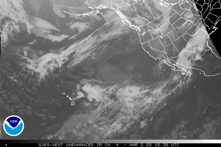