


May 13-14, 2009
Air Temperatures – The following maximum temperatures were recorded across the state of Hawaii Wednesday afternoon:
Lihue, Kauai – 80
Honolulu, Oahu – 84
Kaneohe, Oahu – 80
Kahului, Maui – 85
Hilo, Hawaii – 81
Kailua-kona – 84
Air Temperatures ranged between these warmest and coolest spots near sea level – and on the highest mountains…at 4 p.m. Wednesday afternoon:
Kapalua, Maui – 84F
Hilo, Hawaii – 78
Haleakala Crater – 61 (near 10,000 feet on Maui)
Mauna Kea summit – 46 (near 14,000 feet on the Big Island)
Precipitation Totals – The following numbers represent the largest precipitation totals (inches) during the last 24 hours on each of the major islands, as of Wednesday afternoon:
0.03 Anahola, Kauai
0.02 Waimanalo, Oahu
0.00 Molokai
0.00 Lanai
0.00 Kahoolawe
0.01 West Wailuaiki, Maui
0.03 Piihonua, Big Island
Weather Chart – Here’s the latest (automatically updated) weather map shows a 1025 millibar high pressure system located NE of the islands. This high pressure cell has a ridge running southwest from its center, to a point northwest of Kauai. The placement of this ridge will provide light trade winds, gradually becoming southeast into Friday.
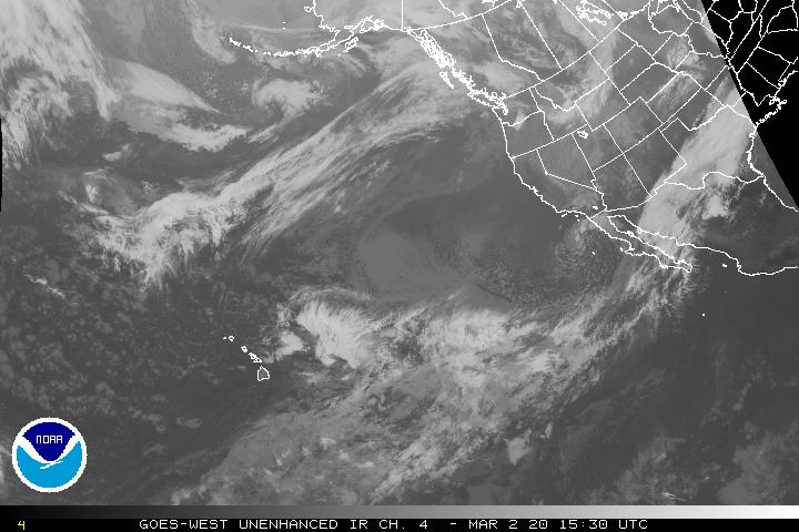
Satellite and Radar Images: To view the cloud conditions we have here in Hawaii, please use the following satellite links, starting off with the Infrared Satellite Image of the islands to see all the clouds around the state during the day and night. This next image is one that gives close images of the islands only during the daytime hours, and is referred to as a Close-up visible image. This next image shows a larger view of the Pacific…giving perspective to the wider ranging cloud patterns in the Pacific Ocean. Finally, here’s a looping IR satellite image, making viewable the clouds around the islands 24 hours a day. To help you keep track of where any showers may be around the islands, here’s the latest animated radar image.
Hawaii’s Mountains – Here’s a link to the live webcam on the summit of near 14,000 foot Mauna Kea on the Big Island of Hawaii. The tallest peak on the island of Maui is the Haleakala Crater, which is near 10,000 feet in elevation. These two webcams are available during the daylight hours here in the islands…and when there’s a big moon rising just after sunset for an hour or two! Plus, during the nights and early mornings you will be able to see stars, and the sunrise too…depending upon weather conditions.
Aloha Paragraphs

Honolua Bay…Maui
Artist Credit: Dillingerarts
Considerably lighter winds will be on tap as we move through the next several days, until slightly cooler northeast breezes arrive by Sunday…followed by light and variable winds again shortly thereafter. A high pressure ridge is located a couple of hundred miles northwest of Kauai Wednesday night. This weather map shows a 1026 millibar high pressure system far to northeast of our islands…with the ridge extending southwest. This weather map also shows a frontal boundary to the north of the ridge. As this front gets pushed further south, it in turn will nudge the ridge of high pressure towards us at the same time…resulting in lighter winds. This lighter air will have a tendency to come up from the southeast, which will likely carry volcanic haze up over the state with it.
Rainfall is scarce now, with little change expected through Saturday…with potentially more showery weather arriving Sunday into Monday. Whatever few showers that fall over the next several days, will consist of just a few light ones in the upcountry areas during the afternoons. A late season cold front may bring an increase in showers Sunday into Monday. This frontal boundary has a pretty good chance of bringing some moisture our way. Despite the computer models strongly suggesting this weather solution, there remains at least a little bit of a chance that the showers will stall before arriving here in the islands. Then again on the other hand, this is beginning to look more likely now, with all of the various computer models converging on this solution now.
The computer models show a fairly deep low pressure system digging down into the area just north or northeast of the islands this weekend. They go on to show a shower bearing cold front pushing down into the state as far as perhaps Maui by Monday. This of course is good news, as this time of year we need every drop, before we head even deeper into our dry season. I’ve been holding back a little in terms of supporting this 100%, and must admit that I’m still not quite there. I also must admit that now that all the models have come into alignment on this wet weather scenario, I’m being pulled in that direction too. I suspect that Kauai and Oahu will get some moisture, but I’m still not absolutely certain that the front will make it all the way down to Maui, much less all the way to the Big Island.
It’s early Wednesday evening as I begin writing this last section of today’s weather narrative. We’ve been doing quite a bit of referencing of this late season cold front. I think it’s about time we take a look at this frontal boundary, so here’s a picture. This of course is the big view, showing this band of clouds extending well to the east and west…in relation to the portion to our north. Here’s a closer look at it, showing how close it is to our islands now. We’ll be discussing this late season cold front much more during the next several days. ~~~ I’m about ready to leave Kihei, for the drive upcountry to Kula. Let me look out the window here, before I get out into my car. It’s almost totally clear out there, with just some partly cloudy areas here and there. I’m hoping that you will join me here again Thursday. I’ll back with our next new weather narrative early Thursday morning, at least early here in the islands. I trust that you will have a great Wednesday night until then! Aloha for now…Glenn.
Interesting: Some Michigan mammal species are rapidly expanding their ranges northward, apparently in response to climate change, a new study shows. In the process, these historically southern species are replacing their northern counterparts. The finding, by researchers at the University of Michigan, Michigan State University and Ohio’s Miami University, appears in the June issue of the journal Global Change Biology.
"When you read about changes in flora and fauna related to climatic warming, most of what you read is either predictive—they’re talking about things that are going to happen in the future—or it’s restricted to single species living in extreme or remote environments, like polar bears in the Arctic," said lead author Philip Myers, professor of ecology and evolutionary biology at U-M.
"But this study documents things that are happening right now, here at home." What will be the ultimate impact of Michigan’s changing mammal communities? "We’re talking about the commonest mammals there, mammals that have considerable ecological impact," Myers said. "They disperse seeds, they eat seeds, they eat the insects that kill trees, they disperse the fungus that grows in tree roots that is necessary for trees to grow, and they’re the prey base for a huge number of carnivorous birds, mammals and snakes.
But we don’t know enough about their natural history to know whether replacing a northern species with a southern equivalent is going to pass unnoticed or is going to be catastrophic. It could work either way. "What we can say is that the potential is there for serious changes to happen, and it would be really smart of us to figure it out, but that will require a lot of detailed, focused ecological research."
Interesting2: Nearly one in 12 people exposed to terrorism report increased use and misuse of alcohol, according to researchers at Columbia University Mailman School of Public Health and the University of Michigan. In a study published in the June issue of the journal Addiction, investigators combined data from 31 studies conducted in the aftermath of such incidents as the terrorist attacks of September 11, 2001, the Oklahoma City Bombings of 1995, and the Intifada uprisings in Israel.
The researchers used this data to look at the prevalence of addictive behavior after terrorist incidents and to assess the likelihood of an increase of addictive behavior in the general population following a terrorist attack. Initial results indicated that nearly 10% of the general population surveyed in those settings reported more or problematic alcohol consumption.
After adjusting for the type of terrorist attack, the type of population surveyed (survivors, responders, or the general population), and the time following the incident when the survey was conducted, the estimate of the isolated effect of terrorism dropped to 7.3%.
However, by using certain research methodologies, investigators were able to estimate that there was a one-in-four chance that the rate could be double that figure. The study found similar reported rates of increased drug and cigarette use.
Interesting3: Ocean fish can contain high levels of mercury, even though mercury levels in the seawater around them are extraordinarily low. Now, scientists have an explanation for what’s going on. A new study in the Pacific Ocean suggests that algae at the water’s surface absorb mercury from the atmosphere and then sink to mid-depths, where they decompose and release methylmercury, a highly toxic form of the metal that poisons both fish and the people who eat them.
Mercury concentrations have increased in the Pacific by 30 percent in the last 20 years, the study found. And if emissions continue to rise as expected, the scientists predict another 50 percent jump by 2050. "We can now explain why large predatory fish in the open oceans have methylmercury in the first place," said Dave Krabbenhoft, a geochemist with the United States Geological Survey in Middleton, Wisc. "We don’t have to scratch our heads anymore."
Interesting4: An internal government memorandum that came to light on Tuesday challenged the scientific and economic basis of a proposed Environmental Protection Agency finding that climate-altering gases are a threat to human health and welfare. The undated and unsigned government document, marked "Deliberative — Attorney Client Privilege," was compiled by the White House Office of Management and Budget from comments offered by various agencies.
A White House official said that many of the criticisms and suggestions came from holdovers from the administration of President George W. Bush and had been rejected by Obama appointees.
The nine-page document was part of a multiagency review of the proposed E.P.A. finding and had little impact on the final agency document, which was issued on April 17, officials said.
But opponents of the Obama administration’s approach to the regulation of heat-trapping gases seized on the memorandum in a flurry of press statements and in a Senate hearing on Tuesday.
Interesting5: The most spectacular stretch of coral reefs on the planet is in danger of collapse from climate change, overfishing and pollution, according to a report being presented today at the World Oceans Conference in Indonesia. Scientists consider the region known as the "coral triangle" to be the centre of marine life on Earth, teeming with fish and almost one-third of the world’s coral reefs.
Covering 1 per cent of the planet from South-East Asia to the Pacific, the area also supports about 100 million people. But in the past 40 years, 40 per cent of the coral reefs and coastal mangroves in the coral triangle have been lost because of pollution, coastal development and overfishing, said a University of Queensland professor, Ove Hoegh-Guldberg, who led the study commissioned by WWF.
"It’s an astounding amount," Professor Hoegh-Guldberg said. "At the moment the coral reefs are disappearing at about 1 to 2 per cent a year. You don’t have to be a brain surgeon to see that within 40 years we could lose the rest. This may sound alarming but this is not alarmist. This is what we are probably going to experience if we don’t get our act together".
The report, The Coral Triangle and Climate Change, comes as ministers involved in the coral triangle initiative, the international effort to protect region, meet at the World Oceans Conference this week. Since the initiative began in August 2007 environment groups have lobbied to declare the region the largest marine reserve in the world.
Australia’s Environment Minister, Peter Garrett, will join leaders from Indonesia, Malaysia, the Philippines, Papua New Guinea, the Solomon Islands and East Timor at the meeting. The new report examines two scenarios for the region under climate change, one where an ambitious global agreement to prevent dangerous climate change is struck at Copenhagen in December and one where this fails.
The report warns without decisive action on climate change, "many parts of the coral triangle will be largely unlivable by the end of this century". An ambitious global climate agreement would require the world to cut greenhouse gases steeply by 2050 with all countries making commitments, the report finds. Developed countries would need to cut their greenhouse emissions by up to 40 per cent of 1990 levels.
The report warns the collapse of marine life will have a serious effect on the 100 million people who live in the region. "Some of the most impoverished people in the world, living on a knife edge with respect to climate change, are going to be really seriously affected by the decisions we take from Copenhagen onwards", Professor Hoegh-Guldberg said.
Interesting6: Common dolphins, once a frequent sight in the Mediterranean, may soon be extinct in Greece’s Ionian Sea due to overfishing, environmentalists warned. WWF and a dozen other environmental organisations said research showed numbers of dark-grey, white-bellied dolphins had decreased from 150 to 15 in 10 years in protected areas in the Ionian, between Greece and Italy.
"It is called the common dolphin but the problem nowadays in the Mediterranean is that it’s not common at all anymore. It is endangered. It is about to be extinct," WWF Greece-based expert Giorgos Paximadis said. "Overfishing has caused the destruction of the marine environment and the dramatic decrease of common dolphins," Mr Paximadis said.
The environmental groups urged Greece to take measures, including the adoption of larger mesh size for all bottom-set nets, restrictions on trawling and on recreational fishing as well as stronger penalties for illegal fishing. The common dolphin population in the Ionian Sea is one of the last in the Mediterranean, Mr Paximadis said.
"As they are on the top of food web, it shows that the rest of the marine web is not healthy," he said. Three other species of dolphins in Greece, including the bottlenose dolphin, are considered vulnerable but not yet in danger of extinction, he said.
Interesting7: Colorado State University hurricane forecaster Bill Gray said Wednesday he may reduce his next Atlantic season forecast because sea temperatures are cooling and a weak El Niño may appear by late summer. "Things are looking better and better for fewer storms," Gray told Reuters in an interview at the Florida Governor’s Hurricane Conference in Fort Lauderdale. "Off the west African coast there’s colder water.
There’s increasing high pressure in the Azores Islands that typically makes the trade winds stronger," he said. In April, Gray’s team predicted the six-month Atlantic hurricane season, which starts on June 1, would see 12 tropical storms, of which six would become hurricanes and two would reach "major" status of Category 3 or higher on the five-step Saffir-Simpson scale of hurricane intensity.
The pioneering forecaster said if his research team lowers the forecast, it would likely drop to 11 storms. The new forecast is scheduled for release on June 2. The April forecast was already reduced from one issued in December, when the CSU team called for 14 tropical storms, including seven hurricanes and three major hurricanes.
Gray said sea surface temperatures in parts of the Atlantic were clearly cooling. Where they were about 0.2 degree Fahrenheit above average last fall, they are now about 0.5 degrees Fahrenheit below average, he said. Hurricanes draw energy from warm water, so cooler temperatures bode well for fewer and possibly weaker storms.
The prospect of an El Niño event — a warming of eastern Pacific waters that can suppress hurricane activity in the Atlantic by increasing storm-wrecking wind shear — could be a key element in the outlook for the 2009 season, Gray said. "We’re watching that carefully. About half the models are forecasting a weak El Niño by this late summer and the other half aren’t," he said.
"But it’s getting warmer (in the eastern Pacific) and perhaps the effect of that is to cause westerly winds to blow over the Caribbean." The hurricane forecasting pioneer, now 79 years old, issued his first formal seasonal prediction in 1984.