


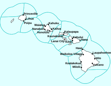
Air Temperatures – The following high temperatures (F) were recorded across the state of Hawaii Wednesday…along with the low temperatures Wednesday:
87 – 79 Lihue, Kauai
91 – 78 Honolulu, Oahu
87 – 73 Molokai AP
90 – 72 Kahului AP, Maui
88 – 77 Kona AP, Hawaii
84 – 71 Hilo, Hawaii
Here are the latest 24-hour precipitation totals (inches) for each of the islands Wednesday evening:
0.33 Mount Waialeale, Kauai
0.20 Poamoho RG, Oahu
0.01 Molokai
0.03 Lanai
0.01 Kahoolawe
1.10 West Wailuaiki, Maui
1.14 Nene Cabin, Big Island
The following numbers represent the strongest wind gusts (mph) Wednesday evening:
18 Port Allen, Kauai
27 Kuaokala, Oahu
24 Molokai
27 Lanai
35 Kahoolawe
33 Maalaea Bay, Maui
24 Pali 2, Big Island
Hawaii’s Mountains – Here’s a link to the live webcam on the summit of our tallest mountain Mauna Kea (13,803 feet high) on the Big Island of Hawaii. Here’s the webcam for the 10,000+ feet high Haleakala Crater on Maui. These webcams are available during the daylight hours here in the islands, and at night whenever there’s a big moon shining down. Also, at night you will be able to see the stars, and the sunrise and sunset too…depending upon weather conditions.

No tropical storms are in the vicinity of the state
(click on the images to enlarge or animate them)

Thunderstorms remain offshore from the islands

Clear to partly cloudy…with localized cloudy areas

Showers locally…Looping image
Small Craft Advisory…pink color below
~~~ Hawaii Weather Narrative ~~~
Broad Brush Overview: Trade wind weather conditions will continue into next week. Showers will fall generally over the windward and mountain areas…with passing clouds over the rest of the state. Increasing humidity and showers are possible over the weekend, as moisture increases across the island chain.
Details: A surface ridge north of the state will continue to produce easterly trade winds through the middle of next week. Drier and more stable air will filter in from the east, and shower activity will slowly trend lower now. A high pressure ridge aloft will produce more stable conditions Thursday through Saturday. Passing clouds and showers will favor windward areas…trending towards the overnight to early morning hours. Trade wind speeds will remain at moderate levels, as the ridge north of the islands weakens due to a passing surface trough.
As we reach Sunday, a developing disturbance in the tropics may bring deeper moisture up from the southeast into the Big Island. However, models differ a bit on the forecast for this time period, and the latest GFS model shows the deeper moisture reaching the southern and eastern sides of the Big Island…before drifting westward Sunday afternoon through Sunday night. Thus, confidence in more humid and wet weather on Sunday for the Big Island and Maui, remains only fair due to evolving model solutions.
Looking Further Ahead: As we push into the early part of next week, a stronger high pressure ridge north of the island chain will bring increasing trade winds. A weak surface trough, with embedded clouds and showers may drift into Kauai County Monday, enhancing shower activity then. Otherwise the weather action will be limited to passing windward and mountain showers in the easterly trade wind flow. Meanwhile, there are no tropical cyclones expected here in the central Pacific through the next 5-days…at least.
Here’s a near real-time Wind Profile of the Pacific Ocean – along with a Closer View of the islands / Here’s the latest Weather Map
Marine Environmental Conditions: The northern end of a surface trough, which is the remnant of former East Pacific Tropical Cyclone Barbara, has been moving westward at around 15 knots, so its direct influence on weather across the state continues to diminish. The current forecast indicates the trade winds may briefly drop below the small craft advisory (SCA) level across these windier waters. However, a new surface high pressure system should build far north of the state later this week. Therefore, SCA winds may return to the typically windier waters again Thursday.
The locally strong trade winds continue to produce elevated rough surf along east facing shores. Surf is expected to gradually lower along east facing shores.
The combination of a declining south-southwest swell and a small southeast swell, generated by strong southeast trade winds in the South Pacific last week, will likely maintain surf heights near or slightly above the summer-time average along exposed south facing shores. New south-southwest swells arriving starting Friday are expected to cause surf to reach the high surf advisory criteria along south facing shores this weekend into next Monday.
Elsewhere, a small northwest swell is expected to arrive. This swell may produce a slight rise in surf along north and west facing shores of some of the smaller islands…tonight through Friday.

World-wide Tropical Cyclone Activity
>>> Here’s the latest Pacific Disaster Center (PDC) Weather Wall Presentation covering the eastern, central, and western Pacific Ocean, the Indian Ocean, and the Arabian Sea
>>> Here’s Thursday’s Pacific Disaster Center (PDC) Weather Wall Presentation covering the Atlantic Ocean, the Caribbean Sea, and the Gulf of Mexico…including Potential Tropical Cyclone 02L
>>> Atlantic Ocean: There are no active tropical cyclones
A tropical wave located several hundred miles southwest of the Cabo Verde Islands is producing disorganized shower activity.
Some slight development of the wave is possible during the next day or two while it moves westward at 15 to 20 mph before environmental conditions become less favorable over the weekend.
* Formation chance through 48 hours…low…10 percent
* Formation chance through 5 days…low…10 percent
Latest satellite image of the Atlantic
>>> Caribbean Sea: There are no active tropical cyclones
Tropical cyclone formation is not expected during the next 5 days
Here’s a satellite image of the Caribbean Sea…and the Gulf of Mexico
>>> Gulf of Mexico:
Potential Tropical Cyclone 02L
NHC textual forecast Advisory
NHC graphical track map
According to the NHC advisory #4A…The system is moving toward the west near 5 mph, but a west-northwest motion is expected Friday, followed by a northwestward track by early Saturday. On the forecast track, the system is expected to approach the Louisiana coast this weekend.
Reports from a NOAA Hurricane Hunter aircraft indicate that maximum sustained winds are near 35 mph with higher gusts. Strengthening is forecast during the next couple of days, and the disturbance is forecast to become a tropical depression or a tropical storm later today, and could become a hurricane by late Friday.
The associated thunderstorm activity is gradually becoming better organized, and the disturbance is expected to become a tropical depression or a tropical storm later today or Friday.
* Formation chance through 48 hours…high…100 percent
* Formation chance through 5 days…high…100 percent
Latest satellite image of the Gulf of Mexico
>>> Eastern Pacific: There are no active tropical cyclones
However, A tropical wave and a weak area of low pressure, located a few hundred miles south of the southern coast of Mexico, is producing disorganized showers and thunderstorms.
Environmental conditions are not forecast to be conducive for significant development during the next several days while the disturbance moves westward to west-northwestward well offshore the southern coast of Mexico.
* Formation chance through 48 hours…low…10 percent
* Formation chance through 5 days…low…10 percent
Here’s the link to the National Hurricane Center (NHC)
>>> Central Pacific: There are no active tropical cyclones
No tropical cyclones are expected during the next 5 days.
Here’s the link to the Central Pacific Hurricane Center (CPHC)
>>> Northwest Pacific Ocean: There are no active tropical cyclones
>>> South Pacific Ocean: There are no active tropical cyclones
>>>North and South Indian Oceans / Arabian Sea: There are no active tropical cyclones
Interesting: A Drier Future Sets the Stage for More Wildfires — November 8, 2018 was a dry day in Butte County, California. The state was in its sixth consecutive year of drought, and the county had not had a rainfall event producing more than a half inch of rain for seven months. The dry summer had parched the spring vegetation, and the strong northeasterly winds of autumn were gusting at 35 miles per hour and rising, creating red flag conditions: Any planned or unplanned fires could quickly get out of control.
Sure enough, just before daybreak, strong winds whipped a stray spark from a power line into an inferno. The Camp Fire became the most destructive fire in California’s history, scorching approximately 240 square miles, destroying nearly 14,000 buildings, causing billions of dollars in damage and killing 88 people. Later the same day, the Woolsey Fire broke out in Los Angeles County, burning 150 square miles and killing three.
Droughts can create ideal conditions for wildfires. Lack of rain and low humidity dry out trees and vegetation, providing fuel. In these conditions, a spark from lightning, electrical failures, human error or planned fires can quickly get out of control.
Global climate change is predicted to change precipitation and evaporation patterns around the world, leading to wetter climate in some areas and drier in others. Areas that face increasingly severe droughts will also be at risk for more and larger fires. Several NASA missions collect valuable data to help scientists and emergency responders monitor droughts and fires. Some instruments monitor water in and below the soil, helping to assess whether areas are moving toward dangerous droughts. Others watch for heat and smoke from fires, supporting both research and active disaster recovery.
Understanding how fires behave in dry conditions can help firefighters, first responders and others prepare for a hotter, drier future.
Climate Change: Not Just Wet
Earth’s warming climate is forecasted to make global precipitation patterns more extreme: Wet areas will become wetter, and dry areas will become drier. Areas such as the American Southwest could see both reduced rainfall and increased soil moisture evaporation due to more intense heat, and in some cases, the resulting droughts could be more intense than any drought of the past millennium.
Ben Cook of NASA’s Goddard Institute for Space Studies (GISS) in New York City researches “megadroughts” — droughts lasting more than three decades. Megadroughts have occurred in the past, like the decades-long North American droughts between 1100 and 1300, and the team used tree ring records to compare these droughts with future projections. He and his team examined soil moisture data sets and drought severity indices from 17 different future climate models, and they all predicted that if greenhouse gas emissions continue to increase at their present rate, the risk of a megadrought in the American Southwest could hit 80 percent by the end of the century. Additionally, these droughts will likely be even more severe than those seen in the last millennium.
Such severe droughts will affect the amount and dryness of fuel such as trees and grass, Cook said.
“Fire depends on two things: having enough fuel and drying that fuel out so it can catch fire. So in the short term, more droughts probably mean more fire as the vegetation dries out,” said Cook. “If those droughts continue for a long period, like a megadrought, however, it can actually mean less fire, because the vegetation will not grow back as vigorously, and you may run out of fuel to burn. It’s definitely complicated.”
Current and future NASA measurements of soil moisture and precipitation will help to evaluate climate models’ predictions, making them even more accurate and useful for understanding Earth’s changing climate.
Cook and his GISS colleague Kate Marvel were the first to provide evidence that human-generated greenhouse gas emissions were influencing observed drought patterns as long ago as the early 1900’s. By showing that human activities have already affected drought in the past, their research provides evidence that climate change from human-generated greenhouse gas emissions will likely influence drought in the future.
Staying Ahead of the Fire
If the future does hold megadroughts for the southwestern United States, what might this mean for its fire seasons?
“Once we change the climatology and get drier and drier fuels, we should expect more intense fires and higher fire severity,” said Adam Kochanski, an atmospheric scientist at the University of Utah, referring to the size and impact of the fires. If fuels are moist, the fire is more likely to stay close to the ground and be less destructive, he said. Dry trees and plants make it more likely that flames will reach the forest canopy, making the fire more destructive and harder to control.
Kochanski and Jan Mandel of the University of Colorado Denver used data from NASA and other sources to simulate the interactions between wildfires, soil moisture and local weather. They built on previous work by the National Center for Atmospheric Research (NCAR) and others to develop the SFIRE module for the widely used Weather Research and Forecasting model (WRF).
This module uses data from NASA’s Moderate Resolution Imaging Spectroradiometer (MODIS) aboard its Aqua and Terra satellites, and the Visible Infrared Imaging Radiometer Suite (VIIRS) aboard the Suomi National Polar-Orbiting Partnership (Suomi NPP) spacecraft.
Weather influences fires, but fires also influence local weather by producing heat, water vapor and smoke, Kochanski said. The winds from large fires can alter local weather patterns, and in extreme conditions, generate firestorms and fire tornadoes.
“It’s not uncommon for people involved in wildland fires to report that although the wind is not very strong, the fires propagate very fast,” Kochanski said. “If it isn’t that windy, but your fire is intense and releases a lot of heat, it has the potential to generate its own winds. Even if the ambient winds are weak, this fire will start moving as if it were really windy.”
Better modeling of these interactions not only helps firefighters better predict where and how a wildfire might spread, but also helps forest managers know whether a planned burn is safe.
A Tale of Fire and Snow
Fires’ effects persist long after they are extinguished, and the availability or lack of fresh water plays an important role in vegetation regrowth and recovery. Dry conditions may prevent new seeds from germinating in the burned areas. Vegetation loss can lead to erosion and sediment blocking waterways, and firefighting chemicals may contaminate water sources.
Forest fires can have impacts on future winter snowpacks as well, said Kelly Gleason, a snow hydrologist and assistant professor at Portland State University. “Snowpack” refers to the snow that accumulates over an entire winter, rather than a single snowfall.
Here too, NASA data are key to understanding the processes involved. Gleason and her team used 16 years of data from NASA’s MODIS instrument to investigate wildfires’ effects on snow melt in forests in the American West. They discovered that soot and debris from fire makes snow darker and less reflective for up to 15 years after a fire.
“It’s like wearing a black T-shirt on a sunny day,” Gleason said. “It primes the snowpack to absorb more sunlight energy. And there’s more energy anyway, because the forest canopy was burned, so more sun comes through.”
Their survey of roughly 850 fires between 2000 and 2016 showed that snow in burned forests melted, on average, five days earlier than snow in unburned forests. In some areas the snow melted weeks or months earlier than normal, Gleason said.
“Every year we experience earlier snow melt, there are strong relationships with big, hot, long-lasting fires the following summer,” she said. “It creates this vicious cycle where snow melts earlier due to climate change, which extends the summer drought period where the soil dries out, and when the fuels dry out, you get these big fires. This further accelerates snowmelt, further extending the summer drought period and fire potential.”
Modeling a safer future
Mandel and Kochanski’s fire-atmosphere model is already in operational use in Israel and Greece. While the software requires computing expertise to use, it is available for free, consistent with NASA’s mission to freely provide its data and other products to the public.
Branko Kosovi?, program manager for Renewable Energy for the Research Applications Laboratory and director of the Weather Systems and Assessment Program at NCAR, also used WRF to develop the fire prediction system for the state of Colorado’s Division of Fire Prevention and Control. This model uses a related module called FIRE and produces a fire, weather and smoke forecast useful for both wildfires and planned fires.
Kosovi? is also using the WRF system for his research, which uses NASA remote sensing data and machine learning to estimate fuel moisture daily over the contiguous Unites States.
“Measuring live fuel moisture [currently] has to be done manually,” Kosovi? said. “People have to go out, take the live fuel, and essentially cure it in ovens to see how much moisture there is. It’s very labor intensive. And you can imagine that, because of that, the data is sparse, both in space and in frequency and time.”
Kosovi?, Mandel and Kochanski hope to build systems that will give forest managers better information to plan controlled fires and help improve resource allocation during wildfires, leading to better risk assessment and recovery.
NASA scientists monitor both freshwater and fires constantly, from space, the air and the ground, collecting short- and long-term data as Earth’s climate continues to change. Programs such as the NASA Earth Science Disasters Program use satellite data to track active fires, monitor their effects on air quality and perform research that helps communities be more prepared before disasters strike. And looking to the future, modeling plays a key role in preparing for changing drought and fire seasons around the world.
Dorli Reeve Says:
Dear Glenn,
ever so thankful for your weather information.
What is known as factors that led to the dramatic weakening of Megahurricane Barbara?
With much Aloha, Dorli
~~~ Hi Dorli, thanks for your comment. Barbara certainly did lose steam once it got into our central Pacific. The main reasons were, as they often are with approaching tropical cyclones, the cooler sea water temperatures, and most importantly, the strong upper level winds (called wind shear) that take down storms below them. These one-two punches did a number on Barbara as she moved westward.
Nonetheless, Barbara still has a noticeable swirl of clouds, as we can see in the satellite images up this page…as the center moves by to our south. The bulk of the heaviest showers will remain to our south, although hopefully we’ll get some over the islands too.
Thanks for your positive comment about my work/website, and thanks for your good question too.
Aloha, Glenn
Gerry Says:
Aloha Glenn
I have noticed several folks wondering if the increased cement and development near the Kahului airport is a factor in the new records for high temperatures. As a farmer in lower Kula I can tell you that it has been abnormally hot which has certainly challenged our crops…no metric to confirm but it is HOT at the bottom of Na’alae!!
~~~ Hi Gerry, good to hear from you again, there in lower Kula. Indeed, hot, hot, hot this spring and now into the first couple of weeks of summer too. I’ve always experienced your area as pretty darn hot during the summer months, although it sounds like a bit more than usual this time around. Sorry your crops are being challenged, I trust things turn out ok…I have a feeling that we’ll all be relieved when we reach fall, and then the even cooler weather during our winter season.
Thanks for letting us know what’s happening there along the lower part of Na’alae Road.
Aloha, Glenn
Heidi Says:
hi! I came across this page while I was seeking information lol 🙂 we are going to Maui for the very first time July 8-15 and I’m concerned Hurricane Barbara is going to ruin our experience or “rain on our parade lol”. We are debating canceling :(. What’s your expert opinion on the weather for next week ?
Thank you 😊
~~~ Hi Heidi, good question, and the answer can be found here: https://www.hawaiiweathertoday.com/maui.php
I don’t know where you are staying on Maui, although just click on the map in the area where you will be…and look for the days you’ll be here.
Good luck!
Aloha, Glenn
robie Says:
it’s a bob marley song.
~~~ Hi again Robie, ahhh…we all like Bob Marley!
Aloha, Glenn
Dennis H. Says:
The current NHC track has Barbara coming right into our neighborhood, with the state at 23N / 155W, just a little off to the left on that NHC tracking map.
~~~ Hi Dennis, thanks for your comment about Barbara. Looking at the latest NHC tracking map, as of 5am Tuesday, July 2nd, the track isn’t out far enough into the central Pacific…to see where it goes in relation to Hawaii. Perhaps you’re just projecting where it might go, using the current end point in the forecast?
At any rate, lets hope for the best for the state of Hawaii!
Aloha, Glenn