


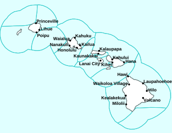
Air Temperatures – The following high temperatures (F) were recorded across the state of Hawaii Saturday…along with the low temperatures Sunday:
77 – 68 Lihue, Kauai
80 – 74 Honolulu, Oahu
81 – 73 Molokai AP
88 – 75 Kahului AP, Maui
86 – 72 Kona AP, Hawaii
85 – 63 Hilo, Hawaii
Here are the latest 24-hour precipitation totals (inches) for each of the islands Sunday morning:
2.43 Kokee, Kauai
4.67 Poamoho, Oahu
0.94 Molokai
0.10 Lanai
0.14 Kahoolawe
1.10 Puu Kukui, Maui
0.63 Keaumo, Big Island
The following numbers represent the strongest wind gusts (mph) Sunday morning:
30 Port Allen, Kauai
21 Waianae Harbor, Oahu
12 Molokai
13 Lanai
33 Kahoolawe
23 Kahului Harbor, Maui
50 Puu Mali, Big Island
Hawaii’s Mountains – Here’s a link to the live webcam on the summit of our tallest mountain Mauna Kea (nearly 13,800 feet high) on the Big Island of Hawaii. Here’s the webcam for the 10,000+ feet high Haleakala Crater on Maui. These webcams are available during the daylight hours here in the islands, and at night whenever there’s a big moon shining down. Also, at night you will be able to see the stars, and the sunrise and sunset too…depending upon weather conditions.

A potent “out of season” cold front, along with a counter-clockwise rotating upper level low pressure system to the north…will be influencing our weather this weekend
(click on the images to enlarge them)

Heavy showers…mostly offshore to the northeast

Variable clouds, mostly over Oahu to Maui County…thick cirrus south

Showers locally…some are heavy – Looping image
High Wind Warning…Big Island summits
Small Craft Advisory…pink color below
Wind Advisory…beige color below
Flood Advisory…green color below
~~~ Hawaii Weather Narrative ~~~
Broad Brush Overview: The leading edge of an out of season cold front has reached Maui County, and will continue eastward to the Big Island tonight. Instability associated this unusual cold front, and a deep upper level low pressure system, dropping south toward the islands, along with plenty of moisture will bring heavy showers, gusty winds…and a few strong thunderstorms. Drier and cooler northwest winds will fill in behind the front tonight through Monday, with trade winds unlikely to make a return until Thursday.
Details: Satellite imagery shows a potent upper low dropping south toward the state. At the surface, the attendant cold front is moving through the state. Ahead of the actual frontal boundary, the upper low continues to trigger moderate to heavy showers….while conditions will continue to deteriorate over the smaller islands. The potential for localized flooding and a few strong thunderstorms will remain a possibility over these areas. Additionally, strong winds of 40+ mph in and around any heavy showers or storms.
The front will continue eastward across the eastern end of the island chain tonight into Sunday. Although some weakening will be a possibility, the potential for heavy showers, gusty winds and strong storms will remain alive. The upper low will drop south into the area just north of the islands through this time, then slowly shift east-northeastward and away from the area Sunday through Monday.
A secondary low wrapping around the back-end of this upper feature will likely bring a band of clouds and showers…moving through from west to east late tonight into Sunday. Very cool conditions, by May standards, are expected to fill in on the northwesterly flow late tonight through Monday. The latest guidance drops dew points into the upper 50s, and daytime high temperatures will likely remain in the upper 70s, which is highly unusual for early May.
Looking Further Ahead: As the upper level low fills and lifts off to the northeast Tuesday and Wednesday, it will leave a weak area of low pressure north of the state. This will produce generally weak west to northwest winds over the islands and will likely lead to somewhat dry conditions. There is no real sign of trade winds until Thursday. A well defined ridge of high pressure west of the state builds across the island chain next weekend…keeping weather pleasantly quiet.
Here’s a near real-time Wind Profile of the Pacific Ocean – along with a Closer View of the islands / Here’s the latest Weather Map
Marine Environmental Conditions: An unseasonably strong cold front will move down the island chain this weekend, bringing a period of unsettled weather, including the potential for thunderstorms, heavy showers and gusty winds. In addition, sustained southwest to northwest winds may briefly reach Small Craft Advisory criteria in some areas.
The gradient between a ridge of high pressure northeast of the Big Island and the approaching front will support increasing south to southwest kona winds in areas southeast of the front, with a shift to gusty northwest to northerly winds in the wake of the front. These northwest winds are expected to diminish Sunday and Sunday night. The front is expected to move quickly down the island chain, reaching Kauai first, then Oahu and Maui County…and then the Big Island tonight into Sunday. After the front moves east of the area, a weak surface low is expected to be northeast of the islands Monday. This will support light to moderate northwest winds that will weaken and become variable Tuesday and Wednesday as the low weakens to a trough.
The current small northwest swell is expected to persist. A surface low accompanying the front will send a moderate sized northwest swell toward the islands tonight through Monday, with surf expected to remain below advisory levels as the swell peaks Sunday night. A small northwest swell is possible around the middle of next week, as is a small northeast swell. Relatively small southwest swells will arrive in the islands through the middle of next week, supporting small surf along exposed leeward shores.

World-wide Tropical Cyclone Activity
Here’s the latest Pacific Disaster Center (PDC) Weather Wall Presentation covering the western Pacific Ocean, the Indian Ocean, and the Arabian Sea, including a tropical disturbance being referred to as Invest 90W
>>> Atlantic Ocean: The 2019 hurricane season begins June 1, 2019
Here’s a satellite image of the Atlantic
>>> Gulf of Mexico: The 2019 hurricane season begins June 1, 2019
>>> Caribbean Sea: The 2019 hurricane season begins June 1, 2019
Here’s a satellite image of the Caribbean Sea…and the Gulf of Mexico
>>> Eastern Pacific: The 2019 hurricane season begins May 15, 2019
Here’s the link to the National Hurricane Center (NHC)
>>> Central Pacific: The 2019 hurricane season begins June 1, 2019
Here’s the link to the Central Pacific Hurricane Center (CPHC)
>>> Northwest Pacific Ocean: There are no active tropical cyclones
>>> South Pacific Ocean: There are no active tropical cyclones
>>> North and South Indian Oceans / Arabian Sea: There are no active tropical cyclones
Interesting: During the Last Lunar Eclipse, a Meteor Smacked the Moon in the Face at 38,000 Mph – On January 21, 2019, the full moon passed entirely into Earth’s shadow and, well, got smacked in the face pretty hard.
Seconds after the total phase of that night’s lunar eclipse began, a meteorite slammed into the moon’s surface, causing a brief but bright flash of light visible to amateur astronomers across the Northern Hemisphere. Professional astronomers were watching too — and now, after months of studying impact footage taken by a fleet of eight telescopes in southern Spain, a team of researchers thinks they know just how hard the moon got smacked, and what did the smacking.
According to a new study published April 30 in the journal Monthly Notice of the Royal Astronomical Society, the object that hit the moon on January 21 was likely a rogue meteoroid measuring just 1 to 2 feet in diameter and traveling at a staggering 38,000 mph. This wee, speedy rock likely created a fresh lunar crater measuring some 50 feet across.
The team reached these estimates after studying the brief impact flash — which lasted only 0.28 seconds — with the Moon Impacts Detection and Analysis System, or MIDAS telescopes. By studying the flash in several different wavelengths of light, the researchers estimated the impact’s temperature to be about 10,000 degrees Fahrenheit, roughly the same temperature as the surface of the sun.
Based on the temperature and duration of the flash, the team then calculated the speed of the impactor, its size and weight (about 100 lbs. or 45 kilograms) and the size of the crater it created. The scientists also estimated that the energy of the blast was equivalent to detonating about 1.65 tons of TNT on our nearest cosmic neighbor.
These numbers are impressive, but not unusual According to a 2016 study in the journal Nature, the moon’s pocked and cracked surface acquires about 140 new craters measuring at least 33 feet across every year. Because the moon has no atmosphere, even the smallest space rocks can make a significant impact on the lunar surface. Usually, however, conditions are too bright for astronomers to see those impacts.
Catching a lunar impact in the midst of a total lunar eclipse is a rare event for researchers like the MIDAS team, who specialize in studying these frequent if unpredictable events. Better understanding lunar impacts could help safeguard the next wave of astronauts set to return to the moon in the next decade, the researchers wrote in the study.
Mary L. Boland Says:
Hi Glenn,
I love your early morning updates…I like that someone else is up and busy this time of the morning! Mahalo.
~~~ Hi Mary, glad to know you are an early riser…like myself. Also happy to know that you appreciate my early morning updates, thanks for letting me know.
Aloha, Glenn
Gerry Says:
Aloha Glenn
Wow. Showers this afternoon dumped 2″ of rain over 3 hours on usually dry Na’alae Road (2000′ lower Kula)!! Our coffee trees (450 of them) will likely get covered in flowers in 10 days….but wait!We still have a heavy crop to pick! The mixed up weather of this year is keeping us and our coffee trees mixed up! What a crazy year for weather.
~~~ Hi Gerry, heavy showers Thursday afternoon, indeed, typically May is one of our driest months of the year…vying with June for that distinction. This is particularly noteworthy of course, being that your area of lower Kula is, as you say, an especially dry area of the island.
I think your choice of words, crazy, is an apt description! Good luck dealing with all the extremities that will be showing up now, and into the coming years and decades…due to climate change!
Best of luck,
Aloha, Glenn
Craig Says:
I cannot find the predictions for the Central Pacific Hurricane season. Have they been published yet? Above/Below/Average?
I realize it depends on what el’Nino activity is expected.
Thanks
~~~ Hi Craig, it’s not out yet, I’ll put the outlook on this website as soon as it gets issued by the Central Pacific Hurricane Center…May 22nd.
Aloha, Glenn