


Air Temperatures – The following high temperatures (F) were recorded across the state of Hawaii Monday…along with the low temperatures Monday:
81 – 71 Lihue, Kauai
82 – 68 Honolulu, Oahu
78 – 67 Molokai AP
84 – 61 Kahului AP, Maui
81 – 68 Kona AP, Hawaii
79 – 63 Hilo, Hawaii
Here are the latest 24-hour precipitation totals (inches) for each of the islands Monday evening:
0.01 Kilohana, Kauai
0.00 Oahu
0.00 Molokai
0.00 Lanai
0.00 Kahoolawe
0.00 Maui
0.09 Kawainui Stream, Big Island
The following numbers represent the strongest wind gusts (mph) Monday evening:
13 Poipu, Kauai
25 Honolulu AP, Oahu
21 Molokai
21 Lanai
32 Kahoolawe
23 Kahului AP, Maui
24 South Point, Big Island
Hawaii’s Mountains – Here’s a link to the live webcam on the summit of our tallest mountain Mauna Kea (nearly 13,800 feet high) on the Big Island of Hawaii. Here’s the webcam for the 10,000+ feet high Haleakala Crater on Maui. These webcams are available during the daylight hours here in the islands, and at night whenever there’s a big moon shining down. Also, at night you will be able to see the stars, and the sunrise and sunset too…depending upon weather conditions.
Aloha Paragraphs

The next cold front is northwest of the islands
(click on the images to enlarge them)

Thunderstorm activity far southwest of the state…high clouds over the Big Island

Clear to partly cloudy leeward…along with cloudy areas locally

A few showers…mostly windward and offshore
Looping image
Small Craft Advisory…pink color below
High Surf Advisory…purple color below
High Surf Warning…green color below
~~~ Hawaii Weather Narrative ~~~
Broad Brush Overview: Generally dry weather will hold through early Tuesday. Trade winds will continue to gradually fade, likely becoming light enough for land and sea breeze conditions tonight through Tuesday. This will occur as a weak cold front approaches and moves into the state. The front will move through the chain late Tuesday through Wednesday, bringing increasing showers. Gusty northerly winds along with drier and cooler conditions will follow Wednesday into Thursday. A return of more typical weather will return Friday into the weekend.
Details: The models continue to show the dry pattern holding, due to high pressure ridging and a strong subsidence inversion. Precipitable water values will range from .75″ to an 1.00″, which is drier than average for late autumn. After a long stretch of windy trades, the pressure gradient is relaxing over the state, as a weak cold front and upper trough approach from the northwest. The trades will respond and gradually trend down, becoming light enough for localized land and sea breezes tonight into Tuesday.
Looking Ahead: The models show the cold front moving down the island chain late Tuesday on Kauai, then clearing the Big Island later Wednesday. This front and upper trough will support a band of clouds and increasing showers. Northerly winds along with much drier and cooler conditions will follow its passage Wednesday through Thursday. High temperatures should remain in the 70’s Wednesday afternoon. These dry and pleasant conditions will likely hold through Friday…with a typical trade wind pattern returning by the weekend.
Here’s a near real-time Wind Profile of the Pacific Ocean – along with a Closer View of the islands / Here’s the latest Weather Map
Marine Environmental Conditions: Moderate to locally strong trades linger, although are expected to weaken as a front approaches from the northwest. The front will push high pressure, currently northeast of the islands, to the east. The front is expected to reach the northwest waters near Kauai Tuesday, and then push down the island chain through Wednesday. Strong northerly winds are expected with and behind the front. High pressure is then expected to settle in for the end of the week.
The current northwest swell is on the decline, as the nearshore buoys are showing. A new, even larger swell is expected to build tonight, peaking above warning levels Tuesday night.
With winds remaining at or near Small Craft Advisory (SCA) levels, coupled with the current swell continuing, the SCA has been extended for all waters. Seas are expected to decrease as the current swell continues to subside. As mentioned above, the next swell is expected to arrive tonight, which will linger into the middle of the week.
Surf is expected to drop below the winter time average along north and west facing shores for the latter part of the week…on into the weekend.

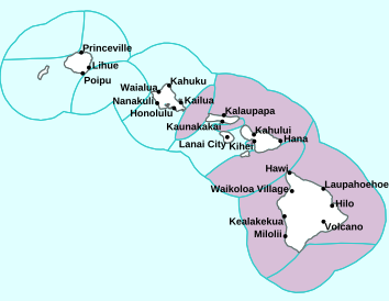
Kauai
World-wide Tropical Cyclone Activity
Here’s the latest Pacific Disaster Center (PDC) Weather Wall Presentation covering the western Pacific Ocean, the Indian Ocean, and the Arabian Sea, including Tropical Cyclone 08B (Phethai), Tropical Cyclone 06S (Kenanga)…and two tropical disturbances
>>> Atlantic Ocean: The 2019 hurricane season begins June 1, 2019
Here’s a satellite image of the Atlantic
>>> Gulf of Mexico: The 2019 hurricane season begins June 1, 2019
>>> Caribbean Sea: The 2019 hurricane season begins June 1, 2019
Here’s a satellite image of the Caribbean Sea…and the Gulf of Mexico
>>> Eastern Pacific: The 2019 hurricane season begins May 15, 2019
Here’s the link to the National Hurricane Center (NHC)
>>> Central Pacific: The 2019 hurricane season begins June 1, 2019
Here’s the link to the Central Pacific Hurricane Center (CPHC)
>>> Northwest Pacific Ocean: No active tropical cyclones
>>> South Pacific Ocean: No active tropical cyclones
>>> North and South Indian Oceans / Arabian Sea:
Tropical Cyclone 08B (Phethai)
JTWC textual advisory
JTWC graphical track map
Tropical Cyclone 06S (Kenanga)
JTWC textual advisory
JTWC graphical track map
Here’s a link to the Joint Typhoon Warning Center (JTWC)
Interesting: Canada’s Huge New Diamond Is … Well, Fine, We Guess – Miners discovered a 552-carat yellow diamond in the Diavik Diamond Mine in the Northwest Territories this October, Dominion Diamond Mines announced last week. For Canada, that’s a big rock: The country’s previous size record for a diamond was 187.7 carats. However, for the world, the largest diamond ever found is the Cullinan Diamond, discovered in South Africa in 1905. That rock clocks in at 3,106.75 carats.
For another comparison, the famous Hope Diamond, held at the Smithsonian Institution in Washington, D.C., is 45 carats. It’s famous both for its rare blue color and its alleged habit of bringing misfortune to those who possess it.
Diamonds typically come from carbon trapped deep in Earth’s mantle. Under super high heat and pressure, this carbon crystallizes into a shiny, much-coveted gemstone. Deep volcanic eruptions bring the diamonds close to the surface. (Diamonds can form in other ways, such as in large asteroid impacts at the surface, but commercial diamonds typically come from the mantle.)
The Canadian record-breaker is a yellow diamond, which gets its color from nitrogen impurities within the crystal. Yellow diamonds are rarer than white diamonds but were still largely considered a cheaper stone until recent years. According to a 2012 Wall Street Journal article, yellow diamonds began to gain in popularity (and price) around 2010, a trend driven by the high cost of colorless diamonds and the choice by several celebrities to use yellow stones for their own jewelry.
The mine where the stone was found sits 137 miles from the Arctic Circle, on an island in a lake called Lac de Gras, where a series of deposits of an igneous rock called kimberlite are studded with diamonds. According to GIA, a nonprofit that evaluates diamond quality, the Diavik mine has produced more than 100 million carats of diamonds since it opened in 2003.
The biggest diamonds on record, however, come from South Africa. The Cullinan was a near-colorless stone that, once cut, yielded two major Crown Jewels of the United Kingdom: the Great Star of Africa (530.4 carats) and the Second Star of Africa (317.4 carats). The former graces the top of a scepter and the latter a crown.
Just this year, South Africa’s Letšeng mine coughed up a 910-carat colorless diamond, the fifth largest ever found.
It’s not entirely clear why South Africa’s mines often contain giant gems. However, some research suggests that the biggest diamonds form differently than smaller stones do. One 2016 study found that the composition of giant diamonds differs from that of smaller diamonds. The larger ones tend to have irregular crystalline structures and few inclusions, or non-diamond material, the research found. However, these bigger stones did contain tiny metallic grains not seen in smaller diamonds, suggesting that the big ones may form in small metallic pockets very deep in the mantle.
Douglas MacDougal Says:
Aloha Glen
I concur with nancy’s thoughts entirely and read with much thought your reply.
Merry Christmas to you both.
Douglas
~~~ Hi Douglas, thank you very much!
Happy Holiday’s to you as well!
Aloha, Glenn
Steve Armstrong Says:
Aloha, Glenn!
We’re coming your way over Christmas from a rather balmy December in Colorado. Can you give us some insight into a longer-range forecast for south Kauai between Christmas and New Years? We’re guessing some rain, some wind, and some sun throughout our stay, but wondering if any of those elements might be more predominant than the other? Fingers crossed for a sunny Christmas in paradise! Thanks for your help- your website is always very helpful when we travel to the islands!
Cheers,
Steve
~~~ Hi Steve, good to hear from you, glad you find my website helpful to use, especially when you’re leaving chilly Colorado…towards the warmth and loveliness of south Kauai!
The truth is that your outlook is pretty much right on the money, matching my own outlook generally. As you know, it’s too early to know just yet which of the weather elements you pointed out…would be the most influential.
I’d say, although guessing from this point, that you have at least a 50/50 chance of warm sunshine beaming down on you and your group…during the Christmas to New Year Years time frame.
Best of luck, and happy holiday’s!
Aloha, Glenn
Nancy Lorenz Says:
Aloha e Glenn,
I don’t check in here as much as I used to. It is heartwarming to know that you are so devoted to your mom. Seniors deserve so much more respect and kindness than our society typically offers. I’m sure it is a challenge for you. You have a good heart. All my best to you and your mom always.
Nancy
~~~ Hi Nancy, thanks for your note, haven’t heard from you lately, probably because my site isn’t as personal as it used to be…when I had more time to travel around and do things.
I appreciate your kind words of support, there are times that I certainly could use them, and then…other times are easier. We are in a rough patch at the moment, as my Mom has recently had oral surgery.
It’s the first time that I’ve been a full-on nurse, fortunately I have the ability to be here in California, and still keep doing my work too.
Happy Holiday’s Nancy!
Aloha, Glenn
Sharon Says:
Thanks for the update, Glenn. I knew you had gone to CA almost 2years ago to visit your mom and help out but did not realize you had not come back to Maui. Good thoughts and prayers to you both.
~~~ Hi Sharon, you are very welcome. Yes, my Mom was in the hospital a couple of years ago, and I felt it was time to be closer to her…once I got her back home.
She has mostly been ok, although recently had a few problems, and I’m definitely needed here in California. Of course I miss being home on Maui…I suppose that goes without saying.
Happy Holiday’s, and thanks for your well wishes!
Aloha, Glenn
mary buchheim Says:
Glenn
Hope your Mom is ok. You are a good son taking care of Mom. Hope you enjoy Christmas and New Years.
Mary
~~~ Hi Mary, thank you, I’m doing my best, it’s not always easy.
Happy Holiday’s to you as well!
Aloha, Glenn