


Air Temperatures – The following high temperatures (F) were recorded across the state of Hawaii Saturday…along with the low temperatures Saturday:
81 – 71 Lihue, Kauai
80 – 71 Honolulu, Oahu
78 – 74 Molokai AP
82 – 74 Kahului AP, Maui
87 – 72 Kailua Kona
82 – 69 Hilo, Hawaii
Here are the latest 24-hour precipitation totals (inches) for each of the islands Saturday evening:
6.48 Kilohana, Kauai
7.20 Ahuimanu Loop, Oahu
7.33 Molokai
0.16 Lanai
0.00 Kahoolawe
6.04 Hana AP, Maui
5.30 Laupahoehoe, Big Island
The following numbers represent the strongest wind gusts (mph) Saturday evening:
20 Mana, Kauai
28 Kalaeloa, Oahu
27 Molokai
27 Lanai
43 Kahoolawe
32 Kapalua, Maui
38 Kohala Ranch, Big Island
Hawaii’s Mountains – Here’s a link to the live webcam on the summit of our tallest mountain Mauna Kea (nearly 13,800 feet high) on the Big Island of Hawaii. Here’s the webcam for the 10,000+ feet high Haleakala Crater on Maui. These webcams are available during the daylight hours here in the islands, and at night whenever there’s a big moon shining down. Also, at night you will be able to see the stars, and the sunrise and sunset too…depending upon weather conditions.
Aloha Paragraphs

A frontal boundary has moved into the state from the northwest
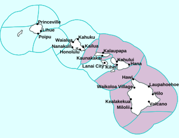
(click on the images to enlarge them)

The cold front is moving down the island chain

Partly to mostly cloudy…clearing areas in the wake of the cold front

Showers locally…some are heavy
Looping image
Small Craft Advisory…pink color below
Wind Advisory…light brown color below
~~~ Hawaii Weather Narrative ~~~
Broad Brush Overview: A cold front will move to the Big Island tonight, then clear the state Sunday. Rainfall along the front will be focused over windward and north facing slopes. A dry, somewhat cool, and breezy northeasterly flow will fill in behind the front. A trade wind weather pattern will dominate during the first half of the new work week. Winds will decrease later in the week…with an increase in shower activity becoming a possibility.
Details: The front continues to move east, spreading showers across the state. Moisture and instability along the front continue to produce moderate to briefly heavy showers, with residual showers affecting areas behind the front. This front will move over the Big island tonight. Passing showers will accompany the front, especially over windward areas. Winds remain light east of the front, with stronger north to northeast winds behind the front.
Looking Ahead: Cooler and drier air will arrive behind the front. However, leftover moisture will likely keep light showers over some windward areas. Most leeward locations will remain rather dry into the first part of the new week. Look for breezy trades during the first half of the week. By Wednesday and Thursday, the trades will become lighter as the pressure gradient relaxes. Models show there may be an increase in moisture and shower activity later in the week.
Here’s a near real-time Wind Profile of the Pacific Ocean – along with a Closer View of the islands / Here’s the latest Weather Map / Here’s the latest Vog Forecast Animation / Here’s the Vog Information website
Marine Environmental Conditions: Moderate to strong northerly winds will continue across the waters, as a cold front moves down the island chain. As a result, the small craft advisory remains in place for all waters to account for a combination of winds and seas. Winds will shift to a more typical trade wind direction Sunday night into early next week, potentially holding in the moderate to strong category…as high pressure builds north of the islands.
A combination of strong northerly winds and a reinforcing northerly swell will keep surf heights around advisory levels for exposed north and west facing shores of the smaller islands. These conditions will hold through Sunday, then slowly ease early next week. A small northwest swell is expected to arrive Monday, with a larger reinforcing north-northwest swell expected Tuesday through mid-week. This reinforcement will likely support advisory level surf for exposed north and west facing shores by Tuesday night.
A moderate southwest swell will peak, at heights around the summer average…then gradually lower into early next week.

World-wide Tropical Cyclone Activity
Here’s the latest Pacific Disaster Center (PDC) Weather Wall Presentation covering a tropical disturbance in the Atlantic Ocean
Here’s the latest Pacific Disaster Center (PDC) Weather Wall Presentation covering the Pacific and Indian Oceans, including a tropical disturbance in the western Pacific, Tropical Cyclone 03S (Alcide), Tropical Cyclone 04S (Bouchra)…and Tropical Cyclone 07B (Gaja)
>>> Atlantic Ocean: No active tropical cyclones
Here’s a satellite image of the Atlantic
>>> Gulf of Mexico: No active tropical cyclones
>>> Caribbean Sea: No active tropical cyclones
Here’s a satellite image of the Caribbean Sea…and the Gulf of Mexico
>>> Eastern Pacific: No active tropical cyclones
Here’s the link to the National Hurricane Center (NHC)
>>> Central Pacific: No active tropical cyclones
Here’s the link to the Central Pacific Hurricane Center (CPHC)
>>> Northwest Pacific Ocean: No active tropical cyclones
Here’s what the computer models show
>>> South Pacific Ocean:
Tropical Cyclone 07B (Gaja)
JTWC textual advisory
JTWC graphical track map
>>> North and South Indian Oceans / Arabian Sea:
Tropical Cyclone 03S (Alcide)
JTWC textual advisory
JTWC graphical track map
Tropical Cyclone 04S (Bouchra)
JTWC textual advisory
JTWC graphical track map
Here’s a link to the Joint Typhoon Warning Center (JTWC)
Interesting: Huge Lakes Thought to Be Hiding Beneath Antarctica’s Ice Seem to Have Vanished -An icy mystery brewing under Recovery Glacier in Antarctica has scientists scratching their heads. Where researchers once thought there was a network of under-ice lakes, there now seem to be none.
Antarctic researchers have long believed that large lakes lie hidden beneath the glacier in East Antarctica, trapped between the base of the ice and the bedrock of the Antarctic continent. A new study, though, failed to find any evidence of such large bodies of water.
“They’re probably not there,” said the study leader, glaciologist Angelika Humbert of the Alfred Wegener Institute’s Helmholtz Center for Polar and Marine Research in Germany.
This apparent lack of lakes is very weird. Without these bodies of water, researchers can’t easily explain other observations made about the ice, like the pockets where the surface of the ice rises and falls in cycles or the glacier’s flow toward the sea.
“It’s hard to understand how it couldn’t be water,” said Ted Scambos, a research scientist at the Earth Science and Observation Center at the Cooperative Institute for Research in Environmental Sciences in Boulder, Colorado who was not involved in the new study.
Mystery on ice
The glacier in question is an enormous river of ice in East Antarctica called Recovery Glacier; its basin stretches 621 miles (1,000 kilometers) inland from the sea and drains 8 percent of the volume of the East Antarctic Ice Sheet. This is currently “a calm glacier,” meaning it’s not undergoing any dramatic speedup. But it has great potential for change as global temperatures rise, she added.
Unraveling how the glacier moves and what influences the speed at which it flows will help researchers understand the whole ice sheet’s response to climate change, Scambos said. Satellite observations had revealed isolated pockets where the ice rises and falls by several meters over months or years.
“The vertical motion has always been attributed, and in some other places proven, to be associated with water bodies beneath the ice.”
Humbert and her colleagues conducted an airplane-based survey of the glacier in 2014, using radar waves to penetrate the surface. As the waves bounced back to a receiver in the airplane, they could reveal things like the thickness of the ice, the presence of water, and the location of boundaries between ice, water and rock. The goal of that survey wasn’t necessarily to search for subglacial lakes, Humbert said; the whole region was a blank spot on the map, and the scientists wanted to know what kind of topography sat under the glacier.
Lost lakes
The data, though, revealed something unexpected. In areas where satellite data suggested lakes should be, the radar revealed no water.
“There have been four really large lakes suggested and 11 smaller lakes, and we found by far less,” Humbert said. “There is one larger area where you could consider a lake to be, but it could also be a swampy area” of wet sediment.
The researchers reported their findings Wednesday (Nov. 7) in an open-access article in the Journal of Geophysical Research.
Scambos isn’t ready to rule out the existence of lakes entirely. The deep troughs under the glacier suggest flowing water, he said, and there’s no good explanation for why the ice surface rises and falls in some areas, unless there are lakes under the ice draining and filling in some sort of cycle.
Complicating the issue is that radar is a tricky tool for measuring ice, Humbert said. The imaging of the subsurface that radar provides is dependent on how the waves travel through the ice, water or rock. This movement is partially dependent on the temperature of the ice, she said. And researchers don’t know much about the ice temperature within Recovery Glacier. This makes it tougher to differentiate between true lakes and areas where the glacier might sit atop very wet sediment or mud, she said.
Finding answers may take time. Humbert and her team are planning a trek to the glacier with explosives, which they’ll detonate in small batches to create seismic waves. As the waves rebound back to the surface, they will carry information about the structures below the ice. But Recovery Glacier is wildly remote, and supplies must be carried nearly 500 miles from the nearest scientific outpost, Humbert said. The mission will happen in 2021, at the earliest.
In the meantime, the best place to find clues is in satellite data, Humbert said. ICESat-2, a satellite that uses laser pulses to measure changes in the ice, launched this year and will provide a sharper-than-ever picture of how the glacier is changing, Scambos said. He and his collaborators also want to work with Humbert’s team to piece together all the disparate evidence for what’s going on beneath the glacier.
“Hats off to them for getting the data,” he said. “And now, we’ve got some reconciling to do.”
Eliza Says:
Aloha Glenn – Upper Pukalani rain report in the 11am hour. Light rains increased in volume within 10 seconds about 45 minutes ago. Quantity falling backed off and has held at the lower level for the intervening time. Looking towards Kahului Bay, it is a gray bank of clouds obscuring the shoreline. Standing water in the street. The volume falling just increased. Wheeee!
How’s things there at your weather tower? Mahalo for all your weather work you share here. Are your friends and mom ok in Calif? Peace and well-being to all.
Eliza
~~~ Hi Eliza, good to hear from you again. Indeed, interesting weather, what with this cold front moving across the islands now! I can always count on your enjoying the changes, just like me!
You’re very welcome, as always, I so much enjoy keeping this long lasting weather website updated…love it in fact.
My Mom is fine, thanks for asking!
Aloha, Glenn