


Air Temperatures – The following temperatures (F) were recorded across the state of Hawaii:
80 – 71 Lihue, Kauai
79 – 70 Honolulu, Oahu
76 – 68 Molokai AP
79 – 70 Kahului AP, Maui
81 – 73 Kailua Kona
81 – 67 Hilo AP, Hawaii
Here are the latest 24-hour precipitation totals (inches) for each of the islands:
mm (mm: missing) Kauai
mm Oahu
mm Molokai
mm Lanai
mm Kahoolawe
mm Maui
mm Big Island
The following numbers represent the strongest wind gusts (mph):
mm Kauai
mm Oahu
mm Molokai
mm Lanai
mm Kahoolawe
mm Maui
mm Big Island
Hawaii’s Mountains – Here’s a link to the live webcam on the summit of our tallest mountain Mauna Kea (nearly 13,800 feet high) on the Big Island of Hawaii. Here’s the webcam for the Haleakala Crater on Maui. These webcams are available during the daylight hours here in the islands, and at night whenever there’s a big moon shining down. Also, at night you will be able to see the stars — and the sunrise and sunset too — depending upon weather conditions.
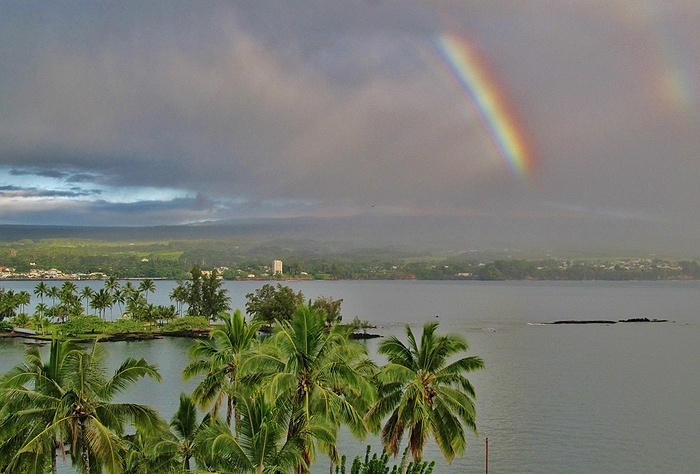
Aloha Paragraphs

A cold front is moving down through the state

Multi-level clouds…coming up from the southwest

Partly to mostly cloudy skies…lots of high cirrus

Showers locally…mostly over the eastern islands
Looping image
~~~ Hawaii Weather Narrative ~~~
Wind Advisory…Big Island summits / 35-50 with gusts to over 60 mph
Small Craft Advisory…waters around Kauai, Oahu, and windward Maui County
High Surf Warning…north and west shores of Kauai and Niihau
High Surf Advisory…Kauai northwest, windward and leeward waters
>>> My friend Hans Rosendal, who lives on Oahu, recently sent out this message: “The various models show an interesting case of a strong cutoff Low centered to the north of Hawaii, potentially inducing tropical cyclone development to the south of the islands. This area to the south of Hawaii is unusually warm this spring in spite of lingering La Nino along the equator. A broad east /west strip of well above normal sea surface temperatures is located south of Hawaii…extending almost as far east as Mexico.
Moderately strong southwest winds (29 to 46 mph) associated with the Low to the north of Hawaii, is forecast to persist in a deep layer at low and mid-levels. This in turn could potentially generate enough cyclonic vorticity over this warm water region…to spin up a tropical cyclone within the models. We shall see if this will happen, and how long this small tropical vortex will last, as it moves northeast in the coming days passing well east of the Big Island of Hawaii.
This type of brief tropical cyclone genesis has been occurring several times this winter/spring season, during the very wet off and on episodes we’ve seen this year so far. This brings to mind the similarly very wet 2006 spring in Hawaii, and the stormy March 1951 with its out of season tropical cyclone vortex…which affected particularly Oahu with flooding rains.”
Broad Brush Overview: Showers are falling across Maui County, as a late season cold front moves down the island chain. This frontal cloud band will reach the Big Island, and then stall just to the east of that island Sunday. Cool and dry air will move in behind the cold front, with a drying trend for most islands through Monday. Lingering unstable moisture however, will continue to drift over the windward Big Island through the upcoming week.
A high pressure system east of the state, and a developing low pressure system to the north of the islands, will help to draw up the unstable cloud band…back northward across the islands Tuesday through Friday. Look for showers affecting mainly Kauai and Oahu Wednesday through Friday, as the unsettled cloud band stalls across the Kauai and Oahu end of the state.
Details: A counterclockwise rotating low pressure system is spinning to the north of the state. This low remains cut off from the mid-latitude steering flow, and will maintain its position for the next several days. Satellite imagery also shows a large band of high level cirrus clouds, being produced by the sub-tropical jet stream. These upper level icy clouds are obscuring a shallow low level cold front…bringing light to moderate showers across Maui County.
The remnants of this front will then move over the Big Island, bringing showers across that island. Drier and cooler air with northerly winds will move in behind the front, diminishing shower activity across most of the state. A drier and relatively cool air mass will linger over Kauai, Oahu and Maui County Sunday and Monday, with decreasing northerly wind speeds.
Looking Ahead: A building high pressure system to the east, and a low pressure trough to the north will combine forces, drawing the unstable cloud band near the Big Island…slowly northward across the state. The Big Island and Maui will see increasing clouds and enhanced showers Monday and Tuesday…as the band drifts northward. This unsettled band of clouds will reach Oahu and Kauai Wednesday, and the forward motion will stall, as an upper level trough begins to sweep across the northern half of the state.
This in turn will cause deeper convection and shower activity along the cloud band, producing showers over Oahu and Kauai…with possible thunderstorms and periods of locally heavy showers for the end of the week. The timing of this rainfall remains a combination of model solutions, while details on rainfall impacts and potential thunderstorms will become clearer as the time period gets closer.
Here’s a wind profile of the Pacific Ocean – Closer view of the islands / Here’s the vog forecast animation / Here’s the latest weather map
Marine environment details: Moderate to strong northerly winds in the wake of a cold front, that’s forecast to shift eastward over the Big Island waters through the weekend, combined with a rising north-northwest swell…will lead to dangerous boating conditions. Small craft advisory seas are expected over the exposed northwest waters through the weekend. Winds are forecast to quickly drop off into the light to moderate range out of the north tonight through early next week, as the front stalls in the vicinity of the Big Island.
A reinforcing north-northwest swell associated with a storm force low north of the state, is expected to fill in, peaking Sunday, then lowering into the upcoming week. Swells associated with nearby sources like this typically come in on time, although larger than projected by a few feet around the peak. As a result, warning level surf will be likely for Kauai and Niihau, then advisory-level surf for exposed coasts on Oahu, Molokai and Maui as the swell peaks tonight through Sunday night. A gradual downward trend is expected Monday through Tuesday.
A new south-southwest swell from recent activity near New Zealand is expected to arrive tonight into Sunday, which will translate to rising surf along south facing shores. A similar reinforcement is expected by mid-week.
Surf along east facing shores will remain small through the first half of the upcoming week…as the winds remain light locally and upstream.
World-wide Tropical Cyclone activity
Here’s the Saturday Pacific Disaster Center (PDC) Weather Wall Presentation…covering Tropical Cyclone 21S (Flamboyan) in the South Indian Ocean
![]()
>>> Atlantic Ocean:
>>> Caribbean Sea:
>>> Gulf of Mexico:
Here’s a satellite image of the Caribbean Sea…and the Gulf of Mexico
Here’s the link to the National Hurricane Center (NHC)
>>> Eastern Pacific:
Here’s a wide satellite image that covers the entire area between Mexico, out through the central Pacific…to the International Dateline.
Here’s the link to the National Hurricane Center (NHC)
>>> Central Pacific:
Here’s a link to the Central Pacific Hurricane Center (CPHC)
>>> Northwest Pacific Ocean: No active tropical cyclones
>>> North and South Indian Oceans / Arabian Sea:
Tropical Cyclone 21S (Flamboyan)
JTWC textual forecast warning
JTWC graphical track map
NOAA satellite image
Here’s a link to the Joint Typhoon Warning Center (JTWC)
Interesting: Many Low-Lying Atoll Islands Will Be Uninhabitable by Mid-21st Century – Sea-level rise and wave-driven flooding will negatively impact freshwater resources on many low-lying atoll islands in such a way that many could be uninhabitable in just a few decades.
According to a new study published in Science Advances, scientists found that such flooding not only will impact terrestrial infrastructure and habitats, but, more importantly, it will also make the limited freshwater resources non-potable and, therefore, directly threaten the sustainability of human populations.
Most of the world’s atolls are in the Pacific and Indian oceans. The scientists focused on Roi-Namur Island on Kwajalein Atoll in the Republic of the Marshall Islands for their site study from November 2013 to May 2015. The Republic of the Marshall Islands has more than 1,100 low-lying islands on 29 atolls, is home for numerous island nations and hundreds of thousands of people.
Scientists from the U.S. Geological Survey, Deltares, National Oceanic and Atmospheric Administration, and the University of Hawai?i at M?noa used a variety of climate-change scenarios to project the impact of sea-level rise and wave-driven flooding on atoll infrastructure and freshwater availability. The approach and findings in this study can serve as a proxy for atolls around the world, most of which have a similar morphology and structure, including, on average, even lower land elevations.
“The tipping point when potable groundwater on the majority of atoll islands will be unavailable is projected to be reached no later than the middle of the 21st century,” said Curt Storlazzi, USGS geologist and lead author of the new report.
Sea levels are rising, with the highest rates in the tropics, where thousands of low-lying coral atoll islands are located. Previous studies on the resilience of these islands to sea-level rise projected they will experience minimal inundation impacts until at least the end of the 21st century. However, those previous studies did not take into account the additional hazard of wave-driven overwash (storm waters and waves that wash up and over the low-lying island) nor its impact on freshwater availability.
“Such information is key to assess multiple hazards and prioritize efforts to reduce risk and increase the resiliency of atoll islands’ communities around the globe,” said Storlazzi.
These findings have relevance not only to populated atoll islands in the Marshall Islands, but also to those in the Caroline Islands, Cook Islands, Gilbert Islands, Line Islands, Society Islands, Spratly Islands, Maldives, Seychelles, and Northwestern Hawaiian Islands.
Thus, the study scientists project that, based on current global greenhouse gas emission rates, the interactions between sea-level rise and wave dynamics over coral reefs will lead to an annual wave-driven overwash of most atoll islands by the mid-21st century. Such annual flooding would result in the islands becoming uninhabitable due to frequent damage to infrastructure and the inability of their freshwater resources to recover between overwash events.
The primary source of freshwater for populated atoll islands is rain that soaks into the ground and remains there as a layer of fresh groundwater that floats on top of denser saltwater. As atoll islands come to be overwashed annually, on average, in the next few decades (assuming current greenhouse gas emission rates), flooding impacts to infrastructure and the loss of freshwater resources would make human habitation difficult in most locations beginning between the 2030s to 2060s, requiring the relocation of island inhabitants or significant financial investments in new infrastructure.
“The overwash events generally result in salty ocean water seeping into the ground and contaminating the freshwater aquifer. Rainfall later in the year is not enough to flush out the saltwater and refresh the island’s water supply before the next year’s storms arrive repeating the overwash events,” explained Stephen Gingerich, USGS hydrologist and co-author of the new report.
Sacha Says:
Hi Glenn,
Is it me or spring is not a good time to go to Hawaii? It seems wet and pretty cool all the time lately.
The weather seems to be better in fall.
What do you think?
Thanks for this amazing website!
~~~ Hi Sacha, first of all, thanks for your positive comment on my website…I appreciate that.
You’re absolutely correct in describing this spring as unusually wet and pretty cool. This type of weather pattern has certainly happened before, although it’s been awhile indeed.
You know, the truth is that I a bit reluctant to say fall will be better than spring, at least in general terms. Things/conditions can change, presenting the islands with varying realities. Typically however, I would say that the early fall period is quite nice, and I’d say that the same thing holds true for the later spring periods. It’s more of a toss up to see which way things go later in the fall…and earlier in the spring.
Thanks for your comment!
Aloha, Glenn
Jay Says:
I don’t know if knowing ahead about more cloudy weather for next week is going to help it be tolerable, but I guess that is all we have. That will mean the lousy weather continues into May. The few nicer days were apppreciated, but there just hasn’t been enough sunshine for this human. It looks like the ITCZ is just too far north.
~~~ Hi Jay, thanks for sharing your comment with us, and I’m pretty sure you aren’t the only person thinking about this cloudy weather…as lousy!
This unusual weather continues, and it looks like it will continue right on into the new week…and the new month ahead as well.
I guess we’ll just have to bear with it for a while longer.
Hang in there…
Aloha, Glenn