


Air Temperatures – The following high temperatures (F) were recorded across the state of Hawaii Sunday…along with the low temperatures Sunday:
80 – 68 Lihue, Kauai
84 – 73 Honolulu, Oahu
84 – 70 Molokai AP
85 – 69 Kahului AP, Maui
87 – 72 Kailua Kona
79 – 69 Hilo AP, Hawaii
Here are the latest 24-hour precipitation totals (inches) for each of the islands Sunday evening:
18.77 Mount Waialeale, Kauai!
6.69 Manoa Lyon Arboretum, Oahu
0.40 Molokai
0.04 Lanai
0.00 Kahoolawe
3.63 Puu Kukui, Maui
7.49 Pahoa, Big Island
The following numbers represent the strongest wind gusts (mph) Sunday evening:
31 Port Allen, Kauai
44 Oahu Forest NWR, Oahu
32 Molokai
36 Lanai
42 Kahoolawe
33 Kahului AP, Maui
32 Waikoloa, Big Island
Hawaii’s Mountains – Here’s a link to the live webcam on the summit of our tallest mountain Mauna Kea (nearly 13,800 feet high) on the Big Island of Hawaii. Here’s the webcam for the Haleakala Crater on Maui. These webcams are available during the daylight hours here in the islands, and at night whenever there’s a big moon shining down. Also, at night you will be able to see the stars — and the sunrise and sunset too — depending upon weather conditions.
Aloha Paragraphs

A trough just west of Kauai…is causing record breaking flooding

Towering cumulus and thunderstorms in the vicinity

Partly to mostly cloudy…some clear areas

Localized showers…over and the islands and offshore
Looping image
~~~ Hawaii Weather Narrative ~~~
Small Craft Advisory…all coastal and channel waters
High Surf Advisory…east shores of Kauai, Oahu, Molokai, Maui and the Big Island
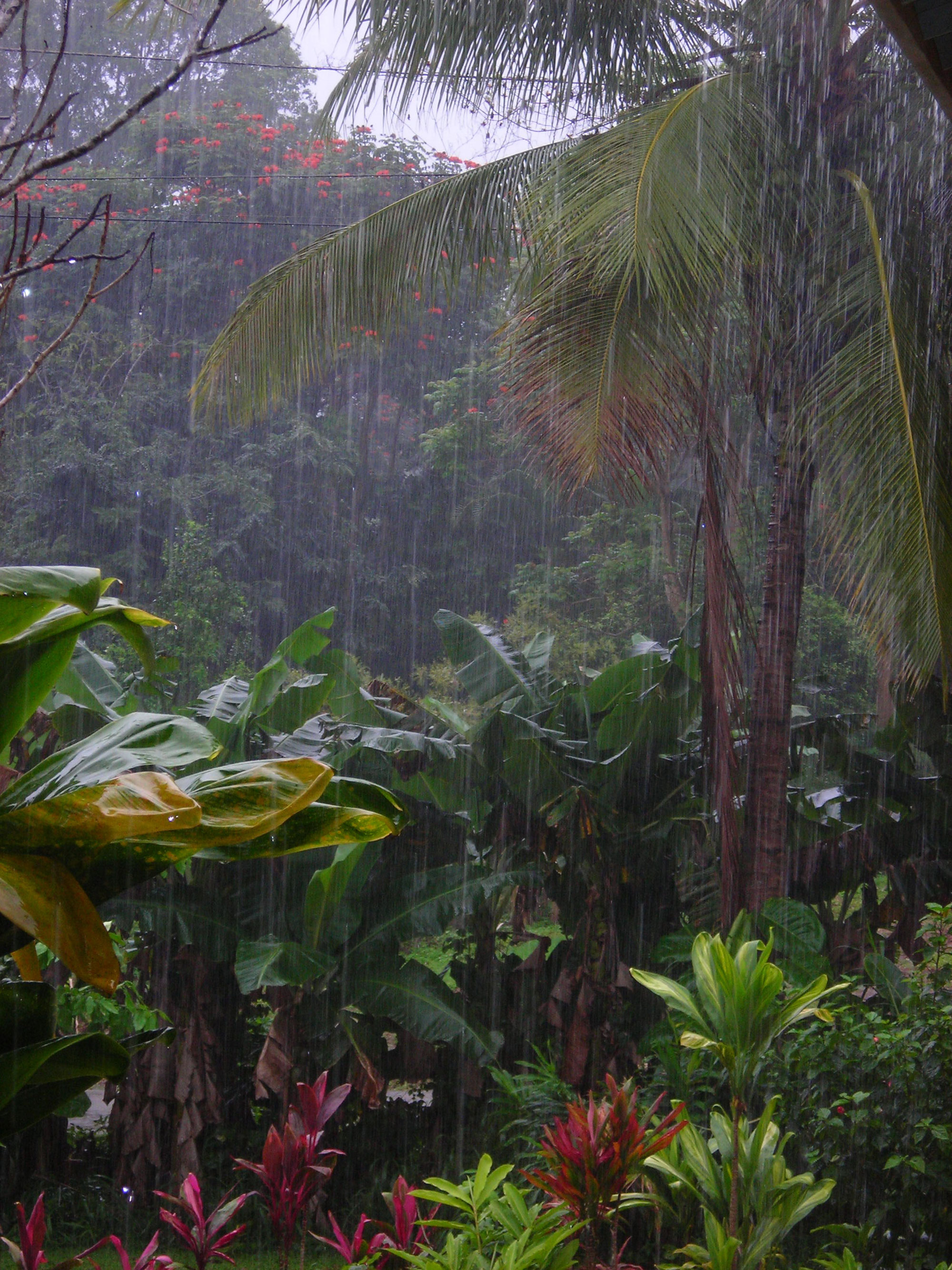
Broad Brush Overview: The unusually wet and windy conditions will continue, with localized serious flooding issues. An upper level low just to the west of the islands will keep deep moisture in the trade wind flow, maintaining the threat of heavy rain and thunderstorms. While the primary flood threat will be across windward slopes, all areas could experience heavy rainfall. As the upper level low slowly moves away Monday and Tuesday, the trades will gradually stabilize, causing more typical rainfall to focus along windward slopes. Breezy trade winds and extensive high clouds will hold through much of the new week…with unsettled weather again possible late in the upcoming work week.
Details: Unstable conditions remain in place over the state. An upper level low parked several hundred miles west of Kauai is generating the instability, along with high clouds blanketing much of the state. A strong surface high passing by far north of the state is driving these gusty trades, while a trough aloft is evident northeast to southwest just west of Kauai. This trough has been focusing heavy showers and thunderstorms over the Garden Isle of Kauai, where historical flooding has recently occurred. From Oahu to Maui, moderate to briefly heavy showers have been largely confined to windward slopes, with occasional light to moderate showers pushing into leeward areas. On the Big Island, more persistent heavy showers and thunderstorms have been pulsing along windward slopes.
The threat of heavy, flooding showers and thunderstorms in the gusty trade wind flow…will persist for the time being. The trough near Kauai will eventually begin to drift westward, taking the focusing mechanism for moisture away from the islands. However, deep moisture will linger over the islands, and the models are showing a weak disturbance aloft passing over the entire state. This points toward a threat of continued heavy, flooding rainfall and a chance of thunderstorms for mainly windward slopes, and potentially the entire island of Kauai. Meanwhile, soils are saturated in many locations, including some leeward areas, and a Flash Flood Watch remains in effect for all locations on all islands.
Looking Ahead: The atmosphere will gradually stabilize Monday and Tuesday, although locally gusty trade winds remain in place. The upper level low will slowly fill and drift westward, bringing an increase in stability, and pulling the deepest moisture away west of the islands. This will likely result in a drying trend over leeward areas of most islands, though moderate rainfall will persist over windward slopes. Sun dimming high clouds will still hang around over most areas. Some instability could return to the trade wind flow later in the new week. The models show the weakened upper trough to the west being pushed back over the state Thursday. If this occurs, heavy showers and thunderstorms could again be possible, with rainfall continuing to be focused along windward slopes.
Here’s a wind profile of the Pacific Ocean – Closer view of the islands / Here’s the vog forecast animation / Here’s the latest weather map
Marine environment details: A northwest swell is on the decline, while surf along east shores increases due to strong trade winds. A High Surf Advisory is in effect for eastern shores. A small north swell is expected Tuesday, and a small/moderate northwest swell will fill in for the second half of the week. Surf will remain small along south facing shores…with some modest increases through the week.
Historic Flooding Rainfall on Kauai
World-wide Tropical Cyclone activity
Here’s the latest Pacific Disaster Center (PDC) Weather Wall Presentation
![]()
>>> Atlantic Ocean:
>>> Caribbean Sea:
>>> Gulf of Mexico:
Here’s a satellite image of the Caribbean Sea…and the Gulf of Mexico
Here’s the link to the National Hurricane Center (NHC)
>>> Eastern Pacific:
Here’s a wide satellite image that covers the entire area between Mexico, out through the central Pacific…to the International Dateline.
Here’s the link to the National Hurricane Center (NHC)
>>> Central Pacific:
Here’s a link to the Central Pacific Hurricane Center (CPHC)
>>> Northwest Pacific Ocean: No active tropical cyclones
>>> North and South Indian Oceans / Arabian Sea: No active tropical cyclones
Here’s a link to the Joint Typhoon Warning Center (JTWC)
Interesting: Small Mussels with Big Effects: Invasive Quagga Mussels Eat Away at Great Lakes Food Web – Since hitching unsolicited rides in boat ballast water in the late 1980s, invasive quagga mussels (Dreissena rostriformis bugensis), which are native to Ukraine, have caused massive changes to the ecology of the Great Lakes. These invasive mussels have also taken a toll on the Great Lakes recreational and commercial fisheries, which are valued at $4-7 billion annually according to Michigan Sea Grant.
The quagga mussel had a sluggish start in its early expansion, although is now present in large numbers far exceeding those of another invasive mussel in the Great Lakes, the zebra mussel, according to a publication by NOAA’s Great Lakes Environmental Research Laboratory (GLERL).
The filter-feeding quagga mussel has a high filtering rate for its size, and coupled with its high abundance, has a significant impact in invaded ecosystems, like the Great Lakes. The mussel uses hair-like cilia on its gills to pull water into its shell through a siphon-like structure. Materials collected are then sorted for ingestion inside the shell or for rejection through the siphon.
The mussel uses hair-like cilia on its gills to pull water containing food particles into its shell cavity through its siphon. By filtering phytoplankton and other materials from lake water, quagga mussels alter both lake habitat and the food web. For example, through their large appetites for phytoplankton, the quagga mussels rob the food web of an important food source for native and non-native fish.
Mike Lagana Says:
Aloha Glenn, not sure if you are on social media but there are lots of scary pics. Also saw a buffalo a standing on flooded Hanalei beach!
~~~ Hi Mike, yes I’ve been looking at the news associated with the historic flooding in the Hanalei, Kauai area. Touch times here in the islands, hard to remember such a prolonged period of rainy weather here in Hawaii…along with lots of flooding!
Aloha, Glenn
Mister Rich Says:
Good Morning Glenn– (I think..) As it states up above, Puna district into it’s 3rd hour of thunder/lightening Blitz, here at 5:30 am. It’s noisy and unnerving on a grand scale..Winds not severe, but gotta be 1 to 2″ rain per hour..Hard to believe the electric here in HPP makai is still operational.
Talk about your unstable atmosphere–guarantee no one is sleeping thru this stuff.. Mr. Rich
~~~ Hi Mr. Rich, thanks for your on the spot report from down there in the Puna District…on the Big Island. Your report sounds rather scary and intense, that’s for sure! Best of luck to everyone on your island, and on Kauai too, where the heaviest rains are currently falling. Hunker down, stay safe everyone!
Aloha, Glenn