


Air Temperatures – The following high temperatures (F) were recorded across the state of Hawaii Sunday…along with the low temperatures Sunday:
79 – 69 Lihue, Kauai
79 – 70 Honolulu, Oahu
81 – 67 Molokai AP
81 – 65 Kahului AP, Maui
83 – 73 Kailua Kona
85 – 65 Hilo AP, Hawaii
Here are the latest 24-hour precipitation totals (inches) for each of the islands Sunday evening:
0.00 Kauai
0.01 Tunnel RG, Oahu
0.00 Molokai
0.00 Lanai
0.00 Kahoolawe
0.03 Kahakuloa, Maui
0.51 Saddle Quarry, Big Island
The following numbers represent the strongest wind gusts (mph) Sunday evening:
16 Mana, Kauai
16 Waianae Harbor, Oahu
09 Molokai
09 Lanai
12 Kahoolawe
12 Hana, Maui
16 South Point, Big Island
Hawaii’s Mountains – Here’s a link to the live webcam on the summit of our tallest mountain Mauna Kea (nearly 13,800 feet high) on the Big Island of Hawaii. Here’s the webcam for the Haleakala Crater on Maui. These webcams are available during the daylight hours here in the islands, and at night whenever there’s a big moon shining down. Also, at night you will be able to see the stars — and the sunrise and sunset too — depending upon weather conditions.
Aloha Paragraphs

Cold front just northwest…high pressure ridge near Kauai

Cold front has stalled just northwest of Kauai

Partly to mostly cloudy over the islands

Showers locally…a few are quite heavy
Looping image
~~~ Hawaii Weather Narrative ~~~
Wind Advisory…Big Island summits / 45-65 mph
Broad Brush Overview: Several weak low pressure systems, passing northeastward along the cold front now northwest of Kauai, will keep wet and unstable weather active across the western half of the island chain through the next week. Southerly breezes will through Thursday, keeping conditions voggy and rather sultry. By Thursday and Friday, the cold front will push down through the island chain, spreading showers as it goes…and likely bringing back our long lost trade winds in its wake.
Details: This uncommon early spring weather pattern, will continue to produce off and on wet conditions across the islands through next week. The current weather circumstances will remain complicated, as the interactions between upper level troughs, and the movement of the lingering surface cold front near Kauai, will at times produce smaller scale shower bands over the island chain. The forecast challenge for this type of pattern focuses on precipitation timing over each island.
By Monday, the first upper trough will help push the cold frontal boundary across Kauai and Oahu, before stalling over Maui County Monday evening. The threat for heavy rainfall along this portion of the frontal band remains small at from this point of view. However, moderate to heavy showers may require a flash flood watch at some point. The strongest of these troughs appears to pass through the island chain Wednesday…pushing a second cold front across the western islands.
Looking Ahead: This second cold front will combine with a weak cloud band near Maui Thursday, with widespread showers developing from Oahu to Maui County. By Friday, the forward motion on this front will push widespread showers over the Big Island…allowing brief improving conditions over Kauai and Oahu. Precipitation timing during this longer range is less certain as usual, and will depend heavily on the movement of these upper level features.
Here’s a wind profile of the Pacific Ocean – Closer view of the islands / Here’s the vog forecast animation / Here’s the latest weather map
Marine environment details: Local winds are forecast to remain in the light to moderate range out of the south and southeast, which will continue to give way to overnight land breezes and daytime sea breezes through Monday near the coasts. The best chance for heavy showers will remain over the northwest waters through Monday, due to a front positioned west of the state. Winds are forecast to shift south-southwest Tuesday through mid-week, and increase into the strong category, as low pressure develops and lifts northeast, potentially dragging a cold front into the area Thursday. More of a widespread rainfall threat will become a possibility Tuesday through the second half of the week as the front begins to advance down the island chain.
The current west-northwest swell that brought advisory level surf to exposed north and west facing shores earlier yesterday will continue to slowly lower through Monday. A small reinforcement out of the same direction is forecast to arrive Wednesday through Thursday.
Choppy surf along south facing shores will become a possibility Tuesday through mid-week, as strong south-southwest winds arrive over the state.

Happy Easter
World-wide Tropical Cyclone activity
Here’s the Sunday Pacific Disaster Center (PDC) Weather Wall Presentation covering retiring Tropical Cyclone 03W (Jelawat), and Tropical Cyclone 18P (Josie)..along with Tropical Cyclone 17P (Iris) offshore from the Queensland coast of Australia
![]()
>>> Atlantic Ocean:
>>> Caribbean Sea:
>>> Gulf of Mexico:
Here’s a satellite image of the Caribbean Sea…and the Gulf of Mexico
Here’s the link to the National Hurricane Center (NHC)
>>> Eastern Pacific:
Here’s a wide satellite image that covers the entire area between Mexico, out through the central Pacific…to the International Dateline.
Here’s the link to the National Hurricane Center (NHC)
>>> Central Pacific:
Here’s a link to the Central Pacific Hurricane Center (CPHC)
>>> Northwest Pacific Ocean:
Tropical Cyclone 03W (Jelawat) – Final Warning
JTWC textual forecast warning
JTWC graphical track map
NOAA satellite image
Tropical Cyclone 17P (Iris)
JTWC textual forecast warning
JTWC graphical track map
NOAA satellite image
Tropical Cyclone 18P (Josie)
JTWC textual forecast warning
JTWC graphical track map
NOAA satellite image
>>> North and South Indian Oceans / Arabian Sea: No active tropical cyclones
Here’s a link to the Joint Typhoon Warning Center (JTWC)
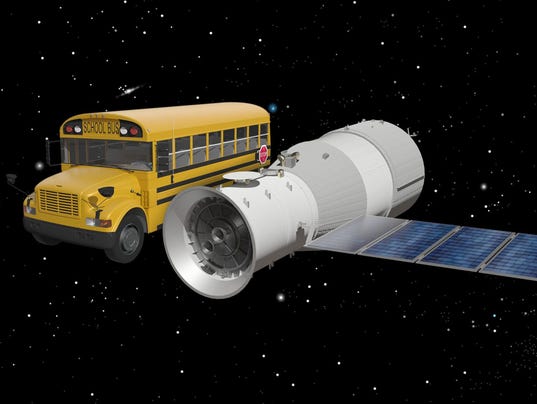
Interesting: April Fools’ Crash? China’s Space Station Will Most Likely Plunge to Earth in Next 24 Hours – It sure looks like the abandoned Chinese space station Tiangong-1 will put on its re-entry light show tonight.
The European Space Agency (ESA), which has been tracking the prototype habitat through its final days and hours, now predicts (as of April 1) it will re-enter the atmosphere sometime tonight (April 1) through early Monday morning (April 2) in UTC time, which is 4 hours ahead of Eastern Daylight Time. The Aerospace Corporation, which has also been tracking the falling station, more or less concurs, writing that the uncontrolled re-entry should happen around April 2 at 02:00 UTC (10 p.m. EDT), give or take 7 hours.
It remains true that no one knows where the 9.4 ton station will come down, other than somewhere between 43 degrees latitude north and 43 degrees latitude south (an area that includes most of the inhabited regions of the planet).
It also remains true that it is not a danger to you or anyone else, because the Earth is very big and still mostly pretty empty, and the station is very small in the scheme of things. And the odds of getting hit by a piece of the space lab that manages to survive the fiery re-entry into our atmosphere are incredibly low.
Worth noting: China has still not officially confirmed that it’s not in control of the falling station, but China did lose contact with the un-crewed object on March 21, 2016, and likely has not re-established contact since.
In any event, there’s a non-zero chance that you’ll witness something extraordinary if you look up into the sky this weekend.
Note: The 9.4 ton Chinese space station, about the size of a school bus, crashed back to Earth over the southern Pacific Ocean Sunday evening, experts said.