


Air Temperatures – The following high temperatures (F) were recorded across the state of Hawaii Thursday…along with the low temperatures Thursday:
81 – 65 Lihue, Kauai
79 – 69 Honolulu, Oahu
75 – 67 Molokai AP
78 – 69 Kahului AP, Maui
78 – 72 Kailua Kona
84 – 72 Hilo AP, Hawaii
Here are the latest 24-hour precipitation totals (inches) for each of the islands Thursday evening:
0.73 Makaha Ridge, Kauai
1.48 Luluku, Oahu
2.02 Molokai
1.44 Lanai
2.22 Kahoolawe
7.59 Puu Kukui, Maui
8.25 Pali 2, Big Island
The following numbers represent the strongest wind gusts (mph) Thursday evening:
18 Puu Opae, Kauai
22 Palehua, Oahu
20 Molokai
15 Lanai
33 Kahoolawe
20 Kula 1, Maui
31 Waikoloa, Big Island
Hawaii’s Mountains – Here’s a link to the live webcam on the summit of our tallest mountain Mauna Kea (nearly 13,800 feet high) on the Big Island of Hawaii. Here’s the webcam for the Haleakala Crater on Maui. These webcams are available during the daylight hours here in the islands, and at night whenever there’s a big moon shining down. Also, at night you will be able to see the stars — and the sunrise and sunset too — depending upon weather conditions.
Aloha Paragraphs

Low pressure northwest moving closer

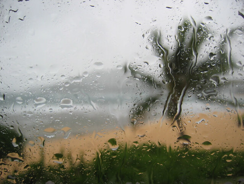
Shower band over Maui and the Big Island…some heavy

Abundant moisture continues arriving…on the southwest kona winds

Showers locally…especially east of the Big Island
Looping image
~~~ Hawaii Weather Narrative ~~~
Wind Advisory…Big Island summits / 35-50 with some 60 mph gusts
Broad Brush Overview: This unusually long lasting period of inclement winter weather will continue to bring periods of rainy weather over portions of the state through the upcoming weekend. This will occur as an area of low pressure to the northwest of Kauai drifts closer. This low will maintain muggy conditions, and bring periods of off-and-on heavy rain…along with an occasional thunderstorm. The best chance for heavy showers will remain over Maui County and the Big Island through Friday, then shifting back toward the west this weekend into early next week…as yet another upper low drops south into the area.
Looking Ahead: Even though the upper low northwest of Kauai will lift northward and away from the state Friday, the models show yet another upper low dropping south into the area just west of Kauai Sunday. The lingering surface trough over the eastern end of the state will begin to drift back toward the west. This surface trough will continue to destabilize the atmosphere, and deep moisture will keep shower and even thunderstorm chances going Saturday night into next week. This unsettled pattern will hold into mid-week before the upper low and surface trough begin to shift westward and away from the state…finally!
Here’s a wind profile of the Pacific Ocean – Closer view of the islands / Here’s the vog forecast animation / Here’s the latest weather map
Marine environment details: The current northwest swell continues breaking, although is starting to show signs of lowering. A series of northwest swells will be reaching our north and west facing shorelines well into the middle of next week. These swells will be small to moderate in size except for one, which will be large enough to warrant a high surf advisory. Fore-runners from this swell are expected to reach our north and west shores next Tuesday night, and peak Wednesday night.
Surf will be building along our windward shores over the weekend into early next week…with surf heights below advisory level.
Continued off and wet around the Big Island…drier elsewhere for the moment
World-wide Tropical Cyclone activity
Here’s the latest PDC Weather Wall Presentation, covering retiring Tropical Cyclone 02W (Sanba) and Tropical Cyclone 09P (Gita)…and a tropical disturbance being referred to as Invest 91S near Broome, Australia
![]()
>>> Atlantic Ocean:
>>> Caribbean Sea:
>>> Gulf of Mexico:
Here’s a satellite image of the Caribbean Sea…and the Gulf of Mexico
Here’s the link to the National Hurricane Center (NHC)
>>> Eastern Pacific:
Here’s a wide satellite image that covers the entire area between Mexico, out through the central Pacific…to the International Dateline.
Here’s the link to the National Hurricane Center (NHC)
>>> Central Pacific:
Here’s a link to the Central Pacific Hurricane Center (CPHC)
>>> Northwest Pacific Ocean: No active tropical cyclones
Tropical Cyclone 09P (Gita)
JTWC textual forecast warning
JTWC graphical track map
NOAA satellite image
>>> North and South Indian Oceans / Arabian Sea:
Tropical Cyclone 10S
JTWC textual forecast warning
JTWC graphical track map
NOAA satellite image
Here’s a link to the Joint Typhoon Warning Center (JTWC)
Interesting: How Olympic Athletes Fare in Freezing Cold – Athletes at the 2018 Olympic Games are dealing with some bitter-cold temperatures — sometimes in the single digits Fahrenheit — as well as blustering wind gusts that make it feel even colder, according to news reports.
But does the chill affect athlete’s performance?
Indeed, cold weather has a number of effects on the body that could result in reduced performance if athletes aren’t prepared for it.
For starters, when it’s cold out, blood vessels near the body’s surface narrow, or constrict, in order to redirect blood to the body’s core. This so-called “vasoconstriction” reduces oxygen levels, forcing the heart to work harder to circulate blood, said David Grinnell, a physical therapist and orthopedic specialist at UCHealth SportsMed Clinic in Steamboat Springs, Colorado. This “puts extra strain on the heart” and could increase blood pressure, he said.
In addition, Grinnell said, cold weather could cause the following effects:
- Signals from the brain to the muscles may slow down, which could affect reaction time or general performance.
- The ability of muscle fibers to contract can be slowed.
- The body’s carbohydrate reserves, which are an athlete’s main source of energy, could drain faster.
- When the body temperature falls below 98.6 degrees F, oxygen in the blood binds more tightly to the protein hemoglobin, which could result in less oxygen delivered to muscle cells.
- The lungs and upper respiratory system need to work harder to heat up cold air.
Dr. Timothy Miller, a sports medicine specialist and orthopedic surgeon at The Ohio State University Wexner Medical Center, added that joints and muscle tendons become stiffer in colder temperatures. This decreases performance and increases the risk of injury if athletes do not warm up properly. There’s a “higher chance of muscle strains or tendon tears” in cold weather if athletes don’t warm up and stretch to get muscle loosened, Miller said.
Coping with cold
One way to mitigate the effects of the cold is to do a long warm-up, Miller said. Even if an athlete’s competition is only a few minutes long, they will start warming up at least an hour, if not 2 hours, before the start, Miller said.
A typical warm-up includes cardiovascular exercise — in the form of a light jog or low-intensity stationary bike ride — followed by stretching. Then, athletes will perform brief bouts of intense speed exercise (sometimes called intervals) to get the body’s muscles warmed up, Miller said.
Ideally, athletes should warm up indoors if it’s cold out, Miller said. That’s because when athletes stop and stretch after their warm-up, their sweat freezes, and there’s a risk of cooling the body down too much.
Another way to offset the cold is to wear the right clothing. Cotton garments allow moisture to stay on the skin, which will draw heat away from the body, Grinnell said. In contrast, clothes that are designed to “wick,” including some synthetic materials, will pull moisture away from the skin so it can evaporate.
To stay warm at Pyeongchang, Team USA was outfitted with battery-powered parkas containing heat-conducting ink, which acts sort of like an electric blanket, according to Scientific American. In addition, suits for the U.S. bobsled team contain a new fabric technology that helps to absorb and retain body heat.
Another strategy to cope with the cold is to wear a face mask that covers the mouth and nose. This will warm the air you breathe in a bit, so your lungs don’t have to work as hard to warm it up, Miller said.
In very cold temperatures close to 0 degrees F, athletes and casual exercisers alike should make sure that their skin is not exposed to the air for more than a few minutes, Miller said. This is necessary to prevent frostbite, he said. Your fingers, nose and toes are the areas most prone to frostbite, he added.
Another important thing to remember is to stay hydrated, even when it’s cold. Although you may not be tempted to drink as much water in cold temperatures, you can still get dehydrated if you don’t get enough fluids, Grinnell said.
Dr John Says:
Great physiology update on cold weather performance. Crater road has been a bit nippy but exhilarating for early morning biking. Miss seeing you on the skate board! Dr John
~~~ Hi Dr. John, thanks for your positive feedback! Glad to hear that you’re still riding your bike up that steep Crater Rd. I’ve taken a break from skateboarding, due to circumstances in my life (spending more time in California), although mark my words…you’ll see me up there again soon!
Enjoy the chilly winter weather in Upper Kula.
Aloha, Glenn