


Air Temperatures – The following high temperatures (F) were recorded across the state of Hawaii Tuesday…along with the low temperatures Tuesday:
80 – 72 Lihue, Kauai
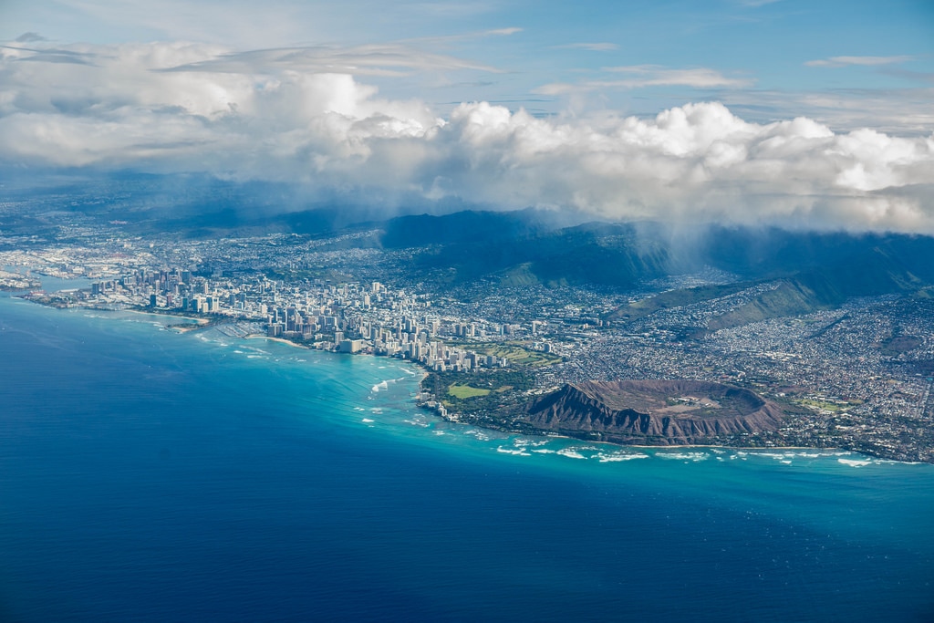
83 – 74 Honolulu, Oahu
80 – 71 Kahului AP, Maui
81 – 70 Kailua Kona
73 – 68 Hilo AP, Hawaii
Here are the latest 24-hour precipitation totals (inches) for each of the islands Tuesday evening:
1.68 Mount Waialeale, Kauai
0.87 Manoa Lyon Arboretum, Oahu
0.64 Molokai
0.20 Lanai
0.01 Kahoolawe
4.82 Puu Kukui, Maui
5.99 Waiakea Experiment Stn, Big Island
The following numbers represent the strongest wind gusts (mph) Tuesday evening:
33 Port Allen, Kauai
33 Oahu Forest NWR, Oahu
29 Molokai
33 Lanai
45 Kahoolawe
40 Maalaea Bay, Maui
33 PTA Range 17, Big Island
Hawaii’s Mountains – Here’s a link to the live webcam on the summit of our tallest mountain Mauna Kea (nearly 13,800 feet high) on the Big Island of Hawaii. Here’s the webcam for the Haleakala Crater on Maui. These webcams are available during the daylight hours here in the islands, and at night whenever there’s a big moon shining down. Also, at night you will be able to see the stars — and the sunrise and sunset too — depending upon weather conditions.
Aloha Paragraphs

High pressure systems east-northeast and far northwest…and the tail-end of a cold front just to the north

Deep clouds northwest…and southeast

Clear to partly cloudy leeward, more clouds windward…cloudy over the Big Island and Maui

Showers locally…some heavy near the Big Island
Looping image
~~~ Hawaii Weather Narrative ~~~
Small Craft Advisory…most coasts and channels except around Kauai waters
High Surf Advisory…east shores of Kauai, Oahu, Molokai, Maui and the Big Island
Broad Brush Overview: The persistent ridge of high pressure north of the state, will keep trade winds blowing through Thursday, with clouds and associated showers focused generally over windward and mountain areas. The trades will diminish Friday, as a cold front approaches from the northwest. This will bring a land and sea breeze pattern into play, with convective showers over the interior of the islands during the afternoon hours Friday. Generally light trade winds should return over the weekend, with showers transitioning back into the more typical windward areas.
Details: This ridge of high pressure to the north and northeast will remain in place, while a cold front approaches the islands from the northwest. Moderate trade winds are expected to continue through Wednesday, with the trades then trending lighter Thursday and Friday. Meanwhile aloft, the upper level trough will shift into the central and eastern islands through Wednesday, while a weak ridge aloft builds over the western end of the state. The upper level trough will lift back across the entire island chain Wednesday night through Thursday night.
Off and on showery weather is expected over windward areas, with showers diminishing across the smaller islands Wednesday, while windward Big Island remains wet. Shower coverage should increase over windward sections of the smaller islands Thursday, while wet conditions persist over windward Big Island. Meanwhile, a few showers may occasionally drift into leeward areas. An isolated thunderstorm will be possible over the Big Island, as the atmosphere will remain unstable there. Snow showers and freezing rain will be possible at the highest elevations of the Big Island as well.
Looking Further Ahead: The models show a cold front stalling northwest of Kauai Friday. Solutions then diverge over the weekend into early next week, with the GFS keeping a trough in place over the islands, while the ECMWF shows ridging north of the islands being dominant, with little in the way of troughing over the state. The GFS solution would suggest light winds with land and sea breezes dominant through the weekend, while the ECMWF solution would suggest light to moderate trade winds. Thus, look for a convective pattern Friday, with a combination of a convective/trade wind pattern during the weekend into early next week.
Here’s a wind profile of the Pacific Ocean – Closer view of the islands / Here’s the vog forecast animation / Here’s the latest weather map
Marine environment details: The high surf advisory in place for east facing shores continues through Wednesday. For the second half of the week, guidance supports the solid easterly swell holding, despite the local winds trending down. The easterly swell will gradually trend down Friday through the weekend.
For north and west facing shores, surf associated with the west-northwest swell will hold, before slowly trending down into mid-week.
For southern shores, surf will remain up due to an out-of- season south swell, from recent activity from the southern Pacific. A new background south-southwest Tasman Sea swell, is forecast to arrive Wednesday, then hold into Thursday…which should be enough to keep southern shores from going flat.
A small west-northwest swell will be possible Thursday through Friday.
A small northerly swell associated with a complex and broad gale force low parked over the Gulf of Alaska may arrive Thursday through the weekend.
A small west-northwest swell will also become a possibility late Friday through the weekend. Small surf will result (largest on Kauai considering direction and shadowing impacts) over the weekend for north and west facing shores.
Moderate trades…localized showers
World-wide Tropical Cyclone activity
>>> Here’s the latest PDC Weather Wall Presentation, covering a tropical disturbance being referred to as Invest 99S off the east coast of Madgascar
![]()
>>> Atlantic Ocean:
>>> Caribbean Sea:
>>> Gulf of Mexico:
Here’s a satellite image of the Caribbean Sea…and the Gulf of Mexico
Here’s the link to the National Hurricane Center (NHC)
>>> Eastern Pacific:
Here’s a wide satellite image that covers the entire area between Mexico, out through the central Pacific…to the International Dateline.
Here’s the link to the National Hurricane Center (NHC)
>>> Central Pacific:
Here’s a link to the Central Pacific Hurricane Center (CPHC)
>>> Northwest Pacific Ocean: No active tropical cyclones
>>> North and South Indian Oceans / Arabian Sea:
Here’s a link to the Joint Typhoon Warning Center (JTWC)
Interesting: Wild Sri Lankan elephants retreat from sound of Asian honey bees – For the first time, researchers have shown that Asian elephants in Sri Lanka are scared of honey bees, much like their African counterparts.
Playbacks have been used for many years to explore the behavioral responses of African elephants to a suspected natural threat. However, the research published in Current Biology, is the first time this technique has been used to record how Asian elephants react to the sound of bees.
The study, led by Dr Lucy King, a Research Associate with the Department of Zoology at Oxford University and head of the Human-Elephant Co-Existence Program for Save the Elephants, showed that Asian elephants responded with alarm to the bee simulations. They also retreated significantly further away and vocalized more in response to the bee sounds compared to controls.
In collaboration with elephant scientists from Cornell University, Save the Elephants, Trunks and Leaves, Disney’s Animal Kingdom and University of Peradeniya the team now hope that beehive deterrents, used so successfully to ward off African elephants from rural farm lands, can be applied to prevent Asian elephant populations from raiding crops.
Dr Lucy King said: ‘Asia has even higher levels of human-elephant conflict than Africa does and Asian elephants are approximately 10 times more endangered than African elephants. If we could help apply the results from this research to develop effective community-based beehive fence deterrent systems for rural Asian farmers living with elephants, we could have a significant impact on the survival of the Asian elephant species.’
The study was performed in Udawalawe National Park, which has an exceptionally large elephant population. ‘Udawalawe is a microcosm for the issues Asian elephants face, because it is practically encircled by agriculture and settlements. This study takes the first step in offering a new way of addressing the conflicts that arise as a result,’ said Dr. Shermin de Silva, Director of the Udawalawe Elephant Research Project.
In partnership with the Sri Lankan Wildlife Conservation Society and Australia’s Newcastle University, a network of 10 trial beehive fence projects are presently being tested to see if they can reduce human-elephant conflict for rural farms in central Sri Lanka.
‘We have a wonderful community of willing farmers there who are helping us understand if beehive fences could work to reduce conflict in this intensely high human-elephant conflict zone,’ said Dr King. ‘Although beehive fences may not completely stop elephant crop-raids the honey bees provide other benefits to the farms in the form of pollination services and a sustainable income from honey and wax products’.
The initiative is already harvesting honey from the beehives and four beekeeping workshops have been held to boost beekeeping knowledge and honey processing skills. Further Asian beehive fence collaborations are being formed with scientists in Thailand, India and Nepal.
Ed Says:
I have to thank you again for your detailed, accurate and informed weather reporting, Glenn. I deal with visitors on a regular basis and always refer them to “Hawaii Weather Today” for the real “scoop” on local kine weather!
~~~ Hi Ed, good to hear from you. Thanks very much for your positive comments on my weather reporting…they’re much appreciated!
Aloha, Glenn