


Air Temperatures – The following high temperatures (F) were recorded across the state of Hawaii Tuesday…along with the low temperatures Tuesday:
88 – 72 Lihue, Kauai
86 – 73 Honolulu, Oahu
86 – 70 Molokai
91 – 68 Kahului AP, Maui – tied the record high temperature Tuesday of 91…back in1997
86 – 75 Kailua Kona
86 – 72 Hilo AP, Hawaii
Here are the latest 24-hour precipitation totals (inches) for each of the islands as of Tuesday evening:
0.43 Mount Waialeale, Kauai
0.29 Punaluu Pump, Oahu
0.05 Molokai
0.02 Lanai
0.00 Kahoolawe
0.02 Kula 1, Maui
1.22 Waiakea Uka, Big Island
The following numbers represent the strongest wind gusts (mph) as of Tuesday evening:
15 Waimea Heights, Kauai
15 Wheeler AAF, Oahu
12 Molokai
15 Lanai
20 Kahoolawe
12 Maalaea Bay, Maui
22 South Point, Big Island
Hawaii’s Mountains – Here’s a link to the live webcam on the summit of our tallest mountain Mauna Kea (nearly 13,800 feet high) on the Big Island of Hawaii. This webcam is available during the daylight hours here in the islands, and at night whenever there’s a big moon shining down. Also, at night you will be able to see the stars — and the sunrise and sunset too — depending upon weather conditions.
Aloha Paragraphs

A cold front is just north of the islands

Scattered thunderstorms…in the deeper tropics to our south

Clear to partly cloudy…some cloudy areas

Most of the clouds are over the islands

Showers locally…locally quite generous – Looping radar image
~~~ Hawaii Weather Narrative ~~~
Broad Brush Overview: A light wind regime will stick around through Thursday, with onshore daytime sea breezes and offshore overnight land breezes. Showers will occur during the afternoon and evening hours across upcountry areas, with most of the shower activity remaining offshore during the late night and early mornings. The trade winds will return later in the week, with moderate to stronger trades expected during the weekend. This will bring a return of more typical trade wind weather, with showers favoring windward and mountain areas.
Details: The early season cold front just northwest of the state will move southward tonight, before stalling north of Kauai Wednesday through Thursday. Aloft, a trough will remain near or over the islands, keeping the atmosphere less stable than normal. Precipitable water values are not expected to be high, generally running at or below 1.5″ through Thursday. Thus, a convective weather pattern, featuring mainly afternoon and evening showers will prevail. Given the upper level trough in place…a few of these showers could be locally heavy.
Looking ahead: High pressure will build in from the east, allowing the trade winds to make a return by Friday into the weekend. Look for a more typical trade wind weather pattern then, with windward showers during the overnight and early morning hours. Meanwhile, in spite of all the recent tropical cyclone activity in the Atlantic, the Caribbean, and the Gulf of Mexico…the Central Pacific remains quiet. Meanwhile, the eastern Pacific now has Tropical Depression 15E…along with several tropical disturbances trying to spin up.
Here’s a wind profile of the Pacific Ocean – Closer view of the islands / Here’s the vog forecast animation / Here’s the latest weather map
Marine environment details: The trades will remain light through Thursday, as a weak cold front approaches the islands from the northwest. This will allow local nighttime land and daytime sea breeze circulations to develop over each of the individual islands…during the next few days. The trades are expected to gradually strengthen later this week, and continue through the weekend, as the front northwest of the islands eventually dissipates, and surface high pressure slowly builds far north of the state. The latest forecast indicates increasing trade wind speeds will likely produce Small Craft Advisory conditions over the typically windy waters adjacent to the Big Island and Maui County starting Saturday…continuing into early next week.
A small north swell spreading down the island chain today is expected to cause a slight increase in surf heights along most north facing shores through Thursday. This north swell will slowly lower Friday.
Swells from sources in the southern hemisphere will maintain small surf along south facing shores. A small to moderate southwest swell, which was generated by a system in the Tasman Sea, is forecast to arrive later today. This swell will continue to increase through Wednesday, causing a noticeable rise in surf heights along most south and west facing shores through mid-week. This swell will gradually lower Friday, although a small reinforcing southwest swell arriving Saturday is expected to cause another slight bump in surf heights along most south and west facing shores this weekend.
Surf along east facing shores will remain smaller than normal during most of the work week due to the light trade wind flow. Choppy surf will likely increase along east facing shores by this weekend…as the trades gradually strengthen.

World-wide tropical cyclone activity
>>> Here’s latest PDC Weather Wall Presentation, covering Hurricane Jose which is located over the open ocean…rated at a Category 1 storm
>>> Here’s Tuesday’s PDC Weather Wall Presentation, covering Typhoon Talim and Tropical Storm 21W (Doksuri)…and Tropical Depression 15E in the eastern Pacific
![]()
>>> Atlantic Ocean:
Hurricane 12L (Jose) is active at the Category 1 level, here’s a NHC graphical track map, a satellite image…and what the computer models are showing
>>> Caribbean Sea: No active tropical cyclones
>>> Gulf of Mexico:
Here’s a satellite image of this remnant low, with the looping version
Here’s a satellite image of the Caribbean Sea…and the Gulf of Mexico
Here’s the link to the National Hurricane Center (NHC)
>>> Eastern Pacific:
Tropical Depression 15E remains active, here’s a NHC graphical track map, a satellite image…and what the computer models are showing
1.) An area of disturbed weather associated with a low pressure system is centered just off the southwestern coast of Mexico. This activity continues to show signs of organization and a tropical depression is likely to form later today or tomorrow before the system moves inland over southwestern Mexico. Regardless of development, locally heavy rains are expected to begin spreading inland over southwestern Mexico later today. These rains could cause life-threatening flash floods and mudslides.
* Formation chance through 48 hours…high…80 percent
* Formation chance through 5 days…high…80 percent
2.) A broad area of low pressure located several hundred miles south of the southern tip of the Baja California peninsula is producing disorganized showers and thunderstorms. Environmental conditions are expected to be conducive for development of this system, and a tropical depression is likely to form by the end of the week while it moves slowly northward.
* Formation chance through 48 hours…medium…60 percent
* Formation chance through 5 days…high…80 percent
3.) Another area of low pressure is located more than 1700 miles west-southwest of the Baja California peninsula. Development, if any, of this system is expected to be slow to occur while it moves little during the next several days.
* Formation chance through 48 hours…low…10 percent
* Formation chance through 5 days…low…20 percent
Here’s a wide satellite image that covers the entire area between Mexico, out through the central Pacific…to the International Dateline.
Here’s the link to the National Hurricane Center (NHC)
>>> Central Pacific: No active tropical cyclones
Here’s a link to the Central Pacific Hurricane Center (CPHC)
>>> Northwest Pacific Ocean:
Typhoon 20W (Talim) is active, here’s a JTWC graphical track map, a satellite image…and what the computer models are showing
Tropical Storm 21W (Doksuri) is active, here’s a JTWC graphical track map, here’s a satellite image of this system…and what the computer models are showing
>>> North and South Indian Oceans / Arabian Sea: No active tropical cyclones
Here’s a link to the Joint Typhoon Warning Center (JTWC)
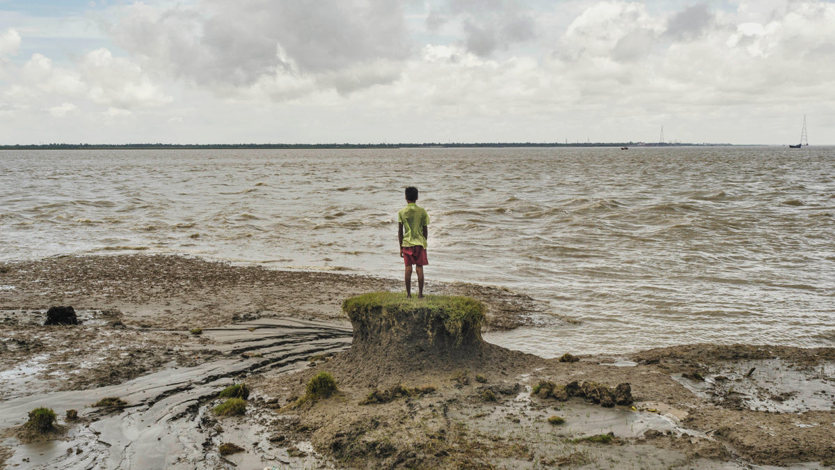
Interesting: Taking the Long View: The ‘Forever Legacy’ of Climate Change – Climate change projections often focus on 2100. But the geological record shows that unless we rapidly reduce greenhouse gas emissions, we will be locking in drastic increases in temperatures and sea levels that will alter the earth not just for centuries, but for millennia.
A century or two from now, people may look back at our current era — with its record-breaking high temperatures year after year, rapid disappearance of Arctic sea ice, and gradually rising sea levels — as part of a much cooler and far more desirable past. The spate of extreme weather events in the past month — which have devastated America’s fourth-largest city, Houston; spawned a massive hurricane that tore through the Caribbean and Florida; and swamped large swaths of India and Bangladesh — may well be a prelude to more monster hurricanes, Biblical rain events, and coastal inundations brought about by extreme weather and vastly higher sea levels.
If getting the public, the media, and politicians to pay attention to what might happen to our planet in 2100 seems hard enough, it’s even more difficult to focus on how high — according to the latest research — sea levels may be only a couple of centuries in the future. Yet recent findings lend urgency to the need to contemplate what the world might look like 200 or 300 years from now if greenhouse gas emissions are not brought under control. “Urgent” may seem like a wildly inappropriate word when applied to such a long span of time, but the truth is that humanity’s continuing failure to bring our enormous carbon emissions under control will have planet-altering impacts that could continue not just for hundreds, but thousands, of years.
Why are we so concerned about the long-term threats global warming may pose to the stable climate that has nurtured human civilization over the past 10,000 years? Because by looking at previous eras of high, naturally occurring carbon emissions and cycles of glaciation and deglaciation, we can see what may well be in store for the earth should human-generated carbon emissions continue on a business-as-usual trajectory. And what’s coming down the road in but a few generations will be determined by the inescapable laws of chemistry and physics: Temperature increases lag behind C02 emissions, a crucial fraction of which can persist in the atmosphere for thousands of years. In turn, sea level increases lag well behind temperature increases. The end result is that the world’s oceans can be expected to continue rising for many thousands of years even after temperatures stabilize.
The sea level increases we’re accustomed to seeing today — rising at 1.2 inches per decade, considerably faster than 50 years ago — may well jump to several inches per decade in a century. But that will just be the beginning. Early stages of irreversible glacial collapse in Greenland and Antarctica indicate that considerably more rapid rise might be in store, although it’s impossible to say exactly when this might occur.
The geological record indicates that seas might have risen in the distant past at truly astounding rates — one foot per decade for centuries. Nothing remotely like that has been known in recorded human history. Yet having happened before, and given current greenhouse gas emissions trends, one can’t say that such epic rates, or higher, won’t happen again.
These possibilities ought to be part of the calculus in decisions about energy, coastal development, and economic policy. Being blind to what the future will look like centuries from now ignores science. Sea level increases will not just miraculously stop in 2100, often our current end-year for forecasting. Indeed, sea level rise may be fast accelerating around then, especially in high-carbon scenarios.
Research indicates that steadily accelerating sea level rise is possible and can become unstoppable for millennia because inertia in the climate system is enormous; a 2016 paper in Nature Climate Change, for example, indicated that sea levels could rise, far in the future, roughly 80 to 170 feet.
Given current trends, keeping to the stated Paris Agreement goal of warming by no more than about 3.6 degrees Fahrenheit looks quite unlikely. This is to say nothing of what the world might look like in 2200, 2300, or after, if global temperatures rise 7 to 10 degrees F over today’s levels, a realistic projection given current emissions trends. Such a climate would be scarcely recognizable. Catastrophic storms and vastly higher sea levels aside, temperatures 7 to 10 degrees F hotter than today’s would wreak havoc with the oceans, agriculture, and, in the warmest parts of the world, go beyond human endurance.
How big an impact would such a jump in temperatures have on the planet in the coming centuries? Consider this: A temperature increase of 7 to 12.6 degrees F is what separates today’s “ideal climate” from the dramatic conditions of the last Ice Age, which peaked about 26,000 years ago. At the height of the last Ice Age, ice sheets covered much of the northern hemisphere and piled up over some parts of North America to a depth of a mile or more.
Until a century or so ago, concentrations of carbon dioxide in the atmosphere had been steady at around 260 to 280 parts per million for thousands of years. By last spring we raced past 410 parts per million and CO2 concentrations continue to steadily increase. As carbon dioxide keeps accumulating in the atmosphere — 20 percent or more of the CO2 in the air today is expected to remain in the atmosphere until 3000 — we could conceivably reach concentrations of 900 to 1,000 parts per million CO2 in a century or two. That would rival C02 concentrations in the Eocene era, 50 million years ago, when global temperatures were as much as 29 degrees higher than pre-industrial temperatures — a time when there was scant ice on earth and temperatures differed little between the Equator and the poles.
What badly needs to be brought home to the public is the massive inertia in the climate system, which means changes in temperature and sea level will go on and on long past the year 2100.
For example, about 20,000 years ago, rising temperatures due to cyclical, non-human-caused swings in the climate were bringing earth out of the last Ice Age. Even after CO2 concentrations plateaued, global temperatures continued to increase, leveling off roughly at today’s levels about 11,000 years ago. Yet sea levels, which were several hundred feet lower than today at the peak of the last Ice Age because so much of the planet’s water was locked up in ice, continued to steadily climb for another 8,000 years, before roughly reaching their current state about 3,000 years ago.
Although we will unquestionably have a less hospitable climate in 2100 than today, that will be nothing compared to what might lie in store in 2200 and beyond. Yes, in 2100, sea levels might be three or more feet higher than today, which will be bad for low-lying nations like Bangladesh and U.S. states like Florida. But if greenhouse gas emissions continue at roughly today’s levels for another century, that may mean that sea levels 500 years from now would be nearly 50 feet higher as the Greenland and Antarctic ice sheets melt. That would mean losing large swaths of coastal areas worldwide. This is not alarmism; this is where the science takes us.
Given current and projected greenhouse gas emissions, we are looking at nothing less than creating a “forever legacy,” imposing monumental changes on the planet that can’t be readily unwound in a time frame meaningful to our species.
We are, at best, now thinking decades into the future, while pressing our foot hard on a CO2 accelerator that virtually guarantees climate chaos for millennia to come. That’s why the issue of considering the long-term costs we might be imposing on the planet is every bit as much a moral issue as a scientific one: Because of our collective failure to rapidly decarbonize the global economy and slash CO2 emissions, we are poised to leave future generations a grim legacy of climate upheaval.
So what is the way out? If there were a simple path, we’d already be following it. Opponents of strong action to curb greenhouse gas emissions say that this is alarmism, highly uncertain, and that to aggressively pursue a low-CO2 path would be onerous and cause widespread economic damage. Most countries are either, by default, choosing inaction or are moving far too slowly to make deep cuts in greenhouse gas emissions. But as renewable energy experts, we believe climate change presents opportunities: for cleaner air, new industries, job growth, and stronger economies.
Many solutions are well known and are readily at hand. The first step might be enacting simple and transparent carbon taxes that begin to reflect true current and long-term costs of dumping CO2 into the atmosphere — costs that are in no way factored into the present-day global economy. It would be much smarter to tax “bads” like climate-changing greenhouse gases, than “goods” like work and productivity. That is what truly conservative, pro-growth, pro-jobs policies ought to look like.
Then there is carbon accounting across the public sector — including with the companies that want to do business with the government — and divestment of fossil fuel assets on the part of pension funds and financial institutions, as well as entities in the private, non-profit, and educational sectors. This is already happening in Northern Europe as renewables are simply growing much more attractive than dirty fossil fuels. And we need initial government support for clean-energy industries, as well as long-term funding for research and development on renewable energy, energy efficiency, and battery technologies.
We could also invest in technologies like “direct air capture” that might eventually employ millions of devices to extract CO2 from the atmosphere. But counting on “silver bullet” solutions to save us is not a sound strategy. These technologies use energy to operate themselves, and the scale of the challenge is immense, which is why we must immediately take concrete steps to drastically lower global emissions.
There is some reason for hope. Numerous European Union countries including Germany, and several U.S. states such as California, are making steady progress toward decarbonizing their economies. China is doing a lot more lately, though far, far more is needed. Sizeable segments of the private sector — including tech giants like Google, Apple, and Microsoft — are choosing clean energy solutions. But without large-scale coordinated action on many levels across government, academia, and the private sector, our efforts to drastically cut emissions will fall far short of what chemistry and physics demand. The atmosphere and climate do not respond to hopes or aspirations.
It’s not easy for humans to look far into the future; we are accustomed to thinking that every mistake can be undone and that the earth is unchanging. But the stakes with climate change are uniquely so high, and the damages to the planet and society so enormous, that scientists, the press, politicians, and the public need to peer a few centuries down the road and imagine what kind of world we will be leaving to our descendants.
jeff Says:
Hi Glenn, in 1821 there was a cat 3 hurricane that hit NY it would have caused a trillion dollars worth of damage if that hit today. In 1935 the Keys got hit with the strongest hurricane with 210mph winds. The record for major hurricanes to hit the USA is 23hrs, happened in 1933 with 2 of them hitting. My question is if input of CO2 is causing more intense hurricanes then why is Hurricane Jose barely hanging on and was over very warm water. It does not seem logical that CO2 is a culprit. Also it had been 12 years since a major hurricane had made landfall in the USA. Regards, Jeff
~~~ Hi Jeff, thanks for pointing out prior hurricanes from the distant past.
I don’t think that C02 is the only culprit here, although it certainly is playing its part.
These major hurricanes are sure having their way with the Caribbean and the United States this year.
Lets hope that the rest of this years hurricane season cools off, and that these hurricanes stay over the open ocean…rather than coming ashore!
Aloha, Glenn
DeeAnn Says:
Thanks for the wake up call, again. I’ve understood this information since I was a teenager, however, I’m steeped in a culture that is not paying attention. Once again I ask the question: How can I be part of the solution within the society that been created around me?
~~~ Hi DeeAnn, nice to hear from you as well, and with your good question.
This culture of ours is aware of climate change, although it’s a tough situation we wrap our minds around!
What to do? Honestly, it’s such an individual call, ranging between nothing at all and hoping for the best…to getting political and shouting loud.
I personally do the little things, I expose my website readers to relevant information, I turn the water off while washing my hands and brushing my teeth. I recycle, I compost when I’m in a place to be able to, I try and shop wisely, and whatever else I can to keep my environmental footprint as small as possible.
I’m glad to know that you are looking to be a part of the solution…as am I.
Aloha, Glenn
Craig H Says:
I will be arriving on the islands for a 2 week stay beginning this coming Saturday. How concerning are the tropical depressions and the other disturbances that are now forming in the Eastern Pacific?
Will the lack of a strong El Nino this year help prevent these/other disturbances from taking a stronger shape?
btw…You have always been my weather go-to guy whenever I visit the islands:0)
Mahalo!
~~~ Hi Craig, good to hear from you, and thanks for making me your go-to-weather guy!
As you note, the central Pacific is the only place that is quiet this hurricane season. This may change, although it may not…which seems more likely to me.
Personally, I wouldn’t be worried about coming to Hawaii in a couple of weeks, I think you will have a great time.
Of course things can change unexpectedly…although at the time of this writing…I don’t see any leanings in that direction.
Aloha, Glenn