


Air Temperatures – The following high temperatures (F) were recorded across the state of Hawaii Monday…along with the low temperatures Monday:
88 – 71 Lihue, Kauai
86 – 75 Honolulu, Oahu
89 – 66 Molokai
91 – 67 Kahului AP, Maui – Monday’s high temperature record was 92…set back in 1980
86 – 73 Kailua Kona
86 – 68 Hilo AP, Hawaii
Here are the latest 24-hour precipitation totals (inches) for each of the islands as of Monday evening:
0.45 Puu Lua, Kauai
0.69 Waipio, Oahu
0.00 Molokai
0.08 Lanai
0.00 Kahoolawe
0.00 Maui
0.48 Waikii, Big Island
The following numbers represent the strongest wind gusts (mph) as of Monday evening:
16 Moloaa Dairy, Kauai
16 Kahuku Trng, Oahu
17 Molokai
14 Lanai
20 Kahoolawe
21 Kapalua, Maui
23 South Point, Big Island
Hawaii’s Mountains – Here’s a link to the live webcam on the summit of our tallest mountain Mauna Kea (nearly 13,800 feet high) on the Big Island of Hawaii. This webcam is available during the daylight hours here in the islands, and at night whenever there’s a big moon shining down. Also, at night you will be able to see the stars — and the sunrise and sunset too — depending upon weather conditions.
Aloha Paragraphs

Deep low with a cold front far north of Hawaii

Thunderstorms offshore to the southwest and south
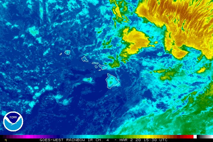
Clear to partly cloudy…some cloudy areas

Showers locally – Looping radar image
Wind Advisory…Big Island Summits
~~~ Hawaii Weather Narrative ~~~
Broad Brush Overview: Light winds with very warm and muggy conditions will prevail into mid-week. Clouds and isolated showers will occur each afternoon, especially over leeward and upcountry sections. Nights will be mostly clear, followed by mostly sunny mornings. A weak cold front north of Kauai will slip southward and stall just north of the islands. Volcanic haze will spread over the state…as the wind flow becomes southeasterly.
Looking Ahead: The trade winds are expected to build back in Wednesday and Thursday, as high pressure strengthens far north and northeast of the state. Showers will become focused over windward slopes, though some low level moisture, from a dissipated cold front may affect the northern side of the island chain as the trades rebuild. Tropical Cyclone activity won’t be a threat through at least the next 5-days.
Here’s a wind profile of the Pacific Ocean – Closer view of the islands / Here’s the vog forecast animation / Here’s the latest weather map
Marine environment details: No marine warnings are expected into Wednesday. A surface ridge located north of Kauai will be pushed southward by an advancing cold front during the next 24 hours, causing light to gentle southeasterly winds to shift more southerly over the northern end of the island chain. The front will stall and begin to fall apart just north of Kauai Wednesday, as high pressure strengthens far north of the state. This will lead to building trade winds that may reach the Small Craft Advisory threshold over the typically windy waters around the Big Island and Maui Thursday and Friday.
The current south swell continues to slowly decline over the next couple of days, although a southeast swell will maintain surf near summer levels through the week.
Surf along north facing shores is awakening from summer hibernation. A north-northwest has been providing small surf, and will be reinforced by a larger north- northwest swell by later Tuesday. This swell will peak well below advisory levels, and a faint west-northwest swell will likely appear at the same time. As these swells decline Friday, a small northwest swell is expected to fill in….persisting through next weekend.

Light winds, muggy…with vog
World-wide tropical cyclone activity
![]()
>>> Atlantic Ocean:
Hurricane 10L (Irma) remains active as a major Category 5 system, here’s a NHC graphical track map, a satellite image…and what the computer models are showing
1.) Showers and thunderstorms associated with an area of low pressure located about 1000 miles west-southwest of the Cabo Verde Islands are gradually becoming better organized. Conditions appear conducive for continued development of this system. There is a high likelihood that a tropical depression or tropical storm will form within the next day or two while the disturbance moves west-northwestward at 10 to 15 mph over the tropical Atlantic Ocean.
* Formation chance through 48 hours…high…80 percent
* Formation chance through 5 days…high…90 percent
>>> Caribbean Sea: No active tropical cyclones
>>> Gulf of Mexico: No active tropical cyclones
1.) A trough of low pressure located over the southwestern Gulf of Mexico is producing numerous showers and thunderstorms. Environmental conditions are conducive for gradual development, and this system is likely to become a tropical depression during the next couple of days while it meanders over the southwestern Gulf of Mexico. Regardless of development, heavy rains associated with this disturbance are likely over portions of eastern Mexico during the remainder of the week.
* Formation chance through 48 hours…medium…60 percent
* Formation chance through 5 days…high…70 percent
Here’s a satellite image of the Caribbean Sea…and the Gulf of Mexico
Here’s the link to the National Hurricane Center (NHC)
>>> Eastern Pacific: No active tropical cyclones
Here’s a wide satellite image that covers the entire area between Mexico, out through the central Pacific…to the International Dateline.
Here’s the link to the National Hurricane Center (NHC)
>>> Central Pacific: No active tropical cyclones
Here’s a link to the Central Pacific Hurricane Center (CPHC)
>>> Northwest Pacific Ocean:
Tropical Depression 19W is dissipating, here’s a JTWC graphical track map, a satellite image – Final Warning
>>> North and South Indian Oceans / Arabian Sea: No active tropical cyclones
Here’s a link to the Joint Typhoon Warning Center (JTWC)
Interesting: A FASCINATING SHORT SEA STORY – The passenger steamer SS Warrimoo was quietly knifing its way through the waters of the mid-Pacific on its way from Vancouver to Australia. The navigator had just finished working out a star fix and brought the master, Captain John Phillips, the result. The Warrimoo’s position was LAT 0º 31′ N and LON 179 30′ W. The date was 31 December 1899.
Helen Says:
Aloha Glenn,
I hope you and your are having a good Labor Day weekend.
Thanks for your answer to my question a few weeks ago.
I really appreciate it. 🙂
I have another one for you. When we look at the NOAA Hurricane Irma cone advisory path there is an “M” there instead of a “H.”
What does the M stand for please?
Thanks !1
~~~ Hi Helen, good question, H stands for Hurricane…while M stands for a Major Hurricane.
Major Hurricane starts at Category 3…and runs through Category 5 / 111-157+ mph
Hope this helps.
Aloha, Glenn