


Air Temperatures – The following high temperatures (F) were recorded across the state of Hawaii Tuesday…along with the low temperatures Tuesday:
85 – 69 Lihue, Kauai
85 – 70 Honolulu, Oahu
83 – 66 Molokai
84 – 65 Kahului AP, Maui
85 – 74 Kona Int’l AP
84 – 69 Hilo AP, Hawaii
Here are the latest 24-hour precipitation totals (inches) for each of the islands as of Tuesday evening:
0.56 N Wailua Ditch, Kauai
1.29 Waianae, Oahu
0.41 Molokai
0.05 Lanai
0.27 Kahoolawe
1.71 Puu Kukui, Maui
0.39 Saddle Quarry, Big Island
The following numbers represent the strongest wind gusts (mph) as of Tuesday evening:
24 Port Allen, Kauai
21 Kahuku Trng, Oahu
21 Molokai
17 Lanai
24 Kahoolawe
27 Kahului AP, Maui
36 Puu Mali, Big Island
Hawaii’s Mountains – Here’s a link to the live webcam on the summit of our tallest mountain Mauna Kea (nearly 13,800 feet high) on the Big Island of Hawaii. This webcam is available during the daylight hours here in the islands, and at night whenever there’s a big moon shining down. Also, at night you will be able to see the stars — and the sunrise and sunset too — depending upon weather conditions.
Aloha Paragraphs

There’s a counter-clockwise rotating upper level low pressure system northwest

An associated cold front will stay away from the islands

Clear to partly cloudy, cloudy areas locally…a few thunderstorms northwest of Kauai

Showers locally – Looping radar image
Small Craft Advisory…windiest coasts and channels around Maui County and the Big Island
~~~ Hawaii Weather Narrative ~~~
Broad Brush Overview: Trade winds will return to the state, as the cold front northwest moves away to the west. A surface high pressure system passing far north of the area over the next few days, will provide moderate to locally strong trade winds. An upper level trough of low pressure will linger in the island vicinity…resulting in off and on wet trade wind weather through the rest of the week.
Details: A long lasting trade wind episode will build back across the area Wednesday. Lingering low clouds in the vicinity, carried by the trades will affect mainly windward areas. Some rainfall may still be heavy, especially for the western islands…due to the unstable atmosphere.
Looking Further Ahead: As more robust trades return to the state Wednesday, most of the clouds and showers will arrive along the windward sides. Forecast models indicate a surface high will pass far north of the area over the next few days…becoming quite strong by the weekend. Some showers may reach the leeward areas of the islands later in the week. We can expect wetter than normal weather over the state into the weekend.
Here’s a wind profile of the Pacific Ocean – Closer view of the islands / Here’s the vog forecast animation / Here’s the latest weather map
Marine environment details: The latest surface analysis showed a weak low pressure along a stalled frontal boundary west of Hawaii, and a high pressure to its north-northwest. This weak low will drift westward through mid-week…as high pressure builds north of the state Wednesday through the second half of the week. Gusty trade winds will result across the local waters tonight…continuing into the weekend.
The late season northwest swell that peaked Sunday night, will steadily trend down through mid-week. Surf along north and west facing shores will respond, and gradually lower each day…with no significant swells expected into next week.
Surf along east facing shores will increase through the second half of the week. This combined with strong onshore winds locally (beginning tonight) will translate to rough surf along east facing shores into the second half of the week.
A slight increase in surf along south facing shores is expected Wednesday into the weekend, as energy from recent southern Pacific activity fills in. For the long range, Tropical Cyclone Donna, currently passing near New Caledonia, is forecast to drop south-southeast toward New Zealand and become absorbed in the westerlies this weekend. Guidance supports a batch of gales setting up within Hawaii’s swell window east of New Zealand…which could translate to a decent south swell around the third week of the month if things materialize.

Returning trades into Wednesday
San Francisco Bay Weather Brief: A cooling trend begins Wednesday, as onshore flow and the marine influence increases. A cold front will enter the North Bay with a slight chance of rain showers Thursday, cooling temperatures there. Continued breezy and unseasonably cool conditions are likely Friday…into the weekend.
.
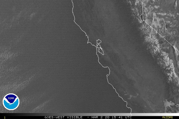
Mostly clear…with low clouds offshore to the west
World-wide tropical cyclone activity
![]()
>>> Atlantic Ocean: The 2017 hurricane season begins June 1st
>>> Caribbean: The 2017 hurricane season begins June 1st
>>> Gulf of Mexico: The 2017 hurricane season begins June 1st
Here’s a satellite image of the Caribbean Sea…and the Gulf of Mexico
Here’s the link to the National Hurricane Center (NHC)
>>> Eastern Pacific: The 2017 hurricane season begins May 15th
Tropical Cyclone 01E (Adrian) is now active in the eastern Pacific, here’s the graphical track map, a satellite image…and what the computer models are showing
Here’s the NOAA 2016 Hurricane Season Summary for the Eastern Pacific Basin
Here’s a wide satellite image that covers the entire area between Mexico, out through the central Pacific…to the International Dateline.
Here’s the link to the National Hurricane Center (NHC)
>>> Central Pacific: The 2017 hurricane season begins June 1st
Here’s the NOAA 2016 Hurricane Season Summary for the Central Pacific Basin
Here’s a link to the Central Pacific Hurricane Center (CPHC)
>>> Northwest Pacific Ocean: No active tropical cyclones
Tropical Cyclone 18P (Donna) remains active in the southwest Pacific, here’s the graphical track map, a satellite image…and what the computer models are showing
Tropical Cyclone 19P (Ella) remains active in the southwest Pacific, here’s the graphical track map, a satellite image…and what the computer models are showing
>>> North and South Indian Oceans / Arabian Sea: No active tropical cyclones
Here’s a link to the Joint Typhoon Warning Center (JTWC)
Interesting: U.S. had 2nd wettest…11th warmest April on record – “April showers bring May flowers,” or so the saying goes.
Perhaps a more appropriate description this year might be, “Heavy April showers bring record flooding.”
All that rain helped shrink the drought footprint for the contiguous U.S. to the lowest level since the nationwide Drought Monitor program began in 2000. It also caused loss of life and extensive property destruction in many communities.
Climate by the numbers
April
Last month, the average contiguous U.S. temperature was 53.8 degrees F, 2.7 degrees above the 20th-century average. The month ranked as the 11th warmest April in the 123-year period of record, according to scientists from NOAA’s National Centers for Environmental Information. Much-above-average temperatures spanned the East, with record warmth in the Mid-Atlantic and Ohio Valley.
The average precipitation total for April was 3.43 inches, 0.91 inch above the 20th-century average, making it the second wettest April on record. Much-above-average precipitation fell across the Northwest, Central Plains, Mid-Mississippi Valley, Great Lakes and Mid-Atlantic.
Year to date
The year to date (January through April 2017) average temperature was 43.7 degrees F, 4.5 degrees above the 20th-century average. This was the second warmest January–April, behind 2012. The total year-to-date precipitation for the Lower 48 states was 11.46 inches, 1.99 inches above average, making it the fifth wettest YTD period on record.
More notable climate events
-
Record warmth across the Mid-Atlantic and Ohio Valley: Delaware, Maryland, New Jersey, North Carolina, Ohio, Pennsylvania, West Virginia, Virginia and Washington, DC each had their warmest April on record.
-
Heavy rainfall caused widespread flooding: Record precipitation was observed in parts of the Northwest, Southern Plains and Mid-Atlantic. North Carolina had its wettest April on record. Rains caused widespread flooding in the Mid-Mississippi River Valley and contributed to numerous landslides in the West.
-
Drought shrunk to lowest extent since 2000: On May 2, 5 percent of the contiguous U.S. was in drought. This was the smallest drought footprint since the Drought Monitor began in 2000. Despite improvement in many areas, drought worsened in the Southwest and across parts of the Southeast where several large wildfires burned in Florida and southern Georgia.
-
April saw substantial tornado activity: During April there were more than 200 preliminary tornado reports across the U.S. Large tornado outbreaks occurred in the Central and Southern U.S. in early and late April; these were responsible for eight deaths in Louisiana, South Carolina and Texas.
-
Winter reluctantly left Maine: Caribou, Maine, had at least 12 inches of snow on the ground for 132 consecutive days through April 10, a new record.
-
Alaska dried out: Alaska saw its eighth warmest and second driest April on record with 0.92 inch of precipitation. Abnormally dry conditions covered one-third of the state.
craig hermes Says:
what is the general forecasted hurricane outlook for the central pacific this year?
Not sure what El Nino is expected to do.
~~~ Hi Craig, good question, however the official NOAA outlook for the central Pacific hasn’t come out yet…and I don’t want to get out ahead of the Central Pacific Hurricane Center issuance.
I will post that information when it becomes available.
Aloha, Glenn