


Air Temperatures – The following high temperatures (F) were recorded across the state of Hawaii Tuesday…along with the low temperatures Tuesday:
83 – 76 Lihue, Kauai
84 – 75 Honolulu, Oahu
82 – 73 Molokai
84 – 73 Kahului AP, Maui
83 – 72 Kona Int’l AP
80 – 66 Hilo AP, Hawaii
Here are the latest 24-hour precipitation totals (inches) for each of the islands as of Tuesday evening:
1.11 Mount Waialeale, Kauai
0.42 Oahu Forest NWR, Oahu
0.26 Molokai
0.00 Lanai
0.01 Kahoolawe
0.62 West Wailuaiki, Maui
5.00 Saddle Quarry, Big Island
The following numbers represent the strongest wind gusts (mph) as of Tuesday evening:
30 Port Allen, Kauai
46 Kahuku Trng, Oahu
29 Molokai
35 Lanai
42 Kahoolawe
35 Kahului AP, Maui
40 Waikoloa, Big Island
Hawaii’s Mountains – Here’s a link to the live webcam on the summit of our tallest mountain Mauna Kea (nearly 13,800 feet high) on the Big Island of Hawaii. This webcam is available during the daylight hours here in the islands, and at night whenever there’s a big moon shining down. Also, at night you will be able to see the stars — and the sunrise and sunset too — depending upon weather conditions.
Aloha Paragraphs

The next late season cold front is well northwest of the islands

Thunderstorms in the deeper tropics to our south

Clear to partly cloudy…with cloudy areas locally

Showers…mostly offshore
Looping radar image
Small Craft Advisory…windiest coasts and channels around Maui County and the Big Island
High Surf Advisory…east shores of Kauai, Oahu, Molokai, Maui and the Big Island
~~~ Hawaii Weather Narrative ~~~
Broad Brush Overview: High pressure northeast of the state will keep moderate to locally strong trades in place through Wednesday, with clouds and showers favoring windward areas. The trades will then diminish late in the work week into the weekend…as a cold front approaches from the northwest. This in turn will trigger daytime sea breezes and overnight land breezes in many areas. The front will likely stall northwest of Kauai early next week, with a return of gusty trade winds, as high pressure becomes re-established north of the island chain.
Details: High pressure northeast of the state will keep the trade wind flows going, and due to the strength of these gusty winds, a few showers will spread leeward from time to time. We’ll find a general decrease in trade wind shower coverage and intensity through Wednesday.
Looking Further Ahead: The trade winds will diminish further Wednesday night, with daytime sea breezes and overnight land breezes setting up Thursday into the weekend. This will occur as the very late season cold front tries to push into the sub-tropics. This front will likely stall northwest of Kauai, given the less than favorable environment conditions it will encounter. By early next week, we should see a more typical trade wind shower pattern…with very common late spring trade winds blowing across the Aloha State.
Here’s a wind profile of the Pacific Ocean – Closer view of the islands / Here’s the vog forecast animation / Here’s the latest weather map
Marine environment details: The latest analysis showed a large area of high pressure over the eastern Pacific, with an associated ridge extending west-southwest to the north of the islands. As a result, there’s a large area of strong trade winds upstream of the state and across the local waters. High pressure is forecast to weaken through the second half of the week, as a cold front approaches. Strong trade winds across local waters will continue into Wednesday, before trending down through the second half of the week. A small craft advisory for the waters east of Kauai remains in effect through early Wednesday morning…and will likely be extended through Wednesday for the typical windier areas.
Surf along east facing shores will remain rough through Wednesday, before gradually lowering through the second half of the week.
Surf along north facing shores will remain small, with no significant swells expected through Wednesday. Mainly trade wind swell wrap at select spots will be the only real source supporting surf. A slight increase in surf is expected Wednesday night along north and west facing shores due to a small northwest swell. This minor swell should hold through Thursday before lowering Friday. Later in the weekend, a larger northwest swell is expected due, which will peak Sunday night into Monday, then lower into the early portion of next week. Surf should remain just under the high surf advisory level for north and west facing shores.
A small south swell is expected to arrive today, although with only a slight increase in surf along south facing shores through Wednesday. Another south swell is forecast for this coming weekend, due to recent Tropical Cyclone Donna in the southern hemisphere. For the long range, guidance supports a very active pattern evolving across the southern Pacific featuring a storm to hurricane force low developing south and southeast of New Zealand Thursday through the weekend. If this materializes as projected this weekend, a good sized south swell would become likely across the local area late next week into the following weekend.
Well established trade wind weather pattern through mid-week
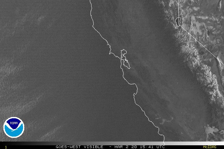
San Francisco Bay Weather Brief: The next weak weather system moves through the Bay Area Tuesday, with continued below normal temperatures…and a slight chance of showers. Long range trends then suggest an ideal spring time pattern setting up with building high pressure and a thermal trough near the coast.
This will leading to a pronounced warming trend late in the week through the weekend…with minimal stratus coverage expected near the coast. These warmer than normal conditions will continue through most of next week. There are no signs of an organized storm impacting the area over the next two weeks.
.
Partly to mostly cloudy…with some clear areas here and there
World-wide tropical cyclone activity
![]()
>>> Atlantic Ocean: The 2017 hurricane season begins June 1st
>>> Caribbean: The 2017 hurricane season begins June 1st
>>> Gulf of Mexico: The 2017 hurricane season begins June 1st
Here’s a satellite image of the Caribbean Sea…and the Gulf of Mexico
Here’s the link to the National Hurricane Center (NHC)
>>> Eastern Pacific: No active tropical cyclones
Here’s the NOAA 2016 Hurricane Season Summary for the Eastern Pacific Basin
Here’s a wide satellite image that covers the entire area between Mexico, out through the central Pacific…to the International Dateline.
Here’s the link to the National Hurricane Center (NHC)
>>> Central Pacific: The 2017 hurricane season begins June 1st
Here’s the NOAA 2016 Hurricane Season Summary for the Central Pacific Basin
Here’s a link to the Central Pacific Hurricane Center (CPHC)
>>> Northwest Pacific Ocean: No active tropical cyclones
>>> North and South Indian Oceans / Arabian Sea: No active tropical cyclones
Here’s a link to the Joint Typhoon Warning Center (JTWC)
Interesting: Research finds spike in dust storms in American Southwest driven by ocean changes – People living in the American Southwest have experienced a dramatic increase in windblown dust storms in the last two decades, likely driven by large-scale changes in sea surface temperature in the Pacific Ocean drying the region’s soil, according to new NOAA-led research.
With the increase in dust storms, scientists have also documented a spike in Valley fever, an infectious disease caught by inhaling a soil-dwelling fungus found primarily in the Southwest.
“We’ve known for some time that the Southwest U.S. is becoming drier,” said lead author Daniel Tong, a scientist at NOAA’s Air Resources Laboratory and George Mason University. “Dust storms in the region have more than doubled between the 1990s and the 2000s. And we see that Valley fever is increasing in the same region.”
The new research, appearing today in the journal Geophysical Research Letters, shows that the average of 20 dust storms per year in the 1990s jumped to 48 per year in the 2000s in the Southwest.
Scientists look to ocean for answers
“When we saw this dramatic increase in dust storms and the drying of soils, we started looking to the ocean for answers,” said Julian Wang, a NOAA climate scientist and co-author. “Changes in the ocean occur over longer periods of times than we typically see in the atmosphere.”
Researchers found there was a combination of warmer sea surface temperatures in the North Pacific during the 2000s than during the 1990s, along with colder waters off the California coast. This allowed for cooler and drier northerly winds from the North Pacific into the southwestern U.S., helping to dry the soil.
The wind pattern also blocked warmer, moister winds from the tropical Pacific. This contributed to increased dust storms in every season except summer, when plant cover and soil moisture increases.
The new research is the first to be based on a long-term data record NOAA is developing to track the history of dust storms in the United States.
“Over time, analyzing the data will help us better predict dust storm patterns and answer the question of whether increased dust storms are a natural variation or could precipitate a larger shift in the area to desert,” said Tong.
Better prediction of dust storms can help the agriculture, aviation and transportation industries, as well as healthcare. Dust storms not only carry the fungus that can cause Valley fever, but also can severely damage aircraft engines, disrupt land transportation and erode and damage farms already hit by drought.
Diane Says:
Dear Glenn,
Thank you again for providing such great website to read. Every morning I check the local weather and then to your website. I live in No.CA so currently I read your info on the local weather as well…yeah, yeah!!
I’m the person who caught the weather bug in 7th grade science class and for at 3 years I have been a loyal reader. For me, it’s like you are talking directly to me, very cool.
This is a late response about the Cockroach “interesting” that you posted. Your comment in response to Woody was accurate!!! I did not understand some of what he said BUT the important part is it made me smile from my experiences with cockroaches on several of your beautiful Hawaiian Islands and it gave me “chill bumps”. Their size and the “crunch” is unforgettable.
Hope all is well with you and your love ones. The are in hands.
Aloha, Diane from No.CA
~~~ Hi Diane, you write ah good comment…like so many others! Yes, I’m in west Sebastopol at the moment, here about another week, before back down to Linda’s in Marin…before flying down to my Mom’s in Long Beach.
I’m so enjoying my friend Greg’s son Julian. He’s 11 years old, and I’m proud to say that I’m his Godfather. I love the weather in Northern California, and thinking back to Maui at the moment, I really like the weather in Upper Kula as well.
I’m enjoying writing a few words about the San Francisco Bay area too, even though I’m now in Sonoma County…which is different. Although Greg’s place is close to the coast, which makes it quite similar to San Francisco in many regards.
Interesting words their “crunch”…I suspect you are talking about what it sounds like when one slaps them with something.
Take care…
Aloha, Glenn