


Air Temperatures – The following high temperatures (F) were recorded across the state of Hawaii Wednesday…along with the low temperatures Wednesday:
77 – 63 Lihue, Kauai
82 – 66 Honolulu, Oahu
79 – 67 Molokai
77 – 67 Kahului AP, Maui
81 – 70 Kona Int’l AP
80 – 67 Hilo AP, Hawaii
Here are the latest 24-hour precipitation totals (inches) for each of the islands as of Thursday morning:
1.07 Princeville AP, Kauai
0.32 Poamoho RG 1, Oahu
0.18 Molokai
0.00 Lanai
0.00 Kahoolawe
3.04 West Wailuaiki, Maui
1.44 Honokaa, Big Island
The following numbers represent the strongest wind gusts (mph) as of Thursday morning:
14 Poipu, Kauai
27 Kuaokala, Oahu
13 Molokai
22 Lanai
29 Kahoolawe
18 Maalaea Bay, Maui
09 Ahumoa, Big Island
Hawaii’s Mountains – Here’s a link to the live webcam on the summit of our tallest mountain Mauna Kea (nearly 13,800 feet high) on the Big Island of Hawaii. This webcam is available during the daylight hours here in the islands, and at night whenever there’s a big moon shining down. Also, at night you will be able to see the stars — and the sunrise and sunset too — depending upon weather conditions.
Aloha Paragraphs

A large low pressure system is spinning well north of the islands

The potential for unsettled weather persists…especially for the eastern islands

Clear to partly cloudy Kauai…mostly cloudy elsewhere

Showers locally…mostly offshore
Looping radar image
High Surf Warning…north and west shores of Kauai, Oahu, Molokai, and north shore of Maui
High Surf Advisory…north shore of the Big Island
Flash Flood Watch…statewide
Small Craft Advisory…increasing seas due to a large northwest swell
High Wind Warning…Big Island Summits / 30-50 with gusts to 70 mph
Winter Storm Warning…Big Island Summits / heavy snow and icing above 12,000 feet
~~~ Hawaii Weather Narrative ~~~
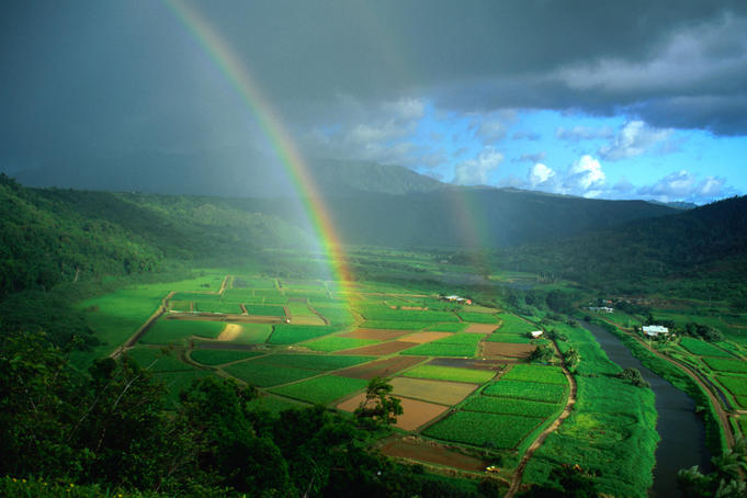
Broad brush overview: Unsettled weather, with heavy rain and thunderstorms will be prevail through today, as strong upper-level disturbances pass over the island chain. For tonight, heavy rain is most likely along a stalled band of moisture currently near Maui and the Big Island. This band of moisture is then expected to spread northward today, potentially shifting the threat of heavy rain to Kauai and Oahu. Gradually improving conditions are expected Friday, with a more settled weather pattern expected for the weekend…with light winds bringing humid conditions.
Details: A weak high pressure system is centered west-northwest of Kauai, with an associated ridge north of Kauai. A band of moisture remains active cross Maui County and the Big Island…with drier air over Oahu and Kauai County. The ridge is generating light to moderate northeast winds over the state. Satellite imagery showed mostly cloudy skies along the windward coasts and slopes, with partly cloudy skies elsewhere over the smaller islands. The Big Island and sections of Maui are covered by a band of layered high clouds coming up from the tropics. Some heavy showers and thunderstorms have popped-up over sections of those eastern islands.
Thunderstorms have been firing in response to the low level moisture pool, tapping into upper level instability, caused by an overhead upper trough of low pressure. The trough has brought a cold pool of air aloft, near 20 thousand feet, that has temperatures much colder than normal…which will enhance showers that form into Thursday…with locally heavy rains and thunderstorms possible. Best chances of this more inclement weather will be along the enhanced moisture boundary over Maui County and the Big Island. The lower moisture content over Kauai and Oahu will inhibit most heavy showers from forming, although brief downpours are possible.
Looking ahead: Global models still suggest weak surface ridging in the island vicinity next week, with a weak front passing just north of the area…along with light trade winds.
Here’s a wind profile of the Pacific Ocean – Closer view of the islands / Here’s the vog forecast animation / Here’s the latest weather map
Marine environment details: The current large northwest swell remains large. The swell continues to come in a couple feet above model guidance. Thus the High Surf Warning has been extended for the smaller islands, and the High Surf Advisory for the Big Island through today. Expect surf to be on the decline today, although will likely continue to produce advisory level surf over most north and west facing shores even into Friday. This swell will continue to diminish Friday into the weekend.
The northwest swell will produce high seas, so a Small Craft Advisory (SCA) is in effect through the day as well. As the swell starts to lower…some areas will begin to drop out of the SCA.
The background surface winds over the waters surrounding the Hawaiian Islands will remain relatively light through the weekend. An unstable airmass over the region will bring locally heavy downpours and isolated thunderstorms today. Mariners should be aware that any thunderstorms will be capable of producing locally strong wind gusts, frequent lightning, and reduced visibilities.
Heavy showers are falling locally
Southern California Weather Summary: High pressure and a weak offshore flow will persist through Friday… with much above normal high temperatures. Dry weather with continued above normal temperatures are expected through the weekend, into early next week. A slight cool down is expected Tuesday and Wednesday, although temperatures will remain above normal for this time of year. There will be high cirrus clouds at times through the period.


Clear…with streaky high cirrus clouds locally
Looping radar for Southern California
World-wide tropical cyclone activity
![]()
>>> Atlantic Ocean: The 2017 hurricane season begins June 1st
Here’s a satellite image of the Atlantic Ocean
>>> Caribbean: The 2017 hurricane season begins June 1st
>>> Gulf of Mexico: The 2017 hurricane season begins June 1st
Here’s a satellite image of the Caribbean Sea…and the Gulf of Mexico
Here’s the link to the National Hurricane Center (NHC)
>>> Eastern Pacific: The 2017 hurricane season begins May 15th
Here’s the NOAA 2016 Hurricane Season Summary for the Eastern Pacific Basin
Here’s a wide satellite image that covers the entire area between Mexico, out through the central Pacific…to the International Dateline.
Here’s the link to the National Hurricane Center (NHC)
>>> Central Pacific: The 2017 hurricane season begins June 1st
Here’s the NOAA 2016 Hurricane Season Summary for the Central Pacific Basin
Here’s a link to the Central Pacific Hurricane Center (CPHC)
>>> Northwest Pacific Ocean: No active tropical cyclones
>>> North and South Indian Oceans / Arabian Sea:
Tropical Cyclone 11S is now over the South Indian Ocean, here’s a graphical track map, along with a satellite image of the system…and what the computer models are showing
Here’s a link to the Joint Typhoon Warning Center (JTWC)
Interesting: SFU technology puts ‘touch’ into long-distance relationships – Long-distance couples can share a walk, watch movies together, and even give each other a massage, using new technologies being developed in Carman Neustaedter’s Simon Fraser University lab.
It’s all about feeling connected, says Neustaedter, an associate professor in SFU’s School of Interactive Arts and Technology (SIAT). Student researchers in his Surrey campus-based Connections Lab are working on myriad solutions.
Among them, researchers have designed a pair of interconnected gloves called Flex-N-Feel. When fingers ‘flex’ in one glove, the actions are transmitted to a remote partner wearing the other. The glove’s tactile sensors allow the wearer to ‘feel’ the movements.
To capture the flex actions, the sensors are attached to a microcontroller. The sensors provide a value for each bend, and are transmitted to the ‘feel’ glove using a WiFi module.
The sensors are also placed strategically on the palm side of the fingers in order to better feel the touch. A soft-switch on both gloves also allows either partner to initiate the touch.
“Users can make intimate gestures such as touching the face, holding hands, and giving a hug,” says Neustaedter. “The act of bending or flexing one’s finger is a gentle and subtle way to mimic touch.”
The gloves are currently a prototype and testing continues. While one set of gloves enables one-way remote touch between partners, Neustaedter says a second set could allow both to share touches at the same time.
Other projects also focus on shared experiences, including a virtual reality video conferencing system that lets one “see through the eyes” of a remote partner, and another that enables users to video-stream a remote partner’s activities to a long-distance partner at home (called Be With Me).
Meanwhile the researchers are also studying how next-generation telepresence robots can help unite couples and participate in activities together.
They’ve embedded a robot, designed by Suitable Technologies, into several Vancouver homes. There, it connects to countries around the world, including India and Singapore. Researchers continue to monitor how the robot is used. One long-distance couple plans a Valentine’s Day ‘date’ while one partner is in Vancouver, and the other, on Vancouver Island.
“The focus here is providing that connection, and in this case, a kind of physical body,” says Neustaedter, who has designed and built eight next-generation telepresence systems for families, and is author of Connecting Families: The Impact of New Communication Technologies on Domestic Life (2012). He has also spent more than a decade studying workplace collaborations over distance, including telepresence attendance at international conferences.
“Long-distance relationships are more common today, but distance don’t have to mean missing out on having a physical presence and sharing space,” says Neustaedter. “If people can’t physically be together, we’re hoping to create the next best technological solutions.”
Mary (S. Kihei) Says:
Glenn
You are missing 1 rainy winter here in Kihei. Hope your Mom continues to improve.
Mary
~~~ Hi Mary, a different Mary in Kihei!
I’m very aware of missing all the interesting weather action this winter.
Thanks for your well wishes for my Mom and I. She is getting better, which is a great relief for me. I have plans to return to Maui early next month, that is if everything continues to improve…as they are now.
Aloha, Glenn
Mary O Mary Says:
OH MY! First we had a hard time getting back to North Kihei from Wailuku because of flash floods coming from upcountry closing South Kihei Road…. we made it finally, and now we have torrential rain and thunder and lightning, but oddly light and weirdly muddy grey sunset skies. The rain is still falling hard, and we are hoping everyone is safe for the duration. Wish you were here, Glenn.
~~~ Hi Mary, OH MY is right, what a ride home back to Kihei!
You are very right, everyone should be very careful over the next couple of days, as our roads will be off and on wet, with flooding remaining in the forecast.
I wish I was there too, I like rain storms!
Thanks for your on the spot report…
Aloha, Glenn
David Hume Says:
Cool, red tires that smell like pizza when you ‘burn out’
~~~ Hi David, yep, pretty cool…right!
Aloha, Glenn