


Air Temperatures – The following high temperatures (F) were recorded across the state of Hawaii Thursday…along with the low temperatures Thursday:
80 – 65 Lihue, Kauai
81 – 68 Honolulu, Oahu
83 – 64 Molokai
84 – 62 Kahului AP, Maui
83 – 70 Kona Int’l AP
84 – 64 Hilo AP, Hawaii
Here are the latest 24-hour precipitation totals (inches) for each of the islands as of Thursday evening:
0.67 Lihue, Kauai
0.12 Poamoho, Oahu
0.00 Molokai
0.00 Lanai
0.00 Kahoolawe
0.01 Kula 1, Maui
0.50 Lower Kahuku, Big Island
The following numbers represent the strongest wind gusts (mph) as of Thursday evening:
24 Port Allen, Kauai
20 Kuaokala, Oahu
18 Molokai
14 Lanai
16 Kahoolawe
18 Maalaea Bay, Maui
23 Kaupulehu, Big Island
Hawaii’s Mountains – Here’s a link to the live webcam on the summit of our tallest mountain Mauna Kea (nearly 13,800 feet high) on the Big Island of Hawaii. This webcam is available during the daylight hours here in the islands, and at night whenever there’s a big moon shining down. Also, at night you will be able to see the stars — and the sunrise and sunset too — depending upon weather conditions.
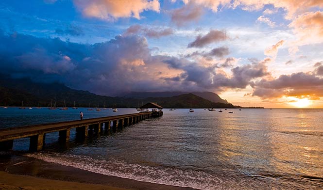
Aloha Paragraphs

A weak cold front is our current weather focus

Clear to partly cloudy…cloudy areas along and behind the cold front

A weak cold front is moving over Oahu this evening…on its way to Maui County

Scattered showers along the frontal boundary – Looping radar image
~~~ Hawaii Weather Narrative ~~~
Broad brush overview: An eastward moving weak cold front will reach Oahu this evening, Maui County overnight into Friday…before reaching the Big Island Friday night. Low clouds and showers associated with this front, will favor north and northeast facing slopes. High pressure building in north of the area behind the front, will allow a dry trade wind weather pattern to become established across the state next week.
Details: The front isn’t expected to bring any significant weather to the islands. However, there will be an increase in the coverage of low clouds and showers. Heavy rainfall is not anticipated due to the shallow structure of this feature. Behind the front, humidity levels will decrease noticeably…as light to moderately strong northerly winds fill in. In addition to ending the recent extended period of light and variable winds with warm and muggy conditions across the state, we’ll finally get relief from the volcanic haze (vog)…which has been enshrouding many of the islands recently.
Looking ahead: As high pressure builds north of the front, the relatively cool north winds this weekend are expected to shift to a more northeasterly direction…by the start of next week. Wind speeds are also expected to increase to moderate levels, or a bit stronger locally…with a dry trade wind weather pattern expected through the first half of the new week.
Here’s a wind profile of the Pacific Ocean – Closer view of the islands / Here’s the vog forecast animation / Here’s the latest weather map
Marine environment details: The current small northwest swell will continue to lower, with another small northwest swell is expected to fill in late tonight…lowering gradually through Saturday.
An eastward moving area of low pressure passing to the north of the area, will produce a northerly swell that will affect our waters Friday through Sunday. Initially the swell will be from the north-northwest, although gradually swing around to the north Saturday…then to the north-northeast on Sunday. This may cause surf to reach advisory levels along exposed east facing shores.
A west-northwest swell is forecast to arrive late Saturday and Saturday night. This swell should peak Sunday then lower gradually Monday and Tuesday. Surf heights during the peak of this swell will likely reach advisory levels along exposed north and west facing shorelines. Due to the more westerly direction of this swell, there will likely be some swell shadowing from adjacent islands, however, west facing shores of The Big Island are expected to see advisory level surf.
Southern hemisphere storms passing by New Zealand, will continue to provide for small surf along south facing shores of our islands for the remainder of the week…into the weekend. Strengthening trade winds will cause an increase in choppy surf along east facing shores early next week as well.
Winds across the area will remain rather light today, with north to northeast winds spreading in with the cold frontal passage. As high pressure continues to build to the north, winds will likely reach Small Craft Advisory levels Sunday over the typically windy waters around Maui County and the Big Island. These winds will likely continue into early next week and become more easterly. The above mentioned west-northwest swell, combined with the trade winds, may cause seas to reach Small Craft Advisory levels around Kauai and Oahu Sunday and Monday.
A weak cold front will bring clouds and showers to the islands locally
Southern California Weather Summary: Fair skies and warm conditions will continue away from the coast through Friday, as a ridge of high pressure builds into the region. A trough of low pressure will move over the area by early next week, supporting significant cooling, increasing clouds, along with rain and mountain snow at times.

Thin high clouds will move across Southern California into Friday

Low clouds and fog along the coast locally…and offshore
World-wide tropical cyclone activity
![]()
>>> Atlantic Ocean: The 2017 hurricane season begins June 1st
Here’s a satellite image of the Atlantic Ocean
>>> Caribbean: The 2017 hurricane season begins June 1st
>>> Gulf of Mexico: The 2017 hurricane season begins June 1st
Here’s a satellite image of the Caribbean Sea…and the Gulf of Mexico
Here’s the link to the National Hurricane Center (NHC)
>>> Eastern Pacific: The 2017 hurricane season begins May 15th
Here’s the NOAA 2016 Hurricane Season Summary for the Eastern Pacific Basin
Here’s a wide satellite image that covers the entire area between Mexico, out through the central Pacific…to the International Dateline.
Here’s the link to the National Hurricane Center (NHC)
>>> Central Pacific: The 2017 hurricane season begins June 1st
Here’s the NOAA 2016 Hurricane Season Summary for the Central Pacific Basin
Here’s a link to the Central Pacific Hurricane Center (CPHC)
>>> Northwest Pacific Ocean: No active tropical cyclones
>>> North and South Indian Oceans / Arabian Sea: No active tropical cyclone
Here’s a link to the Joint Typhoon Warning Center (JTWC)
Interesting: Is Spring Getting Longer? UNH Research Points to a Lengthening “Vernal Window” – With the first day of spring around the corner, temperatures are beginning to rise, ice is melting, and the world around us is starting to blossom. Scientists sometimes refer to this transition from winter to the growing season as the “vernal window,” and a new study led by the University of New Hampshire shows this window may be opening earlier and possibly for longer.
“Historically, the transition into spring is comparatively shorter than other seasons,” said Alexandra Contosta, a research assistant professor at the University of New Hampshire’s Earth Systems Research Center. “You have snow melting and lots of water moving through aquatic systems, nutrients flushing through that water, soils warming up, and buds breaking on trees. Something striking happens after a very cold winter or when there’s been a lot of snow. Things seem to wake up all together, which is why spring seems to happen so quickly and can feel so dramatic.”
However, research shows that the Northern Hemisphere snow cover extent has declined significantly in the past 30 years. To see if this may be influencing the so-called vernal window, or the transition from winter into spring, Contosta led a team of scientists that collected data from a network of New Hampshire EPSCoR soil and water sensors installed across the state. They monitored snow levels and the forest canopy for three years. Their information was supplemented with climate and satellite data along with precipitation and stream data collected by more than 100 volunteers across the state. They not only looked at dates when certain events occurred that marked the seasonal transition, such as the melting of snow and the emergence of leaves in trees, but also the time period between these events. Their findings, published early online in the journal Global Change Biology, showed that warmer winters with less snow resulted in a longer lag time between spring events and a more protracted vernal window.
This type of changing timetable for spring may have potential ecological, social, and economic consequences that Contosta and her team are currently investigating. Agriculture, fisheries, and even outdoor recreation activities can be highly dependent on the timing of springtime climate conditions. A longer spring could mean a longer mud season requiring more road repairs and truck weight restrictions, a possible shift in the duration of the sugar maple season, or earlier lake thaw which might have implications with migratory birds. The ice melts earlier, but the birds may not have returned yet, causing a delay, or lengthening, in springtime ecological events.
The researchers plan to test their conclusions with data from a larger geographic area and over longer periods.