


Air Temperatures – The following high temperatures (F) were recorded across the state of Hawaii Wednesday…along with the low temperatures Wednesday:
80 – 68 Lihue, Kauai
84 – 70 Honolulu, Oahu
84 – 63 Molokai
86 – 63 Kahului AP, Maui
83 – 73 Kona Int’l AP
83 – 66 Hilo AP, Hawaii
Here are the latest 24-hour precipitation totals (inches) for each of the islands as of Wednesday evening:
0.37 Mount Waialeale, Kauai
0.37 St. Stephens, Oahu
0.22 Molokai
0.00 Lanai
0.00 Kahoolawe
0.16 Kahakuloa, Maui
1.54 Lower Kahuku, Big Island
The following numbers represent the strongest wind gusts (mph) as of Wednesday evening:
10 Waimea Heights, Kauai
23 Kuaokala, Oahu
16 Molokai
16 Lanai
21 Kahoolawe
23 Kahului AP, Maui
22 South Point, Big Island
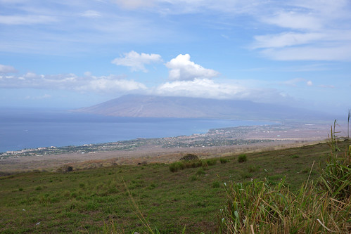
Hawaii’s Mountains – Here’s a link to the live webcam on the summit of our tallest mountain Mauna Kea (nearly 13,800 feet high) on the Big Island of Hawaii. This webcam is available during the daylight hours here in the islands, and at night whenever there’s a big moon shining down. Also, at night you will be able to see the stars — and the sunrise and sunset too — depending upon weather conditions.
Aloha Paragraphs

A weak cold front northwest…is approaching the state

Clear to partly cloudy…with some cloudy areas here and there

High Cirrus clouds moving through the state…clearing from the west

Just a few showers locally – Looping radar image
~~~ Hawaii Weather Narrative ~~~
Broad brush overview: Mainly light winds will continue through tonight, as a surface ridge of high pressure shifts southward over the state. A weak cold front is expected to move across the smaller islands Thursday afternoon through Friday, before reaching the Big Island this weekend. Clouds and showers will accompany this front, especially along north and northeast facing slopes. High pressure will build in north of the area in the wake of the front…with a dry trade wind weather pattern becoming established across the state early next week.
Details: The slack pressure gradient across our area, is due to this ridge of high pressure, keeping winds light. Aloft, an upper level ridge is evident south and southeast of the Big Island. The close proximity of this feature to the state is maintaining relatively stable atmospheric conditions across the region. A weak cold front will approach the area from the northwest, pushing the surface ridge to the east-southeast, with winds remaining rather light. This next front is forecast to reach Kauai later Thursday. The front will then gradually move down across Oahu late Thursday night and early Friday, Maui County later in the day Friday…before reaching the Big Island Saturday.
Light breezes are expected to continue, with local afternoon sea breezes and nighttime land breezes developing over most of the islands. With ample sunshine across most areas during the mornings, coupled with daytime heating and the sea breezes…will result in clouds and some showers in the afternoons over the upcountry areas. The low level east-southeast flow may continue to transport volcanic haze (vog), from the Big Island vents across parts of the state, with variable amounts expected from island to island. The clouds and showers will dissipate at night, once the downslope land breezes become established.
The cold front mentioned above, is expected to approach Kauai from the northwest. This will cause the surface ridge to weaken and push toward the east-southeast. Based on the latest forecast, the front is forecast to reach Kauai Thursday afternoon. The front will be accompanied by clouds and showers, especially along north and northeast facing slopes. This feature will also likely be rather shallow, so heavy rainfall isn’t expected. And finally the really good news: the return of north to northeast winds along and behind this front, should finally ventilate the volcanic haze away from the smaller islands. Also, a much drier atmosphere will follow behind the front…with noticeably lower humidity levels across most of the area.
Looking ahead: High pressure will dominate the weather scenario during the first half of next week, with moderate trade winds expected across the island chain. At the same time, strong mid-level ridging is forecast to become established across the region. This will produce a dry trade wind weather pattern across the state, with low clouds and brief trade showers mainly affecting windward and mountain sections.
Here’s a wind profile of the Pacific Ocean – Closer view of the islands / Here’s the vog forecast animation / Here’s the latest weather map
Marine environment details: The west-northwest swell that peaked early in the week will continue to lower today. Surf along exposed north and west facing beaches will reflect this trend and remain in the small category through Thursday. A small to moderate reinforcing swell out of the same direction will fill in Thursday night, and hold through Friday night before lowering. Surf and seas across the area will remain well below advisory levels as this reinforcement fills in.
A moderate northerly swell is forecast to arrive Friday, and persist through the weekend. Swell direction associated with this source will gradually transition from north-northwest Friday, to north Saturday to north-northeast Sunday. Surf along east facing shores may near or reach advisory levels at some point from Saturday through Sunday as the direction shifts to the north and north-northeast and eastern shores become more exposed.
A west-northwest swell will become a possibility over the local waters late Saturday night and hold into the early portion of next week before lowering. Surf may near advisory levels along exposed north and west facing shores through the day Sunday around the peak, if the swell comes in slightly larger than predicted.
Local winds will remain in the light to moderate range out of the east into Thursday, as a weak ridge of high pressure remains over the area. Winds over the channels between Molokai and the Big Island are forecast to remain slightly higher through this time. High pressure will build north of the state later in the week into the weekend, in the wake of a weak cold front moving through the area Thursday night through Sunday. This will result in moderate to strong trades over the weekend.
Gradually diminishing vog (volcanic haze)
Southern California Weather Summary: Weak high pressure aloft will support fair skies with well above normal temperatures away from the coast through Friday. An approaching trough of low pressure will support a prolonged cooling trend Saturday through early next week. This trough of low pressure will likely bring widespread and possibly significant rain and mountain snow by Tuesday, along and ahead of what currently looks to be a well organized cold front. This system may be the first of several, as a second storm system may bring additional rain and mountain snow by the middle of next week.

The recent high clouds are now east of Southern California

Low clouds and fog along the immediate coast locally…and offshore
World-wide tropical cyclone activity
![]()
>>> Atlantic Ocean: The 2017 hurricane season begins June 1st
Here’s a satellite image of the Atlantic Ocean
>>> Caribbean: The 2017 hurricane season begins June 1st
>>> Gulf of Mexico: The 2017 hurricane season begins June 1st
Here’s a satellite image of the Caribbean Sea…and the Gulf of Mexico
Here’s the link to the National Hurricane Center (NHC)
>>> Eastern Pacific: The 2017 hurricane season begins May 15th
Here’s the NOAA 2016 Hurricane Season Summary for the Eastern Pacific Basin
Here’s a wide satellite image that covers the entire area between Mexico, out through the central Pacific…to the International Dateline.
Here’s the link to the National Hurricane Center (NHC)
>>> Central Pacific: The 2017 hurricane season begins June 1st
Here’s the NOAA 2016 Hurricane Season Summary for the Central Pacific Basin
Here’s a link to the Central Pacific Hurricane Center (CPHC)
>>> Northwest Pacific Ocean: No active tropical cyclones
>>> North and South Indian Oceans / Arabian Sea: No active tropical cyclone
Here’s a link to the Joint Typhoon Warning Center (JTWC)
Interesting: Increase of Alaskan Snow Geese OK for Other Species – A new report by the USGS finds that although snow geese are increasing rapidly in northern Alaska, they are not having a negative effect on black brant. Brant are a goose species that shares its nesting habitat with snow geese.
“We found that in northern Alaska, the habitat where geese rear their young is in very good condition, and that negative effects of too many snow geese as seen in Canada is not happening here,” said Jerry Hupp, a Research Wildlife Biologist with the U.S. Geological Survey and lead author of the new study. “The available habitat in northern Alaska will likely support further growth of goose populations,” said Hupp.
Hupp and other researchers with the USGS, U.S. Fish and Wildlife Service, the University of Nevada Reno, and Alaska Biological Research teamed up to compare current rates of growth of young geese and food availability to rates from the 1990s, before snow geese were so numerous. The researchers found no change in growth rates of geese or habitat quality, despite the rise in numbers of snow geese.
“We also wanted to know whether the increase of snow geese was having a negative effect on black brant because the brant population has declined over the past 50 years,” said David Ward with USGS and a co-author of the study. “Because brant feed in the same habitats used by snow geese during the breeding season, it’s important to continue to monitor habitat conditions.”
This research supports findings from recent USGS work that observed changes in the distribution and abundance of black brant geese due to reduced sea ice in the Arctic Ocean that has led to beneficial habitat changes for many geese.