


Air Temperatures – The following high temperatures (F) were recorded across the state of Hawaii Thursday…along with the low temperatures Thursday:
75 – 64 Lihue, Kauai
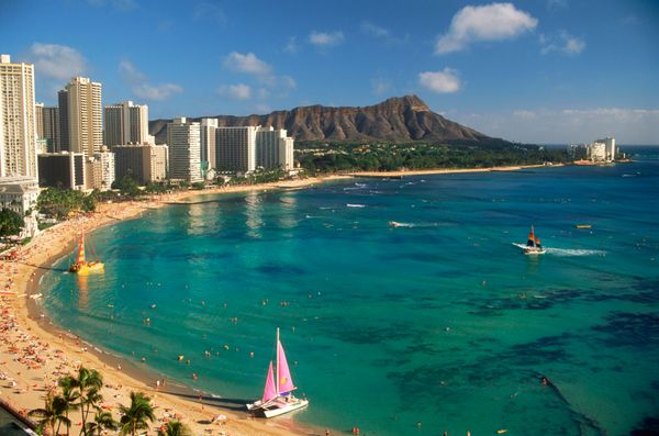
81 – 69 Honolulu, Oahu
82 – 69 Molokai
83 – 71 Kahului AP, Maui
82 – 72 Kona Int’l AP
83 – 66 Hilo AP, Hawaii
Here are the latest 24-hour precipitation totals (inches) for each of the islands as of Thursday evening:
0.15 N Wailua Ditch, Kauai
0.45 Waimanalo, Oahu
0.21 Molokai
0.04 Lanai
0.01 Kahoolawe
0.84 Kahakuloa, Maui
0.05 Waiakea, Big Island
The following numbers represent the strongest wind gusts (mph) as of Thursday evening:
27 Port Allen, Kauai
27 Kuaokala, Oahu
23 Molokai
24 Lanai
23 Kahoolawe
25 Maalaea Bay, Maui
24 Puu Mali, Big Island
Hawaii’s Mountains – Here’s a link to the live webcam on the summit of our tallest mountain Mauna Kea (nearly 13,800 feet high) on the Big Island of Hawaii. This webcam is available during the daylight hours here in the islands, and at night whenever there’s a big moon shining down. Also, at night you will be able to see the stars — and the sunrise and sunset too — depending upon weather conditions.
Aloha Paragraphs

The next cold front is approaching Hawaii…from the northwest

A weakening cold front has stalled over the eastern islands

Clear to partly cloudy skies…although cloudy areas too

A few showers locally – Looping radar image
Special Weather Statement…Strong trade winds returning this weekend…into next week
~~~ Hawaii Weather Narrative ~~~
A weakening cold front…will bring a few showers over the windward sides of Maui and the Big Island. High pressure will build just north of the islands, bringing a brief return of generally light trade winds. Winds will shift to the southeast Friday, as the next cold front approaches from the northwest. We may see a bit of volcanic haze (vog) moving over the smaller islands locally, as these light southeasterly winds arrive. As this front gets closer to the state Friday, sea breezes will likely develop across many areas in the afternoon Friday. Generally dry and stable conditions will continue however, with afternoon cloud buildups over interior sections…although only a few light showers are expected.
This high pressure cell will continue eastward…as this stronger cold front pushes into the Central Pacific from the west. This next front will arrive over Kauai Saturday afternoon, Oahu and Maui County Saturday night, and on to the Big Island Sunday. The frontal boundary will bring a band of showers as it pushes through the state. Strong high pressure will build quickly behind the front, with strong, gusty and cool north to northeast winds expected in the front’s wake. The winds will gradually turn more easterly thereafter, and remain gusty. Showers will favor windward and mountain areas…although some will reach leeward sections on the smaller islands.
Looking further ahead, winds will gradually veer toward the east early next week…and remain quite strong and gusty. Scattered showers will favor windward and mountain areas, although as in many cases with gusty trades blowing, some will spill over into leeward areas. Model consensus shows a rather dry airmass in place during that extended period, so most of the showers should remain light. Heading into the middle of next week, little change is indicated, with a breezy and rather dry trade wind pattern prevailing. It’s hard to believe, although I don’t see the next cold front beyond that, so we might actually have a break from the numerous cold fronts of late!
Here’s a wind profile of the Pacific Ocean – Closer view of the islands / Here’s the vog forecast animation / Here’s the latest weather map
Marine environment details: Northeast trade winds will strengthen today as a high pressure system moves eastward to the north of the area. The trades are expected to become locally strong this afternoon through Friday morning. A Small Craft Advisory (SCA) has been issued for the windy zones around the Big Island and Maui through early Friday morning. The SCA may be need to be extended to waters south of the Big Island tonight.
Starting tonight, winds will shift out of the southeast and weaken, as a surface ridge moves over the area ahead of a front approaching from the northwest. The front will reach Kauai by Saturday afternoon and move down past the Big Island by Sunday night.
A strong high will move east behind the front. Northwest winds behind the front will rapidly shift out of the north, then northeast, and strengthen. Widespread strong trade winds are likely, with gales possible for the Alenuihaha Channel early next week.
The current northwest swell continues to subside, but remains large enough that the High Surf Advisory has been extended through noon today for Kauai County. This swell will also keep seas above the advisory threshold west through north of Kauai County, so advisory has been extended for those waters.
The global models continue to show strong lows moving eastward to the north of the islands. A gale forecast to be about 1000 miles north of the islands Saturday will produce a large north-northwest swell reaching the islands Sunday. A High Surf Advisory will likely be needed for north and west facing shores when this swell arrives. As the trade winds strengthen next week surf may build to advisory levels along east facing shores.
World-wide tropical cyclone activity
![]()
>>> Atlantic Ocean: The 2017 hurricane season begins June 1st
Here’s a satellite image of the Atlantic Ocean
>>> Caribbean: The 2017 hurricane season begins June 1st
>>> Gulf of Mexico: The 2017 hurricane season begins June 1st
Here’s a satellite image of the Caribbean Sea…and the Gulf of Mexico
Here’s the link to the National Hurricane Center (NHC)
>>> Eastern Pacific: The 2017 hurricane season begins May 15th
Here’s the NOAA 2016 Hurricane Season Summary for the Eastern Pacific Basin
Here’s a wide satellite image that covers the entire area between Mexico, out through the central Pacific…to the International Dateline.
Here’s the link to the National Hurricane Center (NHC)
>>> Central Pacific: The 2017 hurricane season begins June 1st
Here’s the NOAA 2016 Hurricane Season Summary for the Central Pacific Basin
Here’s a link to the Central Pacific Hurricane Center (CPHC)
>>> Northwest Pacific Ocean: No active tropical cyclones
>>> North and South Indian Oceans / Arabian Sea: No active tropical cyclones
Here’s a link to the Joint Typhoon Warning Center (JTWC)
Interesting: El Niño resulted in unprecedented erosion of the Pacific coastline, according to research – Last winter’s El Niño might have felt weak to residents of Southern California, but it was in fact one of the most powerful climate events of the past 145 years.
If such severe El Niño events become more common in the future as some studies suggest they might, the California coast — home to more than 25 million people — may become increasingly vulnerable to coastal hazards. And that’s independent of projected sea level rise.
New research conducted by U.S. Geological Survey (USGS) scientists and their colleagues at UC Santa Barbara and six other institutions found that during the 2015-16 El Niño winter beach erosion on the Pacific coast was 76 percent above normal, and that most beaches in California eroded beyond historical extremes. The results appear in the journal Nature Communications.
“This study illustrates the value of broad regional collaboration using long-term data for understanding coastal ecosystem responses to changing climate,” said ecologist David Hubbard, an associate specialist at UCSB’s Marine Science Institute. “We really need this scale of data on coastal process to understand what’s going on with the ecology of the coast.”
The research team assessed seasonal beach behavior for 29 beaches along more than 1,200 miles of the Pacific coast. The investigators’ efforts included making 3-D surface maps and cross-shore profiles using aerial LiDAR (Light Detection and Ranging), GPS topographic surveys and direct measurements of sand quantities. They then combined that with wave and water level data from each beach between 1997 and 2016. Winter beach erosion — the removal and loss of sand from the beach — is a normal seasonal process, but during El Niño events the extent of erosion can be more severe.
“Wave conditions and coastal response were unprecedented for many locations during the winter of 2015-16,” said lead author Patrick Barnard, a geologist with the USGS. “The winter wave energy equaled or exceeded measured historical maximums along the West Coast, corresponding to extreme beach erosion across the region.”
The 2015-16 El Niño was one of the three strongest events ever recorded, along with the El Niño winters of 1982-83 and 1997-98. From a water resources perspective though, the most recent El Niño was largely considered a dud due to the unusually low rainfall, particularly in Southern California, which received 70 percent less rain than during the past two big El Niño events.
“However, the waves that attacked our coast, generated from storms across the North Pacific, were exceptional and among the largest ever recorded,” Barnard said. “Further, the lack of rainfall means the coastal rivers produced very little sand to fill in what was lost from the beaches, so recovery has been slow.” Rivers remain the primary source of sand for California beaches, despite long-term reductions in the 20th century due to extensive dam construction.
While most beaches in the survey eroded beyond historical extremes, some fared better than others. The condition of the beach before the winter of 2015 strongly influenced the severity of erosion and the ability of the beach to recover afterward through natural replenishment processes.
Unlike California, many Pacific Northwest beaches have gained sediment in the years leading up to the 2015-16 El Niño. That’s due — at least in part — to more production of sand from local watersheds, dune growth and a series of mild winter storm seasons. Mild wave activity in the Pacific Northwest and artificial augmentation of beaches (adding sand) in Southern California prior to the winter of 2015-16 prevented some areas from eroding beyond historical landward extremes.
“It looks like climate change will bring us more El Niño events, possibly twice as many, at twice the frequency as in the past,” Hubbard said. “So this is a taste of what’s coming.
“First we need to understand the challenges, and those include the rising sea level and the fact that most of the problems occur during these peak El Niño events,” he added. “Then we need to restore or manage our coasts in ways that will enable us to deal with these events and conserve beach ecosystems. I think that’s the challenge that we as a society have to address.”
“Infrequent and extreme events can be extremely damaging to coastal marine habitats and communities,” said David Garrison, a program director in the National Science Foundation’s (NSF) Division of Ocean Sciences, which funded the research. “While this paper stresses the effect of waves and sediment transport on beach structure, organisms living on and in the sediment will also be profoundly affected.”
Glenn Says:
Aloha. I’m so glad to hear that your mom is doing better! Scary as hell when something happens at her age. I know. I hope she continues to get better and back to her old self. Hopefully you will be back home before we get back to Maalaea in a few weeks. In the meantime, batten down the hatches. I see that you will be having a lot of weather coming in where you are. I know you will enjoy it! I’m the same way.
Aloha and mahalo for all you do with this site.
Glenn in South Jersey
~~~ Hi Glenn, good to hear from you there in NJ again, and thanks so much for your well wishes…my Mom and I appreciate it.
Indeed, southern California does have some dynamic weather, it hasn’t quite reached Long Beach, although it looks like it will start pouring at any moment.
I don’t know whether I’ll be back in Hawaii by the time your vacation starts, although here’s wishing you another great time in paradise!
Aloha, Glenn
woody adamz Says:
Hi Bro..,Read “Comments”…The news of her having a Personal Assistant a couple times a week is Grrrrrr8..as,is the therapist work..Many DON’T comprehend just How Much these things can mean…..especially to someone who is in their nineties.I worked at a Convalescent Home in my 20s and,was appreciated MAINLY because the patients liked me so much as I’ld”Take the Time”,something most nurses”shine”like in”Shine On”;something I found to be quite congruous.! These”pros”can be the difference in whether or not one”pulls thru”and,it’s also more needed by YOU than you consciously comprehend,(even tho Knowing It) UNTILL, they’ve had their session and,you see the diff with Mom, while having the Mindspace to just OBSERVE and,Gain some Chops rather than interacting… I’m sure you have figured that out by now..Please give her a”hug from Woody”..,I felt a bit”guilty”for nor sending a note yesterday but,had my Yearly Followup to Yearly tests with my V.A.doctor who is a real pleasure because of a basic affinity as Caretakers of LIFE in our own idiom..Enjoy&APPRECIATE the assistance you’ve been smart enuff to employ…their input is immeasurable and,will be able to accomplish much AND..THEY MAKE HER HAPPY.????…..Which, is The Most Important factor ..Do find some music (Hawaiin,Classical,Neo classical)that she likes and,if she likes Rap…sheeeet,give her rap(Highly Doubtful..! ????.)Classical pieces actually Improve our I Q.and Stimulate the bodies healing systems..Even in Animals…which IS what these”forms we inhabit)have in common…i.e.We ALL appreciate and respond to Good Energy which Classical pieces hold an abundance of.. The Music Can Be The Most Important of all modalities being employed….A Large hug to you both …You’re both”Troopers”in Life and,what an example of Strength of Character is Mom…She has moved my heart daily as I FEEL….like”Chicken Skin” feel it when sending energy…enjoy your time and,make sure YOU find things of Personal Interest to engage in while there…Not only with”Friends”UNLESS they have coinciding interests…Example:MUSIC VENUES or..,Driving up past San Bernardino/Redlands to the road up to Big Bear..Is there someone who you trust who can stay with Mom while you”take a day off”,drive up to the (even lower part)of the mountains on a weekday so you can Hike a bit,Relax a lot and,absorb NATURE for your Own well being…just my experience but,NATURE and,It’s STILLNESS & quietude are INCOMPARABLY Beneficial…A friend with a Sailboat(No Motor Sounding Off)would be SUPER…..IF..,It’s”your thing”. Hope these words offer some options for GLEN….We all need Glen Up to Par as,he has that Super Neat Weather Site So Many use to plan their day,trip,work etc…Aloha Nui Bruddha….P.S….Havva BUDDHAFULL DAY
~~~ Hi again Woody, as usual, I appreciate your lengthy comments, covering all kinds of issues in relation to my Mom and I.
Thank you…
Aloha, Glenn
Helen Says:
Sending thoughts and prayers to you and your mom.
~~~ Hi Helen, we appreciate your thoughtful concern…thank you!
Aloha, Glenn
Bill Johns Says:
Aloha Glenn:
Funny “techie” question for you as I was unable to get an answer with a google search earlier today. This morning the channel between Maui and Khaoolave was totally socked in with rain so I was wondering how big of an area was affected…The Molokai radar showed nothing…Then I went to the radar status message and the following was shown; “SPOT BLANKING HAS BEEN DISABLED ON THE MOLOKAI NEXRAD”….As you know the south point radar is down and Molokai has been intermitent at best over the this past winter. My memory tells me that the whole state has relatively new hardware. Why can’t the tech’s get them to be more reliable?
I don’t mean to whine, but, let’s get the system operational.
Take it easy on your Mom as she is tough enough without you getting too carried away with her rehab.
~~~ Hi Bill, good question, although like you…I don’t have an answer about those intermittent radar systems.
As for my Mom, I think her rehab is actually what is stimulating her to get better. She loves having this nice lady come twice a week to help her take a shower. It really helps her to feel better it seems. As for the 26 year old physical therapist, who is a doctor, well…she is fun, helpful, and pushes my Mom just enough. My Mom likes these two ladies very much, and it takes a little of the pressure off of me too.
Aloha, Glenn
Mary Says:
Glenn
How is your Mom’s health? I hope she continues to improve and gain strength.
Mary (Kihei)
~~~ Hi Mary, thanks for asking, she is still rather weak, although does some walking each day. I have a physical therapist, and a lady who gives her a shower…who both come twice a week.
I have no plans on returning to Maui at this time, as it will be a while before my Mom is back in the saddle again.
I’m pleased that she has moved past the pneumonia, and she is eating well, as well as getting good sleep. Nonetheless, she is not able to take complete care of herself. I’m still hoping …
Aloha, Glenn