


Air Temperatures – The following high temperatures (F) were recorded across the state of Hawaii Thursday…along with the low temperatures Thursday:
76 – 62 Lihue, Kauai
78 – 64 Honolulu, Oahu
80 – 59 Kahului AP, Maui
81 – 68 Kailua Kona AP
79 – 61 Hilo AP, Hawaii
Here are the latest 24-hour precipitation totals (in inches) for each of the islands as of Thursday evening:
1.01 Kilohana, Kauai
0.80 Poamoho RG 1, Oahu
0.03 Molokai
0.00 Lanai
0.00 Kahoolawe
0.00 Maui
0.11 Honokaa, Big Island
The following numbers represent the strongest wind gusts (mph) as of Thursday evening:
16 Poipu, Kauai
21 Kuaokala, Oahu
14 Molokai
20 Lanai
22 Kahoolawe
23 Maalaea Bay, Maui
24 Kona Intl AP, Big Island
Here’s a wind profile of the Pacific Ocean – Closer view of the islands
Hawaii’s Mountains – Here’s a link to the live webcam on the summit of our tallest mountain Mauna Kea (nearly 13,800 feet high) on the Big Island of Hawaii. This webcam is available during the daylight hours here in the islands, and at night whenever there’s a big moon shining down. Also, at night you will be able to see the stars — and the sunrise and sunset too — depending upon weather conditions.
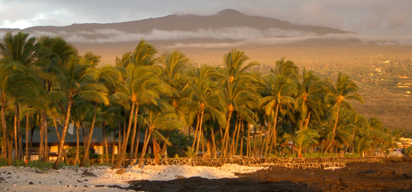
Aloha Paragraphs

A low pressure system remains active well northeast of the islands…with its associated cold front draping southwest

Mostly clear to partly cloudy ahead of weak cold front…which is slowly pushing further into the state tonight

The indistinct cold front moving towards the Big Island

Just a few showers along a weak cold front near Maui County – Looping radar image
Wind Advisory…summits of the Big Island – 40 to 55, gusts to 65 mph
High Surf Advisory…east shores of Kauai, Oahu, Molokai, Maui and the Big Island
~~~ Hawaii Weather Narrative ~~~
The winds will remain cool from the north…in the wake of the current cold front. Here’s the latest weather map, showing a low pressure center to the northeast of Hawaii, with its trailing cold front pushing slowly through the islands. Our winds will be light…as this weak cold front moves down through the state. Cooler north to northeasterly winds will follow in the wake of the cold front into Saturday and Sunday. As we get into the first part of next week, our winds will become lighter from the southeast ahead of the next weak cold front. This in turn could bring some volcanic haze (vog) from the Big Island vents, up along the smaller islands.
Relatively cool and mainly dry weather ahead of a cold front…with just a few showers along the frontal boundary. This cold front will bring very minor windward showers our way. The front has reached Maui County, and may be able to crawl down over the northern half of Big Island later tonight into Friday. We’ll see a very modest increase in showers particularly for the windward areas. Drier and cooler weather will arrive in the wake of this cold front through the weekend into early next week. The next cold front, approaching the Hawaiian Islands around the middle of next week…will likely stall just short of reaching the state.
Marine environment details: The latest surface analysis showed a gale-force low centered around 1000 nautical miles northeast of Oahu, and a very strong high pressure (1048 millibars) centered over the eastern portion of the Bering Sea. The latest model guidance shows this gale remaining nearly stationary over the next 24 to 48 hours…before filling and shifting eastward over the weekend. Although the bulk of the swell energy associated with this source will likely miss the islands to the northwest, moderate north-northeasterly swell energy will continue to generate surf locally along north and northeast facing shores through the weekend before lowering.
Despite some model differences, all support a broad 975-990 millibar low developing across the Gulf of Alaska over the weekend and into early next week, with strong to gale force north-northeast winds favorable for the islands. The GFS model is the more bullish, suggesting wind speeds climbing into the 40 to 45 knot range over a large area. A reinforcement out of the north-northeast associated with this distant source will become a possibility Tuesday through the mid-week period. The magnitude of the swell here in the islands will be the main question due to these model differences mentioned.
Small southerly pulses will continue to generate small surf along the southern shores of the islands through Friday, then again next week due to recent and current activity over the southern Pacific.
Local winds are forecast to shift to a northerly direction as a ridge of high pressure noses southeast across the islands in the wake of an secondary frontal boundary over the next couple of days into the weekend. Although wind speeds will remain in the light to moderate range over the open waters, fresh to even strong breezes will become a possibility between and around islands beginning tonight. Light and variable winds will likely return early next week and remain in place as a ridge axis sets up over the islands from east to west…and a cold front passes by to the north.
For the long range, west to northwest swells will become a possibility next week through the mid-to-late week period, as two compact systems are forecast to develop east of Japan and near the International Date Line.
A few minor windward showers over Maui County and the Big Island
World-wide tropical cyclone activity…with storms showing up when active
![]()
>>> Atlantic Ocean: The 2016 hurricane season has ended
Here’s a satellite image of the Atlantic Ocean
>>> Caribbean: The 2016 hurricane season has ended
>>> Gulf of Mexico: The 2016 hurricane season has ended
Here’s a satellite image of the Caribbean Sea…and the Gulf of Mexico
Here’s the link to the National Hurricane Center (NHC)
>>> Eastern Pacific: The 2016 hurricane season has ended
Here’s the NOAA 2016 Hurricane Season Summary for the Eastern Pacific Basin
Here’s a wide satellite image that covers the entire area between Mexico, out through the central Pacific…to the International Dateline.
Here’s the link to the National Hurricane Center (NHC)
>>> Central Pacific: The 2016 hurricane season has ended
Here’s the NOAA 2016 Hurricane Season Summary for the Central Pacific Basin
Here’s a link to the Central Pacific Hurricane Center (CPHC)
>>> South Pacific Ocean: No active tropical cyclones
>>> North and South Indian Oceans / Arabian Sea: No active tropical cyclones
Here’s a link to the Joint Typhoon Warning Center (JTWC)
Interesting China Announces End to Ivory Trade in 2017 – In an announcement that could prove to be extremely good news for elephants in the wild, the Chinese government has promised to end its domestic ivory market by the end of this year.
Every year, thousands of elephants are killed for their tusks by poachers. Between 2011 and 2014, more than 100,000 elephants were slaughtered. The African elephant population dropped 30 percent from 2007 to 2014. More elephants are being killed than are being born.
A 1989 international ban on the ivory trade has done little to stop the poaching. Why not? Because it doesn’t apply to ivory taken from elephants before the ban was implemented. Poachers can easily lie by saying that the ivory is not new.
While other countries, including the United States and Hong Kong, have already taken stronger measures to end the ivory trade, China has been a holdout until now.
China’s announcement is especially significant because it is the largest market for ivory in the world. At least 50 to 70 percent of smuggled ivory ends up there, the New York Times reports.
“Almost all the ivory is for carving,” John Robinson, with the Wildlife Conservation Society, told NPR. “China has had a history of doing so. Whole tusks are carved into elaborately assembled pieces of one kind or another.”
In its Dec. 30 announcement, China’s Office of the State Council said the shutdown, “to combat illegal trade in ivory,” will occur in stages. It will start by phasing out legal ivory processing factories and sellers before March 31. The legal commercial ivory trade is to end completely by December 31.
Although China did officially ban the import of ivory last March, since the country still has a legal domestic market for it, ivory continues to be smuggled into the country, mainly by criminal syndicates.
‘Game Changer for Elephant Conservation’
Many wildlife conservation groups are encouraged by China’s announcement. It’s “a potential game changer for elephant conservation,” stated Carter Roberts, president and CEO of the World Wildlife Fund. He said the ivory trade is now facing its “twilight years” and the U.S. and China bans “will reverberate around the world.”
Elly Pepper, with the NRDC (Natural Resources Defense Council), is also optimistic. She told the New York Times that China’s announcement “may be the biggest sign of hope for elephants since the current poaching crisis began.”
Save the Elephants founder Iain Douglas-Hamilton agreed, telling the Times that China “is moving from being the main problem to the main solution.” He called the announcement “the most astonishing and wonderful piece of news.”
For many years, these and other wildlife advocates have been urging China to end its ivory trade. More than 177,000 Care2 members have signed three petitions calling for a ban.
An end to China’s ivory trade was finally set in motion in September 2015, when President Xi Jinping and President Obama agreed that both of their countries would combat wildlife trafficking by taking “significant and timely steps to halt the domestic commercial trade of ivory.” The U.S., which was the second-largest market for ivory in the world, imposed a near-total ban on the import and export of these products last year.
Let’s hope China lives up to its promising announcement, and that a prediction by the NRDC’s Pepper comes true. She said China’s ending of its ivory trade could be “the pivotal turning point that brings elephants back from the brink of extinction.”
Laura Says:
Good morning Glenn from dreary Calgary!
Just a quick question about Maui winter weather. We have been coming every year somewhere between March and May for about the last 10 years. We held off booking anything this year because we found last May to be fairly cloudy and somewhat rainier than other years. We are holding off on our trip and if we book at all it will be last minute. With our CDN dollar being what it is, that exchange rate can make it VERY costly so we want sun, sun, sun! There seems to have been a fair bit of rain this winter on Maui so long story short, are you experiencing la nina and if so, do you expect it to last until May? I know you must tire of these questions as obviously no one knows for sure, just wondering if you have a best guess?
Thanks!
~~~ Hi Laura, from dreary Calgary, Canada.
As for your long story short version, yes, we are in the La Nina phase of the ENSO Cycle. This is expected to continue through February. Although, La Nina is expected to give way to the Neutral phase going forward.
So, if we indeed do transition into the Neutral phase, I would expect it continue into May.
I’m not exactly sure, although I think what you are asking about is…when you would have lots of sunshine for a vacation here on Maui.
My best guess would be later May into June, which usually turns out to be our driest time of the year. Again, this is a guess, and what used to be normal isn’t always holding up in this day and age.
I do wish you well on getting through a cold winter in Canada, and being able to escape to the tropics for a big warm up…with lots of sunny and dry weather!
Aloha, Glenn
woody adamz Says:
Hi Glen…..Happy to see the Ivory article; thankful that someone is paying attention. I’ve signed more than three
Petitions and, most thru WWF ….also, WHO did the Honu pic on yesterday and today’s page..? Very Good art..! Hope you are warm…talk about”cold feet”…I gettin….LITERALLY SO, I stay in the pickup with the heater on the floorboards and FINALLY starting to thaw..⛄ ……….!!!! ☺
~~~ Hi Woody, me too, the Ivory trade is horrible!
The art work of the Honu (Green Sea Turtle) has the signature on the picture.
As for the cold, this is the heart of winter here in the islands! Here in upper Kula, my low was 42.
Stay warm down there any way you can Woody!
Aloha, Glenn