


Air Temperatures – The following maximum temperatures (F) were recorded across the state of Hawaii Sunday along with the low temperatures Sunday:
79 – 67 Lihue, Kauai
77 – 67 Honolulu, Oahu
79 – 70 Molokai AP
80 – 74 Kahului AP, Maui
80 – 73 Kailua Kona
80 – 65 Hilo AP, Hawaii
Here are the latest 24-hour precipitation totals (in inches) for each of the islands as of Sunday evening:
1.49 Hanapepe, Kauai
0.96 Hawaii Kai, Oahu
0.10 Molokai
0.11 Lanai
0.16 Kahoolawe
0.20 Kula 1, Maui
0.80 Pahoa, Big Island
The following numbers represent the strongest wind gusts (mph) as of Sunday evening:
17 Moloaa Dairy, Kauai
18 Kii, Oahu
07 Molokai
10 Lanai
06 Kahoolawe
14 Kaupo Gap, Maui
12 Ahumoa, Big Island
Hawaii’s Mountains – Here’s a link to the live webcam on the summit of our tallest mountain Mauna Kea (nearly 13,800 feet high) on the Big Island of Hawaii. This webcam is available during the daylight hours here in the islands, and at night whenever there’s a big moon shining down. Also, at night you will be able to see the stars — and the sunrise and sunset too — depending upon weather conditions.
Aloha Paragraphs

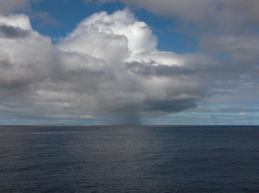
Unsettled weather conditions prevail over and around the islands

A trough of low pressure north is moving away to the north, while a second trough remains active just west of Hawaii…keeping a deep plume of moisture over the state

Mostly cloudy…much of which is of the high and middle level variety…although considerable rain bearing clouds too

Showers will be active over the state except Kauai…fewer showers in general later Monday and Tuesday – Looping radar image
Small Craft Advisory…coasts and channels around Kauai
Flash Flood Watch…Maui County and the Big Island
Flood Advisory…the Big Island
~~~ Hawaii Weather Narrative ~~~
Our winds will remain generally quite light…ranging between southwest and southeast. Here’s the latest weather map, showing our primary high pressure system far northeast of Hawaii, along with a strong near 1037 millibar high pressure cell far north. We still have Small Craft Advisories posted over the coastal and channel waters around Kauai and Oahu. The winds remain on the light side, which will continue into the new week. Thus, winds won’t be an issue in most cases, except where stronger gusts develop in association with random thunderstorms. There will be volcanic haze locally, being carried over the smaller islands on the southeasterly breezes…coming up from the Big Island vents.
Here’s a wind profile of the offshore waters around the islands – and a closer look
Waves of unsettled weather will continue across the islands into Monday. Showers will be hit and miss for the most part, along with heavy rains and thunderstorms here and there at times…thanks to a couple of low pressure troughs lingering near the state. We’ll find abundant moisture being drawn up from the deeper tropics, along with the potential for rains and flooding at times. There will be periodic breaks in this wet weather, although inclement conditions are expected through much of the new week, with increased rain chances at times.
Weather models show another upper level trough of low pressure developing west of the islands…during the middle part of this new week. These models show deep southerly and southeasterly winds drawing tropical moisture back into the area Wednesday through Friday, after a possible short break later Monday into Tuesday. There are no definite signs of a return to more placid weather conditions from this vantage point. As a matter of fact, some of the models are now suggesting yet another trough of low pressure snuggling up to the islands later next weekend.
Marine environment details: The Hilo nearshore buoy has been trending lower, model data indicate that this trend should continue. The Small Craft Advisory has been dropped for the windward waters of the Big Island and Maui County but will be kept up for Oahu and Kauai through the night. The High Surf Advisory for the east facing shores of the Big Island has also been discontinued.
No large swells are expected so surf is expected to remain below High Surf Advisory levels over the coming week.
~~~ Sunday Evening Film, Rust and Bone, starring Marion Cotillard and Matthias Schoenaerts. A struggling single father helps a beautiful whale trainer recover her will to live following a terrible accident that leaves her confined to a wheelchair. Lonely and destitute, Ali (Matthias Schoenaerts) leaves the north of France for his sister’s house in Antibes after becoming the sole guardian of his estranged five-year-old son Sam. When Ali lands a job as a bouncer in a nearby nightclub, things quickly start to look up for the itinerant father and son. Then one night, after breaking up a fight in the club, Ali meets the radiant Stephanie (Marion Cotillard), and slips her his number after dropping her off safely at home. Though Stephanie’s position on the high end of the social spectrum makes romance an unlikely prospect for the pair, a tragic accident at Marineland robs her of her legs, and finds her reaching out in desperation to Ali. Her spirit broken by the same tragedy that took her legs, Stephanie gradually finds the courage to go on living trough transcendent moments spent with Ali — a man with precious little pity, but an enormous love of life. / Marion Cotillard continues to be my favorite actress, and this film was full of her triumphs…along with a very large dose of suffering. Her love interest in this film played an incredible roll as well. They were stunning in this performance, coming away with an A- grade in my opinion, as was my friend Jeff’s take on the film.
Off and on wet weather…improvement Monday-Tuesday
World-wide tropical cyclone activity…with storms showing up when active
![]()
>>> Atlantic Ocean: The 2016 hurricane season has ended
Here’s a satellite image of the Atlantic Ocean
>>> Caribbean: The 2016 hurricane season has ended
>>> Gulf of Mexico: The 2016 hurricane season has ended
Here’s a satellite image of the Caribbean Sea…and the Gulf of Mexico
Here’s the link to the National Hurricane Center (NHC)
>>> Eastern Pacific: The 2016 hurricane season has ended
Here’s a wide satellite image that covers the entire area between Mexico, out through the central Pacific…to the International Dateline.
Here’s the link to the National Hurricane Center (NHC)
>>> Central Pacific: The 2016 hurricane season has ended
Here’s a link to the Central Pacific Hurricane Center (CPHC)
>>> South Pacific Ocean: No active tropical cyclones
>>> North and South Indian Oceans / Arabian Sea: No active tropical cyclones
Here’s a link to the Joint Typhoon Warning Center (JTWC)
Interesting: Four of the world’s largest cities have announced that they will ban diesel cars by 2025 in an effort to cut air pollution. – Leaders from Paris, Madrid, Athens, and Mexico City made the declaration at the C40 Mayors Summit, a biennial meeting of civic leaders concerned about climate change.
Toxic air is responsible for an estimated 3 million premature deaths each year, according to recent research by the World Health Organization.
While diesel engines burn fuel more efficiently and therefore release less carbon dioxide, they do produce nitrogen dioxide and particulates that can inflame and damage people’s lungs.
“Mayors have already stood up to say that climate change is one of the greatest challenges we face,” said Anne Hidalgo, the mayor of Paris.
“Today, we also stand up to say we no longer tolerate air pollution and the health problems and deaths it causes.”
Gman KH7ZS Says:
Hi Glen, Just wanted to know what your opinion is on this La Nina event we’ve been experiencing. Do you think it will last thru next summer? Thanks, GF.
~~~ Hi Gman, we are currently in a weak La Nino phase of the ENSO cycle. This is expected to last through February 2017…then shifting to a neutral state during the spring months.
Don’t as of yet know whether the neutral state would continue into summer, or be replaced by more La Nina or even a weak El Nino…too early to know.
Good question,
Aloha, Glenn
Maurine Says:
Hi Glenn,
I’ve been reading your wonderful blog for awhile now, and particularly appreciate the vog report, complete with its looping imagery. What happened to it? (Did you leave it in California so they can use it for their smog reports?)
Thanks, Maurine
~~~ Hi Maurine, good to hear from you, and for now knowing that you are a happy reader!
As for the vog graphic, no, it’s not working properly, so I took the link off this page. If it begins to work again, I will reinstate it.
Sorry, I liked it too!
Aloha, Glenn
Jay Says:
I loved “la vie en rose” when it came out a few years ago…is it playing in a local theater? We seem to be having one of those used-to-be typical early December bouts of soggy weather…
~~~ Hi Jay, it was so good! Not in the theaters, I watched it with my friend Jeff, over on his big screen.
Indeed, I remember years in the past, like this year, when December’s used to act like December…rather than some mild mannered October or April!
Thanks for your comment.
Aloha, Glenn
Michael Says:
Glenn,
Hope you’re doing well…
Just curious if there’s any indication of how the week of the 12th may shape out or still too early to tell? I reached out a number of days ago. Planning on going to Wailea for a 1week stay with family and really hoping for some sun. My last day to cancel is tomorrow (Monday) and I can’t get a good sense of what the weather has in store. Still a wild guess or is there a bit more clarity on your end?
~~~ Hi Michael, I understand your concern of course, as what’s a vacation without nice dry, warm and sunny weather!
Unfortunately I still don’t know what will be happening during the week starting on the 12th.
I wish I could be more helpful, although anything I could provide you would be a total guess…which doesn’t help.
Best of luck!
Aloha, Glenn