


Air Temperatures – The following maximum temperatures (F) were recorded across the state of Hawaii Wednesday:
82 Lihue, Kauai
88 Honolulu, Oahu
84 Molokai
87 Kahului, Maui
86 Kailua Kona
78 Hilo, Hawaii
Air Temperatures ranged between these warmest and coolest spots near sea level – and on the highest mountain tops on Maui and the Big Island…as of 810pm Wednesday evening (HST):
Kailua Kona – 80
Hilo, Hawaii – 73
Haleakala Summit – 48 (near 10,000 feet on Maui)
Mauna Kea Summit – 32 (13,000+ feet on the Big Island)
Hawaii’s Mountains – Here’s a link to the live web cam on the summit of near 13,800 foot Mauna Kea on the Big Island of Hawaii. This web cam is available during the daylight hours here in the islands…and when there’s a big moon shining down during the night at times. Plus, during the nights you will be able to see stars, and the sunrise and sunset too… depending upon weather conditions.
Aloha Paragraphs
Trade winds remaining active through the rest of this work
week…then a bit lighter this weekend for a couple of days
There will be some passing showers along the windward sides,
mostly at night…a few elsewhere around the state
This looping satellite image shows quite a few lower level
clouds, and high clouds in our general area today
Small Craft Wind Advisory…windiest coasts and channels
around Maui County and the Big Island
The following numbers represent the strongest wind gusts (mph), along with directions…as of Wednesday evening
17 Port Allen, Kauai – NE
31 Oahu Forest NWR, Oahu – NNE
27 Molokai – NE
33 Lanai – NE
31 Kahoolawe – NE
23 Kahului, Maui – NE
29 Upolu airport, Big Island – NNE
Here are the latest 24-hour precipitation totals (inches) for each of the islands…as of Wednesday evening (845pm totals):
2.26 Kilohana, Kauai
0.84 Manoa Lyon Arboretum, Oahu
0.05 Molokai
0.00 Lanai
0.00 Kahoolawe
0.28 Puu Kukui, Maui
1.12 Kawainui Stream, Big Island
We can use the following links to see what’s going on in our area of the north central Pacific Ocean. Here’s the latest NOAA satellite picture – the latest looping satellite image… and finally the latest looping radar image for the Hawaiian Islands.
~~~ Hawaii Weather Narrative ~~~
The trade winds will remain active…decreasing a bit this weekend into early next week. Here’s the latest weather map, showing the Hawaiian Islands, and the rest of the North Pacific Ocean, along with a real-time wind profile of the central Pacific…focused on the Hawaiian Islands. We have moderately strong, near 1031 millibar high pressure system located far to the northeast of the state, with another high pressure cell to the northwest, with a connecting ridge between their centers. The models suggest that the trade winds will remain active, with no definite end in sight through the next week at least.
Satellite imagery shows high cirrus clouds over many parts of the state…which will be around again on Thursday. Looking at this larger looping satellite image, it shows low level clouds riding along in the trade wind flow from east to west, under these high clouds. The high clouds over Hawaii will dim and filter our Hawaiian sunshine at times through Thursday at least. Here’s the looping radar, showing a few passing showers, that will likely increase again some tonight into Thursday morning…along our windward sides. Daytime heating of the islands typically limit these showers…which I expect to happen again Thursday.
Favorably inclined weather conditions, with little change through the weekend. As is often the case, most showers that grace our shores and slopes will occur during the night and early morning hours. There are those typical patches of showery clouds upstream, which will bring moisture our way periodically through the week. The trade winds will be strong enough to carry a few passing showers over to the leeward sides at times too. There’s a chance that our trade winds may ease up a little this weekend into early next week…with an increase in showers late Sunday or by next Monday. These showers will be part of now retired tropical cyclone Fausto, and may keep those tropical showers active into early Tuesday. There’s a chance they could skip us altogether though, and I’ll keep you abreast of its possible arrival as we go forward. It may be asking quite a lot for this area of moisture to remain intact over the next 4-5 days. I’ll be back again early Thursday morning with your next new weather narrative from paradise, I hope you have a great Wednesday night wherever you’re spending it! Aloha for now…Glenn.
Here on Maui, at the 3,100 foot elevation, at my upper Kula, Maui weather tower, the air temperature was a 57.2 degrees at 555am on this Wednesday morning. Skies are partly cloudy, consisting of high cirrus clouds for the most part. These cirrus lit up so beautifully this morning, just amazing!
We’re into the early afternoon now at 1255pm, under partly cloudy skies, much of which is of the high cirrus variety, light breezes…and an air temperature of 81 degrees. Again today, it’s such a classic example of a very typical summer day…here in the tropics.
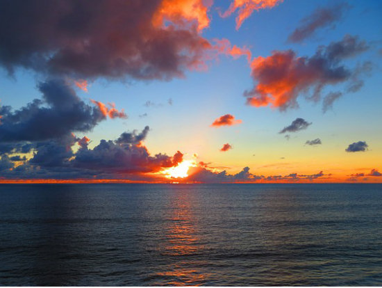
It’s now early evening at 615pm, under partly sunny skies, with near calm winds…and an air temperature of 74.8 degrees. As has been the case all day, our high cirrus clouds have done nothing but get more and more dense. Thus, I expect there to be some good color at sunset, and likely for Thursday’s sunrise too. If you’ve been following along with now retired Fausto, you’ve noticed that it has fallen off the screen now. As I was discussing above, there’s still the chance it will bring some rain our way later this weekend into early next week…stay tuned.
World-wide tropical cyclone activity:
Atlantic Ocean: There are no active tropical cyclones expected through the next 2 days
Here’s a satellite image of the Atlantic Ocean
Caribbean Sea: There are no active tropical cyclones expected through the next 2 days
Gulf of Mexico: There are no active tropical cyclones expected through the next 2 days
Here’s a satellite image of the Caribbean Sea…and the Gulf of Mexico.
Here’s the link to the National Hurricane Center (NHC)
North Eastern Pacific: There are no active tropical cyclones
~~~ However, cloudiness and showers associated with a broad area of low pressure located several hundred miles southwest of the southern tip of the Baja California Peninsula have increased this morning. However, the system is moving over colder water and into an area of stronger upper-level winds. There is still a chance for some development today before conditions become unfavorable for tropical cyclone formation tonight and Friday.
Here’s what the computer models are showing for this area being referred to as Invest 98E.
* Formation chance through 48 hours…low…20 percent
* Formation chance through 5 days…low…20 percent
Here’s a wide satellite image that covers the entire area between Mexico, out through the central Pacific…to the International Dateline.
Central Pacific Ocean: No tropical cyclones are expected through the next two days
Here’s a link to the Central Pacific Hurricane Center (CPHC)
Northwest Pacific Ocean: Tropical storm 08W (Neoguri) is quickly dissipating…as it moves across southern Japan. Here’s the JTWC graphical track map…along with a satellite image – Final Warning
Tropical storm 09W is now active, and will be gradually increasing in strength. Here’s the JTWC graphical track map…along with a satellite image
South Pacific Ocean: There are no active tropical cyclones
North and South Indian Oceans: There are no active tropical cyclones
Here’s a link to the Joint Typhoon Warning Center (JTWC)
Interesting: Oceanic litter is widespread – Litter is now found in even the most remote areas of the oceans, say scientists trying to understand how much rubbish is lying at the bottom of Europe’s seas. The new study, published in Plos One, shows for the first time that there seems to be no area of the ocean left untouched by human litter. Using 588 video clips collected by unmanned submarine vehicles for geological mapping and marine biology studies, the team found that plastics waste like shopping bags is the most prevalent.
‘We didn’t focus on specific footage, it came from lots of different studies but we viewed it all. And the biggest surprise was that we found litter everywhere — everywhere we had footage from had been polluted,’ says Christopher Pham, a PhD student at the University of Azores in Portugal and lead researcher on the project.
‘The majority of what we found was plastic, specifically softer plastics like carrier bags, although we did find other things like pieces of buckets,’ he continues. ‘We found batteries, part of a plane, pieces of oil drum, shoes, chairs, plastic bottles, clothes, but mostly plastic.’
Research into the extent of marine litter has been done before, but this is the largest single survey to date. The study included 32 sites, which took in some of the deepest and most remote locations around Europe, including the Charlie-Gibbs Fracture Zone between the Azores and Iceland.
At almost three miles deep, this fracture is one of the deepest cracks in the Atlantic Ocean, and one of the most remote. At the bottom of it the team were surprised to find rubbish had even collected there.
‘The highest levels of litter were in the submarine canyons, while on the seamounts and around coasts there was less rubbish overall, but what we found was mostly fishing gear,’ explains Pham.
The researchers are concerned that short-use items like plastic bags, which are only used for an hour or two at the most, are the biggest culprit in polluting our oceans. If the problem isn’t addressed soon, it could cause huge damage.
‘It’s really about mitigation at this point – clean-up operations are great but governments need to work on preventing the litter getting any worse. The litter is there but the oceans are not completely destroyed yet, but if we continue to pollute them it will send the community into critical levels,’ Pham says.
Many studies have already shown the effect tiny plastic particles known as micro-plastcs have had on sea life, as fish and birds eat them and eventually starve as their stomachs are full of litter.
Pham suggests that this could eventually affect human health, as the seafood we eat may have had a diet of plastic.
‘We have to work with children and show them how much plastic has an effect on marine animals; it’s not just aesthetic, it’s also a problem for health of animals and most importantly the overall functioning of marine ecosystems,’ he explains.
‘We have to work on our day-to-day usage of plastics. It’s a citizen responsibility but at the higher level they need to be stricter too, we should be more rigid,’ concludes Pham. ‘It’s common sense to minimize pollution – to do things like make sure landfills are buried so waste doesn’t blow off in the wind into the sea. It’s mostly a matter of people being responsible.’