


Air Temperatures – The following maximum temperatures (F) were recorded across the state of Hawaii Saturday:
84 Lihue, Kauai
89 Honolulu, Oahu
84 Molokai
89 Kahului, Maui
87 Kailua Kona
82 Hilo, Hawaii
Air Temperatures ranged between these warmest and coolest spots near sea level – and on the highest mountain tops on Maui and the Big Island…as of 943pm Saturday evening (HST):
Kailua Kona – 80
Hilo, Hawaii – 72
Haleakala Summit – 46 (near 10,000 feet on Maui)
Mauna Kea Summit – 36 (13,000+ feet on the Big Island)
Hawaii’s Mountains – Here’s a link to the live web cam on the summit of near 13,800 foot Mauna Kea on the Big Island of Hawaii. This web cam is available during the daylight hours here in the islands…and when there’s a big moon shining down during the night at times. Plus, during the nights you will be able to see stars, and the sunrise and sunset too… depending upon weather conditions.
Aloha Paragraphs
Trade winds becoming slightly lighter today, then from the east or
southeast through Monday and Tuesday – this will have us feeling
hot and muggy…the returning trades will bring refreshing relief
from the heat on Wednesday
There will be a few passing showers along the windward sides,
mostly at night…which will increase locally later today through
Tuesday time frame, first on the Big Island – a few of which may
become locally quite generous
This looping satellite image shows lower level clouds, and some
high clouds in our general area too, along with this image…showing
tropical moisture approaching the southeast side of the Big Island
Small Craft Wind Advisory…windiest coasts and channels
around Maui County and the Big Island
The following numbers represent the strongest wind gusts (mph), along with directions…as of Saturday evening
20 Port Allen, Kauai – NE
30 Oahu Forest NWR, Oahu – NNE
30 Molokai – NE
28 Lanai – NE
33 Kahoolawe – NE
33 Kahului, Maui, Maui – NE
29 South Point, Big Island – NE
Here are the latest 24-hour precipitation totals (inches) for each of the islands…as of Saturday evening (845pm totals):
0.19 Mount Waialeale, Kauai
0.53 Manoa Lyon Arboretum, Oahu
0.00 Molokai
0.00 Lanai
0.00 Kahoolawe
0.14 Puu Kukui, Maui
0.92 Kawainui Stream, Big Island
We can use the following links to see what’s going on in our area of the north central Pacific Ocean. Here’s the latest NOAA satellite picture – the latest looping satellite image… and finally the latest looping radar image for the Hawaiian Islands.
~~~ Hawaii Weather Narrative ~~~
The winds will be decreasing some into Tuesday…and then rebound by the middle of the new week. Here’s the latest weather map, showing the Hawaiian Islands, and the rest of the North Pacific Ocean, along with a real-time wind profile of the central Pacific…focused on the Hawaiian Islands. We have moderately strong high pressure systems located to the northeast and northwest. Meanwhile, there’s a cold front reaching southward…breaking through the connecting ridge between these two high pressure cells. The models suggest that the trade winds will remain active, although will become lighter later this weekend. A trough of low pressure entering the state from the southeast will shift our winds into a lighter reality, and bring sultry air our way later Sunday into Tuesday…with the outside chance of some volcanic haze arriving too.
Satellite imagery shows high cirrus clouds generally to the southwest, with one rather thick stream over Kauai…and just to the north of the other islands at the time of this writing. Looking at this larger looping satellite image, it shows low level clouds riding along in the trade wind flow from east to west. The high clouds are still around, although are mostly offshore of the islands, except for Kauai. Here’s the looping radar, showing a few passing showers moving across our area, mostly along our windward sides. There will be a couple of days of unusual off and on wet weather locally starting first on the Big Island…mostly along our windward sides. As we get into the middle of the new week, our weather will bounce back into a fairly typical summer trade wind weather pattern, with the usual windward biased showers…mostly at night.
We’ll see an increase in tropical showers Sunday into Tuesday. These showers will arrive thanks to a trough of low pressure moving northwest out of the deeper tropics, and are associated with retired tropical cyclone Fausto…which was active in the northeast Pacific Ocean earlier this week. This will be a boon in terms of rainfall, at least in some areas, which is rather rare during our relatively dry month of July. It usually takes some sort of tropical system coming into our area from the east or southeast to bring summertime rainfall…which is the case this time around. I’ll be back again Sunday morning with your next new weather narrative, I hope you have a great Saturday night wherever you’re spending it! Aloha for now…Glenn.
Here on Maui, at the 3,100 foot elevation, at my upper Kula, Maui weather tower, the air temperature was a relatively warm 60.3 degrees at 605am on this Saturday morning. Skies are partly cloudy, with still some thin cirrus clouds in a few places…which lit up a faint pink at sunrise. There are more than the ordinary amount of low clouds around this morning, although other than that…it’s a nice start to our weekend.
We’re into the early afternoon now at 1230pm, under partly to mostly cloudy skies, light breezes…and an air temperature of 80.1 degrees. I just got back from my shopping trip to Paia, and found the typically hot weather down near the ocean. There was a gnarly traffic back up coming down Baldwin Avenue, and I never saw any reason why it was happening, oh well these things sometimes just happen. At any rate, it’s good to back here in Kula, under the cooling clouds, and the high elevation. It’s about eight degrees cooler up here, than down in Paia, which I appreciate.
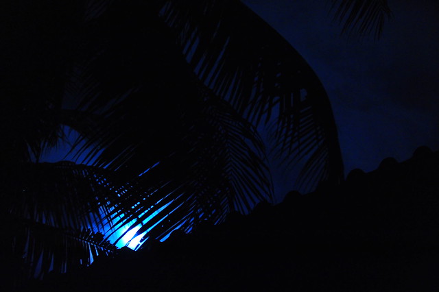
It’s now into the early evening at 615pm, under partly to mostly cloudy skies, near calm winds…and an air temperature of 73.9 degrees. It was cloudier than usual today, although that didn’t make it still feel pretty darn warm…especially down near sea level. Here in Kula, it was more manageable, in terms of the muggy weather, which will become more pronounced over the next few days. Hopefully some of these clouds will part way, and we can get a glimpse of that big moon, which will be beaming down lots of reflected sunlight tonight.
Friday evening film: there’s an abundance of good looking films that I’d like to see, however I decided on one called Third Person. It stars so many great actors, which is probably the thing that pulled me in the most, including: Liam Neeson, Kim Basinger, Adrien Brody, Mila Kunis, James Franco, Olivia Wilde, Riccardo Scamarcio, Maria Bello, and Moran Atlas...among others. The synopsis: Third Person tells three stories of love, passion, trust and betrayal, in a multi-level story line reminiscent of Paul Haggis’s earlier Oscar-winning film Crash. The tales play out in New York, Paris and Rome: three couples who appear to have nothing related but share deep commonalities: lovers and estranged spouses, children lost and found.
This film isn’t getting good ratings from the critics for the most part, although the viewers are seeing it in a better light. As is often the case, I ended up liking the film way more than I expected. I really liked most of the actors, so that was enough in the end, to make this film one that I enjoyed. It was a deep film, and I didn’t always understand what was happening, although to say the least, it was intriguing. There were very few bright spots, and I mean…very few! Nonetheless, I walked away feeling that I’d seen a film that was full of good acting, very good at times. The drama however was a bit overwhelming, or should I say down right melodramatic. Was I glad I saw it, absolutely, it took me on a journey that I wouldn’t have otherwise had…and I enjoyed the ride very much. As for a grade, I’m going with a broad shouldered B, leaning in the direction of a soft B+. Here’s the trailer for the film, and you can get a feeling for it yourself – full screen gives the best experience.
World-wide tropical cyclone activity:
Atlantic Ocean: There are no active tropical cyclones expected through the next 5 days
Here’s a satellite image of the Atlantic Ocean
Caribbean Sea: There are no active tropical cyclones expected through the next 5 days
Gulf of Mexico: There are no active tropical cyclones expected through the next 5 days
Here’s a satellite image of the Caribbean Sea…and the Gulf of Mexico.
Here’s the link to the National Hurricane Center (NHC)
North Eastern Pacific: There are no active tropical cyclones through the next 5 days
Here’s a wide satellite image that covers the entire area between Mexico, out through the central Pacific…to the International Dateline.
Central Pacific Ocean: No tropical cyclones are expected through the next two days
Here’s a link to the Central Pacific Hurricane Center (CPHC)
Northwestern Pacific Ocean: Tropical storm 09W (Rammasun) remains active, and will be gradually increasing in strength. Here’s the JTWC graphical track map…along with a satellite image – animated image
South Pacific Ocean: There are no active tropical cyclones
North and South Indian Oceans: There are no active tropical cyclones
Here’s a link to the Joint Typhoon Warning Center (JTWC)
Interesting: This is a extra special year for “Super Moons” – Super Moons are full moons that are extra, well, super! They are super because they appear larger in the evening sky than your run of the mill full moon.
In June of last year, a full Moon made headlines. The news media called it a “supermoon” because it was 14% bigger and 30% brighter than other full Moons of 2013. Around the world, people went outside to marvel at its luminosity.
If you thought one supermoon was bright, how about three? The full Moons of summer 2014-July 12th, August 10th, and Sept. 9th-will all be supermoons.
The scientific term for the phenomenon is “perigee moon.” Full Moons vary in size because of the oval shape of the Moon’s orbit. The Moon follows an elliptical path around Earth with one side (“perigee”) about 50,000 km closer than the other (“apogee”). Full Moons that occur on the perigee side of the Moon’s orbit seem extra big and bright.
This coincidence happens three times in 2014. On July 12th and Sept 9th the Moon becomes full on the same day as perigee. On August 10th it becomes full during the same hour as perigee—arguably making it an extra-super Moon.”
It might seem that such a sequence must be rare. Not so, says Geoff Chester of the US Naval Observatory.
“Generally speaking, full Moons occur near perigee every 13 months and 18 days, so it’s not all that unusual,” he says. “In fact, just last year there were three perigee Moons in a row, but only one was widely reported.”
In practice, it’s not always easy to tell the difference between a supermoon and an ordinary full Moon. A 30% difference in brightness can easily be masked by clouds and haze. Also, there are no rulers floating in the sky to measure lunar diameters. Hanging high overhead with no reference points to provide a sense of scale, one full Moon looks about the same size as any other.
Chester expects most reports of giant Moons this summer to be … illusory.
“The ”Moon Illusion’ is probably what will make people remember this coming set of Full Moons, more than the actual view of the Moon itself,” he says.
The illusion occurs when the Moon is near the horizon. For reasons not fully understood by astronomers or psychologists, low-hanging Moons look unnaturally large when they beam through trees, buildings and other foreground objects. When the Moon illusion amplifies a perigee Moon, the swollen orb rising in the east at sunset can seem super indeed.