


Air Temperatures – The following maximum temperatures (F) were recorded across the state of Hawaii Thursday:
83 Lihue, Kauai
88 Honolulu, Oahu
84 Molokai
88 Kahului, Maui
87 Kailua Kona
80 Hilo, Hawaii
Air Temperatures ranged between these warmest and coolest spots near sea level – and on the highest mountain tops on Maui and the Big Island…as of 843pm Thursday evening:
Kailua Kona – 81
Hilo, Hawaii – 73
Haleakala Summit – 45 (near 10,000 feet on Maui)
Mauna Kea Summit – 30 (13,000+ feet on the Big Island)
Hawaii’s Mountains – Here’s a link to the live web cam on the summit of near 13,800 foot Mauna Kea on the Big Island of Hawaii. This web cam is available during the daylight hours here in the islands…and when there’s a big moon shining down during the night at times. Plus, during the nights you will be able to see stars, and the sunrise and sunset too… depending upon weather conditions.
Aloha Paragraphs
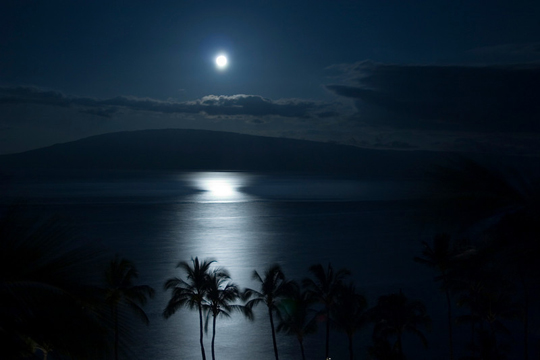
June Full Moon tonight
Trade wind weather pattern…well into the future
Windward showers arriving in an off and on manner
Small Craft Wind Advisory…windiest coasts and
channels – around all the Hawaiian Islands
The following numbers represent the strongest wind gusts (mph), along with directions…as of Thursday evening:
24 Port Allen, Kauai – ENE
33 Kuaokala, Oahu – NE
28 Molokai – NE
31 Lanai – NE
33 Kahoolawe – NE
30 Kapalua, Maui – NE
29 Pali 2, Big Island – NE
Here are the latest 24-hour precipitation totals (inches) for each of the islands…as of Thursday evening (545pm totals):
0.53 Mount Waialeale, Kauai
0.04 Kahuku, Oahu
0.01 Molokai
0.00 Lanai
0.00 Kahoolawe
0.31 Hana airport, Maui
0.61 Kaloko-Honokohau, Big Island
We can use the following links to see what’s going on in our area of the north central Pacific Ocean. Here’s the latest NOAA satellite picture – the latest looping satellite image… and finally the latest looping radar image for the Hawaiian Islands.
~~~ Hawaii Weather Narrative ~~~
Gusty trade winds will prevail into next week. Here’s the latest weather map, showing the Hawaiian Islands, and the rest of the North Pacific Ocean, along with a real-time wind profile of the central Pacific…focused on the Hawaiian Islands. We have a very large, moderately strong, near 1033 millibar high pressure system located far to the north, with its associated ridge extending southwest…to the northwest of the state. Our local winds will remain gusty, with only minor daily variations in speed and direction through the weekend. Those places with the most direct exposure to this wind flow will top 30 mph in gusts during the days…lighter at night.
Satellite imagery shows scattered low clouds to our east and northeast…as well as some higher level clouds across parts of the state as well. Looking at this larger looping satellite image, we see areas of high level clouds well to the north and west, south and southwest…with some wisps of these high cirrus, and some middle level altocumulus clouds moving through the state locally as well. There are also those lower level clouds riding along in the trade wind flow…impacting our windward sides at times. These low clouds along our windward sides…will bring some showers with them during the cooler hours of the night into early Friday morning. Here’s a looping radar image, showing that despite all those clouds upstream, there are just a few showers falling across the state at the time of this writing.
Looking ahead through the rest of this week into next week, there will be little change in rainfall…or our trade wind speeds. We’re now involved in a very well established trade wind weather pattern, as we push through this last week of the late spring season. I don’t see any surprises on the upcoming horizon, at least in terms of our pleasant weather conditions. There continues to be no end in sight, in regards to our ongoing trade wind regime. I’ll be back again early Friday morning with your next new weather narrative from paradise, I hope you have a great Thursday night wherever you’re spending it! Aloha for now…Glenn.
Here on Maui, at the 3,100 foot elevation, at my upper Kula, Maui weather tower, the air temperature was 57.9 degrees at 555am on this Thursday morning. Skies are clear overhead, although there are clouds that are dropping a few showers over along the windward sides…stretching over the West Maui Mountains as well. The leeward facing beaches are in good shape, with nice weather expected today. There are a few minor wisps of high cirrus clouds, which gave a little color to our early morning skies. There’s also a little bit haze down in the central valley, although its not volcanic that I can tell.
It’s now afternoon almost mid-afternoon at 215pm, under partly cloudy skies, light breezes…and a warm air temperature of 83.3 degrees. It sure feels hot and muggy up here, more so than normal…at least to me. The haze I was speaking about this morning is still around, and if anything, has thickened to the moderate levels. It sure looks like volcanic haze, and at the same time, the cirrus up above is muting the sunshine some at the same time. It’s certainly not one of those very clear sunny days that we’re often used to this time of year.
We’re into the early evening hours now at 515pm, under partly cloudy skies, hazy, light breezes…and an air temperature of 79 degrees. The haze that’s been around today remains in force this evening, and is light to moderately thick before sunset. Speaking of which, there’s enough high level cloudiness around, that we could end up seeing some color.
World-wide tropical cyclone activity:
Atlantic Ocean: There are no active tropical cyclones expected through the next 5 days
Here’s a satellite image of the Atlantic Ocean
Caribbean Sea: There are no active tropical cyclones expected through the next 5 days
Gulf of Mexico: There are no active tropical cyclones expected through the next 5 days
Here’s a satellite image of the Caribbean Sea…and the Gulf of Mexico.
Here’s the link to the National Hurricane Center (NHC)
Eastern Pacific: Tropical cyclone 03E (Cristina) remains active, here’s a NHC graphical track map…and a satellite image of this very strong tropical cyclone. Here’s what the hurricane models are showing for Hurricane Cristina. This hurricane will be peaking in strength today, topping out with sustained winds of 150 mph…with much stronger gusts near the center.
Here’s a wide satellite image that covers the entire area between Mexico, out through the central Pacific…to the International Dateline.
Central Pacific Ocean: No tropical cyclones are expected through Sunday morning
Here’s a link to the Central Pacific Hurricane Center (CPHC)
North Pacific Ocean: There are no active tropical cyclones
South Pacific Ocean: There are no active tropical cyclones
North and South Indian Oceans: Tropical Cyclone 02A (Nanauk) remains active in the Arabian Sea. Here’s a JTWC graphical track map…and a satellite image.
Here’s a link to the Joint Typhoon Warning Center (JTWC)
Interesting: How herring populations are affected by commercial fisheries – Scientists analyzed almost half a million fish bones to shed light on the population history of Pacific herring (Clupea pallasii) in the North Pacific Ocean. Their paper, published in the journal Proceedings of the National Academy of Sciences (PNAS) reveals a decline of unprecedented scale. It suggests that while the abundance of Pacific herring does fluctuate naturally, their numbers have fallen precipitously since commercial fishing started targeting the species in the 19th century.
The team, made up of anthropologists and archaeologists hailing from universities across Canada, set out with an ambition to frame depleted 21st century fisheries within a wider historical context.
“We used all available archaeological data compiled from 171 sites spread throughout the coast and collected by researchers over a period of 40 years,” co-author Iain McKechnie, a coastal archaeologist from Simon Fraser University and self-described “counter of fish bones. “Each site has the same type of systematically collected data (fish bones morphologically identified to species, genera, or family) and this totals 435,777 bones.”
McKechnie and his team didn’t start out to study Pacific herring, but from amongst the stories and trends hidden in the bones, the plight of this one species caught their attention.
“Within this data set, one species stood out and stood far above the rest—Pacific herring,” McKechnie said. “From that point on, we knew that we could concentrate on how this one species was proportionally represented across these 171 archaeological sites spanning from 10,400 years ago to the early 1800s.”
The data revealed that historic Pacific herring populations were far more consistently abundant and extensive than they are today.
The Pacific herring is a small fish with large implications for the areas they inhabit. The herring act as food for a diverse range of other animals, including whales, dolphins, seagulls, bears, wolves and other species of fish. According to McKechnie, this makes them a vital protagonist in the effort to preserve marine ecosystems in the northern Pacific Ocean.
“Pacific herring is a forage fish and forage fish are globally significant ecologically and economically in that they are a central node in marine ecosystem—they transform energy from lower trophic levels (e.g., zooplankton) into the higher levels of animals that prey on herring, (including) seabirds, larger fish, and marine mammals,” McKechnie said. “Therefore, without sufficient forage fish population to prey on, a large number of key birds, fish, and marine species can be dramatically affected.”