


Air Temperatures – The following maximum temperatures (F) were recorded across the state of Hawaii Friday:
83 Lihue, Kauai
83 Honolulu, Oahu
82 Molokai
88 Kahului, Maui
84 Kailua Kona
83 Hilo, Hawaii
Air Temperatures ranged between these warmest and coolest spots near sea level – and on the highest mountain tops on Maui and the Big Island…as of 930pm Friday evening:
Kailua Kona – 79
Hilo, Hawaii – 72
Haleakala Summit – 50 (near 10,000 feet on Maui)
Mauna Kea Summit – 39 (13,000+ feet on the Big Island)
Hawaii’s Mountains – Here’s a link to the live web cam on the summit of near 13,800 foot Mauna Kea on the Big Island of Hawaii. This web cam is available during the daylight hours here in the islands…and when there’s a big moon shining down during the night at times. Plus, during the nights you will be able to see stars, and the sunrise and sunset too… depending upon weather conditions.
Aloha Paragraphs
Light breezes continuing through Saturday…making humid
and hazy conditions for one more day
Localized showers will occur during the afternoon hours
over the interior sections, with a few showers falling here
and there elsewhere
A weather change will occur later this weekend, with
increased showers, mostly along the windward
sides on Kauai and Oahu…then stronger trade winds
into next week
The following numbers represent the most recent top wind gusts (mph), along with directions…as of Friday evening:
12 Mana, Kauai – SE
16 Wheeler AAF, Oahu – SW
12 Molokai – SE
16 Lanai – SW
22 Kahoolawe – NE
17 Hana, Maui – SE
23 Hilo, Big Island – E
Here are the latest 24-hour precipitation totals (inches) for each of the islands…as of Friday evening (845pm totals):
0.08 Puu Lua, Kauai
0.25 Palehua, Oahu
0.48 Molokai
0.00 Lanai
0.00 Kahoolawe
0.21 Kepuni, Maui
0.93 Pohakuloa Keamuku, Big Island
We can use the following links to see what’s going on in our area of the north central Pacific Ocean. Here’s the latest NOAA satellite picture – the latest looping satellite image… and finally the latest looping radar image for the Hawaiian Islands.
~~~ Hawaii Weather Narrative ~~~
Generally light southeast to southwest breezes continuing, before giving way to north to northeasterly breezes later this weekend…trade winds during the new week. Here’s the latest weather map, showing the Hawaiian Islands, and the rest of the North Pacific Ocean, along with a real-time wind profile of the central Pacific…focused on the Hawaiian Islands. ~~~ We see a moderately strong, near 1028 millibar high pressure system to the northeast of our islands. It has a trailing ridge of high pressure located over the western islands. At the same time, we see a gale low pressure system to our north, with an associated cold front…approaching Kauai slowly. Our local winds will remain light from the southwest through southeast in response to this very late season cold front. The outlook calls for the return of our normal trade winds later this weekend into the new week.
Satellite imagery shows patchy lower level clouds in some parts of the state…along with the leading of this slow moving cold front to our northwest. Looking at this larger satellite image, we see a late season cold front moving very slowly in our direction. There are also stable looking, lower level cloud patches over and around the state as well. Here’s a looping radar image, showing generally light showers falling locally, over both the ocean offshore from the islands…with a few over the islands as well.
We’re approaching the end of this long light wind episode, with its muggy and hazy conditions, before clouds and showers increase later this weekend…along with the return of refreshing breezes into the new week. We continue to be in a lightly convective weather pattern, with clear to partly cloudy mornings, giving way to afternoon clouds over the slopes…with a few showers. Meanwhile, the forecast continues to show a late season cold front approaching the islands this weekend. As this front moves into our area later Saturday, it will bring an increase in showers first on Kauai, and then slowly travel down towards Maui County…where it should stall and dissipate later Monday. This late season cloud band will usher in slightly cooler northerly breezes at first, which will rather quickly become our more normal trade winds through the new week. These trades will also carry some windward showers our way for several days. The leeward beaches in contrast will find favorably inclined weather, with lots of warm sunshine beaming down during the days. I’ll be back again Saturday morning with your next new weather narrative, I hope you have a great Friday night wherever you’re spending it! Aloha for now…Glenn.
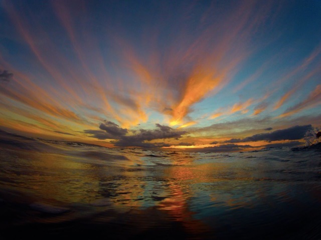
Here on Maui, at the 3,100 foot elevation, at my upper Kula, Maui weather tower, the air temperature was 55.4 degrees at 550am on this Friday morning. Skies were clear to partly cloudy, along with some thin cirrus clouds around the edges too. The vog is still rather thick this morning too, as there’s still no breeze to blow it away. As a matter of fact, we still have our light southeast winds blowing, carrying the volcanic emissions from the Big Island vents…up over the rest of the state. I expect more hot weather here on Maui, with a high temperature approaching 88 degrees again at Kahului, as it has done all this week…topping out at 88 degrees several of the days. I just saw that the high temperature in Kahului was in fact 88 again today!
We’re into our early afternoon hours now, at 1225pm, under cloudy skies, and a light but steady shower. The air is relatively cool at 69.3 degrees, with a light breeze just strong enough to get my wind chimes going a little. Looking down into the central valley, I can see sunshine, and still lots of that long lasting volcanic haze too. As has been the case this week, the clouds began gathering our my area around 9am or so, with cloudy skies remaining in place very likely through the rest of the day. Here in Kula at 120pm, the air temperature was 67.8 degrees…while it was 85 degrees down at the Kahului airport at about the same time.
It’s now early evening at 505pm, under cloudy and hazy skies, near calm winds…and an air temperature of 68 degrees. There have been a couple of lightly showery periods today, although at the moment, it’s dry…although my weather deck is still a little wet from the last shower. The main thing continues to be the volcanically hazy skies, which I would call moderate to heavy at the time of this writing. As I was mentioning above, we’re coming to the end of these stagnant weather conditions, which should be pretty much gone statewide by later Sunday…as the trade winds hopefully have returned by then. Once these trade winds resume, they are expected to continue well into the new week, or perhaps all of the week. Oops, now at 525pm its lightly showering again as I head downtown to see the film described below.
Friday Evening Film: This time I’m going to see the new blockbuster called The Amazing Spider-Man 2, starring Andrew Garfield, Emma Stone, Jamie Fox, Dane DeHaan, Paul Giamatti, Chris Cooper, Felicity Jones, Sarah Gadon…among many others. The synopsis: We’ve always known that Spider-Man’s most important battle has been within himself: the struggle between the ordinary obligations of Peter Parker and the extraordinary responsibilities of Spider-Man. But in The Amazing Spider-Man 2, Peter Parker finds that a greater conflict lies ahead. It’s great to be Spider-Man (Andrew Garfield). For Peter Parker, there’s no feeling quite like swinging between skyscrapers, embracing being the hero, and spending time with Gwen (Emma Stone). But being Spider-Man comes at a price: only Spider-Man can protect his fellow New Yorkers from the formidable villains that threaten the city. With the emergence of Electro (Jamie Foxx), Peter must confront a foe far more powerful than he. And as his old friend, Harry Osborn (Dane DeHaan), returns, Peter comes to realize that all of his enemies have one thing in common: OsCorp.
The critics are being pretty good to this film, although there are not exceptional reviews by any means. I saw the first Spider-Man film several years ago, and remember liking it quite a bit. I have a good feeling about this movie, and expect to like it well enough to make it worthwhile for the drive down to Kahului to see it. I’ll let you know what I thought tomorrow morning, and until then, here’s the trailer for this very well advertised film.
World-wide tropical cyclone activity:
Atlantic Ocean: The Atlantic hurricane season runs from June 1st through November 30th.
Here’s the 2013 hurricane season summary
Here’s a satellite image of the Atlantic Ocean
Caribbean Sea:
Gulf of Mexico:
Here’s a satellite image of the Caribbean Sea…and the Gulf of Mexico.
Here’s the link to the National Hurricane Center (NHC)
Eastern Pacific: The Eastern Pacific hurricane season runs from May 15th through November 30th. Here’s the 2013 hurricane season summary
Here’s a wide satellite image that covers the entire area between Mexico, out through the central Pacific…to the International Dateline.
Central Pacific Ocean: The Central Pacific hurricane season runs from June 1st through November 30th. Here’s the 2013 hurricane season summary
Here’s a link to the Central Pacific Hurricane Center (CPHC)
North Pacific Ocean: There are no active tropical cyclones
South Pacific Ocean: There are no active tropical cyclones
North and South Indian Oceans: There are no active tropical cyclones
Here’s a link to the Joint Typhoon Warning Center (JTWC)
Interesting: Climate Change vs. Natural Variations: Why is Greenland Melting? – The climate change debate continues. Are anthropogenic causes of global warming responsible for melting ice and rising seas or are natural cycles and climate variations to blame?
There’s no question that Greenland’s glaciers are in fact melting. And while the obvious culprit may be global warming caused by rising carbon dioxide emissions, University of Washington atmospheric scientists have estimated that up to half of the recent warming in Greenland and surrounding areas may be due to climate variations.
The kicker? These climate variations originate in the tropical Pacific and are not connected with the overall warming of the planet.
Greenland and parts of neighboring Canada have experienced some of the most extreme warming since 1979 – warming at a rate of about 1 degree Celsius per decade, which is several times the global average.
In an attempt to understand why global warming has not been uniform across the globe, UW researchers conducted a study using observations and advanced computer models to explain why regional warming, specifically in Greenland, may be occurring.
The study shows that a warmer western tropical Pacific Ocean has caused atmospheric changes over the North Atlantic that have warmed the surface by about a half-degree per decade since 1979.
“The pattern of the changes in the tropical Pacific that are responsible for remarkable atmospheric circulation changes and warming in Greenland and the Canadian Arctic are consistent with what we would call natural variability,” said co-author David Battisti, a UW professor of atmospheric sciences.
Researchers say it’s not surprising to find the imprint of natural variability in an area famous for its melting ice. In many of the fastest-warming areas on Earth, global warming and natural variations both contribute to create a “perfect storm” for warming, said co-author John “Mike” Wallace, a UW professor of atmospheric sciences.
The natural variations in new study related to an unusually warm western tropical Pacific, near Papua New Guinea. Since the mid-1990s the water surface there has been about 0.3 degrees hotter than normal. Computer models show this affects the regional air pressure, setting off a stationary wave in the atmosphere that arcs in a great circle from the tropical Pacific toward Greenland before turning back over the Atlantic.
“Along this wave train there are warm spots where the air has been pushed down, and cold spots where the air has been pulled up,” Wallace said. “And Greenland is in one of the warm spots.”
Researchers can’t say for how long the tropical Pacific will remain in this state.