


Air Temperatures – The following maximum temperatures (F) were recorded across the state of Hawaii Monday:
81 Lihue, Kauai
87 Honolulu, Oahu
83 Molokai
88 Kahului, Maui
85 Kailua Kona
83 Hilo, Hawaii
Air Temperatures ranged between these warmest and coolest spots near sea level – and on the highest mountain tops on Maui and the Big Island…as of 810pm Monday evening:
Kailua Kona – 79
Hana airport, Maui – 72
Haleakala Summit – 48 (near 10,000 feet on Maui)
Mauna Kea Summit – 41 (13,000+ feet on the Big Island)
Hawaii’s Mountains – Here’s a link to the live web cam on the summit of near 13,800 foot Mauna Kea on the Big Island of Hawaii. This web cam is available during the daylight hours here in the islands…and when there’s a big moon shining down during the night at times. Plus, during the nights you will be able to see stars, and the sunrise and sunset too… depending upon weather conditions.
Aloha Paragraphs
Light winds…although somewhat stronger trade winds over the
Big Island and Maui County at times locally
A few showers will occur during the afternoon hours over the
interior sections, with a few windward showers falling here
and there too…along with hazy skies in some areas
Celebrating Cinco de Mayo
The following numbers represent the most recent top wind gusts (mph), along with directions…as of Monday evening:
14 Puu Opae, Kauai – S
18 Kahuku Trng, Oahu – SE
21 Molokai – ESE
13 Lanai – NE
24 Kahoolawe – ENE
27 Hana, Maui – NE
28 South Point, Big Island – ENE
Here are the latest 24-hour precipitation totals (inches) for each of the islands…as of Monday evening (545pm totals):
0.22 Mohihi Crossing, Kauai
1.21 Poamoho RG 1, Oahu
0.00 Molokai
0.32 Lanai
0.00 Kahoolawe
0.17 Puu Kukui, Maui
0.46 Kealakekua, Big Island
We can use the following links to see what’s going on in our area of the north central Pacific Ocean. Here’s the latest NOAA satellite picture – the latest looping satellite image… and finally the latest looping radar image for the Hawaiian Islands.
~~~ Hawaii Weather Narrative ~~~
Generally light breezes continuing, stronger trade winds over the Big Island and parts of Maui County at times. Here’s the latest weather map, showing the Hawaiian Islands, and the rest of the North Pacific Ocean, along with a real-time wind profile of the central Pacific…focused on the Hawaiian Islands. ~~~ We see a moderately strong, near 1028 millibar high pressure system to the northeast of our islands. It has a trailing ridge of high pressure located just to the north of Kauai. At the same time, we see a low pressure system to our northwest, with its associated cold front…northwest of the state as well. Our local winds will remain quite light, from the southeast in most areas for the time being…although locally stronger trade winds will sneak into the Big Island and Maui County at times. The longer range outlook calls for the return of our normal trade winds by early next week or so.
Satellite imagery shows just a few high level clouds over some parts of the state…along with patches of lower level clouds locally as well. Looking at this larger satellite image, we see most of the patchy lower level clouds offshore to the south and southwest of the state. There are still a few wisps of high cirrus clouds in places too, although they are much less extensive…compared to the last several days. Here’s a looping radar image, showing generally light showers, although most of them are falling over the ocean offshore of the islands. The most noticeable showers are reaching the southeast coasts and slopes…carried our way on the southeasterly breezes. The island of Oahu was able to attract some locally heavier rainfall this afternoon, and the NWS forecast in Honolulu had to issue a flood advisory in response. The overlying atmosphere remains relatively dry and stable however, which is limiting shower activity for the most part…with just a few of those more generous showers falling locally.
We remain in a well established relatively light wind condition, which will keep our local atmosphere rather stagnant…and hazy at times too. It appears that this light wind episode will last through most of this new week…if not all week! The latest model output continues to show a late season cold front approaching the islands Friday into the weekend. This in turn will help keep our light breezes in place even longer…as well as bring a possible increase in showers to some parts of the state then too. When there isn’t high level clouds around, as there were yesterday, and to a lesser extent today…our daytime hours will begin quite clearly and slightly cooler than normal, and then cloud-up…leading to a few afternoon showers over the interior sections locally. I’ll be back again early Tuesday morning with your next new weather narrative, I hope you have a great Monday night wherever you’re spending it! Aloha for now…Glenn.
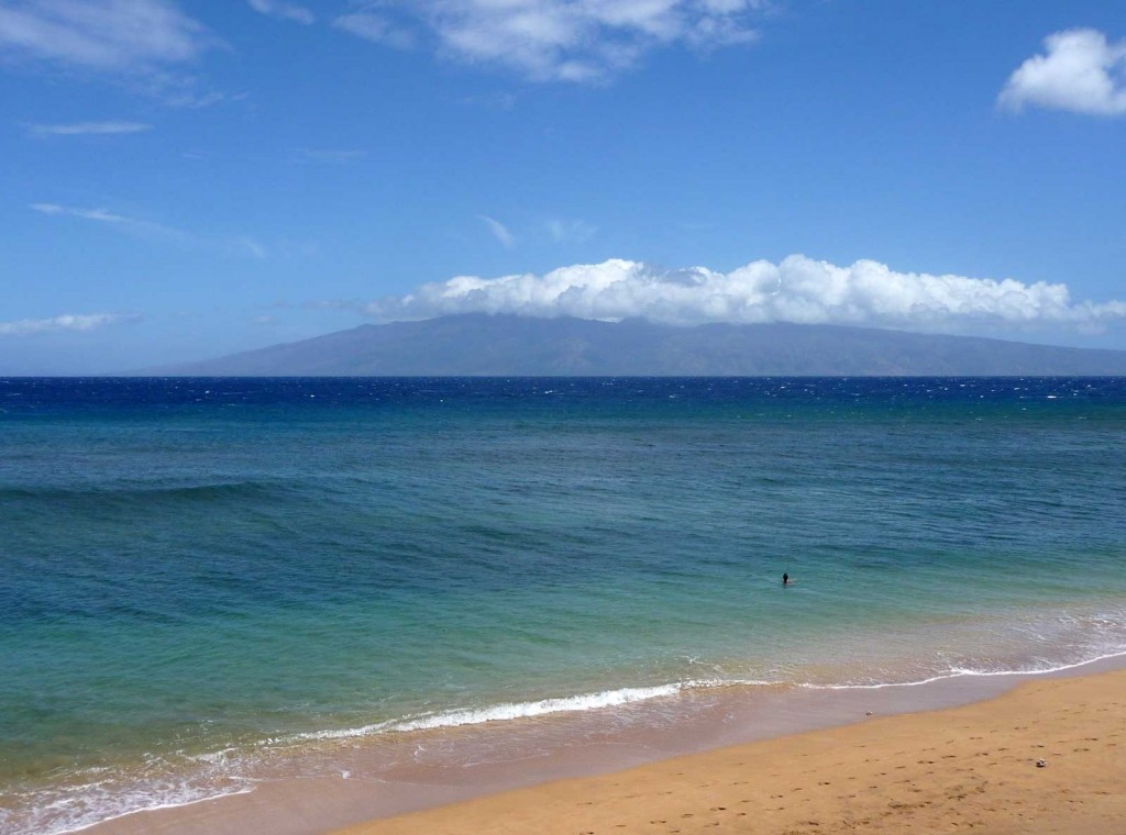
Here on Maui, at the 3,100 foot elevation, at my upper Kula, Maui weather tower, the air temperature was 57.2 degrees at 545am on this Monday morning. Skies were generally clear to partly cloudy, and still a bit hazy too, along with smoke from an early sugar cane burn in the central valley. We remain locked into this light wind condition, with daytime sea breezes in many areas. These breezes will carry moisture from over the ocean, up the mountain slopes, where it will cool and condense into clouds from the late mornings through early evening hours. They will drop a few showers here and there, although not many for the most part.
We’re into the early afternoon hours now, at 1245pm…under mostly cloudy and hazy skies, light winds, and air temperature of 72.7 degrees here in Kula. Interestingly enough, at the same time down at the Kahului airport, just a 22 minute drive down the mountain, it was a much warmer 87 degrees! I found the first very light rain drops falling just before noon, although it didn’t keep up, and now its dry again. However, I should add that the clouds are getting darker minute by minute, and we’ll likely get a few more drops coming down before too long. Glancing down towards the beaches in Paia and across the central valley towards Kihei…it looks nice and sunny down there.
It’s now 535pm early this evening, under dark gray clouds, light winds, and an air temperature of 69.3 degrees. I could recently see sunshine in the central valley, and down at the beaches too. Just before these clouds blocked my view of down below, I could see that there was still the volcanic haze in our air too. It was a generally nice day, especially if you spent it down near the beaches, where warm sunshine held sway most of the day. Here on the mountain slopes on Maui, and the other islands too, clouds gathered, although rainfall was spare in most areas. This wasn’t the case on Oahu this afternoon though, as some locally heavy downpours occurred.
~~~ Here’s a weather product that I produced for the Pacific Disaster Center this morning, which shows a tropical disturbance south of Acapulco, Mexico, which could potentially become the first tropical cyclone of the northeast Pacific season…actually before the season begins on May 15th – stay tuned.
World-wide tropical cyclone activity:
Atlantic Ocean: The Atlantic hurricane season runs from June 1st through November 30th.
Here’s the 2013 hurricane season summary
Here’s a satellite image of the Atlantic Ocean
Caribbean Sea:
Gulf of Mexico:
Here’s a satellite image of the Caribbean Sea…and the Gulf of Mexico.
Here’s the link to the National Hurricane Center (NHC)
Eastern Pacific: The Eastern Pacific hurricane season runs from May 15th through November 30th. Here’s the 2013 hurricane season summary
Here’s a wide satellite image that covers the entire area between Mexico, out through the central Pacific…to the International Dateline.
Central Pacific Ocean: The Central Pacific hurricane season runs from June 1st through November 30th. Here’s the 2013 hurricane season summary
Here’s a link to the Central Pacific Hurricane Center (CPHC)
North Pacific Ocean: There are no active tropical cyclones
South Pacific Ocean: There are no active tropical cyclones
North and South Indian Oceans: There are no active tropical cyclones
Here’s a link to the Joint Typhoon Warning Center (JTWC)
Interesting: Bicycles Can Change the World – Saying that bicycles can change the world might sound like an oversimplification of things, but when you start to break it down, it’s easy to see that the bicycle has an effect on a lot more than just how we get from point A to point B.
Need proof for why bicycles are a good way to change the world? Here are some good ones.
1. They provide alternative transportation
It doesn’t take a scientist to work out that switching from four wheels to two wheels is a good thing. First there’s the environmental reason. For example, if 5 percent of people in New York commuting by car (either private or taxi) were to bike to work, they could save 150 million pounds of CO2 emissions per year. That’s the equivalent to the amount of CO2 reduced by planting a forest 1.3 times the size of Manhattan. And that’s only with a 5 percent change.
Then there’s the societal benefit of switching to two wheels. We would save billions of hours wasted sitting in traffic congestion. In fact, the average American spends an hour a day sitting in their car. Imagine if that hour was spent pedaling. A recent study even showed that if a bicycle was involved in a commute, people felt a whole lot happier about their commute in general.
2. They are a form of empowerment
Susan B. Anthony once said, “Let me tell you what I think of bicycling. I think it has done more to emancipate women than anything else in the world. It gives women a feeling of freedom and self-reliance. I stand and rejoice every time I see a woman ride by on a wheel”?the picture of free, untrammeled womanhood.”
The bicycle continues to play a significant role in women’s empowerment. World Bicycle Relief, for example, provides 50,000 bikes to students in Africa, 70 percent of them to girls. If a girl can ride to school, she can get an education. In Afghanistan, a country often cited for its poor state of women’s rights, there’s a national women’s cycling team, proving that women can stand up and push gender barriers no matter where they are in the world.