


Air Temperatures – The following maximum temperatures were recorded across the state of Hawaii Saturday:
82 Lihue, Kauai
84 Honolulu, Oahu
81 Molokai
88 Kahului, Maui
85 Kona, Hawaii
82 Hilo, Hawaii
Air Temperatures ranged between these warmest and coolest spots near sea level – and on the highest mountain tops around the state…as of 810pm Saturday evening:
Poipu, Kauai – 77
Hilo, Hawaii – 73
Haleakala Summit – 39 (near 10,000 feet on Maui)
Mauna Kea Summit – 34 (13,000+ feet on the Big Island)
Hawaii’s Mountains – Here’s a link to the live web cam on the summit of near 13,800 foot Mauna Kea on the Big Island of Hawaii. This web cam is available during the daylight hours here in the islands…and when there’s a big moon shining down during the night at times. Plus, during the nights you will be able to see stars, and the sunrise and sunset too… depending upon weather conditions. Here’s the Haleakala Crater webcam on Maui – if it’s working.
Aloha Paragraphs
Small Craft Wind Advisory…from Oahu down through
Maui County and the Big Island
Trade wind weather pattern…well into the future
The following numbers represent the most recent top wind gusts (mph), along with directions as of Saturday evening:
22 Waimea Heights, Kauai – NE
39 Kuaokala, Oahu – NE
28 Molokai – NE
38 Kahoolawe – NE
23 Kahului, Maui – NE
32 Kamuela airport, Big Island – NE
Here are the latest 24-hour precipitation totals (inches) for each of the islands as of Saturday evening:
1.12 Mount Waialeale, Kauai
0.26 Oahu Forest NWR, Oahu
0.33 Molokai
0.00 Kahoolawe
1.60 Puu Kukui, Maui
0.93 Waiakea Uka, Big Island
We can use the following links to see what’s going on in our area of the north central Pacific Ocean. Here’s the latest NOAA satellite picture – the latest looping satellite image… and finally the latest looping radar image for the Hawaiian Islands.
~~~ Hawaii Weather Narrative ~~~
The trade winds will prevail through this long holiday weekend, through the next week…at least. Here’s a weather chart showing a near 1030 millibar high pressure system located to the northeast of our islands. At the same time, we find a trough of low pressure to the north of Kauai. The trade winds will remain active in our Hawaiian Island weather picture through the rest of this month, right on into June. These trades will strengthen some as we move through the rest of this holiday weekend, becoming quite gusty in places.
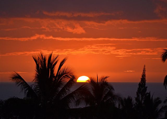
Satellite imagery shows lots of high level cirrus clouds moving over us…as well as many more to our south. Here’s the looping radar image, showing the clouds being carried along in the trade wind flow, arriving along our windward sides. Here’s a looping satellite image – showing lots of high level moisture, the cirrus mentioned above, coming up out of the deeper tropics to our southwest…racing up over our area. As the trade winds will continue well into the future, and we’ll see more of these showers arriving along our north and east facing coasts and slopes…with some elsewhere at times too. An upper level trough of low pressure over the state, is enhancing the showers for the time being. The high cirrus will dim our sunshine at times locally during the days…as well as give us some color at sunset and sunrise. I’ll be back later with more updates. Aloha for now…Glenn.
Here in Kula, Maui, it was foggy with light showers, the air temperature was 66.7F degrees – at 755pm this afternoon.
Friday night film: I’ve of course been wanting to see Iron Man 3, although since it’s been so popular at the theaters, I’ve been waiting to let it cool off a little. Iron Man 3 stars Robert Downey, Don Cheadle, Gwyneth Paltrow, Ben Kingsley, Jon Favreau, Rebecca Hall, Ashley Hamilton, and William Sadler…among others. The synopsis: brilliant industrialist Tony Stark/Iron Man is pitted against an enemy whose reach knows no bounds. When Stark finds his personal world destroyed at his enemy’s hands, he embarks on a harrowing quest to find those responsible. This journey, at every turn, will test his mettle. With his back against the wall, Stark is left to survive by his own devices, relying on his ingenuity and instincts to protect those closest to him. As he fights his way back, Stark discovers the answer to a question that has secretly haunted him: does the man make the suit or does the suit make the man? ~~~ I liked this film, not greatly…but enough, as I was entertained sufficiently. It had all the action and stuff, although it didn’t move me quite as much as I thought it might, I feel comfortable giving it a strong B grade however…here’s the trailer.
>>>The Central Pacific Hurricane Center (CPHC) recently announced that the 2013 hurricane season should see less than a normal number of tropical cyclones. For 2013, the outlook calls for a 70% chance of a below-normal season, a 25% chance of a near-normal season, and a 5% chance of an above-normal season. They expect 1 to 3 tropical cyclones to affect the central Pacific this season. An average season has 4-5 tropical cyclones, which include tropical depressions, tropical storms, and hurricanes.
This outlook is a general guide to the overall seasonal hurricane activity in the central Pacific and does not predict whether, where, when, or how many of these systems will affect Hawaii.
>>>The Eastern north Pacific , according to NOAA, announced recently that a below-normal hurricane season is most likely for the Eastern Pacific this year. The outlook calls for a 55 percent probability of a below-normal season, a 35 percent probability of a near-normal season and a 10 percent probability of an above-normal season.
Seasonal hurricane forecasters are calling for a 70 percent chance of 11 to 16 named storms, which includes 5 to 8 hurricanes, of which 1 to 4 are expected to become major hurricanes (Category 3, 4 or 5 on the Saffir-Simpson Hurricane Wind Scale).
An average Eastern Pacific hurricane season produces 15 named storms, with eight becoming hurricanes and four becoming major hurricanes. The Eastern Pacific hurricane season runs from May 15 through Nov. 30, with peak activity from July through September. Tropical Storm Alvin, the season’s first named storm, developed on May 15.
The key climate factors behind this outlook are:
- A continuation of the climate pattern responsible for the ongoing era of low-activity for Eastern Pacific hurricanes that began in 1995;
- ENSO neutral (meaning El Niño or La Niña is unlikely), but with near- or below-average sea surface temperatures in eastern equatorial Pacific Ocean.
>>>Mr. Kevin Kodama, from the NWS forecast office in Honolulu announced recently:
Dry season (May through September) outlook for Hawaii:NOAA’s Climate Prediction Center forecast probabilities favor below normal precipitation.In recent summers, the number of trade wind rainfall days has been near normal but the amount of rain per day has been below normal.Expecting at least persistence and possible worsening of drought in leeward Maui County and the Big IslandSeasonal leeward dryness on Kauai and Oahu
World-wide tropical cyclone activity:
Atlantic Ocean/Caribbean Sea: There are no active tropical cyclones / Here’s a link to the National Hurricane Center in Miami…which covers tropical cyclone activity in the Atlantic, Caribbean Sea…and the Gulf of Mexico. The hurricane season in the Atlantic, Caribbean, and the Gulf of Mexico all begin as of June 1.
Gulf of Mexico: There are no active tropical cyclones
Eastern Pacific Ocean: There are no active tropical cyclones / A BROAD AREA OF LOW PRESSURE LOCATED ABOUT 600 MILES SOUTH-SOUTHWEST OF MANZANILLO MEXICO CONTINUES TO PRODUCE DISORGANIZED SHOWERS AND THUNDERSTORMS. ANY DEVELOPMENT OF THIS SYSTEM SHOULD BE SLOW TO OCCUR AS IT MOVES LITTLE DURING THE NEXT COUPLE OF DAYS. THIS SYSTEM HAS A LOW CHANCE…10 PERCENT…OF BECOMING A TROPICAL CYCLONE DURING THE NEXT 48 HOURS.
A SMALL AREA OF DISTURBED WEATHER LOCATED A COUPLE OF HUNDRED MILES SOUTH OF EL SALVADOR HAS CHANGED LITTLE IN ORGANIZATION TODAY. SOME SLOW DEVELOPMENT OF THIS SYSTEM IS POSSIBLE AS IT DRIFTS WEST-NORTHWESTWARD DURING THE NEXT COUPLE OF DAYS. THIS SYSTEM HAS A LOW CHANCE…10 PERCENT…OF BECOMING A TROPICAL CYCLONE DURING THE NEXT 48 HOURS.
ANOTHER AREA OF DISTURBED WEATHER IS LOCATED BETWEEN THE ABOVE MENTIONED SYSTEMS…ABOUT 400 MILES SOUTH-SOUTHEAST OF ACAPULCO MEXICO. SOME SLOW DEVELOPMENT OF THIS DISTURBANCE IS ALSO POSSIBLE DURING THE NEXT FEW DAYS AS IT DRIFTS WEST-NORTHWESTWARD OR NORTHWESTWARD. THIS SYSTEM HAS A LOW CHANCE…10 PERCENT…OF BECOMING A TROPICAL CYCLONE DURING THE NEXT 48 HOURS.
ELSEWHERE, TROPICAL CYCLONE FORMATION IS NOT EXPECTED DURING THE NEXT 48 HOURS.
Here’s a wide satellite image that covers the entire area between Mexico, out through the central Pacific…to the International Dateline.
Central Pacific Ocean: There are no active tropical cyclones / Here’s a link to the Central Pacific Hurricane Center (CPHC)…covering our central Pacific. The hurricane season in this part of the Pacific begins as of June 1st.
Western Pacific Ocean: There are no active tropical cyclones / Here’s a link to the Joint Typhoon Warning Center (JTWC), which covers tropical cyclone activity in the western Pacific, and the North and South Indian Ocean…and adjacent Seas.
South Pacific Ocean: There are no active tropical cyclones
North and South Indian Oceans: There are no active tropical cyclones