


Air Temperatures – The following maximum temperatures were recorded across the state of Hawaii Friday:
Lihue, Kauai – 77
Honolulu airport, Oahu – 82
Molokai airport – 78
Kahului airport, Maui – 80
Kona airport – 82
Hilo airport, Hawaii – 73
Air Temperatures ranged between these warmest and coolest spots near sea level – and on the highest mountain tops around the state…as of 630am Saturday morning:
Honolulu, Oahu – 72
Barking Sands, Kauai – 67
Haleakala Summit – 32 (near 10,000 feet on Maui)
Mauna Kea Summit – 21 (13,000+ feet on the Big Island)
Hawaii’s Mountains – Here’s a link to the live web cam on the summit of near 13,800 foot Mauna Kea on the Big Island of Hawaii. This web cam is available during the daylight hours here in the islands…and when there’s a big moon shining down during the night at times. Plus, during the nights you will be able to see stars, and the sunrise and sunset too…depending upon weather conditions. Here's the Haleakala Crater webcam on Maui.
Tropical Cyclone activity in the eastern and central Pacific – Here’s the latest weather information coming out of the National Hurricane Center, covering the eastern north Pacific. You can find the latest tropical cyclone information for the central north Pacific (where Hawaii is located) by clicking on this link to the Central Pacific Hurricane Center. A satellite image, which shows the entire ocean area between Hawaii and the Mexican coast…can be found here. The 2012 hurricane season is over in the eastern and central Pacific…resuming on May 15th and June 1st 2013.
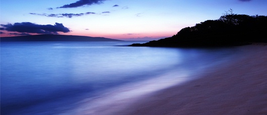
Aloha Paragraphs
Small Craft Advisory for gusty trade winds for all marine
zones across the Hawaiian Islands…through Saturday
High Surf Advisory through Saturday – along north and
west shores of Niihau, Kauai and Molokai, and along north
shores of Oahu and Maui
Windward showers, with some showers leeward at times
~~~702m HST Saturday morning: partly cloudy and calm…
at my upcountry Kula, Maui weather tower: 55.8F degrees~~~
The following numbers represent the most recent top wind gusts (mph), along with directions as of Friday evening:
23 Port Allen, Kauai – NE
31 Kahuku Trng, Oahu – NE
29 Molokai – NE
45 Kahoolawe – ENE
36 Kahului, Maui – ENE
36 South Point, Big Island – NE
Here are the latest 24-hour precipitation totals (inches) for each of the islands as of Friday evening:
0.74 Mount Waialeale, Kauai
0.07 Manoa Lyon Arboretum, Oahu
0.00 Molokai
0.00 Lanai
0.00 Kahoolawe
0.31 Puu Kukui, Maui
1.35 Hilo airport, Big Island
We can use the following links to see what’s going on in our area of the north central Pacific Ocean. Here's the latest NOAA satellite picture – the latest looping satellite image…and finally the latest looping radar image for the Hawaiian Islands.
~~~ Hawaii Weather Commentary ~~~
Our trade winds will remain active through the rest of this week into the new week…increasing in strength as we go. Here's a weather chart showing high pressure systems to the northeast of Hawaii. At the same time, we see a surface trough of low pressure just to our southeast…with a deep storm low pressure system far northwest. Our trade wind weather pattern will continue, increasing this weekend. The extended outlook calls for blustery trade wind weather to continue right on into the new week, which may require wind advisories over a few parts of the island chain…and gale warnings in a few select channels around Maui and the Big Island.
Satellite imagery shows scattered low clouds along our windward sides…with partly cloudy conditions along our leeward sides in places. At the same time, we see those brighter and whiter clouds offshore to the east and southeast, associated with a trough of low pressure. As the trades hold steady, they will bring us a few windward biased showers. The leeward sides will see clouds in places, although generally dry conditions should prevail. Here's a larger view of the clouds, showing those threatening clouds just to the southeast and east of the islands…and approaching high cirrus clouds to the northwest of Hawaii as well.
The current trade weather pattern will continue to bring us generally ok…with stronger trade winds later this weekend into the first part of the new week. We'll see the beginning of this windier episode later Saturday into Sunday. As we push into the new week, we'll see the trade winds increase yet another notch. We already have small craft wind advisories stretching across the entire state now, with the chance of gale warnings going up around Maui and the Big Island as we get into the heart of this upcoming windy episode.
As for rainfall, nothing unusual for most of the state tonight, although there will be an increase in passing showers locally on the Big Island. As we get into the weekend time frame, low pressure aloft may give an increase to windward showers on the other islands in places…although still nothing out of the ordinary. ~~~ I'll be back Saturday morning with your next new weather narrative. I hope you have a great Friday night wherever you happen to be spending it! Aloha for now…Glenn.
World-wide tropical cyclone activity:
Atlantic Ocean/Caribbean Sea: There are no active tropical cyclones
Gulf of Mexico: There are no active tropical cyclones
Eastern Pacific Ocean: There are no active tropical cyclones
Central Pacific Ocean: There are no active tropical cyclones
Western Pacific Ocean: There are no active tropical cyclones
South Pacific Ocean: There are no active tropical cyclones
North and South Indian Oceans: There are no active tropical cyclones