


Air Temperatures – The following maximum temperatures were recorded across the state of Hawaii Thursday afternoon:
Lihue, Kauai – 78
Honolulu airport, Oahu – 82
Molokai airport – 77
Kahului airport, Maui – 77
Kona airport – 80
Hilo airport, Hawaii – 78
Air Temperatures ranged between these warmest and coolest spots near sea level – and on the highest mountain tops around the state…as of 530am Friday morning:
Honolulu, Oahu – 70
Hana airport, Maui – 63
Haleakala Summit – 39 (near 10,000 feet on Maui)
Mauna Kea Summit – 41 (13,000+ feet on the Big Island)
Hawaii’s Mountains – Here’s a link to the live web cam on the summit of near 13,800 foot Mauna Kea on the Big Island of Hawaii. This web cam is available during the daylight hours here in the islands…and when there’s a big moon shining down during the night at times. Plus, during the nights you will be able to see stars, and the sunrise and sunset too…depending upon weather conditions. Here's the Haleakala Crater webcam on Maui…if it's available.
Tropical Cyclone activity in the eastern and central Pacific – Here’s the latest weather information coming out of the National Hurricane Center, covering the eastern north Pacific. You can find the latest tropical cyclone information for the central north Pacific (where Hawaii is located) by clicking on this link to the Central Pacific Hurricane Center. A satellite image, which shows the entire ocean area between Hawaii and the Mexican coast…can be found here. The 2012 hurricane season is over in the eastern and central Pacific…resuming on May 15th and June 1st 2013.
Aloha Paragraphs
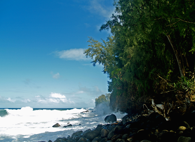
High Surf Warning for north and west shores of Kauai,
Niihau and the north shores of Oahu, Molokai and Maui
High surf Advisory for the west shore of the Big Island
Small Craft Advisory for strengthening trade
winds…and large northwest swell…all waters
Clear to partly cloudy with cloudy periods, showers
falling locally…especially Maui and the Big Island's
windward sides
~~~552am HST Friday morning: clear, light breezes…at my
upcountry Kula, Maui weather tower: 52.3F degrees~~~
The following numbers represent the most recent top wind gusts (mph), along with directions as of Thursday evening:
20 Poipu, Kauai – NE
36 Kuaokala, Oahu – NE
25 Molokai – NNE
18 Kahoolawe – ENE
22 Kapalua, Maui – NE
18 Upolu airport, Big Island – NE
Here are the latest 24-hour precipitation totals (inches) for each of the islands as of late Thursday evening:
0.02 Kilohana, Kauai
0.31 Poamoho RG 1, Oahu
0.08 Molokai
0.00 Lanai
0.00 Kahoolawe
2.45 Puu Kukui, Maui
0.27 Honaunau, Big Island
We can use the following links to see what’s going on in our area of the north central Pacific Ocean. Here's the latest NOAA satellite picture – the latest looping satellite image…and finally the latest looping radar image for the Hawaiian Islands.
~~~ Hawaii Weather Commentary ~~~
Our winds are trades statewide, which will remain light to moderately strong through Friday, then becoming lighter this weekend…before picking up a notch or two again early next week. Here's a weather chart showing a near 1032 millibar high pressure system, located far to the northeast of Hawaii. At the same time, we see a deep storm low pressure system far to our north. A near 1023 millibar high pressure system is also evident to our northwest…moving eastward. Finally, we have the tail-end of a weak cold front to our northwest.
Satellite imagery shows what's left of the old cold front, across parts of Maui County…and part of the Big Island this evening. This weather feature, which brought lots of clouds, and some showers to the eastern islands the last several days, will keep some showers falling along our windward sides tonight, and even into Friday. We can also see the next cold front to our northwest, as it slowly approaches the state. Here's the satellite image, that shows a closer view of the islands, with those clouds associated with the old cold front. The leeward sides should see fewer clouds, and with generally dry conditions prevailing for the most part Friday.
Looking ahead, the weather models continue showing the next cold front approaching the state this weekend, which will stall before arriving by Sunday or Monday. As this next front get closer, it will cause our trade winds to falter again, or at least slow down quite a bit. This will put us back into a modified convective weather pattern, with localized daytime sea breezes, and offshore land breezes at night…at least in our leeward areas. These onshore breezes during the days will prompt afternoon clouds over the leeward slopes of the mountains, with a few showers falling locally. The beaches on our south and west facing leeward sides should have decent weather, with perhaps just a few light showers on the smaller islands. As we get into next week, the front will lose its influence, making way for strengthening trade winds. These trades will be able to carry windward biased clouds and showers our way, with a few sneaking over into the leeward sides at times too. ~~~ I'll be back with more updates this evening, I hope you have a great Thursday night wherever you're reading from! Aloha for now, Glenn.
World-wide tropical cyclone activity:
Atlantic Ocean/Caribbean Sea: There are no active tropical cyclones
Gulf of Mexico: There are no active tropical cyclones
Eastern Pacific Ocean: There are no active tropical cyclones
Central Pacific Ocean: There are no active tropical cyclones
Western Pacific Ocean: There are no active tropical cyclones
South Pacific Ocean: There are no active tropical cyclones
North and South Indian Oceans: Tropical cyclone 13S (Felleng) remains active in the South Indian Ocean, located approximately 275 NM west of La Reunion Island. The Joint Typhoon Warning Center (JTWC) shows this cyclone with 60 knot sustained winds, with gusts to 75 knots. 13S will remain active over the next 96 hours, moving by offshore to the east and southeast of Madagascar, and west and southwest of La Reunion Island…gradually weakening. Here's the graphical track map, along with a satellite image.
Interesting: Few people would argue with the need for air bags on the inside of a car. But on the outside? The idea comes from TNO, a car company in the The Netherlands, where there are now 1.3 bicycles for every resident. Amsterdam alone is home to a half a million riders daily.
In tests, TNO researchers found that when a car hits a bicycle, the rider usually ends up landing on the windshield, with the head and shoulder leading. So they developed an air bag that inflates on the outside of the car, between the bottom edge of the front windshield and the hood.
The car has a forward facing camera under the rear view mirror. Software picks out objects and decides whether it is a pedestrian or cyclist. When either one enters a "time critical" zone — meaning one that they might not have time to get out of the way or the car to brake, the system switches to 'alert' mode.
Sensors in the car bumper detect the collision. Then the air bag deploys, covering the lower half of the windshield. Safety for cyclists is a particularly salient issue in the Netherlands, where the number of bicycles in the country has grown to more than 18 million.
And even though cycling in the Netherlands is relatively safe, there are still some 600 traffic deaths per year involving cyclists and pedestrians, and that number has remained relatively constant.
Mike Says:
Glenn, I'm not sure it is entirely vog. The pollution crisis in China is at an all time high, China now burns almost as much coal as the rest of the world combined….Now, I'm no meteorologist or geophysicist, but might not some of that seemingly inexhaustible exhaust from China be mixing in our our air here in the mid-pacific? CBS NEWS: "The stuff spewing out in China has now been detected in the United States, and some suspect it's beginning to affect the U.S. climate…. "In California, Professor Tom Cahill tracks pollution across the Pacific, and a lot of what he sees these days comes from China" http://www.cbsnews.com/2100-500609_162-178697.html Image from Space: http://mashable.com/2013/01/15/china-pollution-space/ "Detailed chemical and meteorological data from one of these periods … indicates that the surface emissions were lifted into the free troposphere over Asia and then transported to North America in ∼6 days." from the abstract of "Transport of Asian air pollution to North America" Geophysical Research Letters: http://onlinelibrary.wiley.com/doi/10.1029/1999GL900100/abstract Curious your thoughts on this…and mahalo for all you do, Glenn! -mike, Kula, Maui ~~~Hi Mike, very interesting, thank you for your comments! I must admit, it scares me to think I’m breathing the pollution from China these days. Your idea, concerns, seem as right on as anything that I can conceive…concerning this new haze that seems to arrive over parts of the state…even when the trade winds are blowing. I’ll check out those links that you provided, and please stay in touch when you’re inclined. Thanks for your positive comment about my website too. Aloha, Glenn
matt Says:
I think it might be all the vog that got carried up from this last cold front ,then pushed right back on us with the trades . A back and forth kind of thing??~~~That sounds reasonable to me. I trust that once the trade winds start blowing stronger tomorrow, we’ll see some definite clearing of this haze. Aloha, Glenn
matt Says:
Glen ,
I'm so confused with this weather ! I see so much vog but the trades are blowing? I work up in kapalua and usually we always get the windward showers but today was hardly none. When I drove back home today i could see the wind blowing north but still tons of vog Very weird weather lately !!! ~~~ Hi Matt, I totally agree, with that cold front stalling over or near us the last three days, and with lots of passing showers locally, and what looks like vog to me too…I think its weird as well. Here in Kula, it’s been off and on wet for three days, unusual. Thanks for your comments! It toally looks like thick vog to me, although with the winds blowing north and northeast in most areas, I can’t figure it out. Aloha, Glenn
Mel Says:
Hi Glen,
We have trades statewide, and vog? How can this be? ~~~ Mel, I was just looking at what I thought was vog too, from up here in Kula. I was trying to talk myself out of seeing it, as the winds are northeast across the board. I kept thinking that it was just moisture, from all the showers and clouds that are still around now. I’m perplexed, I’ll admit it! Anyone want to chime in, and give their thoughts? Aloha, Glenn
chad Says:
Hi Glenn!
This will be my families 3rd year in a row to Hawaii! We have talked every year about this time. My wife, 3 girls and myself will be coming in on Feb 9th staying until the 18th. We will be staying just north of Lahaina. Like every year my girls want me to write to you to see if you can bring your mojo to those dates:} We are coming from Cold MN so anything at this point would be fine for me! Do you happen to see anything unusual coming your way around those dates?
Take care! We Love your Website!
Chad and Family~~~Hi Chad and family, good to hear from you again. The dates of your visit are still too far out into the future to know for sure. Actually, I don’t have a clue at this point. I’d recommend checking back to this website in about a week, I’ll be writing about the time frame of your vacation in Kaanapali then. Best of luck! Aloha, Glenn