


Air Temperatures – The following maximum temperatures were recorded across the state of Hawaii Wednesday afternoon:
Lihue, Kauai – 81
Honolulu airport, Oahu – M
Molokai airport – 83
Kahului airport, Maui – 86
Kona airport – 80
Hilo airport, Hawaii – 79
Air Temperatures ranged between these warmest and coolest spots near sea level – and on the highest mountain tops around the state…as of 530pm Wednesday evening:
Port Allen, Kauai – 79
Hilo, Hawaii – 74
Haleakala Summit – 45 (near 10,000 feet on Maui)
Mauna Kea Summit – 34 (near 13,800 feet on the Big Island)
Hawaii’s Mountains – Here’s a link to the live web cam on the summit of near 13,800 foot Mauna Kea on the Big Island of Hawaii. This web cam is available during the daylight hours here in the islands…and when there’s a big moon shining down during the night at times. Plus, during the nights you will be able to see stars, and the sunrise and sunset too…depending upon weather conditions. Here's the Haleakala Crater webcam on Maui.
Tropical Cyclone activity in the eastern and central Pacific – Here’s the latest weather information coming out of the National Hurricane Center, covering the eastern north Pacific. You can find the latest tropical cyclone information for the central north Pacific (where Hawaii is located) by clicking on this link to the Central Pacific Hurricane Center. A satellite image, which shows the entire ocean area between Hawaii and the Mexican coast…can be found here.
Aloha Paragraphs
Winds becoming lighter from the southeast,
locally voggy going forward…thick at times
Localized showers at times Thursday-Sunday
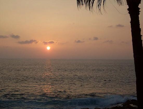
Happy Thanksgiving!
As this weather map shows…we find near 1024 millibar high pressure system now located far to the east-northeast of our islands. Our trades will falter now, and veer to the southeast through the rest of this week.
The following numbers represent the most recent top wind gusts (mph), along with directions as of Wednesday evening:
17 Waimea Heights, Kauai – SW
20 Kahuku Trng, Oahu – ESE
18 Molokai – E
23 Kahoolawe – ESE
20 Lipoa, Maui – ESE
10 Lanai – NE
17 Upolu airport, Big Island – NE
We can use the following links to see what’s going on in our area of the north central Pacific Ocean. Here's the latest NOAA satellite picture – the latest looping satellite image…and finally the latest looping radar image for the Hawaiian Islands.
Here are the latest 24-hour precipitation totals (inches) for each of the islands as of Wednesday evening:
0.56 Mount Waialeale, Kauai
0.64 St. Stephens, Oahu
0.00 Molokai
0.00 Lanai
0.00 Kahoolawe
0.00 Maui
0.38 Mountain View, Big Island
~~ Hawaii evening commentary ~~
Our trade winds are giving way to lighter southeasterly breezes now. We currently find a near 1024 millibar high pressure system (weather map), located far to the east-northeast of the islands…near the west coast. Our local wind flow will become lighter from the southeast now into the weekend. Our atmosphere will turn somewhat more showery, at least locally at times, and especially Thursday and Friday. This off and on showery weather pattern may remain active into the weekend…especially during the afternoon hours. An approaching cold front from the northwest late this weekend, may get driven down through the state Sunday evening…with returning trade winds filling in behind it on Monday.
As we look at this satellite image, we see high and middle level clouds over the islands…although it is breaking up at the moment. It's difficult to see whatever lower level clouds that around, as the higher clouds are blocking them from view. Our trade winds are faltering now, and will remain quite light into the weekend. At the same time, we'll find available moisture to the south of the state, which may help to fuel shower activity in places going forward. The combination of this moisture, lighter winds, and daytime heating of the islands, may lead to an increase in showers…lasting at times into the weekend. As the winds shift to the southeast, we will see hazy conditions develop locally, some of which will be volcanic haze (vog). Here in Maui County this evening, there was already thick volcanic haze in our skies at sunset!
There remains quite a bit of uncertainty around what will happen weatherwise…Thursday through the end of the week. In sum as far as I can tell…we've ended our long lasting trade wind flow now, which will remain absent through the weekend. Low pressure aloft over and around the islands, and near the surface too, will set the stage for unsettled weather conditions through this weekend. Our winds will become noticeably lighter going forward, and remain light from the southeast generally through the weekend as well. This will lead to periods of volcanic haze in some parts of the island chain, some which will be thick in places. The unsettled weather, as mentioned above, will bring possible showers to the islands at times too, although this isn't expected to be a constant rain by any means. The recent high and middle level clouds should thicken up again, filtering and dimming our Hawaiian sunshine during the days, with occasional sunny periods here and there too. Later on Sunday we may see a cold front move down through the state, which will bring a brief period of showery weather. Stay tuned, as there will likely be some necessary fine tuning to all of this over the next few days! Then, we'll see our trade winds finally returning Monday onwards. I'll be back again Thursday morning with your next new weather narrative from paradise, I hope you have a great Wednesday night! Aloha for now…Glenn.
World-wide tropical cyclone activity:
Atlantic Ocean/Caribbean Sea: There are no active tropical cyclones
Gulf of Mexico: There are no active tropical cyclones
Eastern Pacific Ocean: There are no active tropical cyclones
Central Pacific Ocean: There are no active tropical cyclones
Western Pacific Ocean: There are no active tropical cyclones
South Pacific Ocean: There are no active tropical cyclones
North and South Indian Oceans: There are no active tropical cyclones
Interesting: It is no secret that for the last couple decades, as Earth's climate has been changing, sea levels have been steadily rising. But what is not so well known is that in 2011, sea levels throughout the world fell sharply. Of course, with a body of water as large as the world's oceans, a sharp fall only equates to one quarter of an inch.
It is nonetheless, a dramatic change in general trend which caught the eye of NASA and European researchers. Using advanced satellites, they were able to track average sea levels with precision accuracy. What they have found is that after this brief decrease in sea levels, the seas have been rising again and are now back on track with their trajectory of the last twenty years.
The lull occurred between early 2010 and summer 2011. Using the NASA/German Aerospace Center’s Gravity Recovery and Climate Experiment (GRACE) spacecraft, they found that the drop was due to a very strong La Nina that began in late 2010.
This phenomenon which occurs in the Pacific climate changes rain patterns all across the planet, moving immense quantities of water from the oceans and depositing them on continents, particularly Australia, Southeast Asia, and northern South America.
According to a new study recently published, researchers at NASA's Jet Propulsion Laboratory (JPL) in Pasadena, CA found that by mid-2012, global mean sea level had recovered the quarter inch that it dropped in the previous year. Plus, it resumed its long-term annual rise of 0.13 inches per year.
"The water the ocean 'lost' was compensated for rather quickly," said lead study author Carmen Boening of JPL. "The newest data clearly indicate that the drop in 2010-11 was only temporary." Co-author Josh Willis added,
"The dip in global sea levels, brought to us courtesy of a major La Nina event, was little more than a pothole in the long road toward a rising ocean and shrinking coastlines." The severe flooding that occurred during the La Nina has managed to find its way back to the oceans, as the ever-constant hydrologic cycle on Earth continues to find its equilibrium.