


Air Temperatures – The following maximum temperatures were recorded across the state of Hawaii Saturday:
Lihue, Kauai – 83
Honolulu airport, Oahu – 83
Kaneohe, Oahu – 82
Molokai airport – 81
Kahului airport, Maui – 83
Kona airport – 84
Hilo airport, Hawaii – 79
Air Temperatures ranged between these warmest and coolest spots near sea level – and on the highest mountain top around the state…as of 6pm Saturday evening:
Barking Sands, Kauai – 83
Molokai airport – 75
Haleakala Summit – M (near 10,000 feet on Maui)
Mauna Kea Summit – 37 (near 13,800 feet on the Big Island)
Hawaii’s Mountains – Here’s a link to the live web cam on the summit of near 13,800 foot Mauna Kea on the Big Island of Hawaii. This web cam is available during the daylight hours here in the islands…and when there’s a big moon shining down during the night at times. Plus, during the nights you will be able to see stars, and the sunrise and sunset too…depending upon weather conditions. Here's the Haleakala Crater webcam on Maui…although this webcam is not always working correctly.
Tropical Cyclone activity in the eastern and central Pacific – Here’s the latest weather information coming out of the National Hurricane Center, covering the eastern north Pacific. You can find the latest tropical cyclone information for the central north Pacific (where Hawaii is located) by clicking on this link to the Central Pacific Hurricane Center. A satellite image, which shows the entire ocean area between Hawaii and the Mexican coast…can be found here.
Aloha Paragraphs
Locally strong and gusty trade winds, windward
showers at times…a few elsewhere
As this weather map shows, we have a large near 1028 millibar high pressure system to the north-northeast…and northwest of the islands. Our local winds will remain active from the trade wind direction through the next week.
The following numbers represent the most recent top wind gusts (mph), along with directions as of Saturday evening:
30 Waimea Heights, Kauai – ENE
48 Kuaokala, Oahu – ENE
35 Molokai – NE
39 Kahoolawe – ESE
38 Kahului, Maui – NE
40 Lanai – NE
38 Pali 2, Big Island – NE
We can use the following links to see what’s going on in our area of the north central Pacific Ocean. Here's the latest NOAA satellite picture – the latest looping satellite image…and finally the latest looping radar image for the Hawaiian Islands.
Here are the latest 24-hour precipitation totals (inches) for each of the islands as of Saturday evening:
0.45 Mount Waialeale, Kauai
0.74 Manoa Valley, Oahu
0.94 Molokai
0.18 Lanai
0.00 Kahoolawe
2.05 Puu Kukui, Maui
0.87 Kawainui Stream, Big Island
Sunset Commentary: Our trade wind weather pattern will prevail through Sunday…into the new work week ahead. The trade winds remain strong enough to keep small craft wind advisories active across those windiest channels and coastal areas around the state…from Oahu southeast to Maui County and the Big Island. These trade winds will carry windward biased showers our way periodically…most generously during the night and morning hours. A few of these showers will be carried over into leeward sides at times locally. There may be a few generally light afternoon showers at times on the slopes in the Kona and Kau districts on the Big Island…and perhaps along the leeward upcountry slopes of the Haleakala Crater on Maui here and there too.
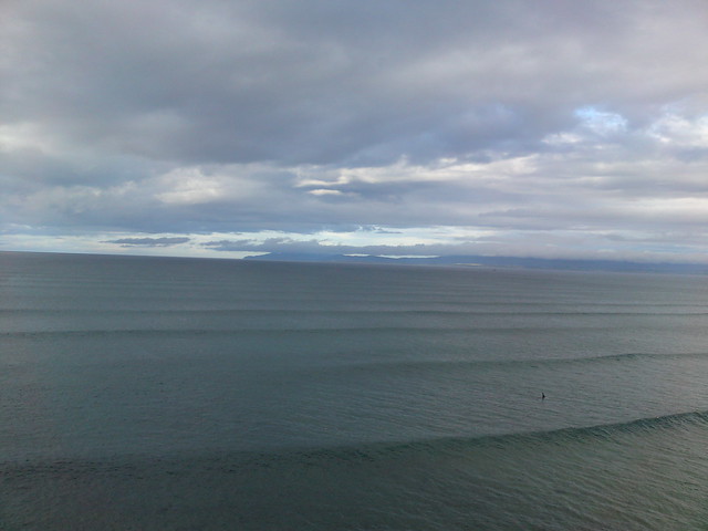
As this satellite image shows, we have more east to west oriented cumulus and stratocumulus clouds upstream clouds to the east and northeast of the islands. These low level clouds will continue to drop occasional showers along our windward sides as they arrive. Meanwhile, there continues to be areas of high cirrus clouds over the ocean, especially to our northwest. The closest ones were located offshore of Kauai and Oahu. Meanwhile, there's a long line of active thunderstorms far south of the islands, down closer to the equator. There's some cirrus pushing toward the islands to some degree. Here's a closer look at our islands using this satellite picture…so we can keep track of those clouds upstream of the islands…as they continue to be carried our way on the gusty trade wind flow.
Friday evening I figured I'd adhere to my regular schedule, so I headed down to Kahului for my usual new film viewing. The one I really want to see is called Savages, although it's just opening, so was likely too crowded for comfort. I'm also looking forward to seeing To Rome With Love, with Woody Allen and Penelope Cruz. Then, lets not forget The Amazing Spider-Man! As it turns out, I saw one that I hadn't planned on seeing, although was getting good marks by the critics, called Magic Mike. The stars in this film include Channing Tatum, Alex Pettyfer, Matthew McConaughey, Cody Horn, and Olivia Munn…among many others. The synopsis: set in the world of male strippers, Mike takes a young dancer called The Kid under his wing and schools him in the fine arts of partying, picking up women, and making easy money. I have to admit, this sounded like fun to me! We'll it happened again, I ended up liking this film quite a bit. I was shocked to see the large theater totally fill up with hip women, who took up every seat in the place. I didn't mind of course, and it was actually rather unique to be one of the few guys in there! Now, after seeing the film, I can see why, they liked the performances by all the handsome men in the film. Fortunately for me, there were some good looking women in the in key roles too. At any rate, I'm going to dole out a solid B grade for Magic Mike, it was entertaining. This trailer may be a bit much for some of you, although on the other hand, it's not overly violent at least…being called a comedy.
Here in Kula, Maui at 635pm, it was partly cloudy with light breeze streaming through my wonderful wind chimes…and a perfect 72.9F degrees. As noted above, our trade winds will continue blowing well into the future. The overall weather picture here in the islands remains rather placid. Nothing unusual happening here in our latitudes of the tropics, which will remain true through Thursday. Looking off in the distance, we have hurricane Daniel far away to our east…in the eastern Pacific. It will continue churning its way westward, more or less in our direction. It want to say that from what I see, there doesn't appear to be a threat for our islands. Despite the strength of the hurricane now, having reached category 2…and the fact that its moving more or less in our direction, it will lose those strong winds well before it gets into our area, although is forecast to still be a tropical storm as it moves into our central part of the Pacific basin. At this point it looks like it might bring us a slug of tropical moisture next Friday or Saturday, which will be about it for us. Here's a looping satellite image of hurricane Daniel, which will peak in strength tonight into Sunday morning. In that same looping satellite image, we see newly formed tropical depression 5E not far to the right of Daniel as well. There's more information about these tropical cyclones just below. ~~~ I'll be back Sunday morning with your next new narrative, and with more information about the tropical cyclones to our east as well. I hope you have a great Saturday night wherever you happen to be spending it! Aloha for now…Glenn.
[World-wide tropical cyclone activity:
Central Pacific Ocean: There are no active tropical cyclones
Eastern Pacific Ocean: Hurricane Daniel (4E) is active about 1050 miles west-southwest of the southern tip of Baja California…with 105 mph sustained winds. Here's the official NHC graphical track map. Here's what the hurricane models are doing with Daniel. Here's a satellite image of this tropical cyclone, and the area of disturbed weather described in the paragraph below. As you can see, Daniel will continue migrating west and then west-northwest away from Mexico, over open ocean in the eastern Pacific. Hurricane Daniel is forecast to remain at hurricane strength through the day Monday. Daniel will then move over cooler sea water, and into an area of drier air, both of which will bring it back into the weaker tropical storm category during the beginning of the new week ahead. It is forecast to gradually lose even more strength as it pushes into our central Pacific basin. The NHC brings it down into a tropical depression as it gets a bit further into our central Pacific…at which point it will still be well to the east-southeast of our Hawaiian Islands. It then becomes a post tropical remnant low pressure system thereafter, thus losing its winds even further to the southeast of the Big Island late in the day Thursday. There's a good chance that the leftover clouds and showers, from what will then be retired tropical cyclone Daniel, as it moves by to the south of the Big Island…could bring a period of increased rainfall to parts of Hawaii later next Friday into the weekend.
Meanwhile, the 5th tropical cyclone of the eastern Pacific remain active, called tropical storm Emilia (5E), located approximately 550 miles south of Manzanillo, Mexico…with 50 mph sustained winds. This strengthening tropical storm will become a hurricane by Monday morning. Here's the official NHC graphical track map. Here's a satellite image showing both 4E and 5E in the far eastern Pacific.
Here's what the hurricane models are showing for this quickly strengthening tropical cyclone.
ELSEWHERE…TROPICAL CYCLONE FORMATION IS NOT EXPECTED DURING THE NEXT 48 HOURS.
Atlantic Ocean/Gulf of Mexico/Caribbean: There are no active tropical cyclones
Western Pacific Ocean: There are no active tropical cyclones
South Pacific Ocean: There are no active tropical cyclones
South and North Indian Oceans: There are no active tropical cyclones
Interesting: A rapid decline for Arctic sea ice extent briefly hit daily record lows in June, led by extensive ice loss in the Bering, Kara, and Beaufort Seas, as well as Hudson and Baffin Bay. Snow extent was unusually low for both May and June, reinforcing the continuing pattern of rapid spring snow melt of the past six years.
Average Arctic sea ice extent for June was 4.24 million square miles, 456,000 square miles below the 1970-2000 average sea ice extent. Sea ice extent for June 2010, 2011, and 2012 has been the lowest in the satellite record. Ice loss was particularly extensive in the Kara and Beaufort Sea, with ice loss in the Hudson and Baffin Bays also contributing to a retreating June ice extent not typically expected until July 21 based on 1970-2000 averages.
Total ice loss for June was 1.10 million square miles, the largest June ice loss in the satellite record, continuing the particularly rapid ice loss in May. Sea ice extent for June 2012 was second lowest on record, behind June 2010. The linear rate of decline of sea ice extent for the month of June measured in the satellite record through 2012 stand at 3.7 percent per decade.
Though weather patterns over the Arctic varied considerably, unusually warm conditions prevailed. Temperatures at about 3000 feet above the ocean surface averaged 1.8 to 7.2 degrees Fahrenheit above the 1981-2000 norm. Near southern Baffin Bay and over Eurasia temperatures were recorded as high as 12.6 to 16.2 degrees F above the ’81-2000 average.
vilamoura weather Says:
My partner and I stumbled over here to your web address and thought I may as well
check things out. I like what I see so now i am following you.
Look forward to exploring your web page again.~~~Hi Vilamoura, good to have you reading my weather information from there in Denmark, Aloha, Glenn
Eliza Says:
Hey Glenn – was looking to use the usual hurricane tracking map you have on the satellite images page, but it is blank. Thanks for the other links above. Appreciation for all your work here. Also… hau'oli la hanau a bit early. ~ Eliza~~~Hi Eliza down in Pukalani, you are right, the satellite page tracking map is broke. I suggest using the ones on the narrative page until further notice. Aloha, Glenn