


Air Temperatures – The following maximum temperatures were recorded across the state of Hawaii Sunday:
Lihue, Kauai – 83
Honolulu airport, Oahu – 85 (Record high temperature for Sunday / 94 -1995)
Kaneohe, Oahu – 81
Molokai airport – 82
Kahului airport, Maui – 85 (Record high temperature for Sunday / 92 -1953)
Kona airport – 85
Hilo airport, Hawaii – 81
Air Temperatures ranged between these warmest and coolest spots near sea level – and on the highest mountain top around the state…as of 5pm Sunday evening:
Barking Sands, Kauai – 84
Kaneohe, Oahu – 75
Haleakala Summit – M (near 10,000 feet on Maui)
Mauna Kea Summit – 41 (near 13,800 feet on the Big Island)
Hawaii’s Mountains – Here’s a link to the live web cam on the summit of near 13,800 foot Mauna Kea on the Big Island of Hawaii. This web cam is available during the daylight hours here in the islands…and when there’s a big moon shining down during the night at times. Plus, during the nights you will be able to see stars, and the sunrise and sunset too…depending upon weather conditions. Here's the Haleakala Crater webcam on Maui…although this webcam is not always working correctly.
Tropical Cyclone activity in the eastern and central Pacific – Here’s the latest weather information coming out of the National Hurricane Center, covering the eastern north Pacific. You can find the latest tropical cyclone information for the central north Pacific (where Hawaii is located) by clicking on this link to the Central Pacific Hurricane Center. A satellite image, which shows the entire ocean area between Hawaii and the Mexican coast…can be found here.
Aloha Paragraphs
Gusty trade winds, windward
showers…a few elsewhere
As this weather map shows, we have a strong near 1037 millibar high pressure system located far to the north-northeast of the islands. Our local winds will remain active from the trade wind direction…moderately strong with some stronger gusts through Monday.
The following numbers represent the most recent top wind gusts (mph), along with directions as of Sunday evening:
31 Puu Opae, Kauai – NNE
39 Kuaokala, Oahu – NE
37 Molokai – NE
39 Kahoolawe – NE
30 Kahului, Maui – NE
35 Lanai – NE
40 Puu Mali, Big Island – NE
We can use the following links to see what’s going on in our area of the north central Pacific Ocean. Here's the latest NOAA satellite picture – the latest looping satellite image…and finally the latest looping radar image for the Hawaiian Islands.
Here are the latest 24-hour precipitation totals (inches) for each of the islands as of Sunday evening:
0.07 Mount Waialeale, Kauai
0.47 Oahu Forest NWR, Oahu
0.16 Molokai
0.00 Lanai
0.00 Kahoolawe
0.82 Puu Kukui, Maui
0.52 Kawainui Stream, Big Island
Sunset Commentary:
Partly to mostly cloudy weather conditions on this Sunday night, with little change in the gusty wind department. High pressure to the northeast will drive our robust trade wind flow. These trades will carry windward showers our way into Monday. A possible modest increase in showers Monday will be an area of clouds that's located ahead of…and to the northwest of now retired tropical cyclone Emilia.
I went to see a new film this past Friday evening, I'm hooked on this type of entertainment…as you may know! I went down to Kahului to see the Woody Allen film called To Rome With Love, starring Woody Allen, Alec Baldwin, Roberto Benigni, Penelope Cruz, Judy Davis, and Greta Gerwig, and Jesse Eisenberg, and Ellen Page…among many others. The synopsis: a story about a number of people in Italy — some American, some Italian, some residents, some visitors — and the romances and adventures and predicaments they get into. The critics are leaning on this film pretty heavily, with not great reviews. Despite this fact, I found myself enjoying this long film quite a bit…with some good laughs throughout. As far as the entertaining value went, I was able to find it easily. I liked the acting, and the fact that that it took place in Rome, Italy. There were some far fetched parts to this film, although that's what Woody Allen is known for. My neighbor met me down there at the theater, and he asked me what grade I'd give it right after the film ended. I couldn't really say at that moment, although now that I've slept on it, a solid B grade is coming to mind. If you like Woody Allen, or the rest of those great actors above, I think you would enjoy sitting through this film. I'm looking forward to getting back into my more regular action packed films next week, likely starting off with a great looking one called Savages. Here's a trailer for the film I saw last night.
I went to see a second film Saturday evening, this was one that I'd been looking forward to seeing greatly…called Savages. This film starred Aaron Johnson, Taylor Kitsch, Salma Hayek, Benicio Del Toro, Blake Lively, Uma Thurman, and John Travolta…among many others. The synopsis: Laguna Beach entrepreneurs Ben, a peaceful and charitable Buddhist, and his closest friend Chon, a former Navy SEAL and ex-mercenary, run a lucrative, homegrown industry–raising some of the best marijuana ever developed. They also share a one-of-a-kind love with the extraordinary beauty Ophelia. Life is idyllic in their Southern California town…until the Mexican Baja Cartel decides to move in and demands that the trio partners with them. When the merciless head of the BC, Elena, and her brutal enforcer, Lado, underestimate the unbreakable bond among these three friends, Ben and Chon–with the reluctant, slippery assistance of a dirty DEA agent–wage a seemingly un-winable war against the cartel. And so begins a series of increasingly vicious ploys and maneuvers in a high stakes, savage battle of wills. ~~~ As you may know, I had high expectations of this action packed film, and believe you me, those were met…but good! This was no light weight film, that's for sure. I liked it very much, and as for a grade, I would put it somewhere between B+ and A-. Now I doubt whether any of you will be clicking on this trailer, but here it is anyway.
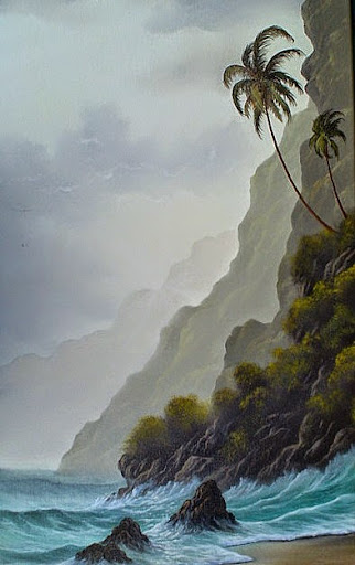
Here in Kula, Maui at 515pm, it was partly to mostly cloudy with occasional breezes…an air temperature of 72.9F degrees. Our local trade winds will continue blowing, generally in the moderately strong range. These winds are pretty normal for our summer season, with gusts up into the 30+ mph range…continuing through the new week ahead. There's a chance that an area of showers may arrive over our windward sides Monday. Otherwise, whatever is left of former Emilia, and it won't be much, will be tracking along very closely to the same path that Daniel took…passing by just to our south by mid-week. The Big Island will have the best chance of seeing a few showers associated with the northern fringe of retired Emilia. In sum, our trade winds will continue well into the future, with windward showers at times into Monday night, otherwise normal summer weather will prevail going forward. ~~~ I'll be back early Monday morning, I hope you have a great Sunday night wherever you happen to be spending it! Aloha for now…Glenn.
[World-wide tropical cyclone activity:
Central Pacific Ocean: There are no active tropical cyclones
Eastern Pacific Ocean: The 6th tropical cyclone of the 2012 hurricane season, called Hurricane Fabio (6E)…is located 685 miles west-southwest of the southern tip of Baja, California. Sustained winds were 90 mph, making this a category 1 hurricane, as it moves in a more or less northwest direction away from the Mexican coast. Here's the official NHC graphical track map, along with a satellite image. Here's the hurricane model output for this hurricane, showing it staying relatively close to Mexico…offshore to the west of Baja California.
ELSEWHERE…TROPICAL CYCLONE FORMATION IS NOT EXPECTED DURING THE NEXT 48 HOURS.
Atlantic Ocean/Gulf of Mexico/Caribbean: There are no active tropical cyclones
Western Pacific Ocean: A tropical cyclone called tropical depression 08W (30 knots of sustained winds)…located 575 NM east-southeast of Kadena AB, Okinawa. 08W will travel in a northwest direction over open ocean, remaining offshore to the southwest and west of the main southern Japanese islands…before impacting south Korea in about three days. Here's the JTWC graphical track map, along with a NOAA satellite image of this gradually strengthening tropical cyclone.
South Pacific Ocean: There are no active tropical cyclones
South and North Indian Oceans: There are no active tropical cyclones
Interesting: A new study by the University of Miami has found that winds played a key role in the British Petroleum Deepwater Horizon oil spill in spring 2010. The oil spill, the largest in the history of the United States, leaked at least 200 million gallons of crude oil into the Gulf of Mexico.
When the accident occurred, the intense loop current drew concerns that the oil at the surface could find its way to southern Florida and the eastern Atlantic Ocean; no oil was observed in the eastern Atlantic Ocean, but was mainly in the area of the northern shorelines of the Gulf of Mexico.
In the study published in the journal Environmental Science & Technology, University of Miami scientists collaborated with the Colorado School of Mines and the Naval Research Laboratory to use numerical simulations to attempt to understand how the oil transported from the site of the oil rig to the northern Gulf coast.
The research team discovered that the wind-induced surface drifts specifically distributed the oil in a path toward the coast. The drift also worked to displace and spread the crude oil on different paths toward the shore. However, the aftereffects of the wind towards the crude oil were not noted in the ocean circulation models of the incident and the nautical weather forecasts during the Deepwater Horizon oil spill.
The team also integrated the wind effect to the ocean currents while executing a three-dimensional model of the oil's extension from the bottom of the Gulf of Mexico to the surface of the ocean. This simulation allowed a practical demonstration of how the oil actually spread to the surface of the Gulf coast.
They also allowed were verified by regional ocean models that incorporate actual data along with the University of Miami's observational composites through their Center for Southeastern Tropical Advanced Remote Sensing. University of Miami scientist Matthieu Le Henaff said that it is extremely daunting to learn how such a large amount of crude oil made it to the surface of the United States, specifically the Gulf Coast and the Atlantic coast of Florida.
"The dominant northward winds during spring and summer of 2010 led the surface oil to be pushed onto the Northern Gulf shelf areas and toward the coasts, away from the interior of the Gulf and the Loop Current southward transport," said Le Hanaff.
"This effect, together with the evolution of the Loop Current, was crucial in maintaining the oil from the Deepwater Horizon rig within the Gulf of Mexico and away from the South Florida coral reefs and beaches."
Interesting2: China, perhaps more than any other country, faces many important and difficult population challenges: reproductive health and reproductive rights, rural-urban migration and reform of the hukou system, and imbalances in the sex ratio at birth. And two deeply connected population issues, the rapid aging of the population, on the one hand, and the low birth rate and the family planning policy on the other, are of great significance to China's future development.
China's population is aging as rapidly as anywhere in the world and its low birth rate means it faces a significant population decline in the not too distant future. In part, China’s population will age because people are living longer, an important dimension of China’s great progress.
But the country’s low birth rate is the most important reason for population aging, leading to a very top-heavy age structure with many elderly, fewer workers, and even fewer children. The low birth rate and population aging mean China faces two important economic challenges.
The first is maintaining economic growth and poverty reduction, while the second is ensuring economic security for hundreds of millions of elderly. First, China needs to retool its approach to capital accumulation. High rates of saving and investment have been critical to fueling economic development, but wealth accumulated by State-owned enterprises and in sovereign wealth funds is not creating economic security for China's elderly.
China needs to refocus its efforts on building strong and successful pension funds that can meet the dual goals of supporting both economic development and economic security for the elderly. China doesn’t need to save more. If anything saving rates are too high. But China needs to save in a different way.
Sandra J Says:
Happy Belated Birthday Glenn. Hope it was very special. Aloha from Vancouver Island, BC~~~Hi Sandra, from all the way up there in Canada! Thanks for your belated BD wishes, it was a very nice day…thanks! Aloha, Glenn