


Air Temperatures – The following maximum temperatures were recorded across the state of Hawaii Friday:
Lihue, Kauai – 79
Honolulu airport, Oahu – 81
Kaneohe, Oahu – M
Molokai airport – 79
Kahului airport, Maui – 83 (Record high temperature for Thursday – 87 / 1950, 66, 70, 84, 97)
Kona airport – 82
Hilo airport, Hawaii – 80
Air Temperatures ranged between these warmest and coolest spots near sea level – and on the highest mountain tops…as of 5pm Friday afternoon:
Barking Sands, Kauai – 80
Princeville, Kauai – 72
Haleakala Crater – 46 (near 10,000 feet on Maui)
Mauna Kea – 34 (near 13,800 feet on the Big Island)
Hawaii’s Mountains – Here’s a link to the live web cam on the summit of near 13,800 foot Mauna Kea on the Big Island of Hawaii. This web cam is available during the daylight hours here in the islands…and when there’s a big moon shining down during the night at times. Plus, during the nights you will be able to see stars, and the sunrise and sunset too…depending upon weather conditions. Here's the Haleakala Crater webcam on Maui…although this webcam is often not working correctly.
Aloha Paragraphs
Nice weather in general, with some windward
showers at times…strong and gusty trades
Small craft wind advisory in the major channels…
in a few of the local coastal zones too
Wind advisory on the Big Island summits
Volcanic haze (vog) starting Monday locally
As this weather map shows, we have near 1033 millibar high pressure systems to the north-northeast, with their associated ridges extending far east and west of the islands. Our winds will remain active from the trade wind direction, locally strong and gusty through the weekend.
The following numbers represent the strongest wind gusts (mph), along with directions Friday evening:
27 Port Allen, Kauai – NE
37 Kuaokala, Oahu – ESE
33 Molokai – NE
44 Kahoolawe – ENE
32 Kahului, Maui – NE
28 Lanai – NE
36 South Point, Big Island – NE
We can use the following links to see what’s going on in our area of the north central Pacific Ocean Friday evening. Looking at this NOAA satellite picture we see scattered low clouds over the ocean in most directions…with some high cirrus clouds to our west. We can use this looping satellite image to see low clouds coming into the state, carried by the gusty trade winds. Checking out this looping radar image we see a few showers being carried over the islands by the trade winds, mostly over the windward coasts and slopes…at the time of this writing.
Here are the 24-hour precipitation totals (inches) for each of the islands as of Friday evening:
0.29 Mount Waialeale, Kauai
0.10 Nuuanu Upper, Oahu
0.00 Molokai
0.00 Kahoolawe
0.07 Puu Kukui, Maui
0.22 Mountain View, Big Island
Sunset Commentary: A well established trade wind weather pattern will remain in control over the islands through the weekend. Small craft wind advisories remain active in the major channels between the islands…and in a few of those windiest coastal zones too. Recently, the NWS office in Honolulu has issued a wind advisory for the summits on the Big Island too. Generally fair weather will prevail through Sunday, as these trade winds prevail.
As we push into the new week ahead, these strong and gusty trade winds will give way to lighter southeast breezes. This will be due to a trough of low pressure, or an associated cold front edging into the area west of Kauai then. The models show this area of low pressure stalling before arriving into the Aloha state however. The winds are forecast to veer to the southeast, we will have vog arriving over the smaller islands for several days.
As for showers through the rest of this week, there will continue to be a few, picking up at night and diminishing during the days for the most part. The latest computer forecast models are still showing some possible weather changes arriving early next week. The first of those could be the arrival of volcanic haze carried over the smaller islands on the southeast winds by Monday. The second could be an increase in clouds and showers…perhaps on the southeast sides of the islands for the most part.
Here in Kula, Maui at 605pm HST, we had light breezes, with partly cloudy skies…and an air temperature of 68F degrees. As I was mentioning above, the trade winds will be our main weather influence here in the islands for the time being. These will carry a few windward biased showers our way, while the leeward sides remain generally dry. The high clouds we see on satellite imagery to our southwest and west, seem to be staying away for the moment. The computer models are showing these high clouds shifting over the islands in a couple of days, which may stick around well into the new work week ahead. When they do make it over us, then we'd see sun filtering and dimming happening during the days. At the moment, they look pretty scattered at best, and continue to just fade away as they get closer. As we move into the early part of the new work week ahead, the winds will turn southeast, carrying volcanic haze over the smaller islands, issuing from the vents on the Big Island. Those southeast winds may be able to carry some moisture from over the ocean onto our islands locally too. The trade winds will rebound by mid-week, ushering in windward showers for several days then.
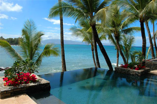
~~~ Gosh, I can't believe I went again today, up into the Haleakala National Park! That makes it three of the last four days, that I took the relatively short drive up there for recreation and pleasure. The recreation included hiking, skateboarding, and just wandering around out in nature. This place that I go, there are hardly any other folks taking advantage of the area, which is fine with me. The pleasure part of going up there is all about experiencing a quiet, peaceful place to hang out, to just enjoy my own company, and to commune with nature. The skateboarding is fine too, as the stretch of road that I do this on, is just the right pitch, with a good smooth surface. I tried to skate on a different part of the road on the way up to this secret spot, but the traffic was too heavy, and I kept having to stop and let cars go by. ~~~ On another note, and as I mentioned this morning, I'm taking a couple of lady friends out to dinner tonight at Mama's Fish House. This is a special treat in terms of quality of service, and the excellent fish dinners that get plated down there! I know several of the employees too, and its always a treat to chat with them during the course of the dinner. ~~~ I'll be back Saturday morning with your next new weather narrative, and will look forward to sharing the latest weather haps that are coming down then! I hope you have a great Friday night until then, Aloha for now…Glenn.
Extra: I'm tracking the number of page views for this website, and continue to be happy with the results, as this evening's number shows 415,000. At the same time, there have been 3,789 google ad clicks, which is good…as this is how I partly earn a few bucks for my time and effort at keeping Hawaii Weather Today updated each day.
Last month there were a total of 388,252 page views, with 3,065 google ad clicks. It's more than the numbers though, its that "I write and you read", that's the real beauty of this weather relationship that we have going on here! It's that you are interested in the weather too, just as I am, and we get the job done together so well.
I absolutely know that when the weather here in Hawaii is a big deal, going off so to speak, many more of you come looking for information…and when things settle down, like they are now, the numbers slim down. At any rate, thank you very much for making this website…at least one of your weather information sources! Aloha, Glenn.
Interesting: What was killing all those honeybees in recent years? New research shows a link between an increase in the death of bees and insecticides, specifically the chemicals used to coat corn seeds. The study, titled "Assessment of the Environmental Exposure of Honeybees to Particulate Matter Containing Neonicotinoid Insecticides Coming from Corn Coated Seeds," was published in the American Chemical Society's Environmental Science & Technology journal, and provides insight into colony collapse disorder.
Colony collapse disorder, or the mass die-off of honeybees, has stumped researchers up to now. This new research may provide information that could lead to even more answers. According to the new study, neonicotinoid insecticides "are among the most widely used in the world, popular because they kill insects by paralyzing nerves but have lower toxicity for other animals."
Beekeepers immediately observed an increase in die-offs right around the time of corn planting using this particular kind of insecticide. Pneumatic drilling machines suck the seeds in and spray them with the insecticide to create a coating before they are planted in the ground.
Researchers suspected the mass die-offs could have been caused by the particles of insecticide that were released into the air by the machines when the chemicals are sprayed. The researchers tested several methods to make the drilling machines safer for bees.
However, they found that all variations that used the neonicotinoid insecticides continued to cause mass die-offs of bees. Honeybees are critical for pollinating food crops. Scientists say the disruption of pollination could dramatically affect entire ecosystems.
In addition, as the researchers wrote in the study, "In view of the currently increasing crop production, and also of corn as a renewable energy source, the correct use of these insecticides within sustainable agriculture is a cause of concern."
Elaine Says:
Good morning I hope you enjoyed your evening at Mamma's Fish House with your Lady Friends.From your comments My Daughter and I have decided that we can't miss this place on our trip this summer. We will be sure to tell them Glenn sent us…….~~~Hi Elaine, I know that you’ll like it very much, all the fish dishes are excellent! Aloha, Glenn
Elaine Says:
HELLO GLENN, I LIVE IN CALGARY ALBERTA. I START OFF MY DAY BY READING WHAT INTERESTING THINGS YOU HAVE TO SAY EACH DAY. I LOVE MAUI AND WISH I COULD VISIT MORE OFTEN. YOUR DAILY NARRATIVE KEEPS ME IN TOUCH AND BRINGS ME CLOSER TO MY DREAM PLACE. I WILL BE VISITING THIS SUMMER WITH MY DAUGHTER AND HAVE BEEN TRYING TO DECIDED IF WE CAN AFFORD MAMMA'S FISH HOUSE. I READ THAT YOU ARE GOING THERE FOR DINNER TONIGHT. PLEASE LET US KNOW HOW YOUR DINNER EXPERIENCE TURNS OUT. IS IT WORTH THE $$$$$$, THANKS AGAIN FOR ALL YOU DO FOR US WHO LIVE FAR AWAY. BUT YOU DO BRINGS US CLOSER TO MAUI JUST BY READING YOUR SITE….PS LOVE THE PICTURES YOU POST AS WELL.~~~Hi Elaine, very nice to hear from you there in the north country, in Calgary…at least in relation to here in the tropics. I can tell you love Maui, as do I, as do many, many others! As for Mama’s Fish House, it is on the expensive side, although if you are looking for a quality experience, right on the ocean, it can’t be beat. It’s my favorite restaurant on the island of Maui. I hope you have fun here, and it sounds like you will be taking full advantage of our lovely island. Thanks for your positive comments too! Aloha, Glenn