


June 8-9, 2010
Air Temperatures – The following maximum temperatures were recorded across the state of Hawaii Tuesday afternoon:
Lihue, Kauai – 83
Honolulu, Oahu – 86
Kaneohe, Oahu – 82
Kaunakakai, Molokai – 84
Kahului, Maui – 87
Hilo, Hawaii – 84
Kailua-kona – 82
Air Temperatures ranged between these warmest and coolest spots near sea level around the state – and on the highest mountains…at 5pm Tuesday evening:
Barking Sands, Kauai – 85F
Princeville, Kauai – 77
Haleakala Crater – 57 (near 10,000 feet on Maui)
Mauna Kea summit – 43 (near 14,000 feet on the Big Island)
Precipitation Totals – The following numbers represent the largest precipitation totals (inches) during the last 24 hours on each of the major islands, as of Tuesday afternoon:
0.47 Mount Waialaele, Kauai
0.24 Manoa Valley, Oahu
0.06 Molokai
0.00 Lanai
0.01 Kahoolawe
0.15 West Wailuaiki, Maui
0.72 Kawainui Stream, Big Island
Marine Winds – Here’s the latest (automatically updated) weather map showing high pressure systems to the northeast of our islands. Trade wind speeds will be locally strong and gusty through Thursday.
Satellite and Radar Images: To view the cloud conditions we have here in Hawaii, please use the following satellite links, starting off with this Infrared Satellite Image of the islands to see all the clouds around the state during the day and night. This next image is one that gives close images of the islands only during the daytime hours, and is referred to as a Close-up visible image. This next image shows a larger view of the Pacific…giving perspective to the wider ranging cloud patterns in the Pacific Ocean. Finally, here’s a Looping IR satellite image, making viewable the clouds around the islands 24 hours a day. To help you keep track of where any showers may be around the islands, here’s the latest animated radar image.
Hawaii’s Mountains – Here’s a link to the live webcam on the summit of near 14,000 foot Mauna Kea on the Big Island of Hawaii. The tallest peak on the island of Maui is the Haleakala Crater, which is near 10,000 feet in elevation. These two webcams are available during the daylight hours here in the islands…and when there’s a big moon rising just after sunset for an hour or two! Plus, during the nights and early mornings you will be able to see stars, and the sunrise too…depending upon weather conditions.
Tropical Cyclone activity in the eastern and central Pacific – Here’s the latest weather information coming out of the National Hurricane Center, covering the eastern north Pacific. You can find the latest tropical cyclone information for the central north Pacific (where Hawaii is located) by clicking on this link to the Central Pacific Hurricane Center. Here’s a tracking map covering both the eastern and central Pacific Ocean. A satellite image, which shows the entire ocean area between Hawaii and the Mexican coast…can be found here. Of course, as we know, our hurricane season won’t begin again until June 1st here in the central Pacific.
Aloha Paragraphs
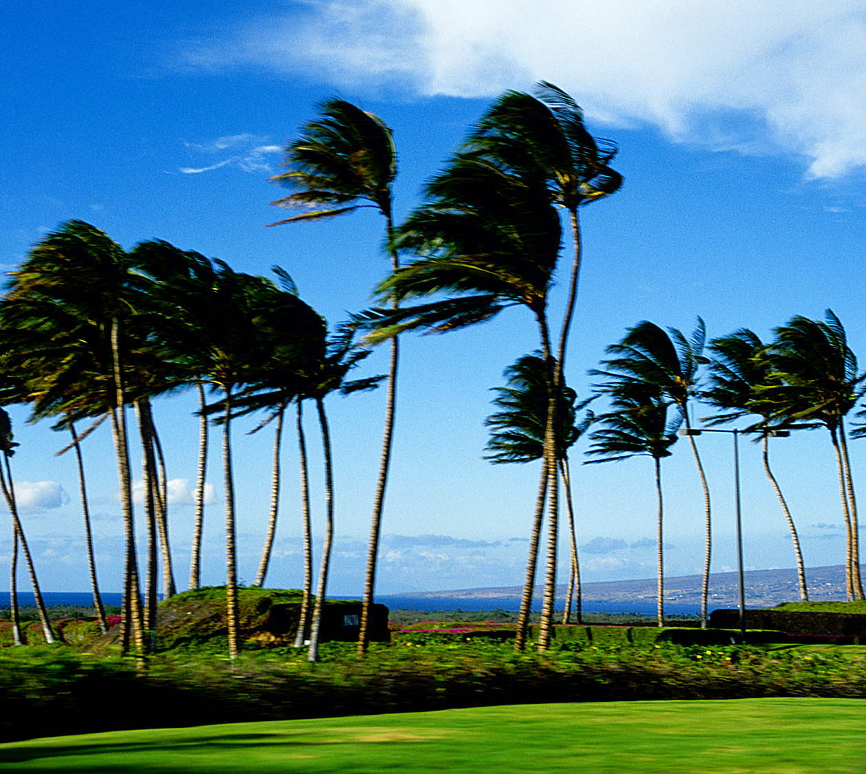
Blustery trade wind weather pattern
Our local trade winds increased during the day Tuesday, which will remain on the blustery side through Friday…calming down a touch by the weekend. As we glance at this weather map, we find several high pressure systems spread out to our northeast Tuesday night
The expected increase in windward showers didn’t happen as expected, despite the presence of a trough of low pressure which recently passed across the island chain. As this IR satellite image shows, we see no lack of low clouds, and some middle level clouds over the
It’s Tuesday evening as I begin writing the last section of today’s narrative. The trade winds are strong enough now, that the NWS forecast office is keeping a small craft wind advisory active in the southern part of the island chain. The winds atop the two highest summits on the Big Island, and Maui too, have gotten windy enough, that the NWS has issued a wind advisory up there through Thursday morning. As noted above, the rainfall that we expected seems to be letting us down. ~~~ Wednesday I will be taking off for a week long visit to see my family in Long Beach, California. I’ll fly back to Maui the following Wednesday. I look forward to seeing my Mom and Dad, and my sisters and brother too. ~~~ Looking out the window of my office here in Kihei, Maui this evening, I can see smoke in the air, coming from two wild fires that are burning upslope from the Maalaea Bay. The winds are still strong enough to really be whipping these flames along. Speaking of strong winds,
these are strongest gusts at around 6pm on each of the islands:
Kauai – 32 mph
Oahu – 38
Molokai – 37
Kahoolawe – 44
Maui – 46
Lanai – 00 – blocked from the gusty trade winds
Big Island – 39
Other than the smokey air, and strong and gusty winds here in Maui County, skies are actually quite cloud free. I’ll return early Wednesday morning to sign off for a week, as I go to visit my family. I hope you have a great Tuesday night until then! Aloha, Glenn
Eliza Says:
Hi Glenn – now that I live in Pukalani (just off the upper end of Iolani), I’d best be prepared for this kind of thing. Just had quite a ‘dust devil’ pass by. Really severe winds and I could see the spin in the leaves picked up as it headed down hill. Back to normal trades now. Wheee! Have a great vacation with your family. ~ Eliza~~~Hi Eliza, it’s a windy day, with winds here on Maui gusting up over 40 mph at both Kahului and Maalaea Bay…I would imagine that you folks are gusting over 30 mph too. Hang on, and thanks for your well wishes! Aloha, Glenn