


June 5-6, 2010
Air Temperatures – The following maximum temperatures were recorded across the state of Hawaii Saturday afternoon:
Lihue, Kauai – 82
Honolulu, Oahu – 87
Kaneohe, Oahu – 82
Kaunakakai, Molokai – 83
Kahului, Maui – 86
Hilo, Hawaii – 83
Kailua-kona – 82
Air Temperatures ranged between these warmest and coolest spots near sea level around the state – and on the highest mountains…at 4pm Saturday afternoon:
Honolulu, Oahu – 84F
Hilo, Hawaii – 79
Haleakala Crater – 61 (near 10,000 feet on Maui)
Mauna Kea summit – 48 (near 14,000 feet on the Big Island)
Precipitation Totals – The following numbers represent the largest precipitation totals (inches) during the last 24 hours on each of the major islands, as of Saturday afternoon:
0.19 Mount Waialaele, Kauai
0.08 Manoa Valley, Oahu
0.05 Molokai
0.00 Lanai
0.00 Kahoolawe
0.05 Oheo Gulch, Maui
0.53 Kawainui Stream, Big Island
Marine Winds – Here’s the latest (automatically updated) weather map showing a 1023 millibar high pressure system to our east-northeast…with its ridge extending westward to the north of Kauai. The trade wind flow will remain light to moderately strong Sunday and Monday.
Satellite and Radar Images: To view the cloud conditions we have here in Hawaii, please use the following satellite links, starting off with this Infrared Satellite Image of the islands to see all the clouds around the state during the day and night. This next image is one that gives close images of the islands only during the daytime hours, and is referred to as a Close-up visible image. This next image shows a larger view of the Pacific…giving perspective to the wider ranging cloud patterns in the Pacific Ocean. Finally, here’s a Looping IR satellite image, making viewable the clouds around the islands 24 hours a day. To help you keep track of where any showers may be around the islands, here’s the latest animated radar image.
Hawaii’s Mountains – Here’s a link to the live webcam on the summit of near 14,000 foot Mauna Kea on the Big Island of Hawaii. The tallest peak on the island of Maui is the Haleakala Crater, which is near 10,000 feet in elevation. These two webcams are available during the daylight hours here in the islands…and when there’s a big moon rising just after sunset for an hour or two! Plus, during the nights and early mornings you will be able to see stars, and the sunrise too…depending upon weather conditions.
Tropical Cyclone activity in the eastern and central Pacific – Here’s the latest weather information coming out of the National Hurricane Center, covering the eastern north Pacific. You can find the latest tropical cyclone information for the central north Pacific (where Hawaii is located) by clicking on this link to the Central Pacific Hurricane Center. Here’s a tracking map covering both the eastern and central Pacific Ocean. A satellite image, which shows the entire ocean area between Hawaii and the Mexican coast…can be found here. Of course, as we know, our hurricane season won’t begin again until June 1st here in the central Pacific.
Aloha Paragraphs
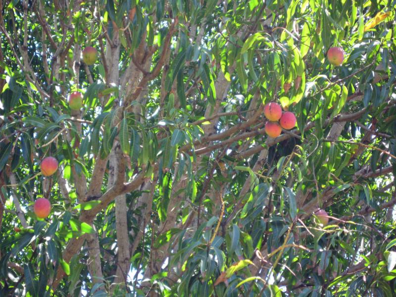
Ripe mangoes hanging…ready for the picking
The trade winds will continue, blowing in the light to moderately strong range through the weekend…into the new week ahead. The forecast calls for a bump-up in strength towards into Wednesday. As the winds are on the lighter side now, there are no small craft advisories active anywhere in the coastal or channel waters. However, the winds atop the summits on the Big Island remain stronger than usual…thus a wind advisory is active up there into Sunday morning. As this weather map shows, we a 1023 high pressure system, more or less to the east-northeast of our islands. This high’s ridge extends westward, passing by to the north of
Besides the somewhat lighter winds now, we find a very dry and stable atmosphere overhead, which in turn is greatly limiting our precipitation activity. There has been hardly any rainfall through the last 24 hours…with little increase expected Sunday. If we take a look at this satellite image, we can see that despite the lack of rainfall, there certainly isn’t any lack of low clouds to our east. There are also some fairly thin high cirrus clouds to our west as well…which appears to be disappearing. This larger view of the tropics shows an area high icy clouds to our southeast. Meanwhile, there may be a couple of modest opportunities for added windward showers, although not all that much rainfall, over the next 4-6 days…associated with upper level troughs in our area. These potential showers would fall generally along the windward sides, leaving the leeward sides alone for the most part.
It’s Saturday evening as I begin writing the last section of today’s narrative.
The trade winds remain active, although as noted above, somewhat less strong than would normally be expected in early June. As has been the case most of this week so far, the generally dry low clouds increase during the nights. These stratocumuls clouds have been evaporating during the days, under the influence of the warm sunshine’s influence. ~~~ As we move into the new week, I will be taking off for a week long visit to visit with my family in Long Beach, California. I’ll leave on Wednesday, and fly back to Maui the following Wednesday. I look forward to seeing my Mom and Dad, and my sisters and brother too. I’ll remind you of this a couple more times before I leave the islands. ~~~ I’m getting ready to head down to the beach again, as I did late in the day Friday. I can see clear blue skies over towards Paia, while it’s cloudy up here in Kula. I’ll go down there and talk a nice walk, and more than likely jump in the warm ocean again too. I’ll be back Sunday morning with your next new weather narrative, I hope you have a great Saturday night until then! Aloha for now…Glenn.
Interesting: Things have gotten quiet at Iceland’s Eyjafjallajokull volcano. The silence is good news for European airlines and passengers who suffered through weeks of travel chaos earlier this year when the Icelandic volcano erupted and spewed ash into the skies over Europe. Scientists monitoring Eyjafjallajokull indicate that the volcano’s magma chambers are nearly empty and ash production has stopped.
The volcano’s temperature has dropped and only steam is puffing benignly from the crater. Forecasting volcanic activity is not an exact science, but experts think that Eyjafjallajokull has gone dormant, for the time being. In the future, volcanic eruptions may not cause the air traffic chaos that followed this spring’s ash clouds from Iceland’s Eyjafjallajokull.
European airline EasyJet has installed an experimental Airborne Volcanic Object Identifier and Detector (Avoid) system on one of its Airbus jets. If it works, the system could allow pilots to see and avoid areas of airborne volcanic ash. Ironically, the new system will have to be tested elsewhere since the skies over Europe are currently ash-free.
Interesting2: The health of a waterway is entirely dependent on the status of its riparian zone, the area of land from which storm water flows. In urban environments, which are typically found along a waterway, that land is altered, and the flow of water to the stream or river is affected. These changes can have a devastating effect on the populations of aquatic life that reside there.
As development increases, impervious surfaces like roads, buildings, and parking lots cover more of the riparian zone. During a storm, the water is unable to penetrate the ground surface to recharge the aquifer. Instead it rapidly flows over the surface in the direction gravity takes it. Storm water drains aid in its precipitous movement to the nearby stream or river.
This massive influx of storm water into river systems can spell trouble for its native species. According to Tom Cuffney, biologist for the United States Geological Survey (USGS), when the area of impervious cover reaches ten percent, one can expect many types of pollution-sensitive aquatic insects to decline by up to one third.
He says, "We learned that there is no ‘safezone,’ meaning that even minimal or early stages of development can negatively affect aquatic life in urban streams." There are several reasons why excess storm water runoff is detrimental to riverine ecosystems. First of all, in urban environments, storm water is a major source of water pollution.
Human activities result in the deposition of environmental contaminants onto the ground in the riparian zone. Fertilizer is used widespread on lawns, parks, and golf courses. While the fertilizer helps the growth of grass, its chemicals can be toxic when ingested by other organisms. Another human source is ice melt, which is strewn intentionally over impervious surfaces, often in liberal quantities.
The rock salt and calcium chloride pellets can change the chemical composition of water systems, which can affect sensitive species. Another source that comes from our roadways is spilled gasoline and leaks of other automotive fluids. In a storm, these petroleum chemicals are whisked directly to the nearest stream.
This all does not even include litter and other industrial pollutants that make their way into storm drains. Secondly, stream/river systems are damaged by the amount of water itself. The rapid rise and fall in the water level can alter the temperature of the water and completely alter the natural flow regime. A steady flow regime is critical for the spawning, juvenile development, and migration of aquatic species.
The increase in water flow can also lead to increased erosion of the stream/river banks and encourage the spread of invasive weeds. The USGS studied the effects of urbanization of nine metropolitan areas. They looked at the effects on algae, aquatic insects, fish, habitat, and chemistry. After comparison, they found that not all the streams react the same way to urbanization.
A lot of this depends on the surrounding land use prior to urbanization, whether it was forested or agricultural. Forested streams were degraded more than agricultural streams. The reason for this is that the streams in agricultural riparian zones were already degraded from fertilizer runoff. The differences also stem from a number of other factors such as population density, soils, hydrology, and climate.
The management of storm water has become a priority for many state and local officials like Tom Schueler, coordinator for the Chesapeake Stormwater Network. Schueler says of the USGS study, "The information has been useful in helping us to predict and manage the future impacts of urban development on streams and reinforces the importance of having green infrastructure to control storm water runoff and protect aquatic life."
There are several methods used for storm water management. Retention ponds can be built near impervious surfaces to capture the runoff and gradually let it evaporate or infiltrate the ground. Systems can be constructed that remove contaminants before they enter the surface water such as drain filters and skimmers.
Wetlands, ponds, or swales can be built using existing drainage structures like pipes and concrete channels. Source control can be implemented to prevent the release of hazardous substances from being released in the first place. And of course, community education about pollution and improving water quality is important.
The USGS studies are helpful in meeting the challenge of urban storm water runoff because they represent an integrated approach. They take into account urbanization’s effects on the physical, chemical, and biological characteristics of river/stream systems. This information is useful to develop strategies for stream protection in varying geographic locations, and can be used to evaluate the effectiveness of those strategies down the road.
leimomi kekina Says:
Hey, Glenn! How are you? Here on Maui little while. Raced from Kahului to Ka’anapali yesterday, took folks out for free sailing canoe rides off Ka’anapali today, and racing tomorrow to hale o lono. Then escort boat back to maui somewhere and fly out monday. What a super busy, beautiful weekend in maui. Wish we coulda hooked up. Have a safe trip. Aloha, Leimomi~~~Hi Leimomi, good to hear from you, racing around Maui…away from your home base on Oahu. Sounds like a lot of fun, enjoy the rest of your time here, and thanks for your well wishes on my week away to see the family. Aloha, Glenn
Sean Crickmer Says:
Interestingly, the beaver- still hunted as a pest in many places- builds environments that control or limit storm water runoff.~~~Sean, I agree, there are many injustices that happen in nature…as a result of mans handling of the situation. Aloha, Glenn