


March 31 – April 1, 2009
Air Temperatures – The following maximum temperatures were recorded across the state of Hawaii Tuesday afternoon:
Lihue, Kauai – 75
Honolulu, Oahu – 81
Kaneohe, Oahu – 76
Kahului, Maui – 78
Hilo, Hawaii – 75
Kailua-kona – 81
Air Temperatures ranged between these warmest and coolest spots near sea level – and on the highest mountains…at 4 p.m. Tuesday afternoon:
Port Allen, Kauai – 79F
Hilo, Hawaii – 68
Haleakala Crater – 41 (near 10,000 feet on Maui)
Mauna Kea summit – 32 (near 14,000 feet on the Big Island)
Precipitation Totals – The following numbers represent the largest precipitation totals (inches) during the last 24 hours on each of the major islands, as of Tuesday afternoon:
1.57 Mount Waialaele, Kauai
0.60 Mililani, Oahu
0.05 Molokai
0.00 Lanai
0.00 Kahoolawe
1.25 Kaupo Gap, Maui
1.13 Mountain View, Big Island
Weather Chart – Here’s the latest (automatically updated) weather map showing a expansive 1038 millibar high pressure system far to the northeast of the islands. Our trade winds will be locally strong and gusty Wednesday and Thursday…lighter in those more protected places.
Satellite and Radar Images: To view the cloud conditions we have here in Hawaii, please use the following satellite links, starting off with the Infrared Satellite Image of the islands to see all the clouds around the state during the day and night. This next image is one that gives close images of the islands only during the daytime hours, and is referred to as a Close-up visible image. This next image shows a larger view of the Pacific…giving perspective to the wider ranging cloud patterns in the Pacific Ocean. Finally, here’s a looping IR satellite image, making viewable the clouds around the islands 24 hours a day. To help you keep track of where any showers may be around the islands, here’s the latest animated radar image.
Hawaii’s Mountains – Here’s a link to the live webcam on the summit of near 14,000 foot Mauna Kea on the Big Island of Hawaii. The tallest peak on the island of Maui is the Haleakala Crater, which is near 10,000 feet in elevation. These two webcams are available during the daylight hours here in the islands…and when there’s a big moon rising just after sunset for an hour or two! Plus, during the nights and early mornings you will be able to see stars, and the sunrise too…depending upon weather conditions.
Aloha Paragraphs
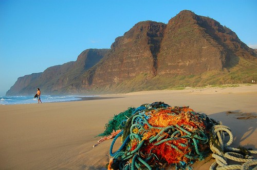
Sandy beach, ropes, nets and stuff…Polihale, Kauai
Photo Credit: Google.com
The gusty trade winds will remain the headline weather news through the next couple of days…at least. An unusually large 1040 millibar high pressure system remains the source of these locally strong and gusty winds Tuesday night…which will be moving slightly closer to Hawaii Wednesday. These winds are strong enough to keep small craft wind advisories active over all of Hawaii’s channel and coastal waters. A high surf advisory for the east facing shores is active, due to the rough surf pounding those beaches. The computer models suggest that these trade winds will blow through the rest of this week into next week.
As the trade winds become even more blustery, we should see even more showers being carried our way…generally along the windward sides. These showers will be moving along rapidly, under the influence of the strong and gusty winds. This will keep the showers from being too overbearing in most areas, falling in an off and on…although more on than off at times! Meanwhile, the high cirrus clouds located to the west and southwest of our islands, have made another surge in our direction Tuesday. Looking at this satellite image, we can see them moving over the 50th state once again…which will filter and dim our Hawaiian sunshine temporarily. As we know, they are famous for sometimes bringing us colorful sunrise and sunset colors.
Let’s keep track of the trade wind gusts again Tuesday, as they will continue to dominate our Hawaiian Island weather picture. These trade winds were still quite gusty at around 4pm Tuesday afternoon, with these numbers (mph) the strongest on each of the individual islands:
Kauai: 32
Oahu: 42
Molokai: 35
Lanai: 35
Kahoolawe: 47
Maui: 42
Big Island: 37
The winds late Tuesday afternoon remain gusty, especially around Maui County and Oahu…where 40+ mph gusts were blowing. These strong trade winds will last for another couple of hours, before settling down some overnight, at least they usually do…only to flare up again on Wednesday.
It’s early Tuesday evening here in Kihei, Maui, as I begin typing out this last section. Not much has changed since early this morning, in terms of the strong and gusty trade winds that is. They’re still kicking up their heels, and should gain a little more velocity on Wednesday. Besides the winds, which I covered quite a bit above, we have generally cloudy skies out there late in the day. This cloudiness isn’t situated in the lower levels of the atmosphere, but rather up high, where those cirrus clouds are being carried along in the sub-tropical jet stream. These will definitely give us a good reason to keep an eye on our skies around sunset time…and then again early Wednesday when the sun comes up again. I notice that there are some middle level clouds mixed into this overcast, which can sometimes get in the way of our most colorful sunset and sunrise events.
~~~ What else? Well, lets see, oh yeah, there was an increase in our trade wind born showers, along our windward sides Tuesday, which will remain wet. The trade winds are coming at us from more or less directly east. This will account for a couple of things, the first is relatively warm air, or what we could call seasonable during the last day of March, going into the first day of April. The second point I want to make is that whatever clouds get carried into our area, will deposit their moisture generally along our north and east facing windward coasts and slopes. That doesn’t mean that the south and west facing leeward beaches won’t see a couple of drops falling, or even a light shower, carried over that way on the fresh trade wind flow…only on the smaller islands from to Molokai. Since we’re talking about precipitation, here’s a looping radar image for the islands.
~~~ I’m just about ready to hit the road, for the 40 or so minute drive back upcountry to Kula. Looking out the window here in Kihei, there’s no doubt about it, it’s cloudy out there. Not a heavy duty rainfall inducing overcast, but just a pretty good high cloud overcast. I may sound quite chipper writing these words, but I’m actually a little down in the mouth, as I got some news about my Dad’s health, that was not uplifting. I’m hoping for the best, and apparently this particular condition is slow growing, and many men can live a long time with such a problem. My Dad, Ed James, is a real trooper, and has got a good strong constitution otherwise. At any rate, setting that aside for the time being, I’ll look forward to catching up with you early Wednesday morning, when I’ll be back online with your next new weather narrative from paradise. I hope you have a great Tuesday night, and if you’re here in the islands, don’t forget to check out the possible nice sunset this evening, and at least lift your head off the pillow Wednesday morning for a peek at that beautiful pink and orange sunrise! Aloha for now…Glenn.
Interesting: Organizers of the 2010 Olympic Winter Games said on Monday they are confident they can find sponsors to help with the estimated $3.6 million cost of keeping the event from adding to global warming. The Winter Games in Vancouver are expected to create about 300,000 tons of carbon emissions, including those from airplanes bringing thousands of athletes and spectators to the western Canadian city.
The Vancouver Organizing Committee said it is in talks with carbon offset management companies it hopes will help sponsor the cost of buying credits, which it said is running between C$10 and C$20 a ton. But the search for sponsors also comes as VANOC and other international sporting event groups are struggling to line up sponsors amid the global economic crisis. We’re very confident we will be able to get partners on this," VANOC chief executive John Furlong told reporters outside an international conference in Vancouver on the environmental costs of major sports events.
Interesting2: The Nature Conservancy has sold 92,000 acres of forest in the Adirondacks to a Danish pension fund as part of a long-term strategy to protect the land from development. The pension fund, ATP, paid $32.8 million for the acreage. The fund will benefit from tax credits related to a planned New York State conservation easement on the land that prohibits development but allows recreation and logging under strict sustainable forestry standards.
RMK Timberland Group will manage the land for the pension fund. Officials at the conservancy, an international nonprofit environmental group, said the transaction struck a balance between protection of wild lands and the region’s economic interests.
Not only will it maintain environmentally responsible logging operations, they said, but it will create the opportunity for moneymaking recreational uses in areas that have been closed to the public. "This is an extraordinary investment in the Adirondack economy by a world leader pension fund, and an affirmation of the viability of green investment in timber," said Michael T. Carr, executive director of the Adirondack chapter of the Nature Conservancy.
The land is part of 161,000 acres in the Adirondacks, including mountain peaks, lakes, ponds, rivers, streams and a commercial forest, that the Nature Conservancy bought in 2007 from the Finch Paper company for $110 million to prevent it from being subdivided and developed by builders of houses and resorts.
Interesting3: Still reeling from the national salmonella outbreak in peanuts, the Food and Drug Administration said central California-based Setton Farms, the nation’s second-largest pistachio processor, was voluntarily recalling all of its 2008 crop — more than 1 million pounds of nuts. "Our advice to consumers is that they avoid eating pistachio products, and that they hold onto those products," said Dr. David Acheson, assistant commissioner for food safety. "The number of products that are going to be recalled over the coming days will grow, simply because these pistachio nuts have then been repackaged into consumer-level containers."
Two people called the FDA complaining of gastrointestinal illness that could be associated with the nuts, but the link hasn’t been confirmed, Acheson said. Still, the plant decided to shut down late last week, officials said. The recalled nuts represent a small fraction of the 60 million pounds of pistachios that the company’s plant can process each year and an even smaller portion of the 278 million pounds produced in the state in the 2008 season, according to the Fresno-based Administrative Committee for Pistachios.
Interesting4: Airlines will reduce their carbon emissions by nearly 8 percent this year as they slash the number of flights they operate in line with a drop in both cargo and passenger demand, executives said on Tuesday. The airline sector was once seen as a driving force behind global warming, which is linked to the burning of fossil fuels such as oil, but the world financial crisis has taken the heat off the industry, which is keen to save fuel to reduce costs.
About 6 percent of the forecast carbon cut will come as a result of carriers flying fewer planes in 2009, and a further 1.8 percent reflects steps to improve energy efficiency, the International Air Transport Association (IATA) said. IATA Director-General Giovanni Bisignani also reported that leading carriers have run successful tests with bio-fuels made from plants, raising the possibility that algae and other crops could be certified to power flights as early as next year. Continental Airlines, Japan Airlines, Air New Zealand and Virgin have all had positive results with bio-jet fuels made from algae, the non-food crop jatropha, and camelina, a type of flax.
Interesting5: The United States has applied to the International Maritime Organization to create a 230-mile emissions control zone around the nation’s coastline, Environmental Protection Agency Administrator Lisa Jackson said Monday. Jackson wants to limit emissions along the nation’s coastline and within its seaports, just as the agency does along highways, with tougher pollution standards on large commercial ships. The move is intended to ensure the shipping industry does its part to improve the air quality of major seaport communities.
Ships moving through the zone would be subject to the tougher emissions standards. "This is an important and long overdue step to protect the air and water along our shores," Jackson said, speaking in front of a row of cranes at a press conference in Port Newark. Jackson estimated that 40 of the 100 largest U.S. ports are located in metropolitan areas that fail to meet federal air quality standards. One of them is the Port Newark facility, which is part of the Port of New York and New Jersey — the East Coast’s largest port complex.
Interesting6: President Barack Obama signed legislation Monday setting aside more than 2 million acres as protected wilderness. Obama called the new law among the most important in decades "to protect, preserve and pass down our nation’s most treasured landscapes to future generations." At a White House ceremony, Obama said the law guarantees that Americans "will not take our forests, rivers, oceans, national parts, monuments, and wilderness areas for granted, but rather we will set them aside and guard their sanctity for everyone to share.
That’s something all Americans can support." The law — a collection of nearly 170 separate measures — represents one of the largest expansions of wilderness protection in a quarter-century. It confers the government’s highest level of protection on land in nine states. Land protected under the 1,200-page law ranges from California’s Sierra Nevada and Oregon’s Mount Hood to Rocky Mountain National Park in Colorado and parts of the Jefferson National Forest in Virginia.
Interesting7: The largest mass extinction in the history of the earth could have been triggered off by giant salt lakes, whose emissions of halogenated gases changed the atmospheric composition so dramatically that vegetation was irretrievably damaged. At least that is what an international team of scientists has reported in the most recent edition of the Proceedings of the Russian Academy of Sciences (Dokladi Earth Sciences). At the Permian/Triassic boundary, 250 million years ago, about 90 percent of the animal and plant species ashore became extinct. Previously it was thought that volcanic eruptions, the impacts of asteroids, or methane hydrate were instigating causes.
The new theory is based on a comparison with today’s biochemical and atmospheric chemical processes. "Our calculations show that airborne pollutants from giant salt lakes like the Zechstein Sea must have had catastrophic effects at that time", states co-author Dr. Ludwig Weißflog from the Helmholtz-Center for Environmental Research (UFZ). Forecasts predict an increase in the surface areas of deserts and salt lakes due to climate change. That is why the researchers expect that the effects of these halogenated gases will equally increase.
The team of researchers from Russia, Austria, South Africa and Germany investigated whether a process that has been taking place since primordial times on earth could have led to global mass extinctions, particularly at the end of the Permian. The starting point for this theory was their discovery in the south of Russia and South Africa that microbial processes in present-day salt lakes naturally produce and emit highly volatile halocarbons such as chloroform, trichloroethene, and tetrachloroethene.
They transcribed these findings to the Zechstein Sea, which about 250 million years ago in the Permian Age, was situated about where present day Central Europe is. The Zechstein Sea with a total surface area of around 600.000 km2 was almost as large as France is today.
The hyper saline flat sea at that time was exposed to a predominantly dry continental desert climate and intensive solar radiation – like today’s salt seas. "Consequently, we assume that the climatic, geo-chemical and microbial conditions in the area of the Zechstein Sea were comparable with those of the present day salt seas that we investigated," Weißflog said.