


September 2-3 2008
Air Temperatures – The following maximum temperatures were recorded across the state of Hawaii Tuesday afternoon:
Lihue, Kauai – 85
Honolulu, Oahu – 88
Kaneohe, Oahu – 82
Kahului, Maui – 88
Hilo, Hawaii – 85
Kailua-kona – 86
Air Temperatures ranged between these warmest and coolest spots near sea level, and on the taller mountains…at 4 p.m. Tuesday afternoon:
Port Allen, Kauai – 88F
Princeville, Kauai – 81
Haleakala Crater- 57 (near 10,000 feet on Maui)
Mauna Kea summit – 48 (near 14,000 feet on the Big Island)
Precipitation Totals – The following numbers represent the largest precipitation totals (inches) during the last 24 hours on each of the major islands, as of Tuesday afternoon:
0.46 Mount Waialeale, Kauai
0.80 Oahu Forest NWR, Oahu
0.00 Molokai
0.00 Lanai
0.00 Kahoolawe
0.19 West Wailuaiki, Maui
0.47 Kealakekua, Big Island
Weather Chart – Here’s the latest (automatically updated) weather map showing a 1031 millibar high pressure system located far to the northeast of Hawaii. This pressure configuration will keep our trade winds blowing generally in the light to moderately strong range…although stronger and gusty in those windiest locations.
Satellite and Radar Images: To view the cloud conditions we have here in Hawaii, please use the following satellite links, starting off with the Infrared Satellite Image of the islands to see all the clouds around the state during the day and night. This next image is one that gives close images of the islands only during the daytime hours, and is referred to as a Close-up visible image. This next image shows a larger view of the Pacific…giving perspective to the wider ranging cloud patterns in the
Aloha Paragraphs
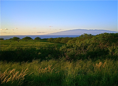
Maui in the distance, from Kohala on the Big Island
Photo Credit: flickr.com
The long lasting trade wind weather pattern will continue through this week. As this weather map shows, we have a 1030 millibar high pressure system far northeast of our islands Tuesday evening…the source of our local winds. In general, light to moderately strong trade winds will prevail, with those typically windier places having higher gusts. The winds have calmed down enough now, or are about to…that the short-lived small craft wind advisory around Maui and the Big Island was dropped Tuesday afternoon.
The trade winds will carry a few showers to the windward sides at times. The upcountry leeward sides could see an afternoon shower as well. The upper level trough of low pressure, which provided some enhancement to our local showers over the last several days, has moved far enough away now…that there will be no more influence here in Hawaii. This leaves us in a fairly normal precipitation regime, with nothing out of the ordinary expected for the time being…with only a minor increase in showers Wednesday into the night, then drier again Thursday.
A tropical disturbance well south-southwest of the Hawaiian Islands remains non-threatening. This area, which is approximately 700 miles south-southwest of Honolulu, is moving in a westerly direction. The upper level winds aren’t favorable for strengthening…with little if any chance of it becoming a tropical depression. Here’s a satellite image of the area, look for the small thunderstorm complex directly south of our islands…showing quite a bit of upper wind shear on the thunderstorms associated with this area of disturbed weather. Here’s what the hurricane models are showing for what’s being called Investigation Area 95C.
In terms of tropical cyclones, all the action remains over in the Caribbean Sea, and the Atlantic Ocean. At last count we have three tropical storms: Josephine, Ike, and Hanna, along with soon to be retired Gustav, which is dissipating quickly, although still brining gusty winds and very heavy rains. Here’s a graphical track map, showing this impressive parade of storms that continue to march westward. The next in line to impact the United States, will be hurricane Hanna, taking aim on the south Carolina coast or thereabouts. I’ll continue to carry some news about these storms, but will back off a little from the detail that I brought to this page with former hurricane Gustav.
It’s early Tuesday evening here in Kihei, Maui, as I begin writing this last paragraph of today’s tropical weather narrative from Hawaii. Glancing out the window here in Kihei, I see a predominance of clear blue skies, with a spattering of white cumulus clouds around the edges. The trade winds continue to blow nicely, helping to temper the otherwise hot late summer afternoon temperatures. The strongest gust that I note at around 5pm this afternoon, was the rather impressive 39 mph, at that windy Maalaea Bay. Looking into the future, I still don’t see anything of any threat on the weather horizon. This leaves us with just the usual windward biased showers, which may become a bit more numerous during the next 24-36 hours. All things considered, our weather remains on the tame side, with just the right amount of wind and rain to keep the word "Paradise", properly fixed to our Aloha state! I’ll be back very early Wednesday morning with your next new tropical weather narrative, I hope you have a great Tuesday night until then! Aloha for now…Glenn.
"Lucky you live Hawaii"
Interesting:
The sun has reached a milestone not seen for nearly 100 years: an entire month has passed without a single visible sunspot being noted. The event is significant as many climatologists now believe solar magnetic activity – which determines the number of sunspots — is an influencing factor for climate on earth. According to data from Mount Wilson Observatory, UCLA, more than an entire month has passed without a spot. The last time such an event occurred was June of 1913. Sunspot data has been collected since 1749. When the sun is active, it’s not uncommon to see sunspot numbers of 100 or more in a single month. Every 11 years, activity slows, and numbers briefly drop to near-zero. Normally sunspots return very quickly, as a new cycle begins. But this year — which corresponds to the start of Solar Cycle 24 — has been extraordinarily long and quiet, with the first seven months averaging a sunspot number of only 3.
August followed with none at all. The astonishing rapid drop of the past year has defied predictions, and caught nearly all astronomers by surprise. In 2005, a pair of astronomers from the National Solar Observatory (NSO) in
Interesting2:
As Anne Giblin was lugging four-foot tubes of Arctic lakebed mud from her inflatable raft to her nearby lab this summer, she said, “Mud is a great storyteller.” Dr. Giblin, a senior scientist at the Marine Biological Laboratory in Woods Hole,
For example, Dr. Vitousek said in an interview, “There’s a great danger in doing something like, oh, overfertilizing a cornfield to boost biofuel consumption, where the carbon benefits are far outweighed by the nitrogen damage.” Soon after Dr. Vitousek’s report, the journal Geophysical Research Letters branded as a “missing greenhouse gas” nitrogen trifluoride, which is used in production of semiconductors and in liquid-crystal displays found in many electronics. Nitrogen trifluoride, which is not one of the six gases covered by the Kyoto Protocol, the celebrated international global warming accord, is about 17,000 times more potent than carbon dioxide. Its estimated worldwide release into the atmosphere this year is equivalent to the total global-warming emissions from
Interesting3:
Researchers confirm that surface temperatures in the Northern Hemisphere were warmer over the last 10 years than any time during the last 1300 years, and, if the climate scientists include the somewhat controversial data derived from tree-ring records, the warming is anomalous for at least 1700 years. "Some have argued that tree-ring data is unacceptable for this type of study," says Michael Mann, associate professor of meteorology and geosciences and director of
In today’s (Sept. 2) online edition of the Proceedings of the National Academy of Sciences, the researchers note, "Conclusions are less definitive for the Southern Hemisphere and globe, which we attribute to larger uncertainties arising from the sparser available proxy data in the Southern Hemisphere." The research team included Mann; Ray Bradley, university distinguished professor, geosciences and director, Climate System Research Center, University of Massachusetts; Malcolm Hughes, regents’ professor, and Fenbiao Ni, research associate, the Laboratory of Tree Ring Research, University of Arizona; Zhihua Zhang and Sonya Miller, research associates, meteorology, Penn State; and Scott Rutherford, assistant professor, environmental sciences, Roger Williams University. The National Research Council suggested revisiting surface temperatures in their "Surface Temperature Reconstructions for the Last 2,000 Years," to include newer data and techniques and confirmed results of a 1990s paper by Mann and colleagues. Results of this study without tree-ring data show that for the Northern Hemisphere, the last 10 years are likely unusually warm for not just the past 1,000 as reported in the 1990s paper and others, but for at least another 300 years going back to about A.D. 700 without using tree-ring data. The same conclusion holds back to A.D. 300 if the researchers include tree-ring data.
Interesting4:
Could our coastlines disappear underwater much sooner than we think? The controversial view that sea levels could rise at a rate of more than 1 metre per century has found support from a new study of a long-melted ice sheet.In reconstructing the events at the end of the last ice age, Anders Carlson of the University of Wisconsin-Madison and colleagues found that the Laurentide ice sheet, which covered most of North America between 95,000 and 7000 years ago, rapidly disintegrated. The researchers began by studying beryllium isotopes in rocks to determine how the outer edges of the two final chunks of the Laurentide ice sheet retreated. They found that the ice retreated rapidly between 9000 and 8500 years ago, stabilised, and then made its final rapid retreat between 7600 and 6800 years ago. The team calculated the volume of water that would have been released in each of these melting stages, and the rate at which it must have raised sea levels. They concluded that levels would have climbed 1.3 metres per century in the earlier period, and 0.7 metres per century in the final melt.
Carlson then used a sophisticated computer model — one that is used to forecast future climate change — to check the results. The model predicted an average sea level rise of 1.3 metres per century. "The forces that led to the demise of the Laurentide ice sheet in a very rapid way are comparable to the forces the same computer models predict we will experience this century if we do not rapidly curb greenhouse gas emissions," says Gavin Schmidt of the NASA Goddard Institute for Space Studies, who collaborated with Carlson on the study. For Mark Siddall of the University of Bristol, UK, and Michael Kaplan of the Lamont Doherty Earth Observatory in New York, however, there remain many differences between what happened nearly 10,000 years ago and the climate change Earth is currently experiencing. "To what extent this dynamic response of the Laurentide ice sheet to past temperature change can be considered analogous to present and future reduction of the