September 17-18 2008
Air Temperatures – The following maximum temperatures were recorded across the state of Hawaii Wednesday afternoon:
Lihue, Kauai – 84
Honolulu, Oahu – 88
Kaneohe, Oahu – 85
Kahului, Maui – 87
Hilo, Hawaii – 80
Kailua-kona – 83
Air Temperatures ranged between these warmest and coolest spots near sea level, and on the taller mountains…at 4 p.m. Wednesday afternoon:
Port Allen, Kauai – 88F
Hilo, Hawaii – 78
Haleakala Crater- 54 (near 10,000 feet on Maui)
Mauna Kea summit – 50 (near 14,000 feet on the Big Island)
Precipitation Totals – The following numbers represent the largest precipitation totals (inches) during the last 24 hours on each of the major islands, as of Wednesday afternoon:
0.07 Mount Waialeale, Kauai
0.13 Kaneohe, Oahu
0.02 Molokai
0.00 Lanai
0.00 Kahoolawe
0.10 Hana airport, Maui
0.55 Pahoa, Big Island
Weather Chart – Here’s the latest (automatically updated) weather map showing two fairly weak high pressure systems located to the north-northwest, and east-northeast of Hawaii. This pressure configuration will keep our winds light Thursday and Friday.
Satellite and Radar Images: To view the cloud conditions we have here in Hawaii, please use the following satellite links, starting off with the Infrared Satellite Image of the islands to see all the clouds around the state during the day and night. This next image is one that gives close images of the islands only during the daytime hours, and is referred to as a Close-up visible image. This next image shows a larger view of the Pacific…giving perspective to the wider ranging cloud patterns in the
Aloha Paragraphs

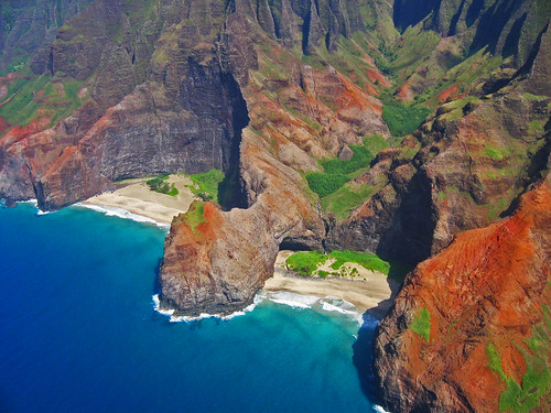
Hidden north shore beaches on Kauai
Photo Credit: flickr.com
The trade winds will continue blowing through the rest of this week into the next…varying in strength from day to day. These balmy breezes won’t be strong enough to trigger small craft wind advisories, although certainly be able to bring their cooling and refreshing relief from the late summer heat. The trade winds will pick up some in strength during the second half of the upcoming weekend…continuing right on into next week.
The bias for showers will remain focused on the windward coasts and slopes. The night and early morning hours will be the favored time of day for these showers. There will be some clouds gathering over and around the leeward slopes during the afternoons too, but showers will be limited for the time being. We may see an increase in showers, which could be locally heavy later this weekend into early next week.
It’s early Wednesday evening here in Kihei, Maui, as I begin writing this last paragraph of today’s tropical weather narrative from Hawaii. The computer models continue showing a change coming our way later this weekend, when an upper level low pressure system moves over the islands Sunday into early next week. The cold air aloft in association with this upper air feature, could enhance our windward biased showers, and cause showers to increase over the leeward slopes then too. Some of these showers could be locally heavy over the upcountry slopes on the Big Island and perhaps Maui as well. ~~~ As is often the case during the late afternoon hours here on Maui’s south coast, the trade winds are rather gusty. Looking at the numbers, we find the strongest gust anywhere in the Hawaiian Islands, pushing out to sea across Maalaea Bay…at 33 mph, while the Kahului airport at the same time (5pm), showed 30 mph gusts. The winds will calm down after dark, and remain quite light through the night into the early morning hours. ~~~ Thursday looks to be yet another nice looking day here in the islands, as will Friday and Saturday for that matter. I’ll be back very early Thursday morning with your next new weather narrative from paradise, I hope you have a great Wednesday night until then! Aloha for now…Glenn.
Interesting:
The search for sustainable energy has never been stronger as climate change concerns drive government, scientists, business and environmentalists around the world in a headlong charge for affordable new technologies. Sources ranging from electricity, wind, biofuel and through solar, geothermal and nuclear to hybrids, fuel cells and methane retrieval _ and many, many more energy possibilities _ are being pursued frantically and expensively. One of the most readily apparent sources _ tidal power _ has been slow to capture the imagination although a
At first blush, the tidal turbines sound a good idea. Certainly, they’re not a new idea; late
Interesting2:
For the first time in waters surrounding New York City, the beckoning calls of endangered fin, humpback and North Atlantic right whales have been recorded, according to experts from the Bioacoustics Research Program at the Cornell Lab of Ornithology and the New York State Department of Environmental Conservation (DEC). "This is an exciting time for New Yorkers. Just think, just miles from the Statue of Liberty, the
"With data generated by acoustic monitoring, we can better understand
Interesting3:
For the 30th consecutive year, the Earth’s summer temperature was above average, according to data released Tuesday by the National Climatic Data Center. Global temperatures were the ninth-warmest since records began in 1880. (Climatologists define summer as the months of June, July and August.) Measuring just the globe’s land areas, it was the seventh-warmest summer on record. The summer was unusually warm in most of the USA, Mexico, Europe, Australia, the British Isles, Asia and South America, while cooler-than-average conditions were recorded across the western and southern coast of Alaska, parts of northern Scandinavia and northwestern Russia. Additionally, the National Snow and Ice Data Center reported Tuesday that Arctic sea ice melted to its second-lowest level on record, just slightly more than the 2007 record-low. Given trends of the past 30 years, likely triggered by man-made global warming, scientists predict that within five to 10 years, the Arctic could be entirely ice-free in the summer.


 Email Glenn James: