


September 16-17 2008
Air Temperatures – The following maximum temperatures were recorded across the state of Hawaii Tuesday afternoon:
Lihue, Kauai – 85
Honolulu, Oahu – 87
Kaneohe, Oahu – 85
Kahului, Maui – 86
Hilo, Hawaii – 82
Kailua-kona – 84
Air Temperatures ranged between these warmest and coolest spots near sea level, and on the taller mountains…at 4 p.m. Tuesday afternoon:
Barking Sands, Kauai – 85F
Princeville, Kauai – 81
Haleakala Crater- 54 (near 10,000 feet on Maui)
Mauna Kea summit – 48 (near 14,000 feet on the Big Island)
Precipitation Totals – The following numbers represent the largest precipitation totals (inches) during the last 24 hours on each of the major islands, as of Tuesday afternoon:
0.08 Wailua, Kauai
0.04 Dillingham, Oahu
0.01 Molokai
0.00 Lanai
0.00 Kahoolawe
0.37 Puu Kukui, Maui
0.32 Pahoa, Big Island
Weather Chart – Here’s the latest (automatically updated) weather map showing a 1022 millibar high pressure system located to the east-northeast of Hawaii…with its associated ridge, located northeast of the islands. This pressure configuration will keep our winds light to moderately strong Wednesday and Thursday…locally stronger and gusty.
Satellite and Radar Images: To view the cloud conditions we have here in Hawaii, please use the following satellite links, starting off with the Infrared Satellite Image of the islands to see all the clouds around the state during the day and night. This next image is one that gives close images of the islands only during the daytime hours, and is referred to as a Close-up visible image. This next image shows a larger view of the Pacific…giving perspective to the wider ranging cloud patterns in the
Aloha Paragraphs
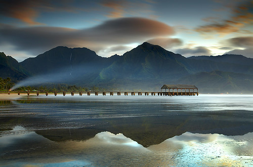
A bonfire on Hanalei beach…Kauai
Photo Credit: flickr.com
Light to moderately strong trade winds will continue through mid-week, stronger and gusty in those usual windier locations…then get softer Friday into the weekend. The trade winds returned Monday, and did a good job of ventilating our hazy atmosphere of the recent volcanic emissions…which got carried over the entire state this past weekend. The trade winds will bring their cooling and refreshing relief from the sultry weather of late too. These cooling and refreshing trade winds will remain quite active through Thursday…then slip a notch or two in strength through the rest of the week.
Whatever showers that fall here in the islands, will generally be deposited along the windward sides. The night and early morning hours will be the favored time of day for these showers. This satellite image shows scattered clouds being carried towards our islands on the trade winds. There will be some clouds gathering over and around the leeward sides during the afternoons too, but showers will be few and far between. Rainfall will generally be light through the week…with nothing heavy on the horizon at this time.
It’s early Tuesday evening here in Kihei, Maui, as I begin writing this last paragraph of today’s tropical weather narrative from Hawaii. The trade winds will be easing back into the lighter realms later this week, but unlike this past weekend, they shouldn’t go away altogether. The reason for these lighter trade wind periods, are gale low pressure systems far to our north, along with their associated cold fronts, pushing our trade wind producing high pressure ridge southward towards Kauai. When the ridge gets closer, our winds slack-off…then pick up again when the ridge migrates further north. The computer forecast models continue to show an early autumn cold front approaching the islands early next week, which may push our ridge right down over the islands. This in turn could turn off the trade winds, and swing our winds around to the southeast…bringing back another round of voggy weather then. The cold front itself doesn’t look like it will bring showers to Hawaii however. ~~~ Looking out the window here in the south coast of Maui, besides the vog free atmosphere, there are hardly any clouds in the sky…while the trade winds are breezy. How breezy you might wonder? Well, the strongest gusts anywhere in the state late Tuesday afternoon where: 30 mph at Kapalua, and 36 mph at Maalaea Bay, both here on Maui. ~~~ I’ll be back here very early early Wednesday morning with your next new weather narrative, I hope you have a great Tuesday night until then! Aloha for now…Glenn.
Interesting: The hole in the ozone layer over Antarctica has already surpassed its 2007 size this year, and is set to keep growing for another few weeks, the U.N. weather agency said on Tuesday. The Antarctic ozone hole appears every year and normally stretches to about the size of North America, reaching its maximum size in late September or early October. But in 2008, the World Meteorological Organization said the protective layer, which shields the Earth from ultra-violet rays that can cause skin cancer, began to thin relatively late. "During the last couple of weeks it has grown rapidly and has now passed the maximum size attained in 2007. Since the ozone hole is still growing, it is too early to determine how large this year’s ozone hole will be," it said in a statement. The ozone hole covered 27 million square km as of last Saturday (September 13), against 25 million square km at its peak last year, according to the WMO whose statement was issued on International Day for the Preservation of Ozone Layer.
Interesting2:
Utility-scale wind power is an important and growing part of the
Since the power generated by a turbine increases exponentially as it gets larger, new turbines will continue to grow in size. But small-scale turbines are perhaps a more exciting realm of development. The standard, propeller-style turbine is well established, and there are many suppliers for this kind of generator in a range of sizes. In 2007, Home Power Magazine had a roundup of more than a dozen small wind turbines ranging from 8 feet to 56 feet in diameter (the latter of which is far larger than even a large, inefficient household would need for their power requirements). Green Building Elements had a review of this article last year.
Interesting3:
In a few weeks, American shoppers will be able to look at a cut of meat or a pound of hamburger and see something they’ve never seen before-a label that says where the meat came from. Starting Sept. 30, food manufacturers and grocery stores have to comply with a new federal law that requires "Country of Origin Labeling," or COOL, on beef, pork, chicken and lamb. The new labels will tell consumers whether their food came from animals raised in the
Because of the complexities of the livestock industry, some product labels may list multiple countries. That’s especially true of ground beef, because some meat processors combine cuts from a number of countries to make ground meat and hamburger patties. Food safety groups have hailed COOL as a necessary step toward broader consumer education and buying choices. But now they complain that the Department of Agriculture has defined it as narrowly as possible. For example, they say, the agency has defined a host of foods as "processed," such as mixed frozen vegetables, which exempts them from the new law. "When they finalized this rule, they bent over backward to make as few things be covered as possible," said Michael Hansen, a senior staff scientist with Consumers Union. "There are giant, giant loopholes in the law."