


September 12-13 2008
Air Temperatures – The following maximum temperatures were recorded across the state of Hawaii Friday afternoon:
Lihue, Kauai – 85
Honolulu, Oahu – 85
Kaneohe, Oahu – 85
Kahului, Maui – 89
Hilo, Hawaii – 85
Kailua-kona – 85
Air Temperatures ranged between these warmest and coolest spots near sea level, and on the taller mountains…at 4 p.m. Friday afternoon:
Kahului, Maui – 86F
Lihue, Kauai – 73
Haleakala Crater- missing (near 10,000 feet on Maui)
Mauna Kea summit – 45 (near 14,000 feet on the Big Island)
Precipitation Totals – The following numbers represent the largest precipitation totals (inches) during the last 24 hours on each of the major islands, as of Friday afternoon:
3.10 Mount Waialaele, Kauai
0.53 Dillingham, Oahu
0.32 Molokai
0.00 Lanai
0.00 Kahoolawe
0.05 Lahainaluna, Maui
0.03 Hakalau, Big Island
Weather Chart – Here’s the latest (automatically updated) weather map showing a 1025 millibar high pressure system located far to the northeast of Hawaii…with its associated ridge moving southward towards Kauai. This pressure configuration will keep our winds light through Sunday from variable directions.
Satellite and Radar Images: To view the cloud conditions we have here in Hawaii, please use the following satellite links, starting off with the Infrared Satellite Image of the islands to see all the clouds around the state during the day and night. This next image is one that gives close images of the islands only during the daytime hours, and is referred to as a Close-up visible image. This next image shows a larger view of the Pacific…giving perspective to the wider ranging cloud patterns in the
Aloha Paragraphs
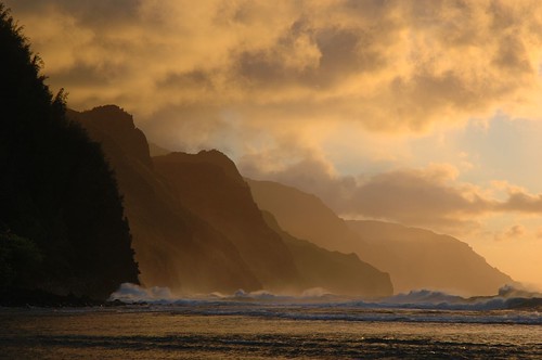
Great sunset on the north shore of Kauai
Photo Credit: flickr.com
Our winds will be coming down in strength now, becoming light and variable over the next several days…with a tendency towards southeast. We can look for the recent light trades to head south, as our trade wind producing ridge of high pressure moves over the Kauai end of the state. As this happens we’ll find our local winds come up from a more southeasterly direction. SE breezes often bring volcanic haze up from the Big Island, along with muggy conditions during the days as well. The trade winds will return Monday into Tuesday, and stick around through most of the new week ahead.
The emphasis for showers will be focused over the upcountry interior sections, especially over and around the leeward slopes…which may slip down towards the beaches locally. A trough of low pressure aloft will edge closer to the islands this weekend, which will destabilize our local atmosphere, especially over Kauai and Oahu. At the same time, the more southern wind flow will carry moisture up over the state from the deeper tropics. The combination of these two factors will cause cloudiness to increase during the afternoons, leading to showers…some of which will be locally quite heavy.
We have two major tropical cyclones in the world at the moment…typhoon Sinlaku in the west Pacific, and hurricane Ike in the Gulf of Mexico. Hurricane Ike continues to be a very dangerous storm, as it gets ready to move inland across the Texas coast. The latest forecast puts a strong category 2 hurricane, making landfall early Saturday morning…along the upper Texas coast. The massive storm surge, along with the exceptionally large waves, coupled with the very blustery winds, and flooding rainfall…will make for a truly damaging situation in that area! Our best wishes go out to the folks who find themselves in harms way for whatever reason! Here’s the latest tracking map for Ike…along with this looping satellite image. Meanwhile, in the western Pacific Ocean, we find typhoon Sinlaku, a strong storm in its own right, moving over northern Taiwan. Here’s a tracking map for Sinlaku. There continues to be no tropical cyclone activity here in the central Pacific.
It’s early Friday evening here in Kihei, Maui, as I begin writing this last section of today’s tropical weather narrative from Hawaii. Recapping what I have described above, we have an upper level trough in the vicinity, with a couple of cold fronts pushing our high pressure ridge down over the Kauai end of the state now. This will cause our local winds to become light, coming out of a more southerly direction than usual. This may bring some volcanic haze up over the state from the vents on the Big Island. At the same time, moisture will be carried over us from the tropics, making for sultry conditions in general.
~~~ The instability prompted by the upper trough, and the rich moisture brought up on the southeast winds, will work together to make our atmosphere shower prone. There will be more clouds around than usual over the next several days, becoming most thick and showery during the afternoon hours. There could easily be some localized downpours here and there…especially on the Kauai end of the island chain. This convective weather situation will give way to the return of the trade winds Monday and Tuesday, with fair weather prevailing through most of the rest of the week.
~~~ Since it’s Friday evening, I’ll be heading over to Kahului soon, to take in new film. This is opening night for Burn After Reading (2008), produced and directed by the Coen Brothers, who also did the best film of 2007…No Country for Old Men as you’ll remember. Burn After Reading, is a dark comedy about a CIA disc that falls into the wrong hands. The stars include Brad Pitt, George Clooney, and John Malkovich, among others. The critics are giving this film pretty good grades, generally around B…which is good enough to draw me in. Here’s a trailer for this film. I don’t often go in for comedies, but I have liked what I’ve seen from the Cohen Brothers, and am willing to try another one. I’ll be back early Saturday morning with a review of this film, along with more, much more tropical weather information for you then. I hope you have a great Friday night wherever you happen to be spending it! Aloha for now…Glenn.
Interesting:
Cutting down on the use of paper is easy enough, but in spite of all your efforts you’ll never become 100% paperless. That’s where tree free paper comes in. Recently launched on the market by GPA, a
Plus it offers antimicrobial protection and conforms to FDA standards for food contact! And due to the water and energy savings made in its manufacturing process, Ultra Green paper is priced 30 to 40% below than regular synthetic paper and film. Replacing one ton of traditional paper with one ton of Ultra Green paper saves 20 trees, according to Environmental Defense’s paper calculator. It also eliminates 42 lbs of waterborne waste, 7,480 gallons water/wastewater, 167 lbs solid waste and 236 lbs carbon emissions. Energy savings amount to 25 million BTU. GPA says that the paper combines the printability of a traditional paper product with the durability of a plastic sheet. It does not require special inks or manufacturing processes. This paper ought to be the invention of the year!
Interesting2:
The amount of sea ice around
"What’s happening is not unexpected…Climate modelers predicted a long time ago that the
Interesting3:
The first whales once swam the seas by wiggling large hind feet, research now suggests. These new findings shed light on the mysterious shift these leviathans made away from land. The ancestors of whales once strode on land on four legs, just as other mammals do. Over time, as they evolved to dwell in water, their front legs became flippers while they lost their back legs and hips, although modern whales all still retain traces of pelvises, and occasionally throwbacks are born with vestiges of hind limbs. A great deal of mystery surrounds how the anatomy of the first whales changed to propel them through the water. A key piece of that puzzle would be the discovery of when exactly the wide flukes on their powerful tails arose. "The origin of flukes is one of the last steps in the transition from land to sea," explained vertebrate paleontologist Mark Uhen of the Alabama Museum of Natural History in
These bones once belonged to the ancient whale Georgiacetus, which swam along the Gulf Coast of North America roughly 40 million years ago, back when
Interesting4: As Hurricane Ike pummels the Texas coast, the only thing standing in the way is a thin stretch of land called Galveston. Galveston is a barrier island, a narrow landmass made mostly of sand that extends along a coastline parallel to the land. These islands, common along the Gulf Coast and East Coast of the United States, are some of the most fragile and changing landforms on Earth. And they are particularly vulnerable to storms. "Barrier islands are exposed to the open ocean, and the waves and storm surges generated by hurricanes," said Bob Morton, a geologist at the U.S. Geological Survey’s Center for Coastal and Watershed Studies in St. Petersburg, Fla. "As a storm makes landfall they’re the ones that are going to receive the strongest winds and the highest wave actions." National Hurricane Center officials have warned residents of Galveston to evacuate or else face "certain death," though several thousand are thought to be staying put.
Barrier islands like Galveston are particularly vulnerable to storm damage because they are made of sand, as opposed to the hard bedrock that underlies larger islands and the mainland. They also tend to have very low elevations, making it easy for water to wash over and submerge the island. Many have questioned the wisdom of choosing to build on and develop barrier islands, given their risks. "Every year there’s reporting on the foolishness of building on barrier islands, but people are going to do it anyway," Morton told LiveScience. "We don’t learn from the past. If you look at the barrier islands on the Mississippi coast in particular, after both Hurricane Camille in 1969, and Katrina, what did they do? They rebuilt. It’s a perfect example of a coastal area that did get hit as bad as it can get, and they just go back and rebuild."