


September 10-11 2008
Air Temperatures – The following maximum temperatures were recorded across the state of Hawaii Wednesday afternoon:
Lihue, Kauai – 85
Honolulu, Oahu – 87
Kaneohe, Oahu – 84
Kahului, Maui – 86
Hilo, Hawaii – 84
Kailua-kona – 85
Air Temperatures ranged between these warmest and coolest spots near sea level, and on the taller mountains…at 4 p.m. Wednesday afternoon:
Barking Sands, Kauai – 87F
Hilo, Hawaii – 79
Haleakala Crater- 46 (near 10,000 feet on Maui)
Mauna Kea summit – 52 (near 14,000 feet on the Big Island)
Precipitation Totals – The following numbers represent the largest precipitation totals (inches) during the last 24 hours on each of the major islands, as of Wednesday afternoon:
0.49 Mount Waialaele, Kauai
0.39 Oahu Forest NWR, Oahu
0.01 Molokai
0.00 Lanai
0.85 Kahoolawe
0.18 Ulupalakua, Maui
0.14 Honokaa, Big Island
Weather Chart – Here’s the latest (automatically updated) weather map showing a 1026 millibar high pressure system located far to the northeast of Hawaii…with its associated ridge now weakening to our north. This pressure configuration will keep our local trade winds quite light Thursday and Friday.
Satellite and Radar Images: To view the cloud conditions we have here in Hawaii, please use the following satellite links, starting off with the Infrared Satellite Image of the islands to see all the clouds around the state during the day and night. This next image is one that gives close images of the islands only during the daytime hours, and is referred to as a Close-up visible image. This next image shows a larger view of the Pacific…giving perspective to the wider ranging cloud patterns in the
Aloha Paragraphs
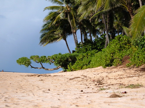
A perfect beach on Oahu…for a little sun bathing
Photo Credit: flickr.com
The trade winds will gradually ease up through Friday, then fade away almost entirely over the weekend. We can look for lighter trades, although those typically windier areas will still find almost moderately strong breezes during the afternoon hours. Storms moving by far to the north of the islands this weekend will disrupt the trade winds Saturday and Sunday, making them almost non-existent…or very light at best. The computer models suggest that early next week, we’ll see the trade winds rebound…with freshening breezes by Tuesday into mid-week.
The trade winds will carry in a few showers to the windward sides, with a few afternoon showers along the leeward sides too. The overlying atmosphere remains stable and relatively dry, limiting the shower production our local clouds. We may see some of the inland leeward showers spreading down towards the coast at times during the afternoon hours. There are still no organized rainmakers on the weather horizon at this time…suggesting fair weather will prevail through the rest of this week into the next.
We have two active storms in the western Pacific, a weakening tropical storm in the eastern Pacific moving over the Baja Peninsula…and then there’s Ike heading towards the Texas coast. Foremost among these at the moment, at least here in the United States, is very dangerous hurricane Ike. This strengthening hurricane is moving across the very warm waters of the Gulf of Mexico…which in spots approaches 90F. Here’s the latest tracking map for Ike. Here’s a tracking map for the quickly weaening tropical depression heading towards southern Baja, whose name is Lowell. Then in the western Pacific Ocean, we find very strong Typhoon Sinlaku in the northern Philippine Sea, as well as tropical cyclone 16W. Here’s a tracking map for Sinlaku, and then one for 16W.
It’s early Wednesday evening here in Kula, Maui, as I begin writing this last paragraph of today’s tropical weather narrative from Hawaii. As was the case Tuesday afternoon, the lighter variety of trade winds, coupled with the daytime heating of the islands…caused clouds and showers to break out locally. This afternoon convective cloudiness was even more pronounced than Wednesday, with considerable cloudiness covering much of the Aloha state. There were some showers that fell locally, although most concentrated along the leeward upcountry slopes…which slipped down towards the coasts in places too. The downslope breezes this evening, along with the cooler temperatures after sunset, will help to evaporate most of the daytime clouds, leading to generally clear skies again by Thursday morning. We should see a repeat performance of this weather pattern each afternoon through the rest of this week. ~~~ When I left Kihei after work, it was lightly showering, and even though it wasn’t raining here in Kula when I got home, the steets were wet, so it had been showery earlier. I’ll be back very early Thursday morning with your next new weather narrative from paradise. I hope you have a great Wednesday night until then! Aloha for now…Glenn.
Interesting:
Australia’s coastline is increasingly being battered by extreme waves that are driven in part by climate change, government scientists say. Research has shown that bigger waves are bearing down on the coastline as severe storms become more frequent. The waves could threaten communities with flooding and coastal erosion. The national science agency said a network of coastal observation sites should be established to monitor shifting wave patterns. Australia has always borne the brunt of nature’s extremes, from drought to bushfires and destructive tropical cyclones. Scientists from the Commonwealth Scientific and Industrial Research Organisation (CSIRO) have identified an emerging threat – monstrous waves that have increasingly pummelled Australia’s southern shores. These ferocious conditions are associated with the passage of extra-tropical storms through the south of the continent. Researchers believe that a shifting climate could be partly to blame. They have said that Australia is vulnerable to an accelerated version of global warming, which is causing serious droughts and sudden severe storms. This vast, arid land was recently listed by the United Nations as a climate change "hotspot".
With energy prices driving the cost of agricultural inputs up, nutrient-rich manure is getting another look.
Now, with fertilizer prices hovering at $1,000 per ton, the nitrogen and other nutrients in manure look more gold than brown. Bass said that a ton of manure contains between $30 to $40 dollars worth of nutrients for the soil, though they're not all available the first year. "Expect a quarter to a half of the nitrogen to be available in the first season," he said, "The remainder is partially available the next year and partially lost to the atmosphere." Fresh scraped and stacked dairy and beef manure can have a total nitrogen content ranging between 12 and 25 pounds of nitrogen per ton of manure, while the same ton may also have 9 to 18 pounds of phosphorus fertilizer equivalent.
Interesting3:
Researchers at the University of California, Berkeley, are continuing their march toward creating a synthetic, gecko-like adhesive, one sticky step at a time. Their latest milestone is the first adhesive that cleans itself after each use without the need for water or chemicals, much like the remarkable hairs found on the gecko lizard's toes. "It brings us closer to being able to build truly all-terrain robots, which will in the future be able to scamper up walls and across ceilings in everyday environments rather than only on clean glass," said Ron Fearing, UC Berkeley professor of electrical engineering and computer sciences and head of the research team developing the new material. "We can envision robots being able to go anywhere they are needed, perhaps in the search for survivors after a disaster." The adhesive's development is reported online today (Wednesday, Sept. 10) in Langmuir, a peer-reviewed journal of the American Chemical Society that covers a wide range of topics, including surface properties, nanostructures and biomimetic materials.
For years, scientists have been trying to develop a man-made version of the toe hairs that make the lizard's acrobatic feats possible. Earlier this year, Fearing's group developed another gecko-inspired adhesive using polymer microfibers that could easily attach to and detach from clean surfaces. But researchers said replicating the gecko's ability to walk through dirty surfaces yet keep its feet clean enough to climb walls has been tricky. In 2005, research led by Kellar Autumn, associate professor of biology at Lewis & Clark College in Portland, Ore., and one of the nation's leading experts on gecko biomechanics, revealed for the first time that a gecko keeps its feet sticky but clean by shedding dirt particles with every step. "It goes completely against our everyday experience with sticky tapes, which are 'magnets' for dirt and can't be reused," said Fearing. "With our gecko adhesive, we have been able to create the first material that is adhesive and yet cleans itself a little bit with every contact."
Interesting4:
To slow global warming, install white roofs…it just makes good sense. Such roofs and reflective pavement in the world's 100 largest cities would have a massive cooling effect, according to data released at
Interesting5: From