Air Temperatures – The following maximum temperatures were recorded across the state of Hawaii Saturday afternoon: Lihue, Kauai – 76 Honolulu, Oahu – 81 Kaneohe, Oahu – 77 Kahului, Maui – 80 Hilo, Hawaii – 78 Kailua-kona – 81 Air Temperaturesranged between these warmest and coolest spots near sea level, and on the highest mountains…at 5 p.m. Saturday afternoon: Barking Sands, Kauai – 78F Hilo, Hawaii – 72
Haleakala Crater – 46 (near 10,000 feet on Maui)
Mauna Kea summit – 37 (near 14,000 feet on the Big Island) Precipitation Totals – The following numbers represent the largest precipitation totals (inches) during the last 24 hours on each of the major islands, as of Saturday afternoon: 0.40 Kapahi, Kauai
0.10 Oahu Forest NWR, Oahu
0.00 Molokai
0.00 Lanai
0.02 Kahoolawe 0.09 West Wailuaiki, Maui 0.41 Honaunau, Big Island Weather Chart – Here’s the latest (automatically updated) weather mapshowing a 1034 millibar high pressure system far to the northeast of the Hawaiian Islands Saturday evening. Our winds will remain out of the trade wind direction through Sunday…strengthening into the new week. Satellite and Radar Images: To view the cloud conditions we have here in Hawaii, please use the following satellite links, starting off with theInfrared Satellite Image of the islands to see all the clouds around the state during the day and night. This next image is one that gives close images of the islands only during the daytime hours, and is referred to as a Close-up visible image. This next image shows a larger view of the Pacific…giving perspective to the wider ranging cloud patterns in the Pacific Ocean. Finally, here’s a looping IR satellite image, making viewable the clouds around the islands 24 hours a day. To help you keep track of where any showers may be around the islands, here’s the latest animatedradar image.
Hawaii’s Mountains – Here’s a link to the live webcam on the summit of near 14,000 footMauna Kea on the Big Island of Hawaii. The tallest peak on the island of Maui is theHaleakala Crater, which is near 10,000 feet in elevation. These two webcams are available during the daylight hours here in the islands…and when there’s a big moon rising just after sunset for an hour or two! Plus, during the nights and early mornings you will be able to see stars, and the sunrise too…depending upon weather conditions.
Aloha Paragraphs
Nice sunset of Molokai…taken from Maui Photo Credit: flickr.com
One more day of light to moderately strong trade winds…before stronger and gusty trades take over during the new week ahead. Wind speeds will remain in the light to moderately strong category Sunday into Monday. A new surge in the trade winds will bring stronger trades, and cooler weather to the state starting later Monday, lasting into the mid-week time frame. The trade winds will calm down some during the second half of the upcoming week.
The windward sides will see a few passing showers, although not many…while the leeward sides will remain dry Sunday.Our weather will remain favorably inclined Sunday through most of Monday. The tail-end of a cold front, or what we call a shear line, will bring an increase in cool showers starting later Monday on Kauai, and then the rest of the island chain into Tuesday. The windward sides will see the bulk of these showers, although with the stronger trade winds blowing, the leeward sides may see a few stretching over there locally on the smaller islands. Weather conditions will improve starting Wednesday, especially along the south and west facing shores. It’s Saturday evening here in Kula, Maui, as I begin writing this last section of today’s narrative. As you read in the two paragraphs above, our weather will be just fine through Sunday into Monday. We will have a down turn starting late Monday on Kauai, as our trade wind speeds pick up, our air temperatures fall some, and we find showery clouds moving into our area…especially along our windward coasts and slopes. This change will reach Oahu later Monday night, with the rest of the state taking the tumble during the day Tuesday.
~~~I went to see the new film Slumdog Millionaire Friday evening after work. As you may remember, last week when I tried to see it, it was sold out. The reviews were very positive, so I was excited to see this new film…and in the end, I certainly wasn’t disappointed. As a matter of fact it was a very well done film, and I enjoyed it very much! It was filmed in India, and so it had a much different character than films produced in the United States. Here’s a short synopsis of this film: "an illiterate kid looks to become a contestant on the Hindi version of Who Wants to be A Millionaire in order to re-establish contact with the girl he loves, who is an ardent fan of the show." This film centered around a deep love between two young people, who started off in the film being kids in the slums. Their love endured through thick and thin…very thin during most of the film. Here’s atrailerof this very good film.
~~~I went over to my neighbors house this morning begging a cup of coffee. I had my own coffee, although what I was looking for was their nice company. We ended up spending the rest of the day together. Late in the morning we all drove, in my car, over to Haiku to another friend of ours. This friend lives in northern California (Marin County) part of the year, and here on Maui part of the year. She is the friend I always spend time with during my vacations to the mainland. At any rate, we hung out on her property, and she fed us a great lunch. My neighbors and I left for the beach, and we all met up again there, after we went shopping in Paia. We saw some other old time friends there, all ladies who have lived on Maui for the last 30 years or so…taking a swim together. Then we drove back upcountry to Pukalani for a bit more of shopping, and now we’re back home in Kula. I’m going to just take it easy for the rest of the day, have a drink, and probably talk on the telephone before reading, and to bed. I’ll be back early Sunday morning with more weather news, I hope you have a great Saturday night from wherever you happen to be reading from! Aloha for now…Glenn. Interesting: Wintry conditions are set to dominate the UK weather in the coming week, bringing heavy snow for many parts. On Friday and Saturday, temperatures across eastern parts of the UK will gradually fall, but it is not until Sunday that the cold weather really takes hold. Temperatures in Birmingham on Sunday are set to peak at just 34F. Wintry showers are set for eastern parts of the UK on Sunday, with anywhere from Aberdeenshire to Kent receiving around half an inch of snow. On Monday and Tuesday, this snow risk extends further west, with significant accumulations possible for much of England, Wales, and southern Scotland. Up to 8 inches of snow is possible over higher ground in the east by the end of Tuesday. The return to colder weather across the UK is due to the influence of an area of high pressure centered over Scandinavia. This high pressure system will remain slow moving into next week, and will draw in very cold air from continental Europe and western Russia. As this cold air moves across the North Sea, it will pick up moisture, which is then deposited as snow showers over the UK. So far, this winter has been the coldest in the UK for over a decade. Forecasters from the Met Office expect temperatures for the whole of winter to be average or below average.
Interesting2: A searing heat wave worsened on Friday in Melbourne, Australia, as the temperature soared to 113 degrees F, or 35 degrees above average. Wednesday and Thursday set respective highs of 110 and 112 degrees F. This was the first time since record-keeping began in 1855 that three consecutive days surpassed 109 degrees F in the city. Friday’s high came close to Melbourne’s all-time highest temperature, 114 degrees F, which was reached on Jan. 13, 1939. The high heat played a role in a massive blackout late on Friday as demand for electricity surged. Furthermore, brushfires instigated by the hot, dry weather burned at least 10 homes.
Interesting3: China needs more rational policies to make the most of its wind power, says an editorial in Nature. Despite doubling their capacity every year for the past three years, China’s wind turbines are less efficient at producing energy and break down more often than those in other countries. China’s bidding system favors developers that promise cheap supplies of electricity — even if such promises make the projects unprofitable, says the editorial. International companies with more efficient turbines don’t even bother to bid. And many appointed projects fail to get off the ground. China could learn from countries with more experience of wind energy, says the editorial. It suggests the first thing to do is focus on producing power, rather than building turbines. The editorial also recommends that China adopts more reasonable targets. Operating at international standards of efficiency, China’s turbines could produce five per cent of the nation’s energy needs by 2020 and could make China the biggest producer of wind energy in the world.
Interesting4: Villagers in the Kamchatka peninsula are reliant on poaching salmon as almost their sole source of income, according to a new report launched today by WWF-Russia and TRAFFIC, the wildlife trade monitoring network. The report assesses the level of poaching in Kamchatka (so-called illegal, unregulated and unreported (IUU) catch) of five species of salmon – pink, chum, sockeye, Coho and Chinook – and analyses the importation of these species by countries in the region. “Salmon is an integral part of Kamchatka’s economy, but stocks are threatened by unsustainable illegal off-take,” says Natalia Dronova, WWF-TRAFFIC co-ordinator and an author of the report. She adds: “The future security of this vital economic resource depends on how we treat it today.” Salmon are mainly poached for their roe (eggs), which are sold as a cheaper alternative to caviar.
According to the report, poaching of salmon on the spawning grounds has increased significantly, driven by a combination of factors including easier access because of better roads, Russia’s economic situation, and an easing of the country’s salmon trade regulations. For example, in 2003-2006 the actual catch of chum salmon was an average 1.5 times more than officially reported. “Combating the poachers is complicated by technical difficulties, corruption, and because the illegal salmon catch is almost the sole source of income for villagers in Kamchatka,” says Dronova. Currently on rivers where legal fisheries exist, poaching provides income to about 30% of households. However, on rivers not used by legal fishing entities, up to 90% or even 100% of families live through poaching. The report says that improving the options for legal processing of fish, plus providing other forms of employment, for example through increased tourism to the region, would reduce the levels of illegally fished salmon. Improved local and federal law enforcement would also help in preserving salmon and salmon-based livelihoods for the people of Kamchatka.
Intersting5: The oceans have long buffered the effects of climate change by absorbing a substantial portion of the greenhouse gas carbon dioxide. But this benefit has a catch: as the gas dissolves, it makes seawater more acidic. Now an international panel of marine scientists says this acidity is accelerating so fast it threatens the survival of coral reefs, shellfish and the marine food web generally. The panel, comprising 155 scientists from 26 countries and organized by the United Nations and other international groups, is not the first to point to growing ocean acidity as an environmental threat, but its blunt language and international credentials give its assessment unusual force. It called for “urgent action” to sharply reduce emissions of carbon dioxide. “Severe damages are imminent,” the group said Friday in a statement summing up its deliberations at a symposium in Monaco last October. The statement, called the Monaco Declaration, said increasing acidity is interfering with the growth and health of shellfish and eating away at coral reefs, processes that would eventually affect marine food webs generally. Already, the group said, there have been detectable decreases in shellfish, shell weights and interference with the growth of coral skeletons.
Interesting6: A new way of making LEDs could see household lighting bills reduced by up to 75% within five years. Gallium Nitride (GaN), a man-made semiconductor used to make LEDs (light emitting diodes), emits brilliant light but uses very little electricity. Until now high production costs have made GaN lighting too expensive for wide spread use in homes and offices. However the Cambridge University based Centre for Gallium Nitride has developed a new way of making GaN which could produce LEDs for a tenth of current prices. GaN, grown in labs on expensive sapphire wafers since the 1990s, can now be grown on silicon wafers. This lower cost method could mean cheap mass produced LEDs become widely available for lighting homes and offices in the next five years. Based on current results, GaN LED lights in every home and office could cut the proportion of UK electricity used for lights from 20% to 5%. That means we could close or not need to replace eight power stations. A GaN LED can burn for 100,000 hours so, on average, it only needs replacing after 60 years. And, unlike currently available energy-saving bulbs GaN LEDs do not contain mercury so disposal is less damaging to the environment.
GaN LEDs also have the advantage of turning on instantly and being dimmable. Professor Colin Humphreys, lead scientist on the project said: “This could well be the holy grail in terms of providing our lighting needs for the future. We are very close to achieving highly efficient, low cost white LEDs that can take the place of both traditional and currently available low energy light bulbs. That won’t just be good news for the environment. It will also benefit consumers by cutting their electricity bills.” GaN LEDs, used to illuminate landmarks like Buckingham Palace and the Severn Bridge, are also appearing in camera flashes, mobile phones, torches, bicycle lights and interior bus, train and plane lighting. Parallel research is also being carried out into how GaN lights could mimic sunlight to help 3m people in the UK with Seasonal Affective Disorder (SAD). Ultraviolet rays made from GaN lighting could also aid water purification and disease control in developing countries, identify the spread of cancer tumors and help fight hospital super bugs’.
Interesting7: A researcher from the University of the West of England was inspired by her own nightmares and a chance encounter at a lecture to examine more closely the stuff that dreams are made of. Her PhD study has focused on an astounding discovery that women suffer more nightmares then men. As a mature student Dr Jennie Parker was interested in looking at some aspect of psychology for her PhD study and it was at a lecture about dreams, given by former UWE researcher Dr Susan Blackmore that she had a moment of epiphany. Dr Parker explains, “My own nightmares had two reoccurring themes, one concerned standing on the beach at Weston Super Mare, my home town, when the tide suddenly goes out very fast and returns as a huge tidal wave that is about to engulf me. The other dream includes a dinosaur roaming the streets at night and looking in at my window.
I wondered if my experience was common amongst women. “Several years on and Dr Parker has completed a study that looks set to turn Dream Research on its head and expand its potential as a subject with multi faceted possibilities hitherto unrealized. In the course of her work she found that research into sleep and dreams had used data collection techniques that discounted entirely the role of emotions in dreams. She believes that this ‘discovery’ opens up a whole new raft of research possibilities into the psychology of dreaming. Dr Parker explains, “My most significant finding is that women in general do experience more nightmares than men. An early study into dreams lead to my discovering that normative research procedures into Dream Research often considered the structure of dreams but that there is a gaping hole in terms of academic study that investigates emotional significance in the analysis of dreams.
Interesting8: Older Americans have experienced huge, negative financial shifts that now make it more difficult to enter retirement with sustainable economic security, a new study finds. Seventy-eight percent of all senior households are financially vulnerable when it comes to their ability to meet essential expenses and cover projected costs over their lifetimes. This is according to the Senior Economic Security Index (SESI), a new research project developed by The Institute on Assets and Social Policy at Brandeis University and Demos, a national public policy and research organization. Single households, African-American households, and Latino households are the most likely groups of seniors to be financially vulnerable. These sobering stats serve as a wakeup call for younger and middle-aged Americans. Though they are financially vulnerable, today’s seniors represent a best-case scenario of having reached retirement under stronger Social Security, better employer-based benefits, and greater opportunities to avoid debt and build assets than future generations will experience.
Air Temperatures – The following maximum temperatures were recorded across the state of Hawaii Friday afternoon: Lihue, Kauai – 76 Honolulu, Oahu – 81 Kaneohe, Oahu – 77 Kahului, Maui – 81 Hilo, Hawaii – 79 Kailua-kona – 81 Air Temperaturesranged between these warmest and coolest spots near sea level, and on the highest mountains…at 4 p.m. Friday afternoon: Honolulu, Oahu – 80F Kaneohe, Oahu – 74
Haleakala Crater – 45 (near 10,000 feet on Maui)
Mauna Kea summit – 34 (near 14,000 feet on the Big Island) Precipitation Totals – The following numbers represent the largest precipitation totals (inches) during the last 24 hours on each of the major islands, as of Friday afternoon:
2.01 Mount Waialaele, Kauai
0.26 Waihee Pump, Oahu
0.02 Molokai
0.00 Lanai
0.00 Kahoolawe 0.02 Hana airport, Maui
0.10 Kealakekua, Big Island Weather Chart – Here’s the latest (automatically updated) weather mapshowing high pressure systems far to the north and northeast of the Hawaiian Islands Friday. Our winds will remain out of the trade wind direction into the weekend. Satellite and Radar Images: To view the cloud conditions we have here in Hawaii, please use the following satellite links, starting off with theInfrared Satellite Image of the islands to see all the clouds around the state during the day and night. This next image is one that gives close images of the islands only during the daytime hours, and is referred to as a Close-up visible image. This next image shows a larger view of the Pacific…giving perspective to the wider ranging cloud patterns in the Pacific Ocean. To help you keep track of where any showers may be around the islands, here’s the latest animatedradar image.
Hawaii’s Mountains – Here’s a link to the live webcam on the summit of near 14,000 footMauna Kea on the Big Island of Hawaii. The tallest peak on the island of Maui is theHaleakala Crater, which is near 10,000 feet in elevation. These two webcams are available during the daylight hours here in the islands…and when there’s a big moon rising just after sunset for an hour or two! Plus, during the nights and early mornings you will be able to see stars, and the sunrise too…depending upon weather conditions.
The Hawaiian Islands have moved into what will be a prolonged period of winter trade winds. A trade wind producing ridge of high pressure will remain nearly stationary to the north of the islands. This ridge will ensure that our trades stick around through the next week. Wind speeds will remain in the light to moderately strong category through the weekend. A surge in the trade winds will bring stronger gusts, and cooler weather to the state after the weekend for several days.
Other than a few passing showers along the windward sides, our weather will be fine through the weekend…especially along the leeward beaches.Our weather will remain favorably inclined through both Saturday and Sunday. The tail-end of a cold front, or what we call a shear line cloud band, will bring an increase in cool showers right after the weekend for a couple of days. The windward sides will see the bulk of these showers, although with the stronger trade winds blowing, the leeward sides may see a few flying over there locally on the smaller islands It’s Friday evening here in Kihei, Maui, as I just finished the work week. Friday was a terrific day, with lots and lots of warm sunshine beaming down just about everywhere. The trade winds blew, but not overly strong, providing just the right amount of ventilation. I see no reason to believe that this fine weather won’t carry forward right into the upcoming weekend. Looking out through the windows here in Kihei, at 530pm or so, the skies are nearly cloud free! ~~~ I’m about to head over to Kahului, and try once again to see the new film Slumdog Millionaire…which was sold out for me last Friday evening. If I get turned away from this film again, which is getting rave reviews by the way, I’ll likely turn to another film called Notorious. I’ll come back again early Saturday morning with your next new weather narrative, and let you know which I saw, and what I thought of it. I hope you have a great Friday night from wherever you happen to be reading from! Aloha for now…Glenn.
Interesting: Wintry conditions are set to dominate the UK weather in the coming week, bringing heavy snow for many parts. On Friday and Saturday, temperatures across eastern parts of the UK will gradually fall, but it is not until Sunday that the cold weather really takes hold. Temperatures in Birmingham on Sunday are set to peak at just 34F. Wintry showers are set for eastern parts of the UK on Sunday, with anywhere from Aberdeenshire to Kent receiving around half an inch of snow. On Monday and Tuesday, this snow risk extends further west, with significant accumulations possible for much of England, Wales, and southern Scotland. Up to 8 inches of snow is possible over higher ground in the east by the end of Tuesday. The return to colder weather across the UK is due to the influence of an area of high pressure centered over Scandinavia. This high pressure system will remain slow moving into next week, and will draw in very cold air from continental Europe and western Russia. As this cold air moves across the North Sea, it will pick up moisture, which is then deposited as snow showers over the UK. So far, this winter has been the coldest in the UK for over a decade. Forecasters from the Met Office expect temperatures for the whole of winter to be average or below average.
Interesting2: A searing heat wave worsened on Friday in Melbourne, Australia, as the temperature soared to 113 degrees F, or 35 degrees above average. Wednesday and Thursday set respective highs of 110 and 112 degrees F. This was the first time since record-keeping began in 1855 that three consecutive days surpassed 109 degrees F in the city. Friday’s high came close to Melbourne’s all-time highest temperature, 114 degrees F, which was reached on Jan. 13, 1939. The high heat played a role in a massive blackout late on Friday as demand for electricity surged. Furthermore, brushfires instigated by the hot, dry weather burned at least 10 homes.
Interesting3: China needs more rational policies to make the most of its wind power, says an editorial in Nature. Despite doubling their capacity every year for the past three years, China’s wind turbines are less efficient at producing energy and break down more often than those in other countries. China’s bidding system favors developers that promise cheap supplies of electricity — even if such promises make the projects unprofitable, says the editorial. International companies with more efficient turbines don’t even bother to bid. And many appointed projects fail to get off the ground. China could learn from countries with more experience of wind energy, says the editorial. It suggests the first thing to do is focus on producing power, rather than building turbines. The editorial also recommends that China adopts more reasonable targets. Operating at international standards of efficiency, China’s turbines could produce five per cent of the nation’s energy needs by 2020 and could make China the biggest producer of wind energy in the world.
Interesting4: Villagers in the Kamchatka peninsula are reliant on poaching salmon as almost their sole source of income, according to a new report launched today by WWF-Russia and TRAFFIC, the wildlife trade monitoring network. The report assesses the level of poaching in Kamchatka (so-called illegal, unregulated and unreported (IUU) catch) of five species of salmon – pink, chum, sockeye, Coho and Chinook – and analyses the importation of these species by countries in the region. “Salmon is an integral part of Kamchatka’s economy, but stocks are threatened by unsustainable illegal off-take,” says Natalia Dronova, WWF-TRAFFIC co-ordinator and an author of the report. She adds: “The future security of this vital economic resource depends on how we treat it today.” Salmon are mainly poached for their roe (eggs), which are sold as a cheaper alternative to caviar.
According to the report, poaching of salmon on the spawning grounds has increased significantly, driven by a combination of factors including easier access because of better roads, Russia’s economic situation, and an easing of the country’s salmon trade regulations. For example, in 2003-2006 the actual catch of chum salmon was an average 1.5 times more than officially reported. “Combating the poachers is complicated by technical difficulties, corruption, and because the illegal salmon catch is almost the sole source of income for villagers in Kamchatka,” says Dronova. Currently on rivers where legal fisheries exist, poaching provides income to about 30% of households. However, on rivers not used by legal fishing entities, up to 90% or even 100% of families live through poaching. The report says that improving the options for legal processing of fish, plus providing other forms of employment, for example through increased tourism to the region, would reduce the levels of illegally fished salmon. Improved local and federal law enforcement would also help in preserving salmon and salmon-based livelihoods for the people of Kamchatka.
Intersting5: The oceans have long buffered the effects of climate change by absorbing a substantial portion of the greenhouse gas carbon dioxide. But this benefit has a catch: as the gas dissolves, it makes seawater more acidic. Now an international panel of marine scientists says this acidity is accelerating so fast it threatens the survival of coral reefs, shellfish and the marine food web generally. The panel, comprising 155 scientists from 26 countries and organized by the United Nations and other international groups, is not the first to point to growing ocean acidity as an environmental threat, but its blunt language and international credentials give its assessment unusual force. It called for “urgent action” to sharply reduce emissions of carbon dioxide. “Severe damages are imminent,” the group said Friday in a statement summing up its deliberations at a symposium in Monaco last October. The statement, called the Monaco Declaration, said increasing acidity is interfering with the growth and health of shellfish and eating away at coral reefs, processes that would eventually affect marine food webs generally. Already, the group said, there have been detectable decreases in shellfish, shell weights and interference with the growth of coral skeletons.
Interesting6: A new way of making LEDs could see household lighting bills reduced by up to 75% within five years. Gallium Nitride (GaN), a man-made semiconductor used to make LEDs (light emitting diodes), emits brilliant light but uses very little electricity. Until now high production costs have made GaN lighting too expensive for wide spread use in homes and offices. However the Cambridge University based Centre for Gallium Nitride has developed a new way of making GaN which could produce LEDs for a tenth of current prices. GaN, grown in labs on expensive sapphire wafers since the 1990s, can now be grown on silicon wafers. This lower cost method could mean cheap mass produced LEDs become widely available for lighting homes and offices in the next five years. Based on current results, GaN LED lights in every home and office could cut the proportion of UK electricity used for lights from 20% to 5%. That means we could close or not need to replace eight power stations. A GaN LED can burn for 100,000 hours so, on average, it only needs replacing after 60 years. And, unlike currently available energy-saving bulbs GaN LEDs do not contain mercury so disposal is less damaging to the environment.
GaN LEDs also have the advantage of turning on instantly and being dimmable. Professor Colin Humphreys, lead scientist on the project said: “This could well be the holy grail in terms of providing our lighting needs for the future. We are very close to achieving highly efficient, low cost white LEDs that can take the place of both traditional and currently available low energy light bulbs. That won’t just be good news for the environment. It will also benefit consumers by cutting their electricity bills.” GaN LEDs, used to illuminate landmarks like Buckingham Palace and the Severn Bridge, are also appearing in camera flashes, mobile phones, torches, bicycle lights and interior bus, train and plane lighting. Parallel research is also being carried out into how GaN lights could mimic sunlight to help 3m people in the UK with Seasonal Affective Disorder (SAD). Ultraviolet rays made from GaN lighting could also aid water purification and disease control in developing countries, identify the spread of cancer tumors and help fight hospital super bugs’.
Interesting7: A researcher from the University of the West of England was inspired by her own nightmares and a chance encounter at a lecture to examine more closely the stuff that dreams are made of. Her PhD study has focused on an astounding discovery that women suffer more nightmares then men. As a mature student Dr Jennie Parker was interested in looking at some aspect of psychology for her PhD study and it was at a lecture about dreams, given by former UWE researcher Dr Susan Blackmore that she had a moment of epiphany. Dr Parker explains, “My own nightmares had two reoccurring themes, one concerned standing on the beach at Weston Super Mare, my home town, when the tide suddenly goes out very fast and returns as a huge tidal wave that is about to engulf me. The other dream includes a dinosaur roaming the streets at night and looking in at my window.
I wondered if my experience was common amongst women. “Several years on and Dr Parker has completed a study that looks set to turn Dream Research on its head and expand its potential as a subject with multi faceted possibilities hitherto unrealized. In the course of her work she found that research into sleep and dreams had used data collection techniques that discounted entirely the role of emotions in dreams. She believes that this ‘discovery’ opens up a whole new raft of research possibilities into the psychology of dreaming. Dr Parker explains, “My most significant finding is that women in general do experience more nightmares than men. An early study into dreams lead to my discovering that normative research procedures into Dream Research often considered the structure of dreams but that there is a gaping hole in terms of academic study that investigates emotional significance in the analysis of dreams.
Interesting8: Older Americans have experienced huge, negative financial shifts that now make it more difficult to enter retirement with sustainable economic security, a new study finds. Seventy-eight percent of all senior households are financially vulnerable when it comes to their ability to meet essential expenses and cover projected costs over their lifetimes. This is according to the Senior Economic Security Index (SESI), a new research project developed by The Institute on Assets and Social Policy at Brandeis University and Demos, a national public policy and research organization. Single households, African-American households, and Latino households are the most likely groups of seniors to be financially vulnerable. These sobering stats serve as a wakeup call for younger and middle-aged Americans. Though they are financially vulnerable, today’s seniors represent a best-case scenario of having reached retirement under stronger Social Security, better employer-based benefits, and greater opportunities to avoid debt and build assets than future generations will experience.
Air Temperatures – The following maximum temperatures were recorded across the state of Hawaii Thursday afternoon: Lihue, Kauai – 75
Honolulu, Oahu – 78 Kaneohe, Oahu – 73 Kahului, Maui – 79 Hilo, Hawaii – 79 Kailua-kona – 80 Air Temperaturesranged between these warmest and coolest spots near sea level, and on the highest mountains…at 4 p.m. Thursday afternoon: Kahului, Maui – 78F Lihue, Kauai – 72
Haleakala Crater – 45 (near 10,000 feet on Maui)
Mauna Kea summit – 30 (near 14,000 feet on the Big Island) Precipitation Totals – The following numbers represent the largest precipitation totals (inches) during the last 24 hours on each of the major islands, as of Thursday afternoon:
0.03 Wailua, Kauai
0.39 Wilson Tunnel, Oahu 1.23 Molokai
0.18 Lanai
0.02 Kahoolawe 0.84 Kahului airport, Maui
0.21 Puu Waawaa, Big Island Weather Chart – Here’s the latest (automatically updated) weather mapshowing high pressure systems far to the north and northeast of the Hawaiian Islands Friday. Our winds will remain out of the trade wind direction into the weekend. Satellite and Radar Images: To view the cloud conditions we have here in Hawaii, please use the following satellite links, starting off with theInfrared Satellite Image of the islands to see all the clouds around the state during the day and night. This next image is one that gives close images of the islands only during the daytime hours, and is referred to as a Close-up visible image. This next image shows a larger view of the Pacific…giving perspective to the wider ranging cloud patterns in the Pacific Ocean. To help you keep track of where any showers may be around the islands, here’s the latest animatedradar image.
Hawaii’s Mountains – Here’s a link to the live webcam on the summit of near 14,000 footMauna Kea on the Big Island of Hawaii. The tallest peak on the island of Maui is theHaleakala Crater, which is near 10,000 feet in elevation. These two webcams are available during the daylight hours here in the islands…and when there’s a big moon rising just after sunset for an hour or two! Plus, during the nights and early mornings you will be able to see stars, and the sunrise too…depending upon weather conditions.
Aloha Paragraphs
The trade winds are back! Photo Credit: flickr.com
Warmer trade winds have returned to the Hawaiian Islands, bringing improved weather…which will last through the rest of this week. The frontal cloud band that brought cool showery weather to Maui County and parts of Oahu lately, is quickly losing its form. The trade winds, as they fill back into the state, will blow in the light to moderately strong range at first. These trade winds will strengthen a bit more on Friday…losing a little strength later this coming weekend. As we move into early next week, the trade winds will carry another cloud band into the state, and become more gusty…continuing through most of next week.
The long lasting frontal cloud band, which kept Maui County and parts of Oahu wet this week…is now quickly moving out of our area. What’s left of the cloud band is being carried westward, pushed in that direction by the returning trade winds from the east. Here’s a looping radar image, so you can see those few lingering showers having shifted towards Oahu’s windward side…reaching Kauai during the evening hours perhaps. Our weather will be quite nice going foward, with a new cloud band bringing more showers early next week…falling generally along the windward sides however. Our weather, after being somewhat lousy of late, has finally turned the corner back…towards the way everyone likes it again. I’m quite sure that just about everyone here in the islands is celebrating this change, which means warmer air temperatures. As the last remnants of the old frontal cloud band dissipate later today, conditions will move quickly back towards the fine weather, that Hawaii’s known for during the winter season. There will be a few passing showers along the windward sides…although the leeward sides will return to generally sunny conditions.
~~~ I’m just getting ready to leave Kihei, for the drive back upcountry. The weather here on Maui is just about perfect, with hardly any clouds in the sky…even over on the windward sides! The trade winds came back during the day, and seem to be a bit stronger than anticipated. At 5pm Thursday evening, the winds were gusting up to 31 mph at Maalaea Bay! We’re moving into a well established period of trade winds, which will last through the rest of this week, and likely most of next week. I’ll be back early Friday morning with your next new weather narrative. I hope you have a great Thursday night until then! Aloha for now…Glenn.
Interesting:Scientists seek to create reliable early warning systems that accurately estimate the magnitude of an earthquake within the first seconds of rupture. In a new paper published by the Bulletin of the Seismological Society of America, authors S. Murphy of University College Dublin, Ireland and S. Nielsen of the Instituto Nazionale di Geofisica e Vulcanologia, Roma, Italy look at the idea that an earthquake’s final size can be determined during its initiation, rather than something that only becomes apparent at the end of the rupture. They found that, while this may be true over a small range of earthquake sizes, it is unlikely to hold for the larger magnitudes, limiting its applicability for early warning systems. Alternatively, the authors found that rapid magnitude estimation could be better explained in terms of what seismic stations capture of an earthquake in a few seconds.
This section is generally quite large and is dependent on the relative position of the station to the fault. Therefore using a number of seismic stations around an earthquake fault, as is the case in early warning systems, the size of the earthquake can be quickly estimated. This explanation shows a scaling between ground motion and final earthquake size similar to that observed from seismograms. The authors found that this relationship breaks down for very large earthquakes, i.e. earthquakes with a magnitude greater than 6.5. In these cases, the seismic stations no longer capture the edges of the fault in a few seconds due to the large area of the fault. When this happens, the authors suggest that early warning systems which use the peak ground displacement technique for estimating earthquake size, shall underestimate the size of the earthquake.
Interesting2: Despite the fact that most of us see our four-legged friends walking around every day, most of us-including many experts in natural history museums and illustrators for veterinary anatomy text books-apparently still don’t know how they do it. A new study published in the January 27th issue of Current Biology, a Cell Press publication, shows that anatomists, taxidermists, and toy designers get the walking gait of horses and other quadruped animals wrong about half the time. That’s despite the fact that their correct walking behavior was described and published more than 120 years ago. "Our key finding is that the chance to find erroneous depictions of quadruped walking in our surrounding environment is about 50 percent, which corresponds to nothing else than pure accident," said Gábor Horváth of Eötvös University.
"This was quite unexpected because the experts of animal locomotion have known well the characteristics of quadruped walking ever since the famous and pioneering work of Eadweard Muybridge, published in the 1880s." So, then, how do they walk? It turns out that all four-legged animals step with their left hind leg followed by their left foreleg. Then they step with their right hind leg followed by the right foreleg, and so on. Animals differ from one another only in the timing of that stepping.
Interesting3: A seed bank that is trying to collect every type of plant in the world is now under threat from the global financial crisis, its director says. The Millennium Seed Bank Project aims to house all the 300,000 different plant species known to exist to ensure future biodiversity and protect a vital source of food and medicines, director Paul Smith said. The project is on track to collect 10 percent of the total by 2010 but the financial crisis is drying up funding, casting serious doubts on future collections, he said. Half the funding comes from the National Lottery, and the rest from corporate donations. But with businesses tightening their belts in the economic downturn and preparation for the 2012 London Olympics sapping lottery money, the pot is about to run dry. Smith hopes government money and international groups will come through with the nearly 10 million pounds per year needed to keep the bank going.
But if that does not happen, new collections and research will stop, he said. "We would say that this is an exceptional bank and that the assets within it, the capital that we have built up, is unique and we can’t squander this," Smith told Reuters Television during a tour of the facility south of London. Each seed costs about 2,000 pounds to collect and store. The Millennium Seed Bank Project is the only project of its kind in the world which aims to collect and conserve all the planet’s wild plant diversity, Smith said. Human activities, such as clearing forests, have put flora and fauna at risk. Because most of the world’s food and medicines come from nature, protecting plant species is critical, scientists say.
Interesting4: The team operating NASA’s Mars Exploration Rover Spirit plans diagnostic tests this week after Spirit did not report some of its weekend activities, including a request to determine its orientation after an incomplete drive. On Sunday, during the 1,800th Martian day, or sol, of what was initially planned as a 90-sol mission on Mars, information radioed from Spirit indicated the rover had received its driving commands for the day but had not moved. That can happen for many reasons, including the rover properly sensing that it is not ready to drive. However, other behavior on Sol 1800 was even more unusual: Spirit apparently did not record the day’s main activities into the non-volatile memory, the part of its memory that persists even when power is off.
On Monday, Spirit’s controllers at NASA’s Jet Propulsion Laboratory in Pasadena, Calif., chose to command the rover on Tuesday, Sol 1802, to find the sun with its camera in order to precisely determine its orientation. Not knowing its orientation could have been one possible explanation for Spirit not doing its weekend drive. Early Tuesday, Spirit reported that it had tried to follow the commands, but had not located the sun. "We don’t have a good explanation yet for the way Spirit has been acting for the past few days," said JPL’s Sharon Laubach, chief of the team that writes and checks commands for the rovers. "Our next steps will be diagnostic activities." Among other possible causes, the team is considering a hypothesis of transitory effects from cosmic rays hitting electronics. On Tuesday, Spirit apparently used its non-volatile memory properly.
Interesting5: Results from a large-scale Johns Hopkins study of more than 40 hospitals and 160,000 patients show that when health information technologies replace paper forms and handwritten notes, both hospitals and patients benefit strongly. "Patients appear safer and hospital bottom lines may improve when health care information is gathered and stored on computers rather than on paper," says senior author Neil R. Powe, M.D., M.P.H. M.B.A, of the Department of Medicine at Johns Hopkins University School of Medicine and director of the Welch Center for Prevention, Epidemiology and Clinical Research. Powe, lead author Ruben Amarasingham, M.D., M.B.A. and colleagues rated clinical information technologies at 41 hospitals in Texas and compared those results with discharge information for 167,233 patients in a new study.
Amarasingham was a Robert Wood Johnson Clinical Scholar in the Department of Medicine at Johns Hopkins the time the study began. "Previous studies only told us how well one particular electronic system used by one particular hospital worked," says Amarasingham. "This study gives us a better sense about the general success of paperless systems in a diverse set of community, academic and safety-net hospitals. We were also able to examine the many components contained in a hospital information system." Results showed that with computerized automation of notes and records, hospitals whose technologies ranked in the top third were associated with a 15 percent decrease in the odds that a patient would die while hospitalized.
Interesting6:It’s been nearly 20 years since Alaska’s Mount Redoubt erupted, but that time of tranquility might end. Recent seismic activity could be a prelude to an eruption, "perhaps within hours to days," said geologists from the Alaska Volcano Observatory. The 10,197-foot peak sits about 50 miles west of Kenai and 100 miles southwest of Anchorage. It last erupted during a five-month stretch beginning December, 1989. Recent activity began around 1 a.m. Sunday, then it eased about five hours later. It was still well above normal "background" tremor levels, said Dave Schneider, a volcanologist from the observatory. An observatory crew flew over Redoubt, and it ruled there had been no eruption. "There was steaming through pre-existing holes, but there were no new holes. … and there was no ash on the snow cover," he said.
But during the flyover, crew members smelled sulfur, so observatory staff will be monitoring activity and satellite images that identify temperature changes round the clock, Schneider said. Observers will also look to weather radar scanners near the Kenai airport for help. Those scanners send data in six-minute intervals. These scanners will be able to detect an ash plume should one appear, Schneider said. Twenty years ago, an eruption forced mud flows from Redoubt into the Drift River drainage. The flows also caused partial flooding of the Drift River Oil Terminal facility. Additionally, the ash plume disrupted international air traffic and a thin ash layer coated Anchorage and surrounding communities. Sunday’s volcanic activity came on the heels of a magnitude 5.7 earthquake at the mouth of Cook Inlet. However, Schneider said that does not necessarily mean the earthquake stirred the volcanic activity. With the two events being more than 100 miles apart, it’s even more unlikely, he said. Interesting7:Scientists at the University of Liverpool have found that heating from carbon dioxide will increase five-fold over the next millennium. Scientists studied the impact that current carbon emissions have on the delicate balance between air and sea carbon exchange. They found that the ocean’s ability to store excessive amounts of carbon dioxide over thousands of years will affect the long-term heating of the planet. The ocean acts as an enormous carbon sink which naturally absorbs any extra carbon dioxide added to the atmosphere. Its ability to store more carbon dioxide than both the atmosphere and land provides long-term storage for the carbon dioxide emitted by human activities.
Scientists at Liverpool, however, have found that if all conventional coal, oil and gas carbon reserves are exhausted, the excessive amounts of carbon dioxide in the atmosphere will begin to alter the ocean’s natural chemistry and hinder its ability to absorb and exchange the gas. Professor Ric Williams, from the University’s School of Earth and Ocean Sciences, explains: “It is accepted that rising atmospheric carbon dioxide concentrations lead to an increase in heating around the globe. It was, however, unclear as to how the ocean’s ability to store carbon could affect the future overall heating of the earth.
Interesting8: The temperature soared over 110 degrees F again on Thursday in southern Australia from southeastern South Australia to many parts of Victoria. In Melbourne, Victoria’s capital, the high of 112 degrees F on Thursday made it the third hottest day on record; it was also 34 degrees above average for the date. The highest temperature registered in Melbourne is 114 degrees on Jan. 13, 1939. At Melbourne’s airport, the temperature was no lower than 87 degrees on Wednesday night; this mark is fully 30 degrees above the average daily low in late January. Thursday was even hotter in some locations near Melbourne. Both Avalon and Geelong soared to 114 degrees F. In South Australia, Adelaide, the state capital, spiked to 110 degrees F, or about 25 degrees above average.
Interesting9: It generates an incredible 1,000 horsepower. Goes zero to 60 mph in a hair-raising 2.5 seconds.Top speed is 208 mph. Now hold on to your seat for the real news: The Ultimate Aero EV is electric. Manufacturer Shelby aims for it to be the world’s fastest electric car. And yes, it was made to prove a point: that green can be mean. Detroit, are you listening? Other details, the company claims:
• Range: 150-200 miles on a single charge.
• Charge time: As little as 10 minutes.
• Transmission: 3-speed automatic.
Ultimate Aero EV deliveries will start as early as fourth quarter 2009, the company said in a statement. The Tesla Roadster, already in production, goes zero to 60 in a not-to-shabby 3.9 seconds. Tesla is the brainchild of Elon Musk, a co-founder of SpaceX, which is developing a new breed of commercial space rockets. Unlike gas engines, which are comparatively sluggish, electric motors supply 100 percent torque from the get-go, as anyone who ever played with slot cars as a kid can recall. Tesla’s web sit describes the difference this way: "A favorite trick here at Tesla Motors is to invite a passenger along and ask him to turn on the radio. At the precise moment we ask, we accelerate. Our passenger simply can’t sit forward enough to reach the dials.
Interesting10: The world’s glaciers thinned by an average of almost 29 inches in 2007, indicating that they are melting twice as fast this decade as during the 1980s and 1990s, Swiss scientists said Thursday. The World Glacier Monitoring Service in Zurich regularly measures 80 glaciers around the globe. It found that some Alpine glaciers lost as much as 10 feet of ice cover, while coastal glaciers in Norway actually thickened in 2007. The rate of decline was less than in 2006, according to Michael Zemp, one of the scientists involved.
But 2007 was the sixth year this decade that the glaciers lost on average more than 20 inches thickness. "This means that the rate of melting during the 1980s and 1990s has more than doubled," Zemp said. The 30 glaciers that have been measured the longest have thinned by an average of 40 feet since 1980, he said. Glacial thickness is directly influenced by the weather during the previous year, while glacier length is considered by scientists to be an indication of long-term climate trends.
Air Temperatures – The following maximum temperatures were recorded across the state of Hawaii Wednesday afternoon: Lihue, Kauai – 73
Honolulu, Oahu – 76 Kaneohe, Oahu – 73 Kahului, Maui – 72 Hilo, Hawaii – 79 Kailua-kona – 80 Air Temperaturesranged between these warmest and coolest spots near sea level, and on the highest mountains…at 4 p.m. Wednesday afternoon: Kailua-kona – 78F Kapalua, Maui – 66
Haleakala Crater – 43 (near 10,000 feet on Maui)
Mauna Kea summit – 32 (near 14,000 feet on the Big Island) Precipitation Totals – The following numbers represent the largest precipitation totals (inches) during the last 24 hours on each of the major islands, as of Wednesday afternoon:
0.01 Hanapepe, Kauai
0.13 Oahu Forest NWR, Oahu
0.69 Molokai
0.34 Lanai
1.40 Kahoolawe 1.67 West Wailuaiki, Maui
0.16 Kahua Ranch, Big Island Weather Chart – Here’s the latest (automatically updated) weather mapshowing high pressure systems far to the northeast and northwest of the Hawaiian Islands. Our winds will gradually become trade winds into Friday. Satellite and Radar Images: To view the cloud conditions we have here in Hawaii, please use the following satellite links, starting off with theInfrared Satellite Image of the islands to see all the clouds around the state during the day and night. This next image is one that gives close images of the islands only during the daytime hours, and is referred to as a Close-up visible image. This next image shows a larger view of the Pacific…giving perspective to the wider ranging cloud patterns in the Pacific Ocean. To help you keep track of where any showers may be around the islands, here’s the latest animatedradar image.
Hawaii’s Mountains – Here’s a link to the live webcam on the summit of near 14,000 footMauna Kea on the Big Island of Hawaii. The tallest peak on the island of Maui is theHaleakala Crater, which is near 10,000 feet in elevation. These two webcams are available during the daylight hours here in the islands…and when there’s a big moon rising just after sunset for an hour or two! Plus, during the nights and early mornings you will be able to see stars, and the sunrise too…depending upon weather conditions.
Aloha Paragraphs
Your reliable Hawaiian weather report! Photo Credit: flickr.com
We’re on the outer edge of the cool north to northeast breezes, associated with the long lasting cold front…which will give way to warmer trade winds later Thursday into the weekend. The frontal cloud band that brought these cool breezes to the state, stalled over Maui County…and has been cemented into place for the last several days. The trade winds, once they fill back into the state, will blow in the light to moderately strong category. As usual though, those typically windier locations will see gusty conditions with time.
The lion’s share of Wednesday’s showers, or rain as the case may be, fell over the islands of Maui County. Clouds continue to stick like glue over the central part of the state.Here’s a looping radar image, so you can see where the precipitation is falling over the Hawaiian islands. We may to see some showers over and around Maui County, and perhaps on Oahu overnight, into the early hours of Thursday. Our local weather conditions will improve later Thursday, with a fairly normal trade wind weather pattern taking over then into the weekend…although the windward showers will continue locally. Yesterday’s cold front is still stretched across the central Islands, with both the Big Island and Kauai outside its associated precipitation shield. Speaking of this difficult to retire cold front, this satellite image shows what’s left of the cloud band. The models continue to show this front, or what’s left of it, dissipating quite a bit on Thursday…which will be good news for those folks who have been wet for the last several days. As the trade winds return, look for off and one showers spraying their way along the windward coasts and slopes. The leeward areas, yes, even in Maui County, will finally see quite a bit of sunshine beaming down!
I’m about ready to leave Kihei for the Upcountry area of Kula. Looking out the window here before heading out, it’s totally cloudy, with a light drizzle falling…like it’s looked all day! I didn’t see one single second of sunshine the entire day here in Kihei, despite its being known for its dry and sunny weather. I know that down on the Big Island, and even on Oahu and Kauai, it has been a nice day, with sunshine galore in many areas. Here on Maui though, as I suspected would happen, with the front stalling over us, has been wintery and cool. It was slightly warmer today than yesterday, but not by much! I know that as I get up to Kula, it will be certainly cooler than down here by sea level, and that the mist will be falling too.
~~~ I’ll be back early Thursday morning with your next new weather narrative. I anticipate improving weather later Thursday, so all you folks who are hanging on by a thread, here in Maui County, please contain yourself a little while longer…the sun will be back sooner than later. I hope you have a great Wednesday night wherever you happen to be reading from. By the way, did you see the whole new set of interesting news stories below, and the comments that we received from you readers today as well? Aloha for now…Glenn. Interesting:
The United Nations has warned of acute food shortages in parts of Burma, despite a better than expected rice harvest over the past year. Its World Food Program has issued a report warning that six million people in Burma are now in need of food aid. They include a million in the Irrawaddy Delta, hit by Cyclone Nargis last year. But the WFP says it cannot get enough food aid to the western Rohingya and Chin areas, because of restrictions imposed by the military government. When Cyclone Nargis wiped out Burma‘s rice-bowl, the Irrawaddy Delta, last year, it was widely assumed that the country would face severe food shortages. And the UN’s World Food Program says that is what has happened – but not because Burma is growing any less rice.
Production has dropped by half in the Irrawaddy Delta – but in other regions, yields have been much higher, so that there is actually a healthy surplus available for export. But the number of Burmese who cannot grow or buy enough to eat has risen sharply to six million, says the WFP. The UN wants to increase food aid – but cannot, because the government inexplicably stopped it from buying rice locally last year, and because the military restricts access to the worst-hit areas along the western border. These are where ethnic Rohingya and Chin people live; their plight is reported to be desperate, with Chin state hit by a huge plague of rats. The UN is hoping its appeal will persuade the Burmese government to lift these restrictions. The dire conditions in which most Rohingyas live is one of the factors driving so many of them to Thailand.
Interesting2:Residents of south-eastern Australia are being warned to expect the worst heat wave in a century. Emergency services are on high alert and, in the state of Victoria, locals are being urged to prepare bush fire plans in case they need to flee. Temperatures went up to 114F in Adelaide, its hottest day in 70 years. In Melbourne, two people died in the searing heat, including a 75-year-old man who collapsed while walking to his car, the AFP news agency said. Some train and tram services were cancelled as rail lines buckled in the heat. There were also power outages, as people turned on their air-conditioning units to cool down. The heat wave in Victoria is expected to last several days and be the region’s worst since 1908, according to AFP. The average temperature in Melbourne at this time of year is 78F.
Play at the Australian Open tennis tournament in Melbourne was interrupted as temperatures reached 106F and organizers for the first time enacted their "extreme heat policy". The women’s singles quarter-final between Serena Williams and Svetlana Kuznetsova was halted for about 45 minutes as the roof on the Rod Laver Arena was closed, allowing the temperature on court to be lowered. Williams said: "I was in like an out-of-body experience. I kept trying to tell myself that it’s not hot, you know… But it got hotter." Meanwhile in the state of South Australia, officials cancelled a horse race meeting in the town of Gawler because of the extreme weather conditions.
Interesting3: Despite the recent winter storms causing havoc across much of the Midwest and northeast USA, ski resorts in the Rockies have been left reaping the benefits. Winter storms during last weekend and at the start of this week have pushed snow depths above 200 inches. The latest storm dumped more than 42 inches of fresh powdery snow across Steamboat in Colorado, bringing their total snowfall to 229 inches so far this season. Crested Butte received 33 inches pushing their snowfall to 202 inches.
Other Colorado resorts also enjoyed fresh snowfall; Aspen Mountain saw around 27 inches and Wolf Creek, Echo Mountain and Powder horn yielded around a foot of snow. With further winter storms likely to develop in the near future, many more resorts could reach their 200 inch benchmark early. Skiing conditions in the Rockies could get even better over the next few weeks as further winter storms are forecast to develop. There is still a lot of ski season left in Colorado, including the month of March, which is traditionally the states snowiest month. Interesting4:Is luck contagious? A new study in the Journal of Consumer Research sheds light on why, at a casino, people seem to gather around machines and people on a winning streak. "It is common to find that people consider luck to be contagious—they are likely to believe that being near a person on a winning streak somehow enhances their own chances of winning," writes author Arul Mishra (University of Utah, Salt Lake City). His research focused on testing whether consumers would make product choices based on the same contagion principle. Participants in one of Mishra’s studies were asked to choose a Pepsi bottle from one of two groups. In one group the bottles were close together and in the other they had been arranged apart.
When the consumers were told that one of the bottles in each group contained a gift coupon, the majority of subjects chose a bottle from the close-together group. But, when participants were told that one of the bottles in each group was defective, they were more likely to choose from the group with the bottles arranged apart. The research showed that "the age-old belief that qualities are contagious and transferable is quite pervasive in simple everyday decisions," writes Mishra. Mishra determined that a group that is considered contagious appears to spread the qualities of one of its members to the complete group. So, for gain, the contagious (close) group appears more attractive since the whole group seems to reflect the positive quality. However, for loss, a non-contagious group appears more attractive since in such a group the loss quality appears to spread less.
Interesting5: The Cretaceous–Tertiary mass extinction, 65 million years ago, may have wiped out the dinosaurs, but those that survived – the ancestors of today’s birds – may have done so because of their bird brains. Analysis of computer tomography (CT) scans of fossilized bird skulls shows they had a more developed, larger brain than previously thought. ‘Birds today are the direct descendents of the Cretaceous extinction survivors, and they went on to become one of the most successful and diverse groups on the planet,’ says Natural History Museum palaeontologist (fossil expert), Dr Stig Walsh.
‘There were other flying animals around, such as pterosaurs and older groups of birds,’ says Dr Walsh, ‘but we’ve not really known why the ancestors of the birds we see today survived the extinction event and the others did not. It has been a great puzzle for us – until now.’ A larger and more complex brain may have given them a competitive advantage over the other more ancient birds and pterosaurs, helping them to better adapt when the environment changed after the mass extinction event.
Interesting6: Give a cow a name and she will reward you with an increased milk yield, researchers in Britain have found. A study by Newcastle University published Wednesday said that cows given names such as Ermintrude or Daisy were happier than those remaining anonymous. "By placing more importance on the individual, such as calling a cow by her name or interacting with the animal more as it grows up, we not only improve the animal’s welfare and her perception of humans, but also increase milk production," said research team leader Catherine Douglas.
"Just as people respond better to the personal touch, cows also feel happier and more relaxed if they are given a bit more one-to-one attention." The research team at the university’s School of Agriculture, Food and Rural Development asked 516 British dairy farmers about their attitude to the behavior and welfare of their cows. Almost half – 46 per cent – said the cows on their farm had individual names. Data showed that farmers who called cows by name had a 258 liter higher milk yield than those who did not. About 48 per cent of respondents said positive human contact was more likely to produce cows with a good milking temperament, and 10 per cent said that a fear of humans resulted in a poor milking temperament.
Interesting7:Imagine never forgetting anything. Virtue? Curse? Four people are said to have such "super-memories," including the latest case, a Southern California man who researchers don’t plan to identify by name. According to USA Today, the man recalls in detail most days of his life, as well as the day and date of key public events, said researchers Larry Cahill. The newspaper interviewed Jill Price, another person with a super memory. Price discussed her mind lat year in the book "The Woman Who Can’t Forget." There is much about memory that scientists don’t understand.
Only this month, in fact, they found that a single brain cell can hold a memory for a brief period before it’s put in long-term storage, a feat that requires connections between brain cells. Two areas in Price’s brain are responsible: the caudate nuclei, typically used for memory when forming automatic habits; and a part of the temporal lobe that stores facts, dates and events, Cahill told USA TODAY. The two brain areas might work together, in ways not realized before, to make allow the unforgettable connections. Better understanding of the condition could lead to improvements in grasping the science of memory in regular folks, the researchers figure.
Interesting8: Tech-savvy South Korea has nearly as many cell phones as people, officials said Wednesday. There were 45.6 million mobile phone subscribers in South Korea in December in a country with a population of 48.6 million, Sung Suk-ham of the Korea Communications Commission said. That’s over 93 percent, a slight rise in rates from six months ago. The number is expected to rise further in the coming year, despite the economic downturn, Sung said.
This indicates one of the highest cell phone saturation rates in the world. Cell phones have become a vital part of everyday life in South Korea, used for shopping, surfing the Web, bank transactions, sending e-mail, listening to music as well as talking. The country — home to Samsung Electronics and LG Electronics, the world’s No. 2 and No. 4 manufacturers of mobile phones — also has a high rate of Internet usage. In addition to an average of 2.75 mobile phones per household, more than 15.4 million South Koreans — just under a third of the population — have high-speed Internet, the commission said.
Air Temperatures – The following maximum temperatures were recorded across the state of Hawaii Tuesday afternoon: Lihue, Kauai – 72
Honolulu, Oahu – 71 Kaneohe, Oahu – 68 Kahului, Maui – 69 Hilo, Hawaii – 79 Kailua-kona – 82 Air Temperaturesranged between these warmest and coolest spots near sea level, and on the highest mountains…at 4 p.m. Tuesday afternoon: Kailua-kona – 79F Molokai airport – 64
Haleakala Crater – 41 (near 10,000 feet on Maui)
Mauna Kea summit – 36 (near 14,000 feet on the Big Island) Precipitation Totals – The following numbers represent the largest precipitation totals (inches) during the last 24 hours on each of the major islands, as of Tuesday afternoon 5.60 Mount Waialaele, Kauai
2.06 Poamoho, Oahu
2.89 Molokai
1.91 Lanai
2.00 Kahoolawe 2.92 Puu Kukui, Maui
0.13 South Point, Big Island Weather Chart – Here’s the latest (automatically updated) weather mapshowing a strong 1039 millibar high pressure system far to the northeast of the Hawaiian Islands. Our winds will generally be from the north to northeast…gradually becoming trade winds. Satellite and Radar Images: To view the cloud conditions we have here in Hawaii, please use the following satellite links, starting off with theInfrared Satellite Image of the islands to see all the clouds around the state during the day and night. This next image is one that gives close images of the islands only during the daytime hours, and is referred to as a Close-up visible image. This next image shows a larger view of the Pacific…giving perspective to the wider ranging cloud patterns in the Pacific Ocean. To help you keep track of where any showers may be around the islands, here’s the latest animatedradar image.
Hawaii’s Mountains – Here’s a link to the live webcam on the summit of near 14,000 footMauna Kea on the Big Island of Hawaii. The tallest peak on the island of Maui is theHaleakala Crater, which is near 10,000 feet in elevation. These two webcams are available during the daylight hours here in the islands…and when there’s a big moon rising just after sunset for an hour or two! Plus, during the nights and early mornings you will be able to see stars, and the sunrise too…depending upon weather conditions.
Aloha Paragraphs
Variably cloudy, some showers…cool Photo Credit: flickr.com
Winds are cool from the north to northeast, keeping air temperatures lower than normal into Wednesday. The frontal cloud band that brought these chilly conditions to the state, stalled over Maui County Tuesday…and is now shifting back over Oahu. These cooler winds and clouds didn’t arrive over the Big Island, so that island warmed up more than the others. As the cloud band crawls back westward, the trade winds will fill into the state from the east Thursday…for a day or two. We may see a second cold front arriving later this coming weekend, shifting our winds back to the southeast Sunday, with possible volcanic haze returning then.
The cold front brought generous showers to all the islands, that is except the Big Island…where most rain gauges remained dry. The largest precipitation total was a very generous 5.60" over the mountains of Kauai, with generally 1-3" rainfall totals from Oahu down to Maui County. Here’s a looping radar image, so we can keep track of any precipitation that’s falling over the Hawaiian islands Tuesday night into Wednesday. Our local weather conditions will improve some Wednesday, with a fairly normal trade wind weather pattern taking over Thursday…although the windward biased showers will likely continue at times. The latest model runs suggest that we may see another cold front approaching later this weekend, which may bring more precipitation early next week. The cold front, which we may more rightly call just a cloud band now…is stretched-out between Oahu and Maui. Speaking of the retired cold front, this satellite image shows what’s left of the frontal cloud band. At the time of this writing it was quite wide, covering most of the central islands. Here’s a looping satellite image of the front that arrived later Monday into Tuesday. As this old front, over the next 24 hours or so, edges back westward, rather than pushing through the entire state, showers will remain in the forecast generally around Oahu, and perhaps back to Kauai…and a little bit over Maui County perhaps too.
~~~I’m about ready to leave Kihei, Maui, where it’s still cloudy, but the morning rains have ended. As mentioned above, it was chilly here in the islands Tuesday, definitely qualifying as a cool winter day just about everywhere. Air temperatures had a difficult time reaching 70F to 72 degrees, even at sea level in many areas. The Big Island, where the cold front didn’t reach, did manage to climb into the lower 80F’s in Kona! Temperatures will be on the cool side tonight and into Wednesday. I really enjoyed the rainfall, and because it fell in the light to moderately heavy realms, it was very helpful in soaking our dry soils…especially in the leeward areas. By the way, the Hana region of east Maui went without a drop of water today…as did several areas on the Big Island. ~~~I’ll be back again early Wednesday morning, with more weather news, and a new narrative for you. We will likely see more clouds Wednesday, although in general, it won’t be a repeat preformance of Tuesday…with less clouds and rain in general. I trust that you will stop back by on Wednesday, for weather information, and of course another set of interesting news stories, such as you find below. I hope you enjoy your Tuesday night! Aloha for now…Glenn. Interesting:
Many people who worry about global warming hope that once emissions of heat-trapping gases decline, the problems they cause will quickly begin to abate. Now researchers are saying that such hope is ill-founded, at least with regard to carbon dioxide. Because of the way carbon dioxide persists in the atmosphere and in the oceans, and the way the atmosphere and the oceans interact, patterns that are established at peak levels will produce problems like “inexorable sea level rise” and Dust-Bowl-like droughts for at least a thousand years, the researchers are reporting in the Proceedings of the National Academy of Sciences. “That peak would be the minimum you would be locking yourself into,” said Susan Solomon, a senior scientist at the National Oceanic and Atmospheric Administration, who led the work. The researchers describe what will happen if the atmospheric concentration of carbon dioxide — the principal heat-trapping gas emission — reaches 450 to 600 parts per million, up from about 385 p.p.m. today. Most climate researchers consider 450 p.p.m. virtually inevitable and 600 p.p.m. difficult to avoid by mid-century, if the use of fossil fuels continues at anything like its present rate. Interesting2: New research into language evolution suggests most Pacific populations originated in Taiwan around 5,200 years ago. Scientists at The University of Auckland have used sophisticated computer analyses on vocabulary from 400 Austronesian languages to uncover how the Pacific was settled. "The Austronesian language family is one of the largest in the world, with 1200 languages spread across the Pacific," says Professor Russell Gray of the Department of Psychology. "The settlement of the Pacific is one of the most remarkable prehistoric human population expansions. By studying the basic vocabulary from these languages, such as words for animals, simple verbs, colours and numbers, we can trace how these languages evolved. The relationships between these languages give us a detailed history of Pacific settlement."
"Our results use cutting-edge computational methods derived from evolutionary biology on a large database of language data," says Dr Alexei Drummond of the Department of Computer Science. "By combining biological methods and linguistic data we are able to investigate big-picture questions about human origins". The results, published in the latest issue of the journal Science, show how the settlement of the Pacific proceeded in a series of expansion pulses and settlement pauses. The Austronesians arose in Taiwan around 5,200 years ago. Before entering the Philippines, they paused for around a thousand years, and then spread rapidly across the 7,000km from the Philippines to Polynesia in less than one thousand years. After settling Fiji, Samoa and Tonga, the Austronesians paused again for another thousand years, before finally spreading further into Polynesia eventually reaching as far as New Zealand, Hawaii and Easter Island.
Interesting3: Researchers at the Institute for Psychology of the Hungarian Academy of Sciences and the Institute for Logic, Language and Computation of the University of Amsterdam demonstrated that two to three day old babies can detect the beat in music. This phenomenon – termed ‘beat induction’ – is likely to have contributed to music’s origin. It enables such actions as clapping, making music together and dancing to a rhythm. Beat induction is also considered to be uniquely human. Even our closest evolutionary relatives, such as the chimpanzee, do not synchronize their behavior to rhythmic sounds. The findings, which have just been published in Proceedings of the National Academy of Sciences, challenge some earlier assumptions that beat induction is learned in the first few months of life, for example by parents rocking the infant.
Instead, the results of this collaborative European study demonstrate that beat perception is either innate or learned in the womb, as the auditory system is at least partly functional as of approximately three month before birth. It should be noted that the auditory capabilities underlying beat induction are also necessary for bootstrapping communication by sounds, allowing infants to adapt to the rhythm of the caretaker’s speech and to find out when to respond to it or to interject their own vocalization. Therefore, although these results are compatible with the notion of the genetic origin of music in humans, they do not provide the final answer in this longstanding debate.
Interesting4:Two ships, one of them carrying hundreds of passengers were stuck in the ice in the Saint Lawrence Seaway off Matane in eastern Canada, news reports said. Ice breakers had failed to clear a path for the two stricken ships, the CTMA Vacancier ferry with 300 people on board, and the Georges-Alexandre-Lebel, a cargo ship owned by Canada’s COGEMA shipping company, Canadian television CTV reported Tuesday. A third ship was freed on Monday. Passengers on the cruise ship were on their way to a one-week cross country ski tour on Monday when the ship became enmeshed in the ice, but the detour has dampened their holiday mood.
"It’s a 24 hour party on board," passenger James Gray told the broadcaster by telephone. "It’s an absolutely incredible experience. I think it’s a historic moment to be on a passenger ship stuck in the ice on the St Lawrence in the middle of winter. It’s about -40 Celsious outside right now," he added. COGEMA general director Andre Landry told the French-language newspaper Le Soleil that ice of that thickness has not been observed in the seaway that early in the year for many years. "That is usually expected in February and March," Landry said. Initial attempts to help the ship by the ice breaker Terry Fox failed. A 5-square-kilometre-large ice blanket has been blocking access to the port at Matane since the weekend, Le Soleil wrote. The Saint Lawrence Seaway connected North America’s Great Lakes with the Atlantic.
Interesting5: The Taipei City Zoo is considering reducing the daily quota for the number of visitors to allow each visitor more time to see two Chinese pandas, a newspaper reported Tuesday. The zoo is mulling cutting the daily quota of visitors to the Panda House from 22,000 to 10,000 after receiving complaints that people were being rushed through the Panda House, giving each person less than a minute to see the pandas, the Taipei Times said. "We will consider making changes after the Chinese New Year holidays, depending on the circumstances," the paper quoted Taipei Zoo Director Jason Yeh as saying. The two pandas, named as Tuan Tuan and Yuan Yuan (Tuanyuan means Reunion in Chinese), were given by Chinese President Hu Jintao to Taiwan on December 23, 2008. Following month-long quarantine, they made their debut on Monday – the first day of the Chinese New Year holidays.
Currently the Taipei Zoo allows only 22,000 people to see the pandas each day, hoping each visitor can stay inside the Panda House for 10 minutes. But because of the long lines, the visitors are rushed through the Panda House and some have even failed to see the pandas, as they often walks around and hide behind the bamboo or wooden structures. Some visitors said they felt cheated as they had driven several hours from south Taiwan to Taipei in order to see the pandas. But they either failed to see the pandas or were pushed out of the viewing area by security guards before they could take a photo of the charismatic megafauna. Pandas are among the most-endangered species in the world. There are about 1,680 pandas in the world, and most of them live in the mountains in southwest China.
Interesting6: Many damaging effects of climate change are already basically irreversible, a team of international researchers declared Monday, warning that even if carbon emissions can somehow be halted temperatures around the globe will remain high until at least the year 3000. "People have imagined that if we stopped emitting carbon dioxide the climate would go back to normal in 100 years, 200 years; that’s not true," climate researcher Susan Solomon said in a teleconference. Solomon, of the National Oceanic and Atmospheric Administration’s Earth System Research Laboratory, is lead author of an international team’s paper reporting irreversible damage from climate change, being published in Tuesday’s edition of Proceedings of the National Academy of Sciences. She defines "irreversible" as change that would remain for 1,000 years even if humans stopped adding carbon to the atmosphere immediately. The findings were announced as President Barack Obama ordered reviews that could lead to greater fuel efficiency and cleaner air, saying the Earth’s future depends on cutting air pollution. Said Solomon, "Climate change is slow, but it is unstoppable" — all the more reason to act quickly, so the long-term situation does not get even worse.
Air Temperatures – The following maximum temperatures were recorded across the state of Hawaii Monday afternoon: Lihue, Kauai – 76
Honolulu, Oahu – 79 Kaneohe, Oahu – 78 Kahului, Maui – 81 Hilo, Hawaii – 76 Kailua-kona – 81 Air Temperaturesranged between these warmest and coolest spots near sea level, and on the highest mountains…at 4 p.m. Monday afternoon: Kailua-kona – 79F Barking Sands, Kauai – 71
Haleakala Crater – missing (near 10,000 feet on Maui)
Mauna Kea summit – 34 (near 14,000 feet on the Big Island) Precipitation Totals – The following numbers represent the largest precipitation totals (inches) during the last 24 hours on each of the major islands, as of Monday afternoon: 1.15 Mount Waialaele, Kauai
0.17 Oahu Forest NWR Oahu
0.00 Molokai
0.00 Lanai
0.00 Kahoolawe 0.10 Hana airport Maui
0.07 Mountain View, Big Island Weather Chart – Here’s the latest (automatically updated) weather mapshowing a 1035 millibar high pressure system located far to the northeast of the Hawaiian Islands. This high pressure cell has its ridge to the east of the islands, which has turned our winds to the southeast through southwest ahead of a cold front. Satellite and Radar Images: To view the cloud conditions we have here in Hawaii, please use the following satellite links, starting off with theInfrared Satellite Image of the islands to see all the clouds around the state during the day and night. This next image is one that gives close images of the islands only during the daytime hours, and is referred to as a Close-up visible image. This next image shows a larger view of the Pacific…giving perspective to the wider ranging cloud patterns in the Pacific Ocean. To help you keep track of where any showers may be around the islands, here’s the latest animatedradar image.
Hawaii’s Mountains – Here’s a link to the live webcam on the summit of near 14,000 footMauna Kea on the Big Island of Hawaii. The tallest peak on the island of Maui is theHaleakala Crater, which is near 10,000 feet in elevation. These two webcams are available during the daylight hours here in the islands…and when there’s a big moon rising just after sunset for an hour or two! Plus, during the nights and early mornings you will be able to see stars, and the sunrise too…depending upon weather conditions.
Aloha Paragraphs
Cold front moving down through the island chain Photo Credit: flickr.com
A cold front has caused our winds to become southeast through southwest across the Hawaiian Islands Monday evening. There may be localized gusty winds, especially around any thunderstorms that occur over or around Maui County Tuesday morning. In the wake of the frontal cloud band, we’ll experience a period of cooler than normal north to northeast winds, followed by the return of warmer trade winds starting later Wednesday or Thursday…continuing through the remainder of the week.
The Hawaiian Islands will see clouds and showers…as a cold front moves down through the island chain through Tuesday. This shower bearing cold front arrived over Kauai during the fternoon, moving over Oahu during the night, bringing briefly heavy precipitation with it. As the frontal band moves down over Maui County early Tuesday, there will be the chance of somewhat heavier rains, and even a thunderstorm. The Big Island will be on the receiving end of these showers later Tuesday. Here’s a looping radar image, so we can track the rainfall marching down through the island chain. Our local weather conditions will improve after Wednesday, with a fairly normal trade wind weather pattern taking over through the rest of the week…althought the windward biased showers will likely continue. It’s Monday evening a cold front moving down through the island chain. This well advertised cold front, which moved over Kauai Monday afternoon, will bring rains to Oahu during the night. As the frontal cloud band migrates down over Maui County Tuesday morning, arriving colder air aloft may trigger heavier showers, and even a thunderstorm or two. It appears that the Big Island will find some of these showers arriving later in the day Tuesday into the night and Wednesday. Speaking of the Big Island, the summits there will likely find snow falling with time too. Speaking of the cold front, this satellite image shows the frontal cloud band. As the winds turn north and northeast in the wake of the front, and then ENE trades arrive Thursday…some of the leftover moisture from the front will be carried back over the windward sides of the islands. The leeward sides will return to generally dry conditions through the rest of the week however.
~~~ The term cold front, will aptly describe the air that floods into the state in the wake of this frontal passage. By the way, here’s a looping satellite image of the cold front. It’s not always that the islands receive colder air (tropically speaking) after a cold front, but this time will be one of those! This chilly reality won’t last too long, as the more easterly trade winds arrive after Wednesday. It may be a good idea to get that extra blanket on your bed soon, especially by Tuesday and Wednesday nights…as temperatures will plummet into the 50F’s…even in many sea level areas.
~~~ I’m about ready to take the drive from Kihei, upcountry to Kula, Maui. Looking out the window, I can see clouds riding in on the south to southwest Kona winds, ahead of the cold front. There’s still quite a bit of clear blue skies out there, but the clouds are increasing rather quickly it seems. I’ll be back very early Tuesday morning with more information about this front. I hope you have a great Monday night until then! Please use the satellite and radar images up a few paragraphs, to follow the progress of this fronts passage down through the state. Aloha for now…Glenn. ~~~ One of the readers of this website sent me some information on the important event occurring now. "The Lunar New Year, which begins Monday, January 26, 2009, is observed in much of the East Asian world. Monday marks the beginning of the Year of the Ox. People born in this sign are dependable, patient and methodical. They do not back down in the face of obstacles. President Obama is an Ox."
Interesting:U.S. President Barack Obama will start reversing former President George W. Bush’s climate change policies on Monday with steps to raise fuel efficiency standards and grant states authority to limit greenhouse gas emissions from cars. An administration official said late on Sunday that Obama, who took office last week, would direct the Environmental Protection Agency to reconsider a request by California to impose its own strict limits on automobile carbon dioxide emissions. The request was denied under the Bush administration, prompting California and several other states to sue. The official said a final decision by the EPA would likely take several months. Another official familiar with the policy shift said Obama would instruct the EPA to approve the waiver allowing California to impose the rules. The state asked the new administration last week to reconsider its request. If the EPA reverses the previous ruling, more than 12 U.S. states could proceed with plans to impose strict carbon dioxide limits. California wants to reduce the emissions by 30 percent by 2016 — the most ambitious federal or state effort to address global warming.
Interesting2:Why is it acceptable for someone who would never purchase "expired" milk at the store to pour "expired" milk into a cup of coffee at breakfast? A new study in the Journal of Consumer Research explores the reasons consumers are more likely to consume products that are past their expiration dates if they are in their refrigerators than if they are in a store. Authors Sankar Sen and Lauren G. Block (both Baruch College/CUNY) explored a phenomenon termed the "endowment effect," meaning that owning a product increases a consumer’s valuation of it. The endowment effect has been studied before, but not in regard to perishable products. "Few people would knowingly purchase products past their freshness dates; in fact, shoppers often leave supermarket shelves in disarray after combing the display for, say, the carton of milk stamped with the freshness date furthest away," the authors write.
While there are many possible reasons consumers may want to consume "expired" food in their refrigerators, including "getting their money’s worth," the authors found that even when they controlled for costs and motivations, consumers were still more likely to eat or drink expired products that were already in their possession. "In this research, we show that merely owning a product past its freshness date provides enough reason for people to be willing to consume such expired products…Importantly, this increase in a person’s willingness to consume an expired product is accompanied by lower estimates of the perceived risk of getting sick from consuming it," the authors explain. In three studies, the researchers compared whether people wanted to consume yogurt smoothies that were past or not past their freshness dates. The authors believe that "ownership" of the smoothie shifted the default hypothesis from "shouldn’t consume because expired" to "okay to consume." "If you caught a glimpse of moldy cheese being served at a function you were attending, you wouldn’t eat it, thinking it likely that you could get sick from old cheese," write the authors. "However, if that same moldy cheese is in your refrigerator, hey, what’s a little mold?
Interesting3: Fish could vanish from huge stretches of the ocean for tens of thousands of years unless we drastically reduce our carbon emissions. Gary Shaffer of the University of Copenhagen, Denmark, and his colleagues used computer models to analyze the long-term impact of global warming on the oceans, looking up to 100,000 years into the future. This is important because less oxygen dissolves in warmer water, affecting the amount of life the oceans can support. To estimate just how much oxygen will be lost, the team used two existing scenarios of future fossil fuel burning published by the Intergovernmental Panel on Climate Change: a worst case scenario in which we burn three quarters of the Earth’s fossil fuel reserves over the coming century, and a mid-range scenario in which we burn only a quarter of reserves.
In both cases it is assumed that burning then stops. Under the worst-case scenario, average ocean oxygen levels will fall by up to 40%, and there will be a 20-fold expansion in the area of "dead zones", like those already discovered in the eastern Pacific and northern Indian Ocean, where there is too little oxygen for fish to survive. Even in the mid-range scenario, dead zones would expand by a factor of 3 or 4. Cold, deep waters will also be affected if warming stifles the currents that deliver oxygen to greater depths. Shaffer’s projections suggest that the oxygen content in surface layers will dip to its lowest levels during the 22nd century, and in deep water a thousand years later. Recovery to pre-industrial levels will be very slow: "Even after 100,000 years, oxygen levels will only have recovered by around 90%, he says."
Interesting4: The heat wave continues across southern Australia this week, with temperatures set to remain close to 104F. Melbourne has been reeling under the unseasonable heat, taking its toll on the competitors of the Australian Tennis Open which is being held there. An area of high pressure off the eastern of coast of Australia will dominate the weather over the next few days, leading to the winds coming from inland. As the winds track over warm land they cause temperatures to rise, leading to unseasonably hot weather across the southeast. Despite it being summer in Australia at the moment, the average temperature for Melbourne at this time of year is around 79F, more than 10C below what they have been experiencing this week. Forecasters at the Australian Bureau of Meteorology expect the heat to continue for the rest of this week, as the area of high pressure remains to the east of Australia. Meanwhile, over the other side of the country, residents of Queensland are bracing themselves for Tropical Cyclone Dominic which formed off the western coast. It is due to make landfall on Tuesday, and is expected to bring strong winds and heavy rain.
Interesting5:Donning a face mask is an easy way to boost protection from severe respiratory illnesses such as influenza and SARS, new research from the University of New South Wales (UNSW) has found, but convincing a reluctant public and health workers is proving a struggle. In a world-first clinical trial of the efficacy of masks, researchers found adult mask wearers in the home were four times more likely than non-wearers to be protected against respiratory viruses, including the common cold. The findings – published recently in Emerging Infectious Diseases, the journal of the US Centres for Disease Control and Prevention – have global implications and are particularly relevant to efforts to combat the spread of flu pandemics and other emerging respiratory diseases such as SARS. "In the event of a severe pandemic, demand for protection could become a law and order issue," said lead author of the paper, Raina MacIntyre, who is Professor of Infectious Diseases Epidemiology and head of UNSW’s School of Public Health and Community Medicine.
"In a crisis, vaccine development is likely to be delayed and drugs may be in short supply or not available at all," she said. "Limited supplies will be directed first to front line health workers, so masks are an important means of protection for the community, who otherwise may be last in line for vaccines and drugs." While some governments are already stockpiling masks for use in emergencies, Professor MacIntyre said these guidelines had been implemented without evidence to support them. "We now have provided that evidence. Masks play an important role in reducing transmission if they are worn properly." At a day-to-day level, the study is also good news for parents of toddlers and young children. "There is no effective treatment for the 90 or so common cold viruses that make families sick each winter, but masks could provide simple and effective protection," Professor MacIntyre said.
Interesting6: Indonesians in several provinces on Monday viewed a partial solar eclipse, but thick clouds blocked the sighting for many others. The annular eclipse, in which the moon is on the far side of its orbit and can’t completely cover the Sun, while not as dramatic as a total eclipse, attracted wide attention throughout the archipelago nation. Among the best viewing locations in Indonesia were Lampung province in southern Sumatra, which experienced more than six minutes of solar annularity near sunset, and the tip of West Java’s Banten province, which saw five minutes of annularity. Thick clouds appeared to follow the solar eclipse as it was tracked across Indonesia, sparking anxiety among viewers at Taman Ismail Marzuki Planetarium in the Indonesian capital of Jakarta, where the partial eclipse began at 3:21 pm (0821 GMT).
However, about 10 minutes before the peak of the eclipse the sky cleared, allowing visitors to view through a big screen the moon passing in front of the sun, local media reports said. But hundreds of residents in West Java district of Tasikmalaya said they were unable to see the phenomenon because thick clouds blocked the view. Many Muslims were conducting prayers at mosques as the eclipse occurred, reported the state-run Antara news agency. Hundreds of others, including foreign visitors, were lined up at Bosscha Observatory in West Java’s Lembang district to get an opportunity to view the sun during the solar eclipse through the telescopes equipped with protective film to protect the eyes. In addition of the South-East Asia, the partial eclipse was visible from southern Africa and Australia.
Interesting7: Emperor penguins, the waddling stars of the 2005 movie March of the Penguins, could face extinction by 2100 as Antarctic sea ice melts because of global warming, a study reported Monday. The study, the first to link climate change with this penguin species, is published in the Proceedings of the National Academy of Sciences. Antarctic sea ice is projected to melt as greenhouse gases, from the burning of fossil fuels warms the atmosphere. "Sea ice is essential to the emperor penguin life cycle, as the animals use it to breed, feed, and molt," the authors write in the study. The scientists, led by Stephanie Jenouvrier and Hal Caswell of the Woods Hole Oceanographic Institution in Massachusetts, based their sea-ice projections on 10 computer models used by the 2007 United Nations’ Intergovernmental Panel on Climate Change.
If sea ice shrinks in Antarctica as the models predict, authors say an emperor penguin colony in Terre Adélie, Antarctica, would decline from its peak of 6,000 breeding pairs in the 1960s to about 400 by 2100. Study co-author Caswell, a Woods Hole biologist, says researchers believe that would qualify as a "quasi-extinction," based on the 95% or more population decline. But last month, the U.S. Fish and Wildlife Service declined to list the emperor penguin as an endangered species. In an online report, the service wrote that "review of the best available scientific information found no significant threats to the current survival of the emperor penguin." Caswell and his co-authors say that "to avoid extinction, emperor penguins will have to adapt, migrate or change the timing of their growth stages." But unlike other Antarctic bird species, emperor penguins have historically seemed slow to change, they note. Interesting8: First it was too cold. Then it was too warm. Well, now the weather is just right for dog mushers to begin racing in Fairbanks. Racing organized by the Alaska Dog Musher’s Association has finally kicked off with a series of weekend competition. The delays lasted more than one month, organizers said. It started with a cold snap featuring extreme temperatures that gripped much of the state for more than two weeks. In the Fairbanks area, temperatures never rose above 20F below zero for 16 straight days, beginning Dec. 27th. Temperatures even dipped to nearly 50 below zero during that stretch.
Such temperatures not only grounded planes and kept people inside, it also keept mushers off the snow trails. "It’s a bummer, but that’s the way it is," co-organizer George Salmon said. "People understand." Those frigid temperatures were followed by warmer temperatures that turned snow into ice and left mushers and skiers with little time to train. This also meant dogs’ bones growing creaky while they waited. "They get out of shape pretty quick," said Scott Campbell of his dogs shortly after winning the race’s three-dog skijoring contest. Various delays and cancellations now put racers on a tight schedule, forcing them to compete nearly every weekend for the remainder of the winter, Campbell said.
Air Temperatures – The following maximum temperatures were recorded across the state of Hawaii Sunday afternoon: Lihue, Kauai – 75
Honolulu, Oahu – 78 Kaneohe, Oahu – 76 Kahului, Maui – 79 Hilo, Hawaii – 74 Kailua-kona – 82 Air Temperaturesranged between these warmest and coolest spots near sea level, and on the highest mountains…at 5 p.m. Sunday evening: Kailua-kona – 77F Lihue, Kauai – 72
Haleakala Crater – 48 (near 10,000 feet on Maui)
Mauna Kea summit – 34 (near 14,000 feet on the Big Island) Precipitation Totals – The following numbers represent the largest precipitation totals (inches) during the last 24 hours on each of the major islands, as of Sunday afternoon: 1.14 Mount Waialaele, Kauai
0.33 Poamoho 2, Oahu
0.01 Molokai
0.00 Lanai
0.00 Kahoolawe 0.26 West Wailuaiki, Maui
0.27 Mountain View, Big Island Weather Chart – Here’s the latest (automatically updated) weather mapshowing a 1035 millibar high pressure system located far to the northeast of the Hawaiian Islands. This high pressure cell has its ridge moving over the islands, which has turned our winds to the southeast and south…to the southwest near Kauai. Satellite and Radar Images: To view the cloud conditions we have here in Hawaii, please use the following satellite links, starting off with theInfrared Satellite Image of the islands to see all the clouds around the state during the day and night. This next image is one that gives close images of the islands only during the daytime hours, and is referred to as a Close-up visible image. This next image shows a larger view of the Pacific…giving perspective to the wider ranging cloud patterns in the Pacific Ocean. To help you keep track of where any showers may be around the islands, here’s the latest animatedradar image.
Hawaii’s Mountains – Here’s a link to the live webcam on the summit of near 14,000 footMauna Kea on the Big Island of Hawaii. The tallest peak on the island of Maui is theHaleakala Crater, which is near 10,000 feet in elevation. These two webcams are available during the daylight hours here in the islands…and when there’s a big moon rising just after sunset for an hour or two! Plus, during the nights and early mornings you will be able to see stars, and the sunrise too…depending upon weather conditions.
Aloha Paragraphs
Increasing clouds…leading to showers Photo Credit: flickr.com
An approaching Pacific cold front has turned our winds to the southeast, south…and eventually southwest Monday. A high pressure system far to the northeast, has its associated ridge of high pressure moving down into the Hawaiian Island chain Sunday evening. The southeast aspect of these breezes, is carrying volcanic haze up over the state. In the wake of the frontal cloud band, we’ll experience a brief period of cool northerly winds, followed by the return of trade winds through the second half of the upcoming week.
The Hawaiian Islands became quite cloudy Sunday, as high cirrus clouds moved over the state. As we move into the new week ahead, a shower bearing cold front will arrive, bringing briefly heavy precipitation to the state…along with chance of a random thunderstorm over the area from Oahu to Maui later Monday into early Tuesday. Our local weather conditions will improve after Wednesday, with a fairly normal trade wind weather pattern taking over through the rest of the week.
Sunday was a rather dry day in general, and pleasant…that is if you didn’t mind the sun filtering high cirrus clouds. The aforementioned cold front will move down across Kauai and Oahu, bringing showers starting later Monday into the night. The frontal cloud band is expected to slow down as it moves over Maui County into Tuesday. This stalling motion may give the front more time to rain on Maui, where perhaps the largest precipitation amounts will end up. The Big Island will see some showers, but the front’s heavy rain producing dynamics will be mostly finished by the time it arrives there…unless it skids to a stop over Maui. It’s Sunday evening here in Kula, Maui, with an partly cloudy overcast before sunset. The bulk of this cloudiness consists of a thick area of high cirrus clouds…being carried overhead by the upper level winds aloft. Speaking of those high clouds, this satellite image shows more of that icy cloudiness moving in our direction. If you had the time to read through the paragraphs above, you know that we have a wet weather cold front approaching from the northwest. The satellite image just above, shows the rather disorganized frontal cloud band, sort of hiding under the high clouds moving out ahead of it. This will be the source of our rainfall, when it arrives later Monday into Tuesday. As the winds turn north and northeast on Wednesday, and then ENE trades Thursday, some of the leftover moisture from the front will be carried back over the windward sides of the islands. The leeward sides will snap back to generally sunny and dry conditions then.
~~~ This afternoon I got in the kitchen and made up a big batch of vegetable soup. I put two vegetable bullion cubes in some filtered water, and got that boiling. I chopped-up organic broccoli, potatoes, green beans, two dried hot peppers, mushrooms, zucchini, and garlic, and threw those in…and then added a can of navy beans. I’ll have a nice bowl of this tasty soup, along with chips, cheese and avocado, for dinner during the upcoming work week.
~~~ Looking out of my weather tower before sunset Sunday, I see that the southeast winds have brought rather thick volcanic haze over Maui County. It’s partly cloudy out there, although there are some thin spots in the high clouds, which are taking on a orange color just before the sun sinks into the Pacific to our west.
~~~ Oh yeah, I almost forgot, one of our readers sent me some information on the important coming up. "The Lunar New Year, which begins Monday, January 26, 2009, is observed in much of the East Asian world. Monday marks the beginning of the Year of the Ox. People born in this sign are dependable, patient and methodical. They do not back down in the face of obstacles. President Obama is an Ox."
~~~ Ok, that’s it for today, the hazy sun is just now going down, and with it, I’m going out to watch it. I hope you will have a great Sunday night, and that you will join me here again Monday, when I’ll be back very early with your next new weather narrative from paradise! Aloha for now…Glenn
Interesting:
Obama-mania is sweeping the nation and concern for the environment, seeping into our collective conscience, is increasingly less likely to be perceived as the hobbyhorse of the liberal elite. As this surge of enthusiasm converges with recession it presents an opportunity for savvy marketing. The reusable packaging industry, as represented by the Reusable Packaging Association (RPA), is doing just that. RPA Board Chairman Bob Klimko claims, “The time is ripe for businesses to embrace the concept of reuse and to realize its potential to help them reach their sustainability objectives while strengthening their own companies through cost savings and improved efficiencies.” We introduced you to the RPA when they hosted an educational forum on the corporate benefits of reusable packaging. The RPA is primarily focused on packaging that “moves product from manufacturer to retailer.”
Recently the New York Times recognized that, “While there are environmental and financial arguments for both types of container, few studies conclusively compare the relative merits of plastic bins and cardboard boxes made from recycled material. But there is a widespread view among environmentalists that it is always better to reuse a product rather than manufacture a new one.” The RPA does not endorse one material of packing over another. We spoke to Welcome and asked him to comment on the most environmental packaging available. He insisted that the RPA does not favor any single material and that each type of packaging has its advantages and disadvantages. As a trade organization, the stated goal of the RPA is to increase demand for the membership’s products. While endorsing the most efficient packaging would likely elicit a reaction within the varied membership, it does seem appropriate for an organization trumpeting sustainability.
Interesting2: Antarctica, the only place that had oddly seemed immune from climate change, is warming after all, according to a new study.For years, Antarctica was an enigma to scientists who track the effects of global warming. Temperatures on much of the continent at the bottom of the world were staying the same or slightly cooling, previous research indicated. The new study went back further than earlier work and filled in a massive gap in data with satellite information to find that Antarctica too is getting warmer, like the Earth’s other six continents. The findings were published in Thursday’s issue of the journal Nature. "Contrarians have sometime grabbed on to this idea that the entire continent of Antarctica is cooling, so how could we be talking about global warming?," said study co-author Michael Mann, director of the Earth System Science Center at Penn State University. "Now we can say: no, it’s not true … It is not bucking the trend." The study does not point to man-made climate change as the cause of the Antarctic warming – doing so is a highly intricate scientific process – but a different and smaller study out late last year did make that connection. "We can’t pin it down, but it certainly is consistent with the influence of greenhouse gases," said NASA scientist Drew Shindell, another study co-author. Some of the effects also could be natural variability, he said. The study showed that Antarctica – about one-and-a-half times bigger than the United States – remains a complicated weather picture, especially with only a handful of monitoring stations in its vast interior. The researchers used satellite data and mathematical formulas to fill in missing information. That made outside scientists queasy about making large conclusions with such sparse information. "This looks like a pretty good analysis, but I have to say I remain somewhat skeptical," Kevin Trenberth, climate analysis chief at the National Center for Atmospheric Research, said in an e-mail. "It is hard to make data where none exist." Shindell said it was more comprehensive than past studies and jibed with computer models. The research found that since 1957, the annual temperature for the entire continent of Antarctica has warmed by about 1 degree Fahrenheit but still is 50 degrees below zero. West Antarctica, which is about 20 degrees warmer than the east, has warmed nearly twice as fast, said study lead author Eric Steig of the University of Washington. East Antarctica, which scientists had long thought to be cooling, is warming slightly when yearly averages are looked at over the past 50 years, said Steig. However, autumn temperatures in east Antarctica are cooling over the long term. And east Antarctica from the late 1970s through the 1990s, cooled slightly, Steig said.
Interesting3:
Only five of the 50 whales that beached on an Australian island are likely to survive, the TasmanianParks and Wildlife Service said Friday. The whales came ashore on PerkinsIsland, near Smithton, on Thursday and have defied frantic efforts to coax them back out into the Tasman Sea. Parks spokeswoman Liz Wren said sandbars around PerkinsIsland were hampering the rescue efforts. More than 250 whales have died in three separate strandings in Tasmania‘s north-west in the past two months. Opinions differ on why strandings happen. The thousands of hours put in by nature lovers trying to refloat whales often end in disappointment when they get too weak to be saved or return to the beach after being pushed out to sea.
Interesting4:
The Obama family could be facing its first controversy of the presidency, and it’s all to do with dolls. The new first family has been fiercely protective of its adorable daughters, Sasha, 7, and Malia, 10, but the message apparently was never received by toy maker, Ty Inc. The maker of the once insanely- popular Beanie Baby toys is aiming to spark another craze with its newest stuffed toys – a pair of pig-tailed African-American dolls named Sweet Sasha and Marvelous Malia. Ty Inc launched the series earlier this month at a few retailers and is set to roll them out nationwide in the coming weeks. But the plan has met with consternation at the White House, where a spokeswoman for Michelle Obama told the Chicago Sun-Times "we believe it is inappropriate to use young private citizens for marketing purposes."Though the company officially insists that the dolls were not modeled on the first daughters, the paper quoted a company spokesperson as saying that the presidential kids were too cute to ignore. "How can we resist?" Ty Inc spokeswoman Tania Lundeen was quoted as saying. The 30-centimeter dolls are priced at 9.99 dollars but were already selling on the internet Friday for 29.99 dollars. But there probably won’t be many buyers from the White House.
Interesting5:
Some of the nation’s largest farms plan to cut back on planting this spring over concerns that federal water supplies will dry up as officials deal with the drought plaguing California. Farmers in the Central Valley said Thursday they would forego planting thousands of acres of water-thirsty canning tomatoes and already have started slashing acreage for lettuce and melons. As growers in Fresno and KingsCounties prepared to sow their dry fields with tomato seeds this week, the giant water district that supplies the irrigation for their sprinklers warned them to think again. Computer models of the state’s parched reservoirs and this year’s patchy snowfall showed shortages so extreme that federal officials could slash supplies down to zero, managers at the Westlands Water District told their members in an emergency conference call.
"We thought it was important to talk to our growers so they can make important planting decisions," said Sarah Woolf, a spokeswoman for Westlands, the coalition of giant agribusinesses in the state’s fertile interior. Officials with the U.S. Bureau of Reclamation and the state Department of Water Resources plan to announce next month how much water they’ll speed to farms and cities. But farmers say that’s too late, since they need to decide what to plant now, as they negotiate with banks for crop loans. Growers who are struggling to revive shriveled vines and dying trees say they’re panicked at the thought of having to solely rely on well water of dubious quality
.
Interesting6:
Skeletons of livestock are piling up in the scorching sun of the Southern Hemisphere’s summer as the worst drought in a generation turns much of Argentina‘s breadbasket into a dust bowl. The nation’s farm sector stands to lose $5 billion this year alone — a huge blow to the economy of Argentina, a top world exporter of soy, corn, wheat and beef — as well as to the government of President Cristina Fernandez, which faces billions of dollars in debt payments this year. Wheat fields that once supplied flour for pasta-loving Argentines now resemble deserts, and spiny thistles are all that survive on cattle ranches in southern Buenos Aires province. Nothing edible grows, said Hilda Schneider, a 65-year-old rancher who has lost nearly 500 cows to starvation. "With the situation we’re in now, without any harvest, there’s nothing to do," said Schneider, one of 2,000 residents in Stroeder, a farming village suffering its worst drought since the 1930s. "We try to save the animals, which is the only thing we have left."
Nationally, there hasn’t been this little rain in Argentina since 1971, according to Liliana Nunez of the National Weather Service. She said ocean temperatures in the Southern Atlantic have fueled wind currents that have prevented colder, wetter Pacific fronts from moving in and forming rain clouds over much of Argentina, Paraguay, Uruguay and southwestern Brazil. Soy growing areas across the region are expecting crop losses. Uruguay has declared a farming emergency. But Argentina seems hardest-hit, with the Agriculture Secretariat projecting a 44% drop in the 2008-2009 wheat harvest, and a 27% drop in corn. Argentine harvests of more resilient soy are expected to increase by just 7% after rising an average of 10% per year since 2003. The farming sector could lose $5 billion this year, and the government could lose $4.3 billion in tax revenue from the agricultural sector, said Milagros Gismondi, an analyst with the economic consultancy Orlando Ferreres y Asociados in Buenos Aires.
How Fernandez responds to the drought could have a big impact on this year’s midterm elections. Her political clout already suffered last year when strikes by farmers and truckers forced her to reverse the tax hikes on grain exports that her government imposed when prices were soaring, in hopes of filling the government’s coffers. Now some Argentine provinces have declared agricultural emergencies — a move Fernandez has resisted nationally because it would mean canceling or suspending more taxes. But her government has reduced export taxes on wheat, corn, fruits and vegetables in recent weeks to compensate for slumping commodity prices, and temporarily suspended the minimum weight for slaughtering livestock so that ranchers can sell cattle before they starve. The government also released $66 million in subsidies to small agricultural producers, which translates to about $4,500 each for qualifying farmers in Stroeder. Many said that wouldn’t even cover diesel for their tractors. Elbio Madarieta’s once-fertile 12,000 acre ranch outside Stroeder is now an arid plain, scattered with the remains of the 900 cattle he lost last year — 25% of his herd. The wind kicks up of clouds of dust, and not a stalk of wheat can be seen, let alone anything green for grazing.
Interesting7: Several days of the coldest temperatures South Florida has seen in years are threatening to ruin orange groves, cucumber fields and tropical fish ponds across the state. "This is peak harvest season for many Florida crops, so damage at this time could have significant consequences stretching far outside Florida‘s borders," Florida Agriculture Commissioner Charles Bronson said. Freezing temperatures hit South Florida on Wednesday night for the first time since January 2003, said Amy Godsey, deputy state meteorologist. Interior areas such as Lake Okeechobee saw temperatures as low as 23. Growers of Florida citrus and other fruits and vegetables said Friday that they will not know until next week how much damage there is to their crops from freezing temperatures that swept through the state this week. Temperatures were forecast to rise today and remain above freezing, Godsey said.
Much of the damage to Florida‘s $7 billion agriculture industry may have already been done, said Terence McElroy, spokesman for the Florida Department of Agriculture and Consumer Services. Florida supplies 70% of domestically grown fruits and vegetables during the winter months, and many of them are still in the field, including oranges, strawberries, blueberries and tomatoes, McElroy said. Meanwhile, residents awake before sunrise also spent the first few minutes outside chipping away a thin layer of ice from their car windshields. No deaths or injuries have been reported due to the cold, but utilities have been issuing warnings. "They want people to be aware that (the cold) can produce extreme demand for electrical heating, the system is under a lot of stress," Craig Fugate, director of Florida‘s Division of Emergency Management.Florida Gov.
Charlie Crist waived weight restrictions on produce trucks so citrus growers could get more frozen fruit to juicers before it spoils. Tom Schuller, president of the Brevard County Farm Bureau, said 90% of the oranges and grapefruits on his 122-acre orchard were damaged. The cold also may cause a die-off in Florida‘s tropical fish industry, 80% of which lies within 50 miles of TampaInternationalAirport, said David Boozer, executive director of the Florida Tropical Fish Farms Association. Boozer said water temperatures in some uncovered fish ponds dipped into the upper 40s. He said 52 degrees is the "critical level" for the South American and African cichlids, mollies, angelfish and tetras. Fugate cautioned that relief may not be near. "This isn’t the end of winter, so more cold snaps could cause more problems," he said.
Air Temperatures – The following maximum temperatures were recorded across the state of Hawaii Saturday afternoon: Lihue, Kauai – 76 Honolulu, Oahu – 80 Kaneohe, Oahu – 76 Kahului, Maui – 79 Hilo, Hawaii – 77
Kailua-kona – 79 Air Temperaturesranged between these warmest and coolest spots near sea level, and on the highest mountains…at 6 p.m. Saturday evening: Kailua-kona – 77F Hilo, Hawaii – 69
Haleakala Crater – 48 (near 10,000 feet on Maui)
Mauna Kea summit – 36 (near 14,000 feet on the Big Island) Precipitation Totals – The following numbers represent the largest precipitation totals (inches) during the last 24 hours on each of the major islands, as of Saturday afternoon: 1.35 Mount Waialaele, Kauai
0.25 Poamoho 2, Oahu
0.03 Molokai
0.00 Lanai
0.00 Kahoolawe 0.32 West Wailuaiki, Maui
0.29 Glenwood, Big Island Weather Chart – Here’s the latest (automatically updated) weather mapshowing a 1036 millibar high pressure system located far to the northeast of the Hawaiian Islands. This high pressure cell has its ridge moving over the islands…which will calm down our trades, and turn them to the southeast and south Sunday, and the southwest Monday. Satellite and Radar Images: To view the cloud conditions we have here in Hawaii, please use the following satellite links, starting off with theInfrared Satellite Image of the islands to see all the clouds around the state during the day and night. This next image is one that gives close images of the islands only during the daytime hours, and is referred to as a Close-up visible image. This next image shows a larger view of the Pacific…giving perspective to the wider ranging cloud patterns in the Pacific Ocean. To help you keep track of where any showers may be around the islands, here’s the latest animatedradar image.
Hawaii’s Mountains – Here’s a link to the live webcam on the summit of near 14,000 footMauna Kea on the Big Island of Hawaii. The tallest peak on the island of Maui is theHaleakala Crater, which is near 10,000 feet in elevation. These two webcams are available during the daylight hours here in the islands…and when there’s a big moon rising just after sunset for an hour or two! Plus, during the nights and early mornings you will be able to see stars, and the sunrise too…depending upon weather conditions.
Our local winds will gradually shift to the southeast and south, to southwest later Sunday into Monday. A high pressure system far to the northeast, has its ridge shifting to over the islands now. Saturday’s trade winds will give way to lighter southeast to southwest breezes…ahead of a cold front, which will arrive in the Monday-Tuesday time frame. In the wake of the frontal cloud band, we’ll experience a brief period of cool northerly winds, followed by northeast breezes for a few days. The trade winds will hold off until the second half of the upcoming work week.
A few generally light showers will spill along the windward coasts and slopes…leaving the leeward sides dry for the time being.The leeward areas will be sunny to partly cloudy Sunday. As the winds turn southeast and south, we’ll find a few afternoon upcountry showers…especially along the south facing slopes near Kauai and Oahu. As we move into the new week ahead, a shower bearing cold front will arrive, bringing briefly heavy precipitation to the state…before our weather turns drier after Wednesday.
Hawaii’s winds will be shifting to the southeast to southwest, ahead of a briefly rainy frontal cloud band Monday and Tuesday…although Sunday will remain quite nice in terms of weather conditions. The cold front will take its time getting here, then move fairly quickly down through the island chain Monday and Tuesday. The frontal cloud band is expected to slow down as it migrates over Maui County. This stalling motion will give the front more time to rain on Maui, where perhaps the largest precipitation amounts will end up.
~~~ Friday evening after work, I saw the new film called Revolutionary Road, starring Leonardo DiCaprio and Kate Winslet, among others. Here’s a synopsis of the film: April and Frank Wheeler are a young, thriving couple living with their two children in a Connecticut suburb in the mid-1950s. Their self-assured exterior masks a creeping frustration at their inability to feel fulfilled in their relationships or careers. Frank is mired in a well-paying but boring office job, and April is a housewife still mourning the demise of her hoped-for acting career. Determined to identify themselves as superior to the mediocre sprawl of suburbanites who surround them, they decide to move to France where they will be better able to develop their true artistic sensibilities, free of the consumerist demands of capitalist America. As their relationship deteriorates into an endless cycle of squabbling, jealousy and recriminations, their trip and their dreams of self-fulfillment are thrown into jeopardy.
~~~This film was depressing, and yet very well done! It reminded me of how I felt after seeing my last film, called The Reader (2008), starring Kate Winslet also, and Ralph Fiennes, among others. They were both great films, but certainly not uplifting. I do enjoy these types of movies, as I’m rarely depressed…and it feels rather novel to experience that emotion. I was a kid growing up in the 1950’s, so that there were many ways that I could relate to that period. Here’s atrailerin case you’re interested in getting a short sneak peek.
~~~It’s Saturday evening here in Kula, Maui, after having a good day. I ate a quick breakfast, and then because it was cold, I just jumped in the car, and headed down the mountain. I called a friend who lives in Haiku, and invited myself for coffee, which was well received. I ended up staying over at their house into the early afternoon hours. I worked there a little, and cut down a stalk of yellow bananas. We sat outside and drank our coffee, and then took a long walk up and down the road she lives on. When we got back, we sat around and talked quite a while. This person works at the Pacific Disaster Center with me, and is the person who takes over my weather duties when I’m away. I then drove down to Paia to shop, and would have taken another walk, but it was quite windy, and the ocean was all chalked-up with white caps. I finally made my way back home later this afternoon, and have then had to wash clothes, and drive down and refill a propane tank that was getting low. It’s now just about dark out, and I’m sitting here drinking a little ginger ale, spiked with a bit of vodka…yum. I’ll finally have some time to relax now, probably talk on the phone a bit to a couple of friends, and then lay low and do some reading before hitting the hay. I’ll meet you back here again Sunday morning, after trying perhaps to sleep in a bit then. I hope you have a great Saturday night! Aloha for now…Glenn.
Interesting:
Obama-mania is sweeping the nation and concern for the environment, seeping into our collective conscience, is increasingly less likely to be perceived as the hobbyhorse of the liberal elite. As this surge of enthusiasm converges with recession it presents an opportunity for savvy marketing. The reusable packaging industry, as represented by the Reusable Packaging Association (RPA), is doing just that. RPA Board Chairman Bob Klimko claims, “The time is ripe for businesses to embrace the concept of reuse and to realize its potential to help them reach their sustainability objectives while strengthening their own companies through cost savings and improved efficiencies.” We introduced you to the RPA when they hosted an educational forum on the corporate benefits of reusable packaging. The RPA is primarily focused on packaging that “moves product from manufacturer to retailer.”
Recently the New York Times recognized that, “While there are environmental and financial arguments for both types of container, few studies conclusively compare the relative merits of plastic bins and cardboard boxes made from recycled material. But there is a widespread view among environmentalists that it is always better to reuse a product rather than manufacture a new one.” The RPA does not endorse one material of packing over another. We spoke to Welcome and asked him to comment on the most environmental packaging available. He insisted that the RPA does not favor any single material and that each type of packaging has its advantages and disadvantages. As a trade organization, the stated goal of the RPA is to increase demand for the membership’s products. While endorsing the most efficient packaging would likely elicit a reaction within the varied membership, it does seem appropriate for an organization trumpeting sustainability.
Interesting2: Antarctica, the only place that had oddly seemed immune from climate change, is warming after all, according to a new study.For years, Antarctica was an enigma to scientists who track the effects of global warming. Temperatures on much of the continent at the bottom of the world were staying the same or slightly cooling, previous research indicated. The new study went back further than earlier work and filled in a massive gap in data with satellite information to find that Antarctica too is getting warmer, like the Earth’s other six continents. The findings were published in Thursday’s issue of the journal Nature. "Contrarians have sometime grabbed on to this idea that the entire continent of Antarctica is cooling, so how could we be talking about global warming?," said study co-author Michael Mann, director of the Earth System Science Center at Penn State University. "Now we can say: no, it’s not true … It is not bucking the trend." The study does not point to man-made climate change as the cause of the Antarctic warming – doing so is a highly intricate scientific process – but a different and smaller study out late last year did make that connection. "We can’t pin it down, but it certainly is consistent with the influence of greenhouse gases," said NASA scientist Drew Shindell, another study co-author. Some of the effects also could be natural variability, he said. The study showed that Antarctica – about one-and-a-half times bigger than the United States – remains a complicated weather picture, especially with only a handful of monitoring stations in its vast interior. The researchers used satellite data and mathematical formulas to fill in missing information. That made outside scientists queasy about making large conclusions with such sparse information. "This looks like a pretty good analysis, but I have to say I remain somewhat skeptical," Kevin Trenberth, climate analysis chief at the National Center for Atmospheric Research, said in an e-mail. "It is hard to make data where none exist." Shindell said it was more comprehensive than past studies and jibed with computer models. The research found that since 1957, the annual temperature for the entire continent of Antarctica has warmed by about 1 degree Fahrenheit but still is 50 degrees below zero. West Antarctica, which is about 20 degrees warmer than the east, has warmed nearly twice as fast, said study lead author Eric Steig of the University of Washington. East Antarctica, which scientists had long thought to be cooling, is warming slightly when yearly averages are looked at over the past 50 years, said Steig. However, autumn temperatures in east Antarctica are cooling over the long term. And east Antarctica from the late 1970s through the 1990s, cooled slightly, Steig said.
Interesting3:
Only five of the 50 whales that beached on an Australian island are likely to survive, the TasmanianParks and Wildlife Service said Friday. The whales came ashore on PerkinsIsland, near Smithton, on Thursday and have defied frantic efforts to coax them back out into the Tasman Sea. Parks spokeswoman Liz Wren said sandbars around PerkinsIsland were hampering the rescue efforts. More than 250 whales have died in three separate strandings in Tasmania‘s north-west in the past two months. Opinions differ on why strandings happen. The thousands of hours put in by nature lovers trying to refloat whales often end in disappointment when they get too weak to be saved or return to the beach after being pushed out to sea.
Interesting4:
The Obama family could be facing its first controversy of the presidency, and it’s all to do with dolls. The new first family has been fiercely protective of its adorable daughters, Sasha, 7, and Malia, 10, but the message apparently was never received by toy maker, Ty Inc. The maker of the once insanely- popular Beanie Baby toys is aiming to spark another craze with its newest stuffed toys – a pair of pig-tailed African-American dolls named Sweet Sasha and Marvelous Malia. Ty Inc launched the series earlier this month at a few retailers and is set to roll them out nationwide in the coming weeks. But the plan has met with consternation at the White House, where a spokeswoman for Michelle Obama told the Chicago Sun-Times "we believe it is inappropriate to use young private citizens for marketing purposes."Though the company officially insists that the dolls were not modeled on the first daughters, the paper quoted a company spokesperson as saying that the presidential kids were too cute to ignore. "How can we resist?" Ty Inc spokeswoman Tania Lundeen was quoted as saying. The 30-centimeter dolls are priced at 9.99 dollars but were already selling on the internet Friday for 29.99 dollars. But there probably won’t be many buyers from the White House.
Interesting5:
Some of the nation’s largest farms plan to cut back on planting this spring over concerns that federal water supplies will dry up as officials deal with the drought plaguing California. Farmers in the Central Valley said Thursday they would forego planting thousands of acres of water-thirsty canning tomatoes and already have started slashing acreage for lettuce and melons. As growers in Fresno and KingsCounties prepared to sow their dry fields with tomato seeds this week, the giant water district that supplies the irrigation for their sprinklers warned them to think again. Computer models of the state’s parched reservoirs and this year’s patchy snowfall showed shortages so extreme that federal officials could slash supplies down to zero, managers at the Westlands Water District told their members in an emergency conference call.
"We thought it was important to talk to our growers so they can make important planting decisions," said Sarah Woolf, a spokeswoman for Westlands, the coalition of giant agribusinesses in the state’s fertile interior. Officials with the U.S. Bureau of Reclamation and the state Department of Water Resources plan to announce next month how much water they’ll speed to farms and cities. But farmers say that’s too late, since they need to decide what to plant now, as they negotiate with banks for crop loans. Growers who are struggling to revive shriveled vines and dying trees say they’re panicked at the thought of having to solely rely on well water of dubious quality
.
Interesting6:
Skeletons of livestock are piling up in the scorching sun of the Southern Hemisphere’s summer as the worst drought in a generation turns much of Argentina‘s breadbasket into a dust bowl. The nation’s farm sector stands to lose $5 billion this year alone — a huge blow to the economy of Argentina, a top world exporter of soy, corn, wheat and beef — as well as to the government of President Cristina Fernandez, which faces billions of dollars in debt payments this year. Wheat fields that once supplied flour for pasta-loving Argentines now resemble deserts, and spiny thistles are all that survive on cattle ranches in southern Buenos Aires province. Nothing edible grows, said Hilda Schneider, a 65-year-old rancher who has lost nearly 500 cows to starvation. "With the situation we’re in now, without any harvest, there’s nothing to do," said Schneider, one of 2,000 residents in Stroeder, a farming village suffering its worst drought since the 1930s. "We try to save the animals, which is the only thing we have left."
Nationally, there hasn’t been this little rain in Argentina since 1971, according to Liliana Nunez of the National Weather Service. She said ocean temperatures in the Southern Atlantic have fueled wind currents that have prevented colder, wetter Pacific fronts from moving in and forming rain clouds over much of Argentina, Paraguay, Uruguay and southwestern Brazil. Soy growing areas across the region are expecting crop losses. Uruguay has declared a farming emergency. But Argentina seems hardest-hit, with the Agriculture Secretariat projecting a 44% drop in the 2008-2009 wheat harvest, and a 27% drop in corn. Argentine harvests of more resilient soy are expected to increase by just 7% after rising an average of 10% per year since 2003. The farming sector could lose $5 billion this year, and the government could lose $4.3 billion in tax revenue from the agricultural sector, said Milagros Gismondi, an analyst with the economic consultancy Orlando Ferreres y Asociados in Buenos Aires.
How Fernandez responds to the drought could have a big impact on this year’s midterm elections. Her political clout already suffered last year when strikes by farmers and truckers forced her to reverse the tax hikes on grain exports that her government imposed when prices were soaring, in hopes of filling the government’s coffers. Now some Argentine provinces have declared agricultural emergencies — a move Fernandez has resisted nationally because it would mean canceling or suspending more taxes. But her government has reduced export taxes on wheat, corn, fruits and vegetables in recent weeks to compensate for slumping commodity prices, and temporarily suspended the minimum weight for slaughtering livestock so that ranchers can sell cattle before they starve. The government also released $66 million in subsidies to small agricultural producers, which translates to about $4,500 each for qualifying farmers in Stroeder. Many said that wouldn’t even cover diesel for their tractors. Elbio Madarieta’s once-fertile 12,000 acre ranch outside Stroeder is now an arid plain, scattered with the remains of the 900 cattle he lost last year — 25% of his herd. The wind kicks up of clouds of dust, and not a stalk of wheat can be seen, let alone anything green for grazing.
Interesting7: Several days of the coldest temperatures South Florida has seen in years are threatening to ruin orange groves, cucumber fields and tropical fish ponds across the state. "This is peak harvest season for many Florida crops, so damage at this time could have significant consequences stretching far outside Florida‘s borders," Florida Agriculture Commissioner Charles Bronson said. Freezing temperatures hit South Florida on Wednesday night for the first time since January 2003, said Amy Godsey, deputy state meteorologist. Interior areas such as Lake Okeechobee saw temperatures as low as 23. Growers of Florida citrus and other fruits and vegetables said Friday that they will not know until next week how much damage there is to their crops from freezing temperatures that swept through the state this week. Temperatures were forecast to rise today and remain above freezing, Godsey said.
Much of the damage to Florida‘s $7 billion agriculture industry may have already been done, said Terence McElroy, spokesman for the Florida Department of Agriculture and Consumer Services. Florida supplies 70% of domestically grown fruits and vegetables during the winter months, and many of them are still in the field, including oranges, strawberries, blueberries and tomatoes, McElroy said. Meanwhile, residents awake before sunrise also spent the first few minutes outside chipping away a thin layer of ice from their car windshields. No deaths or injuries have been reported due to the cold, but utilities have been issuing warnings. "They want people to be aware that (the cold) can produce extreme demand for electrical heating, the system is under a lot of stress," Craig Fugate, director of Florida‘s Division of Emergency Management.Florida Gov.
Charlie Crist waived weight restrictions on produce trucks so citrus growers could get more frozen fruit to juicers before it spoils. Tom Schuller, president of the Brevard County Farm Bureau, said 90% of the oranges and grapefruits on his 122-acre orchard were damaged. The cold also may cause a die-off in Florida‘s tropical fish industry, 80% of which lies within 50 miles of TampaInternationalAirport, said David Boozer, executive director of the Florida Tropical Fish Farms Association. Boozer said water temperatures in some uncovered fish ponds dipped into the upper 40s. He said 52 degrees is the "critical level" for the South American and African cichlids, mollies, angelfish and tetras. Fugate cautioned that relief may not be near. "This isn’t the end of winter, so more cold snaps could cause more problems," he said.
Air Temperatures – The following maximum temperatures were recorded across the state of Hawaii Friday afternoon: Lihue, Kauai – 74
Honolulu, Oahu – 78 Kaneohe, Oahu – 76 Kahului, Maui – 78 Hilo, Hawaii – 73 Kailua-kona – 81 Air Temperaturesranged between these warmest and coolest spots near sea level, and on the highest mountains…at 5 p.m. Friday afternoon Barking Sands, Kauai – 78F Hilo, Hawaii – 72
Haleakala Crater – 48 (near 10,000 feet on Maui)
Mauna Kea summit – 32 (near 14,000 feet on the Big Island) Precipitation Totals – The following numbers represent the largest precipitation totals (inches) during the last 24 hours on each of the major islands, as of Friday afternoon: 1.02 Mount Waialaele, Kauai
0.04 Oahu Forest NWR, Oahu
0.01 Molokai
0.00 Lanai
0.00 Kahoolawe 0.44 West Wailuaiki, Maui
0.68 Pahoa, Big Island Weather Chart – Here’s the latest (automatically updated) weather mapshowing a 1031 millibar high pressure system sitting to the northeast of the Hawaiian Islands. This high pressure cell will keep moderately strong trade winds blowing across our area through Saturday…locally strong and gusty. Satellite and Radar Images: To view the cloud conditions we have here in Hawaii, please use the following satellite links, starting off with theInfrared Satellite Image of the islands to see all the clouds around the state during the day and night. This next image is one that gives close images of the islands only during the daytime hours, and is referred to as a Close-up visible image. This next image shows a larger view of the Pacific…giving perspective to the wider ranging cloud patterns in the Pacific Ocean. To help you keep track of where any showers may be around the islands, here’s the latest animatedradar image.
Hawaii’s Mountains – Here’s a link to the live webcam on the summit of near 14,000 footMauna Kea on the Big Island of Hawaii. The tallest peak on the island of Maui is theHaleakala Crater, which is near 10,000 feet in elevation. These two webcams are available during the daylight hours here in the islands…and when there’s a big moon rising just after sunset for an hour or two! Plus, during the nights and early mornings you will be able to see stars, and the sunrise too…depending upon weather conditions.
The trade winds will continue into the weekend, providing generally favorably inclined weather conditions. A high pressure system to the northeast, will keep moderately strong trade winds across all of the Hawaiian Islands…at times gusty. These trade winds will give way to lighter southeast to southwest breezes…ahead of a cold front, which is expected to arrive in the Monday-Tuesday time period. In the wake of the frontal cloud band, we’ll experience a brief period of cool northerly winds, followed by northeast breezes for a few days. The trade winds will hold off until the second half of the upcoming work week.
The windward sides of the islands will find off and on showers falling…while the leeward sides remain generally dry through the weekend.Some of those windward biased showers will be locally quite generous. The leeward areas will be sunny to partly cloudy during the days. This pleasant winter reality, with those windward biased showers, will remain in place through the weekend. As we move into the new week ahead, a shower bearing cold front will arrive, bringing briefly heavy precipitation to the state…before our weather turns drier after Wednesday.
The trade winds will accompany us into the weekend, with lighter winds and a wet cold front starting the new week. A period of moderately strong trade winds will remain in place through the next day or so…before shifting to the southeast to southwest, ahead of a briefly rainy frontal cloud band Monday and Tuesday. The cold front, which is still far away Friday, will take its time getting here, then move fairly quickly down through the island chain Monday and Tuesday. This front will drop some locally heavy showers, and unless it stalls along its migration through the Aloha state, shouldn’t pose too many serious flooding problems. The weather will turn somewhat cool for a few days after the frontal passage…as the breezes come in from the north and NE directions.~~~Friday was a good day, although the windward sides did find those occasional showery cloud moving overhead. The leeward sides remained toasty warm, with plentiful sunshine beaming down. I anticipate that the weekend will remain nice, with nothing out of the ordinary coming our way…except perhaps a bit of volcanic haze later Sunday. All the action waits until after the weekend, when the fairly well advertised cold front barrels down through the island chain Monday into Tuesday. ~~~ I’m going to see the new film Slumdog Millionaire (2009), this evening, starring Dev Patel and Anil Kapoor, among others. The short synopsis is that a Mumbai, India, street kid attempts to become a contestant on India’s ‘Who Wants to Be a Millionaire’ to find the girl he loved and lost. This film has collected, apparently, 10 Oscar nominations, which suggests to me that it’s a must see film. Here’s a trailer in case you’re interested in getting a short sneak peek. ~~~ I’ll be back Saturday morning with more weather information, and to give you my impression of the film too. I hope you have a great Friday night until then! Aloha for now…Glenn.
Interesting:
Obama-mania is sweeping the nation and concern for the environment, seeping into our collective conscience, is increasingly less likely to be perceived as the hobbyhorse of the liberal elite. As this surge of enthusiasm converges with recession it presents an opportunity for savvy marketing. The reusable packaging industry, as represented by the Reusable Packaging Association (RPA), is doing just that. RPA Board Chairman Bob Klimko claims, “The time is ripe for businesses to embrace the concept of reuse and to realize its potential to help them reach their sustainability objectives while strengthening their own companies through cost savings and improved efficiencies.” We introduced you to the RPA when they hosted an educational forum on the corporate benefits of reusable packaging. The RPA is primarily focused on packaging that “moves product from manufacturer to retailer.”
Recently the New York Times recognized that, “While there are environmental and financial arguments for both types of container, few studies conclusively compare the relative merits of plastic bins and cardboard boxes made from recycled material. But there is a widespread view among environmentalists that it is always better to reuse a product rather than manufacture a new one.” The RPA does not endorse one material of packing over another. We spoke to Welcome and asked him to comment on the most environmental packaging available. He insisted that the RPA does not favor any single material and that each type of packaging has its advantages and disadvantages. As a trade organization, the stated goal of the RPA is to increase demand for the membership’s products. While endorsing the most efficient packaging would likely elicit a reaction within the varied membership, it does seem appropriate for an organization trumpeting sustainability.
Interesting2: Antarctica, the only place that had oddly seemed immune from climate change, is warming after all, according to a new study.For years, Antarctica was an enigma to scientists who track the effects of global warming. Temperatures on much of the continent at the bottom of the world were staying the same or slightly cooling, previous research indicated. The new study went back further than earlier work and filled in a massive gap in data with satellite information to find that Antarctica too is getting warmer, like the Earth’s other six continents. The findings were published in Thursday’s issue of the journal Nature. "Contrarians have sometime grabbed on to this idea that the entire continent of Antarctica is cooling, so how could we be talking about global warming?," said study co-author Michael Mann, director of the Earth System Science Center at Penn State University. "Now we can say: no, it’s not true … It is not bucking the trend." The study does not point to man-made climate change as the cause of the Antarctic warming – doing so is a highly intricate scientific process – but a different and smaller study out late last year did make that connection. "We can’t pin it down, but it certainly is consistent with the influence of greenhouse gases," said NASA scientist Drew Shindell, another study co-author. Some of the effects also could be natural variability, he said. The study showed that Antarctica – about one-and-a-half times bigger than the United States – remains a complicated weather picture, especially with only a handful of monitoring stations in its vast interior. The researchers used satellite data and mathematical formulas to fill in missing information. That made outside scientists queasy about making large conclusions with such sparse information. "This looks like a pretty good analysis, but I have to say I remain somewhat skeptical," Kevin Trenberth, climate analysis chief at the National Center for Atmospheric Research, said in an e-mail. "It is hard to make data where none exist." Shindell said it was more comprehensive than past studies and jibed with computer models. The research found that since 1957, the annual temperature for the entire continent of Antarctica has warmed by about 1 degree Fahrenheit but still is 50 degrees below zero. West Antarctica, which is about 20 degrees warmer than the east, has warmed nearly twice as fast, said study lead author Eric Steig of the University of Washington. East Antarctica, which scientists had long thought to be cooling, is warming slightly when yearly averages are looked at over the past 50 years, said Steig. However, autumn temperatures in east Antarctica are cooling over the long term. And east Antarctica from the late 1970s through the 1990s, cooled slightly, Steig said.
Interesting3:
Only five of the 50 whales that beached on an Australian island are likely to survive, the TasmanianParks and Wildlife Service said Friday. The whales came ashore on PerkinsIsland, near Smithton, on Thursday and have defied frantic efforts to coax them back out into the Tasman Sea. Parks spokeswoman Liz Wren said sandbars around PerkinsIsland were hampering the rescue efforts. More than 250 whales have died in three separate strandings in Tasmania‘s north-west in the past two months. Opinions differ on why strandings happen. The thousands of hours put in by nature lovers trying to refloat whales often end in disappointment when they get too weak to be saved or return to the beach after being pushed out to sea.
Interesting4:
The Obama family could be facing its first controversy of the presidency, and it’s all to do with dolls. The new first family has been fiercely protective of its adorable daughters, Sasha, 7, and Malia, 10, but the message apparently was never received by toy maker, Ty Inc. The maker of the once insanely- popular Beanie Baby toys is aiming to spark another craze with its newest stuffed toys – a pair of pig-tailed African-American dolls named Sweet Sasha and Marvelous Malia. Ty Inc launched the series earlier this month at a few retailers and is set to roll them out nationwide in the coming weeks. But the plan has met with consternation at the White House, where a spokeswoman for Michelle Obama told the Chicago Sun-Times "we believe it is inappropriate to use young private citizens for marketing purposes."Though the company officially insists that the dolls were not modeled on the first daughters, the paper quoted a company spokesperson as saying that the presidential kids were too cute to ignore. "How can we resist?" Ty Inc spokeswoman Tania Lundeen was quoted as saying. The 30-centimeter dolls are priced at 9.99 dollars but were already selling on the internet Friday for 29.99 dollars. But there probably won’t be many buyers from the White House.
Interesting5:
Some of the nation’s largest farms plan to cut back on planting this spring over concerns that federal water supplies will dry up as officials deal with the drought plaguing California. Farmers in the Central Valley said Thursday they would forego planting thousands of acres of water-thirsty canning tomatoes and already have started slashing acreage for lettuce and melons. As growers in Fresno and KingsCounties prepared to sow their dry fields with tomato seeds this week, the giant water district that supplies the irrigation for their sprinklers warned them to think again. Computer models of the state’s parched reservoirs and this year’s patchy snowfall showed shortages so extreme that federal officials could slash supplies down to zero, managers at the Westlands Water District told their members in an emergency conference call.
"We thought it was important to talk to our growers so they can make important planting decisions," said Sarah Woolf, a spokeswoman for Westlands, the coalition of giant agribusinesses in the state’s fertile interior. Officials with the U.S. Bureau of Reclamation and the state Department of Water Resources plan to announce next month how much water they’ll speed to farms and cities. But farmers say that’s too late, since they need to decide what to plant now, as they negotiate with banks for crop loans. Growers who are struggling to revive shriveled vines and dying trees say they’re panicked at the thought of having to solely rely on well water of dubious qualit
y.
Interesting6:
Skeletons of livestock are piling up in the scorching sun of the Southern Hemisphere’s summer as the worst drought in a generation turns much of Argentina‘s breadbasket into a dust bowl. The nation’s farm sector stands to lose $5 billion this year alone — a huge blow to the economy of Argentina, a top world exporter of soy, corn, wheat and beef — as well as to the government of President Cristina Fernandez, which faces billions of dollars in debt payments this year. Wheat fields that once supplied flour for pasta-loving Argentines now resemble deserts, and spiny thistles are all that survive on cattle ranches in southern Buenos Aires province. Nothing edible grows, said Hilda Schneider, a 65-year-old rancher who has lost nearly 500 cows to starvation. "With the situation we’re in now, without any harvest, there’s nothing to do," said Schneider, one of 2,000 residents in Stroeder, a farming village suffering its worst drought since the 1930s. "We try to save the animals, which is the only thing we have left."
Nationally, there hasn’t been this little rain in Argentina since 1971, according to Liliana Nunez of the National Weather Service. She said ocean temperatures in the Southern Atlantic have fueled wind currents that have prevented colder, wetter Pacific fronts from moving in and forming rain clouds over much of Argentina, Paraguay, Uruguay and southwestern Brazil. Soy growing areas across the region are expecting crop losses. Uruguay has declared a farming emergency. But Argentina seems hardest-hit, with the Agriculture Secretariat projecting a 44% drop in the 2008-2009 wheat harvest, and a 27% drop in corn. Argentine harvests of more resilient soy are expected to increase by just 7% after rising an average of 10% per year since 2003. The farming sector could lose $5 billion this year, and the government could lose $4.3 billion in tax revenue from the agricultural sector, said Milagros Gismondi, an analyst with the economic consultancy Orlando Ferreres y Asociados in Buenos Aires.
How Fernandez responds to the drought could have a big impact on this year’s midterm elections. Her political clout already suffered last year when strikes by farmers and truckers forced her to reverse the tax hikes on grain exports that her government imposed when prices were soaring, in hopes of filling the government’s coffers. Now some Argentine provinces have declared agricultural emergencies — a move Fernandez has resisted nationally because it would mean canceling or suspending more taxes. But her government has reduced export taxes on wheat, corn, fruits and vegetables in recent weeks to compensate for slumping commodity prices, and temporarily suspended the minimum weight for slaughtering livestock so that ranchers can sell cattle before they starve. The government also released $66 million in subsidies to small agricultural producers, which translates to about $4,500 each for qualifying farmers in Stroeder. Many said that wouldn’t even cover diesel for their tractors. Elbio Madarieta’s once-fertile 12,000 acre ranch outside Stroeder is now an arid plain, scattered with the remains of the 900 cattle he lost last year — 25% of his herd. The wind kicks up of clouds of dust, and not a stalk of wheat can be seen, let alone anything green for grazing.
Interesting7: Several days of the coldest temperatures South Florida has seen in years are threatening to ruin orange groves, cucumber fields and tropical fish ponds across the state. "This is peak harvest season for many Florida crops, so damage at this time could have significant consequences stretching far outside Florida‘s borders," Florida Agriculture Commissioner Charles Bronson said. Freezing temperatures hit South Florida on Wednesday night for the first time since January 2003, said Amy Godsey, deputy state meteorologist. Interior areas such as Lake Okeechobee saw temperatures as low as 23. Growers of Florida citrus and other fruits and vegetables said Friday that they will not know until next week how much damage there is to their crops from freezing temperatures that swept through the state this week. Temperatures were forecast to rise today and remain above freezing, Godsey said.
Much of the damage to Florida‘s $7 billion agriculture industry may have already been done, said Terence McElroy, spokesman for the Florida Department of Agriculture and Consumer Services. Florida supplies 70% of domestically grown fruits and vegetables during the winter months, and many of them are still in the field, including oranges, strawberries, blueberries and tomatoes, McElroy said. Meanwhile, residents awake before sunrise also spent the first few minutes outside chipping away a thin layer of ice from their car windshields. No deaths or injuries have been reported due to the cold, but utilities have been issuing warnings. "They want people to be aware that (the cold) can produce extreme demand for electrical heating, the system is under a lot of stress," Craig Fugate, director of Florida‘s Division of Emergency Management.Florida Gov.
Charlie Crist waived weight restrictions on produce trucks so citrus growers could get more frozen fruit to juicers before it spoils. Tom Schuller, president of the Brevard County Farm Bureau, said 90% of the oranges and grapefruits on his 122-acre orchard were damaged. The cold also may cause a die-off in Florida‘s tropical fish industry, 80% of which lies within 50 miles of TampaInternationalAirport, said David Boozer, executive director of the Florida Tropical Fish Farms Association. Boozer said water temperatures in some uncovered fish ponds dipped into the upper 40s. He said 52 degrees is the "critical level" for the South American and African cichlids, mollies, angelfish and tetras. Fugate cautioned that relief may not be near. "This isn’t the end of winter, so more cold snaps could cause more problems," he said.
Air Temperatures – The following maximum temperatures were recorded across the state of Hawaii Thursday afternoon: Lihue, Kauai – 76
Honolulu, Oahu – 78 Kaneohe, Oahu – 76 Kahului, Maui – 78 Hilo, Hawaii – 77 Kailua-kona – 82 Air Temperaturesranged between these warmest and coolest spots near sea level, and on the highest mountains…at 4 p.m. Thursday afternoon: Kailua-kona – 79F Lihue, Kauai – 72
Haleakala Crater – 48 (near 10,000 feet on Maui)
Mauna Kea summit – 30 (near 14,000 feet on the Big Island) Precipitation Totals – The following numbers represent the largest precipitation totals (inches) during the last 24 hours on each of the major islands, as of Thursday afternoon:
0.26 Mount Waialaele, Kauai
0.31 Oahu Forest NWR, Oahu
0.02 Molokai
0.00 Lanai
0.00 Kahoolawe 0.28 Puu Kukui, Maui 0.53 Honokaa, Big Island Weather Chart – Here’s the latest (automatically updated) weather mapshowing a 1026 millibar high pressure system sitting to the north-northeast of the Hawaiian Islands. This high pressure cell will keep moderately strong trade winds blowing across our area through Saturday…locally strong and gusty. Satellite and Radar Images: To view the cloud conditions we have here in Hawaii, please use the following satellite links, starting off with theInfrared Satellite Image of the islands to see all the clouds around the state during the day and night. This next image is one that gives close images of the islands only during the daytime hours, and is referred to as a Close-up visible image. This next image shows a larger view of the Pacific…giving perspective to the wider ranging cloud patterns in the Pacific Ocean. To help you keep track of where any showers may be around the islands, here’s the latest animatedradar image.
Hawaii’s Mountains – Here’s a link to the live webcam on the summit of near 14,000 footMauna Kea on the Big Island of Hawaii. The tallest peak on the island of Maui is theHaleakala Crater, which is near 10,000 feet in elevation. These two webcams are available during the daylight hours here in the islands…and when there’s a big moon rising just after sunset for an hour or two! Plus, during the nights and early mornings you will be able to see stars, and the sunrise too…depending upon weather conditions.
Aloha Paragraphs
Sunset…on the north shore of Oahu Photo Credit: flickr.com
The winter trade wind weather pattern will hold on another day or two.Looking at the latest weather map, we see a moderately strong trade wind producing high pressure system, located more or less to the north of Kauai. This high pressure system will keep moderately strong trade winds across all of the Hawaiian Islands into Saturday…at times gusty. This weekend will find a change in our wind directions, turning southeast to southwest…ahead of a cold front in the Monday-Tuesday time frame. As the frontal cloud band moves through, we’ll experience a brief period of cool northerly winds…followed by the trade winds through the remainder of next week.
The Hawaiian islands will find most of the incoming showers falling along the windward sides, leaving the leeward sides in good shape.These windward showers won’t amount to much, as the overlying atmosphere is quite dry and stable. The leeward sides will be sunny to partly cloudy, remaining generally warm during the days. This pleasant winter reality, with those windward biased showers, will remain in place through the upcoming weekend. As we push into early next week, a shower bearing cold front will arrive, bringing briefly heavy precipitation to the state…before our weather turns cooler and drier by mid-week.
It’s Thursday evening here in the islands, after a good day…with lots of sunshine. A period of moderately strong trade winds will remain in place through the next day or two…before slacking off this weekend. Daytime high temperatures will climb into the middle to upper 70F’s at sea level, with a couple of the warmer leeward areas edging up into the lower 80’s. As noted above, these nice weather conditions will remain in place through the weekend. As we move into early next week, a quick paced cold front, preceded by a brief period of warm Kona winds, will bring a short period of showers…some of which may be quite generous. Then, we’ll see cool north breezes bring a tropical chill to the state in the wake of the frontal passage…briefly. The trade winds will return through the remainder of next week, with good weather prospects on tap. ~~~Well, I made it through my first day back to work, after being gone a week and a half on the mainland. I found the same stimulation that I had before leaving, which I enjoy very much. I was barely able to leave my office here in Kihei in the rush of work, escaping briefly during my lunch break, to wolf down a bean and rice tostada.~~~I’m about ready to leave Kihei, for the drive back upcountry to Kula. I’m very much looking forward to changing clothes quickly when I get there, putting on my tennis shoes, and taking my second walk of the day. I have a nice dinner waiting for me, one that my neighbor so kindly brought over last evening, knowing that I had little in the way of food around, after being on the mainland. I plan on doing a bit of reading before falling asleep tonight, as I’m still a bit behind in that regard, both in reading and sleeping! Tomorrow is already Friday, another work day, after which I’ll go see a new film. I’ll have more about that early Friday morning, when I’ll be back online with your next new weather narrative. I hope you enjoy the interesting news stories that I found today, below. Aloha for now…Glenn.
Interesting:Up to one billion frogs are taken from the wild for human consumption each year, according to a new study. Researchers arrived at this conclusion by analyzing UN trade data, although they acknowledge there is a lot of uncertainty in the figure. France and the US are the two biggest importers, with significant consumption in several East Asian nations. About one-third of all amphibians are listed as threatened species, with habitat loss the biggest factor. But hunting is acknowledged as another important driver for some species, along with climate change, pollution and disease – notably the fungal condition chytridiomycosis which has brought rapid extinctions to some amphibians.
The new research, to be published in a forthcoming edition of the journal Conservation Biology, suggests that the global trade in wild frogs has been underestimated in the past. "Frogs legs are on the menu at school cafeterias in Europe, market stalls and dinner tables across Asia to high end restaurants throughout the world," said Corey Bradshaw from Adelaide University in Australia. "Amphibians are already the most threatened animal group yet assessed because of disease, habitat loss and climate change – man’s massive appetite for their legs is not helping." Amphibians are farmed for food in some countries but these animals are not included in the new analysis. Indonesia emerged from Professor Bradshaw’s analysis as both the largest exporter of frogs – 5,000 tons per year – and a major consumer.
Interesting2: Antarctica, the only place that had oddly seemed immune from climate change, is warming after all, according to a new study. For years, Antarctica was an enigma to scientists who track the effects of global warming. Temperatures on much of the continent at the bottom of the world were staying the same or slightly cooling, previous research indicated. The new study went back further than earlier work and filled in a massive gap in data with satellite information to find that Antarctica too is getting warmer, like the Earth’s other six continents. The findings were published in Thursday’s issue of the journal Nature. "Contrarians have sometime grabbed on to this idea that the entire continent of Antarctica is cooling, so how could we be talking about global warming?," said study co-author Michael Mann, director of the Earth System Science Center at Penn State University. "Now we can say: no, it’s not true … It is not bucking the trend." The study does not point to man-made climate change as the cause of the Antarctic warming – doing so is a highly intricate scientific process – but a different and smaller study out late last year did make that connection. "We can’t pin it down, but it certainly is consistent with the influence of greenhouse gases," said NASA scientist Drew Shindell, another study co-author.
Some of the effects also could be natural variability, he said. The study showed that Antarctica – about one-and-a-half times bigger than the United States – remains a complicated weather picture, especially with only a handful of monitoring stations in its vast interior. The researchers used satellite data and mathematical formulas to fill in missing information. That made outside scientists queasy about making large conclusions with such sparse information. "This looks like a pretty good analysis, but I have to say I remain somewhat skeptical," Kevin Trenberth, climate analysis chief at the National Center for Atmospheric Research, said in an e-mail. "It is hard to make data where none exist." Shindell said it was more comprehensive than past studies and jibed with computer models. The research found that since 1957, the annual temperature for the entire continent of Antarctica has warmed by about 1 degree Fahrenheit (0.55 degrees Celsius) but still is 50 degrees below zero (-46 Celsius). West Antarctica, which is about 20 degrees (11 degrees Celsius) warmer than the east, has warmed nearly twice as fast, said study lead author Eric Steig of the University of Washington. East Antarctica, which scientists had long thought to be cooling, is warming slightly when yearly averages are looked at over the past 50 years, said Steig. However, autumn temperatures in east Antarctica are cooling over the long term. And east Antarctica from the late 1970s through the 1990s, cooled slightly, Steig said.
Interesting3:At Beijing’s East Train Station, some travelers are literally carrying their lives on their back. "I don’t know if I’m going to come back," said one migrant worker on his way to his home province. "I might just end up working on the farm." He was weighed down by a giant pack filled with everything he could call his own. Millions of migrant workers are leaving the cities, returning to their homes in the vast Chinese countryside, for the Chinese New Year holidays. But not all will be celebrating. Many do not have jobs to come back to. They flocked to the urban areas during boom times to earn a better living. Some have not seen their families for years — the trip home is too expensive. But they have sent money home faithfully every month. When they finally can go home, the journey is long. "I will be standing on the train for 24 hours," said one man on his way to Zhejiang province on the country’s eastern seaboard. Some will travel much farther. The migrant workers are among 188 million people heading home for the holidays, also known in China as Spring Festival.
The actual numbers might be much higher. Travel is already up significantly compared to last year, when brutal snowstorms stranded passengers for days This year, more people seem to be going home than usual because of the global economic crisis. There are so many passengers trying to get from one place to another that tickets are hard to come by. Planes, trains and buses are fully loaded to destinations across the country. The train is the most popular option, cheaper than a plane and faster than a bus. But tickets are selling out fast. Some people have waited in line for hours, even days to get a ticket. "I started standing in line three days ago," said one man. "There’s no way to buy the ticket." Others stood at the entrance to Beijing’s East Station with signs. "Need two tickets to Weihan" or "Want to go to Inner Mongolia." Some blame the ticket shortage on scalpers who are hoarding tickets, then re-selling them for a profit. One man said he wanted 100 yuan or $15 more per fare and indicated he had tickets to multiple destinations.
Interesting4:For Tenzin Dorje, the road home keeps getting longer. Each year the Tibetan shepherd must walk farther to find streams where his sheep can drink. “I am an old man,” he says, clutching the neck of his cane. Sometimes he trudges six hours a day, twice his old route. He has contemplated learning to ride a motorbike like his grandson, but fears it might be too discomfiting for an 80-year-old man. The problem is that streams in the province of western China where he lives are drying up, receding into the mountains. As recent years have brought higher temperatures and altered how snowmelt trickles down from glaciers on the Tibetan-Qinghai plateau, water is becoming scarce. Mr. Tenzin lives in a small village nestled amid dramatic mountains peaks. Strings of Tibetan prayer flags flap against a still-brilliant blue sky. Yet this apparent purity and timelessness masks another reality: He is living on the frontier of climate change. Tenzin’s village is on the slopes of the rugged Qilian Mountains in western Gansu province. Glaciers on the mountains are the primary source of water for humans, farms, and industry in his village of Baijiaowan and for others north and south of the range.
The streams distinguish the landscape, including a string of oasis towns along the Old Silk Road, from the abutting Gobi Desert. Today, the desert is expanding. “The climate is changing,” says Zhang Mingquan, a professor of earth and environmental sciences at Lanzhou University, in the provincial capital. “Snow is the source of the stream water, and now the stream water is less than before.” Recent years have seen higher temperatures and less precipitation. As a result, mountaintop ice is receding. The Chinese Academy of Social Sciences estimates that the glacial area on the Tibetan-Qinghai plateau, the world’s largest ice sheets outside the poles, is shrinking about 7 percent each year. It might seem that melting glaciers would bring more water in the short term. But that isn’t necessarily the case, says Michael MacCracken of the Climate Institute in Washington.
Interesting5:The office of the San Francisco Mayor issued the following news release:San Francisco International Airport (SFO) is launching the nation’s first Green Rental Car program that rewards customers for renting "green" alternative-fueled vehicles and rental car companies for increasing rentals of high mileage and alternative-fuel vehicles. The innovative incentive program is expected to eliminate more than 4,000 tons of CO2 emissions each year. "San Francisco is a leader in developing creative, sustainable programs that benefit the environment," said Mayor Gavin Newsom. "The Green Rental Car program is an innovative, market-based incentive program that will produce very tangible results in a short period of time. The benefits of this program extend far and wide – travelers, rental car agencies and the environment all gain through this program."
Customers who rent hybrid cars that achieve an EPA rating of 18 or higher will receive a $15 discount at the counter. Cars in this category include the Honda Civic Hybrid, Nissan Altima Hybrid or Toyota Prius. Likewise, airport rental car companies will qualify for a 20 percent reduction of their airport rent fees if they achieve a goal of increasing the percentage of their overall transactions to 15 percent for rentals of hybrid cars or high mileage vehicles – those with an EPA rating of 17 or higher. Cars in this category include the Toyota Camry, Honda Accord and Ford Focus, as well as the hybrid cars. By offering these incentives to customers and rental car companies, SFO hopes to increase the total number of high mileage and hybrid cars in the rental fleet to more than 15 percent. "The Green Rental Car program is the first of several green initiatives the airport is rolling out in 2009," said John L. Martin, Director of San Francisco International Airport. "We’re committed to making SFO the sustainable airport of choice for California travelers."
Interesting6:According to Professor Demain, the petroleum-based economy in the US is getting close to the end of its lifecycle.Global oil reserves and new petroleum discoveries will not be enough to meet the annual demand worldwide. It is therefore essential to anticipate and avoid any shortfall in future supply and to provide access to new bioenergy alternatives for the marketplace. In the context of a strong global political and economical debate on the gradual substitution of petroleum by renewable alternatives such as biofuels, Demain reviews how microbes can help solve the energy problem, and focuses on the organisms that ferment lignocellulosic biomass to produce bioethanol, biobutanol, biodiesel and biohydrocarbons in particular. His review also highlights how the use of these biofuels would help to reduce greenhouse gas emissions.
The plants that produce the biomass remove carbon dioxide from the atmosphere as part of their growth and normal metabolism. Demain also highlights a number of important commercial developments, including the establishment of biotechnology companies in the biofuel sector since 2006, either alone or with companies of the petroleum and chemical industries. In addition, there have been a number of U.S. Government initiatives pushing for and backing the development of biofuels. Demain concludes that: "What remains is a major effort and challenge to biochemical engineering at the many new plants being built for biofuel production. The new processes have to be scaled up and carried out in a cost-effective way. The future of biofuels looks very bright” the best is yet to come."
Interest7:Wood fires are largely to blame for the brown haze that hangs over southern Asia and the Indian Ocean during the winter months.Two thirds of the soot particles in brown haze originate from biomass burning, and only one third from fossil fuel sources, a new study shows. Örjan Gustafsson, from Stockholm University in Sweden, and colleagues measured the proportion of an isotope called carbon-14, or radiocarbon, in soot particles collected from a mountaintop site at Sinhagad, India, and from the Maldives in the Indian Ocean. Radiocarbon decays with a half-life of around 5700 years. In fossil fuels there is very little of the isotope because it has had millions of years to decay, whereas the relatively youthful nature of biomass (plants and animals) means the radiocarbon signature is high.
Gustafsson and his colleagues found that around two thirds of the soot had a high radiocarbon content, indicating that its source was biomass burning. The remaining third of the soot contained no radiocarbon, and was most likely formed during combustion of fossil fuels. In India, many people burn wood and animal dung to heat their homes and cook their food. The new findings indicate that this small-scale burning is a major contributor to the brown haze. Gustafsson believes that encouraging people to switch from wood burning to solar-powered stoves, or gas, would significantly diminish the brown haze. "The effect would be large and quick – improving air quality and reducing global warming," he says. A change to cleaner technology could save many lives too. The soot in brown haze is carcinogenic and linked to the deaths of millions of people in China and India from cardiovascular and respiratory diseases.


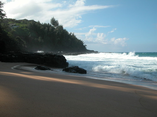


