September 2007
Monthly Archive
Posted by Glenn
[2] Comments
September 30-October 1 2007
Air Temperatures – The following maximum temperatures were recorded across the state of Hawaii Sunday:
Lihue, Kauai – 83F
Honolulu, Oahu – 87
Kaneohe, Oahu – 84
Kahului, Maui – 87
Hilo, Hawaii – 85
Kailua-Kona, Hawaii – 85
Temperatures early Monday morning ranged between these warmest and coolest spots near sea level at the 4 a.m. hour:
Kailua-kona – 78F
Hilo, Hawaii – 70
Precipitation Totals – The following numbers represent the largest precipitation totals (inches) during the last 24 hours on each of the major islands, as of Monday morning:
0.57 KALAHEO, KAUAI
1.50 POAMOHO 2, OAHU
0.06 MOLOKAI
0.14 LANAI
0.01 KAHOOLAWE
2.24 PUU KUKUI, MAUI
0.76 KAMUELA UPPER, BIG ISLAND
Weather Chart – Here’s the latest (automatically updated) weather map…showing a 1030 millibar high pressure system located north of the islands…moving eastward. This pressure configuration will keep moderately strong trade winds blowing across our marine environment through Tuesday…stronger and gusty in those usual windier places. Here’s a Weather Map Symbol page for clarification about what all those weather symbols mean on the map.
Hawaii’s Mountains – Here’s a link to the live webcam on the summit of near 14,000 foot Mauna Kea on the Big Island of Hawaii. The tallest peak on the island of Maui is the Haleakala Crater, which is near 10,000 feet in elevation. These two webcams are available during the daylight hours here in the islands…and when there’s a big moon rising just after sunset for an hour or two! Plus, during the nights and early mornings you will be able to see stars, and the sunrise too…depending upon cloud conditions.
Tropical Cyclone activity in the eastern and central Pacific – Here’s the latest information coming out of the National Hurricane Center, covering the eastern north Pacific. You can find the latest tropical cyclone information for the central north Pacific (where Hawaii is located) by clicking on this link to the Central Pacific Hurricane Center. Here’s a tracking map covering both the eastern and central Pacific Ocean.
Satellite and Radar Images: To view the cloud conditions we have here in Hawaii, please use the following satellite links, starting off with the Infrared Satellite Image of the islands to see all the clouds around the state during the day and night. This next image is one that gives close images of the islands only during the daytime hours, and is referred to as a Close-up visible image. This next image shows a larger view of the Pacific…giving perspective to the wider ranging cloud patterns in the Pacific Ocean…out from the islands. To help you keep track of where any showers may be around the islands, here’s the latest animated radar image.
Aloha Paragraphs

Waimanalo Beach, Oahu
photo credit: flickr.com
The trade winds will continue blowing across the Hawaiian Islands, blowing steadily through the next week at least. The latest weather maps show a 1029 millibar high pressure system located far to the NNW of the islands Sunday evening. This trade wind producing high pressure cell, will keep moderate trade winds over us now. A small craft wind advisory is now in place across those windiest areas in the southern part of the state.
The windward sides will remain off and on wet through the next 24 hours, with a few showers sneaking over in the leeward sides locally. Satellite imagery shows an area of showery clouds to the east of the state. This moisture field will be carried in our direction, ending up most generously along the windward coasts and slopes. This is nothing too unusual, as often the trade winds carry these pockets of showers into the windward sides during such a trade wind weather pattern.
It’s Sunday evening as I begin writing this last paragraph of todays weather narrative. As noted in the two paragraphs above, the trade winds, and their associated showers will remain a fixed entity in our Hawaiian Island weather pattern for the time being. The windward sides have continued to see passing shower activity Sunday, which as mentioned above, will continue into Monday. ~~~ Here in Kula, in the upcountry area of east Maui, the clouds gathered force early, and by mid-morning were already as dark and threatening as they usually get during the afternoon hours. This afternoon, as was expected, we had a brief rain, which didn’t last all that long, but was a relief, after being such a threat all day. Later in the afternoon, the clouds cleared quite a bit, with late afternoon sunshine breaking through the partly cloudy skies at times. ~~~ Satellite imagery shows some more high level cirrus cloudiness streaming our way from the deeper tropics to our SW. This cirrus will likely give some great sunset colors in those areas of the Aloha state where they happen to be overhead…and then perhaps again early Monday morning for sunrise. I’ll be back early Monday morning, well before sunrise with your next weather narrative from paradise. I hope you have a great Sunday night wherever you happen to be spending it! Aloha for now…Glenn.
Posted by Glenn
1 Comment
September 27-28 2007
Air Temperatures – The following maximum temperatures were recorded across the state of Hawaii Thursday:
Lihue, Kauai – 84F
Honolulu, Oahu – 86
Kaneohe, Oahu – 82
Kahului, Maui – 84
Hilo, Hawaii – 83
Kailua-Kona, Hawaii – 85
Temperatures early Friday morning ranged between these warmest and coolest spots near sea level at the 4 a.m. hour:
Lihue, Kauai – 77F
Kahului, Maui – 67
Precipitation Totals – The following numbers represent the largest precipitation totals (inches) during the last 24 hours on each of the major islands, as of Friday morning:
0.53 HANALEI RIVER, KAUAI
0.28 OAHU FOREST NWR, OAHU
0.00 MOLOKAI
0.00 LANAI
0.00 KAHOOLAWE
1.79 PUU KUKUI, MAUI
0.66 POHAKULOA KIPUKA ALALA, BIG ISLAND
Weather Chart – Here’s the latest (automatically updated) weather map…showing a 1031 millibar high pressure system located far to the NNE of Hawaii. Theis high pressure cell will keep moderate trade winds blowing across our Hawaiian islands through Saturday. Here’s a Weather Map Symbol page for clarification about what all those weather symbols mean on the map.
Hawaii’s Mountains – Here’s a link to the live webcam on the summit of near 14,000 foot Mauna Kea on the Big Island of Hawaii. The tallest peak on the island of Maui is the Haleakala Crater, which is near 10,000 feet in elevation. These two webcams are available during the daylight hours here in the islands…and when there’s a big moon rising just after sunset for an hour or two! Plus, during the nights and early mornings you will be able to see stars, and the sunrise too…depending upon cloud conditions.
Tropical Cyclone activity in the eastern and central Pacific – Here’s the latest information coming out of the National Hurricane Center, covering the eastern north Pacific. You can find the latest tropical cyclone information for the central north Pacific (where Hawaii is located) by clicking on this link to the Central Pacific Hurricane Center. Here’s a tracking map covering both the eastern and central Pacific Ocean.
Satellite and Radar Images: To view the cloud conditions we have here in Hawaii, please use the following satellite links, starting off with the Infrared Satellite Image of the islands to see all the clouds around the state during the day and night. This next image is one that gives close images of the islands only during the daytime hours, and is referred to as a Close-up visible image. This next image shows a larger view of the Pacific…giving perspective to the wider ranging cloud patterns in the Pacific Ocean…out from the islands. To help you keep track of where any showers may be around the islands, here’s the latest animated radar image.
Aloha Paragraphs

Great colorful sunsets in Hawaii lately!
photo credit: flickr.com
The trade winds will remain active Thursday evening, and then begin to slow down a little Friday into the upcoming weekend. The latest weather map shows a fairly strong 1032 millibar high pressure system located far to the north of the islands now. This trade wind producing high pressure cell will gradually move southward, and begin weakening a little over the next several days. It appears that our local trade winds will come down a little in strength as a result. The latest computer forecast models show the trades continuing on into next week.
The trade winds will continue to carry a few showers in our direction, focused most intently along the windward sides. Meanwhile, the long lasting upper level low pressure trough to our northeast through southwest, will help to bring high level cirrus clouds overhead. The cold air associated with this upper air weather feature will keep our overlying atmosphere just a little unstable still. This in turn keeps the slight chance of a few briefly heavy shower in the forecast. As the weekend rolls around, we should begin to see more sunshine, with less high clouds and showers.
It’s Thursday evening as I start writing this last paragraph of todays weather narrative. That same area of tropical moisture, in the area southwest of Hawaii, as viewed in this satellite image…remains active. That high level moisture is being carried up into the state on the jet stream winds aloft coming up from the SW. This high cloudiness will give great sunrise and sunset colors, although will dim and filter our Hawaiian sunshine locally too. As this upper low pressure trough fills soon, we should see fewer high cirrus clouds, allowing more of our famous Hawaiian sunshine to return later Friday into the weekend. As this low loses influence in our area, we should see less showers falling along the windward sides too. ~~~ Thursday was anything but a banner day for sunshine here in Hawaii! The one exception was for the island of Kauai, which was mostly out from under the thick veil of high clouds that covered the rest of the state. ~~~ I’ll be back early Friday morning with your next tropical weather narrative from paradise, I hope you have a great Thursday night wherever you are spending it! Aloha for now…Glenn.
Posted by Glenn
No Comments
September 26-27 2007
Air Temperatures – The following maximum temperatures were recorded across the state of Hawaii Wednesday:
Lihue, Kauai – 86F
Honolulu, Oahu – 87
Kaneohe, Oahu – 84
Kahului, Maui – 86
Hilo, Hawaii – 80
Kailua-Kona, Hawaii – 86
Temperatures early Thursday morning ranged between these warmest and coolest spots near sea level at the 4 a.m. hour:
Honolulu, Oahu – 77F
Hilo, Hawaii – 71
Precipitation Totals – The following numbers represent the largest precipitation totals (inches) during the last 24 hours on each of the major islands, as of Thursday morning:
0.51 HANALEI RIVER, KAUAI
1.54 SOUTH FORK KAUKONAHUA, OAHU
0.02 MOLOKAI
0.00 LANAI
0.00 KAHOOLAWE
1.80 PUU KUKUI, MAUI
1.06 GLENWOOD, BIG ISLAND
Weather Chart – Here’s the latest (automatically updated) weather map…showing high pressure systems located far to the north of Hawaii. These high pressure cells will keep moderate trade winds blowing across our Hawaiian islands…locally stronger and gusty in those locally windiest areas through Friday. There will be a slight easing of our local trade wind speeds Friday into the weekend. Here’s a Weather Map Symbol page for clarification about what all those weather symbols mean on the map.
Hawaii’s Mountains – Here’s a link to the live webcam on the summit of near 14,000 foot Mauna Kea on the Big Island of Hawaii. The tallest peak on the island of Maui is the Haleakala Crater, which is near 10,000 feet in elevation. These two webcams are available during the daylight hours here in the islands…and when there’s a big moon rising just after sunset for an hour or two! Plus, during the nights and early mornings you will be able to see stars, and the sunrise too…depending upon cloud conditions.
Tropical Cyclone activity in the eastern and central Pacific – Here’s the latest information coming out of the National Hurricane Center, covering the eastern north Pacific. You can find the latest tropical cyclone information for the central north Pacific (where Hawaii is located) by clicking on this link to the Central Pacific Hurricane Center. Here’s a tracking map covering both the eastern and central Pacific Ocean.
Satellite and Radar Images: To view the cloud conditions we have here in Hawaii, please use the following satellite links, starting off with the Infrared Satellite Image of the islands to see all the clouds around the state during the day and night. This next image is one that gives close images of the islands only during the daytime hours, and is referred to as a Close-up visible image. This next image shows a larger view of the Pacific…giving perspective to the wider ranging cloud patterns in the Pacific Ocean…out from the islands. To help you keep track of where any showers may be around the islands, here’s the latest animated radar image.
Aloha Paragraphs

High cirrus clouds over parts of Hawaii today
photo credit: flickr.com
The gusty trade winds will keep the ocean surface filled with white caps, and the coconut palm fronds swaying to and fro here in the Hawaiian Islands now. Weather maps show a couple of 1029 millibar high pressure systems located far to the NE of the islands Wednesday evening. The latest computer models indicate that the trade winds will continue through the rest of this week, and then right on into next week. There are small craft advisories posted for winds in all the major channels, Maalaea Bay on Maui…and also the waters NW of Kauai.
An upper level low pressure system to the north, in combination with whatever incoming moisture carried in on the trade winds…will keep the windward sides showery at times. This upper level low will help to bring high level cirrus clouds overhead as well…especially over Maui and the Big Island. The cold air associated with this upper air weather feature will keep our overlying atmosphere just a little unstable, although less so than the last several days. This in turn keeps the slight chance of a few briefly heavy shower in the forecast. The leeward sides may even see a few stray showers carried over the lower mountains on the smaller islands on the gusty trade winds.
It’s Wednesday evening as I start writing this last paragraph of todays weather narrative. That same area of tropical moisture, in the area south and southwest of Hawaii, as viewed in this satellite image…is full of towering cumulus and even thunderstorms. The tops of those cumulonimbus clouds are being carried up into the state on the high level winds coming up from the SW. This high cloudiness will give great sunrise and sunset colors, although will dim and filter our Hawaiian sunshine locally as well…especially over Maui and the Big Island. Those thunderstorms to our south are getting quite close now, although won’t likely make it all the way to our islands. Here’s a looping satellie image to keep track of where the heaviest showers are falling. Daytime heating of the volcanic islands may cause some afternoon showers along the leeward slopes, although working against that would be the cooling (shading) effect of the high cirrus clouds streaming overhead. Meanwhile, the windward sides will end up with the most generous rainfall amounts as usual. ~~~ In sum: gusty trade winds, windward showers at times, along with high clouds beautifying our skies. I’ll be back early Thursday morning with your next weather narrative, I hope you have a great Wednesday wherever you are spending it…and don’t forget to check out the September full moon tonight! Aloha for now…Glenn.
Posted by Glenn
No Comments
September 25-26 2007
Air Temperatures – The following maximum temperatures were recorded across the state of Hawaii Tuesday:
Lihue, Kauai – 85F
Honolulu, Oahu – 89
Kaneohe, Oahu – 84
Kahului, Maui – 89
Hilo, Hawaii – 81
Kailua-Kona, Hawaii – 85
Temperatures early Wednesday morning ranged between these warmest and coolest spots near sea level at the 4 a.m. hour:
Honolulu, Oahu – 77F
Hilo, Hawaii – 71
Precipitation Totals – The following numbers represent the largest precipitation totals (inches) during the last 24 hours on each of the major islands, as of Wednesday morning:
0.51 HANALEI RIVER, KAUAI
0.93 POAMOHO 2, OAHU
0.05 MOLOKAI
0.00 LANAI
0.00 KAHOOLAWE
1.43 PUU KUKUI, MAUI
1.44 PAHOA, BIG ISLAND
Weather Chart – Here’s the latest (automatically updated) weather map…showing a 1031 millibar high pressure system located far to the NE of Hawaii. This high pressure cell will keep moderate trade winds blowing across our Hawaiian islands…locally stronger and gusty in those locally windiest areas through Thursday. Here’s a Weather Map Symbol page for clarification about what all those weather symbols mean on the map.
Hawaii’s Mountains – Here’s a link to the live webcam on the summit of near 14,000 foot Mauna Kea on the Big Island of Hawaii. The tallest peak on the island of Maui is the Haleakala Crater, which is near 10,000 feet in elevation. These two webcams are available during the daylight hours here in the islands…and when there’s a big moon rising just after sunset for an hour or two! Plus, during the nights and early mornings you will be able to see stars, and the sunrise too…depending upon cloud conditions.
Tropical Cyclone activity in the eastern and central Pacific – Here’s the latest information coming out of the National Hurricane Center, covering the eastern north Pacific. You can find the latest tropical cyclone information for the central north Pacific (where Hawaii is located) by clicking on this link to the Central Pacific Hurricane Center. Here’s a tracking map covering both the eastern and central Pacific Ocean.
Satellite and Radar Images: To view the cloud conditions we have here in Hawaii, please use the following satellite links, starting off with the Infrared Satellite Image of the islands to see all the clouds around the state during the day and night. This next image is one that gives close images of the islands only during the daytime hours, and is referred to as a Close-up visible image. This next image shows a larger view of the Pacific…giving perspective to the wider ranging cloud patterns in the Pacific Ocean…out from the islands. To help you keep track of where any showers may be around the islands, here’s the latest animated radar image.
Aloha Paragraphs

Hawaiian cumulus clouds
photo credit: flickr.com
The trade winds remain active, and are expected to increase in strength a notch over the next couple of days. Weather maps show a 1030 millibar high pressure system located far to the NE of the islands Tuesday. Wind speeds will range between light to moderately strong, all the way up to strong and gusty, depending upon your location. The latest model output indicates that the trade winds will continue through the rest of this week, and quite likely right on into next week. There are now small craft advisories posted for winds in those windiest areas in the southern part of the state…needed as the winds are boosting in strength now. The winds atop the summits on the Big Island are strong enough to have triggered a wind advisory until midnight.
Showers will continue to favor the windward coasts and slopes, with a few showers making their way into the leeward sides of the islands too…some of which could be locally heavy. The Kona slopes on the Big Island will likely see the most generous showers of any leeward spot, where afternoon or evening showers will develop in the upcountry areas. The upper level low to our north will help to bring some high level cirrus clouds overhead soon…as well as enhance whatever showers that are around at times locally through the rest of the week too. Yet, all things considered, weather will remain quite nice in general.
It’s Tuesday evening as I start writing this last paragraph of todays weather narrative. An area of tropical moisture, in the area southwest through southeast of Hawaii, as viewed in this satellite image, is full of towering cumulus and even thunderstorms. At very least, we’ll see high cirrus clouds being drawn up over the Aloha state, especially over the Big Island and perhaps Maui…carried our way by the upper winds aloft. This area of disturbed weather has only the slightest chance of spinning up into a tropical depression. As the NWS forecast office in Honolulu is saying…"further development, if any, would be slow." The sea water temperatures are plenty warm enough for tropical cyclone development down there, although the winds above this tropical disturbance are not favorable at the moment, creating a relatively unfavorable environment for a tropical system to form. At any rate, the tops of those thunderstorms (cirrus clouds) will stream up over the state. ~~~ In sum, in regards to our weather here in the islands during this very first several days of autumn 2007, nothing too out of the ordinary. The trade winds will dominate our Hawaiian Island weather picture, with some enhancement to the local showers by the upper level trough of low pressure to our north…some of which may be briefly heavy. The best chances for sun bathing and tanning, will continue to be along the south and west facing leeward beaches. ~~~ I will be back early Wednesday morning with your next weather narrative, I hope you have a great Tuesday night until then! Aloha for now…Glenn,
Posted by Glenn
No Comments
September 24-25 2007
Air Temperatures – The following maximum temperatures were recorded across the state of Hawaii Monday:
Lihue, Kauai – 85F
Honolulu, Oahu – 86
Kaneohe, Oahu – 83
Kahului, Maui – 87
Hilo, Hawaii – 84
Kailua-Kona, Hawaii – 86
Temperatures early Tuesday morning ranged between these warmest and coolest spots near sea level at the 4 a.m. hour:
Kaneohe, Oahu – 76F
Hilo, Hawaii – 68
Precipitation Totals – The following numbers represent the largest precipitation totals (inches) during the last 24 hours on each of the major islands, as of Tuesday morning:
0.73 HANALEI RIVER, KAUAI
1.19 NUUANU UPPER, OAHU
0.01 MOLOKAI
0.01 LANAI
0.31 KAHOOLAWE
0.98 WEST WAILUAIKI, MAUI
0.47 KAPAPALA RANCH, BIG ISLAND
Weather Chart – Here’s the latest (automatically updated) weather map…showing a 1030 millibar high pressure system located far to the NE of Hawaii. This high pressure cell will keep moderate trade winds blowing across our Hawaiian islands Tuesday…locally stronger and gusty in those locally windiest areas Wednesday. Here’s a Weather Map Symbol page for clarification about what all those weather symbols mean on the map.
Hawaii’s Mountains – Here’s a link to the live webcam on the summit of near 14,000 foot Mauna Kea on the Big Island of Hawaii. The tallest peak on the island of Maui is the Haleakala Crater, which is near 10,000 feet in elevation. These two webcams are available during the daylight hours here in the islands…and when there’s a big moon rising just after sunset for an hour or two! Plus, during the nights and early mornings you will be able to see stars, and the sunrise too…depending upon cloud conditions.
Tropical Cyclone activity in the eastern and central Pacific – Here’s the latest information coming out of the National Hurricane Center, covering the eastern north Pacific. You can find the latest tropical cyclone information for the central north Pacific (where Hawaii is located) by clicking on this link to the Central Pacific Hurricane Center. Here’s a tracking map covering both the eastern and central Pacific Ocean.
Satellite and Radar Images: To view the cloud conditions we have here in Hawaii, please use the following satellite links, starting off with the Infrared Satellite Image of the islands to see all the clouds around the state during the day and night. This next image is one that gives close images of the islands only during the daytime hours, and is referred to as a Close-up visible image. This next image shows a larger view of the Pacific…giving perspective to the wider ranging cloud patterns in the Pacific Ocean…out from the islands. To help you keep track of where any showers may be around the islands, here’s the latest animated radar image.
Aloha Paragraphs

Wailua Bay on Kauai
photo credit: flickr.com
The Hawaiian Islands head into yet another week, in a long series of weeks…with the trade winds blowing steadily. Weather maps show high pressure systems located far to the NE and north of the islands Monday evening. Wind speeds will range between light to moderately strong, all the way up to strong and gusty, depending upon your location. As usual, these breezes will be strongest during the days, and lightest in general during the nights. The latest model output indicates that the trade winds will continue well into this new week. There are no advisories for winds in the major channels, or the coastal waters at this time. The latest models suggest we may see stronger winds during the last third of this week…which may necessitate small craft advisories in the southern part of the state then.
The overlying atmosphere is primed for windward shower activity, which may be enhanced to some degree as an upper level trough digs into the area north of Hawaii. The windward sides will see the bulk of whatever showers that will be falling at the moment. As is often the case, the leeward areas will remain much less wet, although a few showers may fall even along these south and west facing areas. The Kona slopes on the Big Island will likely see the most generous showers, where afternoon or evening raindrops will develop in the upcountry areas. The upper level low to our north may help to bring some high level cirrus clouds overhead later this week.
It’s Monday evening as I start writing this last paragraph of todays weather narrative. As noted above, the trade winds will be the primary driver of our local weather here in the Aloha state as we begin this new week.. The secondary feature will be the showers that arrive on those trade winds along the north and east facing windward coasts and slopes. The aforementioned upper level trough of low pressure, with its associated cold air aloft, may enhance whatever showers that arrive along those windward sides soon. Looking a little further ahead, we’ll keep an eye on all the tropical moisture that is evident to the south of the Hawaiian Islands, as pointed out in this satellite image. That area of disturbed weather to our south, which looks at times as if it has a slight spin to it…although at this point doesn’t look likely to become a tropical depression. As the upper level trough gets set up to our north, we could see some of those rain bearing clouds get drawn up to the west of our islands later in the week. It’s not a sure thing by any means, although if this rich tropical moisture were to stretch northward, we could see some measure of heavier rains arriving at some point starting around Thursday, with the best chance of showers on the kauai end of the state. Whether these actual rainy clouds arrive or not, we’ll likely see lots of high cirrus clouds moving over our islands with time, as the winds aloft carry the tops of those thunderstorms north and NE over our islands. ~~~ I’ll be back early Tuesday morningwith your next weather narrative from paradise. I hope you have a great Monday night wherever you happen to be! Aloha for now…Glenn.
Posted by Glenn
1 Comment
September 23-24 2007
Air Temperatures – The following maximum temperatures were recorded across the state of Hawaii Sunday:
Lihue, Kauai – 85F
Honolulu, Oahu – 88
Kaneohe, Oahu – 84
Kahului, Maui – 88
Hilo, Hawaii – 82
Kailua-Kona, Hawaii – 89
Temperatures early Monday morning ranged between these warmest and coolest spots near sea level at the 4 a.m. hour:
Kailua-kona – 77F
Hilo, Hawaii – 70
Precipitation Totals – The following numbers represent the largest precipitation totals (inches) during the last 24 hours on each of the major islands, as of Monday morning:
0.24 WAILUA, KAUAI
0.22 MANOA LYON ARBORETUM, OAHU
0.00 MOLOKAI
0.05 LANAI
0.01 KAHOOLAWE
0.45 OHEO GULCH, MAUI
1.61 HONAUNAU, BIG ISLAND
Weather Chart – Here’s the latest (automatically updated) weather map…showing high pressure systems located far to the NNW and NE of Hawaii. These high pressure cells will merge to our northest later Monday or Tuesday. This pressure configuration will keep moderate trade winds blowing across our Hawaiian islands…locally stronger and gusty in those locally windiest areas. Here’s a Weather Map Symbol page for clarification about what all those weather symbols mean on the map.
Hawaii’s Mountains – Here’s a link to the live webcam on the summit of near 14,000 foot Mauna Kea on the Big Island of Hawaii. The tallest peak on the island of Maui is the Haleakala Crater, which is near 10,000 feet in elevation. These two webcams are available during the daylight hours here in the islands…and when there’s a big moon rising just after sunset for an hour or two! Plus, during the nights and early mornings you will be able to see stars, and the sunrise too…depending upon cloud conditions.
Tropical Cyclone activity in the eastern and central Pacific – Here’s the latest information coming out of the National Hurricane Center, covering the eastern north Pacific. You can find the latest tropical cyclone information for the central north Pacific (where Hawaii is located) by clicking on this link to the Central Pacific Hurricane Center. Here’s a tracking map covering both the eastern and central Pacific Ocean.
Satellite and Radar Images: To view the cloud conditions we have here in Hawaii, please use the following satellite links, starting off with the Infrared Satellite Image of the islands to see all the clouds around the state during the day and night. This next image is one that gives close images of the islands only during the daytime hours, and is referred to as a Close-up visible image. This next image shows a larger view of the Pacific…giving perspective to the wider ranging cloud patterns in the Pacific Ocean…out from the islands. To help you keep track of where any showers may be around the islands, here’s the latest animated radar image.
Aloha Paragraphs
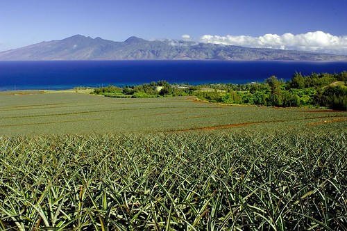
Pineapple fields on Maui…Molokai in the background
photo credit: flickr.com
Moderately strong trade winds will continue to blow across our tropical latitudes here in the islands. Weather maps show high pressure systems located far to the NE and NW of the islands Sunday evening. Wind speeds will range between light to moderately strong, all the way up to strong and gusty, depending upon your location. As usual, these breezes will be strongest during the days, and lightest in general during the nights. The latest model output indicates that the trade winds will continue well into the new week ahead. There are no advisories for winds in major channels, or the coastal waters at this time.
There will still be a few showers around, primarily along the windward sides through Monday here in the Aloha state. A high pressure ridge exists aloft now over Hawaii, which in combination with little upstream moisture to the east…will keep island skies quite sunny and dry in most areas. The windward sides will see the usual few showers, otherwise most all leeward areas will remain dry. An upper level trough of low pressure will take over duty aloft starting Tuesday, bringing back somewhat more showers to the forecast…especially along the windward sides for several days thereafter.
It’s Sunday evening as I start writing this last paragraph of todays weather narrative. This first full day of autumn will see nice weather in the Hawaiian Islands. We should see lots of warm sunshine beaming down, with whatever clouds that gather, dropping just a few showers. As the trade winds are blowing however, there’s always that chance of a few raindrops falling along those windward coasts and slopes. Then too, the daytime heating of the volcanic slopes will cause clouds to form during the afternoons around the mountains on the bigger islands. These clouds will be dry for the most part, although we might see a few sprinkles falling along the upslope areas of Kona, on the Big Island. All things considered, the next several days will have pleasant weather conditions. As noted in the paragraph above, the appearance of an upper level low pressure starting Tuesday, may trigger an increase in showers along the windward sides of the islands. ~~~ I’ll be back early Monday morning with more weather updates, I hope you have a great Sunday night wherever you may be reading from! Aloha for now…Glenn.
Posted by Glenn
No Comments
September 22-23 2007
Air Temperatures – The following maximum temperatures were recorded across the state of Hawaii Saturday:
Lihue, Kauai – 87F
Honolulu, Oahu – 88
Kaneohe, Oahu – 83
Kahului, Maui – 84
Hilo, Hawaii – 80
Kailua-Kona, Hawaii – 87
Temperatures early Sunday morning ranged between these warmest and coolest spots near sea level at the 4 a.m. hour:
Lihue, Kauai – 77F
Hilo, Hawaii – 68
Precipitation Totals – The following numbers represent the largest precipitation totals (inches) during the last 24 hours on each of the major islands, as of Sunday morning:
0.32 KALAHEO, KAUAI
0.65 NUUANU UPPER, OAHU
0.12 MOLOKAI
0.01 LANAI
0.00 KAHOOLAWE
1.32 PUU KUKUI, MAUI
2.13 KEALAKEKUA, BIG ISLAND
Weather Chart – Here’s the latest (automatically updated) weather map…showing high pressure systems located far to the NW and NE of Hawaii. These high pressure cells will merge to our north Monday. This pressure configuration will keep moderate trade winds blowing through Monday across our Hawaiian islands…locally stronger and gusty in those locally windiest areas. Here’s a Weather Map Symbol page for clarification about what all those weather symbols mean on the map.
Hawaii’s Mountains – Here’s a link to the live webcam on the summit of near 14,000 foot Mauna Kea on the Big Island of Hawaii. The tallest peak on the island of Maui is the Haleakala Crater, which is near 10,000 feet in elevation. These two webcams are available during the daylight hours here in the islands…and when there’s a big moon rising just after sunset for an hour or two! Plus, during the nights and early mornings you will be able to see stars, and the sunrise too…depending upon cloud conditions.
Tropical Cyclone activity in the eastern and central Pacific – Here’s the latest information coming out of the National Hurricane Center, covering the eastern north Pacific. You can find the latest tropical cyclone information for the central north Pacific (where Hawaii is located) by clicking on this link to the Central Pacific Hurricane Center. Here’s a tracking map covering both the eastern and central Pacific Ocean.
Satellite and Radar Images: To view the cloud conditions we have here in Hawaii, please use the following satellite links, starting off with the Infrared Satellite Image of the islands to see all the clouds around the state during the day and night. This next image is one that gives close images of the islands only during the daytime hours, and is referred to as a Close-up visible image. This next image shows a larger view of the Pacific…giving perspective to the wider ranging cloud patterns in the Pacific Ocean…out from the islands. To help you keep track of where any showers may be around the islands, here’s the latest animated radar image.
Aloha Paragraphs

Frolicking in the warm Hawaii ocean
photo credit: flickr.com
The trade winds will continue to blow here in the islands on this last day of summer 2007…into the first day of autumn Sunday. Weather maps show a 1029 millibar high pressure system located far to the NNE of the islands Saturday evening. Wind speeds will range between light to moderately strong, all the way up to strong and gusty, depending upon your location. As usual, these breezes will be strongest during the days, and lightest in general during the nights. The latest model output indicates that the trade winds will continue well into the new week ahead.
There will still be a few showers around, although drier air is moving into the Aloha state, with fewer showers through the rest of this weekend into at least the first day of the new week ahead. Shower activity will depend largely on how much cloudiness is being carried into the state by the trade winds at any one time…although satellite imagery shows very few moisture patches heading our way at the moment. The bottom line, in terms of precipitation, is that it will be generally quite dry, especially along our leeward beaches.
It’s Saturday evening as I start writing this last paragraph of todays weather narrative. The weather here in the islands will remain nice through these last few hours of summer 2007…continuing on Sunday, the first full day of autumn…into the new week ahead. The trade winds will prevail well into the future, with no end in sight at the moment. The autumn season in the middle latitudes implies cooler weather and the chance for the first cold fronts of the season. Those weather elements down here in the tropics, don’t happen that soon. The tropics cool down slowly, as we are surrounded by a warm ocean, which just now is attaining its warmest temperatures of the summer season. It will take until late October, even into early November for the ocean to cool a few degrees…which will prompt a cooling in our overlying atmosphere. The arrival of a autumn cold front or two, with their cooler air arriving from more northern latitudes, to finally break the spell of summer. ~~~ I’ll be back Sunday morning with your next weather narrative from paradise. I hope you have a great Saturday night wherever you happen to be spending it! Aloha for now…Glenn.
Posted by Glenn
No Comments
September 21-22 2007
Air Temperatures – The following maximum temperatures were recorded across the state of Hawaii Friday:
Lihue, Kauai – 86F
Honolulu, Oahu – 86
Kaneohe, Oahu – 84
Kahului, Maui – 87
Hilo, Hawaii – 82
Kailua-Kona, Hawaii – 86
Temperatures early Saturday morning ranged between these warmest and coolest spots near sea level at the 5 a.m. hour:
Lihue, Kauai – 78F
Hilo, Hawaii – 70
Precipitation Totals – The following numbers represent the largest precipitation totals (inches) during the last 24 hours on each of the major islands, as of Saturday morning:
0.31 HANALEI RIVER, KAUAI
1.12 POAMOHO 2, OAHU
0.01 MOLOKAI
0.01 LANAI
0.00 KAHOOLAWE
0.82 PUU KUKUI, MAUI
0.69 GLENWOOD, BIG ISLAND
Weather Chart – Here’s the latest (automatically updated) weather map…showing a fairly strong 1032 millibar high pressure system located far NNE of Hawaii. This high pressure system has a ridge of high pressure extending SW to the NW of Hawaii. This pressure configuration will keep moderate to locally strong and gusty trade winds blowing through Sunday. Here’s a Weather Map Symbol page for clarification about what all those weather symbols mean on the map.
Hawaii’s Mountains – Here’s a link to the live webcam on the summit of near 14,000 foot Mauna Kea on the Big Island of Hawaii. The tallest peak on the island of Maui is the Haleakala Crater, which is near 10,000 feet in elevation. These two webcams are available during the daylight hours here in the islands…and when there’s a big moon rising just after sunset for an hour or two! Plus, during the nights and early mornings you will be able to see stars, and the sunrise too…depending upon cloud conditions.
Tropical Cyclone activity in the eastern and central Pacific – Here’s the latest information coming out of the National Hurricane Center, covering the eastern north Pacific. You can find the latest tropical cyclone information for the central north Pacific (where Hawaii is located) by clicking on this link to the Central Pacific Hurricane Center. Here’s a tracking map covering both the eastern and central Pacific Ocean.
Satellite and Radar Images: To view the cloud conditions we have here in Hawaii, please use the following satellite links, starting off with the Infrared Satellite Image of the islands to see all the clouds around the state during the day and night. This next image is one that gives close images of the islands only during the daytime hours, and is referred to as a Close-up visible image. This next image shows a larger view of the Pacific…giving perspective to the wider ranging cloud patterns in the Pacific Ocean…out from the islands. To help you keep track of where any showers may be around the islands, here’s the latest animated radar image.
Aloha Paragraphs

Hawaiian Hula Dancers
photo credit: flickr.com
The very late summer trade winds continue to grace the Hawaiian Islands. Weather maps show a 1033 millibar high pressure system located far to the NNE of the islands Friday evening. Wind speeds will range between light to moderately strong, all the way up to strong and gusty, depending upon your location. As usual, these breezes will be strongest during the days, and lightest in general during the nights. The trade winds are still strong enough now to keep the small craft wind advisory active in those windiest areas across the state. Weather charts suggest that we may see a slight downturn in our local trade wind speeds over the upcoming weekend, although most folks won’t notice this modest softening. The latest model output indicates that the trade winds will continue well into the new week ahead.
The trade winds will continue to carry a few showers our way, being most numerous along our windward coasts and slopes. Shower activity will depend largely on how much cloudiness is being carried into the state by the trade winds at any one time. We may see some very minor shower enhancement at times, as a long lasting upper level low pressure system, to the northwest of Hawaii, remains in the weather picture. That upper level low, along with the jet stream level winds aloft, will help carry high cirrus clouds overhead at times. The bottom line, in terms of precipitation, is that it will be generally quite dry, especially along our leeward beaches.
It’s Friday evening as I start writing this last paragraph of todays weather narrative. The weather here in the islands will remain nice through these last few hours of summer 2007…continuing on into the new week ahead. Looking at this satellite image, we see tons of cloudiness in the deeper tropics to Hawaii’s south. That deep convection down there…consists of large thunderstorms firing-up in the intertropical convergence zone. The tops of these cumulonimbus clouds are being carried northward over Hawaii now. This is coming across our skies in the form of cirrus clouds, which bring great sunrise and sunset colors…but also dim and filter our famous Hawaiian sunshine during the days. Those towering cumulus and thunderstorms are too far away to dump rain on us, and the cirrus clouds are too high to drop rain on us either. Thus, we’ll just have them to beautify our local skies, lighting up perhaps brilliantly as the sun rises, and then again when it goes down at the end of the day. ~~~ Friday is the last full day of summer, as late Saturday night here in Hawaii, the autumnal equinox will occur, at which point we leave summer behind, and slide into the autumn season. It won’t make make much difference to us down here in the tropical latitudes of the north central Pacific however, as summery weather will continue well into the future! ~~~ Looking at the upcoming weekend, I see no weather problems on the horizon, with just smooth sailing on tap. I’ll be back early Saturday morning, and until then, I hope you have a great Friday night! Aloha for now…Glenn.
Posted by Glenn
No Comments
September 20-21 2007
Air Temperatures – The following maximum temperatures were recorded across the state of Hawaii Thursday:
Lihue, Kauai – 86F
Honolulu, Oahu – 89
Kaneohe, Oahu – 83
Kahului, Maui – 88
Hilo, Hawaii – 83
Kailua-Kona, Hawaii – 87
Temperatures early Friday morning ranged between these warmest and coolest spots near sea level at the 4 a.m. hour:
Kaneohe, Oahu – 78F
Hilo, Hawaii – 71
Precipitation Totals – The following numbers represent the largest precipitation totals (inches) during the last 24 hours on each of the major islands, as of Friday morning:
0.65 HANALEI RIVER, KAUAI
0.05 MILILANI, OAHU
0.00 MOLOKAI
0.01 LANAI
0.00 KAHOOLAWE
0.80 WEST WAILUAIKI, MAUI
0.47 WAIAKEA UKA, BIG ISLAND
Weather Chart – Here’s the latest (automatically updated) weather map…showing a fairly strong 1033 millibar high pressure system located far NNE of Hawaii. This high pressure system has a ridge of high pressure extending SW to the NW of Hawaii. Despite this high pressure cell’s high millibar rating, it is too far away to provide us its strongest trade winds. This pressure configuration will keep moderate to locally strong and gusty trade winds blowing. Here’s a Weather Map Symbol page for clarification about what all those weather symbols mean on the map.
Hawaii’s Mountains – Here’s a link to the live webcam on the summit of near 14,000 foot Mauna Kea on the Big Island of Hawaii. The tallest peak on the island of Maui is the Haleakala Crater, which is near 10,000 feet in elevation. These two webcams are available during the daylight hours here in the islands…and when there’s a big moon rising just after sunset for an hour or two! Plus, during the nights and early mornings you will be able to see stars, and the sunrise too…depending upon cloud conditions.
Tropical Cyclone activity in the eastern and central Pacific – Here’s the latest information coming out of the National Hurricane Center, covering the eastern north Pacific. You can find the latest tropical cyclone information for the central north Pacific (where Hawaii is located) by clicking on this link to the Central Pacific Hurricane Center. Here’s a tracking map covering both the eastern and central Pacific Ocean.
Satellite and Radar Images: To view the cloud conditions we have here in Hawaii, please use the following satellite links, starting off with the Infrared Satellite Image of the islands to see all the clouds around the state during the day and night. This next image is one that gives close images of the islands only during the daytime hours, and is referred to as a Close-up visible image. This next image shows a larger view of the Pacific…giving perspective to the wider ranging cloud patterns in the Pacific Ocean…out from the islands. To help you keep track of where any showers may be around the islands, here’s the latest animated radar image.
Aloha Paragraphs

Beautiful offshore rainshower
photo credit: flickr.com
There will be some minor fluctuations in the trade wind speeds, although they will continue to blow across the Hawaiian Islands through at least the next week. Weather maps show a 1032 millibar high pressure system located far to the NNE of the islands Thursday evening. Wind speeds will range between light to moderately strong, all the way up to strong and gusty, depending upon your location. As usual, these breezes will be strongest during the days, and lightest in general during the nights. The trade winds are still strong enough now to keep the small craft wind advisory active in those windiest areas across the state.
Clouds and localized showers will remain most active along the windward sides of the islands through the remainder of this week into next week. Shower activity will depend largely on how much cloudiness is being carried into the state by the trade winds at any one time. We may see some minor shower enhancement at times, as a long lasting upper level low pressure system, to the west of Hawaii, will keep our overlying atmosphere a little unstable at times. That upper level low, along with the jet stream level winds aloft, will carry high cirrus clouds overhead at times as well.
It’s Thursday evening as I start writing this last paragraph of todays weather narrative. The weather will remain just fine for the most part here in the islands…that’s the bottom line. Looking into the fine detail a bit, this satellite imagery showed a band of clouds paralleling the windward sides of the islands Thursday, moving across the central islands during the day. This area of clouds brought a nice increase in showers to the windward sides, as the trade winds carried it aboard. At the same time, there were high clouds over the Kauai end of the chain, the cirrus variety, which have moved to the west of the state now. ~~~ We’re edging right up to the finish line in terms of our summer 2007 season, with just a short while before we slide over into the autumn season…as of late this Saturday night here in Hawaii. The autumnal equinox stands is more significant up in the middle latitudes, although down here in the tropics, we’re going to see lots more summer-like weather well into the future. ~~~ There’s a new hurricane, called Ivo, over in the eastern Pacific now. This storm will stay over there, as it heads towards the southern tip of Baja California at the moment. Here in the central Pacific, we have no such spinning storm activity, nor is any expected. ~~~ I will be back early Friday morning with your next weather narrative. I hope you have a great Thursday night wherever in the world you happen to be reading from! Aloha for now..Glenn.
Posted by Glenn
No Comments
September 19-20 2007
Air Temperatures – The following maximum temperatures were recorded across the state of Hawaii Wednesday:
Lihue, Kauai – 85F
Honolulu, Oahu – 88
Kaneohe, Oahu – 84
Kahului, Maui – 86
Hilo, Hawaii – 78
Kailua-Kona, Hawaii – 86
Temperatures early Thursday morning ranged between these warmest and coolest spots near sea level at the 4 a.m. hour:
Honolulu, Oahu – 77F
Hilo, Hawaii – 70
Precipitation Totals – The following numbers represent the largest precipitation totals (inches) during the last 24 hours on each of the major islands, as of Thursday morning:
0.98 HANALEI RIVER, KAUAI
0.34 MANOA LYON ARBORETUM, OAHU
0.09 MOLOKAI
0.02 LANAI
0.00 KAHOOLAWE
0.69 PUU KUKUI, MAUI
2.11 PIIHONUA, BIG ISLAND
Weather Chart – Here’s the latest (automatically updated) weather map…showing a strong 1038 millibar high pressure system located far NNE of Hawaii. This high pressure system has a ridge of high pressure extending SW to the north and NW of Hawaii. Despite this high pressure cell’s robust rating, it is too far away to provide us its strongest trade winds. This pressure configuration will keep moderate to locally strong trade winds blowing. Here’s a Weather Map Symbol page for clarification about what all those weather symbols mean on the map.
Hawaii’s Mountains – Here’s a link to the live webcam on the summit of near 14,000 foot Mauna Kea on the Big Island of Hawaii. The tallest peak on the island of Maui is the Haleakala Crater, which is near 10,000 feet in elevation. These two webcams are available during the daylight hours here in the islands…and when there’s a big moon rising just after sunset for an hour or two! Plus, during the nights and early mornings you will be able to see stars, and the sunrise too…depending upon cloud conditions.
Tropical Cyclone activity in the eastern and central Pacific – Here’s the latest information coming out of the National Hurricane Center, covering the eastern north Pacific. You can find the latest tropical cyclone information for the central north Pacific (where Hawaii is located) by clicking on this link to the Central Pacific Hurricane Center. Here’s a tracking map covering both the eastern and central Pacific Ocean.
Satellite and Radar Images: To view the cloud conditions we have here in Hawaii, please use the following satellite links, starting off with the Infrared Satellite Image of the islands to see all the clouds around the state during the day and night. This next image is one that gives close images of the islands only during the daytime hours, and is referred to as a Close-up visible image. This next image shows a larger view of the Pacific…giving perspective to the wider ranging cloud patterns in the Pacific Ocean…out from the islands. To help you keep track of where any showers may be around the islands, here’s the latest animated radar image.
Aloha Paragraphs

Morning…along a secluded Hawaiian beach
Photo Credit: flickr.com
The trade winds will remain on the blustery side for the next several days here in the islands. Weather maps show a stronger 1037 millibar high pressure system located far to the NNE of the islands Wednesday evening. The latest computer forecast models show the winds remaining stronger than normal into Thursday, then easing back and becoming a little softer Friday into the weekend…continuing on into next week. These stronger trade winds have caused a small craft wind advisory to be issued for those windiest areas across the 50th state.
We’ll continue to see off and on showers arriving along the windward coasts and slopes, as is usual during a trade wind weather pattern. Shower activity will depend largely on how much cloudiness is being carried into the state by the trade winds at any one time. We’ll see some shower enhancement at times through the rest of the week, as a long lasting upper level low pressure system will keep our overlying atmosphere at least somewhat unstable…with some briefly heavy showers falling at times. That upper level low, along with the jet stream level winds aloft, will carry high cirrus clouds overhead at times too.
It’s Wednesday evening as I start writing this last paragraph of this weather narrative. The late summer trade winds will continue blowing across the Hawaiian Islands now. High pressure will remain well established far to our NNE, the source of our blustery trade winds at mid-week. Satellite imagery shows no lack of moisture upstream to the east. These cloud patches will continue to bring passing showers to the Aloha state, most generously, as always, along those north and east facing windward sections. The leeward sides may see a few stray showers arriving, carried by the stronger than normal trade wind flow, although many of the south and west facing leeward beaches will remain completely dry. The high cirrus clouds noted in the paragraph above, will do some sun filtering and dimming, although it doesn’t appear all that thick at the moment. Those high clouds often give great sunrise and sunset colors while they’re around! ~~~ As I was mentioning in yesterday’s narrative, we’ve only got a couple of days left of summer, at least on the calender, as the official beginning of autumn arrives late Saturday night here in the islands. ~~~ I hope you have a great Wednesday night, either here in the islands, or elsewhere. I’ll be back early Thursday morning with your next weather narrative from paradise. Aloha for now…Glenn.
Next Page »


